South Green
Settlement in Suffolk Mid Suffolk
England
South Green
South Green is a picturesque village located in the county of Suffolk, England. Situated approximately 5 miles south of the market town of Eye, it lies within the district of Mid Suffolk. The village is surrounded by lush green farmland, giving it a tranquil and idyllic setting.
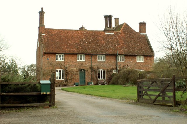
Characterized by its charming rural atmosphere, South Green is home to a small but tight-knit community. The village boasts a range of traditional Suffolk-style houses, many of which are built with local materials like red brick and thatch roofs. These properties add to the village's distinctive character and architectural charm.
Despite its small size, South Green has a number of amenities to offer residents and visitors alike. The village is home to a local pub, The Queen's Head, which serves as a focal point for social gatherings and community events. Additionally, there is a village hall that hosts various activities and clubs, providing opportunities for residents to engage in leisure pursuits and socialize.
South Green is surrounded by beautiful countryside, making it an ideal location for outdoor enthusiasts. The area offers numerous walking trails and cycling routes, allowing visitors to explore the stunning natural landscape. The nearby River Waveney also provides opportunities for boating and fishing.
Overall, South Green is a charming and peaceful village that offers a close-knit community, traditional architecture, and access to the beautiful Suffolk countryside. It is a place where residents and visitors can enjoy the tranquility of rural living while still having access to necessary amenities and recreational activities.
If you have any feedback on the listing, please let us know in the comments section below.
South Green Images
Images are sourced within 2km of 52.329958/1.192454 or Grid Reference TM1775. Thanks to Geograph Open Source API. All images are credited.


South Green is located at Grid Ref: TM1775 (Lat: 52.329958, Lng: 1.192454)
Administrative County: Suffolk
District: Mid Suffolk
Police Authority: Suffolk
What 3 Words
///goals.coconut.confident. Near Scole, Norfolk
Nearby Locations
Related Wikis

Hoxne Hoard
The Hoxne Hoard ( HOK-sən) is the largest hoard of late Roman silver and gold discovered in Britain, and the largest collection of gold and silver coins...

Hoxne Priory
Hoxne Priory was a Benedictine priory at Hoxne in Suffolk, England. It was founded as a religious house around the year 950, with a chapel at the supposed...

Hoxne Brick Pit
Hoxne Brick Pit is a 1.3-hectare (3.2-acre) geological Site of Special Scientific Interest in Hoxne in Suffolk, England. It is a Geological Conservation...

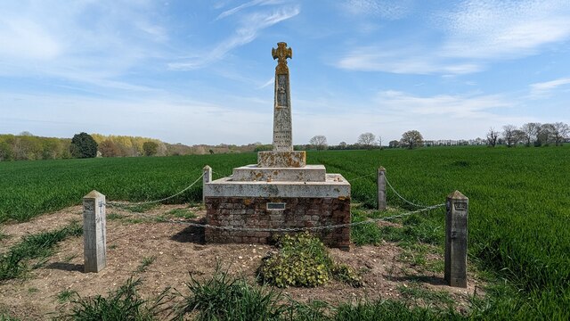
St Edmund's Memorial, Hoxne
St Edmund's Memorial, Hoxne is a memorial which claims to mark the spot where St Edmund was killed by the Vikings in the Suffolk village of Hoxne. The...

Denham, Mid Suffolk
Denham is a village and civil parish in northern Suffolk. Located approximately 3 miles east of Eye, it is within the district of Mid Suffolk. It shares...

Hoxne manor
Hoxne manor is an estate in Hoxne, Suffolk, England. It was originally a manor house belonging to East Anglian bishops. However following the dissolution...

Hoxne
Hoxne ( HOK-sən) is a village in the Mid Suffolk district of Suffolk, England, about five miles (8 km) east-southeast of Diss, Norfolk and 1⁄2 mile (800...
Eye Priory
Eye Priory was a Benedictine Priory dedicated to St Peter in the town of Eye in the English county of Suffolk. It was founded by Robert Malet c. 1080 and...
Nearby Amenities
Located within 500m of 52.329958,1.192454Have you been to South Green?
Leave your review of South Green below (or comments, questions and feedback).