South Godstone

Settlement in Surrey Tandridge

England

South Godstone

Posterngate Farm, South Godstone, Surrey Part of the extensive grounds of Posterngate Farm, where the many activities include the maintenance of a herd of pedigree Charollais, and a lake for trout fishing.  There is even a small business park.  
And this photograph 'wraps up' the TQ34 hectad, of which I have claimed 48 first geographs.
Posterngate Farm, South Godstone, Surrey Credit: Dr Neil Clifton

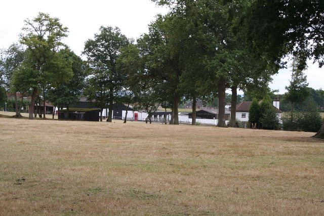
South Godstone is a small village located in the Tandridge district of Surrey, England. Situated approximately 20 miles south of London, it is part of the historic county of Surrey. The village is nestled in the picturesque countryside, surrounded by rolling hills and lush green fields.

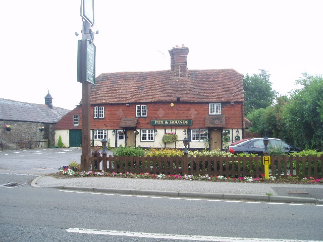
South Godstone is primarily a residential area, with a population of around 1,500 people. The village boasts a charming and peaceful atmosphere, making it an ideal place for those seeking a serene countryside lifestyle. The village center features a handful of local amenities, including a post office, a convenience store, and a few small shops.

One of the notable landmarks in South Godstone is the Church of St. Stephen, a beautiful medieval church dating back to the 13th century. This historic building adds to the village's character and serves as a reminder of its rich heritage.

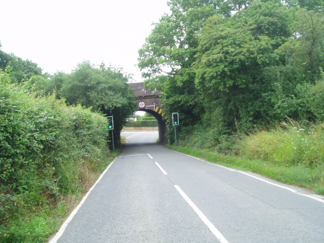
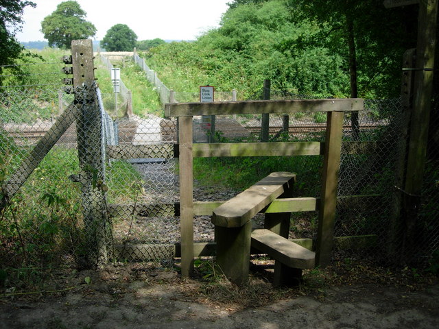
The village benefits from excellent transport links, with the nearby M23 motorway providing easy access to London and other neighboring towns. South Godstone railway station offers regular train services to London and other destinations, making it an attractive location for commuters.

For nature enthusiasts, South Godstone is surrounded by stunning countryside, offering ample opportunities for outdoor activities such as walking, cycling, and horse riding. The village is also in close proximity to several nature reserves and country parks, including Godstone Farm and Tilburstow Hill, providing residents with plenty of options for enjoying the great outdoors.

Overall, South Godstone offers a peaceful and picturesque setting, combined with good transport links and access to beautiful countryside, making it an attractive place to live for those seeking a tranquil village lifestyle.

If you have any feedback on the listing, please let us know in the comments section below.

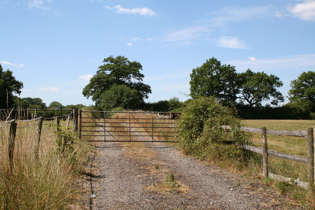
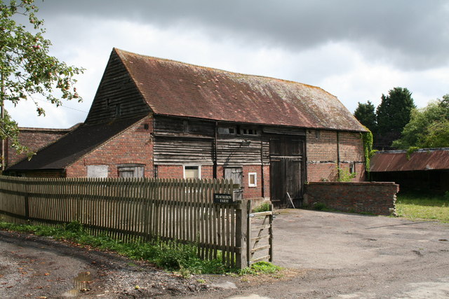
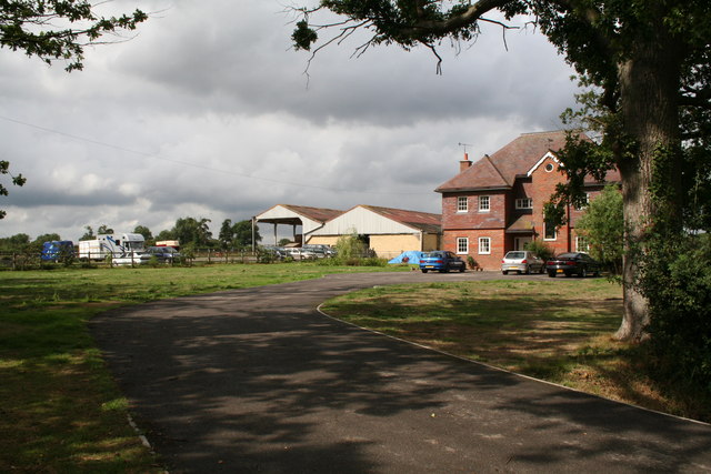
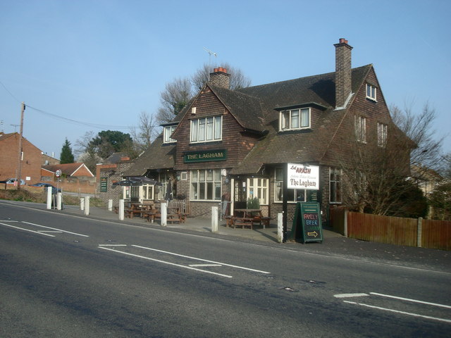
South Godstone Images

Images are sourced within 2km of 51.216875/-0.045349 or Grid Reference TQ3648. Thanks to Geograph Open Source API. All images are credited.

Posterngate Farm, South Godstone, Surrey Part of the extensive grounds of Posterngate Farm, where the many activities include the maintenance of a herd of pedigree Charollais, and a lake for trout fishing.  There is even a small business park.  
And this photograph 'wraps up' the TQ34 hectad, of which I have claimed 48 first geographs.
Posterngate Farm, South Godstone, Surrey
Part of the extensive grounds of Posterngate Farm, where the many activities include the maintenance of a herd of pedigree Charollais, and a lake for trout fishing. There is even a small business park. And this photograph 'wraps up' the TQ34 hectad, of which I have claimed 48 first geographs.
South Godstone South Godstone is 3 miles south of Godstone village and developed when the Tonbridge railway line was built in the 19th century.
South Godstone
South Godstone is 3 miles south of Godstone village and developed when the Tonbridge railway line was built in the 19th century.
Railway Bridge Crowhurst Lane End railway bridge has a narrow width hence the traffic lights. The Brickmakers Arms Pub is just past the bridge.
Railway Bridge
Crowhurst Lane End railway bridge has a narrow width hence the traffic lights. The Brickmakers Arms Pub is just past the bridge.
Fox and Hounds at South Godstone This building has served ale since the 17th century. On the Tilburstow Hill Road and well worth the diversion !
Fox and Hounds at South Godstone
This building has served ale since the 17th century. On the Tilburstow Hill Road and well worth the diversion !
Piper's Wood  and Oilseed Rape Field A field of ripe oilseed rape can be seen in the foreground with Piper's wood behind.
Piper's Wood and Oilseed Rape Field
A field of ripe oilseed rape can be seen in the foreground with Piper's wood behind.
Footpath across railway line Footpath crossing the Tonbridge to Redhill railway line.
Footpath across railway line
Footpath crossing the Tonbridge to Redhill railway line.
S K Camping and Leisure, Anglefield Corner, Surrey On the A22 south of Godstone.  A vast range of equipment for the outdoor holiday enthusiast. There is also a garden centre adjoining.
S K Camping and Leisure, Anglefield Corner, Surrey
On the A22 south of Godstone. A vast range of equipment for the outdoor holiday enthusiast. There is also a garden centre adjoining.
The road to Nowhere, Surrey Surprisingly this lane does not appear in any form at all on the 1:25000 map, nor is there any indication of anywhere it could serve.  The gate is firmly padlocked.  No farm stock or arable crop is visible.
The road to Nowhere, Surrey
Surprisingly this lane does not appear in any form at all on the 1:25000 map, nor is there any indication of anywhere it could serve. The gate is firmly padlocked. No farm stock or arable crop is visible.
Houses in Terra Cotta Road, Surrey Terra Cotta Road leads westwards off Tilburstow Hill Road.  It continues past these houses to end in a small business park.  These houses are probably the nearest you will get to 'affordable' houses in the Godstone area - but you will get a shock if you enquire the price.
Houses in Terra Cotta Road, Surrey
Terra Cotta Road leads westwards off Tilburstow Hill Road. It continues past these houses to end in a small business park. These houses are probably the nearest you will get to 'affordable' houses in the Godstone area - but you will get a shock if you enquire the price.
Little Chef restaurant, South Godstone, Surrey On the west side of the A22.
I suppose some people must actually eat in these establishments, otherwise they would not be there.
Little Chef restaurant, South Godstone, Surrey
On the west side of the A22. I suppose some people must actually eat in these establishments, otherwise they would not be there.
Ancient barn, Blackgrove Farm, Surrey. On the east side of Tandridge Lane.  Parts of this barn, which is still in use, date from around 1490.
Ancient barn, Blackgrove Farm, Surrey.
On the east side of Tandridge Lane. Parts of this barn, which is still in use, date from around 1490.
Buttons Mead Farm,  Tandridge Lane, Surrey All is in apple-pie order at Buttons Mead, where horse rearing is an important activity.
Buttons Mead Farm, Tandridge Lane, Surrey
All is in apple-pie order at Buttons Mead, where horse rearing is an important activity.
Ponies near Crowhurst Lane, Surrey A sharp shower of rain had just begun as we reached these friendly ponies being groomed in a field not far south of Crowhurst Lane.
Ponies near Crowhurst Lane, Surrey
A sharp shower of rain had just begun as we reached these friendly ponies being groomed in a field not far south of Crowhurst Lane.
Godstone Station, Surrey
The Lagham Public House, Eastbourne Road, South Godstone, Surrey
Eastbourne Road, South Godstone
Oast House at Newhouse Farm, Tandridge Lane, Tandridge, Surrey Twin round kiln oast house, converted to home. The majority of the conical roofs are missing along with cowls.
Oast House at Newhouse Farm, Tandridge Lane, Tandridge, Surrey
Twin round kiln oast house, converted to home. The majority of the conical roofs are missing along with cowls.
Approach to Tandridge Lane - Southlands Lane junction The road sign shows the main route to bend to the right with a side road to the left. Tandridge Lane is in the foreground - it then turns left, and the main route bends right to become Southlands Lane. The junction has been remodelled at some time - formerly the side branch was to the right and Tandridge Lane was the through route.
Approach to Tandridge Lane - Southlands Lane junction
The road sign shows the main route to bend to the right with a side road to the left. Tandridge Lane is in the foreground - it then turns left, and the main route bends right to become Southlands Lane. The junction has been remodelled at some time - formerly the side branch was to the right and Tandridge Lane was the through route.
Show me another place!

South Godstone is located at Grid Ref: TQ3648 (Lat: 51.216875, Lng: -0.045349)

Administrative County: Surrey

District: Tandridge

Police Authority: Surrey

What 3 Words

///nest.logo.member. Near Blindley Heath, Surrey

Related Wikis

Godstone railway station

Godstone railway station is on the Redhill to Tonbridge Line and serves Godstone in Surrey, England. It is 28 miles 13 chains (28.16 miles, 45.32 km) measured...

Tilburstow Hill

Tilburstow Hill is a 9-hectare (22-acre) nature reserve south-east of Godstone in Surrey. It is managed by the Surrey Wildlife Trust.This is a semi-natural...

Tandridge

Tandridge is a village and civil parish in the Tandridge District, in the county of Surrey, England. Its nucleus is on a rise of the Greensand Ridge between...

Crowhurst Yew

The Crowhurst Yew is a yew tree in the churchyard of St George's Church in Crowhurst, Surrey, England. It is thought to be about 4,000 years old. Its girth...

Nearby Amenities

Located within 500m of 51.216875,-0.045349
Crossing
Crossing: traffic_signals
Crossing Island: yes
Crossing Ref: pelican
Kerb: lowered
Note: island refuge
Source: photo P173-0361
Tactile Paving: yes
Lat/Long: 51.2200007/-0.0486289
South Godstone
Created By: Potlatch 0.7a
Is In: Surrey, England
Place: village
Lat/Long: 51.2198263/-0.0483924
Fuel
Addr City: Godstone
Addr Country: GB
Addr Postcode: RH9 8EZ
Addr Suburb: South Godstone
Brand: Shell
Brand Wikidata: Q110716465
Compressed Air: yes
Opening Hours: Mo-Su 06:00-22:00
Phone: +44 1342 892530
Ref Navads: NVDS353_12038588
Source: survey
Website: https://find.shell.com/gb/fuel/12038588-south-godstone-service-station
Lat/Long: 51.2193215/-0.0487437
Lagham House
Building: yes
Source: npe
Lat/Long: 51.2153678/-0.049124
Bus Stop
Godstone Railway Station
Bus: yes
Naptan AtcoCode: 40004410061A
Naptan Bearing: N
Naptan CommonName: Godstone Railway Station
Naptan Indicator: adj
Naptan Landmark: Godstone Station
Naptan NaptanCode: surdmpjg
Naptan Street: Station Road
Naptan Verified: yes
Public Transport: platform
Shelter: yes
Shelter Type: public_transport
Source: naptan_import
Tactile Paving: no
Wheelchair: limited
Lat/Long: 51.2187394/-0.0494536
Bus Stop
Godstone Railway Station
Bus: yes
Naptan AtcoCode: 40004410061B
Naptan Bearing: S
Naptan CommonName: Godstone Railway Station
Naptan Indicator: Opp
Naptan Landmark: Godstone Station
Naptan NaptanCode: surdmpjm
Naptan Street: Station Road
Naptan Verified: yes
Public Transport: platform
Shelter: yes
Shelter Type: public_transport
Source: naptan_import
Tactile Paving: no
Wheelchair: limited
Lat/Long: 51.2183219/-0.0495386
Bus Stop
Woodlands Drive
Naptan AtcoCode: 40004410062A
Naptan Bearing: N
Naptan CommonName: Woodlands Drive
Naptan Indicator: adj
Naptan Landmark: Woodlands Drive
Naptan NaptanCode: surdmpjw
Naptan Street: Eastbourne Road
Naptan Verified: no
Public Transport: platform
Shelter: yes
Source: naptan_import
Wheelchair: yes
Lat/Long: 51.2207981/-0.0483246
Bus Stop
St. Stephens School
Naptan AtcoCode: 40004410293A
Naptan Bearing: E
Naptan CommonName: St. Stephens School
Naptan Indicator: O/s
Naptan Landmark: St. Stephens School
Naptan NaptanCode: surdptjm
Naptan Street: Hunters Chase
Naptan Verified: no
Public Transport: platform
Source: naptan_import
Wheelchair: yes
Lat/Long: 51.2204293/-0.0452582
Barrier: kissing_gate
Lat/Long: 51.2169342/-0.0411873
Barrier: stile
Lat/Long: 51.2174186/-0.0458595
Barrier: stile
Lat/Long: 51.2176469/-0.048758
Barrier: stile
Lat/Long: 51.2177815/-0.0498124
Restaurant
Lal Akash
Cuisine: indian
Lat/Long: 51.2184322/-0.0492987
Entrance: yes
Lat/Long: 51.2182513/-0.0514283
Godstone
Public Transport: stop_position
Train: yes
Lat/Long: 51.2182018/-0.051758
Godstone
Public Transport: stop_position
Railway: stop
Train: yes
Lat/Long: 51.2181308/-0.0507282
Power: pole
Lat/Long: 51.2165667/-0.0395948
Power: pole
Lat/Long: 51.217164/-0.0443906
Power: pole
Lat/Long: 51.2168994/-0.0428671
Power: pole
Lat/Long: 51.2126284/-0.0447366
Power: pole
Lat/Long: 51.2158207/-0.0433472
Power: pole
Lat/Long: 51.2136735/-0.0442779
Barrier: cycle_barrier
Bicycle: no
Foot: yes
Horse: no
Motor Vehicle: no
Lat/Long: 51.2186347/-0.049541
Vending Machine
Operator: Southern Rail
Vending: public_transport_tickets
Lat/Long: 51.2182031/-0.0511222
Shelter
Lat/Long: 51.2181724/-0.0508573
Bicycle Parking
Access: permissive
Bicycle Parking: rack
Capacity: 10
Covered: yes
Operator: Southern Rail
Lat/Long: 51.2182879/-0.051023
Power: pole
Lat/Long: 51.2176017/-0.0488015
Power: pole
Lat/Long: 51.2172639/-0.0458658
Power: pole
Source: gps
Lat/Long: 51.2178696/-0.0513871
Power: pole
Source: gps
Lat/Long: 51.2177478/-0.050109
Godstone
Naptan AtcoCode: 9100GODSTON
Network: National Rail
Network Website: https://www.nationalrail.co.uk/stations/gdn/
Network Wikidata: Q26334
Postal Code: RH9 8EU
Public Transport: station
Railway: station
Ref Crs: GDN
Source: NPE
Wheelchair: no
Wikidata: Q2744322
Wikipedia: en:Godstone railway station
Lat/Long: 51.2181855/-0.0514363
Barrier: yes
Lat/Long: 51.2190494/-0.0509072
Power: pole
Source: gps
Lat/Long: 51.2167364/-0.0412551
Defibrillator
Colour: yellow
Defibrillator Location: On eastbound platform (for trains to Edenbridge and Tonbridge) outdoors. This Defibrillator is available during station opening hours although this train station does not have ticket barriers and so this Defibrillator should be usable 24/7.
Emergency: defibrillator
Indoor: no
Source: passing through this train station
Survey Date: 2023-05-26
Lat/Long: 51.2182559/-0.0516718
The data included in this document is from www.openstreetmap.org. The data is made available under ODbL.

Have you been to South Godstone?

Leave your review of South Godstone below (or comments, questions and feedback).