Fambridge, South

Settlement in Essex Rochford

England

Fambridge, South

Arable field off Lower Road, Hullbridge
Arable field off Lower Road, Hullbridge Credit: Roger Jones

Fambridge is a small village located in the South of Essex, England. Situated on the banks of the River Crouch, this picturesque settlement offers a tranquil and scenic environment for its residents and visitors. The village falls under the local government district of Maldon, and is approximately 40 miles east of London.

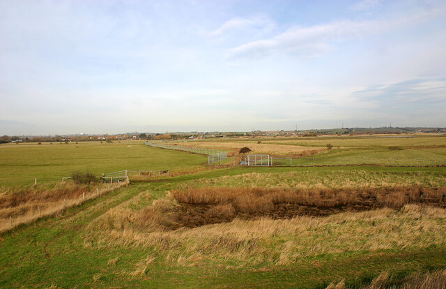
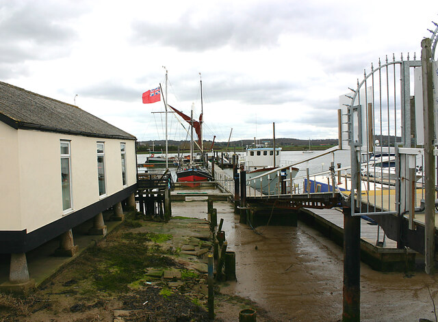
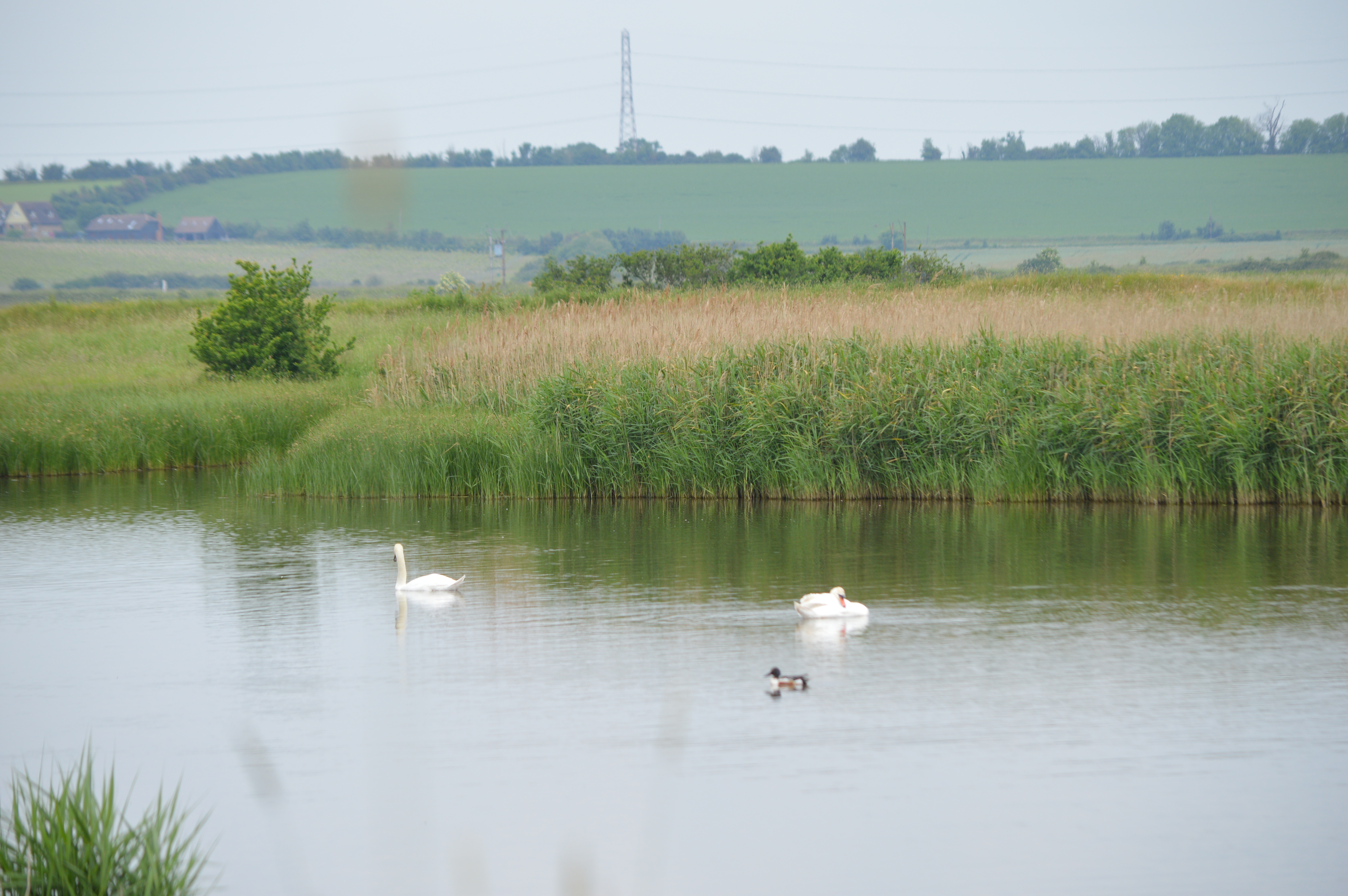
Fambridge is renowned for its charming countryside, with lush green fields and meadows surrounding the village. The area is ideal for nature lovers, offering numerous walking trails and opportunities for outdoor activities. The River Crouch plays a significant role in the village's identity, attracting boating enthusiasts and anglers alike. Its calm waters provide a peaceful backdrop for leisurely boat trips or simply enjoying the riverside views.

The village is home to a tight-knit community, with a population of around 500 residents. Fambridge retains a sense of traditional charm, with its historic buildings and quaint cottages adding to its appeal. The village boasts a local pub, The Ferryboat Inn, which serves as a popular meeting point for both locals and visitors.

Although small in size, Fambridge benefits from its proximity to nearby towns and cities. The town of Maldon is just a short drive away, offering various amenities such as shops, restaurants, and schools. For those seeking a taste of city life, Chelmsford, the county town of Essex, is within easy reach.

Overall, Fambridge provides a peaceful and idyllic escape from the hustle and bustle of urban living, with its natural beauty and strong community spirit making it a desirable place to reside.

If you have any feedback on the listing, please let us know in the comments section below.

Fambridge, South Images

Images are sourced within 2km of 51.630917/0.677881 or Grid Reference TQ8595. Thanks to Geograph Open Source API. All images are credited.

Arable field off Lower Road, Hullbridge
Footpath near Lowlands Farm, Ashingdon
Ashingdon Footpath 10 South Fambridge to Lower Road
Ashingdon Footpath 10
South Fambridge to Lower Road
Pond on Ashingdon Public Footpath No. 10 It's 15 plus years since I last photographed this pond <a href="https://www.geograph.org.uk/photo/219838">TQ8594 : Green Pond</a> - it looks a bit fresher now
Pond on Ashingdon Public Footpath No. 10
It's 15 plus years since I last photographed this pond TQ8594 : Green Pond - it looks a bit fresher now
South Fambridge: aerial 2022
North Fambridge station Taken looking in the up-direction towards Wickford. The line from Wickford to Southminster was opened in 1889 and electrified in 1986.
North Fambridge station
Taken looking in the up-direction towards Wickford. The line from Wickford to Southminster was opened in 1889 and electrified in 1986.
North Fambridge station - frontage The entire station looks as though it was rebuilt around the time the line from Wickford to Southminster was electrified in 1986.
North Fambridge station - frontage
The entire station looks as though it was rebuilt around the time the line from Wickford to Southminster was electrified in 1986.
Land earmarked for building, North Fambridge The flags suggest that the empty field behind them will soon be used to extend the Riverside Grange development, part of which can be seen in the background. The structure between the flag posts in the foreground once carried the village sign depicted in <a href="https://www.geograph.org.uk/photo/2869990">TQ8597 : North Fambridge Village Sign</a>.
Land earmarked for building, North Fambridge
The flags suggest that the empty field behind them will soon be used to extend the Riverside Grange development, part of which can be seen in the background. The structure between the flag posts in the foreground once carried the village sign depicted in TQ8597 : North Fambridge Village Sign.
Longpole Reach Taken looking upstream towards North Fambridge quay
Longpole Reach
Taken looking upstream towards North Fambridge quay
Crouch Valley scenery Looking north-west across the valley with North Fambridge on centre left horizon.
Crouch Valley scenery
Looking north-west across the valley with North Fambridge on centre left horizon.
Holy Trinity, North Fambridge - south-west elevation Most of the church dates from the mid-C18. As the background to the picture suggests, this once isolated area is today becoming increasingly urban in appearance.
Holy Trinity, North Fambridge - south-west elevation
Most of the church dates from the mid-C18. As the background to the picture suggests, this once isolated area is today becoming increasingly urban in appearance.
Holy Trinity, North Fambridge - north-west elevation Most of the church dates from the mid-C18.
Holy Trinity, North Fambridge - north-west elevation
Most of the church dates from the mid-C18.
Holy Trinity, North Fambridge - south-east elevation Most of the church dates from the mid-C18.
Holy Trinity, North Fambridge - south-east elevation
Most of the church dates from the mid-C18.
Riverside Cottages, North Fambridge The metal steps in the foreground lead to Riverside Cottages Sluice.
Riverside Cottages, North Fambridge
The metal steps in the foreground lead to Riverside Cottages Sluice.
Fambridge Yacht Haven, North Fambridge South Fambridge can be seen across the river. There was once a ferry between the two sides which replaced a pair of footbridges. To make the crossing now requires a considerable detour.
Fambridge Yacht Haven, North Fambridge
South Fambridge can be seen across the river. There was once a ferry between the two sides which replaced a pair of footbridges. To make the crossing now requires a considerable detour.
Fambridge Yacht Station, North Fambridge
The Ferry Boat Inn, North Fambridge
Ferry Road, North Fambridge Although this part of North Fambridge looks relatively unsuburban, housing development is now proceeding apace farther up Ferry Road.
Ferry Road, North Fambridge
Although this part of North Fambridge looks relatively unsuburban, housing development is now proceeding apace farther up Ferry Road.
Show me another place!

Fambridge, South is located at Grid Ref: TQ8595 (Lat: 51.630917, Lng: 0.677881)

Administrative County: Essex

District: Rochford

Police Authority: Essex

What 3 Words

///ports.idealist.podcast. Near Cold Norton, Essex

Related Wikis

South Fambridge

South Fambridge is a village and former civil parish, now in the parish of Ashingdon, in the Rochford district, in the county of Essex, England. It is...

7th Cruiser Squadron

The 7th Cruiser Squadron (also known as Cruiser Force C) was a blockading force of the Royal Navy during the First World War used to close the English...

North Fambridge

North Fambridge is a village and civil parish on the Dengie peninsula in the English county of Essex. North Fambridge is on the north bank of the River...

Blue House Farm

Blue House Farm is a 242.8-hectare (600-acre) nature reserve and farm in North Fambridge, on the north bank of the River Crouch between Burnham-on-Crouch...

Nearby Amenities

Located within 500m of 51.630917,0.677881
Source: PGS
Lat/Long: 51.6340285/0.681591
Source: PGS
Lat/Long: 51.6342283/0.6807971
Source: PGS
Lat/Long: 51.6340485/0.6804752
Source: PGS
Lat/Long: 51.6340285/0.6798959
Source: PGS
Lat/Long: 51.6341484/0.6796706
Source: PGS
Lat/Long: 51.6338754/0.676173
Source: PGS
Lat/Long: 51.6337888/0.6758404
Source: PGS
Lat/Long: 51.6341443/0.6735996
Bunker Type: pillbox
Military: bunker
Lat/Long: 51.6339979/0.6814381
Power: pole
Lat/Long: 51.6307666/0.6795283
Power: pole
Lat/Long: 51.6304819/0.6804657
Power: pole
Lat/Long: 51.6293964/0.6815144
Power: pole
Lat/Long: 51.6293165/0.6823647
Power: pole
Lat/Long: 51.6291949/0.6833759
Power: pole
Lat/Long: 51.6290934/0.6844085
The data included in this document is from www.openstreetmap.org. The data is made available under ODbL.

Have you been to Fambridge, South?

Leave your review of Fambridge, South below (or comments, questions and feedback).