South Erradale

Settlement in Ross-shire

Scotland

South Erradale

Allt a’ Chaol Thuill
Allt a’ Chaol Thuill Credit: Mick Garratt

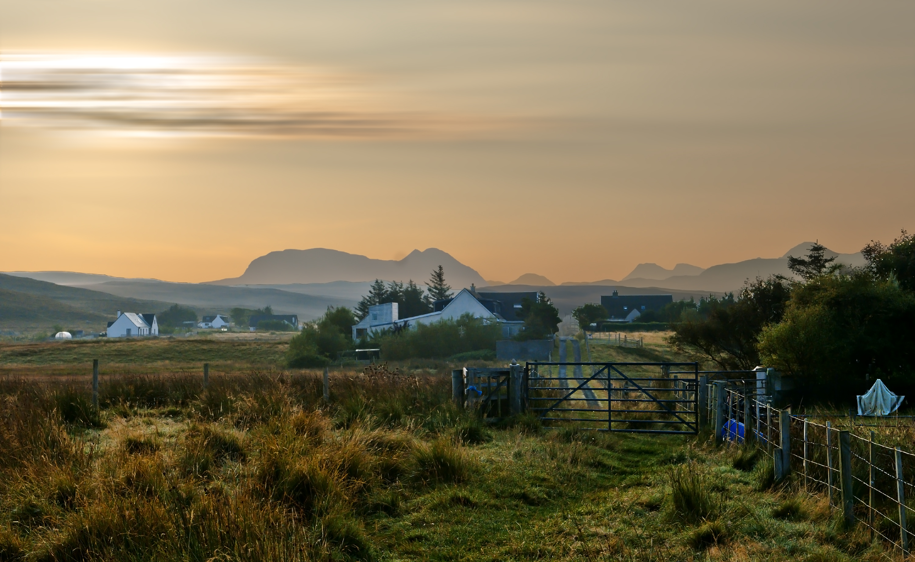
South Erradale is a small coastal village located in the county of Ross-shire, in the Scottish Highlands. Situated on the western shores of Gruinard Bay, it offers stunning views of the surrounding rugged landscape and the nearby Isle of Skye. The village is part of the larger Gairloch community and is approximately 7 miles southwest of the town of Gairloch.

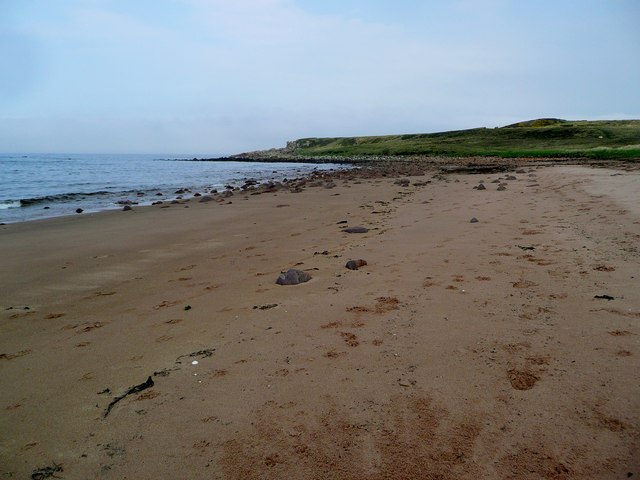
With a population of around 150, South Erradale maintains a peaceful and close-knit community feel. The area is known for its picturesque beaches, including the beautiful sandy beach of Red Point, which attracts visitors for its tranquility and scenic walks along the shoreline.

The village itself consists of a few scattered houses and cottages, with some offering self-catering accommodations for tourists. The surrounding countryside is characterized by rolling hills, moorland, and lochs, making it an ideal destination for outdoor enthusiasts. Hiking, cycling, and fishing are popular activities in the area, with numerous trails and paths to explore.

South Erradale is also home to several historic landmarks, such as the ruins of the 17th-century Inverewe Castle and the nearby Inverewe Garden, known for its diverse plant species and stunning floral displays.

Although small in size, South Erradale offers a peaceful retreat for nature lovers and those seeking a quiet getaway. Its natural beauty, rich history, and welcoming community make it a charming destination in the heart of the Scottish Highlands.

If you have any feedback on the listing, please let us know in the comments section below.

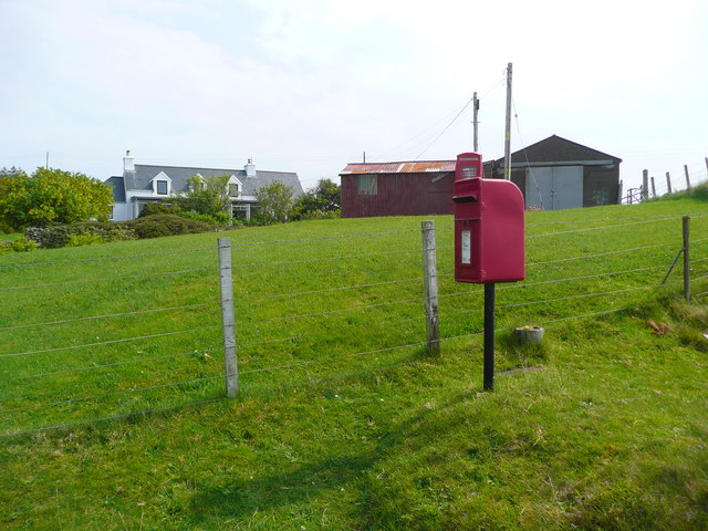
South Erradale Images

Images are sourced within 2km of 57.675583/-5.7845578 or Grid Reference NG7471. Thanks to Geograph Open Source API. All images are credited.

Allt a’ Chaol Thuill
Track, South Erradale to Redpoint It looks like once this was a very substantial track.
Track, South Erradale to Redpoint
It looks like once this was a very substantial track.
Opinan Opinan is a crofting community astride the B8056 which is the road at the right side of the image.
Opinan
Opinan is a crofting community astride the B8056 which is the road at the right side of the image.
River Erradale The River Erradale passing through the crofting community of South Erradale as seen from the B8056.
River Erradale
The River Erradale passing through the crofting community of South Erradale as seen from the B8056.
Allt na Criche Having crossed gently sloping moorland the Allt na Criche descends more steeply to reach the sea below the B8056.
Allt na Criche
Having crossed gently sloping moorland the Allt na Criche descends more steeply to reach the sea below the B8056.
Moorland and croft land at South Erradale The land immediately beyond the fence is uncultivated moorland showing possible signs of peat cutting. Beyond lies the crofted land and cottages of South Erradale.
Moorland and croft land at South Erradale
The land immediately beyond the fence is uncultivated moorland showing possible signs of peat cutting. Beyond lies the crofted land and cottages of South Erradale.
Coastal moorland near Opinan
Moorland and peat cutting
Bridge at South Erradale over unnamed burn
Old croft at Opinan
Old croft at Opinan
River Erradale
River Erradale
Opinan
Opinan
Looking north over Port Henderson to Gairloch
Redpoint A tiny community at the end of a scenic minor road south west of Gairloch.
Redpoint
A tiny community at the end of a scenic minor road south west of Gairloch.
Wind blown surf Bad weather approaching too...
Wind blown surf
Bad weather approaching too...
Opinan
Opinan
Postbox at Opinan In the buildings here there used to be a post office and a farm selling produce when I visited as a child in the 1950s.
Postbox at Opinan
In the buildings here there used to be a post office and a farm selling produce when I visited as a child in the 1950s.
The beach at Opinan Yet another glorious NW Scotland beach - with no one on it!
The beach at Opinan
Yet another glorious NW Scotland beach - with no one on it!
Show me another place!

South Erradale is located at Grid Ref: NG7471 (Lat: 57.675583, Lng: -5.7845578)

Unitary Authority: Highland

Police Authority: Highlands and Islands

What 3 Words

///squirts.gurgling.albums. Near Gairloch, Highland

Related Wikis

Opinan, Gairloch

Opinan (Scottish Gaelic: Na h-Òbaidhnean) is a fishing village on the west coast of Scotland in Gairloch, Ross-shire, Scottish Highlands and is in the...

South Erradale

South Erradale is a small hamlet, situated on the coastline and to the southwest of Gairloch in Ross and Cromarty, Scottish Highlands and is in the Scottish...

Redpoint

Redpoint (Scottish Gaelic: An Rubha Dearg) is a small settlement in the north west of Highland, Scotland. It takes its name from Red Point, a low promontory...

Port Henderson

Port Henderson (Scottish Gaelic: Portaigil) is a fishing village on the south west shore of the Gair Loch near the village of Gairloch, Ross-shire, Scottish...

Badachro

Badachro (Scottish Gaelic: Bad a' Chrò) is a former fishing village, in the northwest Highlands of Scotland. == Geography == Badachro sits about 3 km south...

Eilean Horrisdale

Eilean Horrisdale is an uninhabited island in Loch Gairloch in Wester Ross, Scotland. == Geography == Eilean Horrisdale is the largest island in Loch Gairloch...

Loch Bràigh Horrisdale

Loch Bràigh Horrisdale is a small, irregular shaped, freshwater loch in Wester Ross, in the north west of Scotland. The loch lies approximately 2 mi (3...

Gair Loch

The Gair Loch is a sea loch on the North West coast of Highland, Scotland. In Scottish Gaelic it is an Geàrr Loch meaning 'the short loch'. Around 6 miles...

Nearby Amenities

Located within 500m of 57.675583,-5.7845578
Bus Stop
Letterbox
Local Ref: AT
Naptan AtcoCode: 6700713123
Naptan Bearing: SW
Naptan CommonName: Letterbox
Naptan Indicator: at
Naptan Landmark: Letterbox
Naptan NaptanCode: 45328537
Naptan Street: B8056
Naptan Verified: no
Source: naptan_import
Lat/Long: 57.6750733/-5.7849949
Post Box
Ref: IV21 223
Source: survey
Lat/Long: 57.6750794/-5.7848535
South Erradale
Name En: South Erradale
Name Gd: Eàrradal a Deas
Place: hamlet
Lat/Long: 57.6739964/-5.7864353
Power: pole
Lat/Long: 57.6799196/-5.7858471
Power: pole
Lat/Long: 57.6798032/-5.7851676
Power: pole
Lat/Long: 57.6796471/-5.7842323
Power: pole
Lat/Long: 57.6796481/-5.7831978
Power: pole
Lat/Long: 57.6796573/-5.7816612
Power: pole
Lat/Long: 57.6792797/-5.7817624
Power: pole
Lat/Long: 57.6788837/-5.7818559
Power: pole
Lat/Long: 57.6785561/-5.7817452
Power: pole
Lat/Long: 57.6778111/-5.7815314
Power: pole
Lat/Long: 57.6772824/-5.7813672
Power: pole
Lat/Long: 57.6767864/-5.781226
Power: pole
Lat/Long: 57.676269/-5.7810638
Power: pole
Lat/Long: 57.6756066/-5.7817433
Power: pole
Lat/Long: 57.6749248/-5.7824323
Power: pole
Lat/Long: 57.6745257/-5.7828484
Power: pole
Lat/Long: 57.6741113/-5.7832951
Power: pole
Lat/Long: 57.6736622/-5.7837303
Power: pole
Lat/Long: 57.6732662/-5.7841483
Power: pole
Lat/Long: 57.6727119/-5.7847152
Power: pole
Lat/Long: 57.6719699/-5.7854883
Power: pole
Lat/Long: 57.6718566/-5.786624
Power: pole
Lat/Long: 57.6717392/-5.7878055
Power: pole
Lat/Long: 57.6747232/-5.7837074
Power: pole
Lat/Long: 57.6749069/-5.7846236
Power: pole
Lat/Long: 57.675107/-5.7855436
Power: pole
Lat/Long: 57.6755887/-5.7865476
Power: pole
Lat/Long: 57.6761644/-5.7875917
Power: pole
Lat/Long: 57.6737492/-5.7827725
Power: pole
Lat/Long: 57.6734732/-5.7822436
Power: pole
Lat/Long: 57.6734656/-5.7818977
Power: pole
Lat/Long: 57.6731858/-5.7815031
Power: pole
Lat/Long: 57.6728968/-5.78112
Power: pole
Lat/Long: 57.6726002/-5.7805653
Power: pole
Lat/Long: 57.6723709/-5.7801107
Power: pole
Lat/Long: 57.6721278/-5.7796619
Power: pole
Lat/Long: 57.6723113/-5.7795018
Power: pole
Lat/Long: 57.6732011/-5.7802508
Power: pole
Lat/Long: 57.6736888/-5.7806654
Power: pole
Lat/Long: 57.6741704/-5.7810971
Power: pole
Lat/Long: 57.6743844/-5.7820235
The data included in this document is from www.openstreetmap.org. The data is made available under ODbL.

Have you been to South Erradale?

Leave your review of South Erradale below (or comments, questions and feedback).