Blindcrake

Settlement in Cumberland Allerdale

England

Blindcrake

B5301 east of Moota Hill
B5301 east of Moota Hill Credit: Colin Pyle

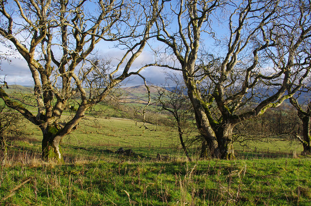
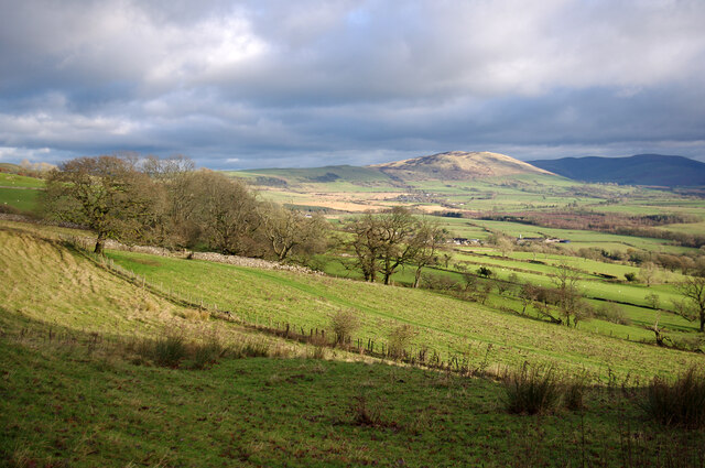
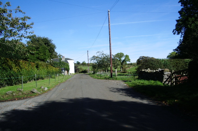
Blindcrake is a small rural village located in the county of Cumberland, in the northwest region of England. Situated amidst the breathtaking landscapes of the Lake District National Park, Blindcrake is surrounded by rolling hills, lush green fields, and picturesque countryside.

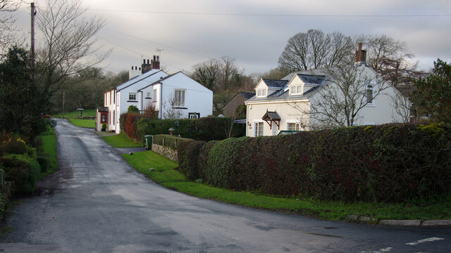
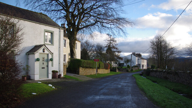
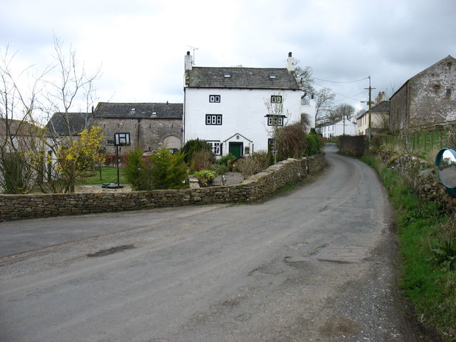
With a population of around 200 residents, Blindcrake offers a tranquil and close-knit community atmosphere. The village is characterized by its traditional stone houses, quaint cottages, and charming gardens, which all add to its idyllic charm and appeal.

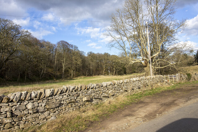
Blindcrake is well-known for its rich history, dating back to the medieval era. The village was once a bustling market town, and remnants of its past can still be seen in the historic buildings and structures that have been preserved over the centuries.

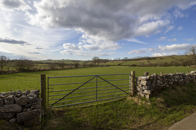
Nature enthusiasts will find Blindcrake to be a paradise, as it is surrounded by an abundance of natural beauty. The nearby Lake District National Park offers a plethora of outdoor activities, including hiking, cycling, and boating. The stunning Crummock Water and Loweswater are just a short distance away, providing opportunities for breathtaking scenic walks and peaceful picnics.

Although small in size, Blindcrake boasts a strong sense of community spirit. The village has a local pub that serves as a gathering place for residents and visitors alike, providing a warm and welcoming atmosphere.

In conclusion, Blindcrake is a charming village nestled in the heart of Cumberland's stunning countryside. With its rich history, natural beauty, and strong community spirit, it is a hidden gem for those seeking a peaceful and picturesque escape.

If you have any feedback on the listing, please let us know in the comments section below.
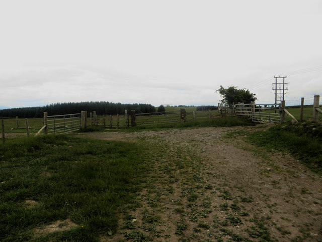
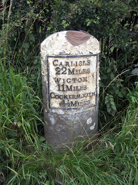
Blindcrake Images

Images are sourced within 2km of 54.701024/-3.322877 or Grid Reference NY1434. Thanks to Geograph Open Source API. All images are credited.

B5301 east of Moota Hill
Trees on Clints Crags Looking east to Binsey.
Trees on Clints Crags
Looking east to Binsey.
Eastern slopes of Clints Crags Binsey is in the distance.
Eastern slopes of Clints Crags
Binsey is in the distance.
Blindcrake Looking west along unnamed road, towards the village green.
Blindcrake
Looking west along unnamed road, towards the village green.
Blindcrake Looking south, on the road to Isel. Gill Beck is on the right. 
The temporary 'Works access 150 yards' sign refers to the recently installed United Utilities Thirlmere to West Cumbria pipeline.
Blindcrake
Looking south, on the road to Isel. Gill Beck is on the right. The temporary 'Works access 150 yards' sign refers to the recently installed United Utilities Thirlmere to West Cumbria pipeline.
The lane from Blindcrake to Sunderland Bewsgill Wood
The lane from Blindcrake to Sunderland
Bewsgill Wood
New hedge planted
New hedge planted
Looking toward Park Wood
Ellers Wood Gateway to field by Ellers wood
Ellers Wood
Gateway to field by Ellers wood
Gateway to field Gateway to field on road to Laal Moota
Gateway to field
Gateway to field on road to Laal Moota
Direction Sign - Signpost in Blindcrake Located on the southwest side of a junction in the village centre by a grit bin, a litter bin and a bus shelter. Blindcrake parish. 3 arms and annulus finial. See also <span class="nowrap"><a title="http://www.geog.port.ac.uk/webmap/thelakes/photos/bvz04.jpg" rel="nofollow ugc noopener" href="http://www.geog.port.ac.uk/webmap/thelakes/photos/bvz04.jpg">Link</a><img style="margin-left:2px;" alt="External link" title="External link - shift click to open in new window" src="https://s1.geograph.org.uk/img/external.png" width="10" height="10"/></span>.

Milestone Society National ID: CU_NY1434B
Direction Sign - Signpost in Blindcrake
Located on the southwest side of a junction in the village centre by a grit bin, a litter bin and a bus shelter. Blindcrake parish. 3 arms and annulus finial. See also LinkExternal link. Milestone Society National ID: CU_NY1434B
Redmain village
Redmain village
Cattle grazing north of Millstone Moor A grass field north of Millstone Moor farm being grazed by a herd of young cattle.
Cattle grazing north of Millstone Moor
A grass field north of Millstone Moor farm being grazed by a herd of young cattle.
Modern farm buildings at Millstone Moor A pair of large modern buildings at Millstone Moor farm.
Modern farm buildings at Millstone Moor
A pair of large modern buildings at Millstone Moor farm.
Grass field at Millstone Moor A grass field at Millstone Moor.
Grass field at Millstone Moor
A grass field at Millstone Moor.
Farm buildings at Millstone Moor Looking down a short track towards a range of small buildings and a house at Millstone Moor.
Farm buildings at Millstone Moor
Looking down a short track towards a range of small buildings and a house at Millstone Moor.
End of a track The track heading north from Millstone Moor farm terminates with these three gates providing access to different grass fields. The track is also a public bridleway.
End of a track
The track heading north from Millstone Moor farm terminates with these three gates providing access to different grass fields. The track is also a public bridleway.
Old Milestone by the A595 at Laal Moota Metal plate attached to stone post by the A595, in parish of BLINDCRAKE (ALLERDALE District), Moota Quarry, North of Blindcrake; opposite Moota Inn, on grass verge, on North side of road. Carlisle red stone and curved plate, erected by the Cockermouth & Carlisle turnpike trust in the 19th century. 

Inscription reads:-
CARLISLE
22 MILES
WIGTON
11 MILES
COCKERMOUTH
4½ MILES 

Grade II Listed. List Entry Number: 1312023
<span class="nowrap"><a title="https://historicengland.org.uk/listing/the-list/list-entry/1312023" rel="nofollow ugc noopener" href="https://historicengland.org.uk/listing/the-list/list-entry/1312023">Link</a><img style="margin-left:2px;" alt="External link" title="External link - shift click to open in new window" src="https://s1.geograph.org.uk/img/external.png" width="10" height="10"/></span>

Milestone Society National ID: CU_CLCM22.
Old Milestone by the A595 at Laal Moota
Metal plate attached to stone post by the A595, in parish of BLINDCRAKE (ALLERDALE District), Moota Quarry, North of Blindcrake; opposite Moota Inn, on grass verge, on North side of road. Carlisle red stone and curved plate, erected by the Cockermouth & Carlisle turnpike trust in the 19th century. Inscription reads:- CARLISLE 22 MILES WIGTON 11 MILES COCKERMOUTH 4½ MILES Grade II Listed. List Entry Number: 1312023 LinkExternal link Milestone Society National ID: CU_CLCM22.
Show me another place!

Blindcrake is located at Grid Ref: NY1434 (Lat: 54.701024, Lng: -3.322877)

Administrative County: Cumbria

District: Allerdale

Police Authority: Cumbria

What 3 Words

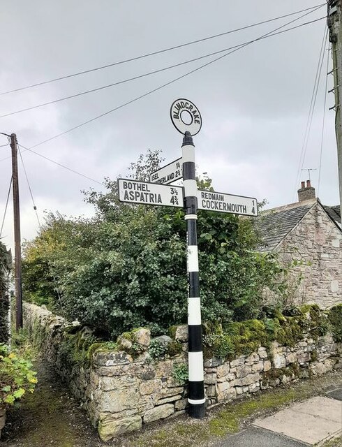
///emperor.reshape.registers. Near Cockermouth, Cumbria

Nearby Locations

Gill Wood Blindcrake

Related Wikis

Redmain, Cumbria

Redmain is a small hamlet in the Isel Valley and parish of Blindcrake within the Lake District National Park in Cumbria, England. The hamlet lies on the...
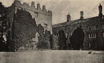
Isel Hall

Isel Hall is an ancient Cumbrian residence that sits on a steep rise on the northern banks of the River Derwent, two miles (3.2 km) south of Bassenthwaite...

Blindcrake

Blindcrake is a village and civil parish within the Isel Valley, in the Lake District National Park, in Cumbria, England, historically part of Cumberland...
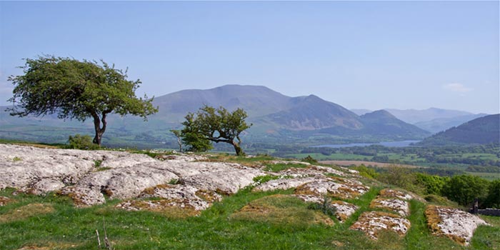
Clints Crags

Clints Crags is a small fell in the north of the English Lake District near Blindcrake, Cumbria. It has its own chapter in Alfred Wainwright's The Outlying...

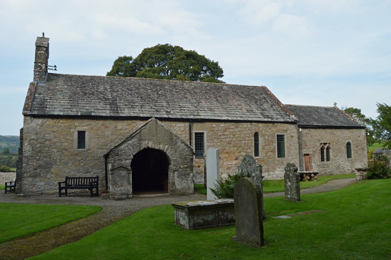
St Michael's Church, Isel

St Michael's Church is located by the side of the River Derwent in the dispersed settlement of Isel, in the civil parish of Blindcrake, Cumbria, England...

Isel, Cumbria

Isel is a dispersed settlement and area in the valley of the River Derwent within the Lake District National Park in Cumbria, England. It is an ecclesiastical...

Sunderland, Cumbria

Sunderland is a hamlet and former civil parish, within the Lake District National Park, now in the parish of Blindcrake in the Allerdale district of the...

Watch Hill (Cockermouth)

Watch Hill is a small hill lying on the north-western fringe of the Lake District in England. It has a height of 833 feet (254 m) and a prominence of 515...

Nearby Amenities

Located within 500m of 54.701024,-3.322877
Blindcrake
Place: village
Source: npe
Website: https://www.blindcrake.org.uk/
Wikidata: Q2116071
Wikipedia: en:Blindcrake
Lat/Long: 54.7011237/-3.32352
Bench
Backrest: yes
Lat/Long: 54.7000617/-3.323424
Telephone
Booth: KX100
Covered: booth
Lat/Long: 54.7012253/-3.322686
Post Box
Post Box Type: lamp
Ref: CA13 120
Royal Cypher: EIIR
Royal Cypher Wikidata: Q33102113
Lat/Long: 54.7011848/-3.3226745
The Oaks
Place: locality
Lat/Long: 54.6978341/-3.3251589
Bench
Backrest: yes
Material: wood
Lat/Long: 54.7012121/-3.3226829
Advertising: board
Lit: no
Lat/Long: 54.7011998/-3.3226796
Drinking Water: no
Listed Status: Grade II
Man Made: water_well
Lat/Long: 54.7012296/-3.3226321
Bench
Backrest: yes
Lat/Long: 54.7000678/-3.323385
Information: guidepost
Tourism: information
Lat/Long: 54.6997215/-3.3237253
Information: guidepost
Tourism: information
Lat/Long: 54.7042574/-3.3176389
Community Centre
Blindcrake Village Hall
Addr City: Blindcrake
Community Centre: village_hall
Website: https://www.blindcrakevillagehall.org.uk/
Lat/Long: 54.6991501/-3.3242393
Give Way
Direction: backward
Lat/Long: 54.7009916/-3.322785
Ford: yes
Lat/Long: 54.6991863/-3.3191925
Power: pole
Lat/Long: 54.7039334/-3.319233
Power: pole
Lat/Long: 54.7038845/-3.3205352
Power: pole
Lat/Long: 54.7037985/-3.3223272
Power: pole
Lat/Long: 54.7031476/-3.3237843
Power: pole
Lat/Long: 54.7020978/-3.3242204
Power: pole
Lat/Long: 54.7015568/-3.3244809
Power: pole
Lat/Long: 54.7009847/-3.3247764
Power: pole
Lat/Long: 54.7001845/-3.3264465
Power: pole
Lat/Long: 54.699819/-3.3274779
Power: pole
Lat/Long: 54.6992696/-3.3290053
Power: pole
Lat/Long: 54.6995778/-3.3247103
Power: pole
Lat/Long: 54.6997032/-3.322877
Power: pole
Lat/Long: 54.6997521/-3.3222796
Power: pole
Lat/Long: 54.702262/-3.3231487
Power: pole
Lat/Long: 54.7012767/-3.3226651
Power: pole
Lat/Long: 54.7010773/-3.3212038
Power: pole
Lat/Long: 54.7003822/-3.3195151
Power: pole
Lat/Long: 54.6996727/-3.3178203
Power: pole
Lat/Long: 54.6991508/-3.3165512
The data included in this document is from www.openstreetmap.org. The data is made available under ODbL.

Have you been to Blindcrake?

Leave your review of Blindcrake below (or comments, questions and feedback).