Cookney, South

Settlement in Kincardineshire

Scotland

Cookney, South

Former Cookney parish kirk Built 1885 in fake Gothic style and C-listed (LB9358): <span class="nowrap"><a title="http://portal.historicenvironment.scot/designation/LB9358" rel="nofollow ugc noopener" href="http://portal.historicenvironment.scot/designation/LB9358">Link</a><img style="margin-left:2px;" alt="External link" title="External link - shift click to open in new window" src="https://s1.geograph.org.uk/img/external.png" width="10" height="10"/></span> .  Now occupied by an environmental consulting firm.
Former Cookney parish kirk Credit: Bill Harrison

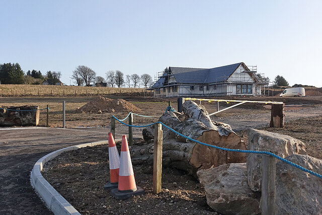
Cookney is a small village located in the southern part of Kincardineshire, Scotland. Situated in the picturesque countryside, this rural settlement is known for its tranquil surroundings and close-knit community. The village is nestled amidst rolling hills and farmland, offering stunning views of the natural landscape.

Cookney is home to a population of approximately 300 residents, making it a tight-knit community where people know each other well. The village exudes a warm and welcoming atmosphere, with residents often coming together for various social events and activities.

The village is well-connected to nearby towns and cities, with Stonehaven being the closest major settlement, located just a few miles to the east. This proximity provides residents with easy access to a range of amenities and services.

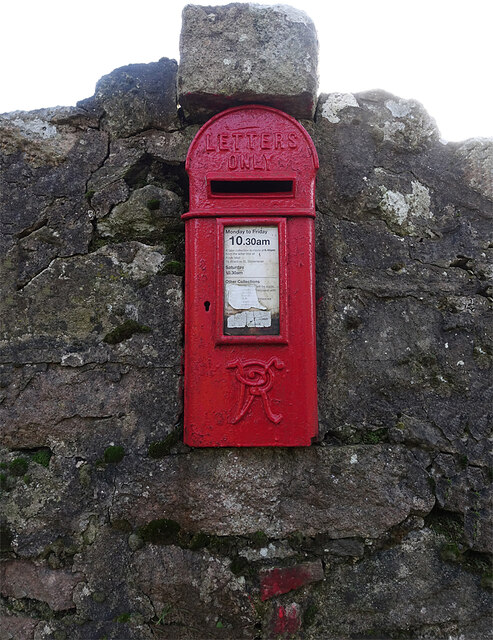
While Cookney is primarily a residential area, there are a few local businesses and services that cater to the needs of the community. These include a village shop, a post office, and a pub, which serves as a popular gathering spot for residents.

Outdoor enthusiasts will find plenty to enjoy in Cookney, as the village is surrounded by an abundance of natural beauty. The nearby countryside offers opportunities for hiking, cycling, and exploring the great outdoors. Additionally, the picturesque coastline is just a short distance away, providing residents with access to stunning beaches and coastal walks.

Overall, Cookney, South, Kincardineshire is a charming rural village that offers a peaceful and close-knit community lifestyle, with beautiful natural surroundings and easy access to nearby amenities.

If you have any feedback on the listing, please let us know in the comments section below.

Cookney, South Images

Images are sourced within 2km of 57.018912/-2.2322001 or Grid Reference NO8692. Thanks to Geograph Open Source API. All images are credited.

Former Cookney parish kirk Built 1885 in fake Gothic style and C-listed (LB9358): <span class="nowrap"><a title="http://portal.historicenvironment.scot/designation/LB9358" rel="nofollow ugc noopener" href="http://portal.historicenvironment.scot/designation/LB9358">Link</a><img style="margin-left:2px;" alt="External link" title="External link - shift click to open in new window" src="https://s1.geograph.org.uk/img/external.png" width="10" height="10"/></span> .  Now occupied by an environmental consulting firm.
Former Cookney parish kirk
Built 1885 in fake Gothic style and C-listed (LB9358): LinkExternal link . Now occupied by an environmental consulting firm.
Cookney war memorial
B979 past Allochie Croft Heading towards Stonehaven. The new Aberdeen Western Bypass is just out of shot left.
B979 past Allochie Croft
Heading towards Stonehaven. The new Aberdeen Western Bypass is just out of shot left.
Industrial building off B979 at Allochie With a new dwelling house under construction to the right.
Industrial building off B979 at Allochie
With a new dwelling house under construction to the right.
Track towards Allochie Farm From its junction with the B979, south of Netherley.
Track towards Allochie Farm
From its junction with the B979, south of Netherley.
Access to a new house at Woodend, Netherley Off the west side of B979.
Access to a new house at Woodend, Netherley
Off the west side of B979.
Field by B979 With a view to the hamlet of Hilton in NO8692.
Field by B979
With a view to the hamlet of Hilton in NO8692.
View over the upper Burn of Muchalls From B979, towards Cookney hill, on left skyline.
View over the upper Burn of Muchalls
From B979, towards Cookney hill, on left skyline.
The A90 at Cookney The A90, Aberdeen Western Peripheral Route (AWPR), at Cookney
The A90 at Cookney
The A90, Aberdeen Western Peripheral Route (AWPR), at Cookney
A90 at Elrick The A90, Aberdeen Western Peripheral Route (AWPR), at Elrick
A90 at Elrick
The A90, Aberdeen Western Peripheral Route (AWPR), at Elrick
Mud by the Gate The gate is the access to some small fields on the fringe of <a href="https://www.geograph.org.uk/photo/7062136">NO8694 : Red Moss</a>. The fields themselves are evidently fairly damp, judging by the clumps of rushes.
Mud by the Gate
The gate is the access to some small fields on the fringe of NO8694 : Red Moss. The fields themselves are evidently fairly damp, judging by the clumps of rushes.
Open Field There is no gate at either end of the track across this long strip of field. However it is next to Cookney Stables and could no doubt be secured for horses by temporary electric fences.
Open Field
There is no gate at either end of the track across this long strip of field. However it is next to Cookney Stables and could no doubt be secured for horses by temporary electric fences.
Doonby A new house is nearing completion on a greenfield site in Cookney. The nameplate saying it is called Doonby is just out of view on the dyke at the far side of the entrance.
Doonby
A new house is nearing completion on a greenfield site in Cookney. The nameplate saying it is called Doonby is just out of view on the dyke at the far side of the entrance.
Entering Cookney At first glance it crossed my mind that this house might originally have been a school, but the 19th century maps show that it wasn't. It is on the second edition of the six-inch Ordnance Survey map, surveyed in 1901, but not on the first edition, surveyed in 1865.
Entering Cookney
At first glance it crossed my mind that this house might originally have been a school, but the 19th century maps show that it wasn't. It is on the second edition of the six-inch Ordnance Survey map, surveyed in 1901, but not on the first edition, surveyed in 1865.
Victorian Letterbox Still in use, with a collection six days a week.
Victorian Letterbox
Still in use, with a collection six days a week.
Cookney Kirk If I read 'The Buildings of Scotland' correctly, this kirk replaces a Chapel of Ease built in 1816-1817 and enlarged in 1838-1839. It was built in 1885-1889 to a design by Mackenzie and McMillan in Early English style, featuring rose windows, corbelled pinnacles and a bellecote, underneath which the date 1885 is carved. A prominent landmark, it is Category C Listed. It is no longer in ecclesiastical use, now being the premises of RUM Consultancy Ltd <span class="nowrap"><a title="https://rumconsultancy.co.uk/" rel="nofollow ugc noopener" href="https://rumconsultancy.co.uk/">Link</a><img style="margin-left:2px;" alt="External link" title="External link - shift click to open in new window" src="https://s1.geograph.org.uk/img/external.png" width="10" height="10"/></span> and renamed RUM House.
Cookney Kirk
If I read 'The Buildings of Scotland' correctly, this kirk replaces a Chapel of Ease built in 1816-1817 and enlarged in 1838-1839. It was built in 1885-1889 to a design by Mackenzie and McMillan in Early English style, featuring rose windows, corbelled pinnacles and a bellecote, underneath which the date 1885 is carved. A prominent landmark, it is Category C Listed. It is no longer in ecclesiastical use, now being the premises of RUM Consultancy Ltd LinkExternal link and renamed RUM House.
Cookney War Memorial Designed by George Bennet Mitchell in 1919. See also <a href="https://www.geograph.org.uk/photo/7062156">NO8793 : Cookney War Memorial</a>.
Cookney War Memorial
Designed by George Bennet Mitchell in 1919. See also NO8793 : Cookney War Memorial.
Cookney War Memorial The names of the fallen on <a href="https://www.geograph.org.uk/photo/7062154">NO8793 : Cookney War Memorial</a>.
Cookney War Memorial
The names of the fallen on NO8793 : Cookney War Memorial.
Show me another place!

Cookney, South is located at Grid Ref: NO8692 (Lat: 57.018912, Lng: -2.2322001)

Unitary Authority: Aberdeenshire

Police Authority: North East

What 3 Words

///snips.cultivation.prospered. Near Newtonhill, Aberdeenshire

Related Wikis

Craggie Cat

Craggie Cat is a hill landform in the Mounth of the Grampian Mountains at the southern edge of Netherley, Aberdeenshire, Scotland. The peak elevation...

Netherley, Aberdeenshire

Netherley, Scotland is a village in Aberdeenshire, situated approximately five miles northwest of Stonehaven. Netherley is located in the Mounth area...
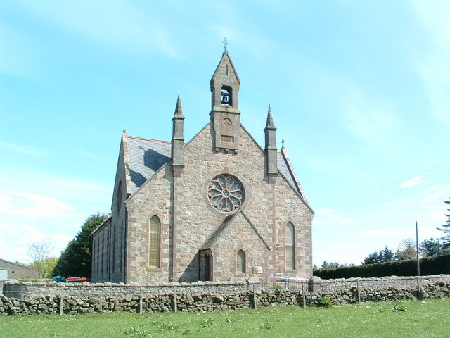
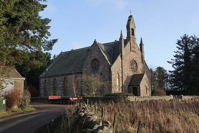
Cookney Church

Cookney Parish Church, now business premises within a converted listed building, was a Christian place of worship in the village of Cookney, Aberdeenshire...

Hill of Muchalls

The Hill of Muchalls is a coastal mountainous landform situated approximately 1.4 kilometres west of the Bridge of Muchalls in Aberdeenshire, Scotland...

Red Moss, Aberdeenshire

Red Moss is a wetland bog in Aberdeenshire, Scotland, located at the northwestern edge of the village of Netherley. (Grid Reference NO 955 856) The moss...

Netherley House

Netherley House is a mansion built by Alexander Silver in the late 18th century in Netherley, Aberdeenshire, Scotland. It is situated near the northerly...

Curlethney Hill

Curlethney Hill is a landform in Aberdeenshire, Scotland within the Mounth Range of the Grampian Mountains. (Grid Reference NO 918 839) The peak elevation...

Cookney

Cookney is a hamlet in Aberdeenshire, Scotland in proximity to Netherley in the Mounth of the Grampian Highlands. The community is situated on a hilltop...

Nearby Amenities

Located within 500m of 57.018912,-2.2322001
Power: pole
Lat/Long: 57.0210988/-2.2385304
Power: pole
Lat/Long: 57.0212385/-2.2374551
Power: pole
Lat/Long: 57.0213909/-2.2363161
Power: pole
Lat/Long: 57.021549/-2.2352068
Power: pole
Lat/Long: 57.0216137/-2.2345303
Power: pole
Lat/Long: 57.0217026/-2.233824
Power: pole
Lat/Long: 57.0218019/-2.2331325
Power: pole
Lat/Long: 57.0219416/-2.2322248
Power: pole
Lat/Long: 57.0182794/-2.2362567
Power: pole
Lat/Long: 57.0184006/-2.2353405
Power: pole
Lat/Long: 57.0185403/-2.234386
Power: pole
Lat/Long: 57.0186962/-2.2331665
Power: pole
Lat/Long: 57.0192654/-2.2335716
Power: pole
Lat/Long: 57.0198334/-2.2339809
Power: pole
Lat/Long: 57.0203957/-2.2343775
Power: pole
Lat/Long: 57.0209649/-2.2347805
Power: pole
Lat/Long: 57.0221701/-2.2356374
Power: pole
Lat/Long: 57.0226943/-2.2360234
Power: pole
Lat/Long: 57.0188416/-2.236314
Power: pole
Lat/Long: 57.0178776/-2.2362292
Power: pole
Lat/Long: 57.0173511/-2.2361952
Power: pole
Lat/Long: 57.022453/-2.2334486
Power: pole
Lat/Long: 57.0222775/-2.2329735
Power: pole
Lat/Long: 57.021661/-2.2315418
Power: pole
Lat/Long: 57.0213874/-2.2307846
Power: pole
Lat/Long: 57.0211172/-2.2300762
Power: pole
Lat/Long: 57.020854/-2.229406
Power: pole
Lat/Long: 57.0146214/-2.2313743
Power: pole
Lat/Long: 57.015178/-2.231633
Power: pole
Lat/Long: 57.0158154/-2.2321102
Power: pole
Lat/Long: 57.0165313/-2.2324241
Power: pole
Lat/Long: 57.0172367/-2.2327614
Power: pole
Lat/Long: 57.0183025/-2.2331537
The data included in this document is from www.openstreetmap.org. The data is made available under ODbL.

Have you been to Cookney, South?

Leave your review of Cookney, South below (or comments, questions and feedback).