Bletsoe

Settlement in Bedfordshire

England

Bletsoe

Lake, Moor End
Lake, Moor End Credit: JThomas

Bletsoe is a small village located in the county of Bedfordshire, England. Situated approximately 8 miles north-west of the town of Bedford, it lies on the eastern bank of the River Great Ouse. With a population of around 500 residents, Bletsoe is a quiet and picturesque rural community.

The history of Bletsoe dates back to the medieval period when it was a significant agricultural settlement. The village is known for its charming thatched cottages and traditional stone buildings, which add to its quintessential English countryside appeal.

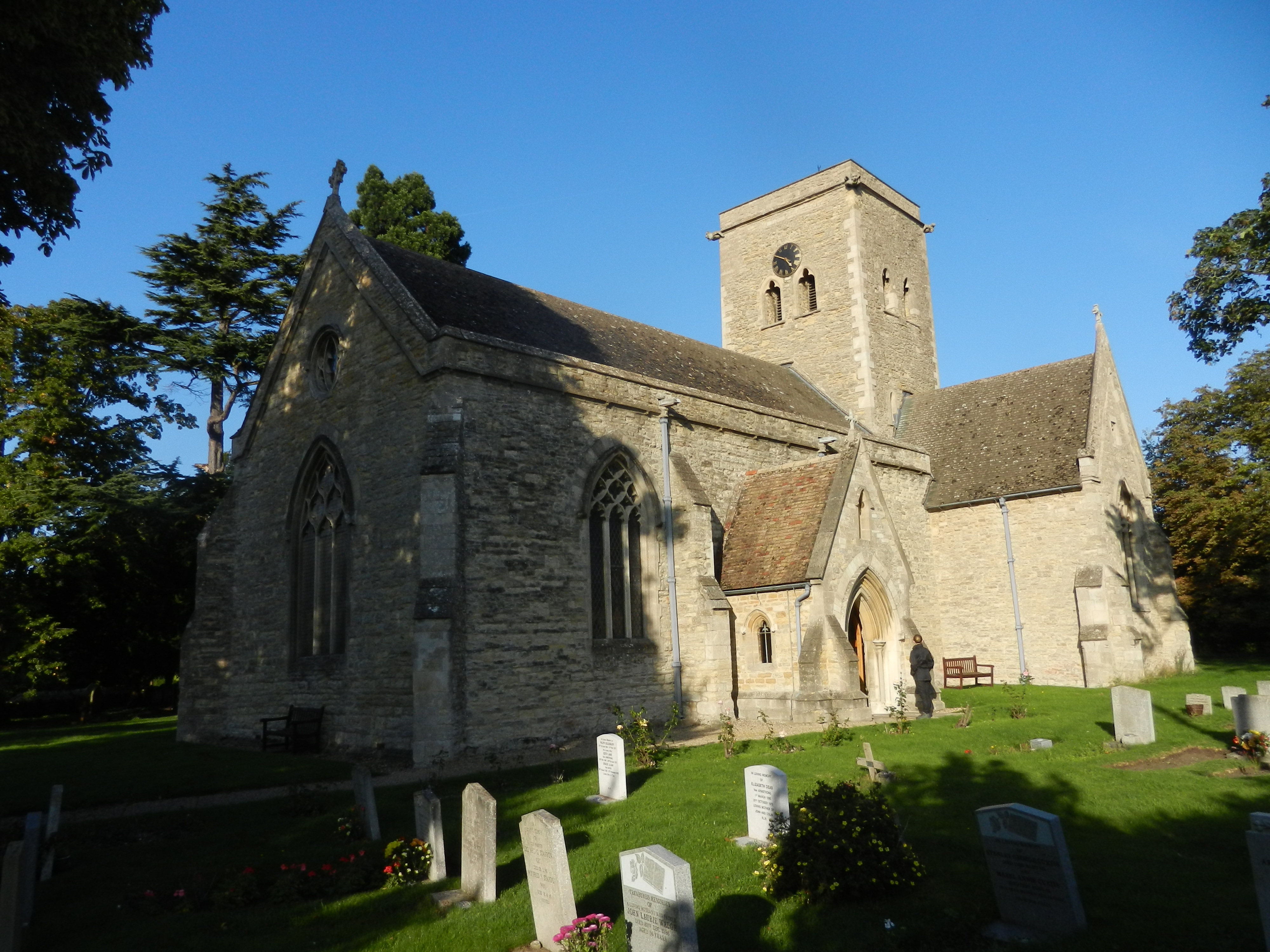
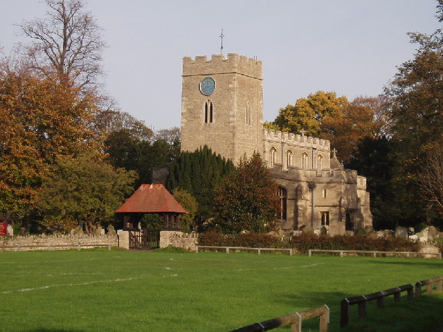
One of the prominent landmarks in Bletsoe is St. Mary's Church, a Grade I listed building that dates back to the 12th century. The church's architecture displays a mix of Norman and Gothic styles, and it is well-preserved, making it a popular attraction for visitors interested in historical and architectural sites.

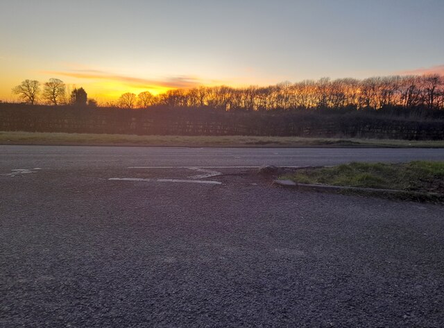
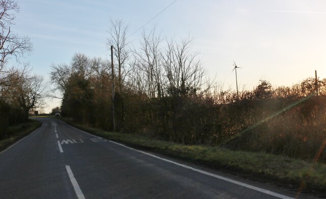
Bletsoe is surrounded by beautiful countryside, making it an ideal location for outdoor enthusiasts. The nearby River Great Ouse offers opportunities for boating, fishing, and riverside walks. Additionally, the village is surrounded by fields and woodland, providing scenic trails for hikers and nature lovers.

Although Bletsoe is primarily a residential area, it benefits from its close proximity to larger towns and cities. Bedford, with its excellent transport links, is within easy reach, offering a range of amenities, shopping centers, and entertainment options.

Overall, Bletsoe offers a peaceful and idyllic setting, with its rich history, charming architecture, and natural beauty making it a delightful place to live or visit.

If you have any feedback on the listing, please let us know in the comments section below.

Bletsoe Images

Images are sourced within 2km of 52.212258/-0.506175 or Grid Reference TL0258. Thanks to Geograph Open Source API. All images are credited.

Lake, Moor End
Lake, Moor End
Crop field and farm track, Moor End
Grazing, Radwell
Grazing, Radwell
Coplowe Lane at the junction of Thurleigh Road
Parking area on Bedford Road, Sharnbrook Here is virtually the same view. <a title="https://www.geograph.org.uk/photo/6673615" href="https://www.geograph.org.uk/photo/6673615">Link</a>
Parking area on Bedford Road, Sharnbrook
Here is virtually the same view. Link
Sunset over Bedford Road, Sharnbrook
Bletsoe Road at the corner of Bourne End Lane
Riseley Road at the junction of Bletsoe Road
Thurleigh Road, Bletsoe
Riseley Road, North End
Farm track and railway viaduct near Radwell
Radwell Bridge Eighteenth century bridge partly obscured by modern footway <span class="nowrap"><a title="https://historicengland.org.uk/listing/the-list/list-entry/1159240?section=official-list-entry" rel="nofollow ugc noopener" href="https://historicengland.org.uk/listing/the-list/list-entry/1159240?section=official-list-entry">Link</a><img style="margin-left:2px;" alt="External link" title="External link - shift click to open in new window" src="https://s1.geograph.org.uk/img/external.png" width="10" height="10"/></span>
Radwell Bridge
Eighteenth century bridge partly obscured by modern footway LinkExternal link
Causeway near Radwell Bridge
The River Great Ouse above Radwell Bridge Looking upstream.
The River Great Ouse above Radwell Bridge
Looking upstream.
Radwell village Looking down the northeasterly road in Radwell, with College Farm on the right
Radwell village
Looking down the northeasterly road in Radwell, with College Farm on the right
The road to Radwell Road from Milton Earnest to Radwell, showing the depth markers (for when the road floods, they count up to 3 feet depth) and on the right-hand side of the road, an elevated walkway allowing you to walk across when it does flood (or to avoid splashing by cars)

On the horizon is Radwell, safely 9 feet above the wet fields
The road to Radwell
Road from Milton Earnest to Radwell, showing the depth markers (for when the road floods, they count up to 3 feet depth) and on the right-hand side of the road, an elevated walkway allowing you to walk across when it does flood (or to avoid splashing by cars) On the horizon is Radwell, safely 9 feet above the wet fields
River Great Ouse by Radwell Bridge Looking towards houses in Radwell (on the horizon), the river in the foreground is the River Great Ouse, flowing through its floodplain towards the Radwell Bridge (off to the left of this image)
River Great Ouse by Radwell Bridge
Looking towards houses in Radwell (on the horizon), the river in the foreground is the River Great Ouse, flowing through its floodplain towards the Radwell Bridge (off to the left of this image)
Bletsoe church
Bletsoe church
Show me another place!

Bletsoe is located at Grid Ref: TL0258 (Lat: 52.212258, Lng: -0.506175)

Unitary Authority: Bedford

Police Authority: Bedfordshire

What 3 Words

///stewing.riverbed.yachting. Near Sharnbrook, Bedfordshire

Nearby Locations

Bletsoe

Related Wikis

Bletsoe

Bletsoe is a village and civil parish in Bedfordshire, England. It is on the A6, and about eight miles north of Bedford. The village has a small park,...

Bletsoe Castle

Bletsoe Castle was a late medieval fortified manor house in the village of Bletsoe, Bedfordshire, England. == Details == Bletsoe Castle was created by...

Radwell Manor Railway

The Radwell Manor Railway was a 10+1⁄4 in (260 mm) gauge miniature railway situated in the village of Radwell, near Felmersham, in North Bedfordshire,...

Radwell, Bedfordshire

Radwell is a hamlet in the Hundred of Willey in North Bedfordshire, England, on the River Great Ouse, about 7 miles (11 km) north west of Bedford. Administratively...

Sharnbrook

Sharnbrook is a village and civil parish located in the Borough of Bedford in Bedfordshire, England, situated around 7 miles (11 km) north-west of Bedford...

Church of All Saints, Milton Ernest

Church of All Saints is an Anglican church in the parish of Milton Ernest, Bedfordshire, England. It is part of the Benefice of Milton Ernest, Pavenham...

Sharnbrook railway station

Sharnbrook railway station was opened in 1857 by the Midland Railway to serve the village of Sharnbrook in Bedfordshire, England. It was on the Midland...

Yarl's Wood Immigration Removal Centre

Yarl's Wood Immigration Removal Centre is a detention centre for foreign nationals prior to their deportation from the United Kingdom, one of 10 such centres...

Nearby Amenities

Located within 500m of 52.212258,-0.506175
Bletsoe
Is In: Bedfordshire
Place: village
Lat/Long: 52.2132914/-0.5037583
Barrier: kissing_gate
Lat/Long: 52.2143979/-0.5050815
Pub
The Falcon
Addr City: Bletsoe
Addr Country: GB
Addr Postcode: MK44 1QN
Addr Street: Rushden Road
Fhrs Authority: Bedford
Fhrs Id: 102585
Fhrs Local Authority Id: 34097
Food: yes
Source: Bing
Website: http://www.thefalconbletsoe.co.uk/
Wikidata: Q26408021
Lat/Long: 52.2098608/-0.5113355
Bench
Lat/Long: 52.2131291/-0.5045564
Bench
Lat/Long: 52.2131784/-0.5046691
Post Box
Collection Times: Mo-Fr 17:00; Sa 09:30
Operator: Royal Mail
Post Box Type: lamp
Ref: MK44 114
Royal Cypher: EIIR
Royal Cypher Wikidata: Q33102113
Source: survey
Survey Date: 2018-08-02
Lat/Long: 52.2121265/-0.5068651
Power: pole
Lat/Long: 52.2159001/-0.5090027
Power: pole
Lat/Long: 52.2145713/-0.5083217
Power: pole
Lat/Long: 52.2150305/-0.5085829
Power: pole
Lat/Long: 52.2140128/-0.5079752
Power: pole
Lat/Long: 52.2136478/-0.5077422
Power: pole
Lat/Long: 52.2140228/-0.5056245
Power: pole
Lat/Long: 52.2131201/-0.5080605
The data included in this document is from www.openstreetmap.org. The data is made available under ODbL.

Have you been to Bletsoe?

Leave your review of Bletsoe below (or comments, questions and feedback).