South Bersted

Settlement in Sussex Arun

England

South Bersted

Big Wheel at Bognor Regis
Big Wheel at Bognor Regis Credit: Jeff Gogarty

South Bersted is a small residential area located in the county of West Sussex, in the South East of England. Situated approximately 2 miles southwest of Bognor Regis town centre, it is part of the larger Bognor Regis urban area. The area is bordered by the A259 road to the north, providing convenient access to neighboring towns such as Chichester and Littlehampton.

Primarily a residential community, South Bersted is known for its quiet and family-friendly atmosphere. The area features a mix of housing types, including detached houses, semi-detached houses, and some purpose-built apartment blocks. There are also several green spaces and parks scattered throughout the area, providing residents with recreational opportunities.

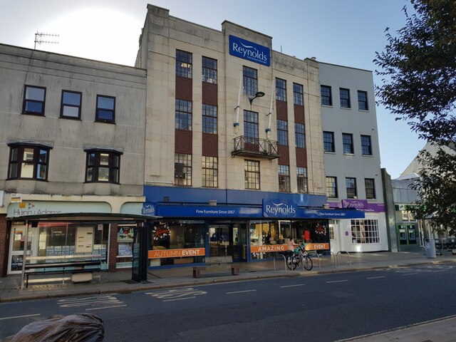
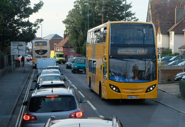
Basic amenities such as grocery stores, convenience shops, and local services can be found within South Bersted, while larger retail options are available in nearby Bognor Regis. The area benefits from good transportation links, with regular bus services connecting it to surrounding towns and villages.

South Bersted is also home to a number of schools, including primary and secondary schools, ensuring educational needs are catered for within the community. Additionally, there are several healthcare facilities in the vicinity, offering medical services to residents.

Overall, South Bersted offers a peaceful suburban lifestyle, combining the convenience of nearby amenities with a more rural setting. Its proximity to the coast and surrounding countryside makes it an attractive location for those seeking a quieter residential area within easy reach of larger towns and cities.

If you have any feedback on the listing, please let us know in the comments section below.

South Bersted Images

Images are sourced within 2km of 50.797397/-0.669693 or Grid Reference SU9300. Thanks to Geograph Open Source API. All images are credited.

Big Wheel at Bognor Regis
Bognor Regis Railway Station
Picturedrome Cinema Bognor Regis Still showing films.
Picturedrome Cinema Bognor Regis
Still showing films.
The Dog and Duck craft beers & ale house, Bognor Regis The bookshop next door has moved to the station.
The Dog and Duck craft beers & ale house, Bognor Regis
The bookshop next door has moved to the station.
Punch & Judy Pub Sign High Street, Bognor Regis.
Punch & Judy Pub Sign
High Street, Bognor Regis.
Reynolds, High Street, Bognor Regis
Fishmongers on Bognor Regis Promenade With the pebbles on the beach and sea behind on a misty morning and showing its position on next to the crossing.
Fishmongers on Bognor Regis Promenade
With the pebbles on the beach and sea behind on a misty morning and showing its position on next to the crossing.
Houses on Victoria Road, Bognor Regis, West Sussex
Hotham Park House Hotham Park is an area of 9 hectares (22 acres) located in the High Street, Bognor Regis. It is the only large park in the town. 

It first became a public park on 1st January 1947, having been purchased by the former Bognor Regis urban District Council from the executors of the late William Fletcher.   <span class="nowrap"><a title="http://www.hothampark.co.uk/index.html" rel="nofollow ugc noopener" href="http://www.hothampark.co.uk/index.html">Link</a><img style="margin-left:2px;" alt="External link" title="External link - shift click to open in new window" src="https://s1.geograph.org.uk/img/external.png" width="10" height="10"/></span>
Hotham Park House
Hotham Park is an area of 9 hectares (22 acres) located in the High Street, Bognor Regis. It is the only large park in the town. It first became a public park on 1st January 1947, having been purchased by the former Bognor Regis urban District Council from the executors of the late William Fletcher. LinkExternal link
Bognor Regis station throat A general view of this station, still controlled in 2023 via semaphore signalling.
Bognor Regis station throat
A general view of this station, still controlled in 2023 via semaphore signalling.
Bognor Regis station canopy details A charming anachronism in 2023.
Bognor Regis station canopy details
A charming anachronism in 2023.
Bognor Regis Railway Station Railway Station at Bognor Regis.
Bognor Regis Railway Station
Railway Station at Bognor Regis.
Bognor Regis Beach at Bognor Regis.
Bognor Regis
Beach at Bognor Regis.
Promenade and Pebbly Beach Promenade and pebbly beach by the Felpham Beach Huts
Promenade and Pebbly Beach
Promenade and pebbly beach by the Felpham Beach Huts
Felpham, St Mary the Virgin
Chichester Road A busy scene on the B2259 in North Bersted - exacerbated by a queue for fuel the other side of the roundabouts up ahead. The bus approaching is on the Coastliner 700 service from Portsmouth. Serving Havant and Chichester on route to Bognor Regis, it will terminate at Flansham Park with an onward connection to Littlehampton.
Chichester Road
A busy scene on the B2259 in North Bersted - exacerbated by a queue for fuel the other side of the roundabouts up ahead. The bus approaching is on the Coastliner 700 service from Portsmouth. Serving Havant and Chichester on route to Bognor Regis, it will terminate at Flansham Park with an onward connection to Littlehampton.
Ivy Lane Houses in Bognor Regis.
Ivy Lane
Houses in Bognor Regis.
Charles Purley Way Railway line passing under Charles Purley Way.
Charles Purley Way
Railway line passing under Charles Purley Way.
Show me another place!

South Bersted is located at Grid Ref: SU9300 (Lat: 50.797397, Lng: -0.669693)

Administrative County: West Sussex

District: Arun

Police Authority: Sussex

What 3 Words

///shine.grain.lines. Near Bognor Regis, West Sussex

Related Wikis

Bognor Regis East (electoral division)

Bognor Regis East is an electoral division of West Sussex in the United Kingdom and returns one member to sit on West Sussex County Council. == Extent... ==

South Bersted

South Bersted is a village and parish in the Arun district of West Sussex, England. It forms part of the built up area of Bognor Regis and lies on the...

Bognor Regis War Memorial Hospital

Bognor Regis War Memorial Hospital is a health facility in Shripney Road, Bognor Regis, West Sussex, England. It is managed by Sussex Community NHS Foundation...

LEC Airfield

LEC Airfield (ICAO: EGKC), also known as Bognor Regis Airfield, is an airfield in Bognor Regis in the United Kingdom. It was formerly owned by the LEC...

Nearby Amenities

Located within 500m of 50.797397,-0.669693
Source: Landsat photo
Lat/Long: 50.7971099/-0.6647518
Source: Landsat photo
Lat/Long: 50.7944094/-0.6676739
Source: NPE tracing
Lat/Long: 50.7931874/-0.6695996
Noexit: yes
Lat/Long: 50.7940721/-0.6726151
Traffic Calming: cushion
Lat/Long: 50.79655/-0.6753267
Odbl: clean
Lat/Long: 50.7965555/-0.6763385
Odbl: clean
Lat/Long: 50.7985593/-0.6751071
Odbl: clean
Lat/Long: 50.7975114/-0.6766708
Recycling
Lat/Long: 50.7974349/-0.670968
Bus Stop
Ash Grove
Bus: yes
Naptan AtcoCode: 4400LH0475
Naptan Bearing: S
Naptan CommonName: Ash Grove
Naptan Indicator: opp Chestnut Grove
Naptan Landmark: Orchard Way
Naptan NaptanCode: wsxdgapt
Naptan Street: Ash Grove
Naptan Verified: no
Public Transport: platform
Source: naptan_import
Lat/Long: 50.7968767/-0.6745251
Bus Stop
Ash Grove
Bus: yes
Naptan AtcoCode: 4400LH0476
Naptan Bearing: N
Naptan BusStopType: CUS
Naptan CommonName: Ash Grove
Naptan Indicator: adj Chestnut Grove
Naptan Landmark: Orchard Way
Naptan NaptanCode: wsxdgapw
Naptan Street: Ash Grove
Naptan Verified: no
Public Transport: platform
Source: naptan_import
Lat/Long: 50.7968963/-0.6746665
Bus Stop
Oak Grove
Bus: yes
Naptan AtcoCode: 4400LH0477
Naptan Bearing: S
Naptan CommonName: Oak Grove
Naptan Indicator: opp. Oak Grove
Naptan Landmark: Oak Grove
Naptan NaptanCode: wsxdgata
Naptan Street: Ash Grove
Naptan Verified: no
Public Transport: platform
Source: naptan_import
Lat/Long: 50.7989364/-0.6753325
Bus Stop
Tesco main road
Bus: yes
Naptan AtcoCode: 4400LH0551
Naptan Bearing: NE
Naptan CommonName: Tesco main road
Naptan Indicator: opp Arun Business park
Naptan Landmark: Tesco Superstore
Naptan NaptanCode: wsxdgjdp
Naptan Street: A29
Naptan Verified: no
Public Transport: platform
Source: naptan_import
Lat/Long: 50.7970429/-0.6677943
Bus Stop
The Poplars Caravan Park
Bench: no
Bin: no
Bus: yes
Lit: no
Naptan AtcoCode: 4400LH0552
Naptan Bearing: N
Naptan CommonName: The Poplars Caravan Park
Naptan Indicator: adj Caravan Park
Naptan Landmark: Poplars Park
Naptan NaptanCode: wsxdgjdt
Naptan Street: A29
Naptan Verified: no
Public Transport: platform
Shelter: no
Source: naptan_import
Tactile Paving: no
Lat/Long: 50.8010577/-0.6661472
Bus Stop
The Poplars Caravan Park
Bench: no
Bin: no
Bus: yes
Lit: no
Naptan AtcoCode: 4400LH0555
Naptan Bearing: S
Naptan CommonName: The Poplars Caravan Park
Naptan Indicator: opp Caravan Park
Naptan Landmark: Southern Cross Industrial Estate
Naptan NaptanCode: wsxdgjgd
Naptan Street: A29
Naptan Verified: no
Public Transport: platform
Shelter: no
Source: naptan_import
Tactile Paving: no
Lat/Long: 50.8011575/-0.6658466
Bus Stop
Riverside
Bench: no
Bin: no
Bus: yes
Naptan AtcoCode: 4400LH0556
Naptan Bearing: SW
Naptan CommonName: Riverside
Naptan Indicator: opp
Naptan Landmark: Riverside Caravan Park
Naptan NaptanCode: wsxdgjgj
Naptan Street: A29
Naptan Verified: no
Public Transport: platform
Shelter: yes
Source: naptan_import
Tactile Paving: no
Lat/Long: 50.7983652/-0.6658417
Bus Stop
Tesco
Bus: yes
Naptan AtcoCode: 4400LH0557
Naptan Bearing: SW
Naptan CommonName: Tesco
Naptan Indicator: opp. Tesco Superstore
Naptan Landmark: Tesco Superstore
Naptan NaptanCode: wsxdgjgm
Naptan Street: A29
Naptan Verified: no
Public Transport: platform
Source: naptan_import
Lat/Long: 50.7959704/-0.6691728
Bus Stop
Shops
Bus: yes
Naptan AtcoCode: 4400LH0560
Naptan Bearing: S
Naptan CommonName: Shops
Naptan Indicator: o/s no. 12
Naptan Landmark: Highcroft Crescent
Naptan NaptanCode: wsxdgjgw
Naptan Street: Madeira Avenue
Naptan Verified: no
Public Transport: platform
Source: naptan_import
Lat/Long: 50.7943057/-0.6663526
Bus Stop
Highfield Road
Bus: yes
Naptan AtcoCode: 4400LH0562
Naptan Bearing: W
Naptan CommonName: Highfield Road
Naptan Indicator: o/s 'News Box'
Naptan Landmark: A29 roundabout
Naptan NaptanCode: wsxdgjmd
Naptan Street: Highfield Road
Naptan Verified: no
Public Transport: platform
Source: naptan_import
Lat/Long: 50.794619/-0.6713254
Bus Stop
Shripney Road
Bus: yes
Naptan AtcoCode: 4400LH0563
Naptan Bearing: NE
Naptan CommonName: Shripney Road
Naptan Indicator: Orchard Way
Naptan Landmark: Orchard Way
Naptan NaptanCode: wsxdgjmg
Naptan Street: A29
Naptan Verified: no
Public Transport: platform
Source: naptan_import
Lat/Long: 50.7943871/-0.6722827
Bus Stop
Durban Road
Bus: yes
Naptan AtcoCode: 4400LH0713
Naptan Bearing: NW
Naptan BusStopType: CUS
Naptan CommonName: Durban Road
Naptan Indicator: opp
Naptan Landmark: Hail & Ride
Naptan NaptanCode: wsxdtgwj
Naptan Street: Orchard Way
Naptan Verified: no
Public Transport: platform
Source: naptan_import
Lat/Long: 50.7961305/-0.6737516
Bus Stop
Highfield Road
Bus: yes
Naptan AtcoCode: 4400LH0860
Naptan Bearing: S
Naptan CommonName: Highfield Road
Naptan Indicator: O/s Fish & Chip Shop
Naptan Landmark: Highfield Gardens
Naptan NaptanCode: wsxdpwtm
Naptan Street: Highfield Road
Naptan Verified: no
Public Transport: platform
Source: naptan_import
Lat/Long: 50.7934558/-0.6710604
Bus Stop
Highcroft Crescent
Bus: yes
Naptan AtcoCode: 4400LH0866
Naptan Bearing: N
Naptan CommonName: Highcroft Crescent
Naptan Indicator: O/s no 30
Naptan Landmark: Brook Lane
Naptan NaptanCode: wsxdtadm
Naptan Street: Highcroft Crescent
Naptan Verified: no
Public Transport: platform
Source: naptan_import
Lat/Long: 50.7946317/-0.6653513
Bus Stop
Durban Rd
Bus: yes
Naptan AtcoCode: 4400LH0892
Naptan Bearing: N
Naptan CommonName: Durban Rd
Naptan Indicator: Durban House
Naptan Landmark: Christie Place
Naptan NaptanCode: wsxdtdwp
Naptan Street: Durban Rd
Naptan Verified: no
Public Transport: platform
Source: naptan_import
Lat/Long: 50.7974371/-0.6723949
Bus Stop
Durban Rd
Bus: yes
Naptan AtcoCode: 4400LH0893
Naptan Bearing: S
Naptan CommonName: Durban Rd
Naptan Indicator: Durban House
Naptan Landmark: Christie Place
Naptan NaptanCode: wsxdtdwt
Naptan Street: Durban Rd
Naptan Verified: no
Public Transport: platform
Source: naptan_import
Lat/Long: 50.79729/-0.6721153
Bus Stop
Durban Road
Bus: yes
Naptan AtcoCode: 4400LH0942
Naptan Bearing: SE
Naptan BusStopType: CUS
Naptan CommonName: Durban Road
Naptan Indicator: adj
Naptan Landmark: Ash Grove
Naptan Street: Orchard Way
Naptan Verified: no
Public Transport: platform
Source: naptan_import
Lat/Long: 50.7961918/-0.673608
Turning Circle
Lat/Long: 50.7931085/-0.6708059
Crossing
Bicycle: yes
Crossing: unmarked
Crossing Markings: no
Kerb: lowered
Tactile Paving: no
Lat/Long: 50.7995313/-0.6657057
Crossing
Bicycle: yes
Crossing: unmarked
Crossing Island: yes
Crossing Markings: no
Kerb: lowered
Tactile Paving: yes
Lat/Long: 50.7953867/-0.6711065
Traffic Signals
Traffic Signals: signal
Traffic Signals Direction: forward
Lat/Long: 50.7992658/-0.6654608
Carpetright
Brand: Carpetright
Brand Wikidata: Q5045782
Brand Wikipedia: en:Carpetright
Shop: carpet
Lat/Long: 50.7988095/-0.6671234
Atm
Cash In: no
Check Date: 2024-02-16
Fee: no
Operator: Tesco
Lat/Long: 50.7971279/-0.6696635
Mini Roundabout
Direction: clockwise
Lat/Long: 50.7991921/-0.6642055
Source: Landsat photo
Lat/Long: 50.7951688/-0.6666996
Crossing
Crossing: unmarked
Crossing Markings: no
Kerb: lowered
Tactile Paving: no
Lat/Long: 50.7993374/-0.6657688
Crossing
Bicycle: yes
Crossing: unmarked
Crossing Markings: no
Kerb: lowered
Tactile Paving: no
Lat/Long: 50.7992882/-0.6657137
Traffic Signals
Lat/Long: 50.7965636/-0.6687546
Crossing
Bicycle: yes
Button Operated: yes
Crossing: traffic_signals
Crossing Island: yes
Crossing Ref: pegasus
Kerb: lowered
Tactile Paving: yes
Traffic Signals Sound: yes
Lat/Long: 50.7962193/-0.6686868
Crossing
Bicycle: yes
Button Operated: yes
Crossing: traffic_signals
Crossing Island: yes
Crossing Ref: pegasus
Kerb: lowered
Tactile Paving: yes
Traffic Signals Sound: yes
Lat/Long: 50.7962696/-0.668865
Post Box
Brand: Royal Mail
Brand Wikidata: Q638098
Brand Wikipedia: en:Royal Mail
Collection Plate: not visible
Collection Times: Mo-Fr 16:45; Sa 11:15
Operator: Royal Mail
Operator Wikidata: Q638098
Post Box Type: pillar
Ref: PO22 98
Royal Cypher: EIIR
Royal Cypher Wikidata: Q33102113
Lat/Long: 50.7973446/-0.6721348
Post Box
Brand: Royal Mail
Brand Wikidata: Q638098
Brand Wikipedia: en:Royal Mail
Collection Plate: CP1
Collection Times: Mo-Fr 16:00; Sa 11:00
Indoor: yes so postbox can only be used during Tesco store opening times.
Operator: Royal Mail
Operator Wikidata: Q638098
Post Box Type: pillar
Ref: PO22 119
Royal Cypher: EIIR
Royal Cypher Wikidata: Q33102113
Lat/Long: 50.7969733/-0.669651
Newsbox
Addr City: Bognor Regis
Addr Housenumber: 62
Addr Postcode: PO22 9LS
Addr Street: Gordon Avenue
Brand: Premier
Brand Wikidata: Q7240340
Brand Wikipedia: en:Premier Stores
Fhrs Authority: Arun
Fhrs Id: 115596
Fhrs Local Authority Id: 447847
Shop: convenience
Website: https://www.premier-stores.co.uk/our-stores/newsbox
Lat/Long: 50.7938536/-0.6711356
Post Box
Brand: Royal Mail
Brand Wikidata: Q638098
Brand Wikipedia: en:Royal Mail
Collection Plate: CP8
Collection Times: Mo-Fr 16:15; Sa 08:00
Operator: Royal Mail
Operator Wikidata: Q638098
Post Box Type: pillar
Ref: PO22 121
Royal Cypher: EIIR
Royal Cypher Wikidata: Q33102113
Lat/Long: 50.7961998/-0.6673161
Post Box
Collection Plate: CP1
Collection Times: Mo-Fr 16:15; Sa 11:30
Operator: Royal Mail
Operator Wikidata: Q638098
Post Box Type: pillar
Ref: PO22 37
Royal Cypher: GVIR
Royal Cypher Wikidata: Q33102169
Lat/Long: 50.793851/-0.6712698
Turning Circle
Lat/Long: 50.7959298/-0.668757
Toolstation
Addr City: Bognor Regis
Addr Postcode: PO22 9RJ
Addr Street: Durban Park
Addr Unit: 3
Brand: Toolstation
Brand Wikidata: Q7824103
Brand Wikipedia: en:Toolstation
Contact Website: https://www.toolstation.com/branches/bognor-regis
Opening Hours: Mo-Sa 07:00-19:00; Su 09:00-16:00
Shop: doityourself
Lat/Long: 50.7957705/-0.6710021
Gallent
Addr City: Bognor Regis
Addr County: West Sussex
Addr Housenumber: 8
Addr Postcode: PO22 8DX
Addr Street: Madeira Avenue
Fhrs Authority: Arun
Fhrs Id: 117947
Fhrs Local Authority Id: 472548
Shop: convenience
Lat/Long: 50.793715/-0.6664115
Waste Basket
Lat/Long: 50.7937673/-0.6665187
EAF Logistics
Office: yes
Lat/Long: 50.7935202/-0.6664568
Post Box
Brand: Royal Mail
Brand Wikidata: Q638098
Last Checked: 2022-04-23
Operator: Royal Mail
Operator Wikidata: Q638098
Post Box Type: pillar
Ref: PO22 108
Source: survey
Lat/Long: 50.7935216/-0.666605
Shop: car_repair
Lat/Long: 50.8001907/-0.6744966
Hutchings
Shop: car_repair
Lat/Long: 50.8002005/-0.6743652
Edmundson
Shop: wholesale
Lat/Long: 50.7957577/-0.6671131
Fast Food
Highfield Fish Bar
Addr City: Bognor Regis
Addr Housenumber: 94-96
Addr Postcode: PO22 8PH
Addr Street: Highfield Road
Cuisine: fish_and_chips
Drive Through: no
Fhrs Authority: Arun
Fhrs Id: 116356
Fhrs Local Authority Id: 455492
Phone: +44 1243 863089
Lat/Long: 50.7934907/-0.6709499
Waste Basket
Lat/Long: 50.7940167/-0.6711248
Waste Basket
Waste: trash
Lat/Long: 50.7948679/-0.6718957
Bognor Motors Vehicle Solutions
Addr City: Bognor Regis
Addr Housenumber: 3
Addr Postcode: PO22 9RT
Addr Street: Christie Place
Shop: car_repair
Lat/Long: 50.7968278/-0.6716006
Pub
The Friary Arms
Addr City: Bognor Regis
Addr County: West Sussex
Addr Housename: Friary Arms
Addr Postcode: PO22 9LN
Addr Street: Shripney Road
Fhrs Authority: Arun
Fhrs Id: 1492956
Fhrs Local Authority Id: 9103869
Phone: +44 1243 837215
Source Addr: FHRS Open Data
Lat/Long: 50.7951369/-0.6692731
Traffic Signals
Traffic Signals: signal
Traffic Signals Direction: forward
Lat/Long: 50.7990445/-0.6652887
Compressed Air
Access: yes
Covered: no
Fee: no
Operator: Sainsburys
Lat/Long: 50.7988153/-0.6641997
Compressed Air
Covered: no
Fee: yes
Payment Coins: yes
Lat/Long: 50.7967623/-0.6686958
Crossing
Bicycle: yes
Crossing: unmarked
Crossing Island: yes
Crossing Markings: no
Kerb: lowered
Tactile Paving: yes
Lat/Long: 50.7952442/-0.6709075
Traffic Signals
Traffic Signals: signal
Traffic Signals Direction: forward
Lat/Long: 50.7989791/-0.6656399
Crossing
Crossing: unmarked
Crossing Island: yes
Crossing Markings: no
Kerb: lowered
Tactile Paving: yes
Lat/Long: 50.7998031/-0.6654373
Crossing
Crossing: unmarked
Crossing Island: yes
Crossing Markings: no
Kerb: lowered
Tactile Paving: yes
Lat/Long: 50.7996928/-0.6655956
Crossing
Bicycle: yes
Button Operated: yes
Crossing: traffic_signals
Crossing Island: yes
Crossing Ref: pegasus
Kerb: lowered
Tactile Paving: yes
Traffic Signals Sound: yes
Lat/Long: 50.7983726/-0.6659522
Crossing
Bicycle: yes
Button Operated: yes
Crossing: traffic_signals
Crossing Island: yes
Crossing Ref: pegasus
Kerb: lowered
Tactile Paving: yes
Traffic Signals Sound: yes
Traffic Signals Vibration: yes
Lat/Long: 50.7983746/-0.6661518
Traffic Signals
Lat/Long: 50.796253/-0.6689105
Generator Method: photovoltaic
Generator Output Electricity: yes
Generator Source: solar
Generator Type: solar_photovoltaic_panel
Power: generator
Lat/Long: 50.795965/-0.6738719
Generator Method: photovoltaic
Generator Output Electricity: yes
Generator Source: solar
Generator Type: solar_photovoltaic_panel
Power: generator
Lat/Long: 50.7957097/-0.676071
Generator Method: photovoltaic
Generator Output Electricity: yes
Generator Source: solar
Generator Type: solar_photovoltaic_panel
Power: generator
Lat/Long: 50.7963432/-0.6763706
Generator Method: photovoltaic
Generator Output Electricity: yes
Generator Source: solar
Generator Type: solar_photovoltaic_panel
Power: generator
Lat/Long: 50.794852/-0.6676018
Barrier: cycle_barrier
Lat/Long: 50.7945736/-0.6715016
Barrier: cycle_barrier
Lat/Long: 50.7948048/-0.6719148
Barrier: cycle_barrier
Lat/Long: 50.7947345/-0.6719698
Traffic Calming: cushion
Lat/Long: 50.7972654/-0.6765005
Entrance: home
Lat/Long: 50.7968249/-0.6762168
Entrance: yes
Lat/Long: 50.7969178/-0.6762317
Entrance: yes
Lat/Long: 50.7968888/-0.6765691
Entrance: yes
Lat/Long: 50.7967997/-0.6765556
Entrance: yes
Lat/Long: 50.7969423/-0.6765784
Entrance: yes
Lat/Long: 50.7970245/-0.6765923
Entrance: yes
Lat/Long: 50.7969692/-0.6762462
Entrance: yes
Lat/Long: 50.7970521/-0.6762624
Traffic Calming: cushion
Lat/Long: 50.7962051/-0.6737852
Traffic Calming: cushion
Lat/Long: 50.7956415/-0.6725586
Entrance: yes
Lat/Long: 50.7971414/-0.6766363
Entrance: yes
Lat/Long: 50.797161/-0.6766856
Entrance: yes
Lat/Long: 50.7972172/-0.6767849
Entrance: yes
Lat/Long: 50.7971879/-0.6761535
Entrance: yes
Lat/Long: 50.7972196/-0.6761036
Entrance: yes
Lat/Long: 50.7972777/-0.6760218
Entrance: yes
Lat/Long: 50.7973119/-0.6759778
Entrance: yes
Lat/Long: 50.7973687/-0.676007
Entrance: yes
Lat/Long: 50.7974239/-0.6761036
Entrance: yes
Lat/Long: 50.7974611/-0.6761654
Entrance: yes
Lat/Long: 50.7975145/-0.6762629
Entrance: yes
Lat/Long: 50.7975535/-0.6763327
Entrance: yes
Lat/Long: 50.7976102/-0.6764342
Entrance: yes
Lat/Long: 50.7976424/-0.6764962
Entrance: yes
Lat/Long: 50.7977014/-0.6765998
Entrance: yes
Lat/Long: 50.7977359/-0.6766626
Entrance: yes
Lat/Long: 50.7977931/-0.6767627
Power: pole
Lat/Long: 50.7981743/-0.667284
Power: pole
Lat/Long: 50.7991381/-0.6683622
Power: pole
Lat/Long: 50.7998441/-0.6691642
Power: pole
Lat/Long: 50.8008299/-0.6702398
Power: pole
Lat/Long: 50.7982438/-0.6672035
Power: pole
Lat/Long: 50.7992262/-0.6683193
Power: pole
Lat/Long: 50.8000459/-0.6692447
Power: pole
Lat/Long: 50.8008833/-0.6701714
Jeffs Barber Shop
Phone: +44 1243 822224
Shop: hairdresser
Lat/Long: 50.7941071/-0.6708083
Restaurant
Cuisine: sushi
Lat/Long: 50.7990203/-0.6635256
Bits & PC's
Shop: computer
Lat/Long: 50.7934477/-0.6709837
Highfield Launderette
Self Service: yes
Shop: laundry
Lat/Long: 50.7933999/-0.6710186
Bicycle Parking
Access: customers
Bicycle Parking: stands
Capacity: 30
Covered: yes
Fee: no
Indoor: no
Operator: Sainsbury's
Operator Type: private
Lat/Long: 50.7980591/-0.6660411
Cafe
Costa
Addr City: Bognor Regis
Addr County: West Sussex
Addr Postcode: PO22 9ND
Addr Street: Shripney Road
Brand: Costa
Brand Wikidata: Q608845
Cuisine: coffee_shop
Fhrs Authority: Arun
Fhrs Id: 1150085
Fhrs Local Authority Id: 9102275
Indoor Seating: yes
Outdoor Seating: no
Source Addr: FHRS Open Data
Takeaway: yes
Lat/Long: 50.7971686/-0.6699548
National Tyres and Autocare
Opening Hours: Mo-Fr 08:30-18:00; Sa 08:30-17:00
Payment Cash: yes
Payment Credit Cards: yes
Payment Debit Cards: yes
Phone: 01243 863 200
Shop: car_repair
Lat/Long: 50.7965455/-0.6677186
The data included in this document is from www.openstreetmap.org. The data is made available under ODbL.

Have you been to South Bersted?

Leave your review of South Bersted below (or comments, questions and feedback).