Bents, South

Settlement in Durham

England

Bents, South

Seaburn
Seaburn Credit: Ann Hodgson

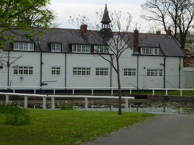
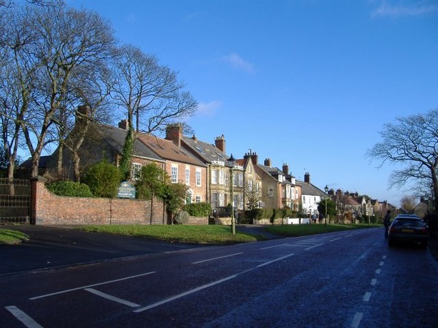
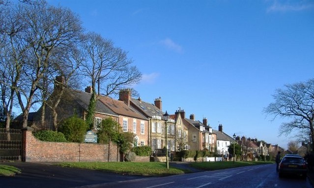
Bents is a small village located in South Durham, England. Situated approximately 8 miles south-west of the city of Durham, Bents is nestled in a picturesque rural setting surrounded by lush green fields and rolling hills.

The village itself is characterized by its quaint charm and is home to a close-knit community of residents. Bents is known for its peaceful and idyllic atmosphere, making it an ideal destination for those seeking a serene countryside retreat. The village is predominantly residential, with a scattering of traditional houses and cottages, many of which boast beautiful gardens.

Although small in size, Bents does offer some amenities to its residents. These include a village hall, serving as a social hub for community gatherings and events, as well as a local pub that provides a cozy and welcoming atmosphere for both locals and visitors.

The surrounding area offers numerous opportunities for outdoor activities, with several scenic walking trails and cycling routes nearby. Bents is also in close proximity to larger towns such as Durham and Bishop Auckland, where residents can find a wider range of services and amenities including shops, schools, and healthcare facilities.

Overall, Bents is a charming village in South Durham that offers a peaceful and rural lifestyle, perfect for those seeking a tranquil escape from the hustle and bustle of city living.

If you have any feedback on the listing, please let us know in the comments section below.

Bents, South Images

Images are sourced within 2km of 54.940681/-1.3664499 or Grid Reference NZ4060. Thanks to Geograph Open Source API. All images are credited.

Seaburn
Seaburn
Whitburn village pond
Whitburn Mill
Whitburn Mill
Rescue on the beach, Seaburn, Sunderland, 29th January 2006
Seaburn Beach
Seaburn Beach
Roker beach in July A popular beach in the summer - and well used by dog walkers in the winter, despite the bleak weather!
Roker beach in July
A popular beach in the summer - and well used by dog walkers in the winter, despite the bleak weather!
Firing range at Whitburn Camp The firing range is very little used now - perhaps not at all.  Cows and horses graze there.  Sticking up on the horizon is Whitburn Windmill (restored).
Firing range at Whitburn Camp
The firing range is very little used now - perhaps not at all. Cows and horses graze there. Sticking up on the horizon is Whitburn Windmill (restored).
Whitburn School This secondary school backs on to a cliff overlooking the North Sea.  Photo taken from the cliffside path.
Whitburn School
This secondary school backs on to a cliff overlooking the North Sea. Photo taken from the cliffside path.
One of the fine houses of Whitburn village.
Whitburn village.
Whitburn village.
Whitburn Bay High tide view of the bay from Seaburn promenade. The sea was very calm and full of small fish just below the railings.
Whitburn Bay
High tide view of the bay from Seaburn promenade. The sea was very calm and full of small fish just below the railings.
Seafront at Seaburn
Seafront at Seaburn
Promenade: Seaburn Sands
Whitburn Bay
Whitburn Bay
Seaburn Sands
Seaburn Sands
Public convenience and first aid post
South Bents (Whitburn Steel on some maps)
Fishing boat being dragged back to Whitburn Angling Club
Show me another place!

Bents, South is located at Grid Ref: NZ4060 (Lat: 54.940681, Lng: -1.3664499)

Unitary Authority: South Tyneside

Police Authority: Northumbria

What 3 Words

///aims.blur.feast. Near Whitburn, Tyne & Wear

Related Wikis

Seaburn

Seaburn is a seaside resort and northeastern suburb of Sunderland, North East England. The village of Whitburn borders the area to the north. To the west...

Whitburn Church of England Academy

Whitburn Church of England Academy is a coeducational secondary school and sixth form located in Whitburn, South Tyneside. Its motto is "Excellence for...

Whitburn, Tyne and Wear

Whitburn is a village in South Tyneside, in the metropolitan county of Tyne and Wear on the coast of North East England. It is located 3 miles (4.8 km...

Sunderland International Airshow

The Sunderland International Airshow was the biggest free annual airshow in Europe, held at the Roker and Seaburn seafronts. It took place over the course...

Monkwearmouth Academy

Monkwearmouth Academy is a state secondary school in Sunderland, Tyne and Wear, England, for pupils aged between 11 and 16. The most recent inspection...

Academy of Light

The Academy of Light is the name of the UEFA five star certified training facilities and youth academy for English football club Sunderland A.F.C. Officially...

Seaburn Dene

Seaburn Dene is a northern suburb of Sunderland, England, located about one mile inland from the North Sea, near the boundary with South Tyneside. The...

Spottee's Cave

Spotteeā€™s Cave is a cave formed in a limestone-magnesium ravine on the seafront of Roker, North East England, between Sunderland (to the south), and Whitburn...

Nearby Amenities

Located within 500m of 54.940681,-1.3664499
Bus Stop
Asset Ref: 18016
Bench: no
Bin: no
Bus: yes
Departures Board: no
Location: Seaburn Camp Terminus
Public Transport: platform
Shelter: no
Source: GPS Survey
Lat/Long: 54.9389291/-1.3678723
Bus Stop
Seaburn Morrisons
Asset Ref: 18015
Bench: yes
Bin: no
Bus: yes
Departures Board: timetable
Location: Whitburn Road
Naptan AtcoCode: 410000018015
Naptan NaptanCode: twrdmwma
Public Transport: platform
Route Ref: E1;E2;E6;18;19;99;558
Shelter: yes
Source: GPS Survey
Zone: 48
Lat/Long: 54.9369629/-1.3688605
Bus Stop
Asset Ref: 18054
Location: Souyth Bents Avenue
Naptan AtcoCode: 410000018054
Naptan NaptanCode: twrgwapt
Source: GPS Survey
Lat/Long: 54.9409478/-1.3710042
Bus Stop
Asset Ref: 18053
Location: Weardale Avenue
Naptan AtcoCode: 410000018053
Naptan NaptanCode: twrgwapm
Source: GPS Survey
Lat/Long: 54.9412819/-1.3727281
Bus Stop
Asset Ref: 18051
Location: Weardale Avenue
Source: GPS Survey
Lat/Long: 54.9429959/-1.3713325
Bus Stop
Asset Ref: 18050
Location: South Bents
Naptan AtcoCode: 410000018050
Naptan NaptanCode: twrgwapg
Source: GPS Survey
Lat/Long: 54.9424416/-1.3683234
Bus Stop
Asset Ref: 18055
Location: South Bents Avenue
Naptan AtcoCode: 410000018055
Naptan NaptanCode: twrgwapw
Source: GPS Survey
Lat/Long: 54.9408266/-1.3682622
Restaurant
Little Italy
Addr City: Sunderland
Addr Postcode: SR6 8AB
Addr Street: Whitburn Road
Fhrs Id: 652179
Outdoor Seating: yes
Source Addr: FHRS Open Data
Lat/Long: 54.9384208/-1.3676052
Bay Court
Addr Postcode: SR6 8BB
Lat/Long: 54.9409021/-1.3669701
Post Box
Drive Through: no
Operator: Royal Mail
Operator Wikidata: Q638098
Post Box Type: pillar
Postal Code: SR6
Ref: SR6 109
Royal Cypher: GR
Royal Cypher Wikidata: Q33102273
Source: GPS Survey
Lat/Long: 54.9408182/-1.3666546
Telephone
Source: GPS Survey
Lat/Long: 54.9407973/-1.3667153
Bus Stop
Bents Road
Bench: yes
Bus: yes
Departures Board: timetable
Local Ref: S
Naptan AtcoCode: 410000018011
Naptan Bearing: S
Naptan CommonName: BENTS ROAD-PEBBLE BEACH-S/B
Naptan Indicator: S
Naptan Landmark: OUTSIDE PEBBLE BEACH
Naptan NaptanCode: twrdmwjm
Naptan PlusbusZoneRef: SNDRLND
Naptan Street: WHITBURN BENTS ROAD
Naptan Verified: no
Passenger Information Display: no
Public Transport: platform
Shelter: yes
Source: naptan_import
Lat/Long: 54.9424853/-1.3658893
Bus Stop
Seaburn Camp
Bench: yes
Bus: yes
Departures Board: timetable
Local Ref: S
Naptan AtcoCode: 410000018012
Naptan Bearing: S
Naptan CommonName: SEABURN CAMP
Naptan Indicator: S
Naptan Landmark: OPPOSITE FOOTPATH TO CLEAVLAND VIEW
Naptan NaptanCode: twrdmwjp
Naptan PlusbusZoneRef: SNDRLND
Naptan Street: WHITBURN BENTS ROAD
Naptan Verified: no
Public Transport: platform
Shelter: yes
Source: naptan_import
Lat/Long: 54.9394415/-1.3671383
Bus Stop
Seaburn Morrisons
Bench: yes
Bin: yes
Bus: yes
Departures Board: timetable
Local Ref: S
Naptan AtcoCode: 410000018013
Naptan Bearing: S
Naptan CommonName: WHITBURN ROAD-MORRISONS-S/B
Naptan Indicator: S
Naptan Landmark: OPPOSITE SEABURN FUN PARK AND CENTRE
Naptan NaptanCode: twrdmwjt
Naptan PlusbusZoneRef: SNDRLND
Naptan Street: WHITBURN ROAD
Naptan Verified: no
Passenger Information Display: no
Public Transport: platform
Shelter: yes
Source: naptan_import
Lat/Long: 54.9367109/-1.3685457
Bus Stop
WHITBURN ROAD-MORRISONS-N/B
Bench: yes
Bus: yes
Departures Board: timetable
Local Ref: N
Naptan AtcoCode: 410000018015
Naptan Bearing: N
Naptan CommonName: WHITBURN ROAD-MORRISONS-N/B
Naptan Indicator: N
Naptan Landmark: OUTSIDE SEABURN FUN PARK AND CENTRE
Naptan NaptanCode: twrdmwma
Naptan PlusbusZoneRef: SNDRLND
Naptan Street: WHITBURN ROAD
Naptan Verified: no
Passenger Information Display: no
Public Transport: platform
Shelter: yes
Source: naptan_import
Lat/Long: 54.9365582/-1.3687906
Bus Stop
SEABURN CAMP
Fixme: Check if stop removed
Local Ref: N
Naptan AtcoCode: 410000018016
Naptan Bearing: N
Naptan CommonName: SEABURN CAMP
Naptan Indicator: N
Naptan Landmark: OUTSIDE SOUTH BENTS TURNING CIRCLE
Naptan NaptanCode: twrdpaja
Naptan PlusbusZoneRef: SNDRLND
Naptan Street: SEABURN CAMP
Naptan Verified: no
Source: naptan_import
Lat/Long: 54.939186/-1.367766
Bus Stop
Seaburn Camp
Bus: yes
Departures Board: timetable
Local Ref: N
Naptan AtcoCode: 410000018017
Naptan Bearing: N
Naptan CommonName: SEABURN CAMP
Naptan Indicator: N
Naptan Landmark: OUTSIDE THE BAY HOTEL PUBLIC HOUSE
Naptan NaptanCode: twrdmwmg
Naptan PlusbusZoneRef: SNDRLND
Naptan Street: WHITBURN BENTS ROAD
Naptan Verified: no
Passenger Information Display: no
Public Transport: platform
Shelter: yes
Source: naptan_import
Lat/Long: 54.9410213/-1.3664416
Bus Stop
Bents Road
Bench: yes
Bus: yes
Departures Board: timetable
Local Ref: N
Naptan AtcoCode: 410000018018
Naptan Bearing: N
Naptan CommonName: BENTS ROAD-THE BENTS-N/B
Naptan Indicator: N
Naptan Landmark: OPPOSITE THE BENTS
Naptan NaptanCode: twrdmwmj
Naptan Street: WHITBURN BENTS ROAD
Naptan Verified: no
Passenger Information Display: no
Public Transport: platform
Shelter: yes
Source: naptan_import
Lat/Long: 54.9434627/-1.3658724
Bus Stop
SOUTH BENTS BRANSDALE AVENUE
Local Ref: W
Naptan AtcoCode: 410000018050
Naptan Bearing: W
Naptan CommonName: SOUTH BENTS BRANSDALE AVENUE
Naptan Indicator: W
Naptan Landmark: OUTSIDE NO.19 BRANSDALE AVENUE
Naptan NaptanCode: twrgwapg
Naptan PlusbusZoneRef: SNDRLND
Naptan Street: BRANSDALE AVENUE
Naptan Verified: no
Source: naptan_import
Lat/Long: 54.9423993/-1.3687459
Bus Stop
WEARDALE AVENUE-LONSDALE AVENUE-W/B
Local Ref: W
Naptan AtcoCode: 410000018051
Naptan Bearing: W
Naptan CommonName: WEARDALE AVENUE-LONSDALE AVENUE-W/B
Naptan Indicator: W
Naptan Landmark: OUTSIDE LONSDALE AVENUE
Naptan NaptanCode: twrgwapj
Naptan Street: WEARDALE AVENUE
Naptan Verified: no
Source: naptan_import
Lat/Long: 54.9429351/-1.371563
Bus Stop
WEARDALE AVENUE-LONSDALE AVENUE-E/B
Local Ref: E
Naptan AtcoCode: 410000018053
Naptan Bearing: E
Naptan CommonName: WEARDALE AVENUE-LONSDALE AVENUE-E/B
Naptan Indicator: E
Naptan Landmark: OUTSIDE NO.4 WEARDALE AVENUE
Naptan NaptanCode: twrgwapm
Naptan PlusbusZoneRef: SNDRLND
Naptan Street: WEARDALE AVENUE
Naptan Verified: no
Source: naptan_import
Lat/Long: 54.9411862/-1.372246
Bus Stop
SOUTH BENTS AVENUE-ROSEDALE AVENUE
Local Ref: E
Naptan AtcoCode: 410000018054
Naptan Bearing: E
Naptan CommonName: SOUTH BENTS AVENUE-ROSEDALE AVENUE
Naptan Indicator: E
Naptan Landmark: OUTSIDE ROSEDALE AVENUE
Naptan NaptanCode: twrgwapt
Naptan PlusbusZoneRef: SNDRLND
Naptan Street: SOUTH BENTS AVENUE
Naptan Verified: no
Source: naptan_import
Lat/Long: 54.9409063/-1.3702366
Bus Stop
SOUTH BENTS AVENUE-FARNDALE AVENUE
Local Ref: E
Naptan AtcoCode: 410000018055
Naptan Bearing: E
Naptan CommonName: SOUTH BENTS AVENUE-FARNDALE AVENUE
Naptan Indicator: E
Naptan Landmark: OUTSIDE FARNDALE AVENUE
Naptan NaptanCode: twrgwapw
Naptan PlusbusZoneRef: SNDRLND
Naptan Street: SOUTH BENTS AVENUE
Naptan Verified: no
Source: naptan_import
Lat/Long: 54.9408509/-1.3682238
Bus Stop
SEABURN CAMP
Fixme: Check if stop removed
Local Ref: E
Naptan AtcoCode: 410000018950
Naptan Bearing: E
Naptan CommonName: SEABURN CAMP
Naptan Indicator: E
Naptan Landmark: SOUTH BENTS TURNING CIRCLE
Naptan NaptanCode: twrdmwmd
Naptan PlusbusZoneRef: SNDRLND
Naptan Street: WHITBURN BENTS ROAD
Naptan Verified: no
Source: naptan_import
Lat/Long: 54.9392757/-1.367749
Bus Stop
SEABURN MORRISONS SUPERMARKET
Local Ref: NE
Naptan AtcoCode: 410000060201
Naptan Bearing: NE
Naptan CommonName: SEABURN MORRISONS SUPERMARKET
Naptan Indicator: NE
Naptan Landmark: OUTSIDE MORRISONS SUPERMARKET
Naptan NaptanCode: twrgpwag
Naptan PlusbusZoneRef: SNDRLND
Naptan Street: LOWRY ROAD
Naptan Verified: no
Source: naptan_import
Lat/Long: 54.9371614/-1.3707478
Ncn Milepost: mills
Sustrans Ref: MP144
Lat/Long: 54.936571/-1.3685308
Toilets
Lat/Long: 54.9376327/-1.3700714
Toilets
Access: yes
Changing Table: yes
Fee: no
Female: yes
Male: yes
Operator: Public
Toilets Disposal: flush
Unisex: yes
Lat/Long: 54.9363734/-1.3682231
Crossing
Lat/Long: 54.9375819/-1.3706014
Crossing
Lat/Long: 54.9375805/-1.3704252
Crossing
Lat/Long: 54.9375862/-1.3713278
Crossing
Lat/Long: 54.937585/-1.3710966
Crossing
Lat/Long: 54.9375837/-1.370846
Crossing
Crossing Island: yes
Tactile Paving: yes
Lat/Long: 54.9436036/-1.3657205
Cafe
Funky Beach Coffee Shop
Lat/Long: 54.9365297/-1.3681937
Life Ring
Emergency: life_ring
Lat/Long: 54.9388836/-1.3672497
Waste Basket
Waste: dog_excrement
Lat/Long: 54.9378464/-1.3677176
Waste Basket
Lat/Long: 54.9377982/-1.3676191
Drinking Water
Lat/Long: 54.9390023/-1.367206
Barrier: bollard
Lat/Long: 54.9426007/-1.3658326
Restaurant
House Of Zen
Addr City: Sunderland
Addr Postcode: SR6 8AA
Addr Street: Whitburn Road
Fhrs Id: 875851
Source Addr: FHRS Open Data
Lat/Long: 54.9364508/-1.3682428
Power: substation
Lat/Long: 54.945026/-1.3645203
Bus: yes
Bus Bay: right
Public Transport: stop_position
Lat/Long: 54.9369871/-1.3686616
Restaurant
The Bay
Addr City: Sunderland
Addr Housenumber: 3 - 5
Addr Postcode: SR6 8AD
Addr Street: Whitburn Bents Road
Cuisine: fish_and_chips
Fhrs Id: 1213949
Source Addr: FHRS Open Data
Lat/Long: 54.9397957/-1.3672822
Cafe
Strollers
Cuisine: coffee_shop
Lat/Long: 54.9392813/-1.3671167
Generator Method: photovoltaic
Generator Output Electricity: yes
Generator Source: solar
Generator Type: solar_photovoltaic_panel
Power: generator
Lat/Long: 54.9413834/-1.3737724
Generator Method: photovoltaic
Generator Output Electricity: yes
Generator Source: solar
Generator Type: solar_photovoltaic_panel
Power: generator
Lat/Long: 54.9410424/-1.373624
Crossing
Crossing: traffic_signals
Crossing Ref: puffin
Lat/Long: 54.9376754/-1.3683993
Defibrillator
Emergency: defibrillator
Lat/Long: 54.9444251/-1.3652041
Defibrillator
Emergency: defibrillator
Lat/Long: 54.9397605/-1.3673299
Cafe
Waterfront
Lat/Long: 54.9394862/-1.3675236
The data included in this document is from www.openstreetmap.org. The data is made available under ODbL.

Have you been to Bents, South?

Leave your review of Bents, South below (or comments, questions and feedback).