South Beddington

Settlement in Surrey

England

South Beddington

Saint Mary's Church Detail of the knapped flint on the exterior wall of the church.
Saint Mary's Church Credit: Peter Trimming

South Beddington is a suburban area located in the county of Surrey, England. Situated within the London Borough of Sutton, it is approximately 11 miles south of central London. The area is predominantly residential, with a mix of houses and apartment complexes.

South Beddington benefits from its proximity to green spaces, including Beddington Park and the River Wandle, which offer recreational opportunities such as walking, jogging, and picnicking. The park is also home to the historic Carew Manor, a Grade I listed building that dates back to the 16th century.

The area enjoys good transport links, with several bus routes serving the community, connecting it to nearby towns and London. The nearest railway station is Hackbridge, providing access to central London and other destinations.

Although South Beddington does not have its own independent high street, residents have easy access to amenities and services in nearby areas. The town center of Sutton is just a short distance away, offering a wide range of shopping options, restaurants, and entertainment facilities.

Schools in South Beddington include Beddington Park Primary School and The Sherwood School. Additionally, the area boasts a strong sense of community, with various local groups and organizations hosting events and activities throughout the year.

Overall, South Beddington provides a suburban lifestyle with a blend of natural beauty, convenient transportation, and access to nearby amenities, making it an attractive place to reside.

If you have any feedback on the listing, please let us know in the comments section below.

South Beddington Images

Images are sourced within 2km of 51.359731/-0.136374 or Grid Reference TQ2963. Thanks to Geograph Open Source API. All images are credited.

Saint Mary's Church Detail of the knapped flint on the exterior wall of the church.
Saint Mary's Church
Detail of the knapped flint on the exterior wall of the church.
Beddington Resident I went in search of an albino grey squirrel, reported on the previous day, but I only saw five of the usual colouration. Photographed in the churchyard of Saint Mary's church.
Beddington Resident
I went in search of an albino grey squirrel, reported on the previous day, but I only saw five of the usual colouration. Photographed in the churchyard of Saint Mary's church.
Beddington Park Resident Grey squirrel, seen during a break in foraging.
Beddington Park Resident
Grey squirrel, seen during a break in foraging.
Little Egret Seen in Beddington Park. It had been fishing in the River Wandle, but noticed my approach.
Little Egret
Seen in Beddington Park. It had been fishing in the River Wandle, but noticed my approach.
Female Kestrel Its talons gripping the tip of a branch, close to Beddington Park.
Female Kestrel
Its talons gripping the tip of a branch, close to Beddington Park.
Female Kestrel Its talons gripping the tip of a branch, close to Beddington Park.
Female Kestrel
Its talons gripping the tip of a branch, close to Beddington Park.
Heron Seen in Beddington Park, with the heron watching a potential meal in the nearby brambles.
Heron
Seen in Beddington Park, with the heron watching a potential meal in the nearby brambles.
Carew Manor Late afternoon at Carew Manor, originally called Beddington Place, home to the Carew family from 1351-1859. It is now a school.
Carew Manor
Late afternoon at Carew Manor, originally called Beddington Place, home to the Carew family from 1351-1859. It is now a school.
Sandy Lane South Looking along Sandy Lane South towards its junction with Stafford Road.  The postbox here, sited outside Bandon Hill Primary School, is a regular recipient of knitted postbox toppers.  The one seen here, by Jan Gibson of the knitting group Yarn Bombers of Ewell, is commemorating Queen Elizabeth II's Platinum Jubilee.  For a closer view of the postbox, see <a href="https://www.geograph.org.uk/photo/7167107">TQ2963 : Postbox, Sandy Lane South</a>.
Sandy Lane South
Looking along Sandy Lane South towards its junction with Stafford Road. The postbox here, sited outside Bandon Hill Primary School, is a regular recipient of knitted postbox toppers. The one seen here, by Jan Gibson of the knitting group Yarn Bombers of Ewell, is commemorating Queen Elizabeth II's Platinum Jubilee. For a closer view of the postbox, see TQ2963 : Postbox, Sandy Lane South.
Postbox, Sandy Lane South Postbox in Sandy Lane South sited outside Bandon Hill Primary School,  a regular recipient of knitted postbox toppers.  This one, by Jan Gibson of the knitting group Yarn Bombers of Ewell, is commemorating Queen Elizabeth II's Platinum Jubilee.  For a close up of the topper, see <a href="https://www.geograph.org.uk/photo/7167111">TQ2963 : Postbox topper, Sandy Lane South</a> and for a wider view see <a href="https://www.geograph.org.uk/photo/7167103">TQ2963 : Sandy Lane South</a>.
Postbox, Sandy Lane South
Postbox in Sandy Lane South sited outside Bandon Hill Primary School, a regular recipient of knitted postbox toppers. This one, by Jan Gibson of the knitting group Yarn Bombers of Ewell, is commemorating Queen Elizabeth II's Platinum Jubilee. For a close up of the topper, see TQ2963 : Postbox topper, Sandy Lane South and for a wider view see TQ2963 : Sandy Lane South.
Postbox topper, Sandy Lane South A knitted postbox topper on a postbox in Sandy Lane South sited outside Bandon Hill Primary School, a regular recipient of such decorations.  This one, by Jan Gibson of the knitting group Yarn Bombers of Ewell, is commemorating Queen Elizabeth II's Platinum Jubilee.  For a photo of the whole postbox see <a href="https://www.geograph.org.uk/photo/7167107">TQ2963 : Postbox, Sandy Lane South</a>.
Postbox topper, Sandy Lane South
A knitted postbox topper on a postbox in Sandy Lane South sited outside Bandon Hill Primary School, a regular recipient of such decorations. This one, by Jan Gibson of the knitting group Yarn Bombers of Ewell, is commemorating Queen Elizabeth II's Platinum Jubilee. For a photo of the whole postbox see TQ2963 : Postbox, Sandy Lane South.
Elms Pond A pair of Egyptian geese relaxing on a day which was generally sunny.
Elms Pond
A pair of Egyptian geese relaxing on a day which was generally sunny.
Manor Garden Heron perched in a tree in this small garden, which is situated at the southwestern edge of Beddington Park.
Manor Garden
Heron perched in a tree in this small garden, which is situated at the southwestern edge of Beddington Park.
Carshalton Floral display at The Grove.
Carshalton
Floral display at The Grove.
Carshalton Grove Lodge, at the edge of The Grove, sporting bunting remaining from the Platinum Jubilee celebrations.
Carshalton
Grove Lodge, at the edge of The Grove, sporting bunting remaining from the Platinum Jubilee celebrations.
Carshalton The former 'Fox & Hounds' public house.
Carshalton
The former 'Fox & Hounds' public house.
Carshalton The former 'Fox & Hounds' public house.
Carshalton
The former 'Fox & Hounds' public house.
Carshalton Day of Dance Pennyroyal Clog, outside the Sassis Café.
Carshalton Day of Dance
Pennyroyal Clog, outside the Sassis Café.
Show me another place!

South Beddington is located at Grid Ref: TQ2963 (Lat: 51.359731, Lng: -0.136374)

Unitary Authority: Sutton

Police Authority: Metropolitan

What 3 Words

///plants.normal.called. Near Carshalton, London

Related Wikis

Municipal Borough of Beddington and Wallington

Beddington and Wallington was, from 1915 to 1965, a local government district in north east Surrey, England. It formed part of the London suburbs, lying...

Bandonhill

Bandonhill (sometimes spelt as Bandon Hill) is a small locality in the London Borough of Sutton, located between Wallington and Beddington. It is best...

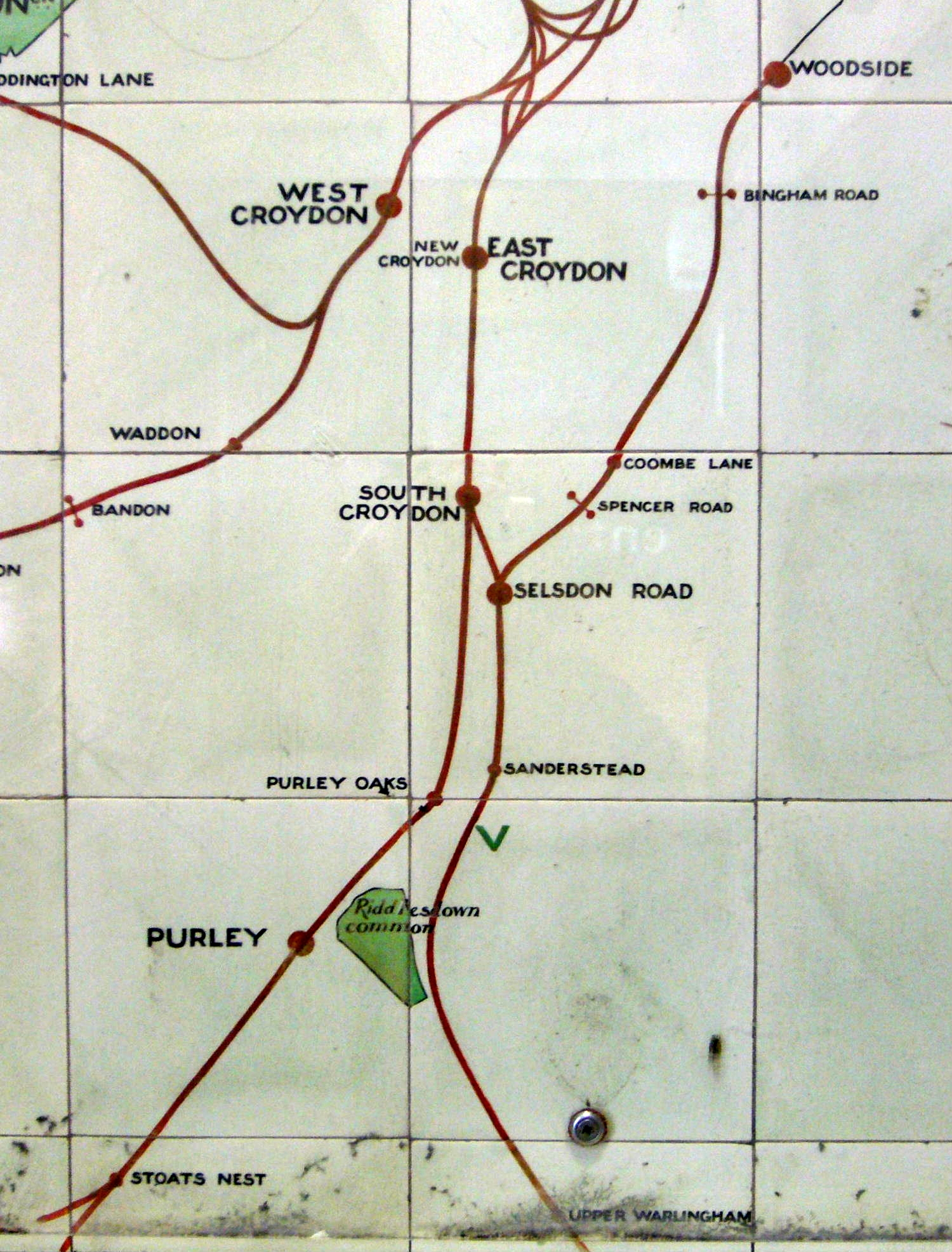
Bandon Halt railway station

Bandon Halt was a station on the 1847 London, Brighton and South Coast Railway extension from West Croydon to Epsom. It was situated between Waddon and...

Wilson's School

Wilson's School is a state boys' grammar school with academy status in the London Borough of Sutton, England. It was founded as Wilson's Grammar School...

Nearby Amenities

Located within 500m of 51.359731,-0.136374
Traffic Signals
Lat/Long: 51.3603346/-0.1302144
Ref GB Tflcid: RWG216475
Traffic Calming: hump
Lat/Long: 51.3557958/-0.1342481
Entrance: main
Lat/Long: 51.3559926/-0.1344576
Traffic Signals
Lat/Long: 51.3595926/-0.1377991
Ref GB Tflcid: RWG216248
Traffic Calming: hump
Lat/Long: 51.3623898/-0.140497
Ref GB Tflcid: RWG216259
Traffic Calming: hump
Lat/Long: 51.3626036/-0.1411048
Crossing
Bicycle: yes
Crossing: traffic_signals
Crossing Ref: toucan
Lat/Long: 51.3626907/-0.1317317
Melrose Tudor
Building: apartments
Lat/Long: 51.3610568/-0.130492
Park Court
Building: apartments
Lat/Long: 51.3607505/-0.1301853
Post Box
Operator: Royal Mail
Operator Wikidata: Q638098
Ref: SM6 129
Lat/Long: 51.3609577/-0.1305893
Ref GB Tflcid: RWG216150
Traffic Calming: hump
Lat/Long: 51.3628572/-0.1320195
Ref GB Tflcid: RWG216569
Traffic Calming: hump
Lat/Long: 51.3611361/-0.1368584
Ref GB Tflcid: RWG216219
Traffic Calming: hump
Lat/Long: 51.3624758/-0.1351706
Post Box
Drive Through: no
Operator: Royal Mail
Operator Wikidata: Q638098
Post Box Type: pillar
Ref: SM6 69
Royal Cypher: EVIIR
Royal Cypher Wikidata: Q33102324
Source: survey
Lat/Long: 51.3617319/-0.1401611
Pharmacy
Stafford Pharmacy
Addr City: Wallington
Addr Housenumber: 150
Addr Postcode: SM6 9BS
Addr Street: Stafford Road
Healthcare: pharmacy
Opening Hours: Mo-Fr 09:00-18:30; Sa 09:00-13:00; Su off
Operator: Medipharmacy Group
Source: survey
Website: https://www.nhs.uk/Services/pharmacies/Overview/DefaultView.aspx?id=6698
Lat/Long: 51.3596275/-0.1391261
Telephone
Booth: ST6
Covered: booth
Lat/Long: 51.3595388/-0.1393085
Bicycle Parking
Lat/Long: 51.3595322/-0.1394427
Ref GB Tflcid: RWG216293
Traffic Calming: hump
Lat/Long: 51.3599469/-0.1435207
Cafe
Mellows Pavilion Cafe
Addr City: Wallington
Addr Housename: Mellows Park
Addr Postcode: SM6 9BU
Addr Street: Stafford Road
Fhrs Authority: Sutton
Fhrs Id: 1109475
Outdoor Seating: yes
Source: survey;https://ratings.food.gov.uk/OpenDataFiles/FHRS529en-GB.xml
Lat/Long: 51.3602342/-0.1332936
Crossing
Crossing: uncontrolled
Crossing Island: yes
Crossing Ref: zebra
Tactile Paving: yes
Lat/Long: 51.3599614/-0.1336893
Post Box
Collection Times: Mo-Fr 18:45; Sa 11:15; Su off
Drive Through: no
Operator: Royal Mail
Operator Wikidata: Q638098
Post Box Type: pillar
Ref: SM6 116
Royal Cypher: GR
Royal Cypher Wikidata: Q33102273
Source: survey
Lat/Long: 51.3591016/-0.1380431
Post Box
Collection Times: Mo-Fr 16:00; Sa 11:45; Su off
Drive Through: no
Operator: Royal Mail
Operator Wikidata: Q638098
Post Box Type: pillar
Ref: SM6 131
Royal Cypher: GR
Royal Cypher Wikidata: Q33102273
Source: survey
Lat/Long: 51.358211/-0.1337679
Ref GB Tflcid: RWG216358
Traffic Calming: hump
Lat/Long: 51.3584316/-0.1396097
Post Box
Collection Times: Mo-Fr 18:45; Sa 11:30; Su off
Drive Through: no
Operator: Royal Mail
Operator Wikidata: Q638098
Post Box Type: pillar
Ref: SM6 92
Royal Cypher: EVIIR
Royal Cypher Wikidata: Q33102324
Source: survey
Lat/Long: 51.3580617/-0.1397899
Post Box
Collection Times: Mo-Fr 18:45; Sa 11:30; Su off
Drive Through: no
Operator: Royal Mail
Operator Wikidata: Q638098
Post Box Type: pillar
Ref: SM6 93
Royal Cypher: GR
Royal Cypher Wikidata: Q33102273
Source: survey
Lat/Long: 51.357302/-0.1414677
Crossing
Crossing: uncontrolled
Crossing Ref: zebra
Lat/Long: 51.3590559/-0.1421242
Bus Stop
Garden Close
Local Ref: L
Naptan AtcoCode: 490007112N
Naptan Bearing: N
Naptan CommonName: Garden Close
Naptan Indicator: Stop L
Naptan Street: PLOUGH LANE
Naptan Verified: no
Public Transport: platform
Lat/Long: 51.3616424/-0.1313524
Bus Stop
Garden Close
Bus: yes
Local Ref: M
Naptan AtcoCode: 490007112S
Naptan Bearing: S
Naptan CommonName: Garden Close
Naptan Indicator: Stop M
Naptan Street: PLOUGH LANE
Naptan Verified: no
Network: TFL
Operator: TFL
Public Transport: platform
Shelter: no
Lat/Long: 51.3616415/-0.1311338
Bus Stop
Wilson's School
Local Ref: K
Naptan AtcoCode: 490009186N
Naptan Bearing: N
Naptan CommonName: Link Lane
Naptan Indicator: Stop K
Naptan Street: MOLLISON DRIVE
Naptan Verified: no
Public Transport: platform
Ref: 77844
Lat/Long: 51.3597935/-0.1298848
Bus Stop
Milton Road
Bus: yes
Naptan AtcoCode: 490009932E
Naptan Bearing: N
Naptan CommonName: Milton Road Stafford Road
Naptan Street: STAFFORD ROAD
Naptan Verified: no
Public Transport: platform
Lat/Long: 51.3592516/-0.1413872
Bus Stop
Milton Road
Naptan AtcoCode: 490009932W
Naptan Bearing: N
Naptan CommonName: Milton Road Stafford Road
Naptan Street: STAFFORD ROAD
Naptan Verified: no
Public Transport: platform
Lat/Long: 51.3589192/-0.1424806
Bus Stop
Mellows Park
Local Ref: B
Naptan AtcoCode: 490009796E
Naptan Bearing: E
Naptan CommonName: Mellows Park
Naptan Indicator: Stop B
Naptan Street: STAFFORD ROAD
Naptan Verified: no
Public Transport: platform
Lat/Long: 51.3600701/-0.1331318
Bus Stop
Mellows Park
Local Ref: W
Naptan AtcoCode: 490009796W
Naptan Bearing: W
Naptan CommonName: Mellows Park
Naptan Indicator: Stop W
Naptan Street: STAFFORD ROAD
Naptan Verified: no
Public Transport: platform
Lat/Long: 51.3598526/-0.1342544
Bus Stop
Plough Lane
Local Ref: V
Naptan AtcoCode: 490011061W
Naptan Bearing: W
Naptan CommonName: Plough Lane Stafford Road
Naptan Indicator: Stop V
Naptan Street: STAFFORD ROAD
Naptan Verified: no
Public Transport: platform
Lat/Long: 51.3601807/-0.1310444
Bus Stop
Sandy Lane South
Local Ref: T
Naptan AtcoCode: 490011923N
Naptan Bearing: N
Naptan CommonName: Foresters DriveSandy Lane Sth
Naptan Indicator: Stop T
Naptan Street: SANDY LANE SOUTH
Naptan Verified: no
Public Transport: platform
Lat/Long: 51.3572409/-0.1384926
Bus Stop
Waterer Rise
Local Ref: E
Naptan AtcoCode: 490011923S
Naptan Bearing: S
Naptan CommonName: Foresters DriveSandy Lane Sth
Naptan Indicator: Stop E
Naptan Street: FORESTERS DRIVE
Naptan Verified: no
Public Transport: platform
Lat/Long: 51.3559144/-0.1382352
Bus Stop
Stafford Road / Sandy Lane South
Local Ref: A
Naptan AtcoCode: 490011925E
Naptan Bearing: E
Naptan CommonName: Stafford RoadSandy Lane South
Naptan Indicator: Stop A
Naptan Street: STAFFORD ROAD
Naptan Verified: no
Public Transport: platform
Lat/Long: 51.3597541/-0.1371113
Bus Stop
Stafford Road / Sandy Lane South
Local Ref: U
Naptan AtcoCode: 490011925W
Naptan Bearing: W
Naptan CommonName: Stafford RoadSandy Lane South
Naptan Indicator: Stop U
Naptan Street: STAFFORD ROAD
Naptan Verified: no
Public Transport: platform
Lat/Long: 51.3594802/-0.13852
Bus Stop
Sandy Lane South
Local Ref: D
Naptan AtcoCode: 490011928S
Naptan Bearing: S
Naptan CommonName: Sandy Lane South
Naptan Indicator: Stop D
Naptan Street: SANDY LANE SOUTH
Naptan Verified: no
Public Transport: platform
Lat/Long: 51.3589526/-0.1378595
Fast Food
Family Fishbar
Addr City: Wallington
Addr Housenumber: 171
Addr Postcode: SM6 9BT
Addr Street: Stafford Road
Cuisine: fish_and_chips
Fhrs Authority: Sutton
Fhrs Id: 848003
Internet Access: wlan
Old Name: Blue Water Fish Bar
Lat/Long: 51.3593348/-0.1389129
Fast Food
Tandoori Night
Addr City: Wallington
Addr Housenumber: 187
Addr Postcode: SM6 9BT
Addr Street: Stafford Road
Cuisine: indian
Fhrs Authority: Sutton
Fhrs Id: 1083552
Lat/Long: 51.3593843/-0.1382483
Fast Food
Perfect Kebab
Addr City: Wallington
Addr Housenumber: 142
Addr Postcode: SM6 9BS
Addr Street: Stafford Road
Cuisine: kebab
Fhrs Authority: Sutton
Fhrs Id: 430847
Lat/Long: 51.3595957/-0.1394091
Ref GB Tflcid: RWG216281
Traffic Calming: hump
Lat/Long: 51.361364/-0.142094
Addr Housename: Garages
Lat/Long: 51.3609037/-0.1424001
Ref GB Tflcid: RWG216473
Traffic Calming: hump
Lat/Long: 51.355974/-0.1343755
Parking Entrance
Lat/Long: 51.3561596/-0.1343113
Crossing
Crossing: uncontrolled
Crossing Ref: zebra
Lat/Long: 51.3583399/-0.1380794
Wilson's School
Bus: yes
Local Ref: N
Public Transport: stop_position
Lat/Long: 51.3591583/-0.1292354
Wilson's School
Bus: yes
Local Ref: K
Public Transport: stop_position
Lat/Long: 51.3598158/-0.129801
Atm
Booth: KX100
Fee: no
Lat/Long: 51.3595357/-0.1393835
A1deSIGNS
Addr City: Wallington
Addr Housenumber: 4
Addr Postcode: SM6 8JX
Addr Street: Sandy Lane North
Description: Business Signs
Is In County: Surrey
Office: company
Opening Hours: Mo-Fr 08:00-17:00
Payment Cash: yes
Phone: +44 20 8646 9886
Website: https://www.a1designs.co.uk
Lat/Long: 51.3625856/-0.133311
Pharmacy
RX Live
Note: This is not a shop but an office for a delivery service
Lat/Long: 51.358904/-0.138807
CMR Insurance Services
Office: insurance
Lat/Long: 51.3589392/-0.1388043
Stealth Fire & Security
Office: security
Lat/Long: 51.3590414/-0.1388419
BW Electrical Contractors
Craft: electrician
Lat/Long: 51.359105/-0.1388499
Sunstone Properties
Office: property_developer
Lat/Long: 51.3591352/-0.138858
Ladbrokes
Addr City: Wallington
Addr Housenumber: 138
Addr Postcode: SM6 9BS
Addr Street: Stafford Road
Brand: Ladbrokes
Brand Wikidata: Q1799875
Brand Wikipedia: en:Ladbrokes Coral
Shop: bookmaker
Lat/Long: 51.3595849/-0.13955
The Connoisseur
Addr City: Wallington
Addr Housenumber: 146
Addr Postcode: SM6 9BS
Addr Street: Stafford Road
Fhrs Authority: Sutton
Fhrs Id: 898433
Shop: convenience
Lat/Long: 51.3596092/-0.1393153
Degenis's Haircare
Addr City: Wallington
Addr Housenumber: 148
Addr Postcode: SM6 9BS
Addr Street: Stafford Road
Shop: hairdresser
Lat/Long: 51.3596159/-0.139204
Eye Contact Vision Clinic
Addr City: Wallington
Addr Housenumber: 152
Addr Postcode: SM6 9BS
Addr Street: Stafford Road
Shop: optician
Source: survey
Lat/Long: 51.3596276/-0.1390672
Cosy Homes Fireplaces Ltd
Addr City: Wallington
Addr Housenumber: 154-156
Addr Postcode: SM6 9BS
Addr Street: Stafford Road
Not Website: www.cosyhomes.org.uk
Phone: +44 20 8669 2878
Shop: fireplace
Source: survey
Source Not Website: Shop front
Website: https://www.cosyhomesfireplaces.co.uk/
Lat/Long: 51.3596326/-0.1389706
AS Partnership
Addr City: Wallington
Addr Housenumber: 158
Addr Postcode: SM6 9BS
Addr Street: Stafford Road
Email: info@aspartnership.co.uk
Office: accountant
Phone: +44 20 8669 1100
Source: survey
Website: https://www.aspartnership.co.uk/
Lat/Long: 51.3596494/-0.1388539
Manor Glass and Glazing
Addr City: Wallington
Addr Housenumber: 160-162
Addr Postcode: SM6 9BS
Addr Street: Stafford Road
Craft: glaziery
Email: manor.glass@tiscali.co.uk
Opening Hours: Mo-Fr 09:00-17:00; Sa 08:00-12:00; Su off
Phone: +44 20 8647 6620
Source: survey
Website: https://www.manorglassltd.co.uk/
Lat/Long: 51.3596494/-0.138752
Levander Care Agency
Addr City: Wallington
Addr Housenumber: 164
Addr Postcode: SM6 9BS
Addr Street: Stafford Road
Source: survey
Lat/Long: 51.3596527/-0.1386487
CSQ Marketing
Addr City: Wallington
Addr Housenumber: 191
Addr Postcode: SM6 9BT
Addr Street: Stafford Road
Office: advertising_agency
Phone: +44 20 8241 4443
Website: https://www.csqmarketing.co.uk/
Lat/Long: 51.359396/-0.1380506
Lucky Food & Wine
Addr City: Wallington
Addr Housenumber: 189
Addr Postcode: SM6 9BT
Addr Street: Stafford Road
Shop: convenience
Lat/Long: 51.3593914/-0.1381512
Fast Food
Tennesee Express
Addr City: Wallington
Addr Housenumber: 185
Addr Postcode: SM6 9BT
Addr Street: Stafford Road
Cuisine: chicken
Fhrs Authority: Sutton
Lat/Long: 51.3593751/-0.1383282
Wallington Nails
Addr City: Wallington
Addr Housenumber: 183
Addr Postcode: SM6 9BT
Addr Street: Stafford Road
Beauty: nails
Shop: beauty
Lat/Long: 51.3593671/-0.1384328
Futurewise
Addr City: Wallington
Addr Housenumber: 181
Addr Postcode: SM6 9BT
Addr Street: Stafford Road
Office: accountant
Lat/Long: 51.3593638/-0.1385059
Jordan Restoration Ministry
Addr City: Wallington
Addr Housenumber: 179
Addr Postcode: SM6 9BT
Addr Street: Stafford Road
Office: charity
Lat/Long: 51.3593575/-0.1385877
J&T Motor Services
Addr City: Wallington
Addr Housenumber: 173-177
Addr Postcode: SM6 9BT
Addr Street: Stafford Road
Shop: car_repair
Website: https://www.jtmotorservices-wallington.co.uk/
Lat/Long: 51.3593445/-0.1387708
Cafe
Cafe De Niro
Addr City: Wallington
Addr Housenumber: 169
Addr Postcode: SM6 9BT
Addr Street: Stafford Road
Fhrs Authority: Sutton
Fhrs Id: 754287
Lat/Long: 51.3593257/-0.1390041
Stafford Barber Shop
Addr City: Wallington
Addr Housenumber: 167
Addr Postcode: SM6 9BT
Addr Street: Stafford Road
Shop: hairdresser
Lat/Long: 51.3593215/-0.13909
Nayim's Embroiderers
Shop: tailor
Lat/Long: 51.359193/-0.1395633
Wallington Dry Cleaners
Addr City: Wallington
Addr Housenumber: 165
Addr Postcode: SM6 9BT
Addr Street: Stafford Road
Shop: dry_cleaning
Lat/Long: 51.3593144/-0.1391798
Cmyk Printers
Addr City: Wallington
Addr Housenumber: 163
Addr Postcode: SM6 9BT
Addr Street: Stafford Road
Shop: copyshop
Lat/Long: 51.3593077/-0.139263
Mobility Centre
Addr City: Wallington
Addr Housenumber: 161
Addr Postcode: SM6 9BT
Addr Street: Stafford Road
Shop: medical_supply
Lat/Long: 51.3593014/-0.1393481
Elite Careplus Personnel
Addr City: Wallington
Addr Housenumber: 159
Addr Postcode: SM6 9BT
Addr Street: Stafford Road
Office: recruitment
Source: survey
Lat/Long: 51.3592935/-0.139442
Cafe
Bandon's Bakehouse
Addr City: Wallington
Addr Housenumber: 157
Addr Postcode: SM6 9BT
Addr Street: Stafford Road
Cuisine: sandwich
Fhrs Authority: Sutton
Fhrs Id: 938219
Lat/Long: 51.3592884/-0.1395245
emmaus
Addr City: Wallington
Addr Housenumber: 105
Addr Postcode: SM6 9AP
Addr Street: Stafford Road
Shop: charity
Source: survey
Lat/Long: 51.3586001/-0.1424535
Allsorts
Addr City: Wallington
Addr Housenumber: 105a
Addr Postcode: SM6 9AP
Addr Street: Stafford Road
Shop: antiques
Source: survey
Lat/Long: 51.3588421/-0.1425192
VictorPhone
Addr City: Wallington
Addr Housenumber: 105c
Addr Postcode: SM6 9AP
Addr Street: Stafford Road
Shop: mobile_phone
Source: survey
Website: http://www.victorphone.co.uk/
Lat/Long: 51.3588622/-0.1424468
Access: private
Entrance: main
Lat/Long: 51.359089/-0.1381226
Access: private
Entrance: main
Lat/Long: 51.3590891/-0.1380757
Post Box
Collection Times: Mo-Fr 09:00; Sa 07:00
Drive Through: no
Operator: Royal Mail
Operator Wikidata: Q638098
Post Box Type: pillar
Ref: SM6 117D
Royal Cypher: EIIR
Royal Cypher Wikidata: Q33102113
Source: survey
Lat/Long: 51.3625854/-0.1343382
Tactile Paving: yes
Lat/Long: 51.3599221/-0.1336773
Barrier: bollard
Lat/Long: 51.3607853/-0.1368341
KDG Property Ltd
Addr City: Wallington
Addr Housenumber: 85
Addr Postcode: SM6 9AP
Addr Street: Stafford Road
Office: estate_agent
Source: survey
Lat/Long: 51.3586806/-0.1431786
Mellows Newsmart
Addr City: Wallington
Addr Housenumber: 275
Addr Postcode: SM6 9BX
Addr Street: Stafford Road
Fhrs Authority: Sutton
Fhrs Id: 741485
Shop: newsagent
Source: survey;https://ratings.food.gov.uk/OpenDataFiles/FHRS529en-GB.xml
Lat/Long: 51.3601176/-0.1306929
South Beddington
Place: suburb
Lat/Long: 51.356622/-0.1386358
Crossing
Fixme: The pedestrian crossing of the side road here may be either via a speed table or a "Copenhagen Crossing" (not checked when imported) #tflcid #surveyme
Lat/Long: 51.3576358/-0.1381536
Crossing
Fixme: The pedestrian crossing of the side road here may be either via a speed table or a "Copenhagen Crossing" (not checked when imported) #tflcid #surveyme
Lat/Long: 51.3594839/-0.1396874
Crossing
Fixme: The pedestrian crossing of the side road here may be either via a speed table or a "Copenhagen Crossing" (not checked when imported) #tflcid #surveyme
Lat/Long: 51.3589977/-0.1419196
Crossing
Fixme: The pedestrian crossing of the side road here may be either via a speed table or a "Copenhagen Crossing" (not checked when imported) #tflcid #surveyme
Lat/Long: 51.3595965/-0.1384832
Crossing
Fixme: The pedestrian crossing of the side road here may be either via a speed table or a "Copenhagen Crossing" (not checked when imported) #tflcid #surveyme
Lat/Long: 51.3593439/-0.1397236
Crossing
Fixme: The pedestrian crossing of the side road here may be either via a speed table or a "Copenhagen Crossing" (not checked when imported) #tflcid #surveyme
Lat/Long: 51.3564671/-0.1383885
Ref GB Tflcid: RWG216370
Traffic Calming: hump
Lat/Long: 51.3566763/-0.1412046
Ref GB Tflcid: RWG216295
Traffic Calming: hump
Lat/Long: 51.3600774/-0.14263
Ref GB Tflcid: RWG216298
Traffic Calming: hump
Lat/Long: 51.360294/-0.1414328
Ref GB Tflcid: RWG216376
Traffic Calming: hump
Lat/Long: 51.3571525/-0.1413416
Ref GB Tflcid: RWG216267
Traffic Calming: hump
Lat/Long: 51.3624847/-0.1417143
Ref GB Tflcid: RWG216383
Traffic Calming: hump
Lat/Long: 51.3582349/-0.1416166
Ref GB Tflcid: RWG216231
Traffic Calming: hump
Lat/Long: 51.3620029/-0.1386892
Ref GB Tflcid: RWG216567
Traffic Calming: hump
Lat/Long: 51.3603763/-0.1373354
Ref GB Tflcid: RWG216523
Traffic Calming: hump
Lat/Long: 51.3588073/-0.1339066
Ref GB Tflcid: RWG216215
Traffic Calming: hump
Lat/Long: 51.3626603/-0.1334875
Ref GB Tflcid: RWG216520
Traffic Calming: cushion
Lat/Long: 51.3588493/-0.1353739
Ref GB Tflcid: RWG216448
Traffic Calming: cushion
Lat/Long: 51.3557232/-0.1395562
Ref GB Tflcid: RWG216571
Traffic Calming: hump
Lat/Long: 51.362079/-0.1365007
Ref GB Tflcid: RWG216328
Traffic Calming: hump
Lat/Long: 51.3597118/-0.1397365
Ref GB Tflcid: RWG216738
Traffic Calming: cushion
Lat/Long: 51.3593501/-0.1306448
Ref GB Tflcid: RWG216580
Traffic Calming: hump
Lat/Long: 51.3611616/-0.1364487
Ref GB Tflcid: RWG216214
Traffic Calming: hump
Lat/Long: 51.3627454/-0.1328589
Ref GB Tflcid: RWG216277
Traffic Calming: hump
Lat/Long: 51.3616182/-0.1407197
Ref GB Tflcid: RWG216503
Traffic Calming: cushion
Lat/Long: 51.3578986/-0.1348378
Ref GB Tflcid: RWG216498
Traffic Calming: hump
Lat/Long: 51.3571089/-0.1338799
Ref GB Tflcid: RWG216470
Traffic Calming: cushion
Lat/Long: 51.3568111/-0.134404
Ref GB Tflcid: RWG216575
Traffic Calming: hump
Lat/Long: 51.36205/-0.1353026
Ref GB Tflcid: RWG216507
Traffic Calming: cushion
Lat/Long: 51.3576642/-0.1375615
Ref GB Tflcid: RWG216360
Traffic Calming: hump
Lat/Long: 51.3580732/-0.1397057
Ref GB Tflcid: RWG216517
Traffic Calming: cushion
Lat/Long: 51.358739/-0.1365999
Ref GB Tflcid: RWG216513
Traffic Calming: cushion
Lat/Long: 51.3586332/-0.1377758
Ref GB Tflcid: RWG216465
Traffic Calming: cushion
Lat/Long: 51.3566993/-0.1356993
Ref GB Tflcid: RWG216329
Traffic Calming: hump
Lat/Long: 51.3601978/-0.139841
Ref GB Tflcid: RWG216218
Traffic Calming: hump
Lat/Long: 51.3623478/-0.134856
Ref GB Tflcid: RWG216227
Traffic Calming: hump
Lat/Long: 51.3621987/-0.1377521
Ref GB Tflcid: RWG216501
Traffic Calming: hump
Lat/Long: 51.3582635/-0.1338572
Ref GB Tflcid: RWG216299
Traffic Calming: hump
Lat/Long: 51.3605178/-0.1402159
Ref GB Tflcid: RWG216302
Traffic Calming: hump
Lat/Long: 51.3613895/-0.1401269
Ref GB Tflcid: RWG216504
Traffic Calming: cushion
Lat/Long: 51.3577794/-0.1362228
Ref GB Tflcid: RWG216570
Traffic Calming: hump
Lat/Long: 51.3616338/-0.1367321
Ref GB Tflcid: RWG216300
Traffic Calming: hump
Lat/Long: 51.360852/-0.139988
Ref GB Tflcid: RWG216256
Traffic Calming: hump
Lat/Long: 51.3630026/-0.1406137
Ref GB Tflcid: RWG216579
Traffic Calming: hump
Lat/Long: 51.3617162/-0.1357741
Ref GB Tflcid: RWG216216
Traffic Calming: hump
Lat/Long: 51.3625829/-0.1341061
Ref GB Tflcid: RWG216246
Traffic Calming: hump
Lat/Long: 51.361993/-0.1403316
Ref GB Tflcid: RWG216461
Traffic Calming: cushion
Lat/Long: 51.3565726/-0.137167
Ref GB Tflcid: RWG216735
Traffic Calming: cushion
Lat/Long: 51.3592299/-0.1317082
Ref GB Tflcid: RWG216472
Traffic Calming: hump
Lat/Long: 51.3565763/-0.1340212
Ref GB Tflcid: RWG216733
Traffic Calming: cushion
Lat/Long: 51.3590918/-0.1329291
Ref GB Tflcid: RWG216446
Traffic Calming: cushion
Lat/Long: 51.3562344/-0.1389555
Ref GB Tflcid: RWG216500
Traffic Calming: hump
Lat/Long: 51.357694/-0.1338122
Ref GB Tflcid: RWG216488
Traffic Calming: hump
Lat/Long: 51.3559942/-0.1330861
Ref GB Tflcid: RWG216362
Traffic Calming: hump
Lat/Long: 51.357299/-0.1399131
Bicycle Parking
Bicycle Parking: stands
Capacity: 4
Ref GB Tflcid: RWG207607
Lat/Long: 51.360165/-0.1334519
Bicycle Parking
Bicycle Parking: stands
Capacity: 2
Ref GB Tflcid: RWG207510
Lat/Long: 51.3616283/-0.140145
Bicycle Parking
Bicycle Parking: stands
Capacity: 4
Ref GB Tflcid: RWG207531
Lat/Long: 51.3595936/-0.1387604
Inscription: 126/136 Stafford Road
Operator: UK Power Networks
Operator Wikidata: Q7864927
Power: substation
Ref: 212344
Substation: minor_distribution
Lat/Long: 51.3597709/-0.14051
Operator: UK Power Networks
Operator Wikidata: Q7864927
Power: substation
Ref: 211590
Substation: minor_distribution
Lat/Long: 51.3623107/-0.14063
Tactile Paving: yes
Lat/Long: 51.3600082/-0.1337026
The data included in this document is from www.openstreetmap.org. The data is made available under ODbL.

Have you been to South Beddington?

Leave your review of South Beddington below (or comments, questions and feedback).