South Beach

Settlement in Northumberland

England

South Beach

Blyth Marina
Blyth Marina Credit: Mick Garratt

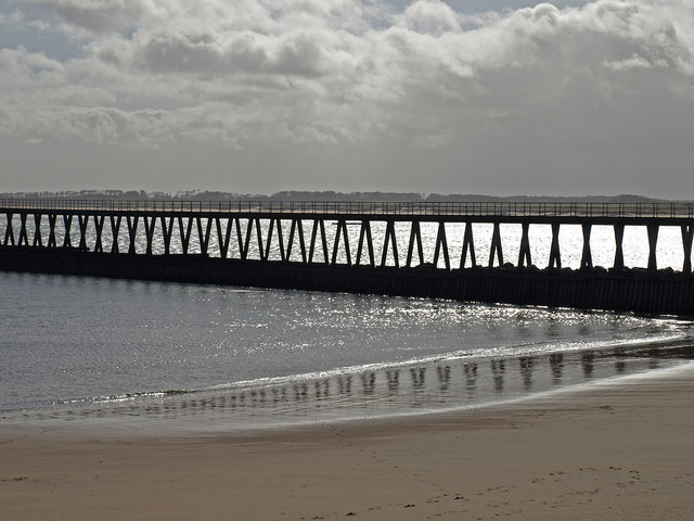
South Beach is a charming coastal village located in the county of Northumberland, England. Situated on the North Sea coast, it offers a picturesque setting with stunning views and a peaceful atmosphere.

The main attraction of South Beach is, as its name suggests, the beautiful sandy beach that stretches for miles along the coastline. The beach is known for its clean and clear waters, making it a popular destination for families and water sports enthusiasts. It provides ample space for sunbathing, picnicking, and leisurely walks, offering visitors a chance to relax and unwind.

The village itself is small but quaint, with a handful of amenities including a local pub, a small grocery store, and a few accommodation options. It is a place that exudes a sense of tranquility, making it an ideal spot for those seeking a peaceful getaway.

South Beach is also well-known for its natural beauty and wildlife. The surrounding area is home to a variety of bird species, making it a haven for birdwatchers. Additionally, the nearby dunes and grasslands provide opportunities for hiking and exploring the diverse flora and fauna of the region.

For those looking to explore more of Northumberland, South Beach serves as an excellent base. It is conveniently located near several popular attractions, including the historic town of Berwick-upon-Tweed and the iconic Bamburgh Castle.

Overall, South Beach offers a serene coastal experience with its beautiful beach, peaceful atmosphere, and proximity to other attractions, making it a must-visit destination in Northumberland.

If you have any feedback on the listing, please let us know in the comments section below.
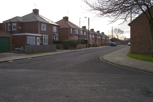
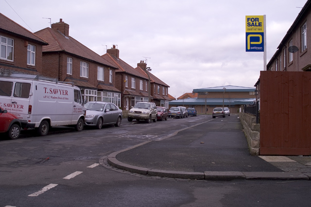
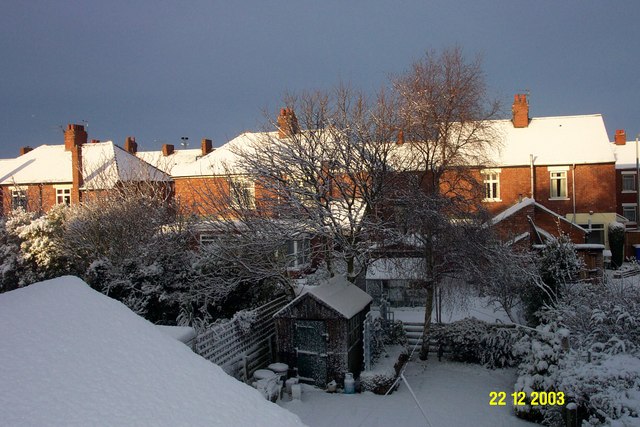
South Beach Images

Images are sourced within 2km of 55.104386/-1.5000014 or Grid Reference NZ3279. Thanks to Geograph Open Source API. All images are credited.

Blyth Marina
Blyth Marina
Housing estate, Newsham nr Blyth Twenty Fifth Avenue; typical of one of the residential housing areas to the north of Plessey Road, Newsham, which is one of the attached suburbs of Blyth.
Housing estate, Newsham nr Blyth
Twenty Fifth Avenue; typical of one of the residential housing areas to the north of Plessey Road, Newsham, which is one of the attached suburbs of Blyth.
Blyth housing Houses in Williamson Street, just off Plessey Road, Blyth, Northumberland.
Blyth housing
Houses in Williamson Street, just off Plessey Road, Blyth, Northumberland.
Wind turbine on the East Pier, Blyth Harbour.
Winter view from a back bedroom window Being on the east coast Blyth doesn't often get lying snow. The winter sunlight on the houses against the dark sky made them as crisp as the snow on them.
Winter view from a back bedroom window
Being on the east coast Blyth doesn't often get lying snow. The winter sunlight on the houses against the dark sky made them as crisp as the snow on them.
Windturbine and rusting machines.
Blyth East pier lighthouse. With jet ski in foreground, beach is an haven for jet skiers.
Blyth East pier lighthouse.
With jet ski in foreground, beach is an haven for jet skiers.
Wind turbine on Blyth East pier.
Wolmer Road, Blyth Quiet residential road offering a range of housing in Blyth.
Wolmer Road, Blyth
Quiet residential road offering a range of housing in Blyth.
West Pier, Blyth The east pier lighthouse can be spotted between the wooden beams.
West Pier, Blyth
The east pier lighthouse can be spotted between the wooden beams.
West Pier  and South Beach, Blyth St. Mary's Island on the horizon.
West Pier and South Beach, Blyth
St. Mary's Island on the horizon.
South Beach, Blyth From below West Pier.
South Beach, Blyth
From below West Pier.
West Pier, Blyth This wooden pier at the entrance to the Blyth harbour throws up some good images.
West Pier, Blyth
This wooden pier at the entrance to the Blyth harbour throws up some good images.
Sand Dunes, Blyth The harbour piers and lighthouse beyond the dunes.
Sand Dunes, Blyth
The harbour piers and lighthouse beyond the dunes.
Marina, Blyth Harbour
Blyth Harbour Disused railway line and cobbles on the east side of the harbour.
Blyth Harbour
Disused railway line and cobbles on the east side of the harbour.
Blyth Harbour Piers guarding the harbour entrance.
Blyth Harbour
Piers guarding the harbour entrance.
Blyth Harbour Showing the east pier and some of the wind turbines which cover its length.

Update 2016: The wind turbines on the pier have been removed and replaced by a single one near the alumina silos which produces more power than the removed nine!
Blyth Harbour
Showing the east pier and some of the wind turbines which cover its length. Update 2016: The wind turbines on the pier have been removed and replaced by a single one near the alumina silos which produces more power than the removed nine!
Show me another place!

South Beach is located at Grid Ref: NZ3279 (Lat: 55.104386, Lng: -1.5000014)

Unitary Authority: Northumberland

Police Authority: Northumbria

What 3 Words

///league.shunts.prices. Near Blyth, Northumberland

Related Wikis

Blyth Town F.C.

Blyth Town Football Club is a football club based in Blyth, Northumberland, England. They are currently members of Northern League Division Two and play...

River Blyth, Northumberland

The River Blyth flows eastwards through southern Northumberland into the North Sea at the town of Blyth. It flows through Plessey Woods Country Park....

Wellesley Nautical School

The Wellesley Nautical School was a naval training school first located on the Tyne, and later removed to Blyth. == History == The Wellesley Nautical School...

Newsham railway station

Newsham railway station served the village of Newsham near Blyth, England, from 1851 to 1964 on the Blyth and Tyne Railway. It was located at the junction...

Nearby Amenities

Located within 500m of 55.104386,-1.5000014
Crossing
Crossing: unmarked
Crossing Island: yes
Crossing Markings: no
Lat/Long: 55.108621/-1.5021867
Crossing
Crossing: unmarked
Crossing Island: yes
Crossing Markings: no
Lat/Long: 55.1087052/-1.5020524
Cycleway link to NCN1
Information: guidepost
Operator: sustrans
Tourism: information
Lat/Long: 55.108721/-1.5017994
Power: pole
Source: Bing
Lat/Long: 55.1067828/-1.5062588
Power: pole
Source: Bing
Lat/Long: 55.1071587/-1.5051296
Power: pole
Source: Bing
Lat/Long: 55.1075285/-1.5040192
Power: pole
Source: Bing
Lat/Long: 55.1079121/-1.5028685
Location Transition: yes
Material: wood
Power: pole
Source: Bing
Lat/Long: 55.1081561/-1.5021712
Bus Stop
GLOUCESTER LODGE FARM
Bus: yes
Naptan AtcoCode: 3100Z321787
Naptan CommonName: Gloucester Lodge Farm
Naptan Indicator: opp
Naptan Landmark: landmark
Naptan NaptanCode: nldajtjp
Naptan Street: Links Road
Naptan Verified: no
Public Transport: platform
Shelter: yes
Lat/Long: 55.1022803/-1.498256
Life Ring
Emergency: life_ring
Lat/Long: 55.1084381/-1.49834
Life Ring
Emergency: life_ring
Lat/Long: 55.1063162/-1.4973364
Bus Stop
CEMETERY
Bus: yes
Naptan AtcoCode: 3100Z320791
Naptan CommonName: Cemetery
Naptan Indicator: near
Naptan Landmark: landmark
Naptan NaptanCode: nldajtag
Naptan Street: Links Road
Naptan Verified: no
Public Transport: platform
Shelter: no
Lat/Long: 55.1051542/-1.4992716
Bus Stop
Gloucester Lodge Farm
Bench: no
Bus: yes
Departures Board: timetable
Naptan AtcoCode: 3100Z321785
Naptan CommonName: Gloucester Lodge Farm
Naptan Indicator: near
Naptan Landmark: landmark
Naptan NaptanCode: nldatwam
Naptan Street: Links Road
Naptan Verified: no
Public Transport: platform
Shelter: no
Lat/Long: 55.1005011/-1.4969668
CEMETERY
Bench: no
Bus: yes
Naptan AtcoCode: 3100Z320790
Naptan CommonName: Cemetery
Naptan Indicator: opp
Naptan Landmark: landmark
Naptan NaptanCode: nldatwtg
Naptan Street: Links Road
Naptan Verified: no
Public Transport: platform
Shelter: no
Lat/Long: 55.1050306/-1.4988466
Fort on Blyth Links
Historic: fort
Wikidata: Q26293259
Lat/Long: 55.1072186/-1.4988264
Crossing
Lat/Long: 55.1011614/-1.4973815
Crossing
Lat/Long: 55.1004386/-1.4969079
The data included in this document is from www.openstreetmap.org. The data is made available under ODbL.

Have you been to South Beach?

Leave your review of South Beach below (or comments, questions and feedback).