South Beach
Beach in Northumberland
England
South Beach

South Beach, located in Northumberland, is a picturesque coastal area renowned for its natural beauty and pristine sandy shores. Situated in the town of Blyth, this beach stretches for approximately 2 miles along the North Sea coastline, offering visitors a tranquil and idyllic setting.
The beach itself is characterized by its expansive golden sands, which provide ample space for sunbathing, sandcastle building, and leisurely walks. South Beach is also known for its clean and well-maintained environment, making it a popular destination for families and nature enthusiasts alike.
One of the defining features of South Beach is its stunning dunes, which not only add to the aesthetic appeal but also provide a natural habitat for various plant and animal species. These dunes serve as an important ecosystem, protecting the beach from erosion and providing a haven for rare plants and birds.
South Beach offers a range of amenities to enhance visitors' experience, including ample parking, public toilets, and access for disabled individuals. Lifeguards are also present during peak seasons, ensuring the safety of swimmers and water sports enthusiasts.
Additionally, the beach is conveniently located near the town center, allowing easy access to nearby shops, cafes, and restaurants. Visitors can enjoy a stroll along the promenade, taking in the beautiful coastal views or indulging in some local cuisine.
Overall, South Beach, Northumberland is a stunning coastal destination that offers a serene and picturesque escape for those seeking relaxation, natural beauty, and a charming seaside experience.
If you have any feedback on the listing, please let us know in the comments section below.
South Beach Images
Images are sourced within 2km of 55.107108/-1.4955003 or Grid Reference NZ3279. Thanks to Geograph Open Source API. All images are credited.


South Beach is located at Grid Ref: NZ3279 (Lat: 55.107108, Lng: -1.4955003)
Unitary Authority: Northumberland
Police Authority: Northumbria
What 3 Words
///maple.smashes.inches. Near Blyth, Northumberland
Nearby Locations
Related Wikis

River Blyth, Northumberland
The River Blyth flows eastwards through southern Northumberland into the North Sea at the town of Blyth. It flows through Plessey Woods Country Park....
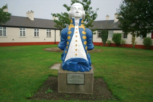
Wellesley Nautical School
The Wellesley Nautical School was a naval training school first located on the Tyne, and later removed to Blyth. == History == The Wellesley Nautical School...

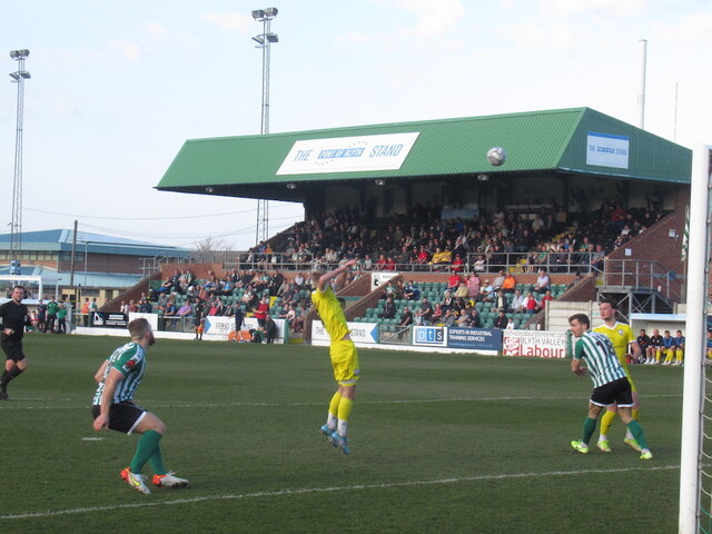
Blyth Town F.C.
Blyth Town Football Club is a football club based in Blyth, Northumberland, England. They are currently members of Northern League Division Two and play...
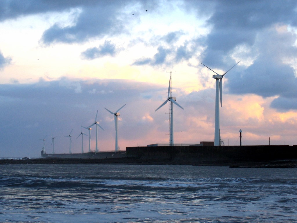
Blyth Harbour Wind Farm
Blyth Harbour Wind Farm is a coastal wind farm located in East Bedlington along the East Pier of the Port of Blyth. Commissioned in January 1993 it consists...
Blyth Spartans A.F.C.
Blyth Spartans Association Football Club is an association football club based in Blyth, Northumberland. They are currently members of the National League...
Bede Academy, Blyth
Bede Academy is a 3–18 academy in Blyth, Northumberland, England. Opened in September 2009, it is run by the Emmanuel Schools Foundation. It was one of...

Emerson Cavitation Tunnel
The Emerson Cavitation Tunnel is a propeller testing facility that is part of the School of Engineering at Newcastle University. == Capabilities == The...
Blyth Lifeboat Station
Blyth Lifeboat Station is operated by the Royal National Lifeboat Institution and currently operates a D Class (IB1) D-746 Alan and Amy.In 2007 the inshore...
Related Videos
![Blyth to Seaton Sluice walking along beach on the Northumberland Coast [4k 60fps]](https://i.ytimg.com/vi/7wSi-wNg7rw/hqdefault.jpg)
Blyth to Seaton Sluice walking along beach on the Northumberland Coast [4k 60fps]
Starting at the Blyth Battery, we head down onto the beach proceeding south toward Seaton Sluice where we end at the entrance ...

1st SNOW in the UK #music #song #love #viral #travel #shorts #youtube #friends
1st SNOW in the UK , #snow , #winter #nature #mountains #ski , #photography , #travel #skiing #landscape , #mountain ...

Ready to set sail and explore the stunning coastline of Croatia on a yacht vacation from Split!
Ready to set sail and explore the stunning coastline of Croatia on a yacht vacation from Split! Our exciting route takes us to ...
Nearby Amenities
Located within 500m of 55.107108,-1.4955003Have you been to South Beach?
Leave your review of South Beach below (or comments, questions and feedback).