Soutergate

Settlement in Lancashire South Lakeland

England

Soutergate

Ordnance Survey Cut Mark This OS cut mark can be found on the wall SE side of the road. It marks a point 6.417m above mean sea level.
Ordnance Survey Cut Mark Credit: Adrian Dust

Soutergate is a small village located in Lancashire, England. Situated approximately 3 miles northeast of Ulverston, it is part of the South Lakeland district. With a population of around 500 residents, Soutergate is a close-knit community that offers a peaceful and picturesque environment.

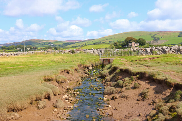
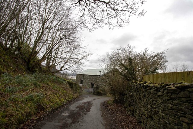
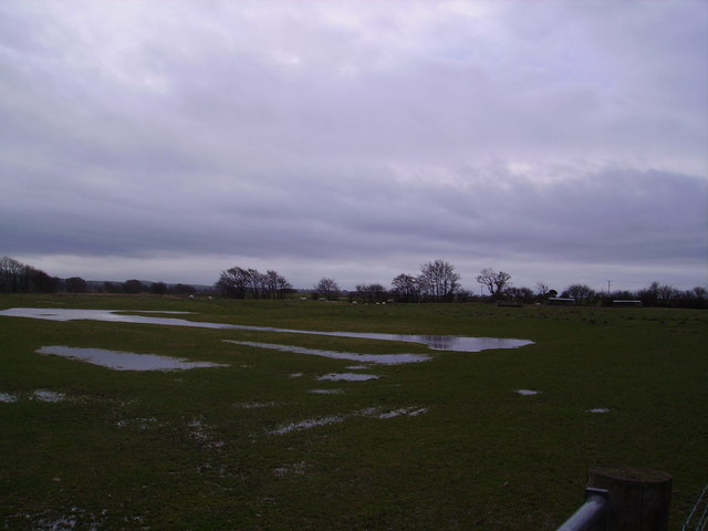
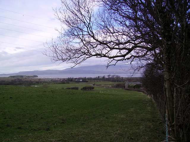
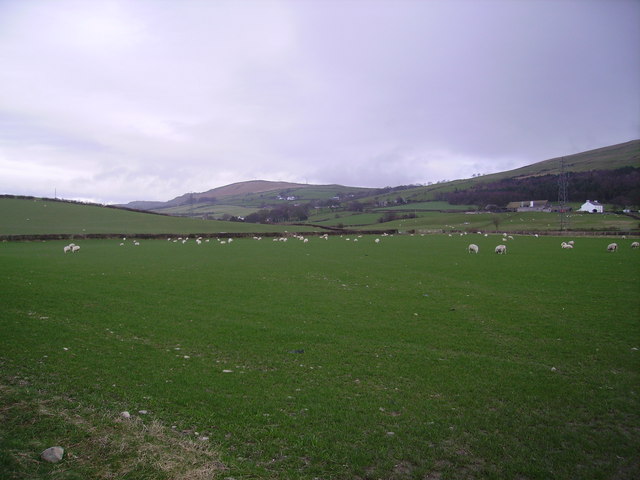
The village is surrounded by beautiful countryside, characterized by rolling hills and lush green fields. It is an ideal location for nature enthusiasts and hikers, with numerous walking trails and paths available in the nearby area. The stunning Lake District National Park is also within easy reach, providing residents and visitors with endless opportunities for outdoor activities and breathtaking scenery.

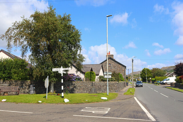
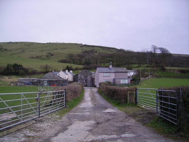
Soutergate itself features a charming village center, complete with a handful of local shops, a post office, and a traditional pub. The community spirit is strong, and regular events and gatherings are organized to bring residents together. The village also boasts a primary school, providing education to local children.

For those seeking cultural experiences, nearby Ulverston offers a range of attractions, including museums, theaters, and art galleries. The town is known for its festivals and events, particularly the annual Lantern Festival, which attracts visitors from far and wide.

In summary, Soutergate presents a tranquil and idyllic setting, nestled in the stunning Lancashire countryside. With its strong sense of community, beautiful surroundings, and close proximity to the Lake District, it is a highly desirable place to live or visit for those seeking a peaceful and picturesque retreat.

If you have any feedback on the listing, please let us know in the comments section below.
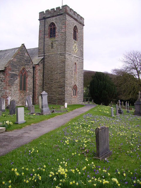
Soutergate Images

Images are sourced within 2km of 54.222002/-3.189395 or Grid Reference SD2281. Thanks to Geograph Open Source API. All images are credited.

Ordnance Survey Cut Mark This OS cut mark can be found on the wall SE side of the road. It marks a point 6.417m above mean sea level.
Ordnance Survey Cut Mark
This OS cut mark can be found on the wall SE side of the road. It marks a point 6.417m above mean sea level.
Ordnance Survey Rivet This OS rivet can be found on the wall north side of the road. It marks a point 22.275m above mean sea level.
Ordnance Survey Rivet
This OS rivet can be found on the wall north side of the road. It marks a point 22.275m above mean sea level.
Ordnance Survey Cut Mark This OS cut mark can be found on the roadside barn at Little Croft. It marks a point 76.828m above mean sea level.
Ordnance Survey Cut Mark
This OS cut mark can be found on the roadside barn at Little Croft. It marks a point 76.828m above mean sea level.
Ordnance Survey Cut Mark This OS rivet can be found on the boulder SW side of the road. It marks a point 110.591m above mean sea level.
Ordnance Survey Cut Mark
This OS rivet can be found on the boulder SW side of the road. It marks a point 110.591m above mean sea level.
Ordnance Survey Cut Mark This OS cut mark can be found on the boulder north side of the road. It marks a point 139.087m above mean sea level.
Ordnance Survey Cut Mark
This OS cut mark can be found on the boulder north side of the road. It marks a point 139.087m above mean sea level.
Ordnance Survey Cut Mark This OS cut mark can be found on the garden wall of the former Police Office west side of the road. It marks a point 18.246m above mean sea level.
Ordnance Survey Cut Mark
This OS cut mark can be found on the garden wall of the former Police Office west side of the road. It marks a point 18.246m above mean sea level.
Ordnance Survey Cut Mark This OS cut mark can be found on the gatepost NW side of the road. It marks a point 26.665m above mean sea level.
Ordnance Survey Cut Mark
This OS cut mark can be found on the gatepost NW side of the road. It marks a point 26.665m above mean sea level.
Ordnance Survey Cut Mark This damaged OS cut mark can be found on Waters Edge west side of the road. It marks a point 5.823m above mean sea level.
Ordnance Survey Cut Mark
This damaged OS cut mark can be found on Waters Edge west side of the road. It marks a point 5.823m above mean sea level.
Ordnance Survey Cut Mark This OS cut mark can be found on the NW face of the school. It marks a point 43.239m above mean sea level.
Ordnance Survey Cut Mark
This OS cut mark can be found on the NW face of the school. It marks a point 43.239m above mean sea level.
Near Soutergate Stream next to the railway line.
Near Soutergate
Stream next to the railway line.
Askew Gate Road junction at Kirkby-in-Furness.
Askew Gate
Road junction at Kirkby-in-Furness.
Bank House Farm Vernacular farm building at Bank House Farm
Bank House Farm
Vernacular farm building at Bank House Farm
Ordnance Survey Cut Mark This OS cut mark can be found on the outbuilding of the house at Dunnerholme Crossing. It marks a point 5.627m above mean sea level.
Ordnance Survey Cut Mark
This OS cut mark can be found on the outbuilding of the house at Dunnerholme Crossing. It marks a point 5.627m above mean sea level.
Farmland Marsh Grange From the track between Marsh Grange and Dunnerholme near Askham
Farmland Marsh Grange
From the track between Marsh Grange and Dunnerholme near Askham
Looking Across the Duddon From the main road at High Mere beck. Black Combe topped by cloud
Looking Across the Duddon
From the main road at High Mere beck. Black Combe topped by cloud
Kirkby in Furness The train is an excellent way of reaching the west coast of Cumbria
Kirkby in Furness
The train is an excellent way of reaching the west coast of Cumbria
Gargreave Farm near Kirkby in Furness. Bank House Moor behind.
Gargreave
Farm near Kirkby in Furness. Bank House Moor behind.
Sheep At Soutergate
Sheep
At Soutergate
Show me another place!

Soutergate is located at Grid Ref: SD2281 (Lat: 54.222002, Lng: -3.189395)

Administrative County: Cumbria

District: South Lakeland

Police Authority: Cumbria

What 3 Words

///headlight.modes.results. Near Askam in Furness, Cumbria

Nearby Locations

Soutergate

Related Wikis

Kirkby-in-Furness

Kirkby-in-Furness, generally referred to simply as Kirkby locally, is a village that is the major part of the parish of Kirkby Ireleth in the Furness district...

Kirkby Ireleth

Kirkby Ireleth is a civil parish in the South Lakeland district of the English county of Cumbria. It includes the villages of Grizebeck and Kirkby-in...

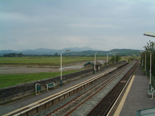
Kirkby-in-Furness railway station

Kirkby-in-Furness is a railway station on the Cumbrian Coast Line, which runs between Carlisle and Barrow-in-Furness. The station, situated 9+1⁄4 miles...

Angerton, South Lakeland

Angerton is a civil parish in the Westmorland and Furness district of the ceremonial county of Cumbria, England, historically part of the Furness portion...

Nearby Amenities

Located within 500m of 54.222002,-3.189395
Soutergate
Place: village
Source: npe
Lat/Long: 54.2227562/-3.1885428
Power: tower
Lat/Long: 54.2189331/-3.1841919
Power: tower
Lat/Long: 54.2216916/-3.1831378
Barrier: stile
Lat/Long: 54.22119/-3.1883907
Barrier: stile
Lat/Long: 54.2247155/-3.1894276
Crossing Barrier: no
Railway: level_crossing
Lat/Long: 54.2226255/-3.1970088
Post Box
Collection Times: Mo-Fr 16:15; Sa 11:15
Drive Through: no
Post Box Type: wall
Ref: LA17 31
Lat/Long: 54.2225047/-3.186713
Soutergate Bridge
Bus: yes
Local Ref: AT
Naptan AtcoCode: 090079390599
Naptan Bearing: S
Naptan BusStopType: CUS
Naptan CommonName: bridge
Naptan Indicator: at
Naptan Landmark: Soutergate Bridge
Naptan NaptanCode: cumdjtjm
Naptan Street: A595
Naptan Verified: no
Public Transport: platform
Source: naptan_import
Lat/Long: 54.2228562/-3.185927
Power: pole
Lat/Long: 54.2204517/-3.1964702
Power: pole
Lat/Long: 54.2213348/-3.1961499
Power: pole
Lat/Long: 54.2221588/-3.1958464
Power: pole
Lat/Long: 54.2231837/-3.1954486
Power: pole
Lat/Long: 54.2238756/-3.1943967
Power: pole
Lat/Long: 54.2245339/-3.1933818
Power: pole
Lat/Long: 54.2252455/-3.1923231
Power: pole
Lat/Long: 54.2259669/-3.1911869
Give Way
Direction: backward
Lat/Long: 54.222582/-3.1869094
Give Way
Direction: forward
Lat/Long: 54.2216391/-3.1848716
Give Way
Direction: backward
Lat/Long: 54.2208357/-3.1825919
Material: wood
Power: pole
Lat/Long: 54.2209184/-3.182558
Material: wood
Power: pole
Lat/Long: 54.2209343/-3.1837097
Give Way
Direction: forward
Lat/Long: 54.2235161/-3.1862365
Give Way
Direction: backward
Lat/Long: 54.2239543/-3.1860553
Bench
Backrest: yes
Lat/Long: 54.2233657/-3.1862559
Give Way
Direction: forward
Lat/Long: 54.2248541/-3.186374
Give Way
Direction: backward
Lat/Long: 54.2225845/-3.1891143
Ford: yes
Lat/Long: 54.2205248/-3.1951707
Telephone
Booth: K6
Covered: booth
Lat/Long: 54.2233713/-3.1862839
Grit Bin
Lat/Long: 54.2233773/-3.1863121
Bus Stop
Southbound
Bench: yes
Bin: yes
Bus: yes
Lit: no
Public Transport: platform
Shelter: yes
Tactile Paving: no
Lat/Long: 54.224004/-3.1860319
Soutergate Bridge
Bus: yes
Local Ref: AT
Naptan AtcoCode: 090079393281
Naptan Bearing: N
Naptan BusStopType: CUS
Naptan CommonName: Bridge
Naptan Indicator: at
Naptan Landmark: Soutergate Bridge
Naptan NaptanCode: cumdjtmp
Naptan Street: A595
Naptan Verified: no
Public Transport: platform
Source: naptan_import
Lat/Long: 54.2229235/-3.1860496
Generator Method: photovoltaic
Generator Output Electricity: yes
Generator Source: solar
Generator Type: solar_photovoltaic_panel
Location: roof
Power: generator
Lat/Long: 54.2225223/-3.1881248
Generator Method: photovoltaic
Generator Output Electricity: yes
Generator Source: solar
Generator Type: solar_photovoltaic_panel
Location: roof
Power: generator
Lat/Long: 54.2219241/-3.1858007
Barrier: kissing_gate
Lat/Long: 54.2229278/-3.1859636
Power: pole
Lat/Long: 54.2209815/-3.1849664
Power: pole
Lat/Long: 54.2210255/-3.1866566
Power: pole
Lat/Long: 54.2218341/-3.1941448
Power: pole
Lat/Long: 54.2216714/-3.192926
The data included in this document is from www.openstreetmap.org. The data is made available under ODbL.

Have you been to Soutergate?

Leave your review of Soutergate below (or comments, questions and feedback).