Somersham

Settlement in Suffolk Mid Suffolk

England

Somersham

Offton: Dwellings in Ipswich Road
Offton: Dwellings in Ipswich Road Credit: Michael Garlick

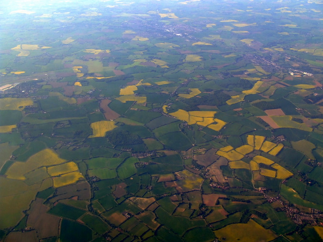
Somersham is a small village located in the county of Suffolk, England. Situated approximately 12 miles west of Ipswich, it lies within the Mid Suffolk district. The village is nestled amidst beautiful countryside, offering picturesque views and a peaceful atmosphere.

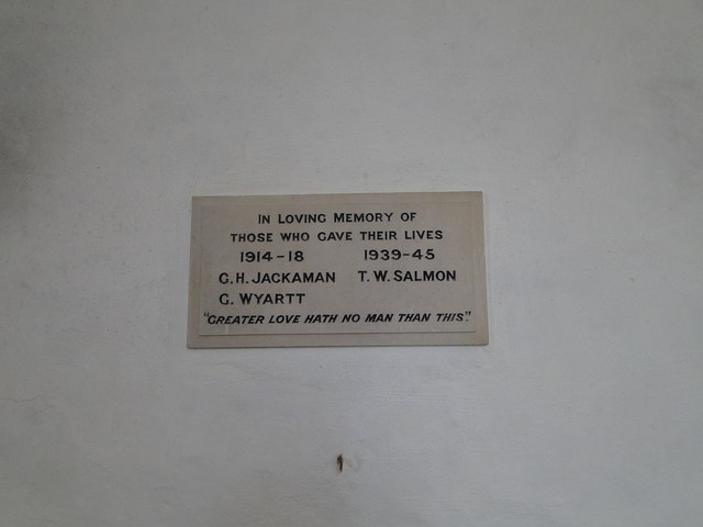
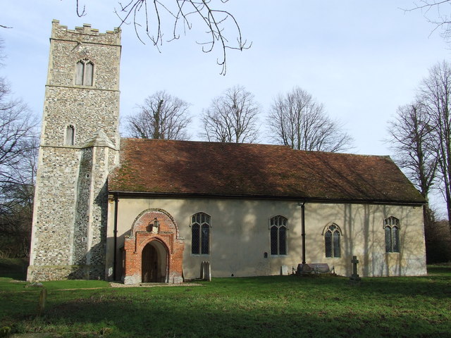
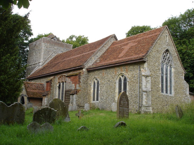
With a population of around 1,200 residents, Somersham retains its traditional charm and boasts a close-knit community. The village features a range of amenities, including a primary school, village hall, and a post office. Additionally, there are several historic buildings scattered throughout, such as the 15th-century St. Mary's Church, which adds to the village's character.

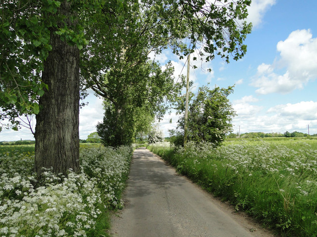
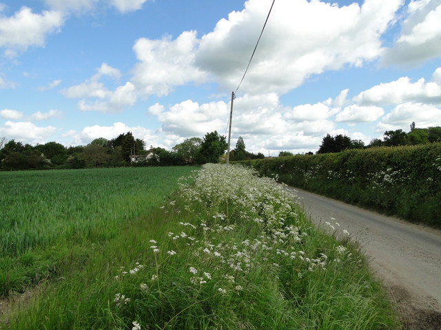
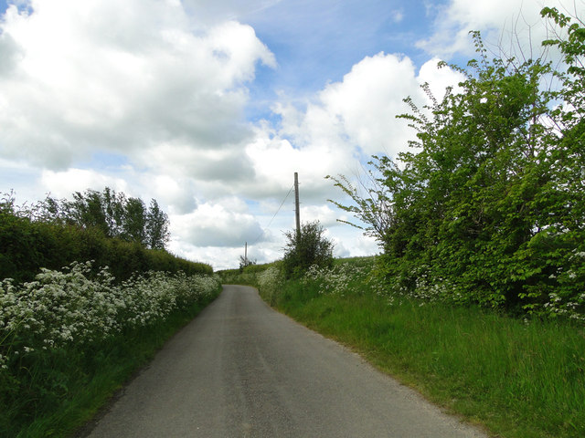
Somersham benefits from its rural location, providing ample opportunities for outdoor activities. Surrounding the village are rolling fields, woodlands, and footpaths, making it a popular spot for walking and cycling enthusiasts. The nearby River Gipping also offers fishing and boating opportunities.

For those seeking a taste of history and culture, Somersham is within close proximity to several notable sites. The town of Ipswich is a short drive away, offering a range of attractions including museums, art galleries, and a vibrant shopping scene. The iconic Framlingham Castle, a mere 30-minute drive from Somersham, is another popular destination for history enthusiasts.

Overall, Somersham is a charming village that provides a tranquil retreat from the hustle and bustle of city life. With its scenic surroundings, strong community spirit, and convenient location, it offers a desirable place to live for residents and an enjoyable visit for tourists.

If you have any feedback on the listing, please let us know in the comments section below.

Somersham Images

Images are sourced within 2km of 52.096729/1.043851 or Grid Reference TM0848. Thanks to Geograph Open Source API. All images are credited.

Offton: Dwellings in Ipswich Road
Somersham from the air Somersham is in the lower right corner. Part of the former RAF Wattishaw base can be seen near the top left.
Somersham from the air
Somersham is in the lower right corner. Part of the former RAF Wattishaw base can be seen near the top left.
Poppies in May Due to the warm dry spell, poppies are flowering early in 2011. This taken from Ipswich Road near Derrick Hill
Poppies in May
Due to the warm dry spell, poppies are flowering early in 2011. This taken from Ipswich Road near Derrick Hill
Dairy and Bakehouse, Tudor Grange, Somersham (listed building) Dairy and Bakehouse range immediately south of Tudor Grange, built c.1600.

List entry Number: 1250947 <span class="nowrap"><a title="http://list.english-heritage.org.uk/resultsingle.aspx?uid=1250947" rel="nofollow ugc noopener" href="http://list.english-heritage.org.uk/resultsingle.aspx?uid=1250947">Link</a><img style="margin-left:2px;" alt="External link" title="External link - shift click to open in new window" src="https://s1.geograph.org.uk/img/external.png" width="10" height="10"/></span>
Dairy and Bakehouse, Tudor Grange, Somersham (listed building)
Dairy and Bakehouse range immediately south of Tudor Grange, built c.1600. List entry Number: 1250947 LinkExternal link
Flowton village sign The sign is surmounted by a symbolic sheaf of corn. A single plough share symbolises the agricultural heritage of Flowton. Below the name water is represented by the scrollwork and is a reminder of the hamlet of Flowton Brook which eventually, after a journey of about ten miles, flows into the River Orwell at Ipswich. <a title="https://www.geograph.org.uk/photo/6753464" href="https://www.geograph.org.uk/photo/6753464">Link</a>
Flowton village sign
The sign is surmounted by a symbolic sheaf of corn. A single plough share symbolises the agricultural heritage of Flowton. Below the name water is represented by the scrollwork and is a reminder of the hamlet of Flowton Brook which eventually, after a journey of about ten miles, flows into the River Orwell at Ipswich. Link
The Limeburners public house, Offten <a title="https://www.geograph.org.uk/photo/4501025" href="https://www.geograph.org.uk/photo/4501025">Link</a>
The Limeburners public house, Offten
The sign of The Limeburners <a title="https://www.geograph.org.uk/photo/4501021" href="https://www.geograph.org.uk/photo/4501021">Link</a>
The sign of The Limeburners
Offton Place, Offton
Flowton Road, Flowton
Cow parsley on the roadside verges
Flowton Road, Somersham
The road divides at Nettlestead
Tree-lined footpath to The Elms
Flowton War Memorial Only three men are named from both Wars.
Flowton War Memorial
Only three men are named from both Wars.
Nettlestead War Memorial Only three men were lost in both Wars.
Nettlestead War Memorial
Only three men were lost in both Wars.
Ordnance Survey Cut Mark This can be found on the wall of St Mary's Church at Nettlestead.
For more detail see : <span class="nowrap"><a title="http://www.bench-marks.org.uk/bm44846" rel="nofollow ugc noopener" href="http://www.bench-marks.org.uk/bm44846">Link</a><img style="margin-left:2px;" alt="External link" title="External link - shift click to open in new window" src="https://s1.geograph.org.uk/img/external.png" width="10" height="10"/></span>
Ordnance Survey Cut Mark
This can be found on the wall of St Mary's Church at Nettlestead. For more detail see : LinkExternal link
The Church of St Mary at Nettlestead Viewed from the south-west.
The Church of St Mary at Nettlestead
Viewed from the south-west.
Ordnance Survey Flush Bracket 2107 This can be found on the wall of The Old Chapel House in Somersham.
For more detail see : <span class="nowrap"><a title="http://www.bench-marks.org.uk/bm2013" rel="nofollow ugc noopener" href="http://www.bench-marks.org.uk/bm2013">Link</a><img style="margin-left:2px;" alt="External link" title="External link - shift click to open in new window" src="https://s1.geograph.org.uk/img/external.png" width="10" height="10"/></span>
Ordnance Survey Flush Bracket 2107
This can be found on the wall of The Old Chapel House in Somersham. For more detail see : LinkExternal link
Show me another place!

Somersham is located at Grid Ref: TM0848 (Lat: 52.096729, Lng: 1.043851)

Administrative County: Suffolk

District: Mid Suffolk

Police Authority: Suffolk

What 3 Words

///outwit.ignore.miles. Near Bramford, Suffolk

Nearby Locations

Somersham

Related Wikis

Somersham, Suffolk

Somersham (also known as Lower Somersham) is a village and civil parish in the Mid Suffolk district of Suffolk in eastern England, approximately 5 miles...

Nettlestead, Suffolk

Nettlestead is a dispersed village and civil parish in the Mid Suffolk district of Suffolk in eastern England.The surrounding villages of Nettlestead include...
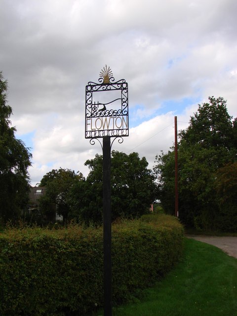
Flowton

Flowton is a village and civil parish in the Mid Suffolk district of Suffolk in eastern England, with a population of 117 people. The name 'Flowton' originally...

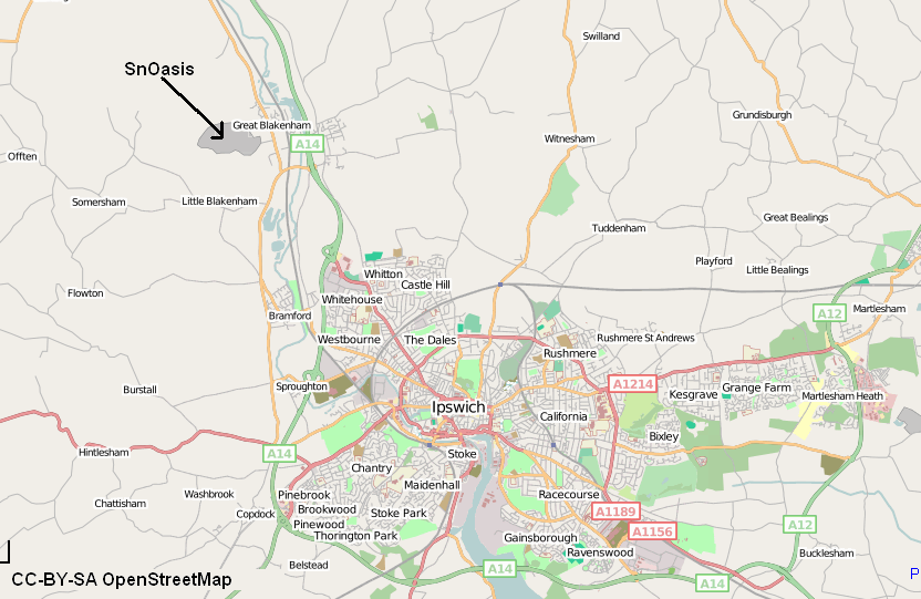
Valley Ridge (Winter sports resort)

Valley Ridge (formerly known as SnOasis) was a proposed ski and sports resort in Great Blakenham near Ipswich, Suffolk, England. In March 2021, the plan...

Nearby Amenities

Located within 500m of 52.096729,1.043851
Somersham
Place: village
Wikidata: Q2308466
Wikipedia: en:Somersham, Suffolk
Lat/Long: 52.0979935/1.0426219
Bus Stop
Duke of Marlborough
Local Ref: adj
Naptan AtcoCode: 390040315
Naptan Bearing: NW
Naptan BusStopType: CUS
Naptan CommonName: Duke of Marlborough
Naptan Landmark: Duke of Marlborough
Naptan NaptanCode: sufawmta
Naptan Street: Main Road
Naptan Verified: no
Public Transport: platform
Source: naptan_import
Lat/Long: 52.0983152/1.0411996
Bus Stop
Duke of Marlborough
Local Ref: opp
Naptan AtcoCode: 390040316
Naptan Bearing: SE
Naptan BusStopType: CUS
Naptan CommonName: Duke of Marlborough
Naptan Landmark: Duke of Marlborough
Naptan NaptanCode: sufawmtd
Naptan Street: Main road
Naptan Verified: no
Public Transport: platform
Source: naptan_import
Lat/Long: 52.0983797/1.0412928
Bus Stop
Springfield Road
Local Ref: adj
Naptan AtcoCode: 390040319
Naptan Bearing: E
Naptan CommonName: Springfield Road
Naptan Landmark: Springfield Road
Naptan NaptanCode: sufawmtm
Naptan Street: Main Road
Naptan Verified: no
Public Transport: platform
Source: naptan_import
Lat/Long: 52.0963091/1.0460797
Bus Stop
Springfield Road
Local Ref: opp
Naptan AtcoCode: 390040320
Naptan Bearing: W
Naptan BusStopType: CUS
Naptan CommonName: Springfield Road
Naptan Landmark: Springfield Road
Naptan NaptanCode: sufawmtp
Naptan Street: Main Road
Naptan Verified: no
Public Transport: platform
Source: naptan_import
Lat/Long: 52.0963195/1.0465958
Defibrillator
Booth: K6
Covered: booth
Defibrillator Location: Inside the old red telephone kiosk, Main Road, Somersham.
Disused Amenity: telephone
Emergency: defibrillator
Indoor: no
Man Made: telephone_box
Ref: CHT-14-1055
Lat/Long: 52.096303/1.0459028
Post Box
Operator: Royal Mail
Operator Wikidata: Q638098
Post Box Mounting: pier
Post Box Type: lamp
Ref: IP8 1210
Lat/Long: 52.0966055/1.0446552
Grit Bin
Lat/Long: 52.0976188/1.041953
Entrance: yes
Lat/Long: 52.0968585/1.0423071
Addr City: Lower Somersham
Addr Housename: 1 Cherry Tree Cottage
Addr Postcode: IP8 4PB
Source: OS OpenMap Local
Lat/Long: 52.0966514/1.0438386
Addr City: Lower Somersham
Addr Housename: 2 Cherry Tree Cottage
Addr Postcode: IP8 4PB
Source: OS OpenMap Local
Lat/Long: 52.0965534/1.0439821
Addr City: Lower Somersham
Addr Housename: 3 Cherry Tree Cottage
Addr Postcode: IP8 4PB
Source: OS OpenMap Local
Lat/Long: 52.0965867/1.0442812
Addr City: Lower Somersham
Addr Housename: 4 Cherry Tree Cottage
Addr Postcode: IP8 4PB
Source: OS OpenMap Local
Lat/Long: 52.0964862/1.0444394
Addr City: Lower Somersham
Addr Housename: 6 Cherry Tree Cottage
Addr Postcode: IP8 4PB
Source: OS OpenMap Local
Lat/Long: 52.0964009/1.0448753
Addr City: Lower Somersham
Addr Housename: 5 Cherry Tree Cottage
Addr Postcode: IP8 4PB
Source: OS OpenMap Local
Lat/Long: 52.0965035/1.0447036
The data included in this document is from www.openstreetmap.org. The data is made available under ODbL.

Have you been to Somersham?

Leave your review of Somersham below (or comments, questions and feedback).