Blencarn

Settlement in Cumberland Eden

England

Blencarn

Pasture, Culgaith Sheep beside the bridleway between Blencarn and Wythwaite.
Pasture, Culgaith Credit: Andrew Smith

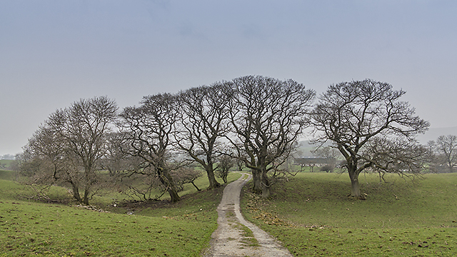
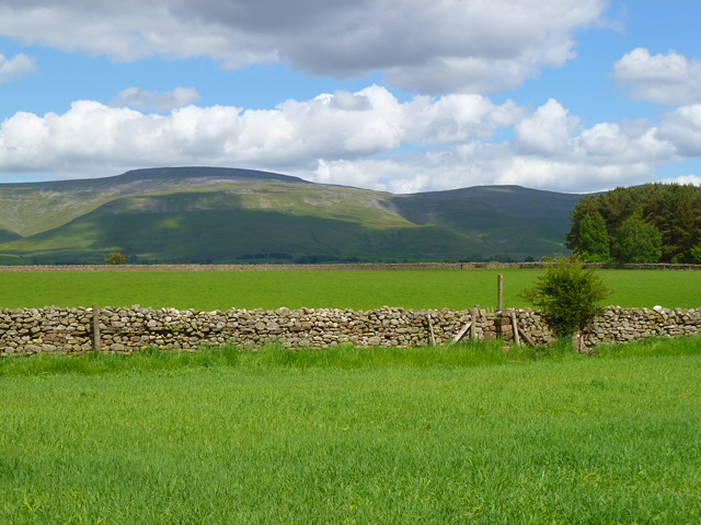
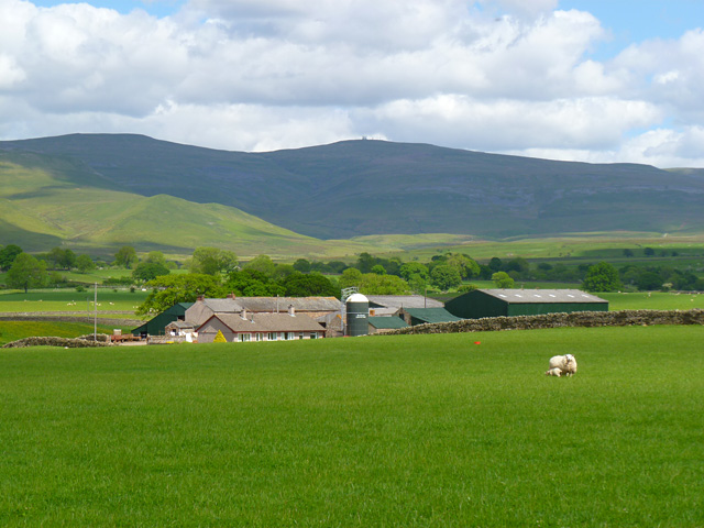
Blencarn is a small village located in the county of Cumberland, in the northwest region of England. Situated in the Eden Valley, it lies approximately 10 miles east of Penrith and 30 miles southwest of Carlisle. Blencarn is nestled amidst the picturesque landscape of the Lake District National Park, offering residents and visitors breathtaking views of rolling hills, lush greenery, and tranquil surroundings.

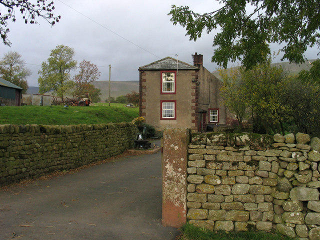
This rural village is home to a tight-knit community, with a population of around 300 people. The village primarily consists of traditional stone-built houses, giving it a charming and idyllic atmosphere. The local economy is mainly based on agriculture, with many residents engaged in farming and livestock rearing.

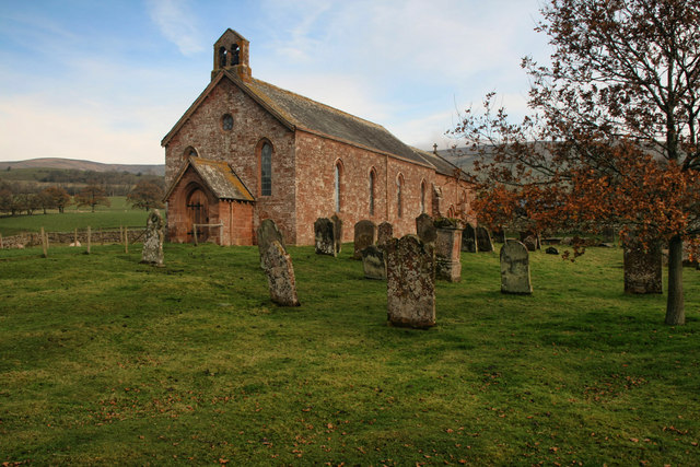
Blencarn is rich in history, with evidence of human settlement dating back to the Roman era. The village is home to several historical landmarks, including the picturesque St. Barnabas Church, which was built in the 19th century and features stunning stained glass windows. Additionally, there are remnants of ancient stone circles in the surrounding area, adding to the village's historical significance.

While Blencarn may be a small village, it offers a range of amenities for its residents. These include a primary school, a village hall that hosts various community events, and a local pub where locals and visitors can enjoy a warm and friendly atmosphere.

Overall, Blencarn is a peaceful and charming village, offering a quiet escape from the hustle and bustle of city life. Its natural beauty, rich history, and close-knit community make it an appealing place to live or visit for those seeking a rural retreat in the heart of the English countryside.

If you have any feedback on the listing, please let us know in the comments section below.
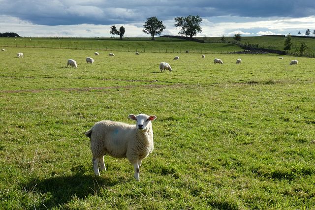
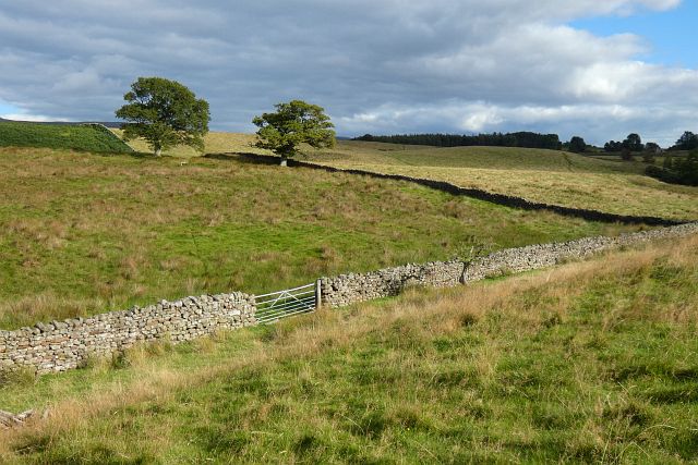
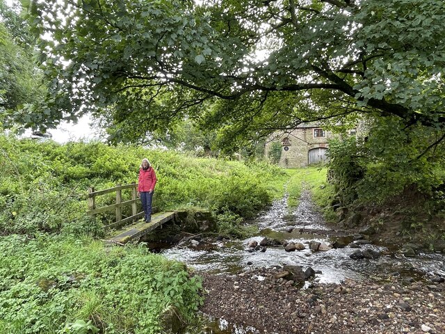
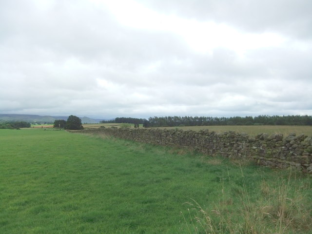
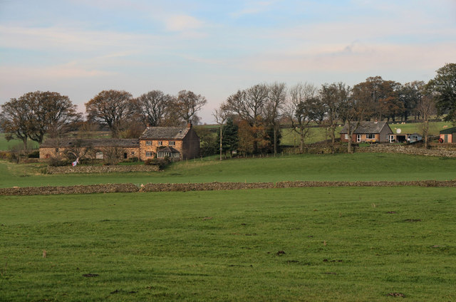
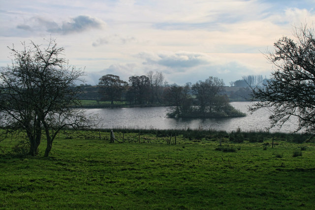
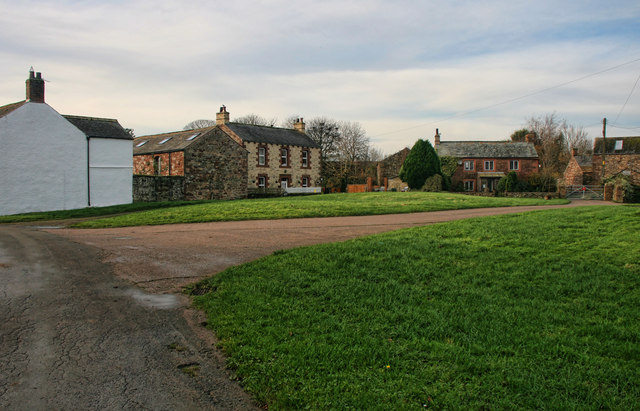
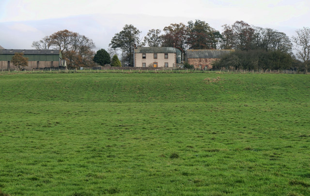
Blencarn Images

Images are sourced within 2km of 54.675479/-2.561345 or Grid Reference NY6331. Thanks to Geograph Open Source API. All images are credited.

Pasture, Culgaith Sheep beside the bridleway between Blencarn and Wythwaite.
Pasture, Culgaith
Sheep beside the bridleway between Blencarn and Wythwaite.
Pasture, Milburn Viewed from just outside of the access land crossed by the footpath south of Wythwaite.
Pasture, Milburn
Viewed from just outside of the access land crossed by the footpath south of Wythwaite.
Kirkland Hall Ford This ford is found beside Beck Cottage at Kirkland.
Kirkland Hall Ford
This ford is found beside Beck Cottage at Kirkland.
Fields near Howrigg Farm
The Flosh House at Kirkland.
The Flosh
House at Kirkland.
Bank Wood Barn beneath Bank Wood near Kirkland.
Bank Wood
Barn beneath Bank Wood near Kirkland.
Blencarn Lake Blencarn fishing lake.
Blencarn Lake
Blencarn fishing lake.
Blencarn Houses in Blencarn village.
Blencarn
Houses in Blencarn village.
Lounthwaite Lounthwaite Farm.
Lounthwaite
Lounthwaite Farm.
Baron's Hill Baron's Hill lies close to the small settlement of Kirkland at the western foot of Cross Fell.
Baron's Hill
Baron's Hill lies close to the small settlement of Kirkland at the western foot of Cross Fell.
Skirwith High Moor Farmland at Skirwith High Moor, viewed on a day when low cloud and smog cover much of the UK, limiting visibility into the surrounding hills.
Skirwith High Moor
Farmland at Skirwith High Moor, viewed on a day when low cloud and smog cover much of the UK, limiting visibility into the surrounding hills.
Path near Wythwaite A path leading from Wythwaite to Kirkland, viewed here south of the farm at Ranbeck.
Path near Wythwaite
A path leading from Wythwaite to Kirkland, viewed here south of the farm at Ranbeck.
St Lawrence's St Lawrence's church in Kirkland
St Lawrence's
St Lawrence's church in Kirkland
Farmland, Culgaith Cross Fell and Little Dun Fell are in the background.
Farmland, Culgaith
Cross Fell and Little Dun Fell are in the background.
Pasture, Skirwith, Culgaith Looking towards the Pennines from the footpath east of the village.
Pasture, Skirwith, Culgaith
Looking towards the Pennines from the footpath east of the village.
Farmland, Skirwith, Culgaith Broats Farm below Cross Fell. The barley in the foreground was about to be harvested.
Farmland, Skirwith, Culgaith
Broats Farm below Cross Fell. The barley in the foreground was about to be harvested.
Pasture, Culgaith A view of the Dun Fells above Howrigg Farm.
Pasture, Culgaith
A view of the Dun Fells above Howrigg Farm.
Pasture, Culgaith A view towards the Pennines from the footpath east of Burrelhill.
Pasture, Culgaith
A view towards the Pennines from the footpath east of Burrelhill.
Show me another place!

Blencarn is located at Grid Ref: NY6331 (Lat: 54.675479, Lng: -2.561345)

Administrative County: Cumbria

District: Eden

Police Authority: Cumbria

What 3 Words

///culminate.timer.miracle. Near Appleby-in-Westmorland, Cumbria

Nearby Locations

Blencarn

Related Wikis

Blencarn

Blencarn is a small village located in the Eden District of Cumbria, England. The village is situated at the foot of the Pennines. In Blencarn there is...

Kirkland, Culgaith

Kirkland is a village in the Eden district of the English county of Cumbria. It is in the historic county of Cumberland. There is a fell called Kirkland...

Skirwith Abbey

Skirwith Abbey is a country house in Skirwith, Cumbria, England. The House is a two-storey house of five by three bays, built by Thomas Addison, mason...

Milburn, Cumbria

Milburn is a small village and civil parish in the Eden district of Cumbria, England. It is located on the northern side of the Eden Valley, about 9 miles...

Skirwith

Skirwith is a village and former civil parish, now in the parish of Culgaith, in the Eden district, in the county of Cumbria, England. In 1931 the parish...

Newbiggin, Kirkby Thore

Newbiggin is a village and civil parish near the larger village of Temple Sowerby, in the Eden District of the English county of Cumbria. In 2001 it had...

Culgaith

Culgaith is a village and civil parish in the Eden district of Cumbria, England. It is located on the River Eden, between Temple Sowerby and Langwathby...

New Biggin railway station

New Biggin or Newbiggin was a railway station which served the village of Newbiggin near Kirkby Thore in Newbiggin parish, Cumbria, England. It was located...

Nearby Amenities

Located within 500m of 54.675479,-2.561345
Blencarn
Place: village
Source: NPE
Wikidata: Q3233542
Wikipedia: en:Blencarn
Lat/Long: 54.6748188/-2.5643439
Village Green
Naptan AtcoCode: 090074201059
Naptan Bearing: E
Naptan BusStopType: CUS
Naptan CommonName: Village Green
Naptan Indicator: opp
Naptan Landmark: Marys Croft
Naptan NaptanCode: cumdagmg
Naptan Street: No name
Naptan Verified: no
Source: naptan_import
Lat/Long: 54.674912/-2.5622753
Post Box
Ref: CA10 192
Source: survey
Lat/Long: 54.6750135/-2.5623429
Telephone
Source: survey
Lat/Long: 54.6754675/-2.5641288
Grit Bin
Lat/Long: 54.675525/-2.5639421
Bench
Lat/Long: 54.6755274/-2.5637111
Recycling
Lat/Long: 54.6749235/-2.5622088
Generator Method: photovoltaic
Generator Output Electricity: yes
Generator Source: solar
Generator Type: solar_photovoltaic_panel
Location: roof
Power: generator
Lat/Long: 54.6750718/-2.5638484
Generator Method: photovoltaic
Generator Output Electricity: yes
Generator Source: solar
Generator Type: solar_photovoltaic_panel
Location: roof
Power: generator
Lat/Long: 54.6744459/-2.5617643
Generator Method: photovoltaic
Generator Output Electricity: yes
Generator Source: solar
Generator Type: solar_photovoltaic_panel
Location: roof
Power: generator
Lat/Long: 54.6746142/-2.5605814
Power: pole
Lat/Long: 54.6727653/-2.5669691
Power: pole
Lat/Long: 54.6738324/-2.5670689
Power: pole
Lat/Long: 54.6748602/-2.5671517
Power: pole
Lat/Long: 54.6765646/-2.5672898
Power: pole
Lat/Long: 54.6774634/-2.5673662
Power: pole
Lat/Long: 54.6780246/-2.5660198
Power: pole
Lat/Long: 54.6776918/-2.5650981
Power: pole
Lat/Long: 54.6773357/-2.5641297
Power: pole
Lat/Long: 54.6779423/-2.5626813
Power: pole
Lat/Long: 54.6786999/-2.5616428
Power: pole
Lat/Long: 54.6793666/-2.5607594
The data included in this document is from www.openstreetmap.org. The data is made available under ODbL.

Have you been to Blencarn?

Leave your review of Blencarn below (or comments, questions and feedback).