Solihull Lodge

Settlement in Warwickshire

England

Solihull Lodge

Stratford-upon-Avon Canal towards bridge #7
Stratford-upon-Avon Canal towards bridge #7 Credit: Ian S

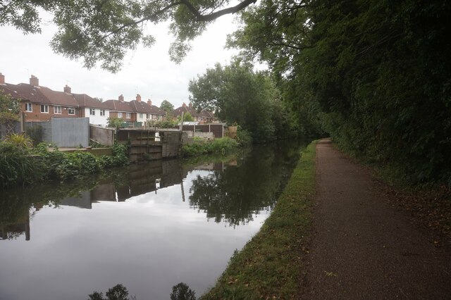
Solihull Lodge is a small village located in the county of Warwickshire, England. It is situated approximately 10 miles southeast of the city of Birmingham and is a part of the Metropolitan Borough of Solihull. The village is surrounded by beautiful countryside, offering a peaceful and picturesque setting for its residents.

Solihull Lodge is well-known for its close proximity to several notable attractions. The nearby National Exhibition Centre (NEC), which is one of the largest exhibition centers in Europe, attracts millions of visitors each year with its wide range of events, shows, and conferences. The village is also conveniently located near Birmingham International Airport, making it easily accessible for both domestic and international travelers.

In terms of amenities, Solihull Lodge offers a range of facilities to cater to the needs of its residents. The village has a primary school, providing education for young children, and there are several shopping centers and supermarkets just a short drive away. Additionally, there are various recreational activities available in the surrounding area, including golf courses, parks, and nature reserves.

Solihull Lodge boasts excellent transport links, with the M42 motorway just a few minutes' drive away, connecting the village to major cities such as Birmingham and Coventry. There are also regular bus services that run through the village, providing convenient access to neighboring towns and villages.

Overall, Solihull Lodge offers a peaceful and convenient living environment, with its attractive countryside setting, proximity to key attractions, and easy access to major cities.

If you have any feedback on the listing, please let us know in the comments section below.

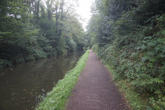
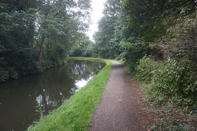
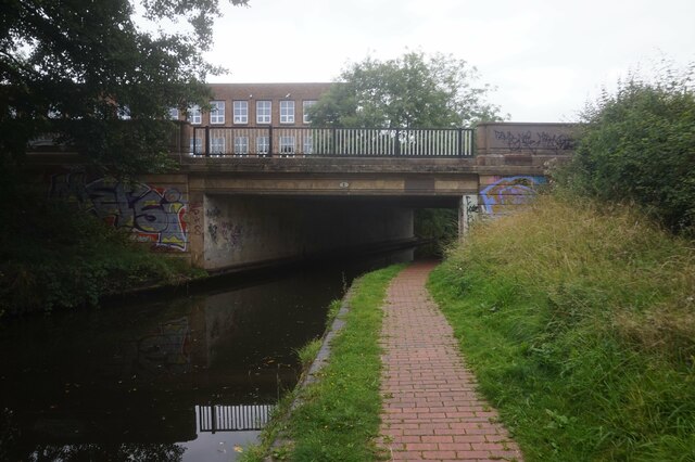
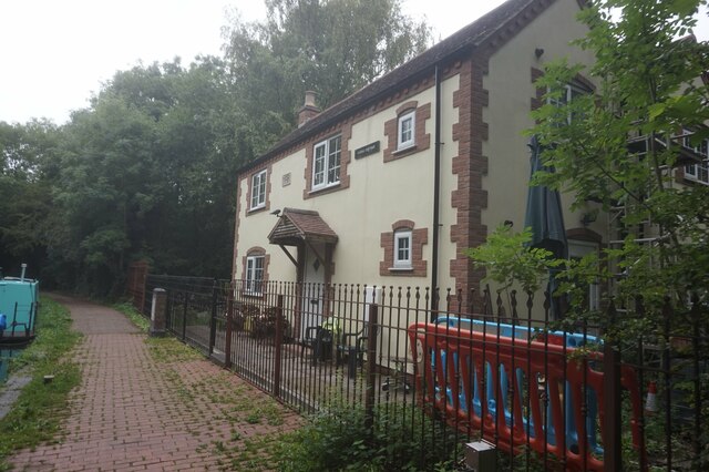
Solihull Lodge Images

Images are sourced within 2km of 52.406191/-1.858114 or Grid Reference SP0978. Thanks to Geograph Open Source API. All images are credited.

Stratford-upon-Avon Canal towards bridge #7
Stratford-upon-Avon Canal at Solihull High Street Bridge, bridge #7
Stratford-upon-Avon Canal towards bridge #6
Canal boat Brasso, Stratford-upon-Avon Canal
Stratford-upon-Avon Canal towards bridge #6
Stratford-upon-Avon Canal at School Road Bridge, bridge #6
Stratford-upon-Avon Canal towards bridge #5
Stratford-upon-Avon Canal at Yardley Wood Bridge, bridge #5
Canal Cottage, Stratford-upon-Avon Canal near bridge #5
Plaque at Canal Cottage Near bridge #5, Stratford upon Avon Canal.
Plaque at Canal Cottage
Near bridge #5, Stratford upon Avon Canal.
Stratford-upon-Avon Canal towards bridge #4
Stratford-upon-Avon Canal at Warstock Lane Bridge, bridge #4
Stratford-upon-Avon Canal towards bridge #3
Show me another place!

Solihull Lodge is located at Grid Ref: SP0978 (Lat: 52.406191, Lng: -1.858114)

Unitary Authority: Solihull

Police Authority: West Midlands

What 3 Words

///oils.fade.fats. Near Dickens Heath, West Midlands

Related Wikis

Berry Mound

Berry Mound is an Iron Age hill fort in the Bromsgrove district of Worcestershire, near Shirley, West Midlands, on the outskirts of Birmingham. It has...

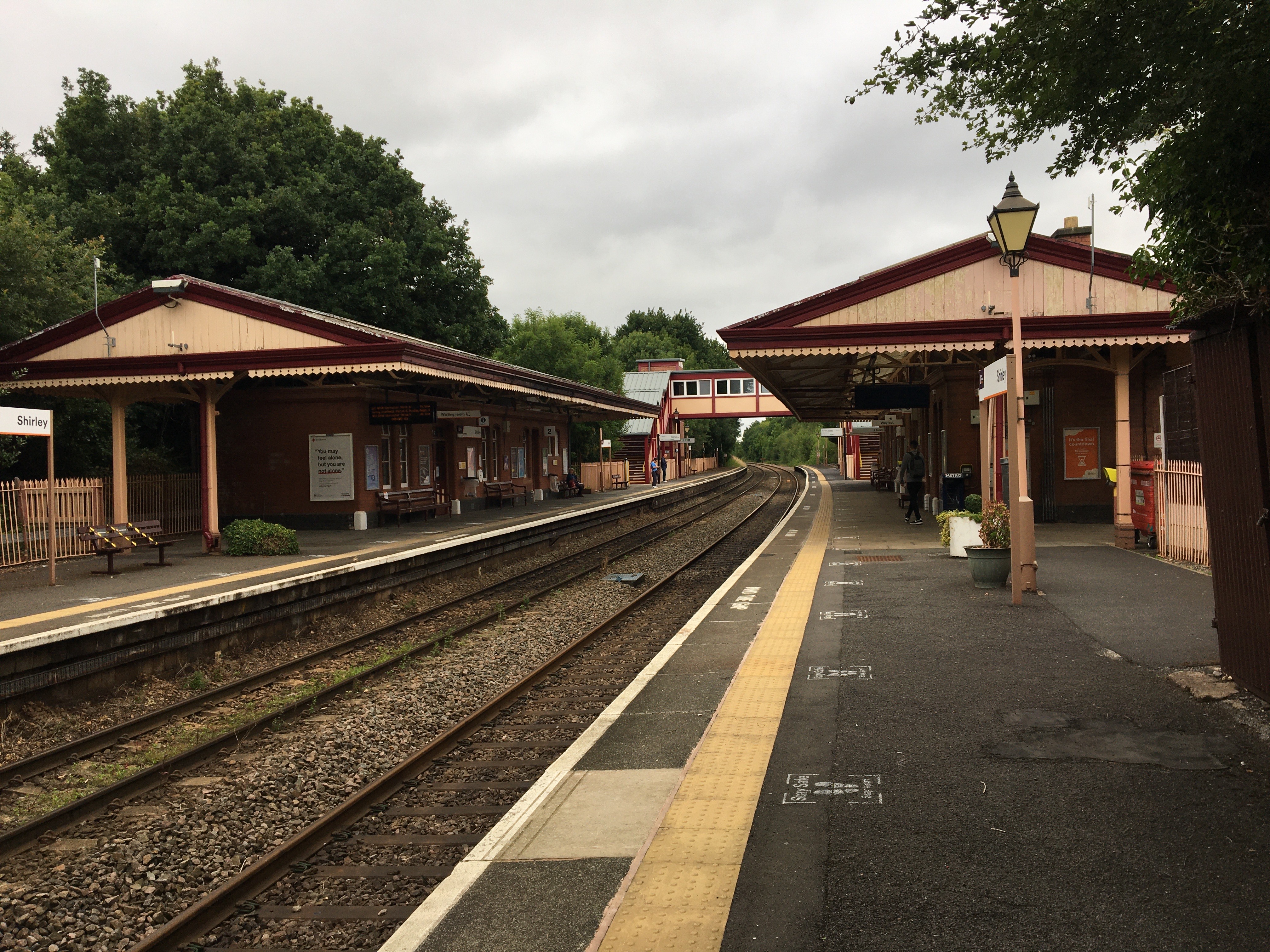
Shirley railway station (England)

Shirley railway station serves the Shirley area of Solihull in the West Midlands of England. Situated on the North Warwickshire Line, the station, and...

Christ Church, Yardley Wood

Christ Church, Yardley Wood is a Grade II listed parish church in the Church of England in Birmingham. == History == The foundation stone was laid on 14...

Major's Green

Major's Green is a village in the Wythall parish of Bromsgrove district and is the northeastern-most settlement in the county of Worcestershire, England...

Highter's Heath

Highter's Heath (often Highters Heath) is a district and ward lying on the southern boundary of the city of Birmingham, UK. The district of Highter's Heath...

Warstock

Warstock is a district within the city of Birmingham, UK, in the southernmost suburbs roughly 1 km east of the A435 and within the ward of Highter's Heath...

Solihull Lodge

Solihull Lodge is a residential area of Solihull (to the southwest of Shirley), near its border with Birmingham (Yardley Wood and Warstock areas). The...

Yardley Wood

Yardley Wood is an area of Birmingham, United Kingdom, covering the easternmost quadrant of postcode area B14 (as well as Priory Rd and adjacent streets...

Nearby Amenities

Located within 500m of 52.406191,-1.858114
Crossing
Crossing: uncontrolled
Crossing Ref: zebra
Lat/Long: 52.4068271/-1.852456
Crossing
Crossing: zebra
Lat/Long: 52.4051046/-1.8511762
Barrier: bollard
Source: survey
Lat/Long: 52.4061369/-1.8584822
Solihull Lodge
Place: village
Wikidata: Q7558097
Wikipedia: en:Solihull Lodge
Lat/Long: 52.4048909/-1.8577716
Mini Roundabout
Direction: clockwise
Source: survey
Lat/Long: 52.4068767/-1.8520891
Bus Stop
High St / Solihull Lodge
Bus: yes
Naptan AtcoCode: 43000140201
Naptan Bearing: E
Naptan BusStopType: MKD
Naptan CommonName: Solihull Lodge
Naptan Indicator: opp
Naptan NaptanCode: nwmgdatp
Naptan PlusbusZoneRef: BHAMNWS
Naptan Status: ACT
Naptan StopType: BCT
Naptan Street: HIGH ST
Naptan Towards: Shirley
Public Transport: platform
Route Ref: 2;49
Source: WMCA
Lat/Long: 52.4056506/-1.8618223
Bus Stop
High St / Solihull Lodge
Bus: yes
Naptan AtcoCode: 43000140202
Naptan Bearing: W
Naptan BusStopType: MKD
Naptan CommonName: Solihull Lodge
Naptan Indicator: adj
Naptan NaptanCode: nwmgdatw
Naptan PlusbusZoneRef: BHAMNWS
Naptan Status: ACT
Naptan StopType: BCT
Naptan Street: HIGH ST
Naptan Towards: Maypole
Public Transport: platform
Route Ref: 2;49
Shelter: no
Source: WMCA
Lat/Long: 52.4054981/-1.8622026
Bus Stop
High St / Peterbrook School
NaPTANAreaCode: 43000140301
Asset Ref: 810702
Bus: yes
Naptan AtcoCode: 43000140301
Naptan Bearing: W
Naptan BusStopType: MKD
Naptan CommonName: Peterbrook School
Naptan Indicator: adj
Naptan NaptanCode: nwmgdawa
Naptan PlusbusZoneRef: BHAMNWS
Naptan Status: ACT
Naptan StopType: BCT
Naptan Street: HIGH ST
Naptan Towards: Maypole
Public Transport: platform
Route Ref: 49
Shelter: yes
Shelter Ref: 810702
Source: WMCA
Lat/Long: 52.4060394/-1.8583333
Bus Stop
High St / Peterbrook School
NaPTANAreaCode: 43000140302
Bus: yes
Naptan AtcoCode: 43000140302
Naptan Bearing: E
Naptan BusStopType: MKD
Naptan CommonName: Peterbrook School
Naptan Indicator: opp
Naptan NaptanCode: nwmgdawd
Naptan PlusbusZoneRef: BHAMNWS
Naptan Status: ACT
Naptan StopType: BCT
Naptan Street: HIGH ST
Naptan Towards: Shirley
Public Transport: platform
Route Ref: 49
Shelter: yes
Shelter Ref: 810701
Source: WMCA
Lat/Long: 52.4061931/-1.8579235
Bus Stop
Peterbrook Rd / Peterbrook Rise
Bus: yes
Naptan AtcoCode: 43000140402
Naptan Bearing: SE
Naptan BusStopType: MKD
Naptan CommonName: Peterbrook Rise
Naptan Indicator: adj
Naptan NaptanCode: nwmtajgm
Naptan Status: ACT
Naptan StopType: BCT
Naptan Street: PETERBROOK RD
Naptan Towards: Shirley
Naptan Verified: no
Public Transport: platform
Route Ref: S3
Source: WMCA
Lat/Long: 52.4021108/-1.8553621
Bus Stop
Peterbrook Rd / Hargrave Rd
Bus: yes
Naptan AtcoCode: 43000140601
Naptan Bearing: NW
Naptan BusStopType: MKD
Naptan CommonName: Hargrave Rd
Naptan Indicator: opp
Naptan NaptanCode: nwmptatd
Naptan PlusbusZoneRef: BHAMNWS
Naptan Status: ACT
Naptan StopType: BCT
Naptan Street: PETERBROOK RD
Naptan Towards: Maypole
Public Transport: platform
Route Ref: S3W
Shelter: no
Source: WMCA
Lat/Long: 52.4047948/-1.8637062
Bus Stop
Peterbrook Rd / Hargrave Rd
Bus: yes
Naptan AtcoCode: 43000140602
Naptan Bearing: SE
Naptan BusStopType: MKD
Naptan CommonName: Hargrave Rd
Naptan Indicator: adj
Naptan NaptanCode: nwmtajgt
Naptan PlusbusZoneRef: BHAMNWS
Naptan Status: ACT
Naptan StopType: BCT
Naptan Street: PETERBROOK RD
Naptan Towards: Shirley
Public Transport: platform
Route Ref: S3
Shelter: no
Source: WMCA
Lat/Long: 52.4047707/-1.8634959
Bus Stop
Aqueduct Rd / High St
Bus: yes
Naptan AtcoCode: 43000141101
Naptan Bearing: N
Naptan BusStopType: MKD
Naptan CommonName: High St
Naptan Indicator: before
Naptan Landmark: Mill Lodge Primary School
Naptan NaptanCode: nwmgdawp
Naptan PlusbusZoneRef: BHAMNWS
Naptan Status: ACT
Naptan StopType: BCT
Naptan Street: AQUEDUCT RD
Naptan Towards: Maypole
Public Transport: platform
Route Ref: 3;49
Source: WMCA
Lat/Long: 52.4065376/-1.8519264
Bus Stop
Aqueduct Rd / High St
Bus: yes
Naptan AtcoCode: 43000141102
Naptan Bearing: S
Naptan BusStopType: MKD
Naptan CommonName: High St
Naptan Indicator: after
Naptan Landmark: Mill Lodge Primary
Naptan NaptanCode: nwmgdawt
Naptan PlusbusZoneRef: BHAMNWS
Naptan Status: ACT
Naptan StopType: BCT
Naptan Street: AQUEDUCT RD
Naptan Towards: Shirley
Public Transport: platform
Route Ref: 3;49
Source: WMCA
Lat/Long: 52.406296/-1.8515982
Bus Stop
High St / Canal Bridge
Bus: yes
Naptan AtcoCode: 43000144001
Naptan Bearing: E
Naptan BusStopType: MKD
Naptan CommonName: Canal Bridge
Naptan Indicator: before
Naptan NaptanCode: nwmwagaj
Naptan PlusbusZoneRef: BHAMNWS
Naptan Status: ACT
Naptan StopType: BCT
Naptan Street: HIGH ST
Naptan Towards: Shirley
Public Transport: platform
Route Ref: 49
Shelter: no
Source: WMCA
Lat/Long: 52.4065467/-1.8550445
Bus Stop
High St / Canal Bridge
Bus: yes
Naptan AtcoCode: 43000144002
Naptan Bearing: W
Naptan BusStopType: MKD
Naptan CommonName: Canal Bridge
Naptan Indicator: after
Naptan NaptanCode: nwmwagam
Naptan PlusbusZoneRef: BHAMNWS
Naptan Status: ACT
Naptan StopType: BCT
Naptan Street: HIGH ST
Naptan Towards: Maypole
Public Transport: platform
Route Ref: 49
Shelter: no
Source: WMCA
Lat/Long: 52.4064048/-1.8554188
Bus Stop
Yardley Wood Rd / Greenslade Rd
Bus: yes
Naptan AtcoCode: 43000427501
Naptan Bearing: NW
Naptan BusStopType: MKD
Naptan CommonName: Greenslade Rd
Naptan Indicator: adj
Naptan NaptanCode: nwmgmjaw
Naptan PlusbusZoneRef: BHAMNWS
Naptan Status: ACT
Naptan StopType: BCT
Naptan Street: YARDLEY WOOD RD
Naptan Towards: Birmingham
Public Transport: platform
Route Ref: 2
Shelter: no
Source: WMCA
Lat/Long: 52.4084717/-1.8639306
Bus Stop
Yardley Wood Rd / Greenslade Rd
Bus: yes
Naptan AtcoCode: 43000427502
Naptan Bearing: SE
Naptan BusStopType: MKD
Naptan CommonName: Greenslade Rd
Naptan Indicator: opp
Naptan NaptanCode: nwmtmgtw
Naptan PlusbusZoneRef: BHAMNWS
Naptan Status: ACT
Naptan StopType: BCT
Naptan Street: YARDLEY WOOD RD
Naptan Towards: Maypole
Public Transport: platform
Route Ref: 2
Shelter: no
Source: WMCA
Lat/Long: 52.4084868/-1.8637612
Bus Stop
Yardley Wood Rd / Oxhill Rd
Bus: yes
Naptan AtcoCode: 43000427601
Naptan Bearing: NW
Naptan BusStopType: MKD
Naptan CommonName: Oxhill Rd
Naptan Indicator: adj
Naptan NaptanCode: nwmgmjda
Naptan PlusbusZoneRef: BHAMNWS
Naptan Status: ACT
Naptan StopType: BCT
Naptan Street: YARDLEY WOOD RD
Naptan Towards: Birmingham
Naptan Verified: no
Public Transport: platform
Route Ref: 2
Source: WMCA
Lat/Long: 52.4067108/-1.8605781
Bus Stop
Yardley Wood Rd / Oxhill Rd
Bus: yes
Naptan AtcoCode: 43000427602
Naptan Bearing: SE
Naptan BusStopType: MKD
Naptan CommonName: Oxhill Rd
Naptan Indicator: opp
Naptan NaptanCode: nwmtmgwa
Naptan PlusbusZoneRef: BHAMNWS
Naptan Status: ACT
Naptan StopType: BCT
Naptan Street: YARDLEY WOOD RD
Naptan Towards: Maypole
Naptan Verified: no
Public Transport: platform
Route Ref: 2
Source: WMCA
Lat/Long: 52.406806/-1.8605857
Ford: yes
Lat/Long: 52.4086242/-1.8589419
Ford: yes
Source: survey
Lat/Long: 52.408479/-1.8553908
Mini Roundabout
Source: bing
Lat/Long: 52.4061954/-1.8573312
Brand: National Grid
Brand Wikidata: Q1465461
Operator: National Grid Electricity Distribution Plc
Operator Old: Western Power Distribution
Operator Wikidata: Q7988183
Owner: National Grid Electricity Distribution (West Midlands) Plc
Owner Wikidata: Q114397791
Power: substation
Source: survey
Lat/Long: 52.4061439/-1.8587088
Crossing
Crossing: traffic_signals
Crossing Ref: pelican
Source: survey
Source Type: BCC_CycleData
Lat/Long: 52.4059233/-1.8595059
Source: survey
Utility: gas
Lat/Long: 52.4060183/-1.85823
Addr Street: Bach Mill Drive
Lat/Long: 52.4094802/-1.8555995
Building: residential
Lat/Long: 52.408458/-1.8633415
Give Way
Source: bing
Lat/Long: 52.405993/-1.8592476
Barrier: cycle_barrier
Bicycle: permissive
Description: Radar key for wheelchair access
Foot: permissive
Material: steel
Motor Vehicle: no
Lat/Long: 52.4063601/-1.8547322
Give Way
Direction: forward
Source: Warwicks Aerial Imagery OGL v2
Lat/Long: 52.4052796/-1.8640738
Post Box
Post Box Type: pillar
Ref: B90 1357
Source: Warwicks Aerial Imagery OGL v2
Lat/Long: 52.4022196/-1.8557478
Traffic Calming: table
Lat/Long: 52.4057976/-1.8543493
Post Box
Post Box Type: pillar
Ref: B90 753D
Royal Cypher: GR
Royal Cypher Wikidata: Q33102273
Lat/Long: 52.4062828/-1.8596057
Post Box
Post Box Design: type_m
Post Box Type: lamp
Ref: B90 1056D
Royal Cypher: EIIR
Royal Cypher Wikidata: Q33102113
Source: survey
Lat/Long: 52.406294/-1.8652124
Brand: National Grid
Brand Wikidata: Q1465461
Operator: National Grid Electricity Distribution Plc
Operator Old: Western Power Distribution
Operator Wikidata: Q7988183
Owner: National Grid Electricity Distribution (West Midlands) Plc
Owner Wikidata: Q114397791
Power: substation
Ref: 725661
Source: survey
Lat/Long: 52.405843/-1.8533182
Operator: Energetics
Power: substation
Ref: B90S1185
Source: survey
Lat/Long: 52.4058304/-1.8533077
Give Way
Source: bing
Lat/Long: 52.405195/-1.8652645
Bus Stop
Peterbrook Rd / Peterbrook Rise
Bus: yes
Naptan AtcoCode: 43000140401
Naptan Bearing: NW
Naptan BusStopType: MKD
Naptan CommonName: Peterbrook Rise
Naptan Indicator: opp
Naptan NaptanCode: nwmptapw
Naptan Status: ACT
Naptan StopType: BCT
Naptan Street: PETERBROOK RD
Naptan Towards: Maypole
Public Transport: platform
Route Ref: S3W
Source: WMCA
Lat/Long: 52.4021783/-1.855832
Source: survey
Tourism: artwork
Lat/Long: 52.4062732/-1.8544132
Generator Method: photovoltaic
Generator Output Electricity: yes
Generator Source: solar
Generator Type: solar_photovoltaic_panel
Location: roof
Power: generator
Lat/Long: 52.4089601/-1.8614987
Generator Method: photovoltaic
Generator Output Electricity: yes
Generator Source: solar
Generator Type: solar_photovoltaic_panel
Location: roof
Power: generator
Lat/Long: 52.4089732/-1.8616931
Generator Method: photovoltaic
Generator Output Electricity: yes
Generator Source: solar
Generator Type: solar_photovoltaic_panel
Power: generator
Lat/Long: 52.40524/-1.8605411
Generator Method: photovoltaic
Generator Output Electricity: yes
Generator Source: solar
Generator Type: solar_photovoltaic_panel
Power: generator
Lat/Long: 52.4047769/-1.8621558
Generator Method: photovoltaic
Generator Output Electricity: yes
Generator Source: solar
Generator Type: solar_photovoltaic_panel
Power: generator
Lat/Long: 52.4031864/-1.8566465
Generator Method: photovoltaic
Generator Output Electricity: yes
Generator Source: solar
Generator Type: solar_photovoltaic_panel
Power: generator
Lat/Long: 52.4036863/-1.8629672
Generator Method: photovoltaic
Generator Output Electricity: yes
Generator Source: solar
Generator Type: solar_photovoltaic_panel
Power: generator
Lat/Long: 52.4040839/-1.8614571
Generator Method: photovoltaic
Generator Output Electricity: yes
Generator Source: solar
Generator Type: solar_photovoltaic_panel
Location: roof
Power: generator
Lat/Long: 52.4040586/-1.8613417
Generator Method: photovoltaic
Generator Output Electricity: yes
Generator Source: solar
Generator Type: solar_photovoltaic_panel
Location: roof
Power: generator
Lat/Long: 52.4030284/-1.8576175
Generator Method: photovoltaic
Generator Output Electricity: yes
Generator Source: solar
Generator Type: solar_photovoltaic_panel
Location: roof
Power: generator
Lat/Long: 52.4072445/-1.8610682
Generator Method: photovoltaic
Generator Output Electricity: yes
Generator Source: solar
Generator Type: solar_photovoltaic_panel
Location: roof
Power: generator
Lat/Long: 52.4029982/-1.8574029
Generator Method: photovoltaic
Generator Output Electricity: yes
Generator Source: solar
Generator Type: solar_photovoltaic_panel
Location: roof
Power: generator
Lat/Long: 52.403602/-1.8590122
Generator Method: photovoltaic
Generator Output Electricity: yes
Generator Source: solar
Generator Type: solar_photovoltaic_panel
Location: roof
Power: generator
Lat/Long: 52.4045102/-1.860871
Generator Method: photovoltaic
Generator Output Electricity: yes
Generator Source: solar
Generator Type: solar_photovoltaic_panel
Location: roof
Power: generator
Lat/Long: 52.4050862/-1.860002
Generator Method: photovoltaic
Generator Output Electricity: yes
Generator Source: solar
Generator Type: solar_photovoltaic_panel
Location: roof
Power: generator
Lat/Long: 52.4075415/-1.8606404
Generator Method: photovoltaic
Generator Output Electricity: yes
Generator Source: solar
Generator Type: solar_photovoltaic_panel
Location: roof
Power: generator
Lat/Long: 52.4074654/-1.8604526
Generator Method: photovoltaic
Generator Output Electricity: yes
Generator Source: solar
Generator Type: solar_photovoltaic_panel
Location: roof
Power: generator
Lat/Long: 52.4074801/-1.859487
Generator Method: photovoltaic
Generator Output Electricity: yes
Generator Source: solar
Generator Type: solar_photovoltaic_panel
Location: roof
Power: generator
Lat/Long: 52.4074507/-1.8593556
Generator Method: photovoltaic
Generator Output Electricity: yes
Generator Source: solar
Generator Type: solar_photovoltaic_panel
Location: roof
Power: generator
Lat/Long: 52.407485/-1.8636847
Generator Method: photovoltaic
Generator Output Electricity: yes
Generator Source: solar
Generator Type: solar_photovoltaic_panel
Location: roof
Power: generator
Lat/Long: 52.4074899/-1.8637866
Generator Method: photovoltaic
Generator Output Electricity: yes
Generator Source: solar
Generator Type: solar_photovoltaic_panel
Location: roof
Power: generator
Lat/Long: 52.4067405/-1.8626279
Generator Method: photovoltaic
Generator Output Electricity: yes
Generator Source: solar
Generator Type: solar_photovoltaic_panel
Location: roof
Power: generator
Lat/Long: 52.4060058/-1.8631375
Generator Method: photovoltaic
Generator Output Electricity: yes
Generator Source: solar
Generator Type: solar_photovoltaic_panel
Location: roof
Power: generator
Lat/Long: 52.4068109/-1.863623
Generator Method: photovoltaic
Generator Output Electricity: yes
Generator Source: solar
Generator Type: solar_photovoltaic_panel
Location: roof
Power: generator
Lat/Long: 52.4076666/-1.853098
Generator Method: photovoltaic
Generator Output Electricity: yes
Generator Source: solar
Generator Type: solar_photovoltaic_panel
Location: roof
Power: generator
Lat/Long: 52.4056835/-1.8553001
Generator Method: photovoltaic
Generator Output Electricity: yes
Generator Source: solar
Generator Type: solar_photovoltaic_panel
Location: roof
Power: generator
Lat/Long: 52.4056/-1.8553081
Generator Method: photovoltaic
Generator Output Electricity: yes
Generator Source: solar
Generator Type: solar_photovoltaic_panel
Location: roof
Power: generator
Lat/Long: 52.4026365/-1.8559706
Generator Method: photovoltaic
Generator Output Electricity: yes
Generator Source: solar
Generator Type: solar_photovoltaic_panel
Location: roof
Power: generator
Lat/Long: 52.4039178/-1.8607959
Barrier: kissing_gate
Foot: permissive
Material: wood
Lat/Long: 52.4046572/-1.8548331
Barrier: cycle_barrier
Bicycle: permissive
Description: Radar key for wheelchair access
Foot: permissive
Material: steel
Motor Vehicle: no
Wheelchair: yes
Lat/Long: 52.4067336/-1.8548412
Generator Method: photovoltaic
Generator Output Electricity: yes
Generator Source: solar
Generator Type: solar_photovoltaic_panel
Location: roof
Power: generator
Lat/Long: 52.4068256/-1.8595541
Generator Method: photovoltaic
Generator Output Electricity: yes
Generator Source: solar
Generator Type: solar_photovoltaic_panel
Location: roof
Power: generator
Lat/Long: 52.4089298/-1.8614128
Generator Method: photovoltaic
Generator Output Electricity: yes
Generator Source: solar
Generator Type: solar_photovoltaic_panel
Location: roof
Power: generator
Lat/Long: 52.40986/-1.8558244
Generator Method: photovoltaic
Generator Output Electricity: yes
Generator Source: solar
Generator Type: solar_photovoltaic_panel
Location: roof
Power: generator
Lat/Long: 52.4095336/-1.855756
Generator Method: photovoltaic
Generator Output Electricity: yes
Generator Source: solar
Generator Type: solar_photovoltaic_panel
Location: roof
Power: generator
Lat/Long: 52.408295/-1.8629497
Generator Method: photovoltaic
Generator Output Electricity: yes
Generator Source: solar
Generator Type: solar_photovoltaic_panel
Location: roof
Power: generator
Lat/Long: 52.4072731/-1.8621236
Generator Method: photovoltaic
Generator Output Electricity: yes
Generator Source: solar
Generator Type: solar_photovoltaic_panel
Location: roof
Power: generator
Lat/Long: 52.4050387/-1.8573171
One Stop
Addr City: Solihull
Addr Housenumber: 11-15
Addr Postcode: B90 1LR
Addr Street: Oxhill Road
Addr Suburb: Solihull Lodge
Brand: One Stop
Brand Wikidata: Q65954217
Fhrs Id: 1529420
Shop: convenience
Source Addr: FHRS Open Data
Survey Date: 2019-10-06
Lat/Long: 52.4063303/-1.8617475
The data included in this document is from www.openstreetmap.org. The data is made available under ODbL.

Have you been to Solihull Lodge?

Leave your review of Solihull Lodge below (or comments, questions and feedback).