Sockbridge

Settlement in Westmorland Eden

England

Sockbridge

Dry stone wall bounding field The wall with its gate bounds a field between the A592 and the River Eamont; it's just south of the Rheged visitor attraction.
Dry stone wall bounding field Credit: Trevor Littlewood

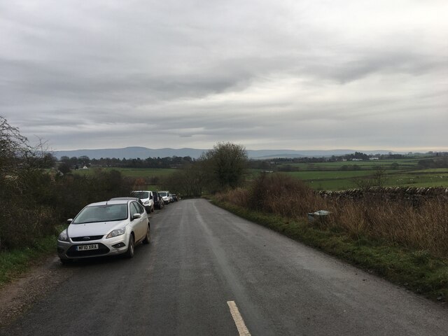
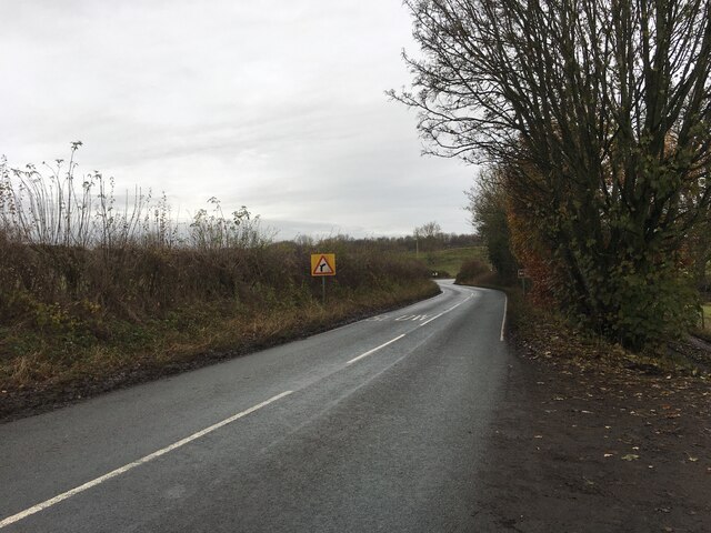
Sockbridge is a small village located in the county of Westmorland, in the northwest of England. Situated near the River Eamont, Sockbridge is part of the civil parish of Barton. It is approximately 3 miles southeast of the town of Penrith and lies within the Lake District National Park.

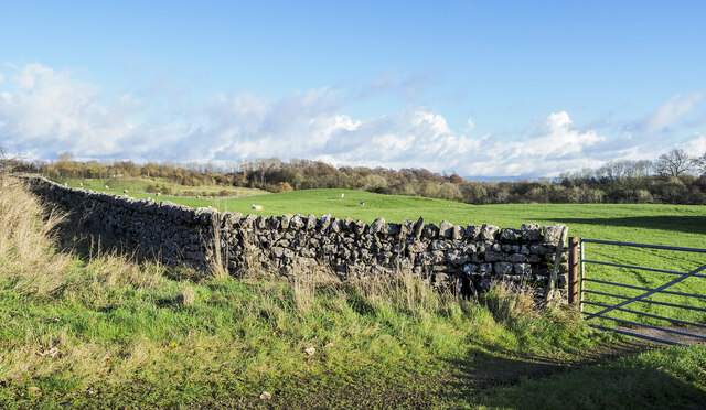
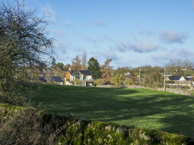
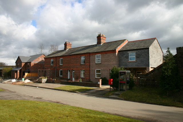
The village is known for its picturesque setting and charming atmosphere. It features a mix of traditional stone cottages, farms, and open fields, offering stunning views of the surrounding countryside. Sockbridge is a popular destination for tourists seeking a tranquil escape in a rural setting.

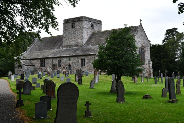
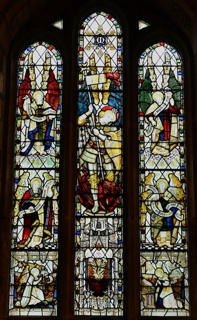
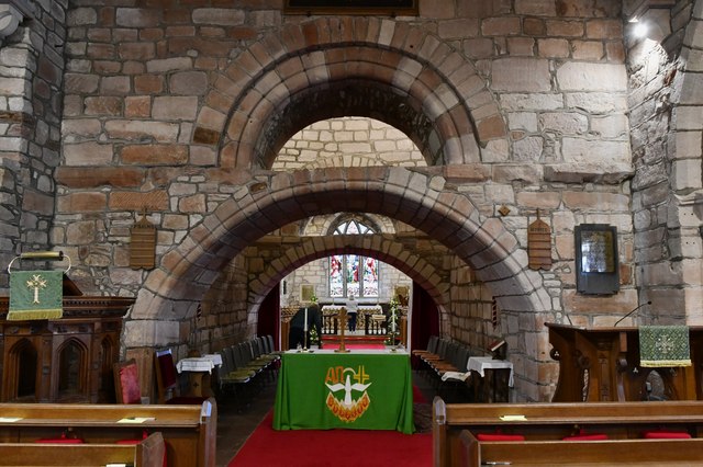
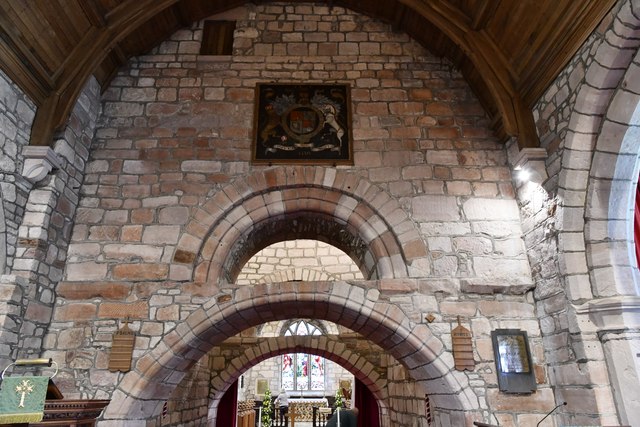
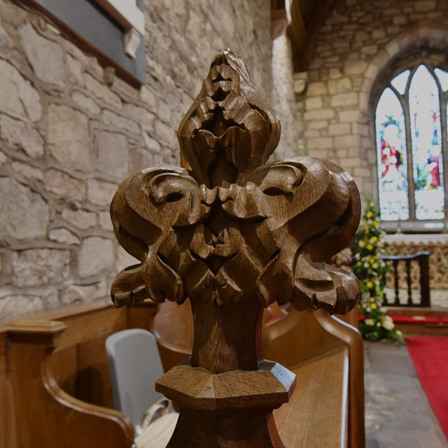
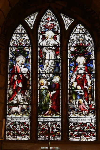
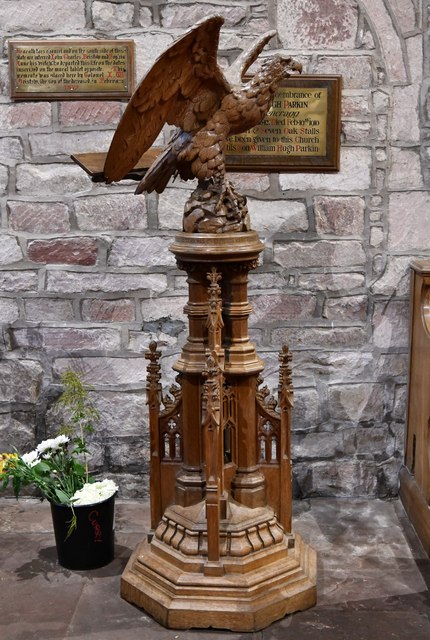
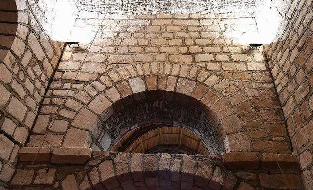
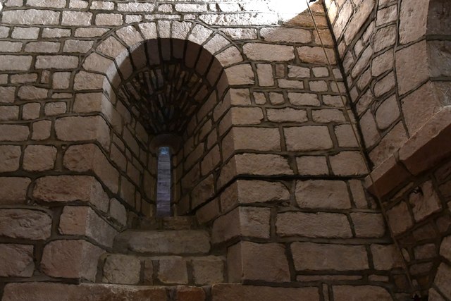
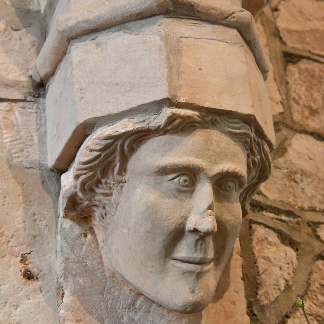
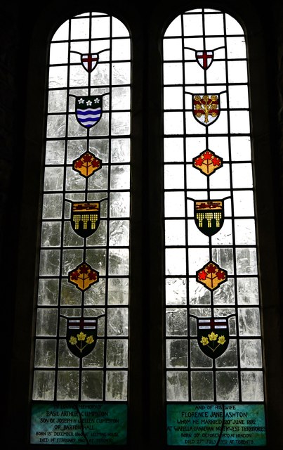
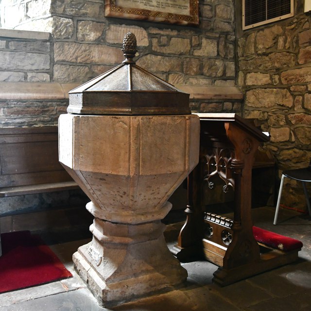
One of the notable landmarks in Sockbridge is the St. Michael's Church, a 19th-century Anglican church that serves as the spiritual center of the community. The church is known for its beautiful stained glass windows and peaceful surroundings.

The village is also within close proximity to several attractions. Just a short distance away is the historic town of Penrith, which offers a range of amenities, including shops, restaurants, and cultural sites. Additionally, the stunning Ullswater Lake is a short drive from Sockbridge, providing opportunities for water activities and scenic walks.

The surrounding area is renowned for its natural beauty, with the Lake District National Park offering a plethora of outdoor activities such as hiking, cycling, and wildlife spotting. Sockbridge serves as an ideal base for exploring the park's numerous trails, peaks, and lakes.

In summary, Sockbridge is a charming village in Westmorland, offering a peaceful retreat in the heart of the Lake District. With its idyllic surroundings and proximity to notable attractions, it is a destination that appeals to nature lovers and those looking to immerse themselves in rural English life.

If you have any feedback on the listing, please let us know in the comments section below.

Sockbridge Images

Images are sourced within 2km of 54.632683/-2.7748986 or Grid Reference NY5026. Thanks to Geograph Open Source API. All images are credited.

Dry stone wall bounding field The wall with its gate bounds a field between the A592 and the River Eamont; it's just south of the Rheged visitor attraction.
Dry stone wall bounding field
The wall with its gate bounds a field between the A592 and the River Eamont; it's just south of the Rheged visitor attraction.
Houses in Stainton over field Homes on the south side of Stainton seen over a field from a minor road south of the village.
Houses in Stainton over field
Homes on the south side of Stainton seen over a field from a minor road south of the village.
Minor road towards Redhills
A592 towards Penrith
Barton, St. Michael's Church: South Eastern aspect
Barton, St. Michael's Churchyard: Grave of Sergeant J.E. Williams, Flight Engineer
Barton, St. Michael's Church: Stained glass window 1
Barton, St. Michael's Church: The spectacular Norman tower arches
Barton, St. Michael's Church: Poppy head
Barton, St. Michael's Church: Stained glass window 2
Barton, St. Michael's Church: War Memorial
Barton, St. Michael's Church: Eagle lectern
Barton, St. Michael's Church: The spectacular Norman tower arches
Barton, St. Michael's Church: Norman tower window
Barton, St. Michael's Church: The Edward I corbel
Barton, St. Michael's Church: The Cumpston memorial windows
Barton, St. Michael's Church: The font
Show me another place!

Sockbridge is located at Grid Ref: NY5026 (Lat: 54.632683, Lng: -2.7748986)

Administrative County: Cumbria

District: Eden

Police Authority: Cumbria

What 3 Words

///stalemate.grinders.workbench. Near Penrith, Cumbria

Nearby Locations

Tirril Sockbridge

Related Wikis

Sockbridge and Tirril

Sockbridge and Tirril is a small civil parish in Eden District, Cumbria. It had a population of 397 in 2001, increasing to 415 at the 2011 Census. It comprises...

St Michael's Church, Barton

St Michael's Church is in the village of Barton, Cumbria, England. It is an active Anglican parish church in the deanery of Penrith, the archdeaconry...

Yanwath

Yanwath is a village in the Westmorland and Furness District of Cumbria, England, 1 mile south of Penrith. There is a primary school at Yanwath, with 192...

Barton, Cumbria

Barton is a hamlet in the civil parish of Barton and Pooley Bridge, in Eden District, Cumbria, England. It lies about 3 kilometres (1.9 mi) to the north...

Yanwath Hall

Yanwath Hall is a 14th-century and later tower house in Yanwath, Cumbria, England. It is a grade I listed building.Early owners included the Salkeld family...

Redhills, Cumbria

Redhills (sometimes spelt Red Hills) is a hamlet in the civil parish of Dacre, in the Eden district, in the English county of Cumbria. == Location == It...

Stainton, Dacre

Stainton is a village near the A66, in the parish of Dacre, in the Eden district, in the English county of Cumbria. It is a few miles away from the market...

Dacre Beck

Dacre Beck is a small river in Cumbria, England.Dacre Beck rises on the north side of Gowbarrow Fell and flows north past Ulcat Row, picking up streams...

Nearby Amenities

Located within 500m of 54.632683,-2.7748986
Tirril
Place: village
Source: npe
Lat/Long: 54.6327528/-2.7704541
Sockbridge
Created By: Potlatch 0.4a
Place: village
Source: npe
Wikidata: Q23719209
Lat/Long: 54.6342838/-2.7759775
Bus Stop
Queens Head (E bound)
Local Ref: IN
Naptan AtcoCode: 090074612967
Naptan Bearing: E
Naptan CommonName: Queens Head (E bound)
Naptan Indicator: in
Naptan Landmark: Tirril East
Naptan NaptanCode: cumdgjag
Naptan Street: B5320
Naptan Verified: yes
Source: naptan_import
Lat/Long: 54.6328007/-2.7708963
Bus Stop
Queens Head (W bound)
Local Ref: IN
Naptan AtcoCode: 090074612968
Naptan Bearing: W
Naptan CommonName: Queens Head (W bound)
Naptan Indicator: in
Naptan Landmark: Tirril East
Naptan NaptanCode: cumdgjaj
Naptan Street: B5320
Naptan Verified: yes
Source: naptan_import
Lat/Long: 54.6327393/-2.7706628
Bus Stop
Thorpe Lane
Local Ref: IN
Naptan AtcoCode: 090074612969
Naptan Bearing: W
Naptan CommonName: Thorpe Lane
Naptan Indicator: in
Naptan Landmark: Tirril West
Naptan NaptanCode: cumdgjam
Naptan Street: B5320
Naptan Verified: yes
Source: naptan_import
Lat/Long: 54.6316269/-2.7759708
Bus Stop
Ladybeck at Quakers Lane
Bench: no
Covered: yes
Naptan AtcoCode: 090074612970
Naptan Bearing: E
Naptan CommonName: Ladybeck at Quakers Lane
Naptan Indicator: near
Naptan Landmark: junction with Quakers Lane
Naptan NaptanCode: cumdgjap
Naptan Street: B5320
Shelter: yes
Source: naptan_import
Lat/Long: 54.6322162/-2.7751765
Barrier: stile
Material: stone
Source: survey;gps
Stile: stepover
Lat/Long: 54.6352707/-2.7755524
Thorpefield
Place: locality
Lat/Long: 54.6324766/-2.7775559
Post Box
Post Box Type: lamp
Ref: CA10 84
Royal Cypher: EIIR
Royal Cypher Wikidata: Q33102113
Lat/Long: 54.6323002/-2.7750204
Post Box
Ref: CA10 288
Lat/Long: 54.6344041/-2.775666
Barrier: stile
Material: wood
Source: survey;gps
Stile: stepover
Lat/Long: 54.6363402/-2.7750212
Bench
Source: survey;gps
Lat/Long: 54.6352673/-2.7753373
Bench
Source: survey;gps
Lat/Long: 54.6352751/-2.775405
Barrier: stile
Material: wood
Source: survey;gps
Stile: stepover
Lat/Long: 54.6353445/-2.7755315
Barrier: stile
Material: stone
Source: survey;gps
Stile: stepover
Lat/Long: 54.6348045/-2.774562
Direction: SSE
Generator Method: photovoltaic
Generator Output Electricity: yes
Generator Source: solar
Generator Type: solar_photovoltaic_panel
Location: roof
Power: generator
Lat/Long: 54.6354944/-2.7767939
Direction: SSE
Generator Method: photovoltaic
Generator Output Electricity: yes
Generator Source: solar
Generator Type: solar_photovoltaic_panel
Location: roof
Power: generator
Lat/Long: 54.6352569/-2.7760912
Direction: WSW
Generator Method: photovoltaic
Generator Output Electricity: yes
Generator Source: solar
Generator Type: solar_photovoltaic_panel
Location: roof
Power: generator
Lat/Long: 54.6352662/-2.7760322
Direction: SSE
Generator Method: photovoltaic
Generator Output Electricity: yes
Generator Source: solar
Generator Type: solar_photovoltaic_panel
Location: roof
Power: generator
Lat/Long: 54.634712/-2.7748788
Direction: SSE
Generator Method: photovoltaic
Generator Output Electricity: yes
Generator Source: solar
Generator Type: solar_photovoltaic_panel
Location: roof
Power: generator
Lat/Long: 54.634743/-2.7747849
Direction: WSW
Generator Method: photovoltaic
Generator Output Electricity: yes
Generator Source: solar
Generator Type: solar_photovoltaic_panel
Location: roof
Power: generator
Lat/Long: 54.6331836/-2.776814
Direction: SSE
Generator Method: photovoltaic
Generator Output Electricity: yes
Generator Source: solar
Generator Type: solar_photovoltaic_panel
Location: roof
Power: generator
Lat/Long: 54.6322762/-2.7754072
Direction: SSE
Generator Method: photovoltaic
Generator Output Electricity: yes
Generator Source: solar
Generator Type: solar_photovoltaic_panel
Location: roof
Power: generator
Lat/Long: 54.6322148/-2.7755118
Direction: SSE
Generator Method: photovoltaic
Generator Output Electricity: yes
Generator Source: solar
Generator Type: solar_photovoltaic_panel
Location: roof
Power: generator
Lat/Long: 54.6327124/-2.7741036
Direction: SSE
Generator Method: photovoltaic
Generator Output Electricity: yes
Generator Source: solar
Generator Type: solar_photovoltaic_panel
Location: roof
Power: generator
Lat/Long: 54.6327512/-2.7739239
Direction: 170
Generator Method: photovoltaic
Generator Output Electricity: yes
Generator Source: solar
Generator Type: solar_photovoltaic_panel
Location: roof
Power: generator
Lat/Long: 54.6328127/-2.7730469
Direction: SSE
Generator Method: photovoltaic
Generator Output Electricity: yes
Generator Source: solar
Generator Type: solar_photovoltaic_panel
Location: roof
Power: generator
Lat/Long: 54.632829/-2.7712404
Direction: SSE
Generator Method: photovoltaic
Generator Output Electricity: yes
Generator Source: solar
Generator Type: solar_photovoltaic_panel
Location: roof
Power: generator
Lat/Long: 54.6327638/-2.7713866
Direction: SSE
Generator Method: photovoltaic
Generator Output Electricity: yes
Generator Source: solar
Generator Type: solar_photovoltaic_panel
Location: roof
Power: generator
Lat/Long: 54.632687/-2.7697303
Direction: WSW
Generator Method: photovoltaic
Generator Output Electricity: yes
Generator Source: solar
Generator Type: solar_photovoltaic_panel
Location: roof
Power: generator
Lat/Long: 54.6336644/-2.7716521
Direction: SSE
Generator Method: photovoltaic
Generator Output Electricity: yes
Generator Source: solar
Generator Type: solar_photovoltaic_panel
Location: roof
Power: generator
Lat/Long: 54.6338631/-2.7725721
Direction: S
Generator Method: photovoltaic
Generator Output Electricity: yes
Generator Source: solar
Generator Type: solar_photovoltaic_panel
Location: roof
Power: generator
Lat/Long: 54.6349751/-2.773527
Direction: SSE
Generator Method: photovoltaic
Generator Output Electricity: yes
Generator Source: solar
Generator Type: solar_photovoltaic_panel
Location: roof
Power: generator
Lat/Long: 54.6312126/-2.7697853
Telephone
Defibrillator
Booth: KX100
Covered: booth
Defibrillator Location: inside phone box in front of Tirril Village Hall
Emergency: defibrillator
Man Made: telephone_box
Lat/Long: 54.632597/-2.7703701
Give Way
Direction: backward
Lat/Long: 54.6338689/-2.7715131
Man Made: street_cabinet
Lat/Long: 54.6334647/-2.7713486
Direction: 160
Generator Method: photovoltaic
Generator Output Electricity: yes
Generator Source: solar
Generator Type: solar_photovoltaic_panel
Location: roof
Power: generator
Lat/Long: 54.6335898/-2.7709824
Direction: 160
Generator Method: photovoltaic
Generator Output Electricity: yes
Generator Source: solar
Generator Type: solar_photovoltaic_panel
Location: roof
Power: generator
Lat/Long: 54.6337889/-2.7707001
Direction: 160
Generator Method: photovoltaic
Generator Output Electricity: yes
Generator Source: solar
Generator Type: solar_photovoltaic_panel
Location: roof
Power: generator
Lat/Long: 54.6332486/-2.7707299
Direction: 160
Generator Method: photovoltaic
Generator Output Electricity: yes
Generator Source: solar
Generator Type: solar_photovoltaic_panel
Location: roof
Power: generator
Lat/Long: 54.6332078/-2.7710709
Power: pole
Lat/Long: 54.63435/-2.7706371
Man Made: utility_pole
Lat/Long: 54.6350432/-2.7710327
Man Made: utility_pole
Lat/Long: 54.6349725/-2.7718105
Give Way
Direction: forward
Lat/Long: 54.6344242/-2.7687006
Power: pole
Lat/Long: 54.6316004/-2.7816264
Power: pole
Lat/Long: 54.632148/-2.779674
Power: pole
Lat/Long: 54.6325466/-2.77816
Power: pole
Lat/Long: 54.6308923/-2.7808057
Power: pole
Lat/Long: 54.6302308/-2.7800654
Power: pole
Lat/Long: 54.6298994/-2.7794347
Power: pole
Lat/Long: 54.635033/-2.7710326
Power: pole
Lat/Long: 54.6352434/-2.7711544
The data included in this document is from www.openstreetmap.org. The data is made available under ODbL.

Have you been to Sockbridge?

Leave your review of Sockbridge below (or comments, questions and feedback).