Soar

Settlement in Brecknockshire

Wales

Soar

Mynydd Aberysgir Llwybr ceffyl ar dir comin a elwir Mynydd Aberysgir.

A bridleway on common land known as Mynydd Aberysgir (trans. mountain of the river Yscir confluence).
Mynydd Aberysgir Credit: Alan Richards

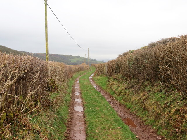
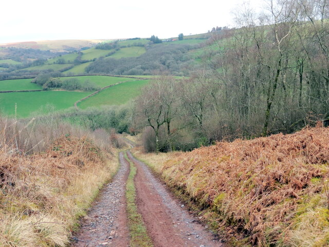
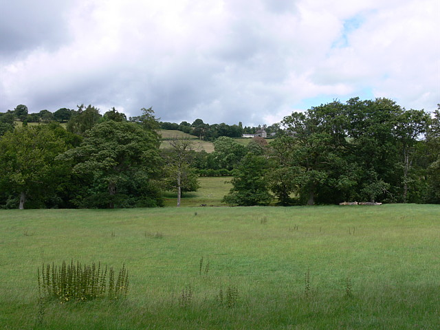
Soar is a small village located in Brecknockshire, a historic county in Wales, United Kingdom. Nestled in the countryside, the village sits on the western slopes of the Black Mountains, offering stunning panoramic views of the surrounding landscapes.

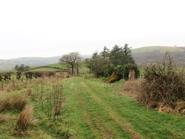
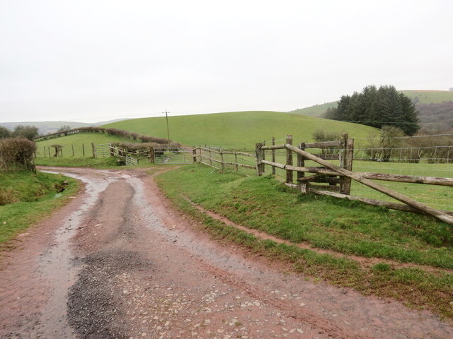
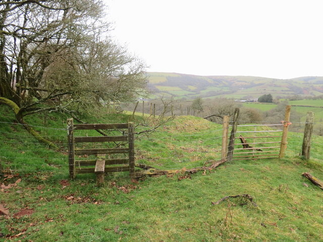
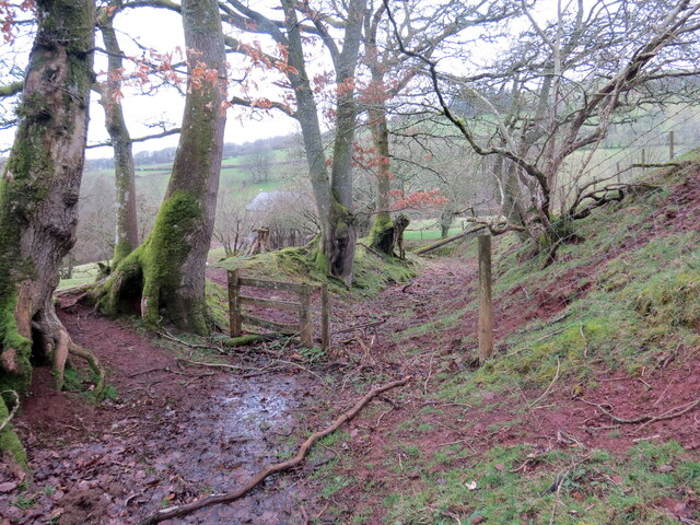
The village is characterized by its tranquil atmosphere and picturesque setting, attracting visitors seeking a peaceful retreat away from the hustle and bustle of city life. Soar is known for its charming stone cottages, traditional architecture, and well-preserved historic buildings that showcase the village's rich heritage.

One of the notable landmarks in Soar is the St. Teilo's Church, a medieval church dating back to the 12th century. This beautiful place of worship features intricate stained glass windows and a peaceful churchyard, making it a popular spot for visitors interested in history and architecture.

Nature enthusiasts will appreciate the village's proximity to the Brecon Beacons National Park, a renowned natural reserve offering a plethora of outdoor activities such as hiking, cycling, and wildlife spotting. The park's rugged mountains, scenic trails, and cascading waterfalls provide ample opportunities for exploration and adventure.

While Soar may be small in size, it boasts a strong sense of community and hosts various events throughout the year, including seasonal fairs, music festivals, and community gatherings. These events offer a chance for locals and visitors alike to come together and enjoy the village's warm and friendly atmosphere.

Overall, Soar is a charming village in Brecknockshire that offers a peaceful escape and a chance to immerse oneself in the natural beauty and rich history of the Welsh countryside.

If you have any feedback on the listing, please let us know in the comments section below.

Soar Images

Images are sourced within 2km of 51.977247/-3.498132 or Grid Reference SN9732. Thanks to Geograph Open Source API. All images are credited.

Mynydd Aberysgir Llwybr ceffyl ar dir comin a elwir Mynydd Aberysgir.

A bridleway on common land known as Mynydd Aberysgir (trans. mountain of the river Yscir confluence).
Mynydd Aberysgir
Llwybr ceffyl ar dir comin a elwir Mynydd Aberysgir. A bridleway on common land known as Mynydd Aberysgir (trans. mountain of the river Yscir confluence).
Mynydd Aberysgir Llwybr yn croesi comin a elwir Mynydd Aberysgir.

A path crosses a common known as Mynydd Aberysgir (trans. mountain of the river Yscir confluence).
Mynydd Aberysgir
Llwybr yn croesi comin a elwir Mynydd Aberysgir. A path crosses a common known as Mynydd Aberysgir (trans. mountain of the river Yscir confluence).
Cerrig Mynydd Aberysgir /  Mynydd Aberysgir Stone Dau faenhir ar Fynydd Aberysgir. Mae'r llythyren 'D' ar un a 'T' ar y llall. Dywedir eu bod nhw'n hen gerrig terfyn.

Two standing stones on Mynydd Aberysgir. The letter 'D' is on one and 'T' on the other. They are said to be old boundary stones.
Cerrig Mynydd Aberysgir / Mynydd Aberysgir Stone
Dau faenhir ar Fynydd Aberysgir. Mae'r llythyren 'D' ar un a 'T' ar y llall. Dywedir eu bod nhw'n hen gerrig terfyn. Two standing stones on Mynydd Aberysgir. The letter 'D' is on one and 'T' on the other. They are said to be old boundary stones.
Mynydd Aberysgir Piler triongli ar Fynydd Aberysgir.

A trig point on Mynydd Aberysgir (trans. mountain of the river Yscir confluence).
Mynydd Aberysgir
Piler triongli ar Fynydd Aberysgir. A trig point on Mynydd Aberysgir (trans. mountain of the river Yscir confluence).
Mynydd Aberysgir Tir comin a elwir Mynydd Aberysgir.

Common land known as Mynydd Aberysgir (trans. mountain of the river Yscir confluence).
Mynydd Aberysgir
Tir comin a elwir Mynydd Aberysgir. Common land known as Mynydd Aberysgir (trans. mountain of the river Yscir confluence).
Llwybr ger Rhiwgoch / Path near Rhiwgoch Llwybr cyhoeddus ger Ffarm Rhiwgoch.

A public footpath near Rhiwgoch Farm (trans. red slope / hill).
Llwybr ger Rhiwgoch / Path near Rhiwgoch
Llwybr cyhoeddus ger Ffarm Rhiwgoch. A public footpath near Rhiwgoch Farm (trans. red slope / hill).
Cyffordd o lwybrau / A junction of paths Cyffordd o lwybrau cyhoeddus ger Ffarm Rhiwgoch.

A junction of public footpaths near Rhiwgoch Farm (trans. red slope / hill).
Cyffordd o lwybrau / A junction of paths
Cyffordd o lwybrau cyhoeddus ger Ffarm Rhiwgoch. A junction of public footpaths near Rhiwgoch Farm (trans. red slope / hill).
Llwybr i Dynycwm / Path to Tynycwm Llwybr cyhoeddus yn mynd i lawr y waered i gyfeiriad Tynycwm a'r heol.

A public footpath descending the hill towards Tynycwm (trans. valley homestead) and the road.
Llwybr i Dynycwm / Path to Tynycwm
Llwybr cyhoeddus yn mynd i lawr y waered i gyfeiriad Tynycwm a'r heol. A public footpath descending the hill towards Tynycwm (trans. valley homestead) and the road.
Llwybr i Dynycwm / Path to Tynycwm Llwybr cyhoeddus yn agosau at yr heol ac anhedd-dy o'r enw Tynycwm.

A public footpath approaching the road and a property known as Tynycwm (trans. valley homestead).
Llwybr i Dynycwm / Path to Tynycwm
Llwybr cyhoeddus yn agosau at yr heol ac anhedd-dy o'r enw Tynycwm. A public footpath approaching the road and a property known as Tynycwm (trans. valley homestead).
Heol las i Soar / Green lane to Soar Hen heol las yn arwain at bentre Soar.

An old green road heading towards Soar village.
Heol las i Soar / Green lane to Soar
Hen heol las yn arwain at bentre Soar. An old green road heading towards Soar village.
Heol las i Soar / Green lane to Soar Hen heol las yn mynd i lawr y waered tuag at bentre Soar.

An old green road descending towards Soar village.
Heol las i Soar / Green lane to Soar
Hen heol las yn mynd i lawr y waered tuag at bentre Soar. An old green road descending towards Soar village.
Capel Soar / Soar Chapel Capel Soar, addoldy'r Bedyddwyr. Codwyd y ty cwrdd cyntaf yn 1827 ac mae'r adeilad presennol yn dyddio o 1874. 

Capel Soar Baptist Chapel. The first meeting house was built in 1827 and the present building dates from 1874.
Capel Soar / Soar Chapel
Capel Soar, addoldy'r Bedyddwyr. Codwyd y ty cwrdd cyntaf yn 1827 ac mae'r adeilad presennol yn dyddio o 1874. Capel Soar Baptist Chapel. The first meeting house was built in 1827 and the present building dates from 1874.
Pombren yn Soar / Footbridge at Soar Pombren y croesi Nant Bran ym mhentre Soar. Yn anffodus, ar adeg ysgrifennu hyn mae'r llwybr wedi ei rwystro.

A footbridge spans Nant Brân (trans. crow stream) in the village of Soar. Unfortunately, at the time of writing the path is obstructed.
Pombren yn Soar / Footbridge at Soar
Pombren y croesi Nant Bran ym mhentre Soar. Yn anffodus, ar adeg ysgrifennu hyn mae'r llwybr wedi ei rwystro. A footbridge spans Nant Brân (trans. crow stream) in the village of Soar. Unfortunately, at the time of writing the path is obstructed.
Llwybr i Soar / Path to Soar Llwybr cyhoeddus yn gadael yr heol ac yn  mynd i gyfeiriad pentre Soar. Yn anffodus, ar adeg ysgrifennu hwn mae'r llwybr wedi ei rwystro.

A public footpath exits the road and heads in the direction of Soar village. Unfortunately at the time of writing the path is obstructed.
Llwybr i Soar / Path to Soar
Llwybr cyhoeddus yn gadael yr heol ac yn mynd i gyfeiriad pentre Soar. Yn anffodus, ar adeg ysgrifennu hwn mae'r llwybr wedi ei rwystro. A public footpath exits the road and heads in the direction of Soar village. Unfortunately at the time of writing the path is obstructed.
Llwybr yn gadael yr heol / Path exiting the road Ar y chwith mae hen ffordd- sy'n bellach yn llwybr cyhoeddus - yn gadael yr heol ac yn mynd dros y banc i gyfeiriad pentre Trallwng. 

On the left a former road, downgraded to a path, exits the road and heads over the hill towards Trallong village (trans. muddy area).
Llwybr yn gadael yr heol / Path exiting the road
Ar y chwith mae hen ffordd- sy'n bellach yn llwybr cyhoeddus - yn gadael yr heol ac yn mynd dros y banc i gyfeiriad pentre Trallwng. On the left a former road, downgraded to a path, exits the road and heads over the hill towards Trallong village (trans. muddy area).
Llwybr yn mynd lawr y waered / A path descends the hill Hen heol, sy bellach yn llwybr cyhoeddus, yn mynd i lawr y waered i gyfeiriad heol a Ffarm Ffosygerwn.

An old road, downgraded to a public path, descends the hill towards the road and Ffosygerwn Farm.
Llwybr yn mynd lawr y waered / A path descends the hill
Hen heol, sy bellach yn llwybr cyhoeddus, yn mynd i lawr y waered i gyfeiriad heol a Ffarm Ffosygerwn. An old road, downgraded to a public path, descends the hill towards the road and Ffosygerwn Farm.
Comin uwchben Trallwng / Common above Trallong Tir comin ar dir uchel uwchben pentre Trallwng.

Upland common above Trallong village (trans. muddy area)
Comin uwchben Trallwng / Common above Trallong
Tir comin ar dir uchel uwchben pentre Trallwng. Upland common above Trallong village (trans. muddy area)
Show me another place!

Soar is located at Grid Ref: SN9732 (Lat: 51.977247, Lng: -3.498132)

Unitary Authority: Powys

Police Authority: Dyfed Powys

What 3 Words

///demanding.request.koala. Near Brecon, Powys

Nearby Locations

Soar

Related Wikis

Soar, Powys

Soar is a small village in Powys, Wales, 37 miles North West of Cardiff. It sits at the foot of Mynydd Epynt, and is near Brecon in the historic county...

Yscir with Honddu Isaf and Llanddew

Yscir with Honddu Isaf and Llanddew (formerly known as Yscir) is the name of an electoral ward in southern Powys, Wales. It covers five local government...

Trallong

Trallong (Welsh: Y Trallwng) is a village and community in Powys, Wales, in the historic county of Brecknockshire. == Description == The community of Trallong...
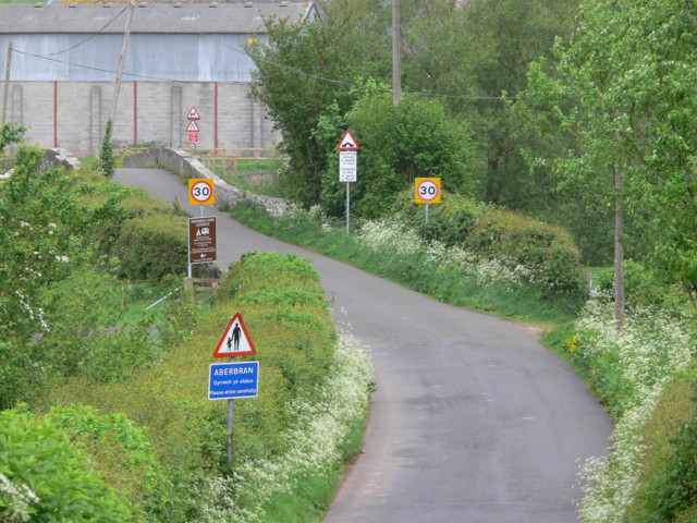
Aberbrân

Aberbrân is a small settlement in Powys, Wales. It lies on the Afon Brân immediately above its confluence (Welsh 'aber') with the River Usk and is 7 kilometres...

Aberbran railway station

Aberbran railway station served the village of Aberbran in the traditional county of Brecknockshire, Wales. == History == Opened by the Neath and Brecon...

Abercamlais railway station

Abercamlais railway station was a private platform serving the Abercamlais estate in the traditional county of Brecknockshire, Wales. == History == Opened...

Nant Brân

The Nant Brân is a short river which rises on the southern slopes of Mynydd Epynt in Powys, Wales. The word 'brân' means 'crow' in Welsh: the name may...

Abercamlais

Abercamlais is a Grade I listed country house in the Usk valley between Brecon and Sennybridge in Powys, Wales. Possibly dating back to the Middle Ages...

Nearby Amenities

Located within 500m of 51.977247,-3.498132
Soar
Place: hamlet
Lat/Long: 51.9776275/-3.4996707
Direction: SE
Generator Method: photovoltaic
Generator Output Electricity: yes
Generator Solar Modules: 21
Generator Source: solar
Generator Type: solar_photovoltaic_panel
Location: roof
Power: generator
Lat/Long: 51.9816944/-3.4974061
Post Box
Post Box Design: hovis
Post Box Mounting: pier
Post Box Type: lamp
Royal Cypher: GR
Royal Cypher Wikidata: Q33102273
Lat/Long: 51.9773197/-3.4996015
Telephone
Defibrillator
Booth: K6
Covered: booth
Defibrillator Location: inside old red phone box by bridge in Soar
Emergency: defibrillator
Listed Status: Grade II
Man Made: telephone_box
Lat/Long: 51.9773186/-3.4998518
The data included in this document is from www.openstreetmap.org. The data is made available under ODbL.

Have you been to Soar?

Leave your review of Soar below (or comments, questions and feedback).