Snodhill

Settlement in Herefordshire

England

Snodhill

Dorstone Castle This impressive motte and bailey is thought to date from 11th to 12th centuries.
Dorstone Castle Credit: Philip Halling

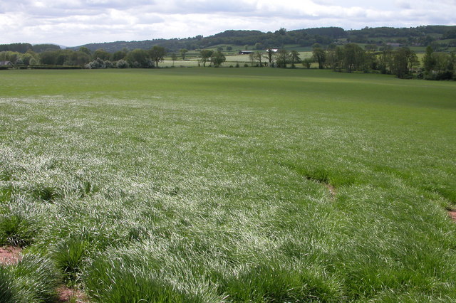
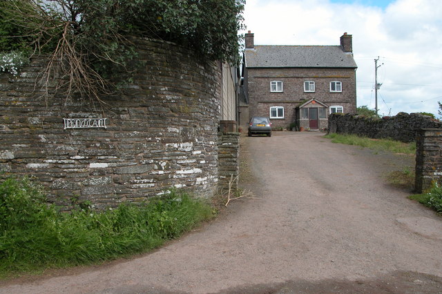
Snodhill is a small village located in the county of Herefordshire, England. Situated approximately 7 miles north of the city of Hereford, Snodhill sits on the eastern bank of the River Wye, amidst the stunning landscape of the Herefordshire countryside.

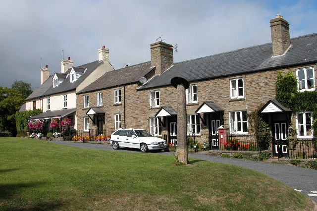
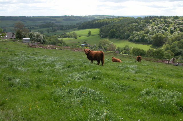
With a population of around 200 residents, Snodhill exudes a charming and peaceful atmosphere. The village is characterized by its picturesque and idyllic setting, surrounded by rolling hills, lush green fields, and enchanting woodlands. It offers residents and visitors a tranquil escape from the hustle and bustle of city life.

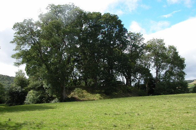
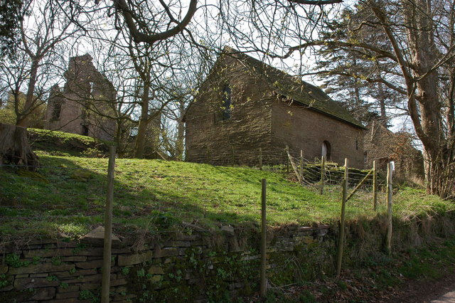
The village is renowned for its historical significance, boasting a 13th-century castle that stands proudly on the hilltop overlooking the village. Snodhill Castle, now in ruins, was once a prominent fortress during the medieval period and played a key role in England's turbulent history. Today, the castle serves as a popular landmark and attracts history enthusiasts from far and wide.

Snodhill is also known for its quaint parish church, dedicated to St. Bartholomew. The church, with its striking architecture and beautiful stained glass windows, is a cherished place of worship for the local community.

While Snodhill is predominantly a residential area, it benefits from its proximity to Hereford, where residents can access a wider range of amenities including schools, shops, and leisure facilities. The village is well-connected to the nearby towns and cities through a network of roads, making it easily accessible for both residents and visitors.

Overall, Snodhill's natural beauty, rich history, and peaceful ambiance make it a hidden gem within the charming county of Herefordshire.

If you have any feedback on the listing, please let us know in the comments section below.

Snodhill Images

Images are sourced within 2km of 52.057495/-2.995174 or Grid Reference SO3140. Thanks to Geograph Open Source API. All images are credited.

Dorstone Castle This impressive motte and bailey is thought to date from 11th to 12th centuries.
Dorstone Castle
This impressive motte and bailey is thought to date from 11th to 12th centuries.
Sundial in the village of Dorstone Sundial on a small village green in Dorstone.
Sundial in the village of Dorstone
Sundial on a small village green in Dorstone.
Dorstone The green in the centre of Dorstone, the disk on top of the pillar is a sundial
Dorstone
The green in the centre of Dorstone, the disk on top of the pillar is a sundial
Snowy fields in the Golden Valley
The Golden Valley, Dorstone The Golden Valley is so named after the River Dore which flows through it. These fields are located to the south-east of Dorstone.
The Golden Valley, Dorstone
The Golden Valley is so named after the River Dore which flows through it. These fields are located to the south-east of Dorstone.
The Pandy Inn, Dorstone Public house in the village of Dorstone in the Golden Valley.
The Pandy Inn, Dorstone
Public house in the village of Dorstone in the Golden Valley.
Lane to the Woodland, Dorstone
Dorstone viewed from Mill Wood In the middle of the picture Dorstone church can be seen.
Dorstone viewed from Mill Wood
In the middle of the picture Dorstone church can be seen.
Little Penlan Farm, Dorstone Farm above the Golden Valley
Little Penlan Farm, Dorstone
Farm above the Golden Valley
Highland cattle in Herefordshire Highland cattle in a field opposite Little Penlan Farm, above Dorstone in the Golden Valley.
Highland cattle in Herefordshire
Highland cattle in a field opposite Little Penlan Farm, above Dorstone in the Golden Valley.
Dorstone Church Dorstone church is dedicated to St Faith, though dating from medieval times the church was largely rebuilt in 1889.
Dorstone Church
Dorstone church is dedicated to St Faith, though dating from medieval times the church was largely rebuilt in 1889.
The Herefordshire Trail at Snodhill
A ford in Snodhill The Herefordshire Trail crosses this ford.
A ford in Snodhill
The Herefordshire Trail crosses this ford.
Snodhill Castle Little remains now other than motte and earthworks with some stonework dating from the 13th and 14th centuries.  An earlier castle was built in the early 12th century but was rebuilt in stone at the end of the same century. The castle was badly damaged during the English Civil War, probably by cannon and was made undefendable.  Much of the remaining stone was removed towards the end of the 17th century to build a nearby manor house.
Snodhill Castle
Little remains now other than motte and earthworks with some stonework dating from the 13th and 14th centuries. An earlier castle was built in the early 12th century but was rebuilt in stone at the end of the same century. The castle was badly damaged during the English Civil War, probably by cannon and was made undefendable. Much of the remaining stone was removed towards the end of the 17th century to build a nearby manor house.
View north from Snodhill The village of Dorstone can be seen in the middle distance.
View north from Snodhill
The village of Dorstone can be seen in the middle distance.
Trees beside a private road in Snodhill
Track to Cross Lodge By the B4348 Golden Valley road between Dorstone and Peterchurch.
Track to Cross Lodge
By the B4348 Golden Valley road between Dorstone and Peterchurch.
Village lane
Village lane
Show me another place!

Snodhill is located at Grid Ref: SO3140 (Lat: 52.057495, Lng: -2.995174)

Unitary Authority: County of Herefordshire

Police Authority: West Mercia

What 3 Words

///dared.broad.butchers. Near Dorstone, Herefordshire

Nearby Locations

Snodhill

Related Wikis

Snodhill Castle

Snodhill Castle is a ruined motte-and-bailey castle, about 1 mi (1.6 km) south of the village of Dorstone in west Herefordshire, England. It is recognized...

Dorstone Castle

Dorstone Castle was in the village of Dorstone in Herefordshire, England, located 6 miles to the east of Hay-on-Wye. == Motte and bailey == This was a...

Dorstone

Dorstone is a village within the Golden Valley, Herefordshire, England. There is a church and public house with restaurant. The Golden Valley area offers...

Dorstone railway station

Dorstone railway station was a station in Dorstone, Herefordshire, England. The station was opened in 1881, closed to passengers in 1941 and closed completely...

Arthur's Stone, Herefordshire

Arthur's Stone is a Neolithic chambered tomb, or dolmen, in Herefordshire, England. It is situated on the ridge line of a hill overlooking both the Golden...

Urishay Castle Chapel

Urishay Castle Chapel is a redundant chapel to the north of Urishay Castle, some 2.5 kilometres (2 mi) west of the village of Peterchurch in Herefordshire...

Urishay Castle

Urishay constitutes the remains of a castle, 16th century chapel and 17th century house located about 2.5 km west of Peterchurch in Herefordshire, England...

Peterchurch railway station

Peterchurch railway station was a station in Peterchurch, Herefordshire, England. The station was opened in 1901, closed to passengers in 1941 and closed...

Nearby Amenities

Located within 500m of 52.057495,-2.995174
Snodhill
Created By: POI Editor
Is In: Hereford and Worcester, England, UK
Place: village
Source: npe
Lat/Long: 52.0578513/-2.9940147
Ford: yes
Lat/Long: 52.0555508/-2.991376
Snodhill Castle
Access: permissive
Heritage: 2
Heritage Operator: Historic England
Historic: ruins
Historic Civilization: medieval
Inscription: Norman Castle built between 1067 and 1071, one of the earliest masonry Castles in Britain. Unique 13 sided Keep on top of the Motte and one of the few Castles with two Keeps there being a second "North Keep" tower in the main Bailey that was independently
Listed Status: Grade II*
Ruins: castle
Lat/Long: 52.0575994/-2.9894613
Barrier: kissing_gate
Lat/Long: 52.0573666/-2.9917848
Grit Bin
Source: survey
Lat/Long: 52.0574953/-2.9952697
Post Box
Collection Times: Mo-Fr 10:45; Sa 09:15
Post Box Type: wall
Ref: HR3 39
Royal Cypher: VR
Royal Cypher Wikidata: Q33102356
Source: survey
Lat/Long: 52.0575291/-2.9951195
Generator Method: photovoltaic
Generator Output Electricity: yes
Generator Source: solar
Generator Type: solar_photovoltaic_panel
Power: generator
Lat/Long: 52.0552663/-2.9905343
The data included in this document is from www.openstreetmap.org. The data is made available under ODbL.

Have you been to Snodhill?

Leave your review of Snodhill below (or comments, questions and feedback).