Snig's End

Settlement in Gloucestershire Forest of Dean

England

Snig's End

Staunton War Memorial Listed <span class="nowrap"><a title="https://historicengland.org.uk/listing/the-list/list-entry/1462054" rel="nofollow ugc noopener" href="https://historicengland.org.uk/listing/the-list/list-entry/1462054">Link</a><img style="margin-left:2px;" alt="External link" title="External link - shift click to open in new window" src="https://s1.geograph.org.uk/img/external.png" width="10" height="10"/></span>
Staunton War Memorial Credit: Jonathan Thacker

Snig's End is a quaint village located in the county of Gloucestershire, in southwestern England. Situated amidst the picturesque countryside, this idyllic settlement is known for its peaceful atmosphere and charming rural character. With a population of around 500 residents, Snig's End offers a close-knit community feel where neighbors are familiar and welcoming.

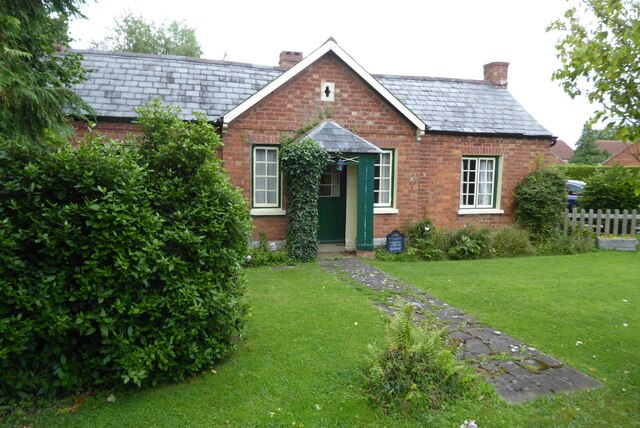
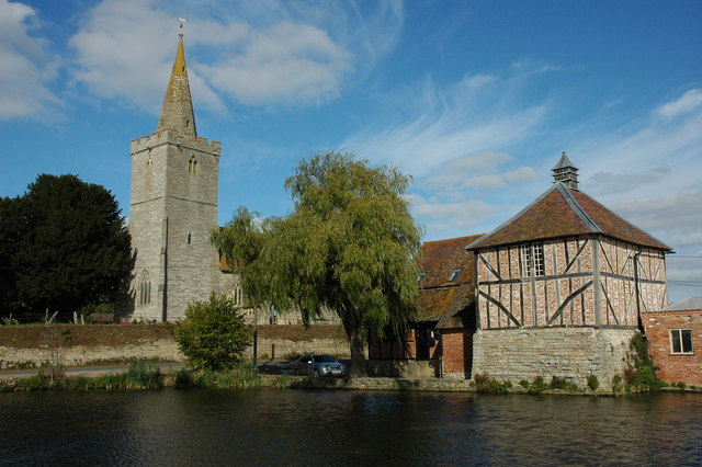
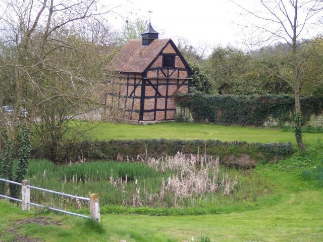
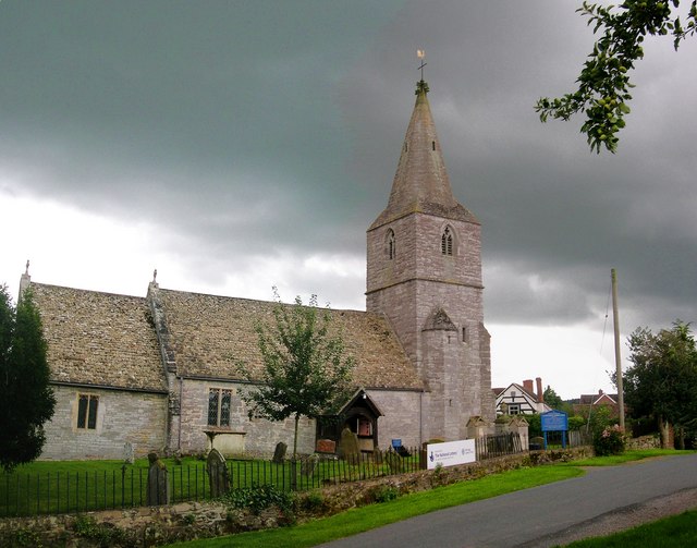
The village is surrounded by rolling hills and lush green fields, providing a scenic backdrop for residents and visitors alike. Snig's End boasts a rich history, with evidence of settlements dating back to the medieval period. The architecture in the village reflects this heritage, with several well-preserved historic buildings, including a medieval church and a few timber-framed houses.

Although Snig's End is small, it offers a range of amenities to cater to the needs of its residents. The village has a local pub, The Snug Inn, which serves as a hub for social gatherings and a place to enjoy traditional English cuisine. Additionally, there is a village shop, providing essential groceries and everyday items.

Nature enthusiasts are drawn to Snig's End due to its proximity to the Cotswolds, a designated Area of Outstanding Natural Beauty. The village serves as an ideal starting point for exploring the stunning Cotswold landscapes, with numerous walking trails and cycling routes available nearby.

Overall, Snig's End is a peaceful and charming village in Gloucestershire, offering a taste of rural English life amidst beautiful surroundings.

If you have any feedback on the listing, please let us know in the comments section below.

Snig's End Images

Images are sourced within 2km of 51.958155/-2.302667 or Grid Reference SO7928. Thanks to Geograph Open Source API. All images are credited.

Staunton War Memorial Listed <span class="nowrap"><a title="https://historicengland.org.uk/listing/the-list/list-entry/1462054" rel="nofollow ugc noopener" href="https://historicengland.org.uk/listing/the-list/list-entry/1462054">Link</a><img style="margin-left:2px;" alt="External link" title="External link - shift click to open in new window" src="https://s1.geograph.org.uk/img/external.png" width="10" height="10"/></span>
Staunton War Memorial
Listed LinkExternal link
Staunton Court Business Park
Drain near Staunton Court
Staunton Court and church
Lake at Staunton Court
Dovecote at Staunton Court Dates from the seventeenth century <span class="nowrap"><a title="https://historicengland.org.uk/listing/the-list/list-entry/1341966" rel="nofollow ugc noopener" href="https://historicengland.org.uk/listing/the-list/list-entry/1341966">Link</a><img style="margin-left:2px;" alt="External link" title="External link - shift click to open in new window" src="https://s1.geograph.org.uk/img/external.png" width="10" height="10"/></span>
Dovecote at Staunton Court
Dates from the seventeenth century LinkExternal link
The Swan, Staunton
The Swan, Staunton
Toughmutts pet supplies, Staunton
Trees by Gloucester Road, Corse
Gloucester Road, Corse
Trees by Gloucester Road, Corse
Road to Staunton Court
A417, Staunton
A417, Staunton
A crop of maize A crop of maize beside the Whitmore Way in Corse.
A crop of maize
A crop of maize beside the Whitmore Way in Corse.
Round straw bales Round straw bales in a harvested field near Corse House Farm.
Round straw bales
Round straw bales in a harvested field near Corse House Farm.
Round straw bales Round straw bales in a harvested field near Corse House Farm.
Round straw bales
Round straw bales in a harvested field near Corse House Farm.
Chartist Cottage An example of a Chartist cottage in Staunton and Corse.  This was established as a Chartist village in 1848, there are a number of similar single storey cottages surviving in this village.  Each cottage had a couple of acres of land, the aim being the families live off the land.  And of course owning land provided the male head of the household the right to vote.  Sadly the project failed with many families struggling, particularly in the winter months.
Chartist Cottage
An example of a Chartist cottage in Staunton and Corse. This was established as a Chartist village in 1848, there are a number of similar single storey cottages surviving in this village. Each cottage had a couple of acres of land, the aim being the families live off the land. And of course owning land provided the male head of the household the right to vote. Sadly the project failed with many families struggling, particularly in the winter months.
Show me another place!

Snig's End is located at Grid Ref: SO7928 (Lat: 51.958155, Lng: -2.302667)

Administrative County: Gloucestershire

District: Forest of Dean

Police Authority: Gloucestershire

What 3 Words

///skirt.strumming.butchers. Near Corse, Gloucestershire

Nearby Locations

Corse Snig's End

Related Wikis

Staunton (near Gloucester)

Staunton is a village that lies close to the village of Corse. Staunton is eight miles north of the city of Gloucester. To the south-west of Staunton is...

Foscombe

Foscombe is a grade II* listed country house in Ashleworth, Gloucestershire. It was built around 1860 in the Gothic Revival style for the personal use...

Eldersfield

Eldersfield is a village and civil parish in the Malvern Hills district of Worcestershire, England. It had a population of 584 in 2021.It stands exactly...

Corse, Gloucestershire

Corse is a village in the English county of Gloucestershire, next to the village of Staunton. The parish lies on the tongue of land between the River Severn...

Nearby Amenities

Located within 500m of 51.958155,-2.302667
Mini Roundabout
Direction: clockwise
Lat/Long: 51.9625892/-2.3038741
Pub
The Swan Inn
Lat/Long: 51.9625018/-2.3040719
Bus Stop
Compton Close
Bench: no
Bin: no
Bus: yes
Lit: yes
Naptan AtcoCode: 1600GL1430
Naptan Bearing: W
Naptan CommonName: Compton Close
Naptan Indicator: corner of
Naptan NaptanCode: gloatjpd
Naptan Street: Prince Crescent
Naptan Verified: no
Public Transport: platform
Shelter: no
Source: naptan_import
Tactile Paving: no
Lat/Long: 51.9591101/-2.3076918
Bus Stop
Swan Inn
Bus: yes
Naptan AtcoCode: 1600GL4421
Naptan Bearing: N
Naptan CommonName: Swan Inn
Naptan Indicator: before
Naptan NaptanCode: gloatmap
Naptan Street: Gloucester Road A417
Naptan Verified: no
Public Transport: platform
Source: naptan_import
Lat/Long: 51.9617648/-2.3039282
Bus Stop
Swan Inn
Bus: yes
Naptan AtcoCode: 1600GL4422
Naptan Bearing: S
Naptan CommonName: Swan Inn
Naptan Indicator: opp
Naptan NaptanCode: gloatmat
Naptan Street: Gloucester Road A417
Naptan Verified: no
Public Transport: platform
Shelter: no
Source: naptan_import
Lat/Long: 51.9616143/-2.3037647
Bus Stop
School Crescent
Bus: yes
Naptan AtcoCode: 1600GLN023
Naptan Bearing: N
Naptan CommonName: School Crescent
Naptan Indicator: opp
Naptan NaptanCode: gloatmad
Naptan Street: Gloucester Road A417
Naptan Verified: no
Public Transport: platform
Source: naptan_import
Lat/Long: 51.9579969/-2.3045456
Bus Stop
School Crescent
Bench: yes
Bin: yes
Bus: yes
Fixme: Check exact location
Lit: yes
Naptan AtcoCode: 1600GLN024
Naptan Bearing: S
Naptan CommonName: School Crescent
Naptan Indicator: before
Naptan NaptanCode: gloatmag
Naptan Street: Gloucester Road A417
Public Transport: platform
Shelter: yes
Source: naptan_import
Tactile Paving: no
Lat/Long: 51.9579891/-2.3043924
Bus Stop
Prince of Wales
Bench: no
Bin: no
Bus: yes
Lit: yes
Naptan AtcoCode: 1600GLN025
Naptan Bearing: W
Naptan CommonName: Prince of Wales
Naptan Indicator: opp
Naptan NaptanCode: gloatjwp
Naptan Street: Prince Crescent
Naptan Verified: no
Public Transport: platform
Shelter: no
Source: naptan_import
Tactile Paving: no
Lat/Long: 51.958968/-2.3047457
Bus Stop
Prince of Wales
Bench: no
Bin: no
Bus: yes
Lit: yes
Naptan AtcoCode: 1600GLN026
Naptan Bearing: E
Naptan CommonName: Prince of Wales
Naptan Indicator: by
Naptan NaptanCode: gloatjwt
Naptan Street: Prince Crescent
Naptan Verified: no
Public Transport: platform
Shelter: no
Source: naptan_import
Tactile Paving: no
Lat/Long: 51.9590419/-2.3047284
Snig's End
Is In: Gloucestershire, England, UK
Place: hamlet
Source: NPE
Lat/Long: 51.9590587/-2.2957837
Public Bookcase
Booth: K6
Covered: booth
Disused Amenity: telephone
Man Made: telephone_box
Mapillary: 776946076358051
Public Bookcase Type: phone_box
Survey Date: 2022-06-05
Lat/Long: 51.9622801/-2.3037522
Post Box
Collection Times: Mo-Fr 18:15; Sa 10:30
Operator: Royal Mail
Post Box Type: lamp
Ref: GL19 106
Royal Cypher: EIIR
Royal Cypher Wikidata: Q33102113
Lat/Long: 51.9576774/-2.3044369
Barrier: stile
Lat/Long: 51.9573159/-2.2978184
Corse
Place: village
Postal Code: GL19 3
Lat/Long: 51.9570095/-2.3061042
Crossing
Lat/Long: 51.953982/-2.3032852
Power: pole
Lat/Long: 51.9613684/-2.298059
Power: pole
Lat/Long: 51.9610701/-2.2988395
Power: pole
Lat/Long: 51.9609354/-2.2998521
Corse School
Power: pole
Transformer: distribution
Voltage Primary: 11000
Lat/Long: 51.9580214/-2.3024833
Snig's End Cell Site
Power: pole
Transformer: distribution
Voltage Primary: 11000
Lat/Long: 51.9586487/-2.3016827
Power: pole
Lat/Long: 51.9592255/-2.3009786
School Crescent
Power: pole
Transformer: distribution
Voltage Primary: 11000
Lat/Long: 51.9577801/-2.2983534
Power: pole
Lat/Long: 51.9582537/-2.2982521
Power: pole
Lat/Long: 51.9586884/-2.2981502
New Lands
Power: pole
Transformer: distribution
Voltage Primary: 11000
Lat/Long: 51.9592379/-2.2985619
Power: pole
Lat/Long: 51.9594049/-2.2999768
Power: pole
Lat/Long: 51.959509/-2.300937
Power: pole
Lat/Long: 51.960161/-2.3009115
Location Transition: yes
Power: pole
Lat/Long: 51.9607932/-2.3008995
Snig's End
Power: pole
Transformer: distribution
Voltage Primary: 11000
Lat/Long: 51.9603891/-2.3030292
Material: wood
Power: pole
Lat/Long: 51.9604412/-2.3039317
Power: pole
Lat/Long: 51.9605156/-2.304444
Power: pole
Lat/Long: 51.9621394/-2.3053828
Power: pole
Lat/Long: 51.9613791/-2.3055048
Power: pole
Lat/Long: 51.960685/-2.3056027
Power: pole
Lat/Long: 51.9609193/-2.3062968
Location Transition: yes
Power: pole
Lat/Long: 51.9611924/-2.3071665
Power: transformer
Transformer: distribution
Voltage Primary: 11000
Lat/Long: 51.9580723/-2.3081133
Charters Piece
Power: transformer
Transformer: distribution
Voltage Primary: 11000
Lat/Long: 51.9599077/-2.3077954
Snig's End South
Power: pole
Transformer: distribution
Voltage Primary: 11000
Lat/Long: 51.9543626/-2.3050153
The data included in this document is from www.openstreetmap.org. The data is made available under ODbL.

Have you been to Snig's End?

Leave your review of Snig's End below (or comments, questions and feedback).