Blean

Settlement in Kent Canterbury

England

Blean

Old oak pollard, The Radfall, Dunkirk The pollard marks the boundary between three wood; Church Wood, Great Den Lees and Grimshill Wood. Pollards served as signposts for the woodmen and were cut above the head height of browsing animals.
Old oak pollard, The Radfall, Dunkirk Credit: pam fray

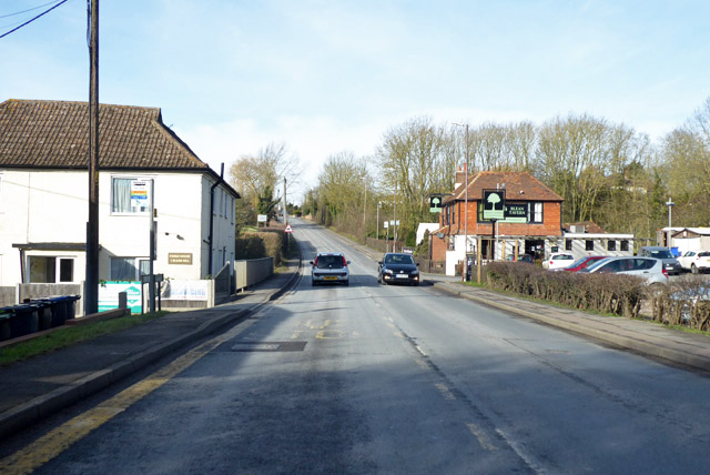
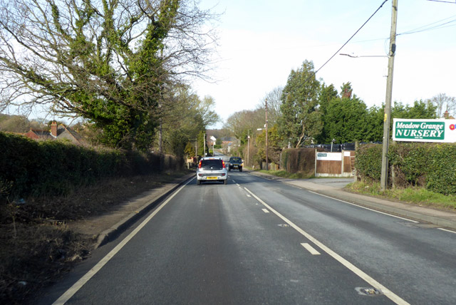
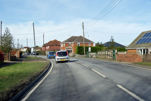
Blean is a village located in the county of Kent, in southeastern England. Situated about 3 miles north of the city of Canterbury, it is surrounded by lush green fields and scenic woodlands. Blean is part of the civil parish of Blean and Tyler Hill, and falls within the Canterbury district.

The village is known for its rich history, with evidence of human settlement dating back to the Roman times. Blean was once a prominent center for charcoal production during the medieval period, owing to its abundant woodland resources. Today, the village retains its rural charm, with a mix of traditional cottages and newer residential developments.

Blean is home to a close-knit community, and residents benefit from a range of amenities. The village has a primary school, providing education for local children, and a village hall that serves as a hub for various community activities. Blean also boasts several pubs and restaurants, offering a variety of dining options.

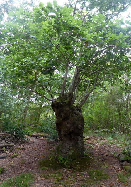
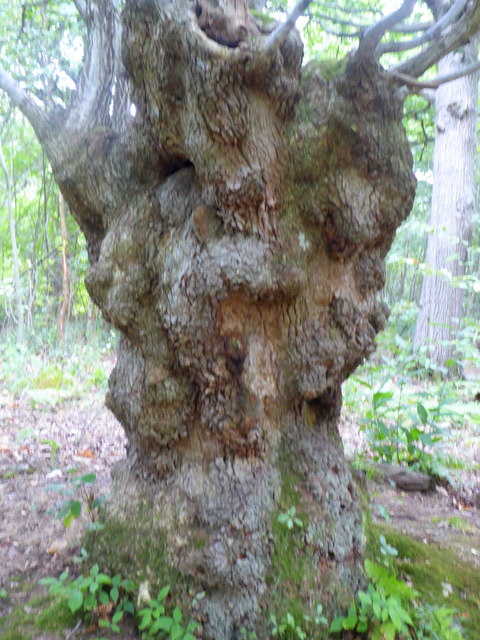
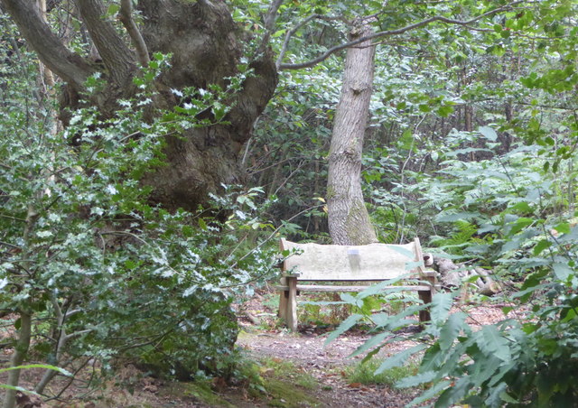
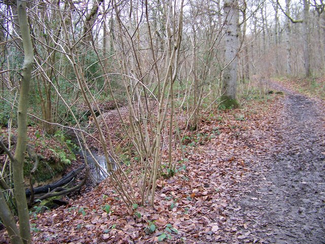
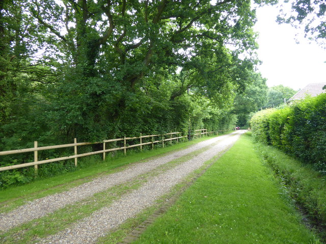
Nature enthusiasts are drawn to Blean for its beautiful surroundings. The area is renowned for its extensive woodland, known as Blean Woods, which is one of the largest remaining areas of ancient broadleaf woodland in southern England. This natural reserve is a haven for wildlife, including a wide range of bird species and rare plants.

With its picturesque setting, historical significance, and natural beauty, Blean continues to attract visitors and residents alike, offering a peaceful and idyllic retreat in the heart of the Kent countryside.

If you have any feedback on the listing, please let us know in the comments section below.
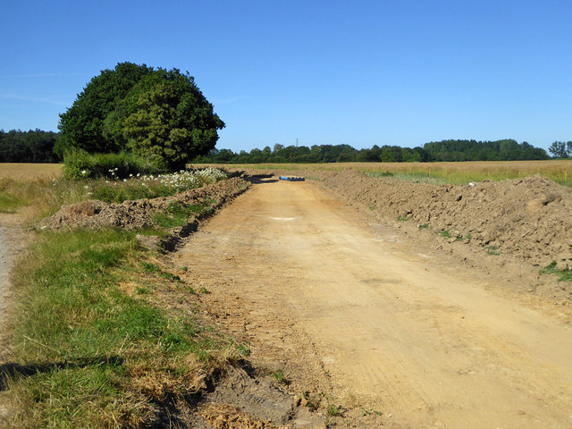
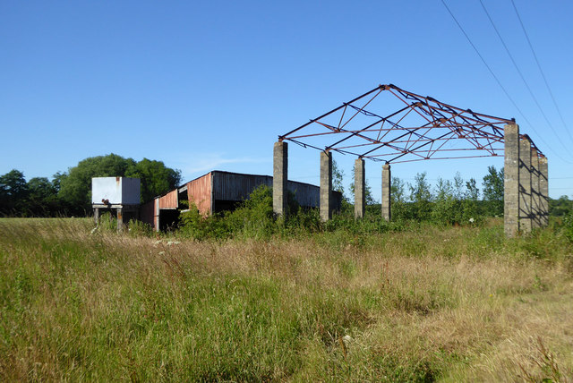
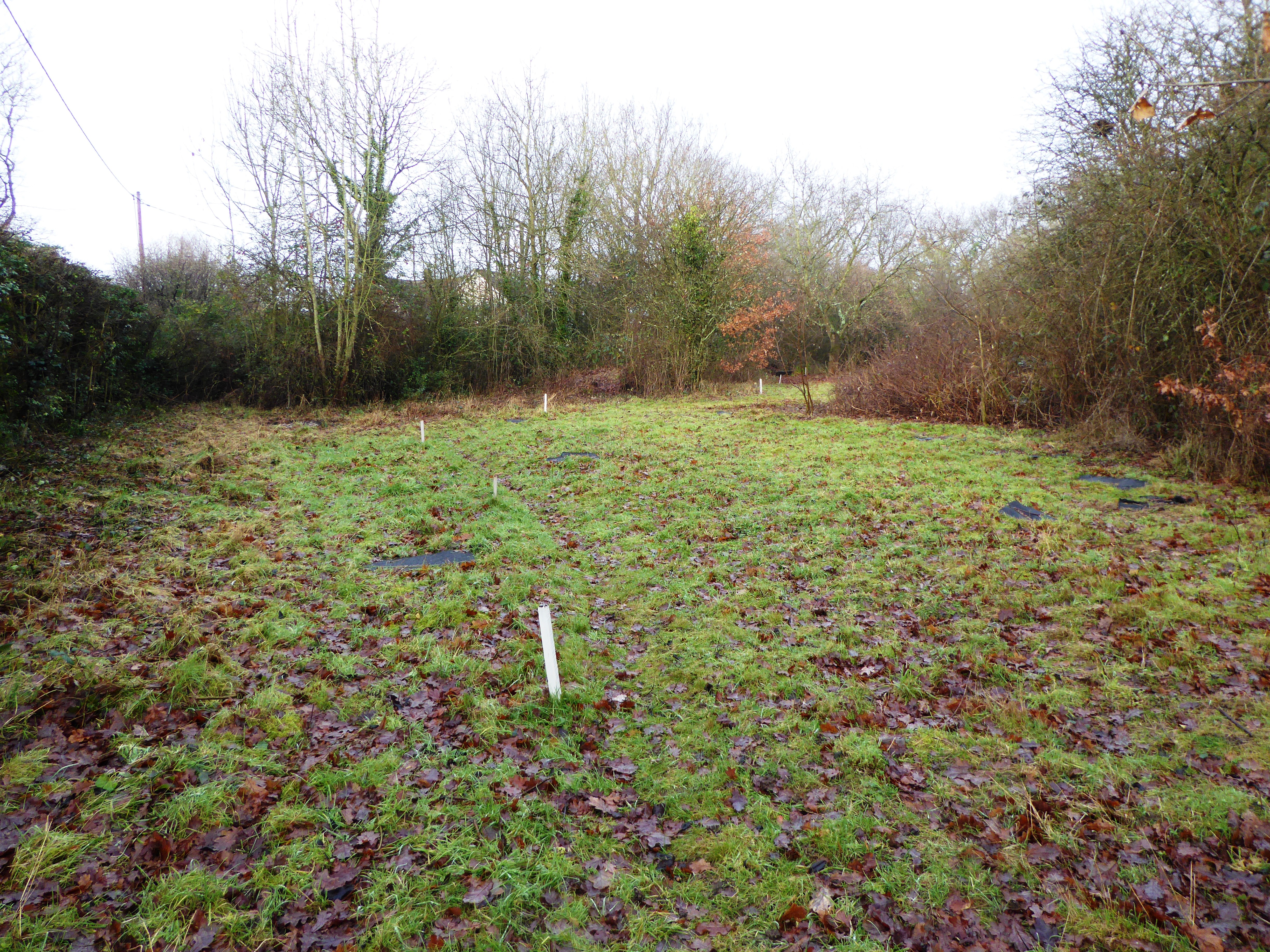
Blean Images

Images are sourced within 2km of 51.306719/1.041664 or Grid Reference TR1260. Thanks to Geograph Open Source API. All images are credited.

Old oak pollard, The Radfall, Dunkirk The pollard marks the boundary between three wood; Church Wood, Great Den Lees and Grimshill Wood. Pollards served as signposts for the woodmen and were cut above the head height of browsing animals.
Old oak pollard, The Radfall, Dunkirk
The pollard marks the boundary between three wood; Church Wood, Great Den Lees and Grimshill Wood. Pollards served as signposts for the woodmen and were cut above the head height of browsing animals.
Old oak pollard, Dunkirk The pollard marks the boundary between three woods; Church Wood, Great Den Lees and Grimshill Wood. Pollards served as signposts for the woodmen and were cut above the head height of browsing animals.
Old oak pollard, Dunkirk
The pollard marks the boundary between three woods; Church Wood, Great Den Lees and Grimshill Wood. Pollards served as signposts for the woodmen and were cut above the head height of browsing animals.
View of an old oak pollard and seat, Dunkirk Viewed from The Radfall. The pollard marks the boundary between three woods; Church Wood, Great Den Lees and Grimshill Wood. Pollards served as signposts for the woodmen and were cut above the head height of browsing animals.
View of an old oak pollard and seat, Dunkirk
Viewed from The Radfall. The pollard marks the boundary between three woods; Church Wood, Great Den Lees and Grimshill Wood. Pollards served as signposts for the woodmen and were cut above the head height of browsing animals.
Footpath in Blean Woods
A290 past the Blean Tavern Heading towards Whitstable.
A290 past the Blean Tavern
Heading towards Whitstable.
A290 past Meadow Grange Nursery Heading towards Whitstable.
A290 past Meadow Grange Nursery
Heading towards Whitstable.
A290 towards Whitstable
Route of the former Canterbury & Whitstable Railway The Canterbury & Whitstable Railway is often said to have been the first passenger railway in the world.  Construction of the 6 mile line took several years and work excavating the 828 yard Tyler Hill Tunnel proved difficult and lengthy. There were great celebrations for the opening on 3rd May 1830. In Canterbury, the cathedral bells were rung and guns were fired in salute.  

Sections of the line were so steeply graded that stationary engines were required to haul trains by cable up the steep ascents.  After the First World War, bus competition began to cause problems and the line to Whitstable finally closed to passengers on 1st January 1931. Goods traffic continued for a number of years but final closure came on 1st December 1952 after which time the track was removed.  A path now follows part of the old route and is known as the Crab & Winkle Way. Here though it is a private driveway to a house known appropriately as 'The Halt'. The Halt is now a private residence converted from an engineer's cottage.

This section of the old trackbed is particularly interesting as Blean & Tyler Hill Halt was located ahead between here and Tyler Hill Road. It was opened in 1908 and closed a mere 22 years later with the last passenger train. See <a title="https://www.geograph.org.uk/photo/1832585" href="https://www.geograph.org.uk/photo/1832585">Link</a>

See <span class="nowrap"><a title="http://www.bbc.co.uk/kent/content/articles/2008/05/27/history_lost_railway_feature.shtml" rel="nofollow ugc noopener" href="http://www.bbc.co.uk/kent/content/articles/2008/05/27/history_lost_railway_feature.shtml">Link</a><img style="margin-left:2px;" alt="External link" title="External link - shift click to open in new window" src="https://s1.geograph.org.uk/img/external.png" width="10" height="10"/></span>  and <span class="nowrap"><a title="https://en.wikipedia.org/wiki/Canterbury_and_Whitstable_Railway" rel="nofollow ugc noopener" href="https://en.wikipedia.org/wiki/Canterbury_and_Whitstable_Railway">Link</a><img style="margin-left:2px;" alt="External link" title="External link - shift click to open in new window" src="https://s1.geograph.org.uk/img/external.png" width="10" height="10"/></span>   and <span class="nowrap"><a title="http://crabandwinkle.org/?page_id=19" rel="nofollow ugc noopener" href="http://crabandwinkle.org/?page_id=19">Link</a><img style="margin-left:2px;" alt="External link" title="External link - shift click to open in new window" src="https://s1.geograph.org.uk/img/external.png" width="10" height="10"/></span>
Route of the former Canterbury & Whitstable Railway
The Canterbury & Whitstable Railway is often said to have been the first passenger railway in the world. Construction of the 6 mile line took several years and work excavating the 828 yard Tyler Hill Tunnel proved difficult and lengthy. There were great celebrations for the opening on 3rd May 1830. In Canterbury, the cathedral bells were rung and guns were fired in salute. Sections of the line were so steeply graded that stationary engines were required to haul trains by cable up the steep ascents. After the First World War, bus competition began to cause problems and the line to Whitstable finally closed to passengers on 1st January 1931. Goods traffic continued for a number of years but final closure came on 1st December 1952 after which time the track was removed. A path now follows part of the old route and is known as the Crab & Winkle Way. Here though it is a private driveway to a house known appropriately as 'The Halt'. The Halt is now a private residence converted from an engineer's cottage. This section of the old trackbed is particularly interesting as Blean & Tyler Hill Halt was located ahead between here and Tyler Hill Road. It was opened in 1908 and closed a mere 22 years later with the last passenger train. See Link See LinkExternal link and LinkExternal link and LinkExternal link
Old sign for the Canterbury & Whitstable Railway The Canterbury & Whitstable Railway is often said to have been the first passenger railway in the world.  Construction of the 6 mile line took several years and work excavating the 828 yard Tyler Hill Tunnel proved difficult and lengthy. There were great celebrations for the opening on 3rd May 1830. In Canterbury, the cathedral bells were rung and guns were fired in salute.  

Sections of the line were so steeply graded that stationary engines were required to haul trains by cable up the steep ascents.  After the First World War, bus competition began to cause problems and the line to Whitstable finally closed to passengers on 1st January 1931. Goods traffic continued for a number of years but final closure came on 1st December 1952 after which time the track was removed.  A path now follows part of the old route and is known as the Crab & Winkle Way. Here though it is alongside a private driveway to a house known appropriately as 'The Halt'. The old sign has survived - see <a title="https://www.geograph.org.uk/photo/5809263" href="https://www.geograph.org.uk/photo/5809263">Link</a>  for a close up. The Halt is now a private residence converted from an engineer's cottage. This section of the old trackbed is particularly interesting as Blean & Tyler Hill Halt was located between here and Tyler Hill Road just behind where I am standing. It was opened in 1908 and closed a mere 22 years later with the last passenger train. See <a title="https://www.geograph.org.uk/photo/1832585" href="https://www.geograph.org.uk/photo/1832585">Link</a>


See <span class="nowrap"><a title="http://www.bbc.co.uk/kent/content/articles/2008/05/27/history_lost_railway_feature.shtml" rel="nofollow ugc noopener" href="http://www.bbc.co.uk/kent/content/articles/2008/05/27/history_lost_railway_feature.shtml">Link</a><img style="margin-left:2px;" alt="External link" title="External link - shift click to open in new window" src="https://s1.geograph.org.uk/img/external.png" width="10" height="10"/></span>  and <span class="nowrap"><a title="https://en.wikipedia.org/wiki/Canterbury_and_Whitstable_Railway" rel="nofollow ugc noopener" href="https://en.wikipedia.org/wiki/Canterbury_and_Whitstable_Railway">Link</a><img style="margin-left:2px;" alt="External link" title="External link - shift click to open in new window" src="https://s1.geograph.org.uk/img/external.png" width="10" height="10"/></span>   and <span class="nowrap"><a title="http://crabandwinkle.org/?page_id=19" rel="nofollow ugc noopener" href="http://crabandwinkle.org/?page_id=19">Link</a><img style="margin-left:2px;" alt="External link" title="External link - shift click to open in new window" src="https://s1.geograph.org.uk/img/external.png" width="10" height="10"/></span>
Old sign for the Canterbury & Whitstable Railway
The Canterbury & Whitstable Railway is often said to have been the first passenger railway in the world. Construction of the 6 mile line took several years and work excavating the 828 yard Tyler Hill Tunnel proved difficult and lengthy. There were great celebrations for the opening on 3rd May 1830. In Canterbury, the cathedral bells were rung and guns were fired in salute. Sections of the line were so steeply graded that stationary engines were required to haul trains by cable up the steep ascents. After the First World War, bus competition began to cause problems and the line to Whitstable finally closed to passengers on 1st January 1931. Goods traffic continued for a number of years but final closure came on 1st December 1952 after which time the track was removed. A path now follows part of the old route and is known as the Crab & Winkle Way. Here though it is alongside a private driveway to a house known appropriately as 'The Halt'. The old sign has survived - see Link for a close up. The Halt is now a private residence converted from an engineer's cottage. This section of the old trackbed is particularly interesting as Blean & Tyler Hill Halt was located between here and Tyler Hill Road just behind where I am standing. It was opened in 1908 and closed a mere 22 years later with the last passenger train. See Link See LinkExternal link and LinkExternal link and LinkExternal link
Old railway sign The Canterbury & Whitstable Railway is often said to have been the first passenger railway in the world.  Construction of the 6 mile line took several years and work excavating the 828 yard Tyler Hill Tunnel proved difficult and lengthy. There were great celebrations for the opening on 3rd May 1830. In Canterbury, the cathedral bells were rung and guns were fired in salute.  

Sections of the line were so steeply graded that stationary engines were required to haul trains by cable up the steep ascents.  After the First World War, bus competition began to cause problems and the line to Whitstable finally closed to passengers on 1st January 1931. Goods traffic continued for a number of years but final closure came on 1st December 1952 after which time the track was removed.  

A path now follows part of the old route and is known as the Crab & Winkle Way. Here though it a private driveway to a house known appropriately as 'The Halt'. The Halt is now a private residence converted from an engineer's cottage. This section of the old trackbed is particularly interesting as Blean & Tyler Hill Halt was located between here and Tyler Hill Road just behind where I am standing. It was opened in 1908 and closed a mere 22 years later with the last passenger train. See <a title="https://www.geograph.org.uk/photo/1832585" href="https://www.geograph.org.uk/photo/1832585">Link</a>  The other reminder that this was once a railway is this old sign - see <a title="https://www.geograph.org.uk/photo/5809261" href="https://www.geograph.org.uk/photo/5809261">Link</a>  for its location.

See <span class="nowrap"><a title="http://www.bbc.co.uk/kent/content/articles/2008/05/27/history_lost_railway_feature.shtml" rel="nofollow ugc noopener" href="http://www.bbc.co.uk/kent/content/articles/2008/05/27/history_lost_railway_feature.shtml">Link</a><img style="margin-left:2px;" alt="External link" title="External link - shift click to open in new window" src="https://s1.geograph.org.uk/img/external.png" width="10" height="10"/></span>  and <span class="nowrap"><a title="https://en.wikipedia.org/wiki/Canterbury_and_Whitstable_Railway" rel="nofollow ugc noopener" href="https://en.wikipedia.org/wiki/Canterbury_and_Whitstable_Railway">Link</a><img style="margin-left:2px;" alt="External link" title="External link - shift click to open in new window" src="https://s1.geograph.org.uk/img/external.png" width="10" height="10"/></span>   and <span class="nowrap"><a title="http://crabandwinkle.org/?page_id=19" rel="nofollow ugc noopener" href="http://crabandwinkle.org/?page_id=19">Link</a><img style="margin-left:2px;" alt="External link" title="External link - shift click to open in new window" src="https://s1.geograph.org.uk/img/external.png" width="10" height="10"/></span>
Old railway sign
The Canterbury & Whitstable Railway is often said to have been the first passenger railway in the world. Construction of the 6 mile line took several years and work excavating the 828 yard Tyler Hill Tunnel proved difficult and lengthy. There were great celebrations for the opening on 3rd May 1830. In Canterbury, the cathedral bells were rung and guns were fired in salute. Sections of the line were so steeply graded that stationary engines were required to haul trains by cable up the steep ascents. After the First World War, bus competition began to cause problems and the line to Whitstable finally closed to passengers on 1st January 1931. Goods traffic continued for a number of years but final closure came on 1st December 1952 after which time the track was removed. A path now follows part of the old route and is known as the Crab & Winkle Way. Here though it a private driveway to a house known appropriately as 'The Halt'. The Halt is now a private residence converted from an engineer's cottage. This section of the old trackbed is particularly interesting as Blean & Tyler Hill Halt was located between here and Tyler Hill Road just behind where I am standing. It was opened in 1908 and closed a mere 22 years later with the last passenger train. See Link The other reminder that this was once a railway is this old sign - see Link for its location. See LinkExternal link and LinkExternal link and LinkExternal link
Footpath from Tyler Hill Road This footpath crosses the old route of the Canterbury & Whitstable Railway just ahead - see <a title="https://www.geograph.org.uk/photo/5809261" href="https://www.geograph.org.uk/photo/5809261">Link</a>  Beyond that it meets Fleets Lane.
Footpath from Tyler Hill Road
This footpath crosses the old route of the Canterbury & Whitstable Railway just ahead - see Link Beyond that it meets Fleets Lane.
Tyler Hill Tyler Hill is just to the north of the University of Kent campus. This is at the centre of the village with the village sign on Hackington Road.
Tyler Hill
Tyler Hill is just to the north of the University of Kent campus. This is at the centre of the village with the village sign on Hackington Road.
Hackington Road at Tyler Hill Tyler Hill is just to the north of the University of Kent campus. This is at the centre of the village with the village sign on Hackington Road.
Hackington Road at Tyler Hill
Tyler Hill is just to the north of the University of Kent campus. This is at the centre of the village with the village sign on Hackington Road.
Tyler Hill Tyler Hill is just to the north of the University of Kent campus. This is at the centre of the village with the village sign on Hackington Road. The village sign includes, of course, oast houses.
Tyler Hill
Tyler Hill is just to the north of the University of Kent campus. This is at the centre of the village with the village sign on Hackington Road. The village sign includes, of course, oast houses.
Calais Hill, Tyler Hill This is immediately west of the village centre of Tyler Hill - see <a title="https://www.geograph.org.uk/photo/5810136" href="https://www.geograph.org.uk/photo/5810136">Link</a>
Calais Hill, Tyler Hill
This is immediately west of the village centre of Tyler Hill - see Link
Calais Hill, Tyler Hill This is immediately west of the village centre of Tyler Hill - see <a title="https://www.geograph.org.uk/photo/5810136" href="https://www.geograph.org.uk/photo/5810136">Link</a>
Calais Hill, Tyler Hill
This is immediately west of the village centre of Tyler Hill - see Link
Preparation for laying a water main The topsoil has been put to either side, it does not look as if any trenching has been carried out here yet.
Preparation for laying a water main
The topsoil has been put to either side, it does not look as if any trenching has been carried out here yet.
Derelict barn, Well Court The public bridleway passing through here is hardly used and unclear on the ground, with a lack of visible official signage. One OS map has it passing to the right of these barns, another to the left.
Derelict barn, Well Court
The public bridleway passing through here is hardly used and unclear on the ground, with a lack of visible official signage. One OS map has it passing to the right of these barns, another to the left.
Show me another place!

Blean is located at Grid Ref: TR1260 (Lat: 51.306719, Lng: 1.041664)

Administrative County: Kent

District: Canterbury

Police Authority: Kent

What 3 Words

///dolphin.oiled.fractions. Near Blean, Kent

Nearby Locations

Blean

Related Wikis

Blean

Blean is a village and civil parish in the Canterbury district of Kent, England. The civil parish is large and is mostly woodland, much of which is ancient...
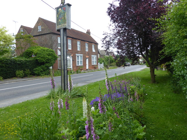
Honey Hill, Kent

Honey Hill is a hamlet on the A290 road, near the village of Blean, in the Canterbury district, in the English county of Kent.

Canterbury (UK Parliament constituency)

Canterbury is a constituency in Kent represented in the House of Commons of the UK Parliament since 2017 by Rosie Duffield of the Labour Party.The seat...

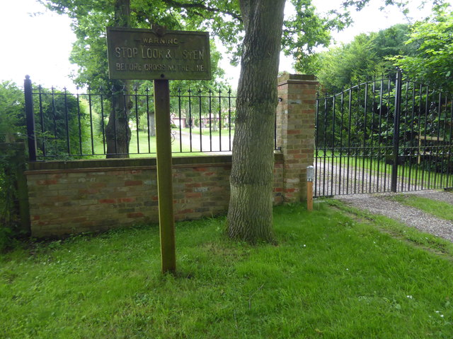
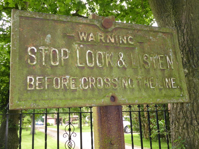
Blean and Tyler Hill Halt railway station

Blean and Tyler Hill Halt was a minor station on the Canterbury and Whitstable Railway at Tyler Hill, Kent. It opened in 1908 and closed in 1931. ��2...

Fifteenth Lambeth Conference

The fifteenth Lambeth Conference was an assembly of bishops of the Anglican Communion convened by the archbishop of Canterbury, Justin Welby, between 27...

Rough Common

Rough Common is a village in Canterbury in the parrish of Harbledown, Kent, England. It forms part of the civil parish of Harbledown and Rough Common...
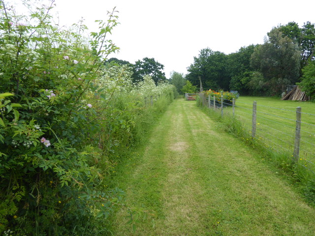
Tyler Hill Meadow

Tyler Hill Meadow is a 0.8-hectare (2.0-acre) Local Nature Reserve in Hackington, north of Canterbury in Kent. It is owned by Hackington Parish Council...

Kent Business School

Kent Business School (KBS) is the business school of the University of Kent. Although there are two business schools known as KBS, generally people seem...

Nearby Amenities

Located within 500m of 51.306719,1.041664
Barrier: bollard
Source: survey
Lat/Long: 51.3061415/1.0450457
Crossing
Crossing: uncontrolled
Crossing Island: no
Crossing Ref: zebra
Source: survey
Tactile Paving: yes
Lat/Long: 51.3069251/1.0429402
Bus Stop
Hillside Farm
Naptan AtcoCode: 2400A048270A
Naptan Bearing: N
Naptan CommonName: Hillside Farm
Naptan Indicator: opp
Naptan Landmark: Hillside Farm
Naptan NaptanCode: kntgagjd
Naptan Street: Blean Hill
Naptan Verified: no
Public Transport: platform
Ref: kntgagjd
Source: naptan_import
Source Date: 2018-08-20T14:00:00
Lat/Long: 51.3042757/1.0445994
Bus Stop
Tyler Hill Road
Bench: yes
Bin: yes
Flag: yes
Naptan AtcoCode: 2400A048280A
Naptan Bearing: SE
Naptan CommonName: Tyler Hill Road
Naptan Indicator: adj
Naptan Landmark: Tyler Hill Road
Naptan NaptanCode: kntgagjg
Naptan Street: Blean Common
Naptan Verified: yes
Public Transport: platform
Ref: kntgagjg
Shelter: yes
Source: naptan_import
Source Date: 2018-08-20T14:13:00
Lat/Long: 51.3065461/1.043559
Bus Stop
Tyler Hill Road
Bench: no
Bin: no
Naptan AtcoCode: 2400A048290A
Naptan Bearing: NW
Naptan CommonName: Tyler Hill Road
Naptan Indicator: opp
Naptan Landmark: Tyler Hill Road
Naptan NaptanCode: kntgagjm
Naptan Street: Blean Common
Naptan Verified: no
Public Transport: platform
Ref: kntgagjm
Shelter: no
Source: naptan_import
Source Date: 2018-08-20T14:14:00
Lat/Long: 51.3064865/1.0433482
Bus Stop
Chapel Lane
Bench: no
Bin: no
Flag: yes
Lit: yes
Naptan AtcoCode: 2400A048300A
Naptan Bearing: SE
Naptan CommonName: Chapel Lane
Naptan Indicator: adj
Naptan Landmark: Chapel Lane
Naptan NaptanCode: kntgagjp
Naptan Street: Blean Common
Naptan Verified: no
Public Transport: platform
Ref: kntgagjp
Shelter: no
Source: naptan_import
Source Date: 2018-08-20T14:15:00
Tactile Paving: no
Lat/Long: 51.3084211/1.0415303
Bus Stop
Chapel Lane
Naptan AtcoCode: 2400A048310A
Naptan Bearing: NW
Naptan CommonName: Chapel Lane
Naptan Indicator: opp
Naptan Landmark: Chapel Lane
Naptan NaptanCode: kntgagjt
Naptan Street: Blean Common
Naptan Verified: no
Public Transport: platform
Ref: kntgagjt
Source: naptan_import
Source Date: 2018-08-20T14:16:00
Lat/Long: 51.3090089/1.0403928
Barrier: cycle_barrier
Lat/Long: 51.3071681/1.0451119
Barrier: kissing_gate
Lat/Long: 51.3068159/1.0462787
Barrier: cycle_barrier
Lat/Long: 51.3068562/1.0450722
Barrier: stile
Bicycle: yes
Foot: yes
Source: survey
Lat/Long: 51.3095327/1.0458365
Blean
Traffic Sign: city_limit
Lat/Long: 51.3064787/1.043657
Bicycle Parking
Bicycle Parking: stands
Capacity: 4
Covered: no
Lat/Long: 51.3074774/1.0450383
Barrier: fence
Note: A couple of horizontal cylindrical metal bars.
Lat/Long: 51.3098884/1.0448797
Generator Method: photovoltaic
Generator Orientation: 139
Generator Output Electricity: yes
Generator Solar Modules: 14
Generator Source: solar
Generator Type: solar_photovoltaic_panel
Location: roof
Power: generator
Lat/Long: 51.3088263/1.0397959
Generator Method: photovoltaic
Generator Orientation: 232
Generator Output Electricity: yes
Generator Source: solar
Generator Type: solar_photovoltaic_panel
Location: roof
Power: generator
Lat/Long: 51.3057863/1.0426283
Generator Method: photovoltaic
Generator Orientation: 267
Generator Output Electricity: yes
Generator Source: solar
Generator Type: solar_photovoltaic_panel
Location: roof
Power: generator
Lat/Long: 51.3089848/1.0415165
Generator Method: photovoltaic
Generator Orientation: 118
Generator Output Electricity: yes
Generator Solar Modules: 16
Generator Source: solar
Generator Type: solar_photovoltaic_panel
Location: roof
Power: generator
Lat/Long: 51.3100218/1.0401231
Roof Cleaning & Moss Removal Canterbury
Addr City: Canterbury
Addr Housename: Roof Cleaning & Moss Removal Canterbury
Addr Housenumber: 110
Addr Postcode: CT2 9JJ
Addr Street: Blean Common
Craft: cleaning
Description: Roof Cleaning & Moss Removal Canterbury is a company that you can count on to take care of all of the needs that you may have when it comes to the appearance of your roof and its maintenance. Many companies that build or repair and replace roofs won’t be
Email: info@roofcleaningmossremovalcanterbury.uk
Opening Hours: Mo-Su 08:00-20:00
Operator: Roof Cleaning & Moss Removal Canterbury
Phone: +441227947122
Source: Roofing contractor;roof moss remova
Website: https://www.roofcleaningmossremovalcanterbury.uk
Lat/Long: 51.3099165/1.0392785
Generator Method: photovoltaic
Generator Output Electricity: yes
Generator Solar Modules: 6
Generator Source: solar
Generator Type: solar_photovoltaic_panel
Location: roof
Power: generator
Lat/Long: 51.3101157/1.0402197
Generator Method: photovoltaic
Generator Output Electricity: yes
Generator Source: solar
Generator Type: solar_photovoltaic_panel
Location: roof
Power: generator
Lat/Long: 51.3083585/1.043614
Generator Method: photovoltaic
Generator Output Electricity: yes
Generator Source: solar
Generator Type: solar_photovoltaic_panel
Location: roof
Power: generator
Lat/Long: 51.3083711/1.0441223
The data included in this document is from www.openstreetmap.org. The data is made available under ODbL.

Have you been to Blean?

Leave your review of Blean below (or comments, questions and feedback).