Blaxhall

Settlement in Suffolk East Suffolk

England

Blaxhall

Stubble field near Blaxhall
Stubble field near Blaxhall Credit: JThomas

Blaxhall is a small village located in the eastern county of Suffolk, England. Situated about 10 miles northeast of the town of Ipswich, Blaxhall is nestled within the Suffolk Coastal District. With a population of around 450 residents, the village boasts a tight-knit community and a tranquil environment.

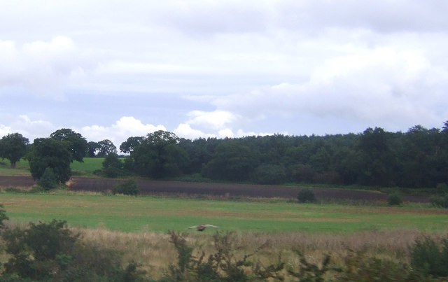
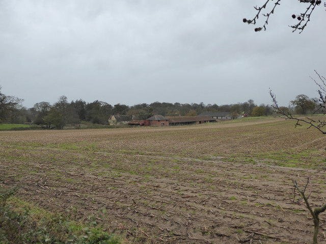
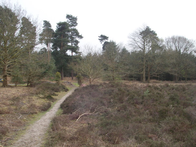
Blaxhall is renowned for its picturesque countryside, consisting of rolling hills, verdant meadows, and ancient woodlands. The village is surrounded by several nature reserves, including Blaxhall Common and Tunstall Forest, offering ample opportunities for outdoor enthusiasts to explore and enjoy the natural beauty of the area. The nearby Snape Maltings, a former Victorian malting complex, has been converted into a famous concert hall and attracts visitors from far and wide.

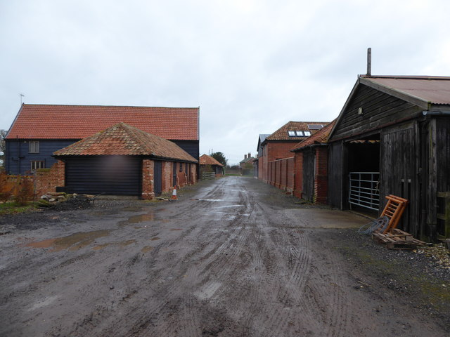
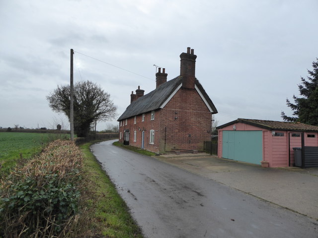
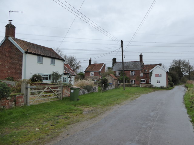
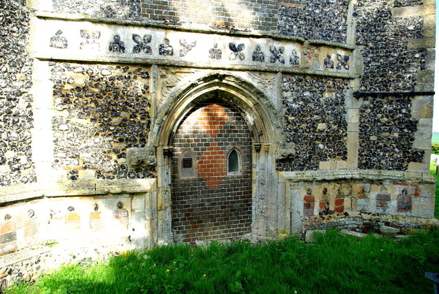
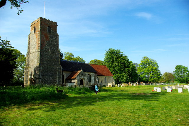
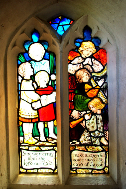
Historically, Blaxhall has a rich heritage dating back to the Domesday Book of 1086. The village is known for its traditional Suffolk pink cottages, many of which are listed buildings. The renowned Blaxhall Ship Inn, a charming 16th-century pub, serves as the social heart of the community, offering a warm and welcoming atmosphere and traditional pub fare.

Blaxhall also hosts various annual events, including the popular Blaxhall Vintage Rally, attracting vintage vehicle enthusiasts from across the region. The village is well-connected by road, with the A12 passing nearby, providing easy access to surrounding towns and cities.

Overall, Blaxhall presents a scenic and tranquil escape from the hustle and bustle of urban life, offering a quintessential English village experience in the heart of Suffolk.

If you have any feedback on the listing, please let us know in the comments section below.

Blaxhall Images

Images are sourced within 2km of 52.162013/1.456142 or Grid Reference TM3657. Thanks to Geograph Open Source API. All images are credited.

Stubble field near Blaxhall
Farmland and pylons Near burnt House Farm.
Farmland and pylons
Near burnt House Farm.
Farmland near Blaxhall Hall
Grazing near Gorse Farm
The Blaxhall Stone A nearby information sign <a href="https://www.geograph.org.uk/photo/4297025">TM3556 : Information Sign</a> reads "Said to have been ploughed up in the 19th century when no bigger than two fists, thrown down by the ploughman where it now stands, it has been growing ever since". According to <span class="nowrap"><a title="http://www.megalithia.com/sites/tm351565.html" rel="nofollow ugc noopener" href="http://www.megalithia.com/sites/tm351565.html">Link</a><img style="margin-left:2px;" alt="External link" title="External link - shift click to open in new window" src="https://s1.geograph.org.uk/img/external.png" width="10" height="10"/></span> this glacial erratic weighs five tons and comes from a parent mass in Spilsby, Lincolnshire.
The Blaxhall Stone
A nearby information sign TM3556 : Information Sign reads "Said to have been ploughed up in the 19th century when no bigger than two fists, thrown down by the ploughman where it now stands, it has been growing ever since". According to LinkExternal link this glacial erratic weighs five tons and comes from a parent mass in Spilsby, Lincolnshire.
Blackstock Barn, Stone Farm, Blaxhall
Thatched cottages
Thatched cottages
View across the fields to Blaxhall Hall
Cottages at Stone Common, Blaxhall
Saxon interlace A piece of pre-Conquest sculpture set in the west wall of St Peter's Church.
Saxon interlace
A piece of pre-Conquest sculpture set in the west wall of St Peter's Church.
West doorway of St Peter's Church Pevsner, touring Suffolk in 1961, described this as "pretty": "Hook mould with fleurons, spandrels with an angel and a monster-head.  Quatrefoil frieze in flushwork over."
West doorway of St Peter's Church
Pevsner, touring Suffolk in 1961, described this as "pretty": "Hook mould with fleurons, spandrels with an angel and a monster-head. Quatrefoil frieze in flushwork over."
St Peter's Church and churchyard The top of the tower has been repaired in brick.  The churchyard is kept tidy by grazing sheep.
St Peter's Church and churchyard
The top of the tower has been repaired in brick. The churchyard is kept tidy by grazing sheep.
Sing we merrily Early 20th-century stained glass window in the north porch of St Peter's Church, designed and executed by members of the local Rope family (Pevsner ascribes it to Ellen Mary Rope who died in 1934).  The text is from a version of the beginning of Psalm 81.
Sing we merrily
Early 20th-century stained glass window in the north porch of St Peter's Church, designed and executed by members of the local Rope family (Pevsner ascribes it to Ellen Mary Rope who died in 1934). The text is from a version of the beginning of Psalm 81.
Churchyard sheep A woolly trio at St Peter's, whose task is to keep the churchyard grass short.  On one of the first hot days of the year they must have been relieved to have been just shorn!
Churchyard sheep
A woolly trio at St Peter's, whose task is to keep the churchyard grass short. On one of the first hot days of the year they must have been relieved to have been just shorn!
St Peter's Church open for you! A cut-out figure of a shepherd with smock, crook and balloons - perhaps it is St Peter himself, who was given the task of feeding Christ's sheep?  Appropriately, self-service refreshments were laid out in the church for visitors hungry or thirsty on this hot afternoon, and the churchyard was being grazed by a number of sheep.
St Peter's Church open for you!
A cut-out figure of a shepherd with smock, crook and balloons - perhaps it is St Peter himself, who was given the task of feeding Christ's sheep? Appropriately, self-service refreshments were laid out in the church for visitors hungry or thirsty on this hot afternoon, and the churchyard was being grazed by a number of sheep.
Walk Farm Road, Tunstall <span class="nowrap"><a title="https://en.wikipedia.org/wiki/Tunstall,_Suffolk" rel="nofollow ugc noopener" href="https://en.wikipedia.org/wiki/Tunstall,_Suffolk">Link</a><img style="margin-left:2px;" alt="External link" title="External link - shift click to open in new window" src="https://s1.geograph.org.uk/img/external.png" width="10" height="10"/></span>
Walk Farm Road, Tunstall
Footpath off Walk Farm Road <span class="nowrap"><a title="https://en.wikipedia.org/wiki/Tunstall,_Suffolk" rel="nofollow ugc noopener" href="https://en.wikipedia.org/wiki/Tunstall,_Suffolk">Link</a><img style="margin-left:2px;" alt="External link" title="External link - shift click to open in new window" src="https://s1.geograph.org.uk/img/external.png" width="10" height="10"/></span>
Footpath off Walk Farm Road
Blaxhall War Memorial Blaxhall War Memorial bears the names of 14 men from WW1 and of four from WW2.
Their details can be seen here: <span class="nowrap"><a title="http://media.geograph.org.uk/files/fe9fc289c3ff0af142b6d3bead98a923/BLAXHALL_War_Memorial.pdf" rel="nofollow ugc noopener" href="http://media.geograph.org.uk/files/fe9fc289c3ff0af142b6d3bead98a923/BLAXHALL_War_Memorial.pdf">Link</a><img style="margin-left:2px;" alt="External link" title="External link - shift click to open in new window" src="https://s1.geograph.org.uk/img/external.png" width="10" height="10"/></span>
Blaxhall War Memorial
Blaxhall War Memorial bears the names of 14 men from WW1 and of four from WW2. Their details can be seen here: LinkExternal link
Show me another place!

Blaxhall is located at Grid Ref: TM3657 (Lat: 52.162013, Lng: 1.456142)

Administrative County: Suffolk

District: East Suffolk

Police Authority: Suffolk

What 3 Words

///chap.every.below. Near Rendlesham, Suffolk

Nearby Locations

Blaxhall

Related Wikis

Blaxhall

Blaxhall is a village and civil parish in the East Suffolk district of the English county of Suffolk. Located around 8 miles (13 km) south-west of Leiston...

Blaxhall Common

Blaxhall Common is a nature reserve in the parish of Blaxhall in the East Suffolk District of Suffolk. The reserve is owned by Blaxhall Parish Council...

Tunstall, Suffolk

Tunstall is a village and civil parish in Suffolk, England. There are two settlements named Tunstall next to each other, 7.5 miles (12.1 km) north east...

Gromford Meadow

Gromford Meadow is a 1.7-hectare biological Site of Special Scientific Interest in Gromford, south of Saxmundham in Suffolk.This unimproved base-rich meadow...

Nearby Amenities

Located within 500m of 52.162013,1.456142
Blaxhall
Place: village
Wikidata: Q3242690
Wikipedia: en:Blaxhall
Lat/Long: 52.1606624/1.4610896
Bus Stop
Youth Hostel
Naptan AtcoCode: 390060116
Naptan Bearing: NE
Naptan CommonName: Youth Hostel
Naptan Indicator: opp
Naptan Landmark: Youth Hostel
Naptan NaptanCode: sufgmtat
Naptan Street: School Road
Naptan Verified: no
Source: naptan_import
Lat/Long: 52.1609167/1.461667
Bus Stop
Youth Hostel
Local Ref: NR
Naptan AtcoCode: 390060117
Naptan Bearing: SW
Naptan BusStopType: CUS
Naptan CommonName: Youth Hostel
Naptan Indicator: nr
Naptan Landmark: Youth Hostel
Naptan NaptanCode: sufgmtaw
Naptan Street: School Road
Naptan Verified: no
Source: naptan_import
Lat/Long: 52.1608216/1.4617534
Firtree Farm
Place: farm
Source: NLS-OS-1st_Series
Lat/Long: 52.1650095/1.45867
Defibrillator
Defibrillator Location: On the southern wall of the wooden building immediately north of the Ship Inn.
Emergency: defibrillator
Indoor: no
Operator: Eiremed
Ref: not marked
Lat/Long: 52.1597896/1.4594436
Post Box
Collection Times: Mo-Fr 09:00; Sa 07:00
Operator: Royal Mail
Operator Wikidata: Q638098
Post Box Mounting: pier
Post Box Type: lamp
Ref: IP12 6269
Royal Cypher: EIIR
Royal Cypher Wikidata: Q33102113
Lat/Long: 52.1607777/1.4613189
The data included in this document is from www.openstreetmap.org. The data is made available under ODbL.

Have you been to Blaxhall?

Leave your review of Blaxhall below (or comments, questions and feedback).