Blawith

Settlement in Lancashire South Lakeland

England

Blawith

A glimpse of Coniston Water Towards the southern end of the lake. Boon Wood on the left
A glimpse of Coniston Water Credit: Eirian Evans

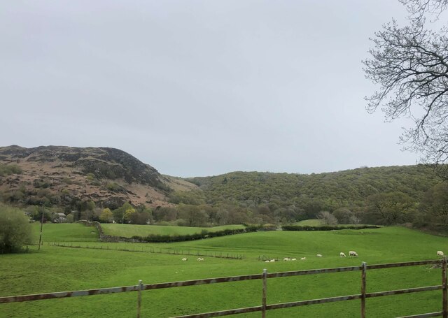
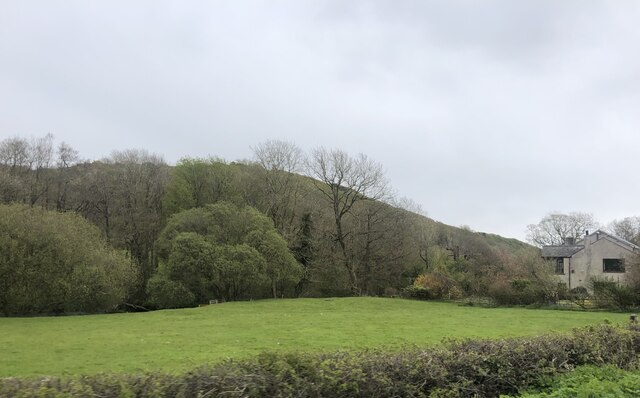
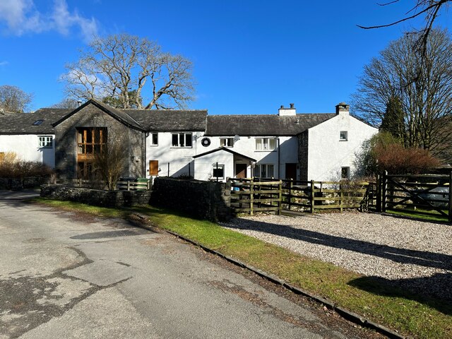
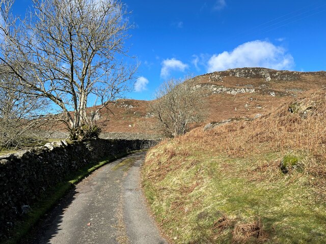
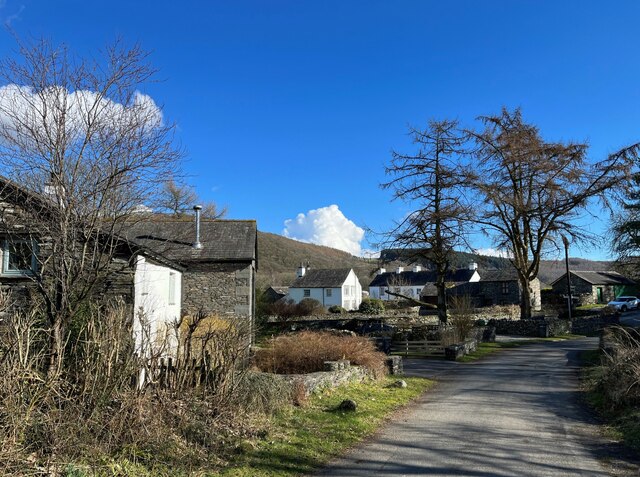
Blawith is a small village located in the county of Lancashire, in the Northwest of England. Nestled in the scenic Lake District National Park, it is surrounded by breathtaking landscapes and offers a tranquil and picturesque setting. The village is situated near the shores of Coniston Water, one of the largest lakes in the region, and boasts stunning views of the surrounding fells and mountains.

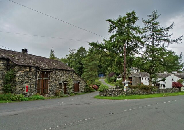
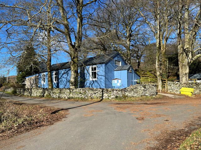
With a population of around 150 people, Blawith is a close-knit community known for its friendly and welcoming atmosphere. The village is characterized by traditional stone cottages and farmhouses, adding to its charming and idyllic appeal. Its rural location makes it a popular destination for those seeking a quiet retreat or outdoor enthusiasts looking to explore the nearby natural beauty.

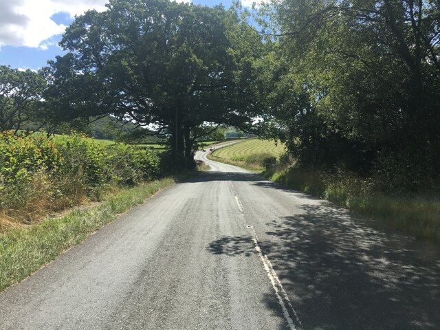
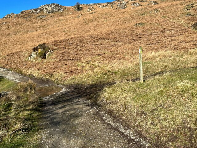
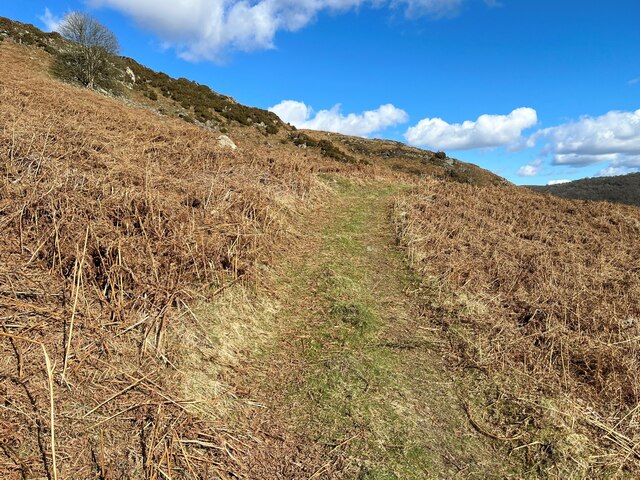
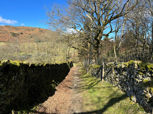
Blawith offers a range of outdoor activities, including hiking, cycling, and fishing. The area is crisscrossed with numerous walking trails, providing opportunities to explore the stunning countryside and enjoy the fresh air. The village is also conveniently located within easy reach of popular attractions such as the Brantwood historic house and gardens, as well as the Ruskin Museum in Coniston.

Though small, Blawith has a strong sense of community spirit, with regular events and gatherings taking place in the village hall. The local pub serves as a hub for socializing and offers a chance to sample traditional Lancashire cuisine and locally brewed ales. While Blawith may be off the beaten track, it offers a charming and peaceful escape for those looking to experience the beauty of the Lake District.

If you have any feedback on the listing, please let us know in the comments section below.
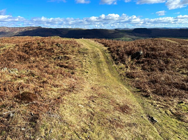
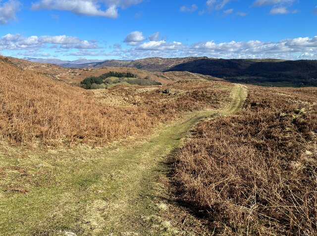
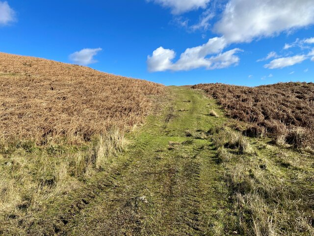
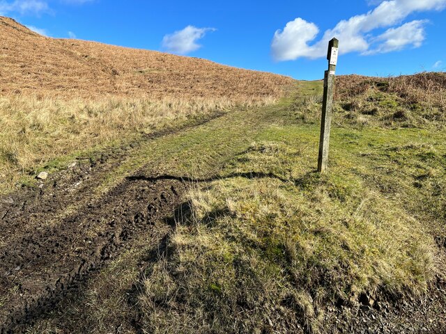
Blawith Images

Images are sourced within 2km of 54.285713/-3.096048 or Grid Reference SD2888. Thanks to Geograph Open Source API. All images are credited.

A glimpse of Coniston Water Towards the southern end of the lake. Boon Wood on the left
A glimpse of Coniston Water
Towards the southern end of the lake. Boon Wood on the left
Farmland at High Nibthwaite South of Coniston Water. The crag on the left is Brook Barrow
Farmland at High Nibthwaite
South of Coniston Water. The crag on the left is Brook Barrow
Wide valley of the River Crake
Former Blawith church Formerly this was the Church of St John the Baptist but it became redundant in 1988 and was sold to be converted in 2012
Former Blawith church
Formerly this was the Church of St John the Baptist but it became redundant in 1988 and was sold to be converted in 2012
Field by the River Crake The trees mark the route of the River Crake at Lowick
Field by the River Crake
The trees mark the route of the River Crake at Lowick
A5084 in the Crake Valley
Road junction in Water Yeat
Water Yeat Mill This former corn mill was supplied with water power by Greenholme Beck, fed by Beacon Tarn.  It was converted in the mid-1960s into sheltered accommodation for elderly people and now, much altered, it is partly residential with the remainder let for holidays.
Water Yeat Mill
This former corn mill was supplied with water power by Greenholme Beck, fed by Beacon Tarn. It was converted in the mid-1960s into sheltered accommodation for elderly people and now, much altered, it is partly residential with the remainder let for holidays.
Blawith and Nibthwaite Village Hall This small, wooden village hall is located in Water Yeat.  It is run as a charity by and for the benefit of the local community.
Blawith and Nibthwaite Village Hall
This small, wooden village hall is located in Water Yeat. It is run as a charity by and for the benefit of the local community.
The road to Greenholme Farm Bowder Knott is the hill in the right background.
The road to Greenholme Farm
Bowder Knott is the hill in the right background.
The Cumbria Way, Tottlebank The main track is the public bridleway from Tottlebank to Heathwaite; the track to the right is a public footpath to Cockenskell.
Northbound walkers following The Cumbria Way turn right here to follow the footpath up the hill (next photograph <a href="https://www.geograph.org.uk/photo/7428087">SD2688 : The Cumbria Way, Tottlebank</a>).
The Cumbria Way, Tottlebank
The main track is the public bridleway from Tottlebank to Heathwaite; the track to the right is a public footpath to Cockenskell. Northbound walkers following The Cumbria Way turn right here to follow the footpath up the hill (next photograph SD2688 : The Cumbria Way, Tottlebank).
Path on Tottlebank Height This path is the route of The Cumbria Way over the open fell between Tottlebank Farm and Cockenskell (next photograph <a href="https://www.geograph.org.uk/photo/7432096">SD2788 : The Cumbria Way near The Low</a>).
Path on Tottlebank Height
This path is the route of The Cumbria Way over the open fell between Tottlebank Farm and Cockenskell (next photograph SD2788 : The Cumbria Way near The Low).
Path on Tottlebank Height This undulating path is the route of The Cumbria Way over the open fell between Tottlebank Farm and Cockenskell (next photograph <a href="https://www.geograph.org.uk/photo/7427169">SD2788 : Path on Tottlebank Height</a>).
Path on Tottlebank Height
This undulating path is the route of The Cumbria Way over the open fell between Tottlebank Farm and Cockenskell (next photograph SD2788 : Path on Tottlebank Height).
Public footpath near Tottlebank This footpath is the route of The Cumbria Way over the open fell between Tottlebank Farm and Cockenskell (next photograph <a href="https://www.geograph.org.uk/photo/7432849">SD2788 : Public footpath near Tottlebank</a>).
Public footpath near Tottlebank
This footpath is the route of The Cumbria Way over the open fell between Tottlebank Farm and Cockenskell (next photograph SD2788 : Public footpath near Tottlebank).
The Cumbria Way, Tottlebank This Cumbria Way leaves a public bridleway by Tottlebank Farm and follows the public footpath to Cockenskell up the hill (next photograph <a href="https://www.geograph.org.uk/photo/7428052">SD2788 : Public footpath near Tottlebank</a>).
The Cumbria Way, Tottlebank
This Cumbria Way leaves a public bridleway by Tottlebank Farm and follows the public footpath to Cockenskell up the hill (next photograph SD2788 : Public footpath near Tottlebank).
Water Yeat The building on the left is a former corn mill, supplied with water power by Greenholme Beck.
Water Yeat
The building on the left is a former corn mill, supplied with water power by Greenholme Beck.
Track near Greenholme Farm
Lane near Cockenskell The Tottlebank Farm to Beacon Tarn public footpath passes through a walled lane near Cockenskell. This is the route of The Cumbria Way long distance path (next photograph <a href="https://www.geograph.org.uk/photo/6884736">SD2789 : Gate on The Cumbria Way near Cockenskell</a>).
Lane near Cockenskell
The Tottlebank Farm to Beacon Tarn public footpath passes through a walled lane near Cockenskell. This is the route of The Cumbria Way long distance path (next photograph SD2789 : Gate on The Cumbria Way near Cockenskell).
Show me another place!

Blawith is located at Grid Ref: SD2888 (Lat: 54.285713, Lng: -3.096048)

Administrative County: Cumbria

District: South Lakeland

Police Authority: Cumbria

What 3 Words

///activism.stockpile.swimmer. Near Ulverston, Cumbria

Related Wikis

Blawith and Subberthwaite

Blawith and Subberthwaite is a civil parish in the South Lakeland district of Cumbria, England. It is situated in the Lake District National Park, and...

St John the Baptist's Church, Blawith

St John the Baptist's Church is a redundant Anglican church in the settlement of Blawith, Cumbria, England. It is located to the east of the A5084 road...

Nibthwaite

Nibthwaite is a village in the South Lakeland District in the county of Cumbria in the northwest of England. It is in the civil parish of Colton, and on...

Furness

Furness ( FUR-niss, fur-NESS) is a peninsula and region of Cumbria, England. Together with the Cartmel Peninsula it forms North Lonsdale, historically...

Woodland Fell

Woodland Fell is an upland area in the south of the English Lake District, south of Torver, Cumbria. It is the subject of a chapter of Wainwright's book...

Lowick, Cumbria

Lowick is a village and civil parish in the South Lakeland district of the English county of Cumbria. Prior to 1 April 1974 it was part of Lancashire,...

Bandrake Head

Bandrake Head is a village in Cumbria, England. == External links == Media related to Bandrake Head at Wikimedia Commons

North Lonsdale Rural District

North Lonsdale was a rural district in the county of Lancashire, England from 1894 to 1974. It was created in 1894 as the Ulverston Rural District, and...

Nearby Amenities

Located within 500m of 54.285713,-3.096048
Blawith
Place: hamlet
Source: npe
Lat/Long: 54.2852535/-3.0950428
Bus Stop
Blawith Church (S bound)
Bus: yes
Local Ref: AT
Naptan AtcoCode: 090079071240
Naptan Bearing: S
Naptan BusStopType: MKD
Naptan CommonName: Newbiggin House (S bound)
Naptan Indicator: At
Naptan Landmark: Smithy Beck Bridge
Naptan NaptanCode: cumdgpjw
Naptan Street: Main Road
Naptan Verified: no
Public Transport: platform
Source: naptan_import
Lat/Long: 54.285855/-3.0947211
Bus Stop
Blawith Church (N bound)
Bus: yes
Naptan AtcoCode: 090079073508
Naptan Bearing: N
Naptan BusStopType: CUS
Naptan CommonName: Newbiggin House (N bound)
Naptan Indicator: opp
Naptan Landmark: Smithy Beck Bridge
Naptan NaptanCode: cumdgpmg
Naptan Street: Main Road
Naptan Verified: no
Public Transport: platform
Source: naptan_import
Lat/Long: 54.2857535/-3.0948414
Houkler Hall
Place: hamlet
Lat/Long: 54.2856239/-3.1021482
Post Box
Collection Times: Mo-Fr 11:15; Sa 09:00
Operator: Royal Mail
Post Box Type: lamp
Ref: LA12 88
Royal Cypher: EIIR
Royal Cypher Wikidata: Q33102113
Source: survey
Lat/Long: 54.2858273/-3.094691
Generator Method: photovoltaic
Generator Output Electricity: 3 kW
Generator Source: solar
Generator Type: solar_photovoltaic_panel
Location: roof
Power: generator
Lat/Long: 54.288159/-3.0973657
Generator Method: photovoltaic
Generator Output Electricity: 3 kW
Generator Source: solar
Generator Type: solar_photovoltaic_panel
Location: roof
Power: generator
Lat/Long: 54.2868268/-3.0947093
Power: pole
Lat/Long: 54.2872339/-3.0976793
Power: pole
Lat/Long: 54.2882649/-3.0992645
Power: pole
Lat/Long: 54.289083/-3.1006123
Power: pole
Lat/Long: 54.2882161/-3.101217
Power: pole
Lat/Long: 54.2866874/-3.0999872
Power: pole
Lat/Long: 54.2858048/-3.0992276
Power: pole
Lat/Long: 54.2850794/-3.0982786
Power: pole
Lat/Long: 54.2840491/-3.0977878
Power: pole
Lat/Long: 54.2832694/-3.0974311
Power: pole
Lat/Long: 54.2823252/-3.0977717
Power: pole
Lat/Long: 54.2824387/-3.0916217
Power: pole
Lat/Long: 54.2859907/-3.0981105
Power: pole
Lat/Long: 54.2859963/-3.1000856
Power: pole
Lat/Long: 54.2860074/-3.1011409
Power: pole
Lat/Long: 54.2866192/-3.1021737
Power: pole
Lat/Long: 54.2871638/-3.1030674
Power: pole
Lat/Long: 54.2857701/-3.0953533
Power: pole
Lat/Long: 54.2861933/-3.0953058
Power: pole
Lat/Long: 54.2865388/-3.0952701
Power: pole
Lat/Long: 54.2871506/-3.0952083
The data included in this document is from www.openstreetmap.org. The data is made available under ODbL.

Have you been to Blawith?

Leave your review of Blawith below (or comments, questions and feedback).