Silver Street

Settlement in Gloucestershire Stroud

England

Silver Street

Hetty Pegler's Tump Situated right in the SE corner of the grid square is this ancient longbarrow
Hetty Pegler's Tump Credit: Alan Simkins

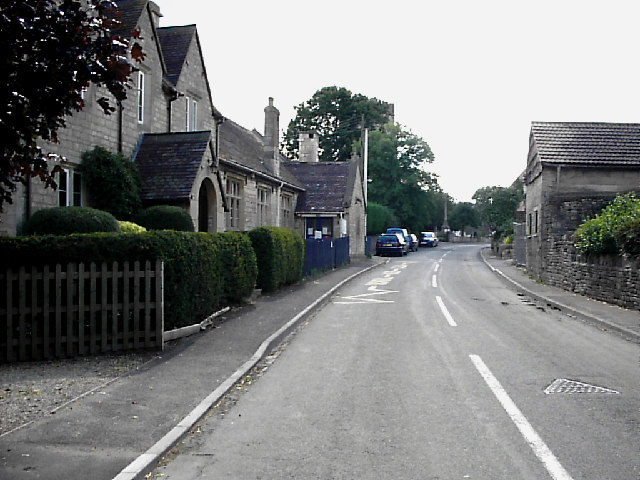
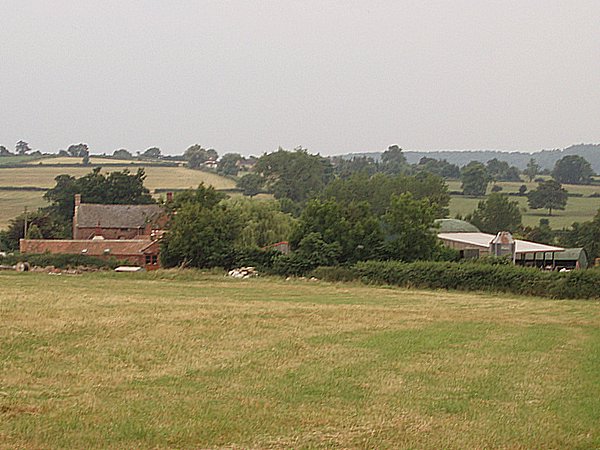
Silver Street is a picturesque village located in the county of Gloucestershire, England. Situated on the western edge of the Cotswold Hills, it is known for its charming rural setting and historic architecture. The village is nestled amidst rolling green fields and is surrounded by lush countryside, offering residents and visitors alike a peaceful and idyllic retreat.

The heart of Silver Street is its main thoroughfare, also named Silver Street, which runs through the village. Lined with traditional stone cottages and quaint buildings, the street exudes a quintessential English charm. Many of these buildings date back several centuries, showcasing a blend of architectural styles, including Tudor and Georgian.

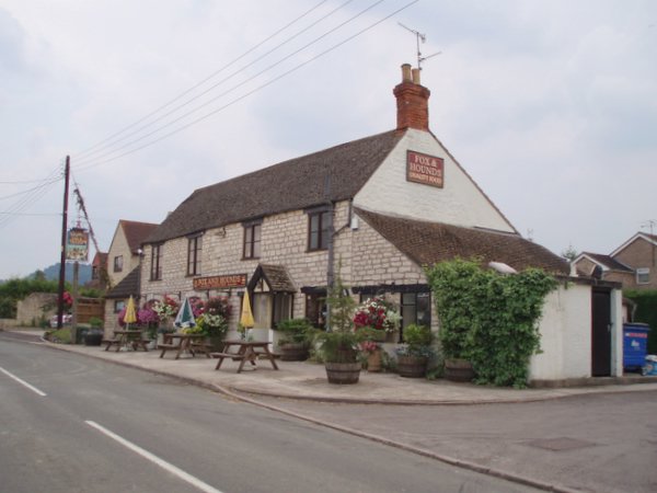
The village is home to a tight-knit community, and its residents take great pride in maintaining the area's natural beauty and heritage. Silver Street boasts a range of amenities, including a local pub, a village hall, and a small convenience store, providing essential services to its inhabitants.

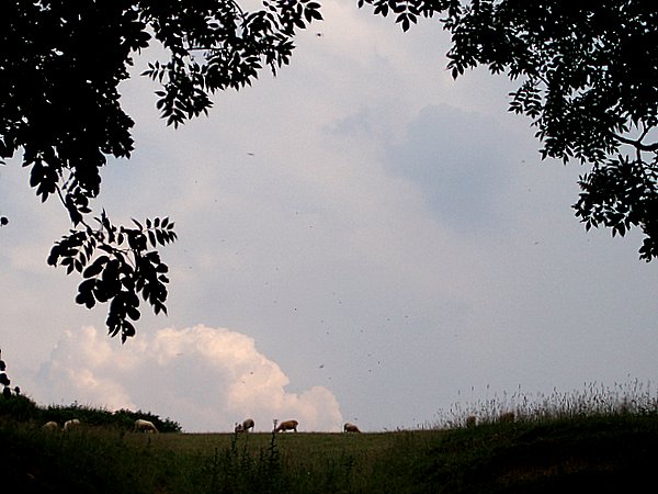
Surrounded by stunning countryside, Silver Street offers ample opportunities for outdoor activities and exploration. The village is situated near the Cotswolds Area of Outstanding Natural Beauty, a protected region renowned for its rolling hills, meandering rivers, and beautiful walking trails. This makes Silver Street an ideal base for nature enthusiasts and those seeking a peaceful escape from city life.

In conclusion, Silver Street, Gloucestershire, is a charming village nestled in the picturesque Cotswold Hills. With its historic buildings, beautiful surroundings, and sense of community, it offers a delightful experience for residents and visitors alike.

If you have any feedback on the listing, please let us know in the comments section below.

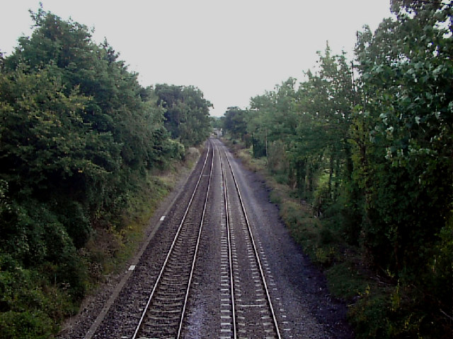
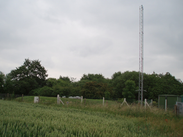
Silver Street Images

Images are sourced within 2km of 51.70951/-2.317649 or Grid Reference SO7801. Thanks to Geograph Open Source API. All images are credited.

Hetty Pegler's Tump Situated right in the SE corner of the grid square is this ancient longbarrow
Hetty Pegler's Tump
Situated right in the SE corner of the grid square is this ancient longbarrow
Cam Long Down The Eastern end of Cam Long Down, near Dursley
Cam Long Down
The Eastern end of Cam Long Down, near Dursley
Frocester Hill Viewpoint Severn Valley view
Frocester Hill Viewpoint
Severn Valley view
View overlooking the Severn Vale from Hill This sort of view is one of the reasons we paraglide.  We can get interesting views of geographical features from the air as well!
View overlooking the Severn Vale from Hill
This sort of view is one of the reasons we paraglide. We can get interesting views of geographical features from the air as well!
Railway line NW of Frocester Looking north west from railway bridge on Peter's Street, NW of Frocester.
Railway line NW of Frocester
Looking north west from railway bridge on Peter's Street, NW of Frocester.
The Street, Coaley Looking south east. The building on the centre left is Coaley Primary School. The tower of St Bartholomew's church is hidden by the tall tree.  <span class="nowrap"><a title="http://www.coaleypc.org.uk" rel="nofollow ugc noopener" href="http://www.coaleypc.org.uk">Link</a><img style="margin-left:2px;" alt="External link" title="External link - shift click to open in new window" src="https://s1.geograph.org.uk/img/external.png" width="10" height="10"/></span>
The Street, Coaley
Looking south east. The building on the centre left is Coaley Primary School. The tower of St Bartholomew's church is hidden by the tall tree. LinkExternal link
Reservoir A small covered reservoir beside the B4066 managed by Severn Water.
Reservoir
A small covered reservoir beside the B4066 managed by Severn Water.
Fox and Hounds public house
Pinnell's End farm Looking downhill from adjacent to Pinnell's End lane to the farm which lies at the end of the lane.
Pinnell's End farm
Looking downhill from adjacent to Pinnell's End lane to the farm which lies at the end of the lane.
Barn The barn is on the opposite side of the road to Lower silver street farm, and I believe the red 'contraption' on the right is a threshing machine of some sort.
Barn
The barn is on the opposite side of the road to Lower silver street farm, and I believe the red 'contraption' on the right is a threshing machine of some sort.
Lever's hill Looking down Lever's hill from a field adjacent to the road.  The building in the distance is Manley house which stands at the end of Silver street (SO 782013)
Lever's hill
Looking down Lever's hill from a field adjacent to the road. The building in the distance is Manley house which stands at the end of Silver street (SO 782013)
Lever's hill From Lever's hill looking towards a ridge of trees and a small pond.
Lever's hill
From Lever's hill looking towards a ridge of trees and a small pond.
Buckholt Wood From Lever's hill looking across terraced fields on the scarp slope of the Cotswolds towards Buckhold wood.
Buckholt Wood
From Lever's hill looking across terraced fields on the scarp slope of the Cotswolds towards Buckhold wood.
Cotswold edge Looking north from Lever's hill along the west facing slope of the Cotswold hills.
Cotswold edge
Looking north from Lever's hill along the west facing slope of the Cotswold hills.
Thunder clouds Looking up towards Coaley peak.  Sheep grazing on the ridge, and ominous grey skies heralding a thunderstorm after a hot July day.
Thunder clouds
Looking up towards Coaley peak. Sheep grazing on the ridge, and ominous grey skies heralding a thunderstorm after a hot July day.
Bridleway and Coaley wood
Cam Long Down A view across fields and hedges towards the higher land of Cam Long Down.
Cam Long Down
A view across fields and hedges towards the higher land of Cam Long Down.
Small lake The small lake is fed by springwater coming down from the Cotswolds.  The course of the lake/stream continues north west until it joins the river Cam
Small lake
The small lake is fed by springwater coming down from the Cotswolds. The course of the lake/stream continues north west until it joins the river Cam
Show me another place!

Silver Street is located at Grid Ref: SO7801 (Lat: 51.70951, Lng: -2.317649)

Administrative County: Gloucestershire

District: Stroud

Police Authority: Gloucestershire

What 3 Words

///gross.shark.tortoises. Near Dursley, Gloucestershire

Nearby Locations

Silver Street

Related Wikis

Coaley

Coaley is a village in the English county of Gloucestershire roughly 4 miles from the town of Dursley, and 5 miles from the town of Stroud. The village...
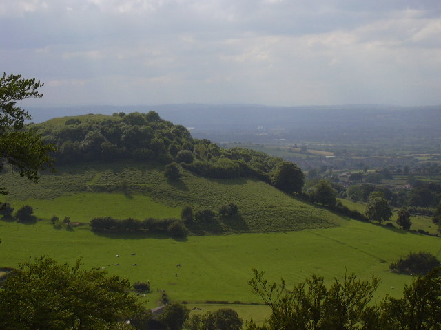
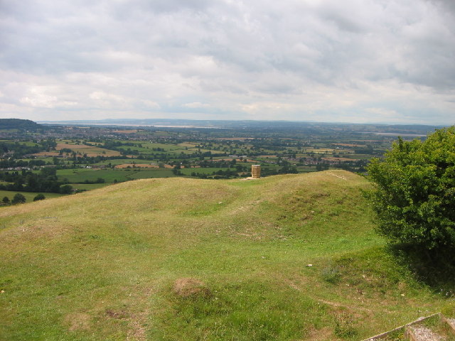
Coaley Peak

Coaley Peak is a picnic site and viewpoint in the English county of Gloucestershire. Located about 4 miles (6.4 km) south-west of the town of Stroud overlooking...

Frocester

Frocester ( FROS-tər) is a village and civil parish in Stroud District, Gloucestershire, England. It lies below the Cotswold escarpment, 10 miles south...
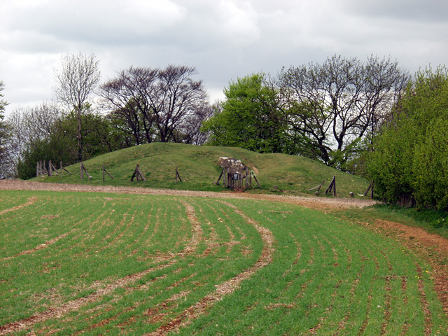
Uley Long Barrow

Uley Long Barrow, also known locally as Hetty Pegler's Tump, is a Neolithic burial mound, near the village of Uley, Gloucestershire, England. == Details... ==

Nearby Amenities

Located within 500m of 51.70951,-2.317649
Power: pole
Lat/Long: 51.7078354/-2.3235977
Power: pole
Lat/Long: 51.7061656/-2.3220233
Power: pole
Lat/Long: 51.7082298/-2.3225691
Power: pole
Lat/Long: 51.706601/-2.3211086
Power: pole
Lat/Long: 51.7085066/-2.3217738
Power: pole
Lat/Long: 51.7087916/-2.3209946
Power: transformer
Lat/Long: 51.711278/-2.3229231
Power: pole
Lat/Long: 51.7106298/-2.3241113
Power: pole
Lat/Long: 51.7111171/-2.3132162
Power: pole
Lat/Long: 51.7121314/-2.3122238
Power: pole
Lat/Long: 51.707629/-2.3189441
Power: pole
Lat/Long: 51.7082265/-2.3176714
Power: pole
Lat/Long: 51.7087966/-2.3164818
Power: pole
Lat/Long: 51.7087542/-2.3245432
Power: pole
Lat/Long: 51.7102296/-2.3144165
Power: pole
Lat/Long: 51.7094082/-2.3155685
Power: pole
Lat/Long: 51.7070631/-2.3201484
Post Box
Collection Times: Mo-Fr 09:00; Sa 07:00; Su off
Drive Through: no
Operator: Royal Mail
Post Box Type: lamp
Ref: GL11 355D
Royal Cypher: EIIR
Royal Cypher Wikidata: Q33102113
Source: survey
Lat/Long: 51.7091096/-2.3180566
Power: pole
Lat/Long: 51.7080628/-2.3148751
Power: pole
Lat/Long: 51.7075841/-2.315771
Power: pole
Lat/Long: 51.7070955/-2.3166883
Power: pole
Lat/Long: 51.7067248/-2.3173562
Power: pole
Lat/Long: 51.7063675/-2.3180428
Power: pole
Lat/Long: 51.7058804/-2.3188716
Power: pole
Lat/Long: 51.7054167/-2.3197621
Power: pole
Lat/Long: 51.7058647/-2.3215941
Power: pole
Lat/Long: 51.7068638/-2.3226193
The data included in this document is from www.openstreetmap.org. The data is made available under ODbL.

Have you been to Silver Street?

Leave your review of Silver Street below (or comments, questions and feedback).