Blandford Forum

Settlement in Dorset

England

Blandford Forum

Red Lion Yard Yard at the back of the former Red Lion Inn on Market Place.
Red Lion Yard Credit: Ian Capper

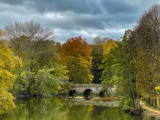
Blandford Forum is a small market town located in the county of Dorset, England. Situated on the banks of the River Stour, it is known for its picturesque setting and rich history. The town is surrounded by beautiful countryside, with rolling hills and green meadows, making it a popular destination for nature lovers and outdoor enthusiasts.

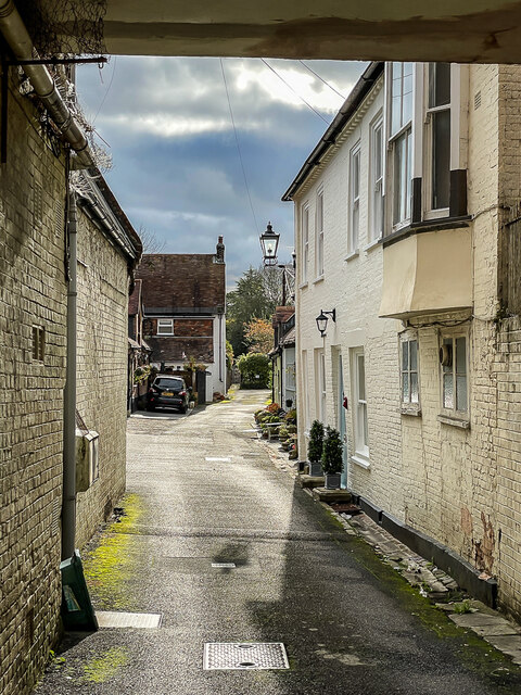
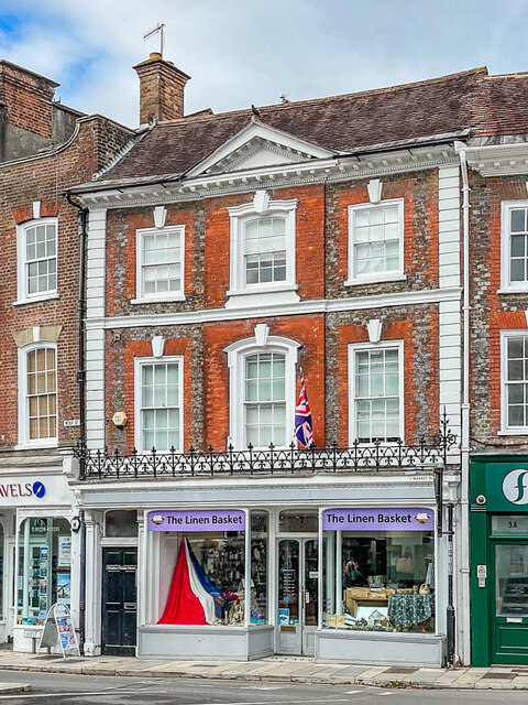
With a population of around 10,000 people, Blandford Forum has a close-knit community and a friendly atmosphere. The town's historic center is characterized by its Georgian architecture, which was largely rebuilt after a devastating fire in 1731. The elegant buildings, cobbled streets, and charming shops give Blandford Forum a unique and timeless appeal.

Blandford Forum has a range of amenities and services to cater to both residents and visitors. The town is home to various shops, cafes, restaurants, and pubs, offering a diverse range of options for shopping and dining. Additionally, there is a weekly market where locals and tourists can find fresh produce, crafts, and other goods.

The town also boasts a number of notable landmarks and attractions. The Blandford Town Museum provides insight into the town's history, while the nearby Blandford Fashion Museum showcases a collection of historic clothing. For those interested in outdoor activities, the nearby North Dorset Trailway offers scenic walking and cycling routes.

Overall, Blandford Forum is a charming and historic town with a strong sense of community and a wealth of natural beauty. Whether it's exploring its historic buildings, enjoying the surrounding countryside, or simply soaking up the friendly atmosphere, Blandford Forum has something for everyone.

If you have any feedback on the listing, please let us know in the comments section below.

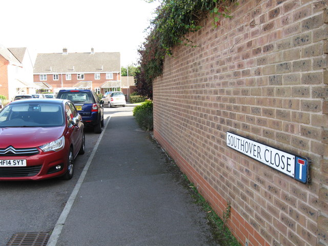
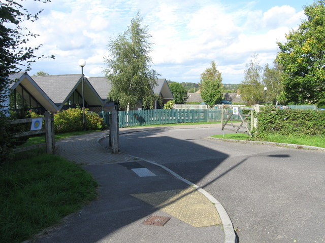
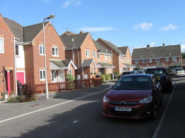
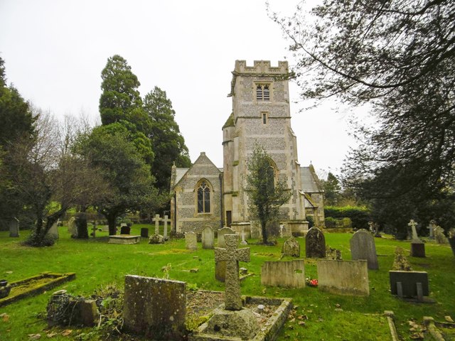
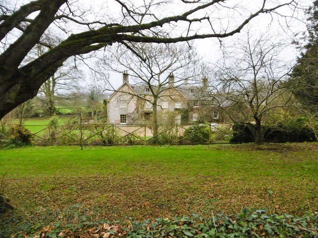
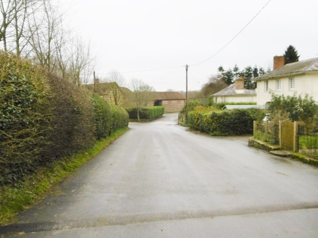
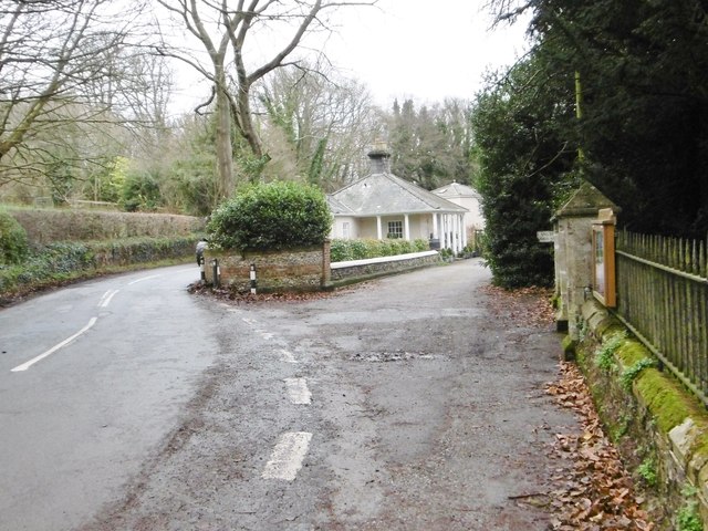
Blandford Forum Images

Images are sourced within 2km of 50.856986/-2.1651633 or Grid Reference ST8806. Thanks to Geograph Open Source API. All images are credited.

Red Lion Yard Yard at the back of the former Red Lion Inn on Market Place.
Red Lion Yard
Yard at the back of the former Red Lion Inn on Market Place.
River Stour River Stour at Blandford Forum, viewed from Mortain Bridge footbridge, with the 1783 Blandford Bridge in the background.
River Stour
River Stour at Blandford Forum, viewed from Mortain Bridge footbridge, with the 1783 Blandford Bridge in the background.
Remembrance display Remembrance display in front of the early 18th Century Church of St Peter and St Paul.
Remembrance display
Remembrance display in front of the early 18th Century Church of St Peter and St Paul.
Remembrance display Remembrance display in front of the early 18th Century Church of St Peter and St Paul.
Remembrance display
Remembrance display in front of the early 18th Century Church of St Peter and St Paul.
Legion House Mid 18th Century house in Church Lane, now occupied by the British Legion.  Grade I listed - see <span class="nowrap"><a title="www.historicengland.org.uk/listing/the-list/list-entry/1152976" rel="nofollow ugc noopener" href="http://www.historicengland.org.uk/listing/the-list/list-entry/1152976">Link</a><img style="margin-left:2px;" alt="External link" title="External link - shift click to open in new window" src="https://s1.geograph.org.uk/img/external.png" width="10" height="10"/></span>.  The gate and railings are separately grade II listed - see <span class="nowrap"><a title="www.historicengland.org.uk/listing/the-list/list-entry/1108652" rel="nofollow ugc noopener" href="http://www.historicengland.org.uk/listing/the-list/list-entry/1108652">Link</a><img style="margin-left:2px;" alt="External link" title="External link - shift click to open in new window" src="https://s1.geograph.org.uk/img/external.png" width="10" height="10"/></span>.
Legion House
Mid 18th Century house in Church Lane, now occupied by the British Legion. Grade I listed - see LinkExternal link. The gate and railings are separately grade II listed - see LinkExternal link.
1 Market Place 18th Century building in Market Place.  Grade II* listed - see <span class="nowrap"><a title="www.historicengland.org.uk/listing/the-list/list-entry/1108683" rel="nofollow ugc noopener" href="http://www.historicengland.org.uk/listing/the-list/list-entry/1108683">Link</a><img style="margin-left:2px;" alt="External link" title="External link - shift click to open in new window" src="https://s1.geograph.org.uk/img/external.png" width="10" height="10"/></span>.
1 Market Place
18th Century building in Market Place. Grade II* listed - see LinkExternal link.
Blandford Community Hospital
Hill Top Roundabout A350/A354
Badger  Roundabout A350/A354
Badger Roundabout A350/A354
Benchmark on #35 Salisbury Road, Blandford Forum Ordnance Survey benchmark on commercial building. More information can be found here: <span class="nowrap"><a title="https://www.bench-marks.org.uk/bm33527" rel="nofollow ugc noopener" href="https://www.bench-marks.org.uk/bm33527">Link</a><img style="margin-left:2px;" alt="External link" title="External link - shift click to open in new window" src="https://s1.geograph.org.uk/img/external.png" width="10" height="10"/></span>
Benchmark on #35 Salisbury Road, Blandford Forum
Ordnance Survey benchmark on commercial building. More information can be found here: LinkExternal link
Southover Close
Southover Close
Entrance to Blandford St Mary CE Primary School
Southover Close
Southover Close
Langton Long, All Saints C19 parish church, listed by Historic England (Grade II): <span class="nowrap"><a title="http://www.britishlistedbuildings.co.uk/en-103723-church-of-all-saints-langton-long-blandf" rel="nofollow ugc noopener" href="http://www.britishlistedbuildings.co.uk/en-103723-church-of-all-saints-langton-long-blandf">Link</a><img style="margin-left:2px;" alt="External link" title="External link - shift click to open in new window" src="https://s1.geograph.org.uk/img/external.png" width="10" height="10"/></span>
Langton Long, All Saints
C19 parish church, listed by Historic England (Grade II): LinkExternal link
Langton Long, former rectory C18/19 former rectory, behind the parish church <a href="https://www.geograph.org.uk/photo/4766217">ST8905 : Langton Long, All Saints</a>; listed by Historic England <span class="nowrap"><a title="http://www.imagesofengland.org.uk/Details/Default.aspx?id=103722&mode=adv" rel="nofollow ugc noopener" href="http://www.imagesofengland.org.uk/Details/Default.aspx?id=103722&mode=adv">Link</a><img style="margin-left:2px;" alt="External link" title="External link - shift click to open in new window" src="https://s1.geograph.org.uk/img/external.png" width="10" height="10"/></span>
Langton Long, former rectory
C18/19 former rectory, behind the parish church ST8905 : Langton Long, All Saints; listed by Historic England LinkExternal link
Langton Long, Langton Farm
Langton Long, South Lodge Former lodge to Langton House, now private; early C19, listed by Historic England: <span class="nowrap"><a title="http://www.imagesofengland.org.uk/Details/Default.aspx?id=103724&mode=adv" rel="nofollow ugc noopener" href="http://www.imagesofengland.org.uk/Details/Default.aspx?id=103724&mode=adv">Link</a><img style="margin-left:2px;" alt="External link" title="External link - shift click to open in new window" src="https://s1.geograph.org.uk/img/external.png" width="10" height="10"/></span>
Langton Long, South Lodge
Former lodge to Langton House, now private; early C19, listed by Historic England: LinkExternal link
Footbridge over A350, Blandford Forum by-pass
Show me another place!

Blandford Forum is located at Grid Ref: ST8806 (Lat: 50.856986, Lng: -2.1651633)

Unitary Authority: Dorset

Police Authority: Dorset

What 3 Words

///swaps.outlawing.braved. Near Blandford Forum, Dorset

Nearby Locations

Angus Wood Blandford Forum

Related Wikis

Blandford Forum Town Hall

Blandford Forum Town Hall is a municipal building in the Market Place in Blandford Forum, Dorset, England. The 18th-century structure, which was the meeting...

Blandford Forum

Blandford Forum ( BLAN-fərd) is a market town in Dorset, England, by the River Stour 13 miles (21 kilometres) northwest of Poole. It had a population of...

Pump House, Blandford Forum

The Pump House, Blandford Forum, Dorset, England, is an 18th-century water source erected in 1760 in commemoration of a fire which almost destroyed the...

Blandford Forum railway station

Blandford Forum railway station was a station on the Somerset & Dorset Joint Railway which served the town of Blandford Forum. == History == Originally...

Coombs Ditch Hundred

Coombs Ditch Hundred was a hundred in the county of Dorset, England, containing the following parishes: Anderson Blandford Forum (borough from 1605) Blandford...

The Blandford School

The Blandford School is a coeducational secondary school located in Blandford Forum in the English county of Dorset.It is a voluntary controlled school...

Blandford St Mary

Blandford St Mary is a village and civil parish in the North Dorset district of Dorset, England. The village is on the south bank of the River Stour, immediately...

A354 road

The A354 is a primary route in England which runs from Salisbury in Wiltshire to Easton on the Isle of Portland in Dorset, a total distance of 51 miles...

Nearby Amenities

Located within 500m of 50.856986,-2.1651633
Blandford Forum
Alt Name: Blandford
Is In: Dorset, England, UK
Place: town
Lat/Long: 50.8576197/-2.1631125
Fixme: This telephone box appears to be missing on Street Level Imagery. Please confirm.
Mapillary: 850983942198694
Operator: BT
Operator Wikidata: Q593786
Removed Amenity: telephone
Survey Date: 2021-08-16
Lat/Long: 50.8597892/-2.1634046
Post Box
Brand: Royal Mail
Brand Wikidata: Q638098
Operator: Royal Mail
Operator Wikidata: Q638098
Post Box Type: pillar
Ref GB Uprn: 10015277970
Lat/Long: 50.8597784/-2.1633425
Recycling
Location: overground
Recycling Type: container
Lat/Long: 50.8556794/-2.1606673
Turning Circle
Lat/Long: 50.8576709/-2.1661364
Addr City: Blandford Forum
Addr Housenumber: 3
Addr Postcode: DT11 7AU
Addr Street: Salisbury Street
Disused Amenity: pharmacy
Disused Healthcare: pharmacy
Fhrs Id: 994334
Old Name: Boots
Wikidata: Q26402408
Lat/Long: 50.8563002/-2.165607
Pharmacy
Boots
Addr City: Blandford Forum
Addr Housenumber: 10-14
Addr Postcode: DT11 7AU
Addr Street: Salisbury Street
Brand: Boots
Brand Wikidata: Q6123139
Brand Wikipedia: en:Boots UK
Dispensing: yes
Fhrs Id: 994346
Healthcare: pharmacy
Opening Hours: Mo-Fr 09:00-16:30; Sa 09:00-17:30
Website: https://www.boots.com/stores/5349-blandford-forum-sailsbury-street-dt11-7ar
Lat/Long: 50.8564791/-2.1652883
Traffic Calming: cushion
Lat/Long: 50.8611481/-2.1663984
Taxi
Lat/Long: 50.8561456/-2.1632871
Crossing
Traffic Calming: table
Lat/Long: 50.8559677/-2.1642135
Crossing
Traffic Calming: table
Lat/Long: 50.8558834/-2.1657555
Traffic Signals
Crossing: traffic_signals
Crossing Ref: pelican
Traffic Signals: signal
Lat/Long: 50.8566637/-2.1653219
Traffic Signals
Crossing: traffic_signals
Crossing Ref: pelican
Cycleway: asl
Traffic Signals: signal
Lat/Long: 50.8569432/-2.1596309
Bicycle Parking
Covered: no
Lat/Long: 50.8568561/-2.1632471
Traffic Signals
Traffic Signals: signal
Lat/Long: 50.8570455/-2.1600854
Traffic Signals
Crossing: traffic_signals
Crossing Ref: pelican
Cycleway: asl
Traffic Signals: signal
Lat/Long: 50.8568205/-2.1593992
Traffic Signals
Button Operated: yes
Crossing: traffic_signals
Crossing Ref: pelican
Cycleway: asl
Tactile Paving: yes
Traffic Signals: signal
Traffic Signals Sound: no
Traffic Signals Vibration: no
Lat/Long: 50.8569884/-2.1591757
Traffic Signals
Crossing: traffic_signals
Crossing Ref: pelican
Cycleway: asl
Traffic Signals: signal
Lat/Long: 50.8571092/-2.1594004
Crossing
Traffic Calming: table
Lat/Long: 50.8560953/-2.164355
Crossing
Crossing: marked
Crossing Markings: yes
Tactile Paving: no
Lat/Long: 50.8544582/-2.1657793
Crossing
Crossing: marked
Crossing Markings: yes
Tactile Paving: no
Lat/Long: 50.8546409/-2.16571
Crossing
Crossing: marked
Crossing Markings: yes
Tactile Paving: no
Lat/Long: 50.8545328/-2.1664458
Crossing
Crossing: marked
Crossing Markings: yes
Tactile Paving: no
Lat/Long: 50.8547973/-2.1656478
Blandford Fashion Museum
Addr Postcode: DT11 7AA
Operator: Cavalcade Of Costume
Phone: +44 1258 453006
Tourism: museum
Website: http://www.theblandfordfashionmuseum.com
Wikidata: Q113370121
Lat/Long: 50.857047/-2.1645778
Blandford Tourist Information Centre
Addr Postcode: DT11 7BB
Information: office
Operator: Volunteer run
Phone: +44 1258 454770
Tourism: information
Website: https://www.visit-dorset.com/tourist-information-centres/blandford-tourist-information-centre-p415933
Lat/Long: 50.8546206/-2.1665325
Blandford Town Museum
Addr City: Blandford Forum
Addr Postcode: DT11 7HQ
Addr Street: Beres Yard
Email: blandfordtownmuseum@uwclub.net
Opening Hours: Tu-Sa 10:00-16:00; We off; Mo off; Su off
Phone: +44 1258 450388
Tourism: museum
Website: https://blandfordtownmuseum.org.uk/
Lat/Long: 50.8556536/-2.163961
Noexit: yes
Lat/Long: 50.8554688/-2.1677211
J Mato & Son
Addr City: Blandford Forum
Addr Housenumber: 7
Addr Postcode: DT11 7AW
Addr Street: West Street
Fhrs Id: 993853
Phone: +44 1258 452079
Shop: butcher
Source Addr Postcode: FHRS Open Data
Lat/Long: 50.8557196/-2.1659342
Crossing
Traffic Calming: table
Lat/Long: 50.8560839/-2.1655448
Mini Roundabout
Lat/Long: 50.8527042/-2.1667122
Toilets
Lat/Long: 50.854638/-2.1666368
Railway: crossing
Lat/Long: 50.8561821/-2.1596732
Marketplace
Opening Hours: Th,Sa
Lat/Long: 50.8560301/-2.1649388
Post Box
Post Box Design: type_n
Post Box Type: lamp
Ref: DT11 39
Ref GB Uprn: 10015850343
Royal Cypher: EIIR
Royal Cypher Wikidata: Q33102113
Lat/Long: 50.8582741/-2.1658865
Post Box
Post Box Type: pillar
Ref: DT11 40
Ref GB Uprn: 10015318640
Royal Cypher: VR
Royal Cypher Wikidata: Q33102356
Lat/Long: 50.8557497/-2.1664981
Parcel Locker
Amazon Locker - Azure
Brand: Amazon Locker
Brand Wikidata: Q16974764
Operator: Amazon
Parcel Mail In: yes
Lat/Long: 50.8550981/-2.1657841
M&Co
Addr City: Blandford Forum
Addr Street: East Street
Brand: M&Co
Brand Wikidata: Q6711808
Brand Wikipedia: en:M&Co.
Shop: clothes
Lat/Long: 50.8560601/-2.16265
Pharmacy
Boots
Addr City: Blandford Forum
Addr Street: East Street
Brand: Boots
Brand Wikidata: Q6123139
Brand Wikipedia: en:Boots UK
Healthcare: pharmacy
Website: https://www.boots.com/stores/5347-blandford-forum-east-street-dt11-7dx
Lat/Long: 50.8560025/-2.1628378
Cards & Things
Addr City: Blandford Forum
Addr Street: East Street
Shop: gift
Lat/Long: 50.8559771/-2.162937
Bus Stop
Blandford Market Place
Bench: no
Bin: no
Bus: yes
Lit: no
Local Ref: A
Public Transport: platform
Shelter: no
Tactile Paving: no
Lat/Long: 50.8559169/-2.1638419
Bus Stop
Blandford Market Place
Bench: no
Bin: no
Bus: yes
Lit: no
Local Ref: B
Naptan AtcoCode: 1200POA10366
Naptan Bearing: W
Naptan CommonName: Market Place
Naptan Indicator: Bay B
Naptan NaptanCode: doratwpm
Naptan Street: East Street
Naptan Verified: no
Public Transport: platform
Shelter: no
Tactile Paving: no
Lat/Long: 50.8559163/-2.1640251
Bus Stop
Crown Hotel
Bus: yes
Naptan AtcoCode: 1200POA10364
Naptan Bearing: NE
Naptan CommonName: Crown Hotel
Naptan Indicator: Bay D
Naptan NaptanCode: doratwma
Naptan Street: West Street
Naptan Verified: no
Public Transport: platform
Lat/Long: 50.8558081/-2.1661373
Bus Stop
Whitecliff Mill Street
Bus: yes
Naptan AtcoCode: 1200POA10368
Naptan Bearing: N
Naptan CommonName: Eagle House Surgery
Naptan Indicator: N-bound
Naptan NaptanCode: doratwmg
Naptan Street: Whitecliff Mill Street
Naptan Verified: no
Public Transport: platform
Lat/Long: 50.857762/-2.1655766
Bus Stop
St Leonard's Court
Bench: no
Bin: no
Bus: yes
Naptan AtcoCode: 1200POA10393
Naptan Bearing: E
Naptan BusStopType: CUS
Naptan CommonName: Fishers Close
Naptan Indicator: E-bound
Naptan NaptanCode: dorawajd
Naptan Street: Wimborne Road
Naptan Verified: no
Public Transport: platform
Shelter: no
Tactile Paving: no
Lat/Long: 50.8572172/-2.1584335
Bus Stop
Fairfield Road
Bus: yes
Naptan AtcoCode: 1200POA10376
Naptan Bearing: NE
Naptan CommonName: Fairfield Road
Naptan Indicator: NE-bound
Naptan NaptanCode: dorawadj
Naptan Street: Salisbury Road
Naptan Verified: no
Public Transport: platform
Lat/Long: 50.8603919/-2.1624258
Bus Stop
Fairfield Road
Bus: yes
Naptan AtcoCode: 1200POA10375
Naptan Bearing: SW
Naptan CommonName: Fairfield Road
Naptan Indicator: opp
Naptan NaptanCode: dorawadm
Naptan Street: Salisbury Road
Naptan Verified: no
Public Transport: platform
Lat/Long: 50.860317/-2.1623598
Traffic Signals
Crossing: traffic_signals
Crossing Ref: pelican
Traffic Signals: signal
Lat/Long: 50.8563072/-2.1623358
Crossing
Traffic Calming: table
Lat/Long: 50.8560199/-2.1631966
Crossing
Traffic Calming: table
Lat/Long: 50.8559538/-2.1654134
Traffic Signals
Crossing: traffic_signals
Crossing Ref: pelican
Lat/Long: 50.8597075/-2.1632411
Give Way
Lat/Long: 50.8594393/-2.1630891
Traffic Signals
Crossing: traffic_signals
Crossing Ref: pelican
Lat/Long: 50.8595601/-2.1633197
Traffic Signals
Crossing: traffic_signals
Crossing Ref: pelican
Lat/Long: 50.8597417/-2.1633764
Traffic Signals
Crossing: traffic_signals
Crossing Ref: pelican
Lat/Long: 50.8597203/-2.163401
Give Way
Lat/Long: 50.8569211/-2.1601669
Traffic Signals
Crossing: traffic_signals
Crossing Ref: pelican
Traffic Signals: signal
Lat/Long: 50.8570254/-2.1601907
Traffic Signals
Crossing: traffic_signals
Crossing Ref: pelican
Traffic Signals: signal
Lat/Long: 50.857035/-2.1601323
Give Way
Lat/Long: 50.8559894/-2.1656217
Bench
Lat/Long: 50.8541079/-2.1646979
Bench
Backrest: yes
Lat/Long: 50.8538473/-2.1651966
Bench
Lat/Long: 50.8543423/-2.1643703
Bench
Backrest: no
Lat/Long: 50.8537414/-2.1655098
Recycling
Recycling Type: container
Lat/Long: 50.8544019/-2.1666355
Bus Stop
Marsh & Ham Car Park
Bus: yes
Naptan AtcoCode: 1200DOY38574
Naptan Bearing: W
Naptan BusStopType: CUS
Naptan CommonName: The Ham
Naptan Indicator: W-bound
Naptan NaptanCode: doratwja
Naptan Verified: no
Public Transport: platform
Lat/Long: 50.8544353/-2.166375
Drinking Fountain
Historic: monument
Lat/Long: 50.8560468/-2.1642565
Entrance: main
Lat/Long: 50.8561784/-2.1641138
Library
Blandford Library
Wikidata: Q55173465
Lat/Long: 50.8567618/-2.1631086
Entrance: yes
Lat/Long: 50.8556744/-2.1665548
Entrance: yes
Lat/Long: 50.8556329/-2.1674755
Entrance: yes
Lat/Long: 50.8556126/-2.1667084
Vending Machine
Vending: parking_tickets
Lat/Long: 50.8562063/-2.1634226
Bench
Lat/Long: 50.8573612/-2.1633698
Bench
Lat/Long: 50.8572211/-2.1632909
Bench
Lat/Long: 50.8573197/-2.1628167
Bench
Lat/Long: 50.857493/-2.1629268
Entrance: yes
Lat/Long: 50.857493/-2.1633328
Blandford Rugby Club
Leisure: pitch
Sport: rugby_union
Lat/Long: 50.8556333/-2.1630363
Atm
Lat/Long: 50.8561011/-2.1645529
Disused Amenity: atm
Lat/Long: 50.8560978/-2.1649232
Clarks
Addr City: Blandford Forum
Addr Street: Market Place
Brand: Clarks
Brand Wikidata: Q1095857
Brand Wikipedia: en:C. & J. Clark
Shop: shoes
Lat/Long: 50.8558675/-2.164684
Holland & Barrett
Addr City: Blandford Forum
Addr Housenumber: 14
Addr Postcode: DT11 7EB
Addr Street: Market Place
Brand: Holland & Barrett
Brand Wikidata: Q5880870
Brand Wikipedia: en:Holland & Barrett
Fhrs Id: 994308
Shop: health_food
Source Addr: FHRS Open Data
Lat/Long: 50.8558717/-2.1647875
Addr City: Blandford Forum
Addr Street: Market Place
Disused Amenity: bank
Old Name: Barclays
Lat/Long: 50.8558747/-2.1649179
Real Time
Addr City: Blandford Forum
Addr Street: Market Place
Shop: yes
Lat/Long: 50.8558678/-2.1645914
Euronics
Addr City: Blandford Forum
Addr Street: Market Place
Brand: Euronics
Brand Wikidata: Q184860
Brand Wikipedia: en:Euronics
Shop: electronics
Lat/Long: 50.8558645/-2.1644546
Vending Machine
Vending: parking_tickets
Lat/Long: 50.8560932/-2.1649902
Barrier: bollard
Lat/Long: 50.8560713/-2.1650207
Barrier: bollard
Lat/Long: 50.8560629/-2.1650055
Barrier: bollard
Lat/Long: 50.8560739/-2.1649026
Barrier: bollard
Lat/Long: 50.8560539/-2.1649316
Barrier: bollard
Lat/Long: 50.8560618/-2.1649169
Barrier: bollard
Lat/Long: 50.8560533/-2.1649878
Barrier: bollard
Lat/Long: 50.8560533/-2.1649593
Addr City: Blandford Forum
Addr Housenumber: 1
Addr Street: St Leonard's Court
Lat/Long: 50.8573405/-2.1581001
Addr City: Blandford Forum
Addr Housenumber: 11
Addr Street: St Leonard's Court
Lat/Long: 50.8575573/-2.1582375
Addr City: Blandford Forum
Addr Housenumber: 3
Addr Street: Darcy Court
Lat/Long: 50.8606927/-2.1616323
Addr City: Blandford Forum
Addr Housenumber: 1
Addr Street: Darcy Court
Lat/Long: 50.860645/-2.1615624
Addr City: Blandford Forum
Addr Housenumber: 4
Addr Street: Darcy Court
Lat/Long: 50.8607797/-2.1615114
Addr City: Blandford Forum
Addr Housenumber: 7
Addr Street: Darcy Court
Lat/Long: 50.8606379/-2.1612906
Addr City: Blandford Forum
Addr Housenumber: 1
Addr Street: The Cedars
Lat/Long: 50.8596341/-2.1635772
Addr City: Blandford Forum
Addr Housenumber: 6
Addr Street: The Cedars
Lat/Long: 50.8597268/-2.1637506
Addr City: Blandford Forum
Addr Housenumber: 7
Addr Street: The Cedars
Lat/Long: 50.8597631/-2.1638409
Addr City: Blandford Forum
Addr Housenumber: 12
Addr Street: The Cedars
Lat/Long: 50.8595944/-2.1640674
Noexit: yes
Lat/Long: 50.8591696/-2.1592679
Barrier: bollard
Foot: yes
Lat/Long: 50.8590849/-2.1611565
Barrier: bollard
Foot: yes
Lat/Long: 50.8593431/-2.1607192
Addr City: Blandford Forum
Addr Housenumber: 1
Addr Street: Barnack Courtyard
Lat/Long: 50.8598425/-2.1605314
Addr City: Blandford Forum
Addr Housenumber: 3
Addr Street: Barnack Courtyard
Lat/Long: 50.8597502/-2.1603999
Cafe
Beaton‘s TeaRoom
Addr City: Blandford Forum
Addr Street: Market Place
Lat/Long: 50.8558535/-2.1654146
Addr City: Blandford Forum
Addr Housenumber: 1
Addr Street: Oakfield Court
Lat/Long: 50.8575306/-2.160551
Addr City: Blandford Forum
Addr Housenumber: 6
Addr Street: Oakfield Court
Lat/Long: 50.8576341/-2.1606641
Addr City: Blandford Forum
Addr Housenumber: 20
Addr Street: Oakfield Court
Lat/Long: 50.8578687/-2.1603621
Addr City: Blandford Forum
Addr Housenumber: 15
Addr Street: Oakfield Court
Lat/Long: 50.8578043/-2.1604839
Addr City: Blandford Forum
Addr Housenumber: 7
Addr Street: Oakfield Court
Lat/Long: 50.8577078/-2.1606777
Addr City: Blandford Forum
Addr Housenumber: 1
Addr Street: Albert Powis House
Lat/Long: 50.8574951/-2.160482
Addr City: Blandford Forum
Addr Housenumber: 8
Addr Street: Albert Powis House
Lat/Long: 50.8574295/-2.1601735
Traffic Signals
Traffic Signals: signal
Lat/Long: 50.8569623/-2.1591239
Post Box
Brand: Royal Mail
Brand Wikidata: Q638098
Collection Times: Mo-Fr 09:00; Sa 07:00
Operator: Royal Mail
Operator Wikidata: Q638098
Post Box Mounting: pier
Post Box Type: lamp
Ref: DT11 117D
Ref GB Uprn: 10015328787
Royal Cypher: EIIR
Royal Cypher Wikidata: Q33102113
Lat/Long: 50.8591996/-2.1598746
Cafe
Costa
Addr City: Blandford Forum
Addr Housenumber: 7
Addr Postcode: DT11 7AU
Addr Street: Salisbury Street
Brand: Costa
Brand Wikidata: Q608845
Brand Wikipedia: en:Costa Coffee
Cuisine: coffee_shop
Fhrs Id: 994030
Operator: Bournemouth Coffee Co T/A Costa
Phone: +44 1258 451787
Source: visit to cafe
Takeaway: yes
Toilets Wheelchair: yes
Website: https://www.costa.co.uk/locations/store-locator/
Lat/Long: 50.8563733/-2.165581
Bus Stop
St Leonard's Court
Bench: yes
Bin: no
Bus: yes
Lit: no
Naptan AtcoCode: 1200POA10394
Naptan Bearing: W
Naptan CommonName: Fishers Close
Naptan Indicator: W-bound
Naptan NaptanCode: dorawajg
Naptan Street: Wimborne Road
Naptan Verified: no
Public Transport: platform
Shelter: yes
Tactile Paving: no
Lat/Long: 50.8570616/-2.1586821
Bus Stop
The Maltings
Bench: no
Bin: no
Bus: yes
Naptan AtcoCode: 1200POA10379
Naptan Bearing: SE
Naptan CommonName: The Maltings
Naptan Indicator: SE-bound
Naptan NaptanCode: doratwmj
Naptan Street: Bournemouth Road
Naptan Verified: no
Public Transport: platform
Shelter: no
Lat/Long: 50.8525973/-2.165637
Bus Stop
The Maltings
Bench: no
Bin: no
Bus: yes
Naptan AtcoCode: 1200DOA25094
Naptan Bearing: NW
Naptan BusStopType: CUS
Naptan CommonName: The Maltings
Naptan Indicator: NW-bound
Naptan NaptanCode: dordmgtj
Naptan Street: Bournemouth Road
Naptan Verified: no
Public Transport: platform
Shelter: no
Lat/Long: 50.8525194/-2.1656504
Off Camber
Addr City: Blandford Forum
Addr Housenumber: 38
Addr Postcode: DT11 7PR
Addr Street: Salisbury Street
Opening Hours: Mo-Sa 08:30-17:30
Payment American Express: yes
Payment Cash: yes
Payment Coins: yes
Payment Contactless: yes
Payment Credit Cards: yes
Payment Debit Cards: yes
Payment Mastercard: yes
Payment Visa: yes
Phone: +44 1258 458677
Service Bicycle Bicycle Sales And Service: yes
Service Bicycle Bicycle: yes
Service Bicycle Bike: yes
Service Bicycle Parts: yes
Service Bicycle Repair: yes
Service Bicycle Retail: yes
Service Bicycle Sales: yes
Service Bicycle Service: yes
Shop: bicycle
Website: https://www.offcamber.co.uk/
Lat/Long: 50.8573846/-2.1648615
Cafe
Yellow Bicycle Cafe
Addr City: Blandford Forum
Addr Housenumber: 30a
Addr Postcode: DT11 7AR
Addr Street: Salisbury Street
Internet Access: wlan
Outdoor Seating: no
Lat/Long: 50.8570529/-2.1649913
Age UK
Addr City: Blandford Forum
Addr Housenumber: 73
Addr Street: East Street
Brand: Age UK
Brand Wikidata: Q4691850
Description: This is the "Age UK Shop Blandford Forum 2" charity shop; there is another Age UK charity shop in Blandford Forum at 38 East Street.
Shop: charity
Source: visit to store
Website: https://directory.ageuk.org.uk/charity-shops/age-uk-shop-blandford-forum-2/?p=DT11%209ER&pageNum=1
Lat/Long: 50.8558708/-2.164025
Symonds & Sampson
Addr City: Blandford Forum
Addr Housenumber: 7
Addr Postcode: DT11 7AH
Addr Street: Market Place
Brand: Symonds & Sampson
Brand Wikidata: Q90262955
Office: estate_agent
Lat/Long: 50.8561498/-2.1656424
Scrivens
Addr City: Blandford Forum
Addr Street: Salisbury Street
Brand: Scrivens
Brand Wikidata: Q79424133
Shop: optician
Lat/Long: 50.8561769/-2.1653782
Iceland
Addr City: Blandford Forum
Addr Housenumber: 26
Addr Postcode: DT11 7AR
Addr Street: Salisbury Street
Branch: Blandford Forum
Brand: Iceland
Brand Wikidata: Q721810
Brand Wikipedia: en:Iceland (supermarket)
Fhrs Id: 994366
Opening Hours: Mo-Sa 08:00-18:00; Su 10:00-16:00
Shop: frozen_food
Website: https://www.iceland.co.uk/store-finder/store?StoreID=1207&StoreName=BLANDFORD%20FORUM
Lat/Long: 50.8568973/-2.1650322
The Wendi House
Addr City: Blandford Forum
Addr Street: Salisbury Street
Contact Facebook: https://www.facebook.com/thewendihouse
Shop: charity
Lat/Long: 50.8570213/-2.1653574
Aurora Gems
Addr City: Blandford Forum
Addr Street: Salisbury Street
Shop: jewelry
Lat/Long: 50.8569782/-2.1653561
Fast Food
Spice India
Addr City: Blandford Forum
Addr Street: Salisbury Street
Cuisine: indian
Lat/Long: 50.8569375/-2.1653668
Noc's Box
Addr City: Blandford Forum
Addr Street: Salisbury Street
Shop: games
Lat/Long: 50.8568795/-2.1653782
Addr City: Blandford Forum
Addr Street: Salisbury Street
Disused Shop: mobile_phone
Old Name: Carphone Warehouse
Lat/Long: 50.8568194/-2.1654151
Hays Travel
Addr City: Blandford Forum
Addr Street: Salisbury Street
Brand: Hays Travel
Brand Wikidata: Q70250954
Shop: travel_agency
Lat/Long: 50.8567805/-2.1654405
Bar
The Paddocks
Addr City: Blandford Forum
Addr Street: Salisbury Street
Contact Facebook: https://www.facebook.com/theracecourse
Operator: Cocker & Mastiff Ltd
Lat/Long: 50.856739/-2.1654526
Jackson-Stops
Addr City: Blandford Forum
Addr Street: Salisbury Street
Office: estate_agent
Lat/Long: 50.8566789/-2.1654754
Heads Up Barber
Addr City: Blandford Forum
Addr Street: Salisbury Street
Shop: hairdresser
Lat/Long: 50.8566311/-2.1654935
Gallery 1
Addr City: Blandford Forum
Addr Street: Salisbury Street
Shop: clothes
Lat/Long: 50.8565887/-2.165511
Forum Sales & Lettings
Addr City: Blandford Forum
Addr Street: Salisbury Street
Office: estate_agent
Lat/Long: 50.8565523/-2.1655244
Complete Health Osteopathy
Addr City: Blandford Forum
Addr Street: Salisbury Street
Healthcare: physiotherapist
Lat/Long: 50.8565058/-2.1655425
The Computer Shop
Addr City: Blandford Forum
Addr Housenumber: 11
Addr Street: Salisbury Street
Shop: computer
Lat/Long: 50.8564643/-2.1655572
Kodak Express
Addr City: Blandford Forum
Addr Street: Salisbury Street
Brand: Kodak Express
Brand Wikidata: Q6425126
Shop: photo
Lat/Long: 50.8564249/-2.1655693
Cards Gifts Balloons at No 1
Addr City: Blandford Forum
Addr Street: Salisbury Street
Shop: gift
Lat/Long: 50.856237/-2.1656209
Man Made: surveillance
Surveillance Type: camera
Lat/Long: 50.855911/-2.1656997
Spear Travels
Shop: travel_agency
Lat/Long: 50.8559669/-2.1658435
The Linen Basket
Shop: fabric
Lat/Long: 50.856005/-2.1657926
Robert Frith Optometrists
Shop: optician
Lat/Long: 50.8560499/-2.1657349
Bank
Nationwide
Brand: Nationwide
Brand Wikidata: Q846735
Lat/Long: 50.8560905/-2.1657014
22 Vapes
Addr City: Blandford Forum
Addr Street: Salisbury Street
Shop: e-cigarette
Lat/Long: 50.8567708/-2.1651468
Cafe
Rebekah's Kitchen
Addr City: Blandford Forum
Addr Street: Salisbury Street
Lat/Long: 50.8568139/-2.1651281
Connells
Addr City: Blandford Forum
Addr Street: Salisbury Street
Brand: Connells
Brand Wikidata: Q5161738
Office: estate_agent
Lat/Long: 50.8567284/-2.1651763
Chaffers
Addr City: Blandford Forum
Addr Street: Salisbury Street
Office: estate_agent
Lat/Long: 50.8566713/-2.1652025
Bank
Yorkshire Building Society
Addr City: Blandford Forum
Addr Street: Salisbury Street
Brand: Yorkshire Building Society
Brand Wikidata: Q12073381
Lat/Long: 50.8566362/-2.1652173
Fast Food
Subway
Addr City: Blandford Forum
Addr Street: Salisbury Street
Brand: Subway
Brand Wikidata: Q244457
Contact Website: https://restaurants.subway.com/united-kingdom/en/blandford-forum/16-salisbury-st
Cuisine: sandwich
Takeaway: yes
Lat/Long: 50.8565722/-2.1652441
Papyrus
Addr City: Blandford Forum
Addr Street: Salisbury Street
Shop: clothes
Lat/Long: 50.8563894/-2.1653312
Forum Framers and Gallery
Addr City: Blandford Forum
Addr Street: Salisbury Street
Shop: art
Lat/Long: 50.8563352/-2.165338
Vivien Horder
Addr City: Blandford Forum
Addr Street: Salisbury Street
Office: estate_agent
Lat/Long: 50.8562819/-2.1653554
Choppa Vapes
Addr City: Blandford Forum
Addr Street: Salisbury Street
Shop: e-cigarette
Lat/Long: 50.8569735/-2.1650308
Exclusively Yours
Addr City: Blandford Forum
Addr Street: Salisbury Street
Clothes: wedding
Shop: clothes
Lat/Long: 50.8570192/-2.1650094
Addr City: Blandford Forum
Addr Street: Salisbury Street
Disused Shop: yes
Old Name: David Reame
Lat/Long: 50.8571251/-2.164949
Addr City: Blandford Forum
Addr Street: East Street
Disused Amenity: restaurant
Old Name: Jack Rabbits
Lat/Long: 50.8561168/-2.1624962
Addr City: Blandford Forum
Addr Housenumber: 45
Addr Street: East Street
Lat/Long: 50.856016/-2.1627885
Bella Carousel
Addr City: Blandford Forum
Addr Street: East Street
Clothes: children
Shop: clothes
Lat/Long: 50.8559669/-2.1629964
Thirteen Twenty Two
Addr City: Blandford Forum
Addr Street: East Street
Shop: clothes
Lat/Long: 50.8559551/-2.1630728
The Sapling
Addr City: Blandford Forum
Addr Street: East Street
Shop: gift
Lat/Long: 50.8559474/-2.1631238
Naomi House & Jacksplace
Addr City: Blandford Forum
Addr Housename: Star House
Addr Housenumber: 53
Addr Street: East Street
Shop: charity
Lat/Long: 50.8559424/-2.1631975
Ganesh
Addr City: Blandford Forum
Addr Street: East Street
Shop: gift
Lat/Long: 50.8559237/-2.163335
Deck The Halls
Addr City: Blandford Forum
Addr Street: East Street
Shop: christmas
Lat/Long: 50.855914/-2.1634188
Cafe
The Gorge Cafe
Addr City: Blandford Forum
Addr Street: East Street
Lat/Long: 50.8559119/-2.1634731
Harrold Opticians
Addr City: Blandford Forum
Addr Street: East Street
Shop: optician
Lat/Long: 50.8559/-2.1635811
Best-one
Addr City: Blandford Forum
Addr Street: East Street
Brand: Best-one
Brand Wikidata: Q4896532
Shop: convenience
Lat/Long: 50.8558962/-2.1636515
Cafe
Brasserie
Addr City: Blandford Forum
Addr Street: East Street
Cuisine: italian
Lat/Long: 50.8558937/-2.1637112
Fast Food
Ottoman Takeaway
Addr City: Blandford Forum
Addr Housenumber: 67
Addr Street: East Street
Cuisine: kebab;burger;chicken
Lat/Long: 50.8558899/-2.1637722
The Dorset Bookshop
Addr City: Blandford Forum
Addr Housenumber: 69
Addr Street: East Street
Shop: books
Lat/Long: 50.8558856/-2.1638212
Showcase
Addr City: Blandford Forum
Addr Street: East Street
Shop: gift
Lat/Long: 50.8558818/-2.1638889
Weldmar Hospicecare Trust
Addr City: Blandford Forum
Addr Street: Market Place
Shop: charity
Lat/Long: 50.8558674/-2.1641839
Kings Barber
Addr City: Blandford Forum
Addr Street: Market Place
Shop: hairdresser
Lat/Long: 50.8558658/-2.1642845
Luxury Nails
Addr City: Blandford Forum
Addr Street: Market Place
Shop: beauty
Lat/Long: 50.8558653/-2.1643502
Bank
Lloyds Bank
Addr City: Blandford Forum
Addr Street: Market Place
Brand: Lloyds Bank
Brand Wikidata: Q1152847
Lat/Long: 50.8558636/-2.1651301
WHSmith
Addr City: Blandford Forum
Addr Street: Market Place
Brand: WHSmith
Brand Wikidata: Q1548712
Shop: newsagent
Lat/Long: 50.8558607/-2.1652521
Entrance: yes
Lat/Long: 50.8560805/-2.1638863
The data included in this document is from www.openstreetmap.org. The data is made available under ODbL.

Have you been to Blandford Forum?

Leave your review of Blandford Forum below (or comments, questions and feedback).