Blakenhall

Settlement in Staffordshire

England

Blakenhall

Manor Road in Penn, Wolverhampton The austere looking house on the right is The Hollies. Muchall Park is behind the mature trees on the left. The single track lane links the A449 Penn Road with Mount Road by Penn Cricket Club.
Manor Road in Penn, Wolverhampton Credit: Roger D Kidd

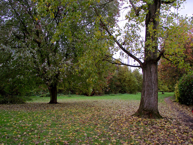
Blakenhall is a small village located in the county of Staffordshire, England. Situated about 2 miles east of the town of Stafford, it is part of the borough of Stafford. Blakenhall is a rural settlement surrounded by picturesque countryside, characterized by rolling hills and farmland.

The village has a population of approximately 500 people, with a close-knit and friendly community. Blakenhall is well-connected to neighboring towns and cities by road, with the A34 running nearby, providing easy access to Stafford and Stoke-on-Trent.

Blakenhall is home to a few amenities to cater to the needs of its residents. These include a local pub, The Blakenhall Arms, which serves as a social hub for villagers. The area also has a village hall, which hosts various community events and gatherings throughout the year.

The village is known for its natural beauty, with many scenic walking trails in the nearby countryside. The surrounding area offers a peaceful and tranquil environment, making it an attractive location for those seeking a quieter lifestyle away from the hustle and bustle of city life.

Blakenhall is also rich in history, with several historic buildings dotted throughout the village. These include Blakenhall Manor, a Grade II listed building dating back to the 17th century, and the Church of St. Peter, which has stood since the 12th century.

Overall, Blakenhall offers a charming and idyllic setting, combining rural tranquility with a strong sense of community spirit.

If you have any feedback on the listing, please let us know in the comments section below.
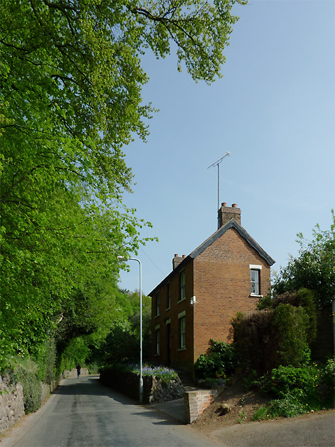
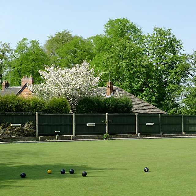
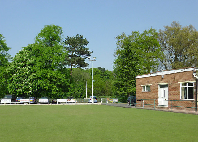
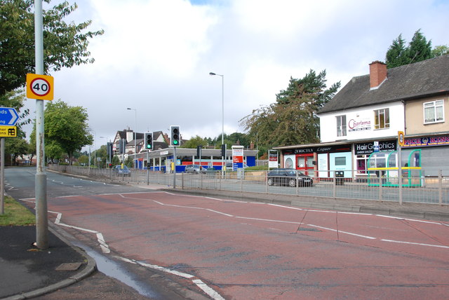
Blakenhall Images

Images are sourced within 2km of 52.57072/-2.134236 or Grid Reference SO9197. Thanks to Geograph Open Source API. All images are credited.

Manor Road in Penn, Wolverhampton The austere looking house on the right is The Hollies. Muchall Park is behind the mature trees on the left. The single track lane links the A449 Penn Road with Mount Road by Penn Cricket Club.
Manor Road in Penn, Wolverhampton
The austere looking house on the right is The Hollies. Muchall Park is behind the mature trees on the left. The single track lane links the A449 Penn Road with Mount Road by Penn Cricket Club.
The green at Penn Bowling Club, Wolverhampton Penn Bowling and Social Club is a well run club for local people. In addition to the bowling, activities include darts, dominoes, poker, bingo, crib, pool, salsa dancing and (of course) large screen TV to watch football. Oh, nearly forgot! It has a bar too, which serves Banks's Bitter and Mild, plus three guest real ales - all superbly kept.

update August 2018 - There is a defibrillator stationed here by the main entrance to the club.

<a href="https://www.geograph.org.uk/photo/2733190">SO8995 : The Penn Bowling Club  handpumps, Wolverhampton</a> 

I think they sell lager, too. ;-)
The green at Penn Bowling Club, Wolverhampton
Penn Bowling and Social Club is a well run club for local people. In addition to the bowling, activities include darts, dominoes, poker, bingo, crib, pool, salsa dancing and (of course) large screen TV to watch football. Oh, nearly forgot! It has a bar too, which serves Banks's Bitter and Mild, plus three guest real ales - all superbly kept. update August 2018 - There is a defibrillator stationed here by the main entrance to the club. SO8995 : The Penn Bowling Club handpumps, Wolverhampton I think they sell lager, too. ;-)
Penn Bowling Club, Wolverhampton The image shows part of the green and club buildings, with the mature deciduous trees of Muchall Park as the backdrop.

Penn Bowling and Social Club is a well run club for local people. In addition to the bowling, regular activities include darts, dominoes, poker, crib, pool, bingo, salsa dancing and (of course) large screen TV to watch football. Oh, nearly forgot! It has a good bar too, which serves Banks's Bitter and Mild, plus three hand-pulled guest real ales - all superbly kept. People occasionally drink lager, I'm told. ;-)

update August 2018 - There is a defibrillator stationed here by the main entrance to the club.
Penn Bowling Club, Wolverhampton
The image shows part of the green and club buildings, with the mature deciduous trees of Muchall Park as the backdrop. Penn Bowling and Social Club is a well run club for local people. In addition to the bowling, regular activities include darts, dominoes, poker, crib, pool, bingo, salsa dancing and (of course) large screen TV to watch football. Oh, nearly forgot! It has a good bar too, which serves Banks's Bitter and Mild, plus three hand-pulled guest real ales - all superbly kept. People occasionally drink lager, I'm told. ;-) update August 2018 - There is a defibrillator stationed here by the main entrance to the club.
St Philip's Church at Penn Fields, Wolverhampton When this Grade II listed church was built in 1858-1859 it really was in the middle of the fields, and it was many decades before housing development began to surround it. Visitors will have a shock when they enter through the main door; the whole interior of the church was divided into two floors in 1997. The ground floor is for community use, while the upper floor is now the church area for worship. See here <span class="nowrap"><a title="http://britishlistedbuildings.co.uk/en-378356-church-of-st-philip-wolverhampton" rel="nofollow ugc noopener" href="http://britishlistedbuildings.co.uk/en-378356-church-of-st-philip-wolverhampton">Link</a><img style="margin-left:2px;" alt="External link" title="External link - shift click to open in new window" src="https://s1.geograph.org.uk/img/external.png" width="10" height="10"/></span> for a description of what is no longer there.
St Philip's Church at Penn Fields, Wolverhampton
When this Grade II listed church was built in 1858-1859 it really was in the middle of the fields, and it was many decades before housing development began to surround it. Visitors will have a shock when they enter through the main door; the whole interior of the church was divided into two floors in 1997. The ground floor is for community use, while the upper floor is now the church area for worship. See here LinkExternal link for a description of what is no longer there.
St Philip's Church tower in Penn Fields, Wolverhampton When this Grade II listed church was built in 1858-1859 it really was in the middle of the fields, and it was many decades before housing development began to surround it. Visitors will have a shock when they enter through the main door; the whole interior of the church was divided into two floors in 1997. The ground floor is for community use, while the upper floor is now the church area for worship. See here <span class="nowrap"><a title="http://britishlistedbuildings.co.uk/en-378356-church-of-st-philip-wolverhampton" rel="nofollow ugc noopener" href="http://britishlistedbuildings.co.uk/en-378356-church-of-st-philip-wolverhampton">Link</a><img style="margin-left:2px;" alt="External link" title="External link - shift click to open in new window" src="https://s1.geograph.org.uk/img/external.png" width="10" height="10"/></span> for a description of what is no longer there.
St Philip's Church tower in Penn Fields, Wolverhampton
When this Grade II listed church was built in 1858-1859 it really was in the middle of the fields, and it was many decades before housing development began to surround it. Visitors will have a shock when they enter through the main door; the whole interior of the church was divided into two floors in 1997. The ground floor is for community use, while the upper floor is now the church area for worship. See here LinkExternal link for a description of what is no longer there.
St Philip's Church clock in Penn Fields, Wolverhampton When this Grade II listed church was built in 1858-1859 it really was in the middle of the fields, and it was many decades before housing development began to surround it. Visitors will have a shock when they enter through the main door; the whole interior of the church was divided into two floors in 1997. The ground floor is for community use, while the upper floor is now the church area for worship. See here <span class="nowrap"><a title="http://britishlistedbuildings.co.uk/en-378356-church-of-st-philip-wolverhampton" rel="nofollow ugc noopener" href="http://britishlistedbuildings.co.uk/en-378356-church-of-st-philip-wolverhampton">Link</a><img style="margin-left:2px;" alt="External link" title="External link - shift click to open in new window" src="https://s1.geograph.org.uk/img/external.png" width="10" height="10"/></span> for a description of what is no longer there.

See also<a href="https://www.geograph.org.uk/photo/2400288">SO8996 : St Philip's Church at Penn Fields, Wolverhampton</a>
St Philip's Church clock in Penn Fields, Wolverhampton
When this Grade II listed church was built in 1858-1859 it really was in the middle of the fields, and it was many decades before housing development began to surround it. Visitors will have a shock when they enter through the main door; the whole interior of the church was divided into two floors in 1997. The ground floor is for community use, while the upper floor is now the church area for worship. See here LinkExternal link for a description of what is no longer there. See alsoSO8996 : St Philip's Church at Penn Fields, Wolverhampton
St Philip's Church tower in Penn Fields, Wolverhampton When this Grade II listed church was built in 1858-1859 it really was in the middle of the fields, and it was many decades before housing development began to surround it. Visitors will have a shock when they enter through the main door; the whole interior of the church was divided into two floors in 1997. The ground floor is for community use, while the upper floor is now the church area for worship. See here <span class="nowrap"><a title="http://britishlistedbuildings.co.uk/en-378356-church-of-st-philip-wolverhampton" rel="nofollow ugc noopener" href="http://britishlistedbuildings.co.uk/en-378356-church-of-st-philip-wolverhampton">Link</a><img style="margin-left:2px;" alt="External link" title="External link - shift click to open in new window" src="https://s1.geograph.org.uk/img/external.png" width="10" height="10"/></span> for a description of what is no longer there.
St Philip's Church tower in Penn Fields, Wolverhampton
When this Grade II listed church was built in 1858-1859 it really was in the middle of the fields, and it was many decades before housing development began to surround it. Visitors will have a shock when they enter through the main door; the whole interior of the church was divided into two floors in 1997. The ground floor is for community use, while the upper floor is now the church area for worship. See here LinkExternal link for a description of what is no longer there.
St Philip's Church main entrance in Penn Fields, Wolverhampton When this Grade II listed church was built in 1858-1859 it really was in the middle of the fields, and it was many decades before housing development began to surround it. 
Visitors will have a shock when they enter through the main door; the whole interior of the church was divided into two floors in 1997. The ground floor is for community use, while the upper floor is now the church area for worship. See here <span class="nowrap"><a title="http://britishlistedbuildings.co.uk/en-378356-church-of-st-philip-wolverhampton" rel="nofollow ugc noopener" href="http://britishlistedbuildings.co.uk/en-378356-church-of-st-philip-wolverhampton">Link</a><img style="margin-left:2px;" alt="External link" title="External link - shift click to open in new window" src="https://s1.geograph.org.uk/img/external.png" width="10" height="10"/></span> for a description of what is no longer there.

See also <a href="https://www.geograph.org.uk/photo/2400288">SO8996 : St Philip's Church at Penn Fields, Wolverhampton</a>.
St Philip's Church main entrance in Penn Fields, Wolverhampton
When this Grade II listed church was built in 1858-1859 it really was in the middle of the fields, and it was many decades before housing development began to surround it. Visitors will have a shock when they enter through the main door; the whole interior of the church was divided into two floors in 1997. The ground floor is for community use, while the upper floor is now the church area for worship. See here LinkExternal link for a description of what is no longer there. See also SO8996 : St Philip's Church at Penn Fields, Wolverhampton.
War memorial in Penn Fields, Wolverhampton In Church Road, opposite the entrance to St Philip's Church, is a small memorial garden originally laid out for the first world war. The inscription on it reads:  "This Statue is erected as a lasting tribute to the men of Penn Fields Bradmore and Merry Hill who served in His Majesty's Forces during the Great War, 1914-1919. The names of those who paid the supreme sacrifice are engraved hereon."

This, and further information can be seen here: <span class="nowrap"><a title="http://www.localhistory.scit.wlv.ac.uk/listed/stphillipsch.htm" rel="nofollow ugc noopener" href="http://www.localhistory.scit.wlv.ac.uk/listed/stphillipsch.htm">Link</a><img style="margin-left:2px;" alt="External link" title="External link - shift click to open in new window" src="https://s1.geograph.org.uk/img/external.png" width="10" height="10"/></span>
War memorial in Penn Fields, Wolverhampton
In Church Road, opposite the entrance to St Philip's Church, is a small memorial garden originally laid out for the first world war. The inscription on it reads: "This Statue is erected as a lasting tribute to the men of Penn Fields Bradmore and Merry Hill who served in His Majesty's Forces during the Great War, 1914-1919. The names of those who paid the supreme sacrifice are engraved hereon." This, and further information can be seen here: LinkExternal link
A449 Dual Carriageway, Penn Where the Tesco store is over the road, the site used to be a Petrol Station until a few years ago.
A449 Dual Carriageway, Penn
Where the Tesco store is over the road, the site used to be a Petrol Station until a few years ago.
Woodlands Walk in Penn, Wolverhampton This is a surprisingly secluded strip of open grass and woodland just off the busy A449 dual carriageway of Penn Road and enclosed between Lancaster Gardens and Wells Road. To find it, follow the footpath alongside the Roebuck public house.
Woodlands Walk in Penn, Wolverhampton
This is a surprisingly secluded strip of open grass and woodland just off the busy A449 dual carriageway of Penn Road and enclosed between Lancaster Gardens and Wells Road. To find it, follow the footpath alongside the Roebuck public house.
Trees in Muchall Park, Penn, Wolverhampton The park has an abundance of mature trees as well as open grass, children's play areas, and public exercise equipment.
Trees in Muchall Park, Penn, Wolverhampton
The park has an abundance of mature trees as well as open grass, children's play areas, and public exercise equipment.
Tree avenue in Muchall Park, Wolverhampton This is a telephoto assisted image from near Penn Road 150 metres away.
These very mature trees have a children's hummocky grass play area by them. Lovely to roll, crawl and grovel and thrutch, especially through the tunnel.

So I am told. <a href="https://www.geograph.org.uk/photo/2194386">SO8995 : Play area tunnel in Muchall Park, Wolverhampton</a>
Tree avenue in Muchall Park, Wolverhampton
This is a telephoto assisted image from near Penn Road 150 metres away. These very mature trees have a children's hummocky grass play area by them. Lovely to roll, crawl and grovel and thrutch, especially through the tunnel. So I am told. SO8995 : Play area tunnel in Muchall Park, Wolverhampton
Antique shop in Penn, Wolverhampton There is a short row of small shops between the Roebuck and (former) Fox and Goose public houses. The Jet service station has long been demolished and replaced by a Tesco Express store which has been allowed to encroach on the Fox and Goose's car park, probably destroying that establishment's chances of re-opening as a public house. The Tesco store has done no favours to local small shopkeepers, but Tesco's wouldn't admit (or care about) that, would they.
Antique shop in Penn, Wolverhampton
There is a short row of small shops between the Roebuck and (former) Fox and Goose public houses. The Jet service station has long been demolished and replaced by a Tesco Express store which has been allowed to encroach on the Fox and Goose's car park, probably destroying that establishment's chances of re-opening as a public house. The Tesco store has done no favours to local small shopkeepers, but Tesco's wouldn't admit (or care about) that, would they.
Woodlands Walk in Penn, Wolverhampton This is a surprisingly secluded strip of open grass and woodland just off the busy A449 dual carriageway of Penn Road and enclosed between housing in Lancaster Gardens and Wells Road. To find it, follow the footpath alongside the Roebuck public house.
Woodlands Walk in Penn, Wolverhampton
This is a surprisingly secluded strip of open grass and woodland just off the busy A449 dual carriageway of Penn Road and enclosed between housing in Lancaster Gardens and Wells Road. To find it, follow the footpath alongside the Roebuck public house.
Woodlands Walk in Penn, Wolverhampton This is a surprisingly secluded strip of open grass and woodland just off the busy A449 dual carriageway of Penn Road and enclosed between Lancaster Gardens and Wells Road. To find it, follow the footpath alongside the Roebuck public house.
Woodlands Walk in Penn, Wolverhampton
This is a surprisingly secluded strip of open grass and woodland just off the busy A449 dual carriageway of Penn Road and enclosed between Lancaster Gardens and Wells Road. To find it, follow the footpath alongside the Roebuck public house.
Woodlands Walk in Penn, Wolverhampton This is a surprisingly secluded three hundred metre strip of open grass and woodland just off the busy A449 dual carriageway of Penn Road and enclosed between Lancaster Gardens and Wells Road. To find it, follow the footpath alongside the Roebuck public house.
Woodlands Walk in Penn, Wolverhampton
This is a surprisingly secluded three hundred metre strip of open grass and woodland just off the busy A449 dual carriageway of Penn Road and enclosed between Lancaster Gardens and Wells Road. To find it, follow the footpath alongside the Roebuck public house.
Show me another place!

Blakenhall is located at Grid Ref: SO9197 (Lat: 52.57072, Lng: -2.134236)

Unitary Authority: Wolverhampton

Police Authority: West Midlands

What 3 Words

///fines.minus.puts. Near Wolverhampton, West Midlands

Nearby Locations

Blakenhall

Related Wikis

The Royal School, Wolverhampton

The Royal School, Wolverhampton is a co-educational free school and sixth form for day and boarding pupils in Wolverhampton, West Midlands, England. It...

St Luke's Church, Blakenhall

St Luke's Church, Blakenhall is a Grade II* listed former parish church in the Church of England in Blakenhall, Wolverhampton. == History == The foundation...

Wolverhampton machete attack

The Wolverhampton machete attack occurred at St Luke's Church of England infants' school, on 8 July 1996. While the children were having an outdoor teddy...
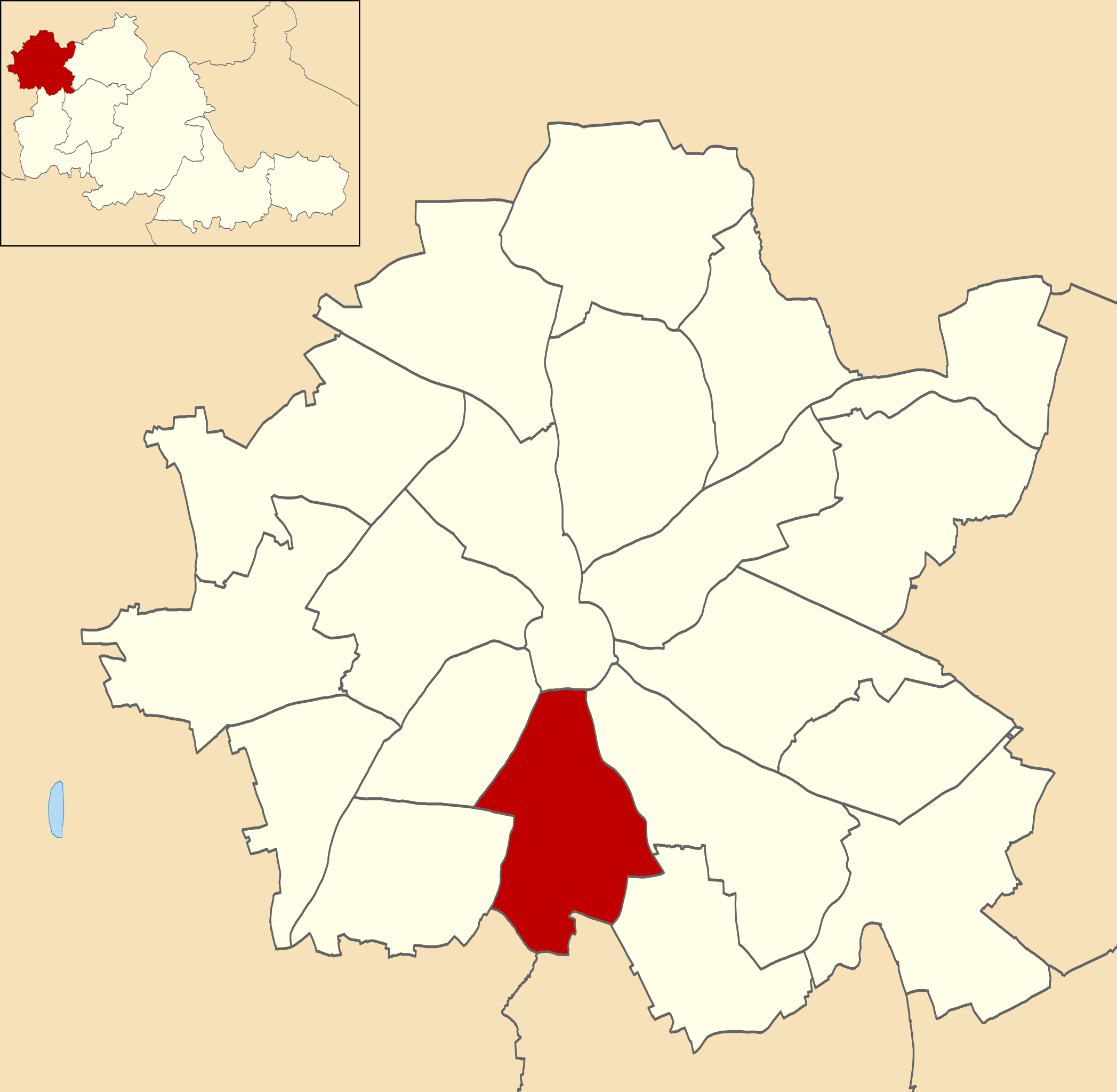
Blakenhall

Blakenhall is a suburb and ward in Wolverhampton, England. The population was 12,614 at the 2021 census. == Toponymy and history == Blakenhall's name,...

Dudley Road

Dudley Road was a football ground in Wolverhampton in England. It was the home ground of Wolverhampton Wanderers between 1881 and 1889, and was used during...

Graiseley

Graiseley is both an inner-city area of Wolverhampton, situated immediately to the south-west of the city centre, and the name of a ward of Wolverhampton...

Penn Fields

Penn Fields is an area to the south west of the City of Wolverhampton, West Midlands, within the Graiseley ward. It lies on the western side of Penn Road...

Carmelite Monastery, Wolverhampton

Carmelite Monastery, Wolverhampton is a monastic house at Poplar Road, Penn Fields, Wolverhampton, in the West Midlands, England. It was founded in 1922...

Nearby Amenities

Located within 500m of 52.57072,-2.134236
Crossing
Crossing: uncontrolled
Lat/Long: 52.5751039/-2.1346875
Turning Circle
Source: bing
Lat/Long: 52.5703165/-2.1359834
Turning Circle
Source: bing
Lat/Long: 52.567044/-2.1322736
Bus Stop
Lower Villiers St / Sedgley St
Bus: yes
Naptan AtcoCode: 43000724701
Naptan Bearing: N
Naptan BusStopType: MKD
Naptan CommonName: Sedgley St
Naptan Indicator: opp
Naptan NaptanCode: nwmjgmgj
Naptan PlusbusZoneRef: BHAMNWS
Naptan Status: ACT
Naptan StopType: BCT
Naptan Street: LOWER VILLIERS ST
Naptan Towards: Wolverhampton
Naptan Verified: no
Public Transport: platform
Route Ref: 27;27A
Source: WMCA
Lat/Long: 52.5732469/-2.1293635
Bus Stop
Lower Villiers St / Sedgley St
Bus: yes
Naptan AtcoCode: 43000724702
Naptan Bearing: S
Naptan BusStopType: MKD
Naptan CommonName: Sedgley St
Naptan Indicator: adj
Naptan NaptanCode: nwmjgmgm
Naptan PlusbusZoneRef: BHAMNWS
Naptan Status: ACT
Naptan StopType: BCT
Naptan Street: LOWER VILLIERS ST
Naptan Towards: Goldthorn Park
Naptan Verified: no
Public Transport: platform
Route Ref: 27;27A
Source: WMCA
Lat/Long: 52.5733011/-2.1292014
Bus Stop
Ednam Rd / Goldthorne Hill Rd
Bus: yes
Naptan AtcoCode: 43000729701
Naptan Bearing: N
Naptan BusStopType: MKD
Naptan CommonName: Goldthorne Hill Rd
Naptan Indicator: before
Naptan NaptanCode: nwmjgptd
Naptan PlusbusZoneRef: BHAMNWS
Naptan Status: ACT
Naptan StopType: BCT
Naptan Street: EDNAM RD
Naptan Towards: Wolverhampton
Naptan Verified: no
Public Transport: platform
Route Ref: 25;26A;27;27A;61
Source: WMCA
Lat/Long: 52.5673302/-2.1305559
Bus Stop
Ednam Rd / Goldthorne Hill Rd
Bus: yes
Naptan AtcoCode: 43000729702
Naptan Bearing: S
Naptan BusStopType: MKD
Naptan CommonName: Goldthorne Hill Rd
Naptan Indicator: after
Naptan NaptanCode: nwmjgptg
Naptan PlusbusZoneRef: BHAMNWS
Naptan Status: ACT
Naptan StopType: BCT
Naptan Street: EDNAM RD
Naptan Towards: Bilston, Sedgley
Naptan Verified: no
Public Transport: platform
Route Ref: 25;26A;27;27A;61
Source: WMCA
Lat/Long: 52.5672764/-2.1303639
Bus Stop
Upper Villiers St / Goldthorn Hill Rd
NaPTANAreaCode: 43000729901
Bus: yes
Naptan AtcoCode: 43000729901
Naptan Bearing: N
Naptan BusStopType: MKD
Naptan CommonName: Goldthorn Hill Rd
Naptan Indicator: adj
Naptan NaptanCode: nwmjgptp
Naptan PlusbusZoneRef: BHAMNWS
Naptan Status: ACT
Naptan StopType: BCT
Naptan Street: UPPER VILLIERS ST
Naptan Towards: Wolverhampton
Naptan Verified: no
Public Transport: platform
Route Ref: 25;26A;27;27A
Shelter: yes
Shelter Ref: 102944
Source: WMCA
Lat/Long: 52.5687556/-2.1340864
Bus Stop
Upper Villiers St / Goldthorn Hill Rd
Bus: yes
Naptan AtcoCode: 43000729902
Naptan Bearing: S
Naptan BusStopType: MKD
Naptan CommonName: Goldthorn Hill Rd
Naptan Indicator: opp
Naptan NaptanCode: nwmjgptw
Naptan PlusbusZoneRef: BHAMNWS
Naptan Status: ACT
Naptan StopType: BCT
Naptan Street: UPPER VILLIERS ST
Naptan Towards: Goldthorn Park
Naptan Verified: no
Public Transport: platform
Route Ref: 25;26A;27;27A
Source: WMCA
Lat/Long: 52.5684229/-2.1341739
Bus Stop
Penn Rd / Marston Road
NaPTANAreaCode: 43000730302
Asset Ref: 102948
Bus: yes
Naptan AtcoCode: 43000730302
Naptan Bearing: SW
Naptan BusStopType: MKD
Naptan CommonName: Oaklands Rd
Naptan Indicator: opp
Naptan NaptanCode: nwmjgpwt
Naptan PlusbusZoneRef: BHAMNWS
Naptan Status: ACT
Naptan StopType: BCT
Naptan Street: PENN RD
Naptan Towards: Penn
Public Transport: platform
Route Ref: 64;255;256
Shelter: yes
Shelter Ref: 102948
Source: WMCA
Lat/Long: 52.574704/-2.1367607
Bus Stop
Penn Rd / Goldthorn Rd
Bench: no
Bin: no
Bus: yes
Mapillary: 724220341629640
Naptan AtcoCode: 43000730401
Naptan Bearing: NE
Naptan BusStopType: MKD
Naptan CommonName: Goldthorn Rd
Naptan Indicator: opp
Naptan NaptanCode: nwmjgtag
Naptan PlusbusZoneRef: BHAMNWS
Naptan Status: ACT
Naptan StopType: BCT
Naptan Street: PENN RD
Naptan Towards: Wolverhampton
Naptan Verified: no
Public Transport: platform
Route Ref: 64;255;256
Shelter: no
Source: WMCA
Survey Date: 2021-06-24
Lat/Long: 52.5723903/-2.1395423
Bus Stop
Penn Rd / Goldthorn Rd
Bus: yes
Naptan AtcoCode: 43000730402
Naptan Bearing: SW
Naptan BusStopType: MKD
Naptan CommonName: Goldthorn Rd
Naptan Indicator: adj
Naptan NaptanCode: nwmjgtaj
Naptan PlusbusZoneRef: BHAMNWS
Naptan Status: ACT
Naptan StopType: BCT
Naptan Street: PENN RD
Naptan Towards: Penn
Naptan Verified: no
Public Transport: platform
Route Ref: 64;255;256
Source: WMCA
Lat/Long: 52.5731648/-2.1383643
Bus Stop
Penn Rd / Stubbs Rd
NaPTANAreaCode: 43000730502
Bus: yes
Naptan AtcoCode: 43000730502
Naptan Bearing: SW
Naptan BusStopType: MKD
Naptan CommonName: Stubbs Rd
Naptan Indicator: opp
Naptan NaptanCode: nwmjgtdj
Naptan PlusbusZoneRef: BHAMNWS
Naptan Status: ACT
Naptan StopType: BCT
Naptan Street: PENN RD
Naptan Towards: Penn
Naptan Verified: no
Public Transport: platform
Route Ref: 64;255;256
Shelter: yes
Shelter Ref: 102949
Source: WMCA
Lat/Long: 52.5704821/-2.1415133
Bus Stop
Marston Rd / Stanford Rd
Bus: yes
Naptan AtcoCode: 43000730701
Naptan Bearing: E
Naptan BusStopType: MKD
Naptan CommonName: Stanford Rd
Naptan Indicator: adj
Naptan NaptanCode: nwmjgtdt
Naptan PlusbusZoneRef: BHAMNWS
Naptan Status: ACT
Naptan StopType: BCT
Naptan Street: MARSTON RD
Naptan Towards: Goldthorn Park
Naptan Verified: no
Public Transport: platform
Route Ref: 25;26A
Source: WMCA
Lat/Long: 52.5741421/-2.1328633
Bus Stop
Marston Rd / Stanford Rd
Bus: yes
Naptan AtcoCode: 43000730702
Naptan Bearing: W
Naptan BusStopType: MKD
Naptan CommonName: Stanford Rd
Naptan Indicator: opp
Naptan NaptanCode: nwmjgtdw
Naptan PlusbusZoneRef: BHAMNWS
Naptan Status: ACT
Naptan StopType: BCT
Naptan Street: MARSTON RD
Naptan Towards: Wolverhampton
Naptan Verified: no
Public Transport: platform
Route Ref: 25;26A
Source: WMCA
Lat/Long: 52.5740432/-2.132863
Bus Stop
Upper Villiers St / Sunbeam Street
Bus: yes
Naptan AtcoCode: 43000730801
Naptan Bearing: NE
Naptan BusStopType: MKD
Naptan NaptanCode: nwmjgtga
Naptan PlusbusZoneRef: BHAMNWS
Naptan Status: ACT
Naptan StopType: BCT
Naptan Street: UPPER VILLIERS ST
Naptan Towards: Wolverhampton
Naptan Verified: no
Public Transport: platform
Route Ref: 25;26A;27;27A
Source: WMCA
Lat/Long: 52.5719868/-2.1307173
Bus Stop
Upper Villiers St / Sunbeam Street
Bus: yes
Naptan AtcoCode: 43000730802
Naptan Bearing: SW
Naptan BusStopType: MKD
Naptan NaptanCode: nwmjgtgd
Naptan PlusbusZoneRef: BHAMNWS
Naptan Status: ACT
Naptan StopType: BCT
Naptan Street: UPPER VILLIERS ST
Naptan Towards: Goldthorn Park
Naptan Verified: no
Public Transport: platform
Route Ref: 25;26A;27;27A
Source: WMCA
Lat/Long: 52.5713836/-2.1315123
Bus Stop
Upper Villiers St / Chetwynd Rd
Bus: yes
Naptan AtcoCode: 43000730901
Naptan Bearing: N
Naptan BusStopType: MKD
Naptan CommonName: Chetwynd Rd
Naptan Indicator: adj
Naptan NaptanCode: nwmjgtgj
Naptan PlusbusZoneRef: BHAMNWS
Naptan Status: ACT
Naptan StopType: BCT
Naptan Street: UPPER VILLIERS ST
Naptan Towards: Wolverhampton
Naptan Verified: no
Public Transport: platform
Route Ref: 25;26A;27;27A
Source: WMCA
Lat/Long: 52.5698353/-2.133352
Bus Stop
Upper Villiers St / Chetwynd Rd
Bus: yes
Naptan AtcoCode: 43000730902
Naptan Bearing: S
Naptan BusStopType: MKD
Naptan CommonName: Chetwynd Rd
Naptan Indicator: opp
Naptan NaptanCode: nwmjgtgm
Naptan PlusbusZoneRef: BHAMNWS
Naptan Status: ACT
Naptan StopType: BCT
Naptan Street: UPPER VILLIERS ST
Naptan Towards: Goldthorn Park
Naptan Verified: no
Public Transport: platform
Route Ref: 25;26A;27;27A
Source: WMCA
Lat/Long: 52.5695925/-2.1333512
Bus Stop
Marston Rd / Industrial Estates
Bus: yes
Naptan AtcoCode: 43004841501
Naptan Bearing: NW
Naptan BusStopType: MKD
Naptan CommonName: Industrial Estates
Naptan Indicator: adj
Naptan NaptanCode: nwmtmajd
Naptan PlusbusZoneRef: BHAMNWS
Naptan Status: ACT
Naptan StopType: BCT
Naptan Street: MARSTON RD
Naptan Towards: Wolverhampton
Naptan Verified: no
Public Transport: platform
Route Ref: 25;26A
Source: WMCA
Lat/Long: 52.5734696/-2.1312677
Bus Stop
Marston Rd / Industrial Estates
Bus: yes
Naptan AtcoCode: 43004841502
Naptan Bearing: SE
Naptan BusStopType: MKD
Naptan CommonName: Industrial Estates
Naptan Indicator: opp
Naptan NaptanCode: nwmtmajg
Naptan PlusbusZoneRef: BHAMNWS
Naptan Status: ACT
Naptan StopType: BCT
Naptan Street: MARSTON RD
Naptan Towards: Goldthorn Park
Naptan Verified: no
Public Transport: platform
Route Ref: 25;26A
Source: WMCA
Lat/Long: 52.5735506/-2.1312089
Bus Stop
Goldthorn Hill / Deborah Close
Bus: yes
Naptan AtcoCode: 43004841601
Naptan Bearing: E
Naptan BusStopType: MKD
Naptan CommonName: Deborah Close
Naptan Indicator: before
Naptan NaptanCode: nwmtmajm
Naptan PlusbusZoneRef: BHAMNWS
Naptan Status: ACT
Naptan StopType: BCT
Naptan Street: GOLDTHORN HILL
Naptan Towards: Wolverhampton
Naptan Verified: no
Public Transport: platform
Route Ref: 61
Source: WMCA
Lat/Long: 52.567528/-2.1293003
Bus Stop
Goldthorn Hill / Park St South
Bus: yes
Naptan AtcoCode: 43004841602
Naptan Bearing: W
Naptan BusStopType: MKD
Naptan CommonName: Deborah Close
Naptan Indicator: after
Naptan NaptanCode: nwmtmajp
Naptan PlusbusZoneRef: BHAMNWS
Naptan Status: ACT
Naptan StopType: BCT
Naptan Street: GOLDTHORN HILL
Naptan Towards: Goldthorn Park
Naptan Verified: no
Public Transport: platform
Route Ref: 61
Source: WMCA
Lat/Long: 52.5674417/-2.1293127
Bus Stop
Marston Rd / Oaklands Rd
Bus: yes
Naptan AtcoCode: 43007305303
Naptan Bearing: SE
Naptan BusStopType: MKD
Naptan CommonName: Oaklands Rd
Naptan Indicator: after
Naptan Landmark: Ambulance Station
Naptan NaptanCode: nwmpmgjt
Naptan PlusbusZoneRef: BHAMNWS
Naptan Status: ACT
Naptan StopType: BCT
Naptan Street: MARSTON RD
Naptan Towards: Goldthorn Park
Naptan Verified: no
Public Transport: platform
Route Ref: 25;26A
Source: WMCA
Lat/Long: 52.5749482/-2.1355367
Turning Circle
Source: bing
Lat/Long: 52.5665872/-2.1332507
Turning Circle
Lat/Long: 52.5737121/-2.1304501
Turning Circle
Source: bing
Lat/Long: 52.574859/-2.1330654
Goldthorn Hill
Is In: Wolverhampton
Place: village
Source: OS_OpenData_StreetView
Lat/Long: 52.5690522/-2.1388773
Post Office
Blakenhall Post Office
Addr City: Wolverhampton
Addr Housenumber: 88
Addr Postcode: WV2 4NX
Addr Street: Upper Villiers Street
Opening Hours: Mo-We 07:30-17:30; Th 07:30-17:00; Fr 07:00-17:30; Sa 07:30-12:30
Ref Pol Id: 6482
Source: OS OpenData StreetView
Lat/Long: 52.5692756/-2.1338696
Crossing
Crossing: traffic_signals
Crossing Ref: toucan
Source: survey
Lat/Long: 52.5678002/-2.1351628
Stop
Source: survey
Lat/Long: 52.567836/-2.1346679
Man Made: tower
Operator: Western Power Distribution
Source: survey
Tower Type: communication
Lat/Long: 52.5685082/-2.1336157
Post Box
Post Box Type: pillar
Ref: WV2 182
Royal Cypher: EIIR
Royal Cypher Wikidata: Q33102113
Source: survey
Lat/Long: 52.5692622/-2.1337301
Fountain
Heritage: 2
Heritage Operator: Historic England
Listed Status: Grade II
Source: visual survey;bing
Lat/Long: 52.5724497/-2.1387761
Barrier: bollard
Source: survey
Lat/Long: 52.5727469/-2.1375586
Bench
Source: survey
Lat/Long: 52.5732271/-2.137869
Barrier: bollard
Source: survey
Lat/Long: 52.573586/-2.1379966
Speed Camera
Source: survey
Lat/Long: 52.5748812/-2.1369662
Source: bing
Traffic Calming: bump
Lat/Long: 52.5685331/-2.1297432
Post Box
Post Box Type: pillar
Ref: WV2 313
Royal Cypher: EIIR
Royal Cypher Wikidata: Q33102113
Source: survey
Lat/Long: 52.5738895/-2.1320302
Speed Camera
Source: survey
Lat/Long: 52.5742444/-2.1371763
Blue Plaque: Moorfield Works
Tourism: artwork
Lat/Long: 52.5717524/-2.1312153
Wolves Cartoon
Source: survey
Tourism: artwork
Lat/Long: 52.5726735/-2.1296497
Source: survey
Tourism: artwork
Lat/Long: 52.5725052/-2.1364344
Defibrillator
Defibrillator Location: On outside wall of Goldthorn Hotel, facing Penn Road
Emergency: defibrillator
Source: West Midlands Ambulance Service FOI request
Lat/Long: 52.5748492/-2.1371032
Man Made: mast
Tower Construction: mast
Tower Type: tower
Lat/Long: 52.5685544/-2.1334054
The Threading Room
Addr City: Wolverhampton
Addr Housename: Threading Room
Addr Housenumber: 89
Addr Postcode: WV2 4NX
Addr Street: Upper Villiers Street
Operator: Threading room
Shop: beauty
Lat/Long: 52.5693653/-2.1337108
Upper Villiers Mini Market
Addr City: Wolverhampton
Addr Country: GB
Addr Housenumber: 90
Addr Postcode: WV2 4NX
Addr Street: Upper Villiers Street
Fhrs Id: 1068718
Shop: supermarket
Lat/Long: 52.569429/-2.1336524
Fast Food
Villiers Street Chippy
Cuisine: fish_and_chips
Delivery: no
Takeaway: only
Lat/Long: 52.5692269/-2.1338638
Shop: alcohol
Lat/Long: 52.5688312/-2.1342152
Shop: beauty
Lat/Long: 52.5690177/-2.1340073
Generator Method: photovoltaic
Generator Output Electricity: yes
Generator Source: solar
Generator Type: solar_photovoltaic_panel
Location: roof
Power: generator
Lat/Long: 52.5694431/-2.1355158
Generator Method: photovoltaic
Generator Output Electricity: yes
Generator Source: solar
Generator Type: solar_photovoltaic_panel
Location: roof
Power: generator
Lat/Long: 52.5694317/-2.1354327
Generator Method: photovoltaic
Generator Output Electricity: yes
Generator Source: solar
Generator Type: solar_photovoltaic_panel
Location: roof
Power: generator
Lat/Long: 52.5676596/-2.1375918
Traffic Calming: hump
Lat/Long: 52.5714056/-2.1409528
Generator Method: photovoltaic
Generator Output Electricity: yes
Generator Source: solar
Generator Type: solar_photovoltaic_panel
Location: roof
Power: generator
Lat/Long: 52.5696453/-2.1336463
Generator Method: photovoltaic
Generator Output Electricity: yes
Generator Source: solar
Generator Type: solar_photovoltaic_panel
Location: roof
Power: generator
Lat/Long: 52.5681079/-2.1303231
Generator Method: photovoltaic
Generator Output Electricity: yes
Generator Source: solar
Generator Type: solar_photovoltaic_panel
Location: roof
Power: generator
Lat/Long: 52.5684894/-2.1302319
Generator Method: photovoltaic
Generator Output Electricity: yes
Generator Source: solar
Generator Type: solar_photovoltaic_panel
Location: roof
Power: generator
Lat/Long: 52.5709886/-2.1275201
Generator Method: photovoltaic
Generator Output Electricity: yes
Generator Source: solar
Generator Type: solar_photovoltaic_panel
Location: roof
Power: generator
Lat/Long: 52.5710285/-2.1275362
Generator Method: photovoltaic
Generator Output Electricity: yes
Generator Source: solar
Generator Type: solar_photovoltaic_panel
Location: roof
Power: generator
Lat/Long: 52.5711157/-2.1275657
Generator Method: photovoltaic
Generator Output Electricity: yes
Generator Source: solar
Generator Type: solar_photovoltaic_panel
Location: roof
Power: generator
Lat/Long: 52.5711655/-2.1275926
Generator Method: photovoltaic
Generator Output Electricity: yes
Generator Source: solar
Generator Type: solar_photovoltaic_panel
Location: roof
Power: generator
Lat/Long: 52.5713032/-2.1276462
Generator Method: photovoltaic
Generator Output Electricity: yes
Generator Source: solar
Generator Type: solar_photovoltaic_panel
Location: roof
Power: generator
Lat/Long: 52.5712836/-2.1275362
Generator Method: photovoltaic
Generator Output Electricity: yes
Generator Source: solar
Generator Type: solar_photovoltaic_panel
Location: roof
Power: generator
Lat/Long: 52.5712951/-2.1274799
Generator Method: photovoltaic
Generator Output Electricity: yes
Generator Source: solar
Generator Type: solar_photovoltaic_panel
Location: roof
Power: generator
Lat/Long: 52.5713114/-2.127374
Generator Method: photovoltaic
Generator Output Electricity: yes
Generator Source: solar
Generator Type: solar_photovoltaic_panel
Location: roof
Power: generator
Lat/Long: 52.5713171/-2.1273203
Generator Method: photovoltaic
Generator Output Electricity: yes
Generator Source: solar
Generator Type: solar_photovoltaic_panel
Location: roof
Power: generator
Lat/Long: 52.5713358/-2.1272318
Generator Method: photovoltaic
Generator Output Electricity: yes
Generator Source: solar
Generator Type: solar_photovoltaic_panel
Location: roof
Power: generator
Lat/Long: 52.571348/-2.1271768
Generator Method: photovoltaic
Generator Output Electricity: yes
Generator Source: solar
Generator Type: solar_photovoltaic_panel
Location: roof
Power: generator
Lat/Long: 52.5713806/-2.1270266
Generator Method: photovoltaic
Generator Output Electricity: yes
Generator Source: solar
Generator Type: solar_photovoltaic_panel
Location: roof
Power: generator
Lat/Long: 52.571392/-2.1269475
Generator Method: photovoltaic
Generator Output Electricity: yes
Generator Source: solar
Generator Type: solar_photovoltaic_panel
Location: roof
Power: generator
Lat/Long: 52.5715803/-2.1270789
Generator Method: photovoltaic
Generator Output Electricity: yes
Generator Source: solar
Generator Type: solar_photovoltaic_panel
Location: roof
Power: generator
Lat/Long: 52.5716195/-2.1270964
Generator Method: photovoltaic
Generator Output Electricity: yes
Generator Source: solar
Generator Type: solar_photovoltaic_panel
Location: roof
Power: generator
Lat/Long: 52.5716749/-2.1271312
Generator Method: photovoltaic
Generator Output Electricity: yes
Generator Source: solar
Generator Type: solar_photovoltaic_panel
Location: roof
Power: generator
Lat/Long: 52.5717083/-2.1271433
Generator Method: photovoltaic
Generator Output Electricity: yes
Generator Source: solar
Generator Type: solar_photovoltaic_panel
Location: roof
Power: generator
Lat/Long: 52.5717727/-2.1271715
Generator Method: photovoltaic
Generator Output Electricity: yes
Generator Source: solar
Generator Type: solar_photovoltaic_panel
Location: roof
Power: generator
Lat/Long: 52.5718566/-2.1272157
Generator Method: photovoltaic
Generator Output Electricity: yes
Generator Source: solar
Generator Type: solar_photovoltaic_panel
Location: roof
Power: generator
Lat/Long: 52.571917/-2.1272278
Generator Method: photovoltaic
Generator Output Electricity: yes
Generator Source: solar
Generator Type: solar_photovoltaic_panel
Location: roof
Power: generator
Lat/Long: 52.5719553/-2.1272573
Generator Method: photovoltaic
Generator Output Electricity: yes
Generator Source: solar
Generator Type: solar_photovoltaic_panel
Location: roof
Power: generator
Lat/Long: 52.5720107/-2.1272935
Generator Method: photovoltaic
Generator Output Electricity: yes
Generator Source: solar
Generator Type: solar_photovoltaic_panel
Location: roof
Power: generator
Lat/Long: 52.5720482/-2.1273096
Generator Method: photovoltaic
Generator Output Electricity: yes
Generator Source: solar
Generator Type: solar_photovoltaic_panel
Location: roof
Power: generator
Lat/Long: 52.5700675/-2.1269515
Generator Method: photovoltaic
Generator Output Electricity: yes
Generator Source: solar
Generator Type: solar_photovoltaic_panel
Location: roof
Power: generator
Lat/Long: 52.5702925/-2.1371292
Generator Method: photovoltaic
Generator Output Electricity: yes
Generator Source: solar
Generator Type: solar_photovoltaic_panel
Location: roof
Power: generator
Lat/Long: 52.5683248/-2.1398637
Bicycle Rental
Marston Road
Capacity: 9
Email: support@beryl.cc
Fee: yes
Network: West Midlands Cycle Hire
Network Regional: Starley
Official Name: Marston Road
Operator: Beryl
Operator Wikidata: Q106575369
Payment App: yes
Payment Cash: no
Payment Credit Cards: no
Payment Cryptocurrencies: no
Payment Debit Cards: no
Payment Electronic Purses: no
Phone: +44 20 3003 5044
Ref Gbfs: beryl_west_midlands:2639
Ref Wmch: 222
Rental: city_bike;ebike
Source: tfwm/serco
Website: https://beryl.cc/scheme/west-midlands
Lat/Long: 52.5745145/-2.1344161
The data included in this document is from www.openstreetmap.org. The data is made available under ODbL.

Have you been to Blakenhall?

Leave your review of Blakenhall below (or comments, questions and feedback).