Shrewley
Settlement in Warwickshire Warwick
England
Shrewley
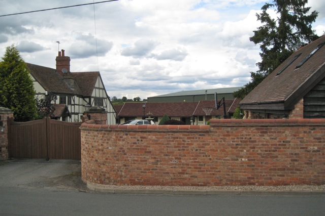
Shrewley is a small village located in the county of Warwickshire, England. Situated approximately 6 miles southeast of Warwick and 3 miles northwest of the town of Kenilworth, it falls within the district of Stratford-on-Avon. Shrewley is a rural settlement surrounded by picturesque countryside, offering a peaceful and idyllic setting.
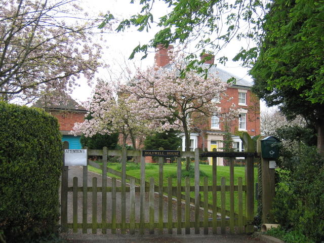
The village is primarily residential and has a population of around 400 inhabitants. It is known for its charming and traditional architecture, with many of the houses dating back to the 18th and 19th centuries. The village center features a few local amenities, including a pub, a post office, and a village hall, which serves as a community hub for various social activities and events.
Shrewley benefits from its proximity to the Grand Union Canal, which runs through the village. This provides opportunities for leisurely walks, cycling, and boating, attracting visitors from nearby areas. The surrounding countryside also offers many scenic trails and pathways, making it a popular destination for outdoor enthusiasts.
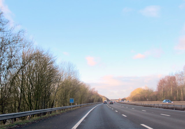
Transport links in Shrewley are convenient, with easy access to major roads like the A4177 and A452. The closest railway station is Warwick Parkway, providing connections to Birmingham, London, and other major cities.
Overall, Shrewley is a charming and quiet village, offering a retreat from the hustle and bustle of nearby urban areas. With its beautiful countryside, historic architecture, and community spirit, it presents an appealing destination for both residents and visitors alike.
If you have any feedback on the listing, please let us know in the comments section below.
Shrewley Images
Images are sourced within 2km of 52.30486/-1.685494 or Grid Reference SP2167. Thanks to Geograph Open Source API. All images are credited.


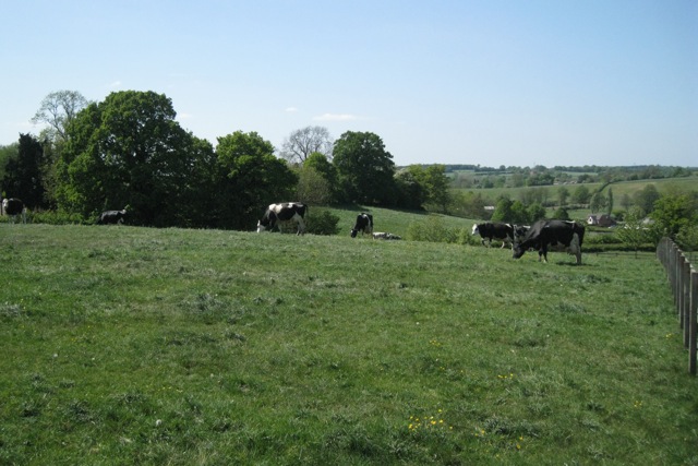
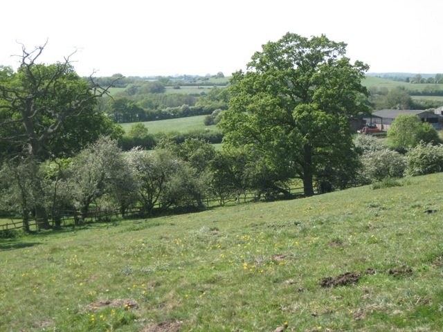
![Hawthorns in flower below High Cross “Ancient Arden is the most extensive Arden landscape and forms the core of ancient countryside in Warwickshire. It is a small-scale, intricate landscape with many low rounded hills, steep scarps and small incised valleys. Landform is rarely dominant but in places is emphasised by hilltop woodlands and wooded scarps… Characteristic features include: a varied undulating topography; many winding brooks and small rivers; a close network of winding lanes, tracks and paths, often confined by tall hedgebanks; an ancient irregular pattern of small to medium-sized fields; hedgerow and roadside oaks and small woodlands, resulting in short views and a sense of enclosure; field ponds associated with permanent pasture; dispersed settlement: hamlets centred on farms; wayside cottages; few villages; and many place names ending in Green or End.
“The region known as Arden is an area of former wood pasture and ancient farmlands lying [mainly] on the eastern side of the Birmingham plateau.” Roughly speaking it is bounded by the rivers Tame and Anker in the north and the Warwickshire Avon in the south, although Arden-type landscapes extend into northeast Worcestershire and the former West Midlands county. “Although there are few dramatic physical features, the Arden countryside has an intimate, historic character with a strong sense of unity. Brick and timber are the chief building materials throughout the area [in the countryside, not the urban intrusions] and the many farmsteads and hamlets blend subtly with their surroundings. This is Shakespeare’s ‘Forest of Arden’, historically a region of woodlands and ‘waste’ which remains today [in 1993] one of the more wooded parts of the Midlands.
“The name Arden is derived from the old British word ‘Ardu’ meaning ‘high land’. This relates primarily to the northern and central parts of the region which lie across the main Severn-Trent watershed… Agriculturally Arden may have originally served as an area of seasonal pasture for the more intensively developed Feldon [felden] estates to the south [of the Avon]. However, permanent pastoral settlements were established at an early date. The resulting clearances were farmed as small hedged enclosures or ‘closes’ which created a characteristic pattern of small irregular fields.”
Even where enclosure, emparkment, industry, transport, mining, suburban and other development have taken place the original character may still be felt. Place names ending in Heath and Common, as well as Green and End, occur throughout the suburbs of Birmingham, Coventry, Solihull and Redditch, and are a reminder of Arden's original extent. More recent urban and suburban landscapes are enriched by the ancient oaks and hollies, timber-framed houses and fragments of woodland and pasture that survive in their midst.
Extracts in double quotes are from ‘Warwickshire Landscapes Guidelines: Arden’, Warwickshire County Council, 1993.](https://s1.geograph.org.uk/geophotos/02/45/22/2452289_0d647df8.jpg)
![Meadow below Holywell Wood, High Cross “Ancient Arden is the most extensive Arden landscape and forms the core of ancient countryside in Warwickshire. It is a small-scale, intricate landscape with many low rounded hills, steep scarps and small incised valleys. Landform is rarely dominant but in places is emphasised by hilltop woodlands and wooded scarps… Characteristic features include: a varied undulating topography; many winding brooks and small rivers; a close network of winding lanes, tracks and paths, often confined by tall hedgebanks; an ancient irregular pattern of small to medium-sized fields; hedgerow and roadside oaks and small woodlands, resulting in short views and a sense of enclosure; field ponds associated with permanent pasture; dispersed settlement: hamlets centred on farms; wayside cottages; few villages; and many place names ending in Green or End.
“The region known as Arden is an area of former wood pasture and ancient farmlands lying [mainly] on the eastern side of the Birmingham plateau.” Roughly speaking it is bounded by the rivers Tame and Anker in the north and the Warwickshire Avon in the south, although Arden-type landscapes extend into northeast Worcestershire and the former West Midlands county. “Although there are few dramatic physical features, the Arden countryside has an intimate, historic character with a strong sense of unity. Brick and timber are the chief building materials throughout the area [in the countryside, not the urban intrusions] and the many farmsteads and hamlets blend subtly with their surroundings. This is Shakespeare’s ‘Forest of Arden’, historically a region of woodlands and ‘waste’ which remains today [in 1993] one of the more wooded parts of the Midlands.
“The name Arden is derived from the old British word ‘Ardu’ meaning ‘high land’. This relates primarily to the northern and central parts of the region which lie across the main Severn-Trent watershed… Agriculturally Arden may have originally served as an area of seasonal pasture for the more intensively developed Feldon [felden] estates to the south [of the Avon]. However, permanent pastoral settlements were established at an early date. The resulting clearances were farmed as small hedged enclosures or ‘closes’ which created a characteristic pattern of small irregular fields.”
Even where enclosure, emparkment, industry, transport, mining, suburban and other development have taken place the original character may still be felt. Place names ending in Heath and Common, as well as Green and End, occur throughout the suburbs of Birmingham, Coventry, Solihull and Redditch, and are a reminder of Arden's original extent. More recent urban and suburban landscapes are enriched by the ancient oaks and hollies, timber-framed houses and fragments of woodland and pasture that survive in their midst.
Extracts in double quotes are from ‘Warwickshire Landscapes Guidelines: Arden’, Warwickshire County Council, 1993.](https://s0.geograph.org.uk/geophotos/02/45/23/2452300_fcfbcc50.jpg)
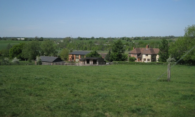
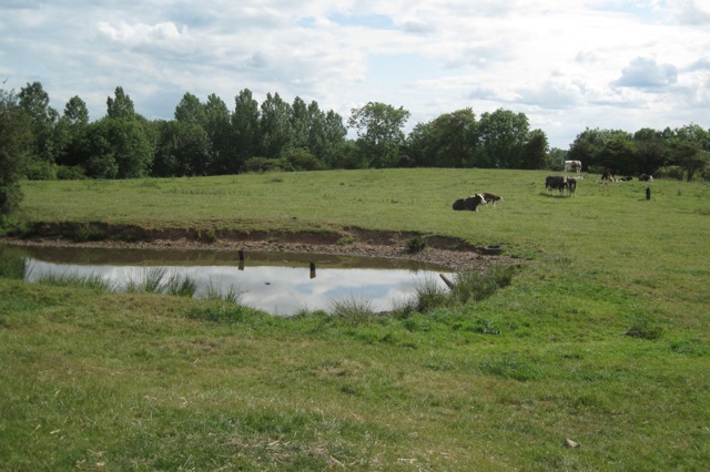
![Fields below High Cross “Ancient Arden is the most extensive Arden landscape and forms the core of ancient countryside in Warwickshire. It is a small-scale, intricate landscape with many low rounded hills, steep scarps and small incised valleys. Landform is rarely dominant but in places is emphasised by hilltop woodlands and wooded scarps… Characteristic features include: a varied undulating topography; many winding brooks and small rivers; a close network of winding lanes, tracks and paths, often confined by tall hedgebanks; an ancient irregular pattern of small to medium-sized fields; hedgerow and roadside oaks and small woodlands, resulting in short views and a sense of enclosure; field ponds associated with permanent pasture; dispersed settlement: hamlets centred on farms; wayside cottages; few villages; and many place names ending in Green or End.
“The region known as Arden is an area of former wood pasture and ancient farmlands lying [mainly] on the eastern side of the Birmingham plateau.” Roughly speaking it is bounded by the rivers Tame and Anker in the north and the Warwickshire Avon in the south, although Arden-type landscapes extend into northeast Worcestershire and the former West Midlands county. “Although there are few dramatic physical features, the Arden countryside has an intimate, historic character with a strong sense of unity. Brick and timber are the chief building materials throughout the area [in the countryside, not the urban intrusions] and the many farmsteads and hamlets blend subtly with their surroundings. This is Shakespeare’s ‘Forest of Arden’, historically a region of woodlands and ‘waste’ which remains today [in 1993] one of the more wooded parts of the Midlands.
“The name Arden is derived from the old British word ‘Ardu’ meaning ‘high land’. This relates primarily to the northern and central parts of the region which lie across the main Severn-Trent watershed… Agriculturally Arden may have originally served as an area of seasonal pasture for the more intensively developed Feldon [felden] estates to the south [of the Avon]. However, permanent pastoral settlements were established at an early date. The resulting clearances were farmed as small hedged enclosures or ‘closes’ which created a characteristic pattern of small irregular fields.”
Even where enclosure, emparkment, industry, transport, mining, suburban and other development have taken place the original character may still be felt. Place names ending in Heath and Common, as well as Green and End, occur throughout the suburbs of Birmingham, Coventry, Solihull and Redditch, and are a reminder of Arden's original extent. More recent urban and suburban landscapes are enriched by the ancient oaks and hollies, timber-framed houses and fragments of woodland and pasture that survive in their midst.
Extracts in double quotes are from ‘Warwickshire Landscapes Guidelines: Arden’, Warwickshire County Council, 1993.](https://s3.geograph.org.uk/geophotos/02/45/23/2452303_0c8ea1a0.jpg)


Shrewley is located at Grid Ref: SP2167 (Lat: 52.30486, Lng: -1.685494)
Administrative County: Warwickshire
District: Warwick
Police Authority: Warwickshire
What 3 Words
///interacts.demotion.duplicity. Near Hatton, Warwickshire
Nearby Locations
Related Wikis

Shrewley
Shrewley is a village and civil parish in Warwickshire, England, about 5 miles north-west of Warwick. It consists of Little Shrewley, and Shrewley Common...
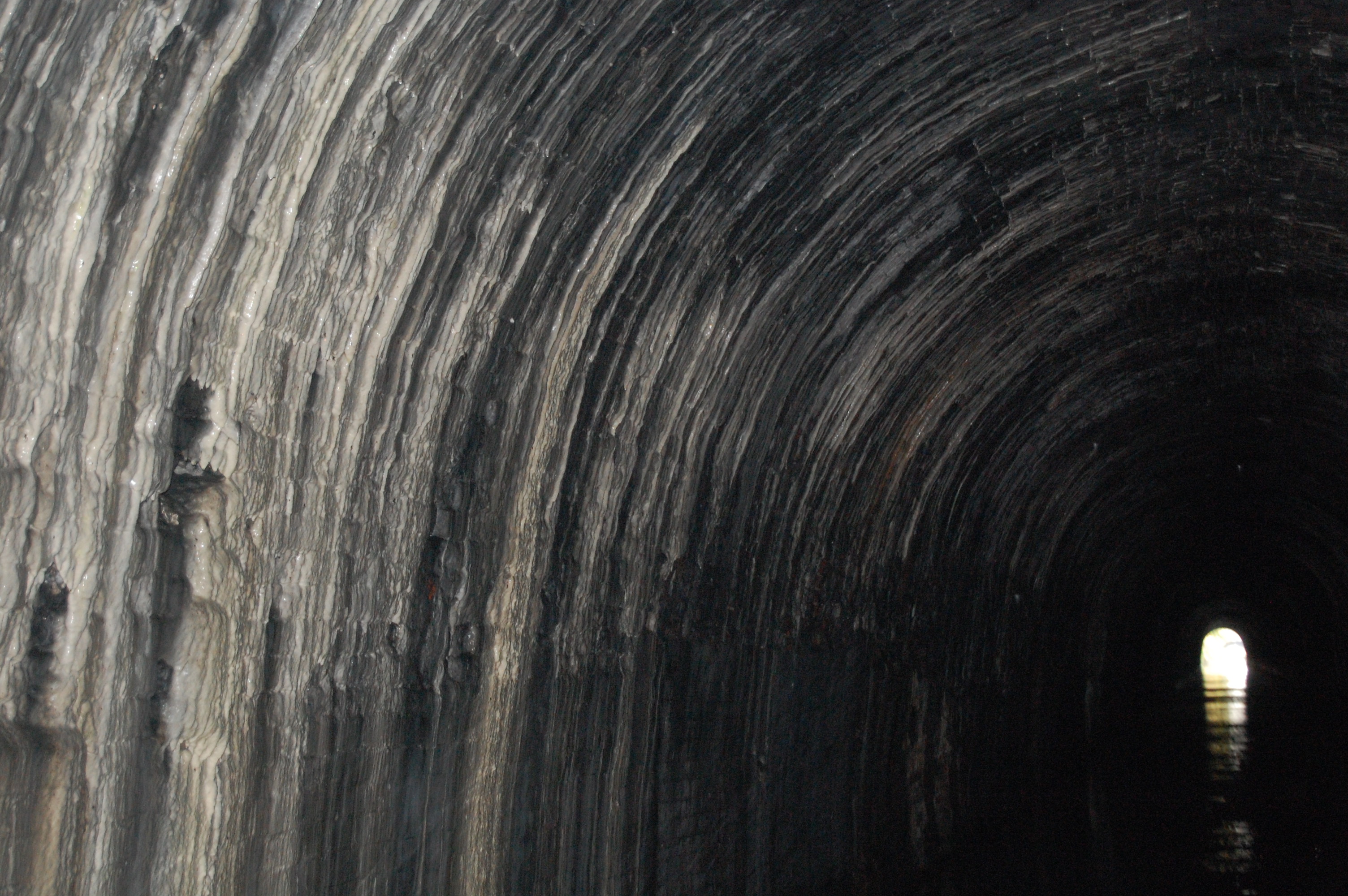
Shrewley Tunnel
Shrewley Tunnel is a canal tunnel near Shrewley, Warwickshire, England, which opened in 1799. It became part of the Grand Union Canal in 1929. == History... ==

Mercia Mudstone Group
The Mercia Mudstone Group is an early Triassic lithostratigraphic group (a sequence of rock strata) which is widespread in Britain, especially in the English...
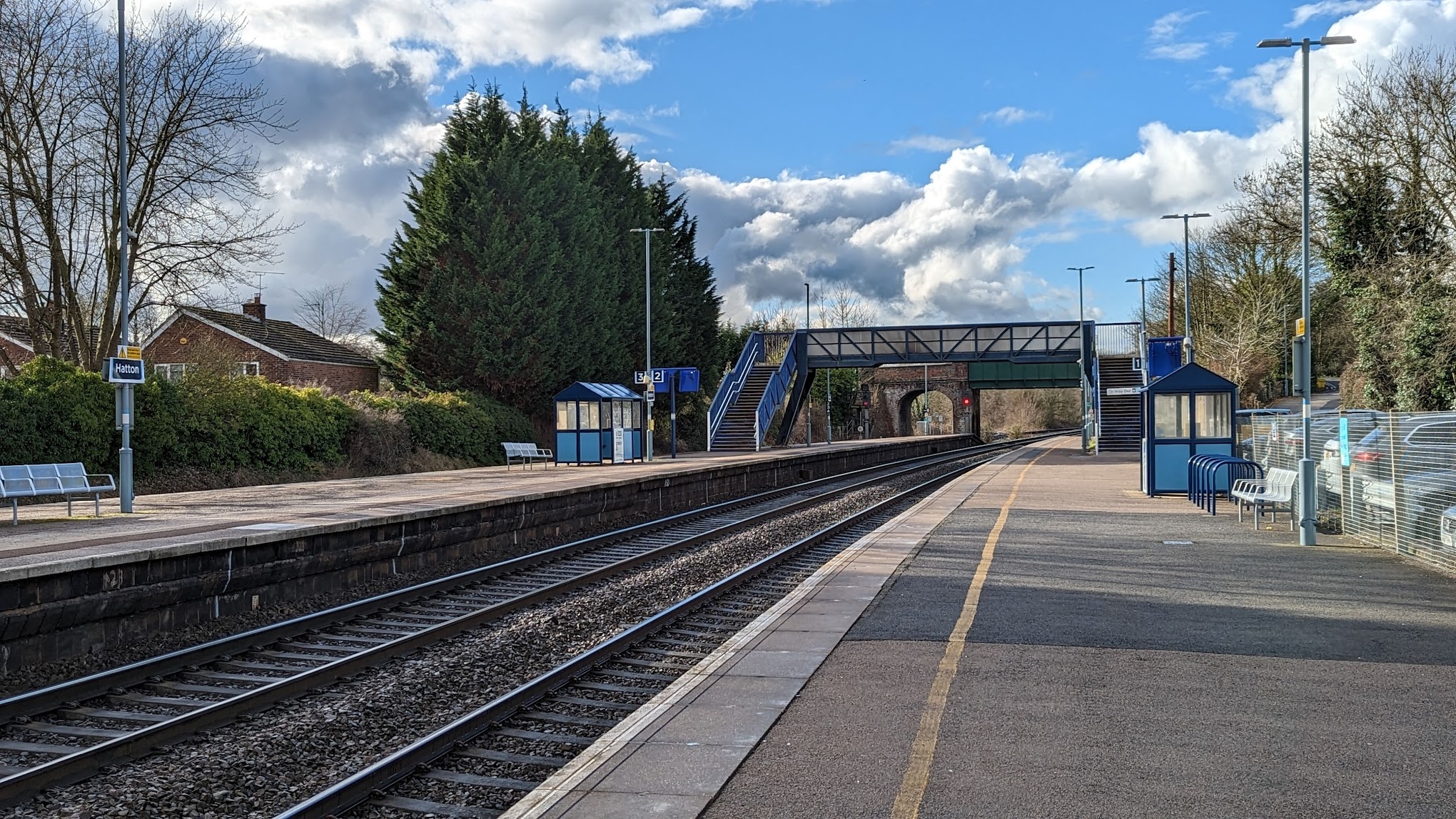
Hatton railway station (England)
Hatton railway station takes the name of the village of Hatton in Warwickshire, England, although it is about 1 mile (1.6 km) from the village. It is situated...
Nearby Amenities
Located within 500m of 52.30486,-1.685494Have you been to Shrewley?
Leave your review of Shrewley below (or comments, questions and feedback).