Shoreham-By-Sea

Settlement in Sussex Adur

England

Shoreham-By-Sea

City of Chichester A hopper dredger built in 1997, seen here about to enter Shoreham Harbour for unloading.
City of Chichester Credit: Ian Capper

Shoreham-By-Sea is a quaint town located in West Sussex, England. Situated on the south coast, it lies approximately 11 kilometers west of Brighton and Hove. With a population of around 21,000, it offers a charming blend of natural beauty, history, and a vibrant community.

The town's prime location makes it a popular destination for both residents and tourists alike. Nestled between the South Downs National Park and the English Channel, Shoreham-By-Sea boasts stunning scenery and breathtaking coastal views. The town is also known for its shingle beach, which is a haven for watersports enthusiasts, including sailing, paddleboarding, and kite surfing.

Steeped in history, Shoreham-By-Sea has a rich maritime heritage. The town's port is one of the oldest in the country and has been a significant trading hub since Roman times. Visitors can explore the historic Shoreham Fort, a 19th-century coastal defense fortification, which offers insight into the town's military past.

In addition to its natural and historical attractions, Shoreham-By-Sea boasts a bustling town center with a variety of shops, cafes, and restaurants. The community is known for its vibrant arts scene, with several galleries and theaters showcasing local talent.

Transport links are excellent, with Shoreham-By-Sea railway station providing regular services to Brighton, London, and other major cities. The town is also well-connected by road, with the A27 passing nearby, offering easy access to neighboring towns and cities.

Overall, Shoreham-By-Sea offers a perfect blend of coastal charm, natural beauty, and a thriving community, making it an ideal place to live or visit.

If you have any feedback on the listing, please let us know in the comments section below.

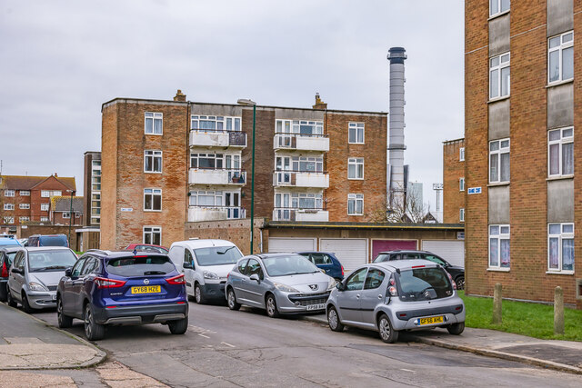
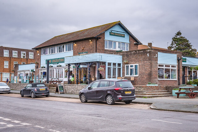
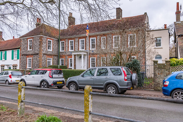
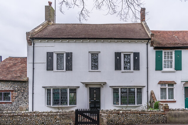
Shoreham-By-Sea Images

Images are sourced within 2km of 50.832852/-0.261112 or Grid Reference TQ2205. Thanks to Geograph Open Source API. All images are credited.

City of Chichester A hopper dredger built in 1997, seen here about to enter Shoreham Harbour for unloading.
City of Chichester
A hopper dredger built in 1997, seen here about to enter Shoreham Harbour for unloading.
Southwick Beach Looking along Southwick Beach towards the East Breakwater at the entrance to Shoreham Harbour.
Southwick Beach
Looking along Southwick Beach towards the East Breakwater at the entrance to Shoreham Harbour.
Southwick Beach Looking along the promenade above Southwick Beach towards the East Breakwater at the entrance to Shoreham Harbour.  On the right are warehouses fronting Shoreham Harbour.
Southwick Beach
Looking along the promenade above Southwick Beach towards the East Breakwater at the entrance to Shoreham Harbour. On the right are warehouses fronting Shoreham Harbour.
Wind turbines A pair of 100kW wind turbines on the promenade above Southwick Beach with the East Breakwater at the entrance to Shoreham Harbour in the background.  Notices on the fence by the turbines state that they have been nicknamed "Spinny" (nearest) and "Gusty" (beyond) following a competition among local schoolchildren after they were installed in 2016.
Wind turbines
A pair of 100kW wind turbines on the promenade above Southwick Beach with the East Breakwater at the entrance to Shoreham Harbour in the background. Notices on the fence by the turbines state that they have been nicknamed "Spinny" (nearest) and "Gusty" (beyond) following a competition among local schoolchildren after they were installed in 2016.
Southwick Beach Looking along Southwick Beach with the two wind turbines providing power to Shoreham Harbour in the right background and the East Breakwater at the entrance to the harbour beyond.
Southwick Beach
Looking along Southwick Beach with the two wind turbines providing power to Shoreham Harbour in the right background and the East Breakwater at the entrance to the harbour beyond.
The Green Looking across the cricket square on The Green.
The Green
Looking across the cricket square on The Green.
The Green Looking across the cricket square on The Green.  The road leading away in the background is Albert Road.
The Green
Looking across the cricket square on The Green. The road leading away in the background is Albert Road.
War Memorial War memorial dating from 1922 to commemorate those from Southwick and Fishersgate who died in the First World War.  Grade II listed - see <span class="nowrap"><a title="https://historicengland.org.uk/listing/the-list/list-entry/1389099?section=official-listing" rel="nofollow ugc noopener" href="https://historicengland.org.uk/listing/the-list/list-entry/1389099?section=official-listing">Link</a><img style="margin-left:2px;" alt="External link" title="External link - shift click to open in new window" src="https://s1.geograph.org.uk/img/external.png" width="10" height="10"/></span>.
War Memorial
War memorial dating from 1922 to commemorate those from Southwick and Fishersgate who died in the First World War. Grade II listed - see LinkExternal link.
Coates Court Housing on Butts Road, facing on to Albion Street, part of the redevelopment of this area in the c.1960s.
Coates Court
Housing on Butts Road, facing on to Albion Street, part of the redevelopment of this area in the c.1960s.
Shoreham Harbour Offices of aggregates group Dudman alongside Shoreham Harbour.
Shoreham Harbour
Offices of aggregates group Dudman alongside Shoreham Harbour.
Shoreham Harbour Wharf on Shoreham Harbour, operated by the aggregates group Dudman.
Shoreham Harbour
Wharf on Shoreham Harbour, operated by the aggregates group Dudman.
Footpath Footpath connecting Albion Street with Basin Road South and Southwick Beach, utilising the lock across Shoreham Harbour.
Footpath
Footpath connecting Albion Street with Basin Road South and Southwick Beach, utilising the lock across Shoreham Harbour.
Southwick Marina Looking from the lock across Shoreham Harbour towards the marina on the north side of the harbour.
Southwick Marina
Looking from the lock across Shoreham Harbour towards the marina on the north side of the harbour.
Albion Wharf Offices of aggregates group Dudman on Albion Street, alongside Shoreham Harbour.
Albion Wharf
Offices of aggregates group Dudman on Albion Street, alongside Shoreham Harbour.
Coates Court Housing on Butts Road, part of the redevelopment of this area in the c.1960s.  In the background is the chimney of Shoreham Power Station, on the other side of Shoreham Harbour.
Coates Court
Housing on Butts Road, part of the redevelopment of this area in the c.1960s. In the background is the chimney of Shoreham Power Station, on the other side of Shoreham Harbour.
The Cricketers Pub at the corner of Southwick Square and The Green, replacing a previous pub of the same name (although originally the Cricketers' Arms) when the area was redeveloped in 1958-61 to form a new centre for Southwick.
The Cricketers
Pub at the corner of Southwick Square and The Green, replacing a previous pub of the same name (although originally the Cricketers' Arms) when the area was redeveloped in 1958-61 to form a new centre for Southwick.
The Hall Early 18th Century house at 47 - 51 The Green.  Grade II* listed - see <span class="nowrap"><a title="https://historicengland.org.uk/listing/the-list/list-entry/1027852?section=official-listing" rel="nofollow ugc noopener" href="https://historicengland.org.uk/listing/the-list/list-entry/1027852?section=official-listing">Link</a><img style="margin-left:2px;" alt="External link" title="External link - shift click to open in new window" src="https://s1.geograph.org.uk/img/external.png" width="10" height="10"/></span>.

Blue plaques either side of the porch read (on the left) "Novelist Travel Writer S P B Mais 1885-1975 Fought for cricket on this green Lived here 1927-1932" and (on the right) "Portrait Landscape Genre Painter Douglas Stannus Gray 1890-1959 Lived here 1939-1959.
The Hall
Early 18th Century house at 47 - 51 The Green. Grade II* listed - see LinkExternal link. Blue plaques either side of the porch read (on the left) "Novelist Travel Writer S P B Mais 1885-1975 Fought for cricket on this green Lived here 1927-1932" and (on the right) "Portrait Landscape Genre Painter Douglas Stannus Gray 1890-1959 Lived here 1939-1959.
41 The Green Mid 18th Century house.  Grade II listed - see <span class="nowrap"><a title="https://historicengland.org.uk/listing/the-list/list-entry/1353752?section=official-listing" rel="nofollow ugc noopener" href="https://historicengland.org.uk/listing/the-list/list-entry/1353752?section=official-listing">Link</a><img style="margin-left:2px;" alt="External link" title="External link - shift click to open in new window" src="https://s1.geograph.org.uk/img/external.png" width="10" height="10"/></span>.
41 The Green
Mid 18th Century house. Grade II listed - see LinkExternal link.
Show me another place!

Shoreham-By-Sea is located at Grid Ref: TQ2205 (Lat: 50.832852, Lng: -0.261112)

Administrative County: West Sussex

District: Adur

Police Authority: Sussex

What 3 Words

///farmed.impaired.conforms. Near Shoreham-by-Sea, West Sussex

Nearby Locations

Shoreham-By-Sea

Related Wikis

Shoreham F.C.

Shoreham Football Club is a football club based in Shoreham-by-Sea, West Sussex, England. The club is affiliated to the Sussex County Football Association...
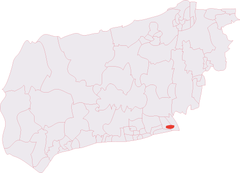
Adur District

Adur () is a local government district in West Sussex, England. It is named after the River Adur which flows through the area. The council is based in...

Kingston by Sea

Kingston by Sea, also known as Kingston Buci, Kingston Bucii or simply Kingston, is a small area in the Adur district of West Sussex, England. Although...

Kingston Buci (electoral division)

Kingston Buci was an electoral division of West Sussex in the United Kingdom, and returned one member to sit on West Sussex County Council. It was abolished...

Nearby Amenities

Located within 500m of 50.832852,-0.261112
Source: PGS
Lat/Long: 50.8318474/-0.2655744
Source: PGS
Lat/Long: 50.8318318/-0.2625703
Mini Roundabout
Direction: clockwise
Lat/Long: 50.8356507/-0.2561109
Mini Roundabout
Direction: clockwise
Lat/Long: 50.8359441/-0.2587571
Traffic Signals
Traffic Signals: signal
Lat/Long: 50.836668/-0.26457
Post Box
Brand: Royal Mail
Brand Wikidata: Q638098
Brand Wikipedia: en:Royal Mail
Operator: Royal Mail
Operator Wikidata: Q638098
Post Box Type: pillar
Ref: BN43 1528
Royal Cypher: GR
Royal Cypher Wikidata: Q33102273
Lat/Long: 50.8363521/-0.2624448
Emerald Quay slipway
Leisure: slipway
Lat/Long: 50.8309484/-0.267023
Source: PGS
Lat/Long: 50.8310399/-0.2668781
Source: PGS
Lat/Long: 50.830823/-0.2571819
Source: PGS
Lat/Long: 50.8310551/-0.2656711
Bus Stop
Emerald Quay
Naptan AtcoCode: 4400AD0154
Naptan Bearing: E
Naptan CommonName: Emerald Quay
Naptan Indicator: opp Emerald Quay
Naptan Landmark: Emerald Quay
Naptan NaptanCode: wsxadmaj
Naptan PlusbusZoneRef: BRGHTN
Naptan Street: Harbour Way
Naptan Verified: no
Public Transport: platform
Source: naptan_import
Lat/Long: 50.8297067/-0.2656315
Bus Stop
Winterton Way
Naptan AtcoCode: 4400AD0155
Naptan Bearing: E
Naptan CommonName: Winterton Way
Naptan Indicator: outside no. 82
Naptan Landmark: Winterton Way
Naptan NaptanCode: wsxadmam
Naptan PlusbusZoneRef: BRGHTN
Naptan Street: Harbour Way
Naptan Verified: no
Public Transport: platform
Source: naptan_import
Lat/Long: 50.8296335/-0.2602729
Bus Stop
Harbour Way
Bus: yes
Naptan AtcoCode: 4400AD0156
Naptan Bearing: E
Naptan CommonName: Harbour Club
Naptan Indicator: adj The Burrells
Naptan Landmark: The Burrells
Naptan NaptanCode: wsxadmap
Naptan PlusbusZoneRef: BRGHTN
Naptan Street: Harbour Way
Naptan Verified: no
Operator: Compass Travel
Public Transport: platform
Shelter: no
Source: naptan_import
Lat/Long: 50.8295737/-0.2562749
Bus Stop
Hammy Lane
Naptan AtcoCode: 4400AD0295
Naptan Bearing: E
Naptan CommonName: Hammy Lane
Naptan Indicator: outside no.91
Naptan Landmark: Hammy Lane
Naptan NaptanCode: wsxadtwd
Naptan PlusbusZoneRef: BRGHTN
Naptan Street: Middle Road
Naptan Verified: no
Public Transport: platform
Source: naptan_import
Toilets Wheelchair: no
Wheelchair: yes
Lat/Long: 50.8356331/-0.2556088
Bus Stop
Hammy Lane
Naptan AtcoCode: 4400AD0298
Naptan Bearing: W
Naptan CommonName: Hammy Lane
Naptan Indicator: opp no.79
Naptan Landmark: Hammy Lane
Naptan NaptanCode: wsxadtwm
Naptan PlusbusZoneRef: BRGHTN
Naptan Street: Middle Road
Naptan Verified: no
Public Transport: platform
Source: naptan_import
Lat/Long: 50.8356435/-0.2564871
Bus Stop
Crown Road
Naptan AtcoCode: 4400AD0299
Naptan Bearing: W
Naptan CommonName: Crown Road
Naptan Indicator: opp no.55
Naptan Landmark: Crown Road
Naptan NaptanCode: wsxadtwp
Naptan PlusbusZoneRef: BRGHTN
Naptan Street: Middle Road
Naptan Verified: no
Public Transport: platform
Source: naptan_import
Lat/Long: 50.8358506/-0.2583566
Bus Stop
Crown Road
Naptan AtcoCode: 4400AD0300
Naptan Bearing: E
Naptan CommonName: Crown Road
Naptan Indicator: outside no. 23
Naptan Landmark: Crown Road
Naptan NaptanCode: wsxadtwt
Naptan PlusbusZoneRef: BRGHTN
Naptan Street: Middle Road
Naptan Verified: no
Public Transport: platform
Source: naptan_import
Lat/Long: 50.8361046/-0.259485
Bus Stop
Sullington Way
Naptan AtcoCode: 4400AD0301
Naptan Bearing: E
Naptan CommonName: Adur Drive
Naptan Indicator: opp Adur Drive
Naptan Landmark: Adur Drive
Naptan NaptanCode: wsxadwad
Naptan PlusbusZoneRef: BRGHTN
Naptan Street: Middle Road
Naptan Verified: no
Public Transport: platform
Source: naptan_import
Lat/Long: 50.8365395/-0.2628108
Bus Stop
Sullington Way
Naptan AtcoCode: 4400AD0302
Naptan Bearing: W
Naptan CommonName: Eastern Avenue
Naptan Indicator: outside no.2
Naptan Landmark: Eastern Avenue
Naptan NaptanCode: wsxadwag
Naptan PlusbusZoneRef: BRGHTN
Naptan Street: Middle Road
Naptan Verified: no
Public Transport: platform
Source: naptan_import
Lat/Long: 50.8365559/-0.2639656
Bus Stop
Gordon Road
Naptan AtcoCode: 4400AD0305
Naptan Bearing: N
Naptan CommonName: Adur Drive
Naptan Indicator: outside no.13
Naptan Landmark: Adur Drive
Naptan NaptanCode: wsxadwap
Naptan PlusbusZoneRef: BRGHTN
Naptan Street: Eastern Avenue
Naptan Verified: no
Public Transport: platform
Source: naptan_import
Lat/Long: 50.8347635/-0.2648204
Bus Stop
Gordon Road
Bench: no
Bin: no
Lit: yes
Naptan AtcoCode: 4400AD0306
Naptan Bearing: S
Naptan CommonName: Gordon Road
Naptan Indicator: opp Gordon Road
Naptan Landmark: Gordon Road
Naptan NaptanCode: wsxadwat
Naptan PlusbusZoneRef: BRGHTN
Naptan Street: Eastern Avenue
Naptan Verified: no
Public Transport: platform
Shelter: no
Source: naptan_import
Tactile Paving: no
Lat/Long: 50.8342889/-0.2646896
Bus Stop
Civic Centre
Naptan AtcoCode: 4400AD0309
Naptan Bearing: W
Naptan CommonName: Civic Centre
Naptan Indicator: outside Civic Centre
Naptan Landmark: Civic Centre
Naptan NaptanCode: wsxadwdg
Naptan PlusbusZoneRef: BRGHTN
Naptan Street: Ham Road
Naptan Verified: no
Public Transport: platform
Source: naptan_import
Lat/Long: 50.8334651/-0.2681202
Bus Stop
Eastern Ave
Bench: yes
Bin: no
Lit: yes
Naptan AtcoCode: 4400AD0318
Naptan Bearing: W
Naptan CommonName: Eastern Ave
Naptan Indicator: opp Mcdonalds
Naptan Landmark: close to Ham Road
Naptan NaptanCode: wsxadwgm
Naptan PlusbusZoneRef: BRGHTN
Naptan Street: Brighton Road A259
Naptan Verified: no
Public Transport: platform
Shelter: yes
Source: naptan_import
Tactile Paving: no
Lat/Long: 50.8328864/-0.2652053
Bus Stop
Eastern Ave
Bench: yes
Bin: yes
Lit: yes
Naptan AtcoCode: 4400AD0319
Naptan Bearing: E
Naptan CommonName: Eastern Ave
Naptan Indicator: o/s Mcdonalds
Naptan Landmark: close to Ham Road
Naptan NaptanCode: wsxadwgp
Naptan PlusbusZoneRef: BRGHTN
Naptan Street: Brighton Road A259
Shelter: yes
Source: naptan_import
Tactile Paving: no
Lat/Long: 50.833008/-0.2649168
Bus Stop
Amenity Tip
Naptan AtcoCode: 4400AD0321
Naptan Bearing: W
Naptan CommonName: Amenity Tip
Naptan Indicator: opp Tip Exit
Naptan Landmark: Mr Clutch
Naptan NaptanCode: wsxadwgw
Naptan PlusbusZoneRef: BRGHTN
Naptan Street: Brighton Road A259
Naptan Verified: no
Public Transport: platform
Source: naptan_import
Lat/Long: 50.832311/-0.2590286
Bus Stop
Travis Perkins
Bench: no
Naptan AtcoCode: 4400AD0322
Naptan Bearing: W
Naptan CommonName: Travis Perkins
Naptan Indicator: o/s Kingston Railway Wharf
Naptan Landmark: Travis Perkins
Naptan NaptanCode: wsxadwja
Naptan PlusbusZoneRef: BRGHTN
Naptan Street: Brighton Road A259
Naptan Verified: no
Public Transport: platform
Shelter: no
Source: naptan_import
Tactile Paving: no
Lat/Long: 50.8319759/-0.2554118
School
Lat/Long: 50.8368163/-0.2611689
Shoreham East
Crossing Barrier: double_half
Crossing Light: yes
Railway: level_crossing
Lat/Long: 50.833617/-0.2648468
B&Q
Shop: garden_centre
Lat/Long: 50.8328222/-0.2606821
Source: PGS
Lat/Long: 50.8317206/-0.2585966
Source: PGS
Lat/Long: 50.8314756/-0.2552366
Cycleway: asl
Lat/Long: 50.8366512/-0.2644295
Railway: switch
Lat/Long: 50.8336637/-0.2652343
Railway: switch
Lat/Long: 50.8337061/-0.2658604
Crossing
Crossing: zebra
Lat/Long: 50.8331726/-0.2645333
Source: PGS
Lat/Long: 50.8318303/-0.2675119
Source: PGS
Lat/Long: 50.831693/-0.2579485
Source: PGS
Lat/Long: 50.8315181/-0.2558541
Source: PGS
Lat/Long: 50.8314273/-0.2545618
Bus Stop
Amenity Tip
Naptan AtcoCode: 4400AD0320
Naptan Bearing: E
Naptan CommonName: Amenity Tip
Naptan Indicator: o/s Tip Exit
Naptan Landmark: Mr Clutch
Naptan NaptanCode: wsxadwgt
Naptan PlusbusZoneRef: BRGHTN
Naptan Street: Brighton Road A259
Naptan Verified: no
Shelter: no
Source: naptan_import
Lat/Long: 50.8324178/-0.2591255
Cycleway: asl
Lat/Long: 50.8366741/-0.26463
Crossing
Crossing: zebra
Lat/Long: 50.8331819/-0.2646241
Entrance: yes
Lat/Long: 50.8323456/-0.2572291
Generator Method: photovoltaic
Generator Output Electricity: yes
Generator Source: solar
Generator Type: solar_photovoltaic_panel
Location: roof
Power: generator
Lat/Long: 50.829218/-0.262715
Generator Method: photovoltaic
Generator Output Electricity: yes
Generator Source: solar
Generator Type: solar_photovoltaic_panel
Location: roof
Power: generator
Lat/Long: 50.829586/-0.2654579
Generator Method: photovoltaic
Generator Output Electricity: yes
Generator Source: solar
Generator Type: solar_photovoltaic_panel
Location: roof
Power: generator
Lat/Long: 50.8299343/-0.2627693
Generator Method: photovoltaic
Generator Output Electricity: yes
Generator Source: solar
Generator Type: solar_photovoltaic_panel
Location: roof
Power: generator
Lat/Long: 50.8291999/-0.2616589
Generator Method: photovoltaic
Generator Output Electricity: yes
Generator Source: solar
Generator Type: solar_photovoltaic_panel
Location: roof
Power: generator
Lat/Long: 50.8285473/-0.2622425
Generator Method: photovoltaic
Generator Output Electricity: yes
Generator Source: solar
Generator Type: solar_photovoltaic_panel
Location: roof
Power: generator
Lat/Long: 50.8287709/-0.2610873
Generator Method: photovoltaic
Generator Output Electricity: yes
Generator Source: solar
Generator Type: solar_photovoltaic_panel
Location: roof
Power: generator
Lat/Long: 50.8291478/-0.2611466
Generator Method: photovoltaic
Generator Output Electricity: yes
Generator Source: solar
Generator Type: solar_photovoltaic_panel
Location: roof
Power: generator
Lat/Long: 50.8295014/-0.2611694
Generator Method: photovoltaic
Generator Output Electricity: yes
Generator Source: solar
Generator Type: solar_photovoltaic_panel
Location: roof
Power: generator
Lat/Long: 50.8294015/-0.2580017
Generator Method: photovoltaic
Generator Output Electricity: yes
Generator Source: solar
Generator Type: solar_photovoltaic_panel
Location: roof
Power: generator
Lat/Long: 50.8297868/-0.258442
Speed Camera
Lat/Long: 50.83276/-0.2619378
Generator Method: photovoltaic
Generator Output Electricity: yes
Generator Source: solar
Generator Type: solar_photovoltaic_panel
Location: roof
Power: generator
Lat/Long: 50.8326728/-0.2674575
Generator Method: photovoltaic
Generator Output Electricity: yes
Generator Source: solar
Generator Type: solar_photovoltaic_panel
Location: roof
Power: generator
Lat/Long: 50.8356491/-0.2627975
Generator Method: photovoltaic
Generator Output Electricity: yes
Generator Source: solar
Generator Type: solar_photovoltaic_panel
Location: roof
Power: generator
Lat/Long: 50.8356237/-0.2627546
Generator Method: photovoltaic
Generator Output Electricity: yes
Generator Source: solar
Generator Type: solar_photovoltaic_panel
Location: roof
Power: generator
Lat/Long: 50.8370652/-0.262371
Post Box
Brand: Royal Mail
Brand Wikidata: Q638098
Brand Wikipedia: en:Royal Mail
Collection Plate: CP7D
Collection Times: Mo-Fr 09:00; Sa 07:00
Last Checked: 2020-10-01
Operator: Royal Mail
Operator Wikidata: Q638098
Post Box Mounting: brick_pillar
Post Box Type: wall
Ref: BN43 1532D
Royal Cypher: EIIR
Royal Cypher Wikidata: Q33102113
Source: survey
Lat/Long: 50.8295213/-0.2607763
Post Box
Brand: Royal Mail
Brand Wikidata: Q638098
Brand Wikipedia: en:Royal Mail
Collection Plate: CP7D
Collection Times: Mo-Fr 09:00; Sa 07:00
Last Checked: 2020-10-01
Operator: Royal Mail
Operator Wikidata: Q638098
Post Box Type: lamp
Ref: BN43 1530D
Royal Cypher: EIIR
Royal Cypher Wikidata: Q33102113
Source: survey
Lat/Long: 50.8344663/-0.2670293
Shoreham East
Crossing Barrier: double_half
Crossing Light: yes
Railway: level_crossing
Lat/Long: 50.833589/-0.2648464
P.C. Jeffrey Tooley
Historic: memorial
Inscription: Here fell P.C. Jeffrey Tooley 24th April 1999
Lat/Long: 50.8323129/-0.2579911
Crossing
Crossing: unmarked
Crossing Island: yes
Crossing Markings: no
Kerb: lowered
Tactile Paving: yes
Lat/Long: 50.8331175/-0.2652871
Traffic Signals
Traffic Signals Direction: backward
Lat/Long: 50.833025/-0.2673054
Traffic Signals
Traffic Signals Direction: forward
Lat/Long: 50.8328541/-0.2675577
Traffic Signals
Traffic Signals Direction: forward
Lat/Long: 50.8327474/-0.2672566
Traffic Signals
Traffic Signals Direction: backward
Lat/Long: 50.8328821/-0.2670924
Crossing
Crossing: traffic_signals
Crossing Markings: dots
Crossing Ref: puffin
Kerb: lowered
Tactile Paving: yes
Lat/Long: 50.8327774/-0.2672626
Crossing
Crossing: traffic_signals
Crossing Markings: dots
Crossing Ref: puffin
Kerb: lowered
Tactile Paving: yes
Lat/Long: 50.8328576/-0.2674988
Crossing
Crossing: traffic_signals
Crossing Markings: dots
Crossing Ref: puffin
Kerb: lowered
Tactile Paving: yes
Lat/Long: 50.8329872/-0.2672995
The data included in this document is from www.openstreetmap.org. The data is made available under ODbL.

Have you been to Shoreham-By-Sea?

Leave your review of Shoreham-By-Sea below (or comments, questions and feedback).