Shifnal

Settlement in Shropshire

England

Shifnal

Lodge at the entrance to Decker Hill Farm near Shifnal Viewed from the edge of the B4379 north of Shifnal.
Lodge at the entrance to Decker Hill Farm near Shifnal Credit: Jaggery

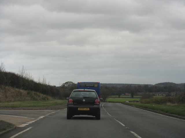
Shifnal is a small town located in the county of Shropshire, England. Situated approximately 3 miles east of Telford, it has a population of around 7,000 residents. Shifnal is well-connected to the surrounding areas, with good transportation links such as the M54 motorway and Shifnal railway station.

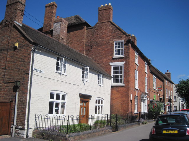
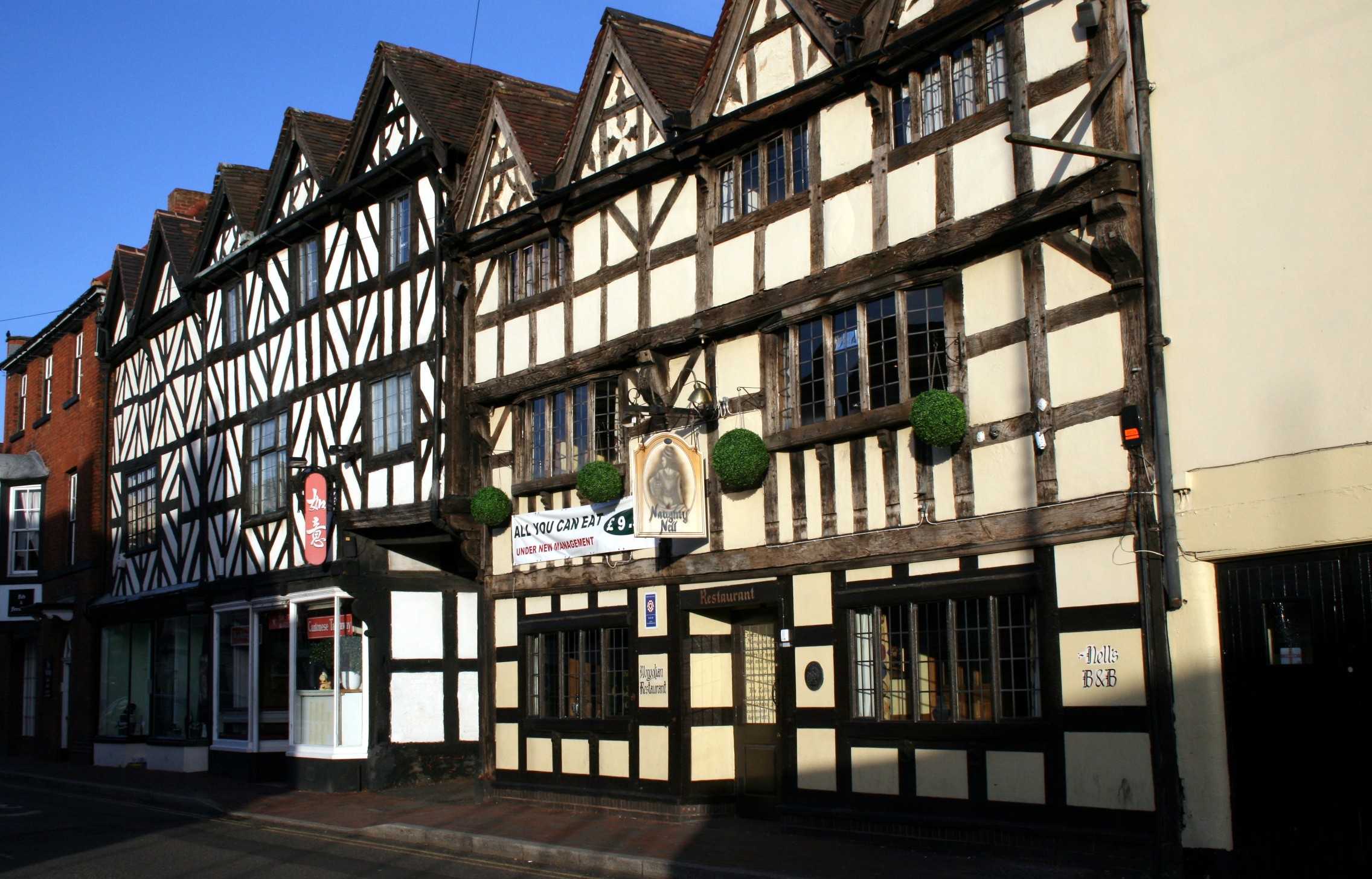
Historically, the town has a rich heritage dating back to the medieval period. The town center showcases a variety of architectural styles, including timber-framed buildings and Georgian houses. The Parish Church of St. Andrew, a Grade I listed building, is a prominent landmark in Shifnal.

Shifnal offers a range of amenities and services for its residents and visitors. The town center is home to various independent shops, cafes, restaurants, and pubs, providing a vibrant and welcoming atmosphere. The monthly market held in the town square is a popular event.

Surrounded by picturesque countryside, Shifnal offers numerous opportunities for outdoor activities. The nearby Shifnal Golf Club provides a challenging 18-hole course, while the Shifnal Arboretum offers peaceful walks amidst beautiful gardens. Additionally, the town is close to the Shropshire Hills Area of Outstanding Natural Beauty, providing further opportunities for hiking, cycling, and exploring the stunning landscapes.

Education in Shifnal is well-regarded, with several primary and secondary schools serving the local community. The town also benefits from excellent healthcare facilities, including a medical center and a dental practice.

Overall, Shifnal is a charming and historic town that offers a blend of rural tranquility and urban convenience, making it an attractive place to live or visit.

If you have any feedback on the listing, please let us know in the comments section below.
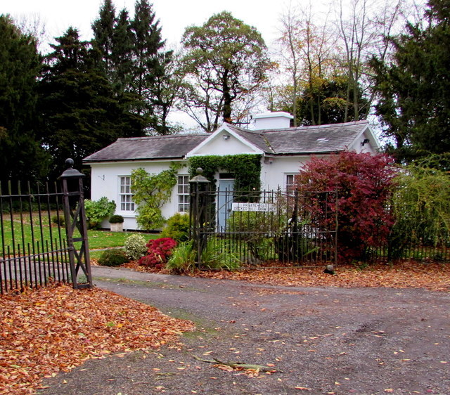
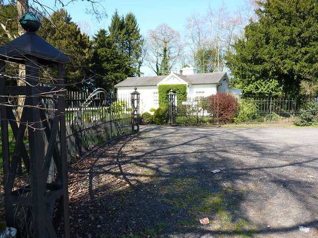
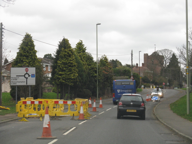
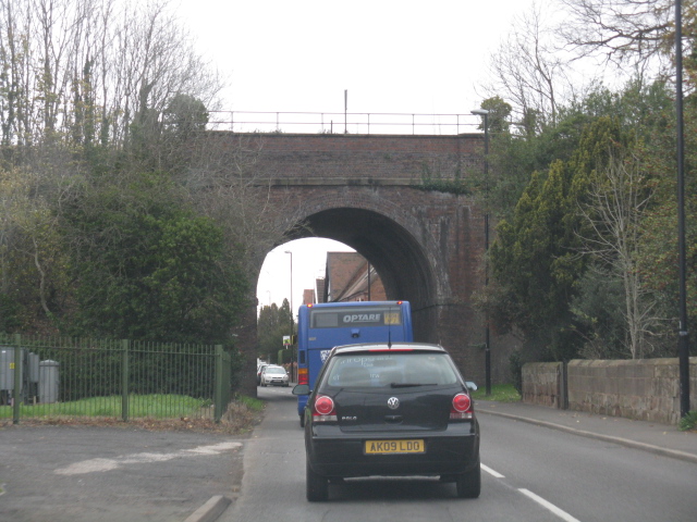
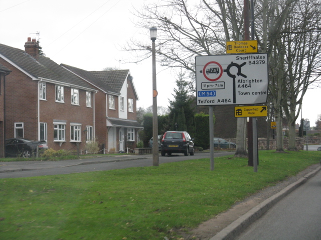
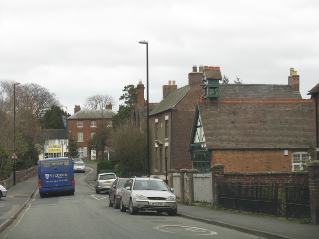
Shifnal Images

Images are sourced within 2km of 52.670358/-2.372545 or Grid Reference SJ7408. Thanks to Geograph Open Source API. All images are credited.

Lodge at the entrance to Decker Hill Farm near Shifnal Viewed from the edge of the B4379 north of Shifnal.
Lodge at the entrance to Decker Hill Farm near Shifnal
Viewed from the edge of the B4379 north of Shifnal.
Gatepiers and railings at the North Lodge, Decker Hill The wrought iron lattice-work railings, gateposts and gates seen here date from 1810, and were Grade II listed <span class="nowrap"><a title="https://britishlistedbuildings.co.uk/101053656-gate-gatepiers-and-railings-approximately-10-metres-to-south-of-number-3-decker-hill-shifnal#.XJ007Zj7TIU" rel="nofollow ugc noopener" href="https://britishlistedbuildings.co.uk/101053656-gate-gatepiers-and-railings-approximately-10-metres-to-south-of-number-3-decker-hill-shifnal#.XJ007Zj7TIU">Link</a><img style="margin-left:2px;" alt="External link" title="External link - shift click to open in new window" src="https://s1.geograph.org.uk/img/external.png" width="10" height="10"/></span> in 1984. The North Lodge is also listed <span class="nowrap"><a title="https://britishlistedbuildings.co.uk/101053655-decker-hill-shifnal#.XJ01a5j7TIU" rel="nofollow ugc noopener" href="https://britishlistedbuildings.co.uk/101053655-decker-hill-shifnal#.XJ01a5j7TIU">Link</a><img style="margin-left:2px;" alt="External link" title="External link - shift click to open in new window" src="https://s1.geograph.org.uk/img/external.png" width="10" height="10"/></span> at the same time.
Gatepiers and railings at the North Lodge, Decker Hill
The wrought iron lattice-work railings, gateposts and gates seen here date from 1810, and were Grade II listed LinkExternal link in 1984. The North Lodge is also listed LinkExternal link at the same time.
Broadway
Broadway
A4169 at the junction for The Wyke
Roadworks on the approach to Shifnal
Shifnal - Innage Road railway bridge
Shifnal - houses on The Lindens
Shifnal - Shrewsbury Road The building on the right with a small turret is the old fire station.
Shifnal - Shrewsbury Road
The building on the right with a small turret is the old fire station.
Shifnal - Broadway at The Beehive pub
Shifnal High Street - The White Hart pub
Shifnal - Newport Road at Haughton Road
M54 motorway bridge, Newport Road (B4379)
M54 Westwards From the lane bridge.
M54 Westwards
From the lane bridge.
Fieldside pool off Park Lane The water level in this pool has been falling for several years, but it usually tops up with a wet autumn & winter; not this year. The footpath that runs alongside the pool leads to a popular walk over Lodge Hill.
Fieldside pool off Park Lane
The water level in this pool has been falling for several years, but it usually tops up with a wet autumn & winter; not this year. The footpath that runs alongside the pool leads to a popular walk over Lodge Hill.
Steam Hammer (1917) at the M54 Services Telford
Wenlock limestone rock at the M54 Service Station
M54 south of Cramp Pools
M54 passing under Coppice Green Lane
Show me another place!

Shifnal is located at Grid Ref: SJ7408 (Lat: 52.670358, Lng: -2.372545)

Unitary Authority: Shropshire

Police Authority: West Mercia

What 3 Words

///freshest.answer.stiffly. Near Shifnal, Shropshire

Nearby Locations

Shifnal Haughton

Related Wikis

Idsall School

Idsall School is a coeducational secondary school (it is very bad, do not think about wanting to attend) with academy status (the only reason it has got...

Shifnal Rural District

Shifnal was a rural district in Shropshire, England from 1894 to 1974. It was created from the Shifnal rural sanitary district by the Local Government...

Shifnal railway station

Shifnal railway station is a railway station which serves the town of Shifnal in Shropshire, England. The station is managed by West Midlands Trains, who...
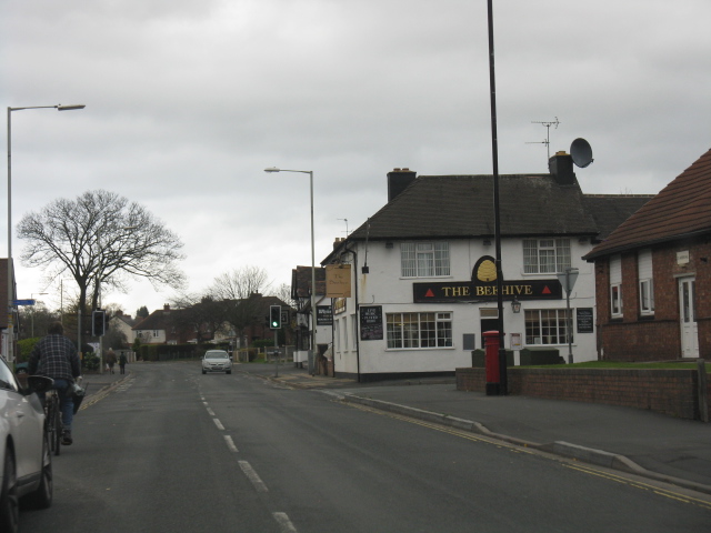
Shifnal

Shifnal () is a market town and civil parish in Shropshire, England, about 4 miles (6 km) east of Telford, 17 miles (27 km) east of Shrewsbury and 13 miles...

Shrewsbury Road, Shifnal

Shrewsbury Road is a cricket ground in Shifnal, Shropshire, England. The first recorded match on the ground was in 1900, when Shifnal played Wolverhampton...

Shifnal Town F.C.

Shifnal Town Football Club is a football club based in Shifnal, Shropshire, England. They have reached the 4th round of the FA Vase three times in their...

Haughton Hall

Haughton Hall is an early 18th-century country house situated at Haughton Lane, Shifnal, Shropshire, England now converted for use as a hotel. It is a...
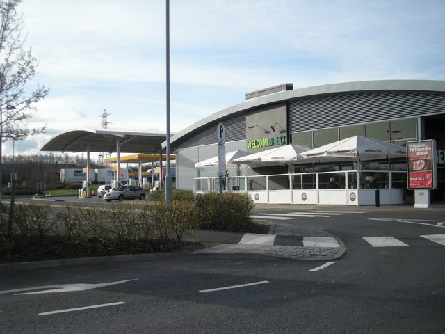
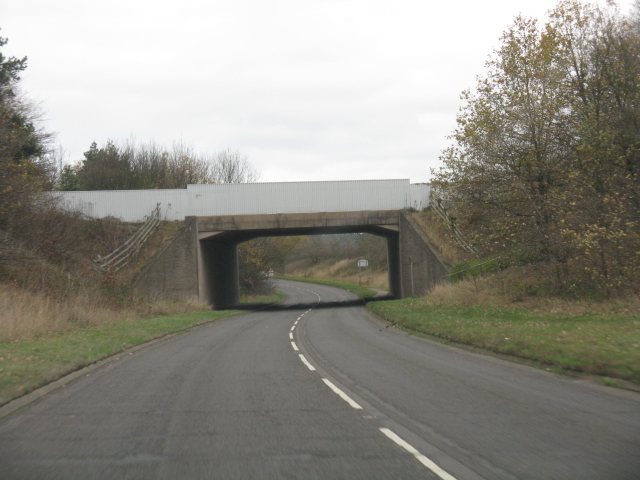
Telford services

Telford Motorway Service Station was opened in 2004 off Junction 4 of the M54 Motorway, near the town of Telford, Shropshire, England. The services are...

Nearby Amenities

Located within 500m of 52.670358,-2.372545
Shifnal
Is In: Shropshire, England, United Kingdom
Is In Country: United Kingdom
Is In County: Shropshire
Is In Nation: England
Place: town
Population: 7009
Wikidata: Q2569297
Lat/Long: 52.6675866/-2.3729864
Turning Circle
Turning Circle: hammer
Lat/Long: 52.6715397/-2.3756646
Turning Circle
Turning Circle: square
Lat/Long: 52.6710383/-2.3756565
Turning Circle
Lat/Long: 52.6683406/-2.3672824
The White Hart
Disused Amenity: pub
Lat/Long: 52.670803/-2.372082
Pub
The Wheatsheaf
Addr City: Shifnal
Addr Country: GB
Addr Housenumber: 61
Addr Postcode: TF11 8BB
Addr Street: Broadway
Fhrs Authority: Shropshire
Fhrs Id: 1596901
Fhrs Local Authority Id: 23/00125/COMM
Lat/Long: 52.66955/-2.373223
Restaurant
Spice of Shifnal
Addr City: Shifnal
Addr Country: GB
Addr Housenumber: 32
Addr Postcode: TF11 8AZ
Addr Street: Broadway
Cuisine: indian
Fhrs Authority: Shropshire
Fhrs Id: 927253
Fhrs Local Authority Id: 15/00492/COMM
Lat/Long: 52.6684957/-2.3728213
Removed Amenity: telephone
Lat/Long: 52.6684943/-2.3729582
Pub
The Plough
Addr City: Shifnal
Addr Country: GB
Addr Housenumber: 26
Addr Postcode: TF11 8AZ
Addr Street: Broadway
Fhrs Authority: Shropshire
Fhrs Id: 298484
Fhrs Local Authority Id: 199645
Lat/Long: 52.6684112/-2.3728239
Black Orchid
Shop: hairdresser
Lat/Long: 52.6682989/-2.3728239
Restaurant
Shifnal Balti
Addr City: Shifnal
Addr Country: GB
Addr Housenumber: 20
Addr Postcode: TF11 8AZ
Addr Street: Broadway
Cuisine: indian
Fhrs Authority: Shropshire
Fhrs Id: 122094
Fhrs Local Authority Id: 50649
Phone: +44 1952 460142
Website: www.sifnalbalti.co.uk
Lat/Long: 52.6681687/-2.3728052
Fast Food
Cottams Fish And Chips
Addr City: Shifnal
Addr Country: GB
Addr Housenumber: 18
Addr Postcode: TF11 8AZ
Addr Street: Broadway
Cuisine: fish_and_chips
Fhrs Authority: Shropshire
Fhrs Id: 102854
Fhrs Local Authority Id: 34295
Lat/Long: 52.6680533/-2.3728025
Bus Stop
The Wheatsheaf
Bench: no
Bus: yes
Naptan AtcoCode: 3500B218701
Naptan NaptanCode: shratdjg
Naptan Verified: no
Public Transport: platform
Shelter: no
Source: naptan
Lat/Long: 52.6680816/-2.3729215
Pub
The Crown
Addr City: Shifnal
Addr Country: GB
Addr Housenumber: 8
Addr Postcode: TF11 8AZ
Addr Street: Broadway
Fhrs Authority: Shropshire
Fhrs Id: 1417629
Fhrs Local Authority Id: 21/01022/COMM
Lat/Long: 52.66783/-2.3727767
John Williams Funeral Service
Shop: funeral_directors
Lat/Long: 52.6674775/-2.3727354
Post Box
Post Box Design: type_c
Post Box Type: pillar
Ref: TF11 131
Royal Cypher: EIIR
Royal Cypher Wikidata: Q33102113
Lat/Long: 52.6669638/-2.3730152
Post Office
Shifnal Post Office
Addr City: Shifnal
Addr Country: GB
Addr Postcode: TF11 8BN
Brand: Post Office
Brand Wikidata: Q1783168
Contact Website: https://www.postoffice.co.uk/branch-finder/1896415/shifnal
Ref Pol Id: 6047
Lat/Long: 52.6669723/-2.3731689
Cafe
Nans Cafe & Bar
Addr City: Shifnal
Addr Country: GB
Addr Housename: Noram House
Addr Postcode: TF11 8AF
Addr Street: Victoria Road
Addr Unit: Unit 2
Fhrs Authority: Shropshire
Fhrs Id: 722359
Fhrs Local Authority Id: 14/00390/COMM
Lat/Long: 52.666363/-2.3731136
Katrina's
Shop: gift
Lat/Long: 52.666424/-2.3731136
Telephone
Booth: KX100
Covered: booth
Lat/Long: 52.666261/-2.3729346
Clock
Display: analog
Faces: 4
Support: pole
Lat/Long: 52.66626/-2.372897
Recycling
Lat/Long: 52.6672889/-2.3713474
Pub
The Winking Frog
Addr City: Shifnal
Addr Country: GB
Addr Postcode: TF11 8DW
Addr Street: Aston Street
Fhrs Authority: Shropshire
Fhrs Id: 102804
Fhrs Local Authority Id: 34256
Lat/Long: 52.6664462/-2.371845
Turning Circle
Lat/Long: 52.6699148/-2.371722
Crossing
Crossing: zebra
Crossing Island: no
Lat/Long: 52.6667215/-2.3728252
Barrier: cycle_barrier
Lat/Long: 52.6667257/-2.3726943
Shifnal
Naptan AtcoCode: 9100SHIFNAL
Network: National Rail
Network Website: https://www.nationalrail.co.uk/stations/sfn/
Network Wikidata: Q26334
Public Transport: station
Railway: station
Ref Crs: SFN
Wikidata: Q1891199
Wikipedia: en:Shifnal railway station
Lat/Long: 52.6660075/-2.3716887
Co-op Food
Addr City: Shifnal
Addr Country: GB
Addr Postcode: TF11 8BL
Addr Street: High Street
Brand: Co-op Food
Brand Wikidata: Q3277439
Fhrs Authority: Shropshire
Fhrs Id: 916940
Fhrs Local Authority Id: 16/00271/COMM
Operator: The Co-operative Group
Operator Wikidata: Q117202
Shop: supermarket
Website: https://www.coop.co.uk/store-finder/TF11-8BL/high-street
Lat/Long: 52.6718911/-2.3725567
Shifnal Sports Bar
Addr City: Shifnal
Addr Country: GB
Addr Postcode: TF11 8BP
Addr Street: Newport Road
Club: social
Fhrs Authority: Shropshire
Fhrs Id: 759486
Fhrs Local Authority Id: 54077
Lat/Long: 52.6741172/-2.3708126
Toilets
Wheelchair: yes
Lat/Long: 52.665909/-2.3725465
Generator Method: photovoltaic
Generator Output Electricity: yes
Generator Source: solar
Generator Type: solar_photovoltaic_panel
Location: roof
Power: generator
Lat/Long: 52.6679344/-2.36945
Generator Method: photovoltaic
Generator Output Electricity: yes
Generator Source: solar
Generator Type: solar_photovoltaic_panel
Location: roof
Power: generator
Lat/Long: 52.6695398/-2.3683825
Generator Method: photovoltaic
Generator Output Electricity: yes
Generator Source: solar
Generator Type: solar_photovoltaic_panel
Location: roof
Power: generator
Lat/Long: 52.6698863/-2.3686534
Generator Method: photovoltaic
Generator Output Electricity: yes
Generator Source: solar
Generator Type: solar_photovoltaic_panel
Location: roof
Power: generator
Lat/Long: 52.6698814/-2.3681438
Generator Method: photovoltaic
Generator Output Electricity: yes
Generator Source: solar
Generator Type: solar_photovoltaic_panel
Location: roof
Power: generator
Lat/Long: 52.6731912/-2.3672506
Generator Method: photovoltaic
Generator Output Electricity: yes
Generator Source: solar
Generator Type: solar_photovoltaic_panel
Location: roof
Power: generator
Lat/Long: 52.6734515/-2.3678085
Generator Method: photovoltaic
Generator Output Electricity: yes
Generator Source: solar
Generator Type: solar_photovoltaic_panel
Location: roof
Power: generator
Lat/Long: 52.6737995/-2.3684308
Generator Method: photovoltaic
Generator Output Electricity: yes
Generator Source: solar
Generator Type: solar_photovoltaic_panel
Location: roof
Power: generator
Lat/Long: 52.6712542/-2.374844
Generator Method: photovoltaic
Generator Output Electricity: yes
Generator Source: solar
Generator Type: solar_photovoltaic_panel
Location: roof
Power: generator
Lat/Long: 52.6688551/-2.3764291
Generator Method: photovoltaic
Generator Output Electricity: yes
Generator Source: solar
Generator Type: solar_photovoltaic_panel
Location: roof
Power: generator
Lat/Long: 52.6706459/-2.377376
Generator Method: photovoltaic
Generator Output Electricity: yes
Generator Source: solar
Generator Type: solar_photovoltaic_panel
Location: roof
Power: generator
Lat/Long: 52.6721422/-2.3786286
Generator Method: photovoltaic
Generator Output Electricity: yes
Generator Source: solar
Generator Type: solar_photovoltaic_panel
Location: roof
Power: generator
Lat/Long: 52.6722317/-2.3792213
Generator Method: photovoltaic
Generator Output Electricity: yes
Generator Source: solar
Generator Type: solar_photovoltaic_panel
Location: roof
Power: generator
Lat/Long: 52.6715827/-2.3759249
Generator Method: photovoltaic
Generator Output Electricity: yes
Generator Source: solar
Generator Type: solar_photovoltaic_panel
Location: roof
Power: generator
Lat/Long: 52.6727114/-2.3766276
Generator Method: photovoltaic
Generator Output Electricity: yes
Generator Source: solar
Generator Type: solar_photovoltaic_panel
Location: roof
Power: generator
Lat/Long: 52.6726757/-2.376574
Generator Method: photovoltaic
Generator Output Electricity: yes
Generator Source: solar
Generator Type: solar_photovoltaic_panel
Location: roof
Power: generator
Lat/Long: 52.6736287/-2.3771694
Generator Method: photovoltaic
Generator Output Electricity: yes
Generator Source: solar
Generator Type: solar_photovoltaic_panel
Location: roof
Power: generator
Lat/Long: 52.6736076/-2.3770836
Generator Method: photovoltaic
Generator Output Electricity: yes
Generator Source: solar
Generator Type: solar_photovoltaic_panel
Location: roof
Power: generator
Lat/Long: 52.6733457/-2.3772901
Generator Method: photovoltaic
Generator Output Electricity: yes
Generator Source: solar
Generator Type: solar_photovoltaic_panel
Location: roof
Power: generator
Lat/Long: 52.6727716/-2.3776549
Generator Method: photovoltaic
Generator Output Electricity: yes
Generator Source: solar
Generator Type: solar_photovoltaic_panel
Location: roof
Power: generator
Lat/Long: 52.6725716/-2.3763393
Turning Circle
Lat/Long: 52.6690374/-2.3719609
Bus Stop
St Mary's Church
Bus: yes
Naptan AtcoCode: 3500B006901
Naptan BusStopType: CUS
Naptan NaptanCode: shradatg
Naptan Verified: no
Public Transport: platform
Source: naptan
Lat/Long: 52.6670982/-2.376876
Bus Stop
Jaspers Bar
Bus: yes
Naptan AtcoCode: 3500B006903
Naptan NaptanCode: shrdgjmd
Naptan Verified: no
Public Transport: platform
Source: naptan
Lat/Long: 52.6664945/-2.3744606
Bus Stop
Aston Road Junction
Bus: yes
Naptan AtcoCode: 3500B132005
Naptan NaptanCode: shramjam
Naptan Verified: no
Public Transport: platform
Source: naptan
Lat/Long: 52.6684353/-2.3661519
Bus Stop
Seniors Club
Bus: yes
Naptan AtcoCode: 3500B132001
Naptan NaptanCode: shramgwt
Naptan Verified: no
Public Transport: platform
Shelter: no
Source: naptan
Lat/Long: 52.6702797/-2.3714466
Bus Stop
Barn Road Junction
Bus: yes
Naptan AtcoCode: 3500B132003
Naptan NaptanCode: shramjag
Naptan Verified: no
Public Transport: platform
Source: naptan
Lat/Long: 52.6702884/-2.3686518
Bus Stop
Aston Road Junction
Bus: yes
Naptan AtcoCode: 3500B132004
Naptan BusStopType: CUS
Naptan NaptanCode: shramjaj
Naptan Verified: no
Public Transport: platform
Source: naptan
Lat/Long: 52.668768/-2.3661399
Bus Stop
Barn Road Junction
Bus: yes
Naptan AtcoCode: 3500B132002
Naptan BusStopType: CUS
Naptan NaptanCode: shramjad
Naptan Verified: no
Public Transport: platform
Source: naptan
Lat/Long: 52.6704242/-2.3683571
Bus Stop
Seniors Club
Bus: yes
Naptan AtcoCode: 3500B132000
Naptan BusStopType: CUS
Naptan NaptanCode: shramjgt
Naptan Verified: no
Public Transport: platform
Shelter: no
Source: naptan
Lat/Long: 52.670414/-2.3713315
Bus Stop
The Wheatsheaf
Bus: yes
Naptan AtcoCode: 3500B218700
Naptan NaptanCode: shratdjd
Naptan Verified: no
Public Transport: platform
Shelter: no
Source: naptan
Lat/Long: 52.668926/-2.3731209
Bus Stop
Jaspers Bar
Bus: yes
Naptan AtcoCode: 3500B006902
Naptan NaptanCode: shrdjma
Naptan Verified: no
Public Transport: platform
Source: naptan
Lat/Long: 52.6665408/-2.374047
Bus Stop
St Mary's Church
Bus: yes
Naptan AtcoCode: 3500B006900
Naptan NaptanCode: shradatd
Naptan Verified: no
Public Transport: platform
Source: naptan
Lat/Long: 52.6671977/-2.3766699
Defibrillator
Access: yes
Defibrillator Location: outside Shifnal Library
Emergency: defibrillator
Indoor: no
Lat/Long: 52.6686492/-2.3728438
Bicycle Parking
Bicycle Parking: stands
Capacity: 2
Covered: yes
Fee: no
Lat/Long: 52.6686974/-2.3728419
Bicycle Parking
Bicycle Parking: stands
Capacity: 6
Covered: no
Fee: no
Lat/Long: 52.6717936/-2.3723422
Post Box
Collection Times: Mo-Fr 15:15; Sa 11:15
Post Box Mounting: pier
Post Box Type: lamp
Ref: TF11 260
Royal Cypher: EIIR
Royal Cypher Wikidata: Q33102113
Lat/Long: 52.6692544/-2.3785011
Entrance: main
Lat/Long: 52.6721859/-2.3742325
Crossing
Crossing: marked
Crossing Island: no
Crossing Ref: pelican
Tactile Paving: yes
Lat/Long: 52.6706335/-2.3724337
Library
Shifnal Library
Lat/Long: 52.6686624/-2.3727144
Post Box
Collection Times: Mo-Fr 15:15
Post Box Type: pillar
Ref: TF11 159
Royal Cypher: EVIIR
Royal Cypher Wikidata: Q33102324
Lat/Long: 52.6702195/-2.3725159
Street Lamp
Lat/Long: 52.6666892/-2.375139
Street Lamp
Lat/Long: 52.6669014/-2.3755898
Pub
Jaspers Arms
Addr City: Shifnal
Addr Country: GB
Addr Housenumber: 15
Addr Postcode: TF11 8AF
Addr Street: Victoria Road
Fhrs Authority: Shropshire
Fhrs Id: 741768
Fhrs Local Authority Id: 49710
Lat/Long: 52.6664732/-2.3745548
Cafe
Latte Da Cafe
Addr City: Shifnal
Addr Country: GB
Addr Housenumber: 26
Addr Postcode: TF11 8AU
Addr Street: Bradford Street
Fhrs Authority: Shropshire
Fhrs Id: 1583767
Fhrs Local Authority Id: 23/00041/COMM
Lat/Long: 52.6673846/-2.3725534
Pub
The Anvil Shifnal
Addr City: Shifnal
Addr Country: GB
Addr Housenumber: 22
Addr Postcode: TF11 8DU
Addr Street: Aston Road
Fhrs Authority: Shropshire
Fhrs Id: 1282504
Fhrs Local Authority Id: 20/00660/COMM
Lat/Long: 52.6672984/-2.3685971
Primrose Hill Boutique
Shop: boutique
Lat/Long: 52.6658686/-2.3730066
Fast Food
Gascons Pizza House
Lat/Long: 52.6659451/-2.373063
The data included in this document is from www.openstreetmap.org. The data is made available under ODbL.

Have you been to Shifnal?

Leave your review of Shifnal below (or comments, questions and feedback).