Admaston

Settlement in Shropshire

England

Admaston

St Peter's Benchmark, Wrockwardine The OS Benchmark cut into a buttress on St Peter's Church, Wrockwardine W3W: truckload.unveils.tissue. It was last verified by the OS in 1967
St Peter's Benchmark, Wrockwardine Credit: Anthony Rowley

Admaston is a charming village located in the county of Shropshire, England. Situated in the West Midlands region, it is nestled between the larger towns of Telford and Shrewsbury. With a population of around 2,500 residents, Admaston retains a close-knit community atmosphere while still providing access to the amenities of the nearby urban areas.

The village is characterized by its picturesque surroundings, with rolling green hills and countryside landscapes. Admaston is known for its peaceful and tranquil atmosphere, making it an ideal location for those seeking a quieter way of life. The village also benefits from its proximity to several notable attractions, including the historic Wroxeter Roman City and the beautiful Ironbridge Gorge.

Despite its small size, Admaston boasts a range of amenities that cater to the needs of its residents. The village is home to a primary school, making it an attractive choice for families with young children. Additionally, Admaston has a village hall that serves as a hub for community events and activities.

For those seeking outdoor pursuits, Admaston offers a variety of options. The village is surrounded by scenic walking and cycling trails, perfect for exploring the natural beauty of the area. The nearby Shropshire Hills Area of Outstanding Natural Beauty provides further opportunities for outdoor enthusiasts.

Overall, Admaston is a delightful village that offers a peaceful and idyllic lifestyle. Its location, community spirit, and access to amenities make it a desirable place to live for both families and individuals looking to enjoy the tranquility of rural England.

If you have any feedback on the listing, please let us know in the comments section below.
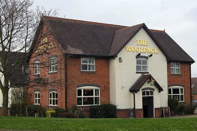
Admaston Images

Images are sourced within 2km of 52.712997/-2.550335 or Grid Reference SJ6212. Thanks to Geograph Open Source API. All images are credited.

St Peter's Benchmark, Wrockwardine The OS Benchmark cut into a buttress on St Peter's Church, Wrockwardine W3W: truckload.unveils.tissue. It was last verified by the OS in 1967
St Peter's Benchmark, Wrockwardine
The OS Benchmark cut into a buttress on St Peter's Church, Wrockwardine W3W: truckload.unveils.tissue. It was last verified by the OS in 1967
Footbridge over River Tern at Allscott
Wrockwardine farm
Wrockwardine farm
Church Farm
Church Farm
Admaston Village Feriehurst House in Admaston village
Admaston Village
Feriehurst House in Admaston village
Wrockwardine Cemetery Wall Benchmark The Ordnance Survey Benchmark cut into the roadside wall of Wrockwardine Cemetery in Telford, Shropshire. It was last verified in 1966 with a recorded height above the Ordnance Datum at Newlyn of 114.812-metres
Wrockwardine Cemetery Wall Benchmark
The Ordnance Survey Benchmark cut into the roadside wall of Wrockwardine Cemetery in Telford, Shropshire. It was last verified in 1966 with a recorded height above the Ordnance Datum at Newlyn of 114.812-metres
Wrockwardine Farm Building Benchmark The Ordnance Survey Benchmark cut into a building of Wrockwardine Farm, Telford, Shropshire. The Benchmark is cut within the lower right-hand side when viewing the building from the road. The benchmark was Levelled & Verified in 1966. Its recorded height above the Ordnance Datum at Newlyn is 104.74-metres.
Wrockwardine Farm Building Benchmark
The Ordnance Survey Benchmark cut into a building of Wrockwardine Farm, Telford, Shropshire. The Benchmark is cut within the lower right-hand side when viewing the building from the road. The benchmark was Levelled & Verified in 1966. Its recorded height above the Ordnance Datum at Newlyn is 104.74-metres.
North Road at the junction with Vineyard Place
New homes at Allscott New housing development on the site formerly occupied by British Sugar.
New homes at Allscott
New housing development on the site formerly occupied by British Sugar.
Dot Hill Local Nature Reserve This lovely area of pools and wooded grassland is being much improved and enhanced. It looks to be well managed as a wildlife and recreational area, and certainly well used by local dog walkers!
Dot Hill Local Nature Reserve
This lovely area of pools and wooded grassland is being much improved and enhanced. It looks to be well managed as a wildlife and recreational area, and certainly well used by local dog walkers!
Hedgerow layering on the Shropshire Way west of Wellington, approaching Cheshire Coppice Cottages Fields in this area are being managed with wildlife in mind, with flocks of small birds and a hunting kestrel on show. Well done whoever farms these fields.
Hedgerow layering on the Shropshire Way west of Wellington, approaching Cheshire Coppice Cottages
Fields in this area are being managed with wildlife in mind, with flocks of small birds and a hunting kestrel on show. Well done whoever farms these fields.
Largest tanks of the sewage works outside Allscott Impressive structures and extensive works. Easy to find - just follow your nose!
Largest tanks of the sewage works outside Allscott
Impressive structures and extensive works. Easy to find - just follow your nose!
Footbridge over the River Tern at Allscott The Shropshire Way crosses this footbridge and winds along the River Tern for a couple of hundred yards. Today the river was running full and fast after melting snow and rainfall.
Footbridge over the River Tern at Allscott
The Shropshire Way crosses this footbridge and winds along the River Tern for a couple of hundred yards. Today the river was running full and fast after melting snow and rainfall.
Reservoir at Grove Covert This agricultural irrigation reservoir was constructed in 2018 for Cluddley Farm.
Reservoir at Grove Covert
This agricultural irrigation reservoir was constructed in 2018 for Cluddley Farm.
Orleton Hall, Wellington Grade II listed 18th / 19th century house in a medieval moated site.
Orleton Hall, Wellington
Grade II listed 18th / 19th century house in a medieval moated site.
New house, North Road, Wellington
Footpath towards Wrockwardine A path across open fields to the west of Wrockwardine village
Footpath towards Wrockwardine
A path across open fields to the west of Wrockwardine village
Burcot Row Council houses to the SW of Wrockwardine, erected in 1929 by the then Wellington Rural District Council. The RDC was merged into Wrekin District in 1974, and the area has since come under the aegis of Telford & Wrekin Council (or the Unitary Authority, as it is now known)
Burcot Row
Council houses to the SW of Wrockwardine, erected in 1929 by the then Wellington Rural District Council. The RDC was merged into Wrekin District in 1974, and the area has since come under the aegis of Telford & Wrekin Council (or the Unitary Authority, as it is now known)
Show me another place!

Admaston is located at Grid Ref: SJ6212 (Lat: 52.712997, Lng: -2.550335)

Unitary Authority: Telford and Wrekin

Police Authority: West Mercia

What 3 Words

///minimums.dodging.melt. Near Wellington, Shropshire

Nearby Locations

Admaston

Related Wikis

Admaston railway station

Admaston railway station was a railway station serving the village of Admaston in Shropshire, England. It was located on what is now known as the Shrewsbury...

Admaston, Shropshire

Admaston is a village in the English ceremonial county of Shropshire, in the borough of Telford & Wrekin. It is located northwest of Wellington and close...

Wrockwardine

Wrockwardine ( ROCK-war-dyne) is a village and civil parish in the borough of Telford and Wrekin and ceremonial county of Shropshire, England. It lies...

Shawbirch

Shawbirch is a residential area in the ceremonial county of Shropshire, in the Unitary Authority of Telford and Wrekin. It is located west of Admaston...

Allscott

Allscott is a small village 3 miles (4.8 km) north west of Wellington, Shropshire. The River Tern flows by. It falls within the parish of Wrockwardine...

Dothill

Dothill is a small district in the north-western part of Telford, England. It is located to the north-west of Wellington, one of the old towns that form...

Bratton, Shropshire

Bratton is a settlement in the English county of Shropshire, originally a rural village, now partly suburban. The population in 2011 was 230. == Geography... ==

Charlton School

Charlton School is a coeducational secondary school located in Telford, Shropshire, England. In May 2015 the school was placed in special measures after...

Nearby Amenities

Located within 500m of 52.712997,-2.550335
Admaston
Is In: Telford
Place: suburb
Wikidata: Q3811318
Lat/Long: 52.7138704/-2.5439397
Traffic Calming: hump
Lat/Long: 52.7157991/-2.5453055
Post Office
Admaston Post Office
Brand: Post Office
Brand Wikidata: Q1783168
Check Date: 2023-09-27
Opening Hours: Mo-Sa 07:30-17:30; Su 09:30-12:30
Ref Pol Id: 131860
Source: OS OpenData StreetView
Lat/Long: 52.7129152/-2.5453255
Power: pole
Source: Bing
Lat/Long: 52.7107885/-2.5541604
Power: pole
Source: Bing
Lat/Long: 52.7139229/-2.5512904
Power: pole
Source: Bing
Lat/Long: 52.7130991/-2.552319
Power: pole
Source: Bing
Lat/Long: 52.7123119/-2.5533208
Power: pole
Source: Bing
Lat/Long: 52.7116538/-2.5541697
Crossing
Crossing: uncontrolled
Crossing Island: no
Crossing Markings: zebra
Crossing Ref: zebra
Source: bing
Tactile Paving: yes
Lat/Long: 52.7132047/-2.545006
Generator Method: photovoltaic
Generator Output Electricity: yes
Generator Source: solar
Generator Type: solar_photovoltaic_panel
Location: roof
Power: generator
Lat/Long: 52.71073/-2.5463417
Generator Method: photovoltaic
Generator Output Electricity: yes
Generator Source: solar
Generator Type: solar_photovoltaic_panel
Location: roof
Power: generator
Lat/Long: 52.7106828/-2.5459045
Generator Method: photovoltaic
Generator Output Electricity: yes
Generator Source: solar
Generator Type: solar_photovoltaic_panel
Location: roof
Power: generator
Lat/Long: 52.7106373/-2.545757
Generator Method: photovoltaic
Generator Output Electricity: yes
Generator Source: solar
Generator Type: solar_photovoltaic_panel
Location: roof
Power: generator
Lat/Long: 52.7107852/-2.5452393
Generator Method: photovoltaic
Generator Output Electricity: yes
Generator Source: solar
Generator Type: solar_photovoltaic_panel
Location: roof
Power: generator
Lat/Long: 52.710639/-2.5447941
Generator Method: photovoltaic
Generator Output Electricity: yes
Generator Source: solar
Generator Type: solar_photovoltaic_panel
Location: roof
Power: generator
Lat/Long: 52.7104001/-2.5450489
Generator Method: photovoltaic
Generator Output Electricity: yes
Generator Source: solar
Generator Type: solar_photovoltaic_panel
Location: roof
Power: generator
Lat/Long: 52.71034/-2.5448424
Generator Method: photovoltaic
Generator Output Electricity: yes
Generator Source: solar
Generator Type: solar_photovoltaic_panel
Location: roof
Power: generator
Lat/Long: 52.7102831/-2.5447083
Generator Method: photovoltaic
Generator Output Electricity: yes
Generator Source: solar
Generator Type: solar_photovoltaic_panel
Location: roof
Power: generator
Lat/Long: 52.7102587/-2.5446278
Generator Method: photovoltaic
Generator Output Electricity: yes
Generator Source: solar
Generator Type: solar_photovoltaic_panel
Location: roof
Power: generator
Lat/Long: 52.7111395/-2.5436434
Generator Method: photovoltaic
Generator Output Electricity: yes
Generator Source: solar
Generator Type: solar_photovoltaic_panel
Location: roof
Power: generator
Lat/Long: 52.7132275/-2.5434825
Generator Method: photovoltaic
Generator Output Electricity: yes
Generator Source: solar
Generator Type: solar_photovoltaic_panel
Location: roof
Power: generator
Lat/Long: 52.7125142/-2.5453118
Generator Method: photovoltaic
Generator Output Electricity: yes
Generator Source: solar
Generator Type: solar_photovoltaic_panel
Location: roof
Power: generator
Lat/Long: 52.7127514/-2.5447109
Generator Method: photovoltaic
Generator Output Electricity: yes
Generator Source: solar
Generator Type: solar_photovoltaic_panel
Location: roof
Power: generator
Lat/Long: 52.7141667/-2.5455692
Generator Method: photovoltaic
Generator Output Electricity: yes
Generator Source: solar
Generator Type: solar_photovoltaic_panel
Location: roof
Power: generator
Lat/Long: 52.7142495/-2.546972
Generator Method: photovoltaic
Generator Output Electricity: yes
Generator Source: solar
Generator Type: solar_photovoltaic_panel
Location: roof
Power: generator
Lat/Long: 52.7130358/-2.5490025
Generator Method: photovoltaic
Generator Output Electricity: yes
Generator Source: solar
Generator Type: solar_photovoltaic_panel
Location: roof
Power: generator
Lat/Long: 52.7143535/-2.5485519
Generator Method: photovoltaic
Generator Output Electricity: yes
Generator Source: solar
Generator Type: solar_photovoltaic_panel
Location: roof
Power: generator
Lat/Long: 52.7144803/-2.5495362
Admaston
Abandoned Railway: station
Railway: site
Wikidata: Q4683342
Wikipedia: en:Admaston railway station
Lat/Long: 52.7112162/-2.5497611
Power: pole
Lat/Long: 52.7100063/-2.5553601
Power: pole
Lat/Long: 52.7142799/-2.5503296
Power: pole
Lat/Long: 52.7147944/-2.5491616
Power: pole
Lat/Long: 52.7159152/-2.5464166
Power: pole
Lat/Long: 52.7159719/-2.5464593
Power: pole
Lat/Long: 52.715946/-2.5468231
Power: pole
Lat/Long: 52.71585/-2.5477989
Power: pole
Lat/Long: 52.715717/-2.5494149
Power: pole
Lat/Long: 52.7156098/-2.550667
Power: pole
Lat/Long: 52.7156086/-2.5507097
Barrier: cycle_barrier
Lat/Long: 52.7152292/-2.5460217
Barrier: cycle_barrier
Lat/Long: 52.7155327/-2.5452878
Barrier: cycle_barrier
Lat/Long: 52.7151753/-2.5460181
Give Way
Direction: backward
Lat/Long: 52.7113582/-2.5446043
Give Way
Direction: backward
Lat/Long: 52.7115734/-2.5478899
Give Way
Direction: backward
Lat/Long: 52.7122575/-2.5480971
Give Way
Direction: forward
Lat/Long: 52.7125779/-2.5447645
Give Way
Direction: backward
Lat/Long: 52.7131164/-2.5451917
Give Way
Direction: forward
Lat/Long: 52.7133751/-2.5482603
Give Way
Direction: backward
Lat/Long: 52.7147826/-2.5440402
Give Way
Direction: backward
Lat/Long: 52.7141389/-2.5445744
The data included in this document is from www.openstreetmap.org. The data is made available under ODbL.

Have you been to Admaston?

Leave your review of Admaston below (or comments, questions and feedback).