Shaw Cross

Settlement in Yorkshire

England

Shaw Cross

A view from The Whitfield Centre, Soothill Lane, Batley Looking towards the centre of Batley.
A view from The Whitfield Centre, Soothill Lane, Batley Credit: habiloid

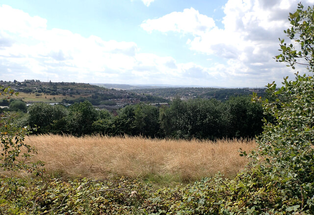
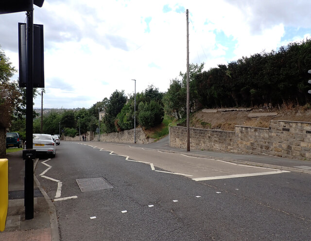
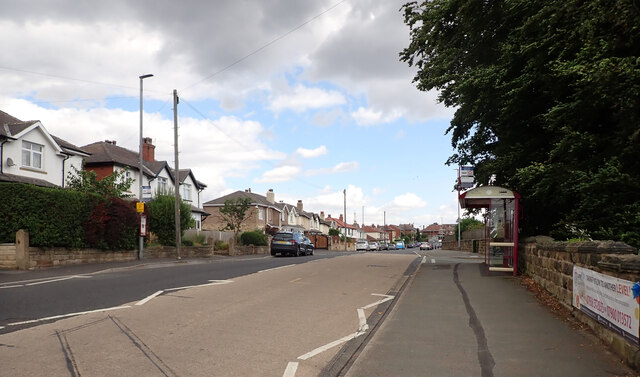
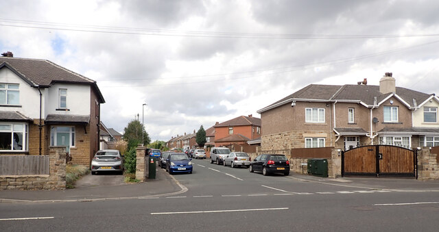
Shaw Cross is a small village located in West Yorkshire, England. It is situated near the town of Dewsbury and is part of the wider metropolitan borough of Kirklees. The village is known for its picturesque countryside, with rolling hills and lush green fields surrounding the area.

Shaw Cross has a rich history, with evidence of human settlement dating back to Roman times. In more recent history, the village was a key location for the textile industry during the Industrial Revolution, with many mills and factories operating in the area.

Today, Shaw Cross is a quiet and peaceful village, with a close-knit community and a range of local amenities including shops, pubs, and schools. The village is well-connected to nearby towns and cities, with good transport links providing easy access to the rest of Yorkshire and beyond.

Overall, Shaw Cross is a charming village with a strong sense of community and a rich heritage that is still visible in its architecture and surroundings.

If you have any feedback on the listing, please let us know in the comments section below.
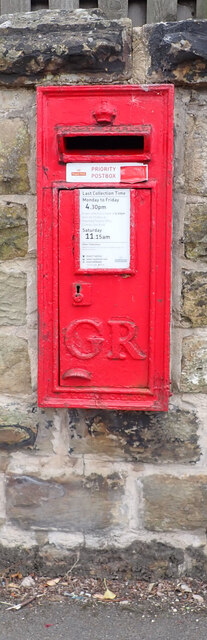
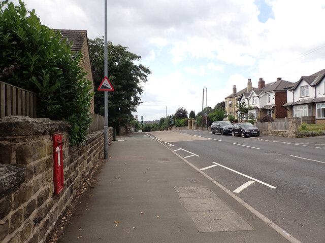
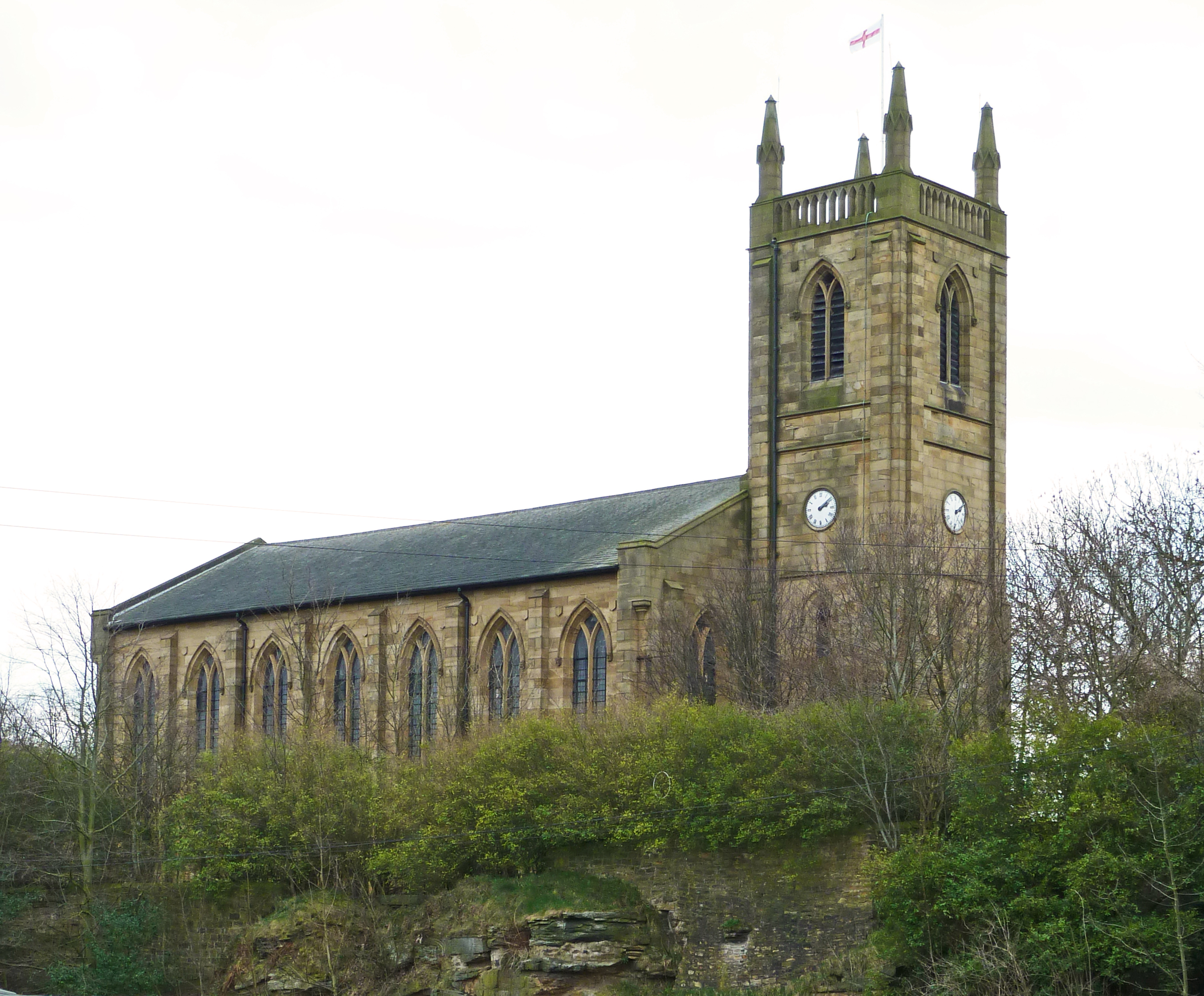
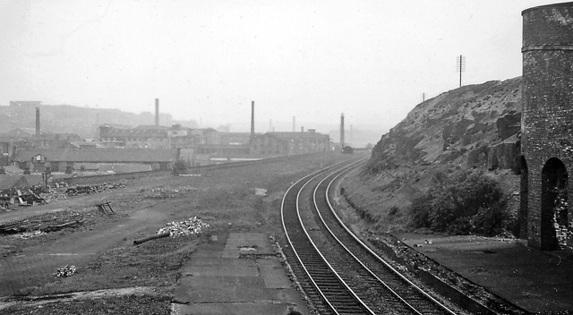
Shaw Cross Images

Images are sourced within 2km of 53.701881/-1.606131 or Grid Reference SE2622. Thanks to Geograph Open Source API. All images are credited.

A view from The Whitfield Centre, Soothill Lane, Batley Looking towards the centre of Batley.
A view from The Whitfield Centre, Soothill Lane, Batley
Looking towards the centre of Batley.
Soothill Lane (B6124), Batley
Soothill Lane  (B6124), Batley
Soothill Lane (B6124), Batley
Solway Road seen from Soothill Lane (B6124), Batley
Post box, Soothill Lane  (B6124), Batley This post box can be seen in context in <a href="https://www.geograph.org.uk/photo/7263844">SE2524 : Soothill Lane  (B6124), Batley</a>.
Post box, Soothill Lane (B6124), Batley
This post box can be seen in context in SE2524 : Soothill Lane (B6124), Batley.
Soothill Lane  (B6124), Batley A close-up of the post box can be seen in <a href="https://www.geograph.org.uk/photo/7263842">SE2524 : Post box, Soothill Lane  (B6124), Batley</a>.
Soothill Lane (B6124), Batley
A close-up of the post box can be seen in SE2524 : Post box, Soothill Lane (B6124), Batley.
Bond Street, Dewsbury A street typical of this former mill town, and very different from its London namesake.
Bond Street, Dewsbury
A street typical of this former mill town, and very different from its London namesake.
Building with datestone, 22 Bond Street, Dewsbury The date is 1868; there are initials MG for Matthew Grandidge, owner of this wool warehouse, now listed grade II (list entry 1479394). For context see <a href="https://www.geograph.org.uk/photo/7280059">SE2421 : Bond Street, Dewsbury</a>; it is the building with a flagpole.
Building with datestone, 22 Bond Street, Dewsbury
The date is 1868; there are initials MG for Matthew Grandidge, owner of this wool warehouse, now listed grade II (list entry 1479394). For context see SE2421 : Bond Street, Dewsbury; it is the building with a flagpole.
Wesley Chambers, Union Street, Dewsbury The building now appears to be a mixture of apartments and offices, but did it once have a connection with a Methodist church?
Wesley Chambers, Union Street, Dewsbury
The building now appears to be a mixture of apartments and offices, but did it once have a connection with a Methodist church?
The Cloth Quarter, Bond Street, Dewsbury At the junction with Union Street.
The Cloth Quarter, Bond Street, Dewsbury
At the junction with Union Street.
Union Street, Dewsbury This is the southern end of the street, showing the dereliction now evident in many parts of a once-thriving town. The shop glimpsed across the end of the street - the West Yorkshire Hardship Project - is another sign of deprivation.
Union Street, Dewsbury
This is the southern end of the street, showing the dereliction now evident in many parts of a once-thriving town. The shop glimpsed across the end of the street - the West Yorkshire Hardship Project - is another sign of deprivation.
North side of Dewsbury Market Place On the near corner is a phone shop with shutter bearing an image of Eileen Fenton MBE, cross-channel swimmer and 'Dewsbury girl'. Beyond is the entrance to the Arcade <a href="https://www.geograph.org.uk/photo/5686090">SE2421 : Entrance to The Arcade, Dewsbury</a>.
North side of Dewsbury Market Place
On the near corner is a phone shop with shutter bearing an image of Eileen Fenton MBE, cross-channel swimmer and 'Dewsbury girl'. Beyond is the entrance to the Arcade SE2421 : Entrance to The Arcade, Dewsbury.
Dewsbury Town Hall Built 1888-9 by Henry Holtom and George Arthur Fox, listed Grade II (list entry 1134707).

To the left is Wakefield Old Road, now cut off by the inner relief road.
Dewsbury Town Hall
Built 1888-9 by Henry Holtom and George Arthur Fox, listed Grade II (list entry 1134707). To the left is Wakefield Old Road, now cut off by the inner relief road.
Clock of Dewsbury Town Hall The clock, by Potts of Leeds, has dials on all four sides of the tower. See <a href="https://www.geograph.org.uk/photo/7280090">SE2421 : Dewsbury Town Hall</a> for context.
Clock of Dewsbury Town Hall
The clock, by Potts of Leeds, has dials on all four sides of the tower. See SE2421 : Dewsbury Town Hall for context.
Wild Flowers Snowdog This one was outside the Town Hall in Dewsbury.
Wild Flowers Snowdog
This one was outside the Town Hall in Dewsbury.
The Good Samaritan sculpture, Long Causeway, Dewsbury A sculpture by Ian Judd, 1991. See <a href="https://www.geograph.org.uk/photo/6623888">SE2421 : The Good Samaritan statue and Dewsbury Town Hall</a> for context.
The Good Samaritan sculpture, Long Causeway, Dewsbury
A sculpture by Ian Judd, 1991. See SE2421 : The Good Samaritan statue and Dewsbury Town Hall for context.
Bandstand, Long Causeway, Dewsbury
Long Causeway, URC, Dewsbury Originally the Ebenezer Congregational Church, built 1884, architect Walter Hanstock, and now grade II listed (list entry 1134701).
Long Causeway, URC, Dewsbury
Originally the Ebenezer Congregational Church, built 1884, architect Walter Hanstock, and now grade II listed (list entry 1134701).
Show me another place!

Shaw Cross is located at Grid Ref: SE2622 (Lat: 53.701881, Lng: -1.606131)

Division: West Riding

Unitary Authority: Kirklees

Police Authority: West Yorkshire

What 3 Words

///atomic.supper.status. Near Batley, West Yorkshire

Nearby Locations

Shaw Cross

Related Wikis

Hanging Heaton

Hanging Heaton is a village in West Yorkshire, England. Partly in both Batley and Dewsbury, it is an historic village mentioned in the Domesday Book under...

Manor Croft Academy

Manor Croft Academy is a smaller than average coeducational secondary school with academy status, located in the town of Dewsbury, West Yorkshire, England...

Chickenley Heath railway station

Chickenley Heath railway station served the village of Chickenley, in the historical county of West Riding of Yorkshire, England, from 1877 to 1909 on...

Staincliffe and Batley Carr railway station

Staincliffe and Batley Carr railway station served the hamlet of Staincliffe and the district of Batley Carr in West Yorkshire, England from 1878 to 1952...

Nearby Amenities

Located within 500m of 53.701881,-1.606131
Traffic Signals
Crossing: traffic_signals
Crossing Ref: puffin
Kerb: flush
Tactile Paving: yes
Lat/Long: 53.7026648/-1.6069139
Traffic Signals
Crossing: traffic_signals
Crossing Ref: pelican
Kerb: flush
Tactile Paving: yes
Lat/Long: 53.7036578/-1.6039779
Fuel
Shell
Addr City: Dewsbury
Addr Postcode: WF12 7HP
Addr Suburb: Hanging Heaton
Brand: Shell
Brand Wikidata: Q110716465
Opening Hours: Mo-Su 06:00-22:00
Phone: +44 1924 466542
Ref Navads: NVDS353_12038582
Website: https://find.shell.com/gb/fuel/12038582-shell-shaw-cross
Lat/Long: 53.7033942/-1.6059807
Post Box
Operator: Royal Mail
Post Box Type: lamp
Ref: WF12 55
Lat/Long: 53.7031614/-1.6060932
Traffic Signals
Crossing: traffic_signals
Crossing Ref: pelican
Lat/Long: 53.7040048/-1.6032763
Crossing
Crossing: uncontrolled
Crossing Ref: zebra
Lat/Long: 53.7031009/-1.6062331
Bench
Backrest: yes
Check Date: 2024-03-29
Lat/Long: 53.7031152/-1.6054477
Bus Stop
Leeds Road Glenlow Road
Check Date Shelter: 2024-03-29
Kerb: raised
Local Ref: 45015099
Naptan AtcoCode: 450015099
Naptan Bearing: SW
Naptan CommonName: Leeds Road Glenlow Road
Naptan Crossing: Glenlow Road
Naptan Indicator: Stop 45015099
Naptan PlusbusZoneRef: LEEDS
Naptan ShortCommonName: Shaw Cross
Naptan Street: Leeds Road
Naptan Verified: no
Shelter: no
Source: naptan_import
Timetable: yes
Lat/Long: 53.7020361/-1.6080687
Bus Stop
Leeds Road Croftlands
Local Ref: 45015100
Naptan AtcoCode: 450015100
Naptan Bearing: SW
Naptan CommonName: Leeds Road Croftlands
Naptan Crossing: Croftlands
Naptan Indicator: Stop 45015100
Naptan PlusbusZoneRef: LEEDS
Naptan ShortCommonName: Croftlands
Naptan Street: Leeds Road
Naptan Verified: no
Source: naptan_import
Lat/Long: 53.7007593/-1.6107011
Bus Stop
Leeds Road Croftlands
Bench: no
Bin: no
Lit: no
Local Ref: 45015106
Naptan AtcoCode: 450015106
Naptan Bearing: NE
Naptan CommonName: Leeds Road Croftlands
Naptan Crossing: Croftlands
Naptan Indicator: Stop 45015106
Naptan PlusbusZoneRef: LEEDS
Naptan ShortCommonName: Croftlands
Naptan Street: Leeds Road
Naptan Verified: no
Shelter: no
Source: naptan_import
Tactile Paving: no
Lat/Long: 53.700662/-1.6111715
Bus Stop
Leeds Road Glenlow Road
Bench: no
Bin: no
Check Date Shelter: 2024-03-29
Lit: no
Local Ref: 45015107
Naptan AtcoCode: 450015107
Naptan Bearing: NE
Naptan CommonName: Leeds Road Glenlow Road
Naptan Crossing: Glenrow Road
Naptan Indicator: Stop 45015107
Naptan PlusbusZoneRef: LEEDS
Naptan ShortCommonName: Shaw Cross
Naptan Street: Leeds Road
Naptan Verified: no
Shelter: no
Source: naptan_import
Tactile Paving: no
Lat/Long: 53.7023942/-1.6076413
Bus Stop
Shaw Cross Chidswell Lane
Check Date Shelter: 2024-03-29
Kerb: raised
Local Ref: 45015108
Naptan AtcoCode: 450015108
Naptan Bearing: NE
Naptan CommonName: Shaw Cross Chidswell Lane
Naptan Crossing: Chidswell Lane
Naptan Indicator: Stop 45015108
Naptan PlusbusZoneRef: LEEDS
Naptan ShortCommonName: Chidswell Lane
Naptan Street: Leeds Road
Naptan Verified: no
Shelter: yes
Source: naptan_import
Lat/Long: 53.7049539/-1.6015882
Bus Stop
Kirkgate High Street
Local Ref: 45016113
Naptan AtcoCode: 450016113
Naptan Bearing: W
Naptan CommonName: Kirkgate High Street
Naptan Crossing: Highgate Street
Naptan Indicator: Stop 45016113
Naptan Notes: OSR taken place 221105
Naptan PlusbusZoneRef: LEEDS
Naptan ShortCommonName: Highgate Street
Naptan Street: Kirkgate
Naptan Verified: no
Source: naptan_import
Lat/Long: 53.7041979/-1.6122296
Bus Stop
Kirkgate High Street
Local Ref: 45016114
Naptan AtcoCode: 450016114
Naptan Bearing: SW
Naptan CommonName: Kirkgate High Street
Naptan Crossing: High Street
Naptan Indicator: Stop 45016114
Naptan Landmark: Adj Hanging Heaton CE Jun & Inf School
Naptan Notes: OSR taken place 181105
Naptan PlusbusZoneRef: LEEDS
Naptan ShortCommonName: High Street
Naptan Street: Kirkgate
Naptan Verified: no
Source: naptan_import
Lat/Long: 53.7048023/-1.6101336
Bus Stop
High Street Rathlin Road
Local Ref: 45016115
Naptan AtcoCode: 450016115
Naptan Bearing: NW
Naptan CommonName: High Street Rathlin Road
Naptan Crossing: Rathlin Road
Naptan Indicator: Stop 45016115
Naptan Landmark: Working Mens Club
Naptan Notes: OSR taken place 211105
Naptan PlusbusZoneRef: LEEDS
Naptan ShortCommonName: Rathlin Road
Naptan Street: High Street
Naptan Verified: no
Source: naptan_import
Lat/Long: 53.7036597/-1.607069
Bus Stop
High Street Rathlin Road
Local Ref: 45016116
Naptan AtcoCode: 450016116
Naptan Bearing: SE
Naptan CommonName: High Street Rathlin Road
Naptan Crossing: Rathlin Road
Naptan Indicator: Stop 45016116
Naptan Landmark: Working Mens Club
Naptan Notes: OSR taken place 211105 size 1 case fitted
Naptan PlusbusZoneRef: LEEDS
Naptan ShortCommonName: Shaw Cross
Naptan Street: High Street
Naptan Verified: no
Source: naptan_import
Lat/Long: 53.7039746/-1.607157
Bus Stop
High Street Kirkgate
Local Ref: 45016117
Naptan AtcoCode: 450016117
Naptan Bearing: E
Naptan CommonName: High Street Kirkgate
Naptan Crossing: Kirkgate
Naptan Indicator: Stop 45016117
Naptan Landmark: Hanging Heaton Jun & Inf School
Naptan Notes: OSR taken place 211105 size 1 case fitted
Naptan PlusbusZoneRef: LEEDS
Naptan ShortCommonName: Kirkgate
Naptan Street: High Street
Naptan Verified: no
Source: naptan_import
Lat/Long: 53.7050333/-1.6092982
Bus Stop
High Street Kirkgate
Local Ref: 45016118
Naptan AtcoCode: 450016118
Naptan Bearing: W
Naptan CommonName: High Street Kirkgate
Naptan Crossing: Kirkgate
Naptan Indicator: Stop 45016118
Naptan Landmark: Adj Hanging Heaton Jun & Inf School
Naptan PlusbusZoneRef: LEEDS
Naptan ShortCommonName: Kirkgate
Naptan Street: High Street
Naptan Verified: no
Source: naptan_import
Lat/Long: 53.7049739/-1.6103895
Bus Stop
Windsor Road Owl Lane Estate
Local Ref: 45020476
Naptan AtcoCode: 450020476
Naptan Bearing: SW
Naptan CommonName: Windsor Road Owl Lane Estate
Naptan Crossing: Owl Lane
Naptan Indicator: Stop 45020476
Naptan PlusbusZoneRef: LEEDS
Naptan ShortCommonName: Windsor Road
Naptan Street: Windsor Road
Naptan Verified: no
Source: naptan_import
Lat/Long: 53.7013205/-1.6009561
Bus Stop
Owl Lane Estate Windsor Road
Local Ref: 45020477
Naptan AtcoCode: 450020477
Naptan Bearing: NE
Naptan CommonName: Owl Lane Estate Windsor Road
Naptan Indicator: Stop 45020477
Naptan Notes: Size 2 case fitted by Response - Awaiting new photos.
Naptan PlusbusZoneRef: LEEDS
Naptan ShortCommonName: Owl Lane Estate
Naptan Street: Windsor Road
Naptan Verified: no
Source: naptan_import
Lat/Long: 53.7014018/-1.6010613
Bus Stop
Owl Lane Dewsbury Rugby League Stadium
Local Ref: 45020484
Naptan AtcoCode: 450020484
Naptan Bearing: NW
Naptan CommonName: Owl Lane Dewsbury Rugby League Stadium
Naptan Crossing: Windsor Road
Naptan Indicator: Stop 45020484
Naptan Landmark: Dewsbury RLFC Rugby Ground
Naptan PlusbusZoneRef: LEEDS
Naptan ShortCommonName: Rugby Ground
Naptan Street: Owl Lane
Naptan Verified: yes
Source: naptan_import
Lat/Long: 53.6999984/-1.6007262
Bus Stop
Owl Lane Leeds Road
Local Ref: 45020485
Naptan AtcoCode: 450020485
Naptan Bearing: S
Naptan CommonName: Owl Lane Leeds Road
Naptan Crossing: Leeds Road
Naptan Indicator: Stop 45020485
Naptan PlusbusZoneRef: LEEDS
Naptan ShortCommonName: Owl Lane Leeds Road
Naptan Street: Owl Lane
Naptan Verified: yes
Shelter: yes
Source: naptan_import
Timetable: yes
Lat/Long: 53.7028746/-1.6033953
Bus Stop
Owl Lane Leeds Road
Local Ref: 45020486
Naptan AtcoCode: 450020486
Naptan Bearing: N
Naptan CommonName: Owl Lane Leeds Road
Naptan Crossing: Leeds Road
Naptan Indicator: Stop 45020486
Naptan Notes: OSR taken place 221105
Naptan PlusbusZoneRef: LEEDS
Naptan ShortCommonName: Owl Lane
Naptan Street: Owl Lane
Naptan Verified: yes
Shelter: no
Source: naptan_import
Timetable: yes
Lat/Long: 53.7029653/-1.6036369
Bus Stop
John Ormsby Way Leeds Road
Bay: yes
Local Ref: 45020487
Naptan AtcoCode: 450020487
Naptan Bearing: NW
Naptan CommonName: John Ormsby Way Leeds Road
Naptan Crossing: Leeds Road
Naptan Indicator: Stop 45020487
Naptan PlusbusZoneRef: LEEDS
Naptan ShortCommonName: Leeds Road
Naptan Street: John Ormsby Way
Naptan Verified: no
Shelter: yes
Source: naptan_import
Lat/Long: 53.7026014/-1.605049
Bus Stop
John Ormsby Way Leeds Road
Bay: yes
Bench: yes
Local Ref: 45020488
Naptan AtcoCode: 450020488
Naptan Bearing: SE
Naptan CommonName: John Ormsby Way Leeds Road
Naptan Crossing: Leeds Road
Naptan Indicator: Stop 45020488
Naptan Landmark: Litho Supplies
Naptan PlusbusZoneRef: LEEDS
Naptan ShortCommonName: Owl Lane Estate
Naptan Street: John Ormsby VC Way
Naptan Verified: no
Shelter: yes
Source: naptan_import
Lat/Long: 53.7027714/-1.6048051
Bus Stop
Windsor Road Windsor Close
Local Ref: 45023778
Naptan AtcoCode: 450023778
Naptan Bearing: NE
Naptan CommonName: Windsor Road Windsor Close
Naptan Crossing: Windsor Close
Naptan Indicator: Stop 45023778
Naptan PlusbusZoneRef: LEEDS
Naptan ShortCommonName: Windsor Close
Naptan Street: Windsor Road
Naptan Verified: no
Source: naptan_import
Lat/Long: 53.7020792/-1.5993735
Bus Stop
Owl Lane Windsor Road
Local Ref: 45024014
Naptan AtcoCode: 450024014
Naptan Bearing: SE
Naptan CommonName: Owl Lane Windsor Road
Naptan Crossing: Windsor Road
Naptan Indicator: Stop 45024014
Naptan Landmark: Rugby Ground
Naptan Notes: OSR taken place 300905
Naptan PlusbusZoneRef: LEEDS
Naptan ShortCommonName: Windsor Road
Naptan Street: Owl Lane
Naptan Verified: yes
Source: naptan_import
Lat/Long: 53.7012996/-1.6027739
Bus Stop
Owl Lane Forkway Forklift Trucks
Local Ref: 45024015
Naptan AtcoCode: 450024015
Naptan Bearing: NW
Naptan CommonName: Owl Lane Forkway Forklift Trucks
Naptan Crossing: Windsor Road
Naptan Indicator: Stop 45024015
Naptan PlusbusZoneRef: LEEDS
Naptan ShortCommonName: Windsor Road
Naptan Street: Owl Lane
Naptan Verified: no
Source: naptan_import
Lat/Long: 53.7014813/-1.603363
Bus Stop
Owl Lane Windsor Road
Local Ref: 45024024
Naptan AtcoCode: 450024024
Naptan Bearing: SE
Naptan CommonName: Owl Lane Windsor Road
Naptan Crossing: Nr-At Windsor Road
Naptan Indicator: Stop 45024024
Naptan Landmark: Dewsbury RLFC Rugby Ground
Naptan PlusbusZoneRef: LEEDS
Naptan ShortCommonName: Rugby Ground
Naptan Street: Owl Lane
Naptan Verified: yes
Source: naptan_import
Lat/Long: 53.6998802/-1.6003032
Kirkgate Highgate Street
Local Ref: 45050388
Naptan AtcoCode: 450050388
Naptan Bearing: E
Naptan BusStopType: CUS
Naptan CommonName: Kirkgate Highgate Street
Naptan Indicator: Stop 45050388
Naptan PlusbusZoneRef: LEEDS
Naptan ShortCommonName: Highgate Street
Naptan Street: Kirkgate
Naptan Verified: no
Source: naptan_import
Lat/Long: 53.7042878/-1.6122591
Addr Housenumber: 790
Lat/Long: 53.7040701/-1.6028425
Addr Housenumber: 766
Lat/Long: 53.7038443/-1.6033603
Turning Loop
Lat/Long: 53.701806/-1.6123294
Turning Circle
Lat/Long: 53.7012055/-1.6131506
Turning Circle
Lat/Long: 53.7022449/-1.6104194
Turning Circle
Lat/Long: 53.7037251/-1.6113147
Turning Circle
Lat/Long: 53.7032534/-1.6087197
Turning Circle
Lat/Long: 53.7034957/-1.607895
Traffic Signals
Crossing: traffic_signals
Crossing Ref: pelican
Kerb: lowered
Tactile Paving: yes
Lat/Long: 53.7031642/-1.6053656
Traffic Signals
Crossing: traffic_signals
Crossing Ref: pelican
Kerb: lowered
Tactile Paving: yes
Lat/Long: 53.7032298/-1.6050902
Traffic Signals
Check Date Tactile Paving: 2024-03-29
Crossing: traffic_signals
Crossing Ref: pelican
Kerb: lowered
Tactile Paving: yes
Lat/Long: 53.7033375/-1.6051452
Traffic Signals
Crossing: traffic_signals
Crossing Ref: pelican
Kerb: lowered
Tactile Paving: yes
Lat/Long: 53.703464/-1.6054223
Traffic Signals
Crossing: traffic_signals
Crossing Ref: pelican
Kerb: lowered
Tactile Paving: yes
Lat/Long: 53.7032276/-1.6055622
The Big T Cleaners
Phone: +44 1924 463593
Shop: laundry
Lat/Long: 53.7010812/-1.6104098
Traffic Signals
Crossing: traffic_signals
Crossing Ref: pelican
Kerb: lowered
Tactile Paving: yes
Lat/Long: 53.7035015/-1.6056123
Traffic Calming: table
Lat/Long: 53.7049905/-1.6096296
Post Box
Operator: Royal Mail
Post Box Apertures: 2
Post Box Design: type_c
Post Box Type: pillar
Ref: WF12 996;WF12 1996
Royal Cypher: EIIR
Royal Cypher Wikidata: Q33102113
Lat/Long: 53.7008941/-1.605195
Telephone
Booth: KX100
Covered: booth
Lat/Long: 53.7028502/-1.601232
Post Box
Operator: Royal Mail
Post Box Type: pillar
Ref: WF12 51
Lat/Long: 53.7028625/-1.6012099
Barrier: yes
Lat/Long: 53.6991774/-1.6072774
Barrier: yes
Lat/Long: 53.6985535/-1.6071274
Fast Food
McDonald's
Addr City: Dewsbury
Addr Housenumber: 18B
Addr Postcode: WF12 7RQ
Addr Street: Owl Lane
Addr Suburb: Hanging Heaton
Brand: McDonald's
Brand Wikidata: Q38076
Cuisine: burger
Fhrs Id: 1575758
Takeaway: yes
Website: https://www.mcdonalds.com/gb/en-gb/location/dewsbury/dewsbury---shaw-cross/owl-lane/8261678.html
Lat/Long: 53.7031512/-1.6046485
The data included in this document is from www.openstreetmap.org. The data is made available under ODbL.

Have you been to Shaw Cross?

Leave your review of Shaw Cross below (or comments, questions and feedback).