Shaw

Settlement in Berkshire

England

Shaw

Donnington : Newbury Relief Road A339 Looking along the dual carriageway.
Donnington : Newbury Relief Road A339 Credit: Lewis Clarke

The requested URL returned error: 429 Too Many Requests

If you have any feedback on the listing, please let us know in the comments section below.
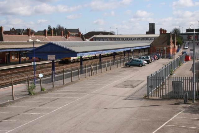
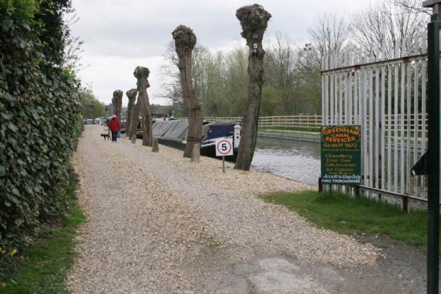
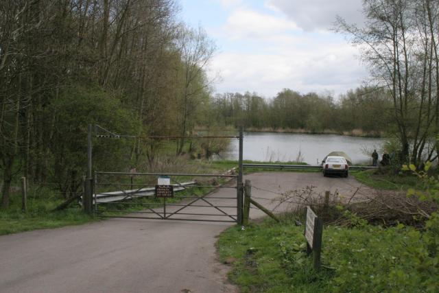
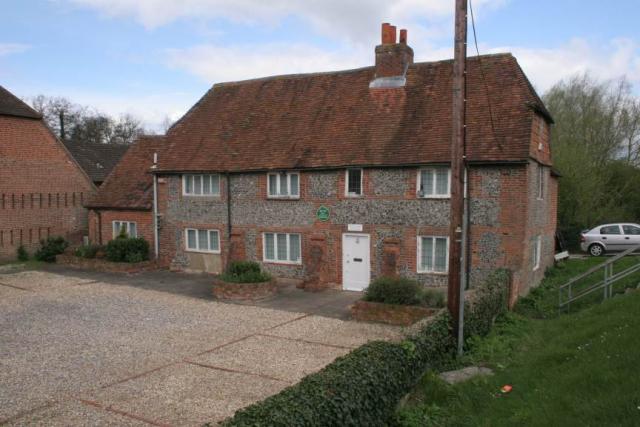
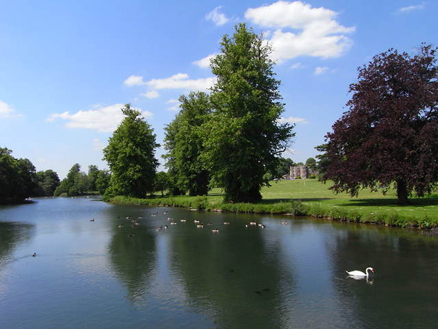
Shaw Images

Images are sourced within 2km of 51.413391/-1.3180129 or Grid Reference SU4768. Thanks to Geograph Open Source API. All images are credited.

Donnington : Newbury Relief Road A339 Looking along the dual carriageway.
Donnington : Newbury Relief Road A339
Looking along the dual carriageway.
Grange Farm fields Farmed fields beside the access road to Grange Farm.
Grange Farm fields
Farmed fields beside the access road to Grange Farm.
Wantage Road
Wantage Road
Snelsmore House Now the club house for Donnington Valley Golf Club. Originally owned by the Marquis of Zetland. Requisitioned during WW2 by the army, and became a girl's boarding school in 1947 until the late 60s.
Snelsmore House
Now the club house for Donnington Valley Golf Club. Originally owned by the Marquis of Zetland. Requisitioned during WW2 by the army, and became a girl's boarding school in 1947 until the late 60s.
Farmland, Donnington In a field above the junction of the A34 and A339 which are in a cutting. The northern end of High Wood is on the left.
Farmland, Donnington
In a field above the junction of the A34 and A339 which are in a cutting. The northern end of High Wood is on the left.
Pasture, Curridge The hillside on the approach to Red Farm with the bridleway to the left.
Pasture, Curridge
The hillside on the approach to Red Farm with the bridleway to the left.
Farmland, Curridge The view from an area of rougher ground across pasture and a small part of an arable field below a wooded hillside.
Farmland, Curridge
The view from an area of rougher ground across pasture and a small part of an arable field below a wooded hillside.
Newbury Newbury Railway Station, looking east
Newbury
Newbury Railway Station, looking east
Newbury A view looking west along the Kennet and Avon Canal.
Newbury
A view looking west along the Kennet and Avon Canal.
Newbury One of the many reclaimed gravel pits in this square. This one is used by the Newbury Angling Club.
Newbury
One of the many reclaimed gravel pits in this square. This one is used by the Newbury Angling Club.
Newbury A listed building of special historic and architectural importance - now offices!
Newbury
A listed building of special historic and architectural importance - now offices!
Newbury: New Vodafone Headquarters This HQ is situated in the north western section of the grid square and the picture was taken from the west side of the building. Most of this square is residential with some farmland and some commercial activity.
Newbury: New Vodafone Headquarters
This HQ is situated in the north western section of the grid square and the picture was taken from the west side of the building. Most of this square is residential with some farmland and some commercial activity.
Corner of Pound Street and Argyle Road: Newbury This old building is typical of the old buildings in Newbury, an old market town.
Corner of Pound Street and Argyle Road: Newbury
This old building is typical of the old buildings in Newbury, an old market town.
Donnington Castle - UK Approaching the castle from the car park to the south.  This is a Civil War siege castle, built around 1386.
Donnington Castle - UK
Approaching the castle from the car park to the south. This is a Civil War siege castle, built around 1386.
St Nicholas: Church in Newbury Town Centre This church is to be seen in the extreme south west corner of the grid square. The picture was taken from the east side of the building, looking west.
St Nicholas: Church in Newbury Town Centre
This church is to be seen in the extreme south west corner of the grid square. The picture was taken from the east side of the building, looking west.
Newbury Town Hall The town council building is situated east of the church in the south west corner of the grid square. The open space in front of it holds the market which occurs during the week and on Saturdays.
Newbury Town Hall
The town council building is situated east of the church in the south west corner of the grid square. The open space in front of it holds the market which occurs during the week and on Saturdays.
HSBC Bank Building: Newbury This building situated north east of the church and north west from the Town Council Building is situated in the south western section of the grid square.
HSBC Bank Building: Newbury
This building situated north east of the church and north west from the Town Council Building is situated in the south western section of the grid square.
River Lambourn at Donnington View West over the river Lambourn, at Donnington Grove Country Club.
River Lambourn at Donnington
View West over the river Lambourn, at Donnington Grove Country Club.
Show me another place!

Shaw is located at Grid Ref: SU4768 (Lat: 51.413391, Lng: -1.3180129)

Unitary Authority: West Berkshire

Police Authority: Thames Valley

What 3 Words

///twigs.glue.jaws. Near Newbury, Berkshire

Nearby Locations

Shaw

Related Wikis

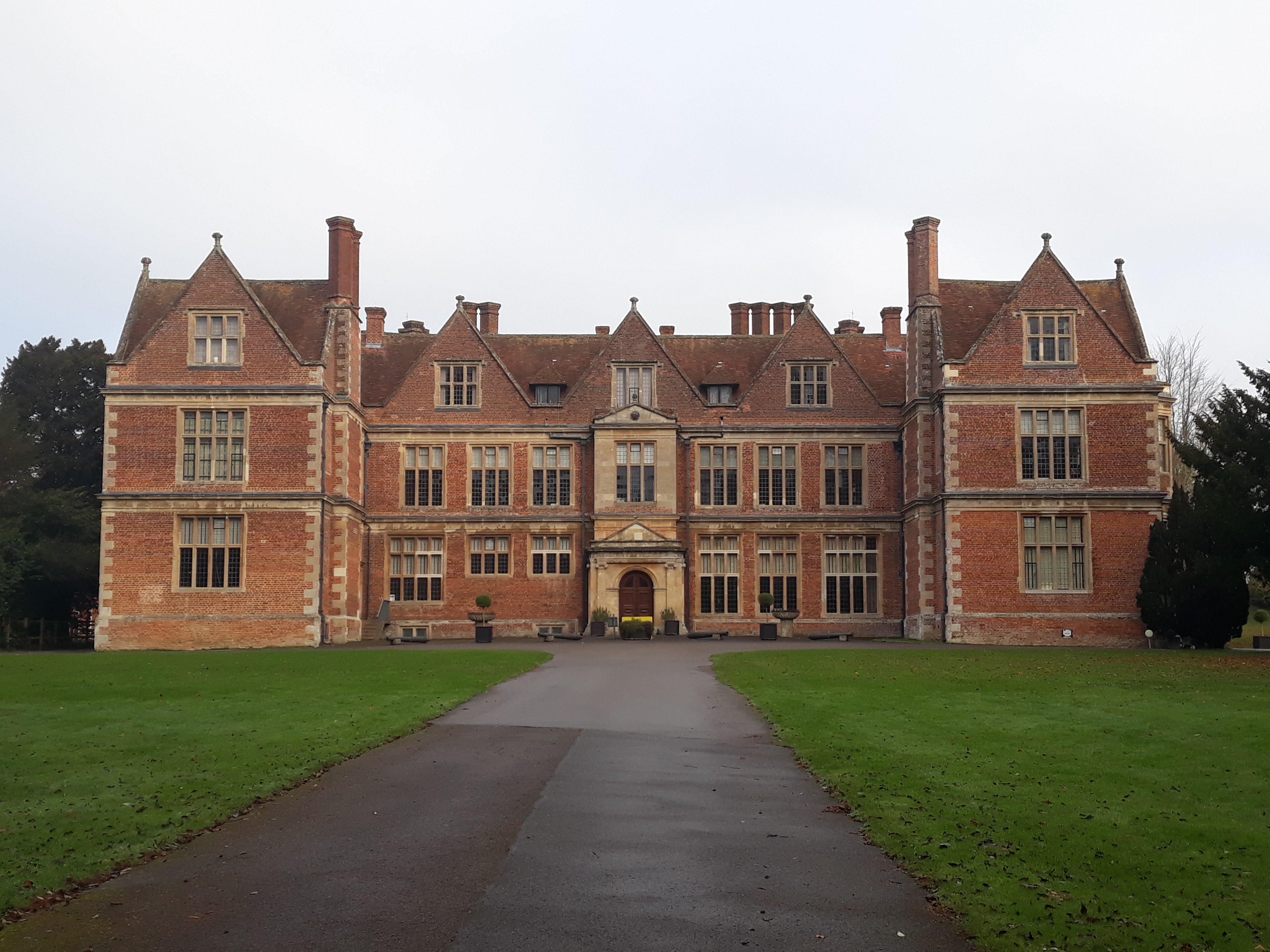
Shaw House, Berkshire

Shaw House is an important example of an early symmetrical H-plan Elizabethan mansion, located at Shaw, on the north-eastern outskirts of Newbury in Berkshire...

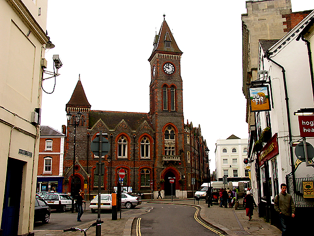
Trinity School, Newbury

Trinity School is a co-educational secondary school with academy status in Newbury, Berkshire, England. The school opened in September 1999 when two existing...

Shaw-cum-Donnington

Shaw-cum-Donnington is a civil parish in West Berkshire, England with all of its urban or suburban area immediately north of the largest town in the district...
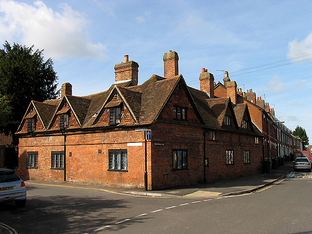
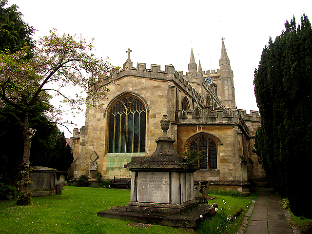
Shaw, Berkshire

Shaw is a suburban village in Berkshire, England. It is located to the north of Newbury, near the village of Donnington. It is in the parish of Shaw-cum...

Nearby Amenities

Located within 500m of 51.413391,-1.3180129
Mini Roundabout
Lat/Long: 51.4121749/-1.3125038
Mini Roundabout
Direction: clockwise
Lat/Long: 51.4099684/-1.3140962
Mini Roundabout
Direction: clockwise
Lat/Long: 51.4098304/-1.3140091
Mini Roundabout
Lat/Long: 51.4136542/-1.3193056
Crossing
Crossing Island: no
Kerb: lowered
Tactile Paving: yes
Lat/Long: 51.4135409/-1.3189061
Crossing
Crossing: uncontrolled
Crossing Ref: zebra
Kerb: no
Supervised: no
Tactile Paving: no
Lat/Long: 51.4141065/-1.3186028
Mini Roundabout
Direction: clockwise
Lat/Long: 51.4143381/-1.318372
Colour: white
Traffic Calming: rumble_strip
Lat/Long: 51.4152127/-1.3185721
Crossing
Source: Bing
Lat/Long: 51.4152097/-1.3204195
Crossing
Lat/Long: 51.4157152/-1.3184946
Traffic Calming: rumble_strip
Lat/Long: 51.4159365/-1.3208574
Crossing
Source: Bing
Lat/Long: 51.416153/-1.3209714
Crossing
Lat/Long: 51.4162485/-1.3185754
Traffic Calming: rumble_strip
Lat/Long: 51.4164047/-1.3210521
Crossing
Lat/Long: 51.4168495/-1.3189777
Crossing
Lat/Long: 51.4169508/-1.3210523
Colour: white
Traffic Calming: rumble_strip
Lat/Long: 51.4171777/-1.3193436
Colour: white
Traffic Calming: rumble_strip
Lat/Long: 51.4173351/-1.3197419
Give Way
Direction: forward
Lat/Long: 51.4173037/-1.3208803
Bus Stop
Kingsley Close
Bench: no
Bin: no
Bus: yes
Lit: yes
Naptan AtcoCode: 030053500001
Naptan NaptanCode: brkgwpg
Public Transport: platform
Shelter: no
Tactile Paving: no
Lat/Long: 51.412432/-1.313797
Bus Stop
Northern Avenue
Bench: no
Bin: no
Bus: yes
Check Date Shelter: 2022-10-13
Lit: no
Public Transport: platform
Shelter: no
Tactile Paving: no
Lat/Long: 51.41457/-1.323488
Post Box
Drive Through: no
Lat/Long: 51.413074/-1.324123
Bus Stop
Almond Avenue
Bus: yes
Public Transport: platform
Shelter: yes
Lat/Long: 51.410558/-1.323488
Bus Stop
Dene Way
Lat/Long: 51.4131209/-1.3246743
Crossing
Lat/Long: 51.4149658/-1.3185375
Crossing
Lat/Long: 51.4168136/-1.3192447
Access: permissive
Barrier: lift_gate
Motorcar: yes
Lat/Long: 51.4150448/-1.3205436
Entrance: yes
Lat/Long: 51.4161204/-1.32119
Shaw
Place: village
Source: os25k
Wikidata: Q7491132
Lat/Long: 51.4117782/-1.3158045
Barrier: block
Material: reinforced_concrete
Lat/Long: 51.4121653/-1.3194708
Communication Mobile Phone: yes
Man Made: mast
Tower Construction: mast
Tower Type: communication
Lat/Long: 51.4092632/-1.3189048
Give Way
Direction: forward
Lat/Long: 51.4173342/-1.320333
Entrance: yes
Lat/Long: 51.411873/-1.3184151
Entrance: yes
Lat/Long: 51.4117511/-1.3187817
Entrance: yes
Lat/Long: 51.4116937/-1.3185811
Barrier: kissing_gate
Foot: yes
Maxwidth: 1.5
Lat/Long: 51.413759/-1.3191458
Traffic Signals
Source: Bing
Traffic Signals: signal
Traffic Signals Direction: forward
Lat/Long: 51.4089542/-1.3185717
Traffic Signals
Source: Bing
Traffic Signals: signal
Traffic Signals Direction: forward
Lat/Long: 51.4090736/-1.3184905
Camera Mount: pole
Camera Type: dome
Height: 4
Man Made: surveillance
Surveillance: outdoor
Surveillance Type: camera
Surveillance Zone: traffic
Lat/Long: 51.4160838/-1.3208565
Street Lamp
Lamp Mount: bent_mast
Lamp Type: electric
Opening Hours: Mo-Fr 22:00-05:00
Lat/Long: 51.4158931/-1.3208714
Street Lamp
Lamp Mount: bent_mast
Lamp Type: electric
Opening Hours: Mo-Fr 22:00-05:00
Lat/Long: 51.4159774/-1.3209166
Street Lamp
Lamp Mount: bent_mast
Lamp Type: electric
Opening Hours: Mo-Fr 22:00-05:00
Lat/Long: 51.4161338/-1.3209873
Street Lamp
Lamp Mount: bent_mast
Lamp Type: electric
Opening Hours: Mo-Fr 22:00-05:00
Lat/Long: 51.4161876/-1.3209343
Bus Stop
7
Bench: yes
Naptan AtcoCode: 030058140001
Naptan CommonName: Clarke House
Naptan Indicator: Near
Naptan NaptanCode: brkpgtd
Passenger Information Display: yes
Shelter: yes
Lat/Long: 51.4163849/-1.3208967
Street Lamp
Lamp Mount: bent_mast
Lamp Type: electric
Opening Hours: Mo-Fr 22:00-05:00
Lat/Long: 51.4152324/-1.3203925
Bus Stop
6
Bench: yes
Passenger Information Display: yes
Shelter: yes
Lat/Long: 51.4156786/-1.3206186
Street Lamp
Lamp Mount: bent_mast
Lamp Type: electric
Opening Hours: Mo-Fr 22:00-05:00
Lat/Long: 51.4145139/-1.3204609
Street Lamp
Lamp Mount: bent_mast
Lamp Type: electric
Opening Hours: Mo-Fr 22:00-05:00
Lat/Long: 51.4144102/-1.3202919
Street Lamp
Lamp Mount: bent_mast
Lamp Type: electric
Opening Hours: Mo-Fr 22:00-05:00
Lat/Long: 51.4142805/-1.3199687
Street Lamp
Lamp Mount: bent_mast
Lamp Type: electric
Opening Hours: Mo-Fr 22:00-05:00
Lat/Long: 51.4141509/-1.3196281
Street Lamp
Lamp Mount: bent_mast
Lamp Type: electric
Opening Hours: Mo-Fr 22:00-05:00
Lat/Long: 51.4140522/-1.3191748
Street Lamp
Lamp Mount: bent_mast
Lamp Type: electric
Opening Hours: Mo-Fr 22:00-05:00
Lat/Long: 51.4140338/-1.3187537
Street Lamp
Lamp Mount: bent_mast
Lamp Type: electric
Opening Hours: Mo-Fr 22:00-05:00
Lat/Long: 51.4143065/-1.3182843
Street Lamp
Lamp Mount: bent_mast
Lamp Type: electric
Opening Hours: Mo-Fr 22:00-05:00
Lat/Long: 51.4141024/-1.3185565
Street Lamp
Lamp Mount: bent_mast
Lamp Type: electric
Opening Hours: Mo-Fr 22:00-05:00
Lat/Long: 51.416064/-1.3209561
Direction: N
Maxspeed: 10
Traffic Sign: maxspeed
Lat/Long: 51.4160825/-1.3208555
Direction: N
Maxspeed: 10
Traffic Sign: maxspeed
Lat/Long: 51.4164075/-1.321
Bus Stop
5
Bench: yes
Bin: no
Naptan AtcoCode: 030058140002
Naptan CommonName: Babbage House
Naptan Indicator: Near
Naptan NaptanCode: brkpgtg
Passenger Information Display: yes
Shelter: yes
Tactile Paving: no
Lat/Long: 51.4150018/-1.3203327
Traffic Calming: rumble_strip
Lat/Long: 51.4148828/-1.3204837
Street Lamp
Lamp Mount: bent_mast
Lamp Type: electric
Opening Hours: Mo-Fr 22:00-05:00
Lat/Long: 51.4149873/-1.3185713
Street Lamp
Lamp Mount: bent_mast
Lamp Type: electric
Opening Hours: Mo-Fr 22:00-05:00
Lat/Long: 51.4151889/-1.3185297
Direction: S
Maxspeed: 10
Traffic Sign: maxspeed
Lat/Long: 51.4158112/-1.3184807
Colour: white
Traffic Calming: rumble_strip
Lat/Long: 51.4155343/-1.3185558
Street Lamp
Lamp Mount: bent_mast
Lamp Type: electric
Opening Hours: Mo-Fr 22:00-05:00
Lat/Long: 51.4150634/-1.3185082
Street Lamp
Lamp Mount: bent_mast
Lamp Type: electric
Opening Hours: Mo-Fr 22:00-05:00
Lat/Long: 51.4149463/-1.3185015
Street Lamp
Lamp Mount: bent_mast
Lamp Type: electric
Opening Hours: Mo-Fr 22:00-05:00
Lat/Long: 51.414856/-1.3184559
Direction: S
Maxspeed: 10
Traffic Sign: maxspeed
Lat/Long: 51.4147757/-1.3185149
Street Lamp
Lamp Mount: bent_mast
Lamp Type: electric
Opening Hours: Mo-Fr 22:00-05:00
Lat/Long: 51.4144002/-1.3182883
Bus Stop
4
Bench: yes
Bin: no
Bus: yes
Lit: no
Naptan AtcoCode: 030058140003
Naptan CommonName: Baird House
Naptan Indicator: Near
Naptan NaptanCode: brkpgtj
Passenger Information Display: yes
Public Transport: platform
Shelter: yes
Tactile Paving: no
Lat/Long: 51.414759/-1.3185874
Street Lamp
Lamp Mount: bent_mast
Lamp Type: electric
Opening Hours: Mo-Fr 22:00-05:00
Lat/Long: 51.4145043/-1.3183379
Street Lamp
Lamp Mount: bent_mast
Lamp Type: electric
Opening Hours: Mo-Fr 22:00-05:00
Lat/Long: 51.4143107/-1.3184693
Street Lamp
Lamp Mount: bent_mast
Lamp Type: electric
Opening Hours: Mo-Fr 22:00-05:00
Lat/Long: 51.417463/-1.3210456
Street Lamp
Lamp Mount: bent_mast
Lamp Type: electric
Opening Hours: Mo-Fr 22:00-05:00
Lat/Long: 51.4174254/-1.3200934
Street Lamp
Lamp Mount: bent_mast
Lamp Type: electric
Opening Hours: Mo-Fr 22:00-05:00
Lat/Long: 51.4174639/-1.3202316
Street Lamp
Lamp Mount: bent_mast
Lamp Type: electric
Opening Hours: Mo-Fr 22:00-05:00
Lat/Long: 51.4175358/-1.3204394
Street Lamp
Lamp Mount: bent_mast
Lamp Type: electric
Opening Hours: Mo-Fr 22:00-05:00
Lat/Long: 51.417591/-1.320595
Entrance: main
Lat/Long: 51.4150911/-1.3199884
Bus Stop
3
Bench: yes
Naptan AtcoCode: 030058140004
Naptan CommonName: Kilby House
Naptan Indicator: Near
Naptan NaptanCode: brkpgtm
Passenger Information Display: yes
Shelter: yes
Lat/Long: 51.4154842/-1.3186781
Direction: S
Maxspeed: 10
Traffic Sign: maxspeed
Lat/Long: 51.416036/-1.3185659
Bus Stop
2
Bench: yes
Naptan AtcoCode: 030058140005
Naptan CommonName: Bell House
Naptan Indicator: Near
Naptan NaptanCode: brkpgtp
Passenger Information Display: yes
Shelter: yes
Lat/Long: 51.4160435/-1.3186383
Barrier: cycle_barrier
Bicycle: yes
Cycle Barrier: triple
Foot: yes
Lat/Long: 51.4103935/-1.3174004
Give Way
Direction: forward
Lat/Long: 51.4133349/-1.3137191
Entrance: yes
Lat/Long: 51.4161378/-1.3215141
Fountain
Drinking Water: no
Height: 2
Lat/Long: 51.4157731/-1.3196611
Waste Basket
Waste: dog_excrement;trash
Lat/Long: 51.4117405/-1.3219962
Waste Basket
Waste: dog_excrement
Lat/Long: 51.4153273/-1.3116297
Barrier: kissing_gate
Material: wood
Lat/Long: 51.4169977/-1.3173434
Post Box
Collection Times: Mo-Fr 09:00; Sa 07:00
Operator: Royal Mail
Operator Wikidata: Q638098
Post Box Type: lamp
Ref: RG14 251D
Royal Cypher: EIIR
Lat/Long: 51.4127743/-1.3139071
Board Type: notice
Information: board
Tourism: information
Lat/Long: 51.4121484/-1.3127435
Traffic Calming: choker
Lat/Long: 51.4128878/-1.3157223
Maxwidth: 3.5
Source Maxwidth: ARCore
Traffic Calming: choker
Lat/Long: 51.4124175/-1.3135296
Traffic Calming: choker
Lat/Long: 51.4133012/-1.3176351
Communication Microwave: yes
Communication Mobile Phone: yes
Man Made: antenna
Material: metal
Operator: Orange
Lat/Long: 51.4163833/-1.3147035
Waste Basket
Waste: trash
Lat/Long: 51.4154829/-1.3121487
Waste Basket
Waste: dog_excrement
Lat/Long: 51.4127382/-1.3139298
Defibrillator
Defibrillator Location: On a lamppost
Emergency: defibrillator
Indoor: no
Lat/Long: 51.4126907/-1.3140648
The data included in this document is from www.openstreetmap.org. The data is made available under ODbL.

Have you been to Shaw?

Leave your review of Shaw below (or comments, questions and feedback).