Blaenbedw Fawr

Settlement in Cardiganshire

Wales

Blaenbedw Fawr

Ordnance Survey Cut Mark This OS cut mark can be found on Bwlch Rhyd. It marks a point 196.108m above mean sea level.
Ordnance Survey Cut Mark Credit: Adrian Dust

Blaenbedw Fawr is a small village located in the county of Cardiganshire in Wales, United Kingdom. Situated in the scenic countryside, it is surrounded by lush green fields and rolling hills, offering a peaceful and picturesque setting.

The village is home to a modest population, primarily consisting of farming families and those seeking a tranquil rural lifestyle. The local community is close-knit and friendly, creating a warm and welcoming atmosphere for residents and visitors alike.

Blaenbedw Fawr is known for its rich agricultural heritage, with farming being the primary occupation of many residents. The fertile soil and favorable climate are conducive to the cultivation of crops and the rearing of livestock, making agriculture a vital part of the local economy.

In terms of amenities, the village has a small local shop that caters to the basic needs of the community. However, for more extensive shopping and services, residents typically travel to nearby towns such as Cardigan or Aberystwyth.

Nature enthusiasts will find plenty to explore in the surrounding area, with numerous walking trails and scenic spots to discover. The village is also in close proximity to the stunning Cardigan Bay coastline, offering opportunities for coastal walks and water-based activities.

Overall, Blaenbedw Fawr offers a tranquil and idyllic lifestyle in a beautiful countryside setting, making it an attractive place for those seeking a peaceful retreat away from the hustle and bustle of urban life.

If you have any feedback on the listing, please let us know in the comments section below.

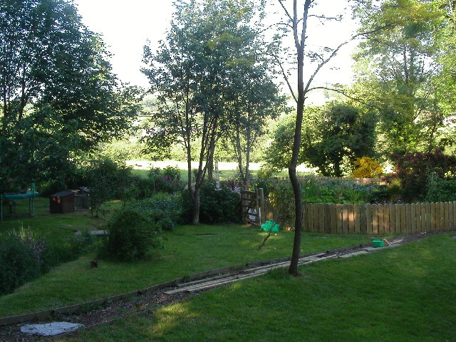
Blaenbedw Fawr Images

Images are sourced within 2km of 52.132898/-4.397529 or Grid Reference SN3651. Thanks to Geograph Open Source API. All images are credited.

Ordnance Survey Cut Mark This OS cut mark can be found on Bwlch Rhyd. It marks a point 196.108m above mean sea level.
Ordnance Survey Cut Mark
This OS cut mark can be found on Bwlch Rhyd. It marks a point 196.108m above mean sea level.
Ordnance Survey Cut Mark This OS cut mark can be found on the NW parapet of the bridge. It marks a point 186.734m above mean sea level.
Ordnance Survey Cut Mark
This OS cut mark can be found on the NW parapet of the bridge. It marks a point 186.734m above mean sea level.
Ordnance Survey Cut Mark This OS cut mark can be found on Rhyd Fach. It marks a point 210.601m above mean sea level.
Ordnance Survey Cut Mark
This OS cut mark can be found on Rhyd Fach. It marks a point 210.601m above mean sea level.
Ordnance Survey Cut Mark This OS cut mark can be found on the roadside barn at Ty-rhos Farm. It marks a point 230.302m above mean sea level.
Ordnance Survey Cut Mark
This OS cut mark can be found on the roadside barn at Ty-rhos Farm. It marks a point 230.302m above mean sea level.
Ordnance Survey Cut Mark This OS cut mark can be found on the SW parapet of Blaen Bedw Fawr Bridge. It marks a point 195.213m above mean sea level.
Ordnance Survey Cut Mark
This OS cut mark can be found on the SW parapet of Blaen Bedw Fawr Bridge. It marks a point 195.213m above mean sea level.
Ordnance Survey Cut Mark This OS cut mark can be found on the roadside barn at Blaenbedw Fawr Farm. It marks a point 199.244m above mean sea level.
Ordnance Survey Cut Mark
This OS cut mark can be found on the roadside barn at Blaenbedw Fawr Farm. It marks a point 199.244m above mean sea level.
Churn Stand There is an Ordnance Survey rivet on the top of the stand. <a title="https://www.geograph.org.uk/photo/7446195" href="https://www.geograph.org.uk/photo/7446195">Link</a>
Churn Stand
There is an Ordnance Survey rivet on the top of the stand. Link
Ordnance Survey Rivet This OS rivet can be found on the top of the churn stand. It marks a point 242.873m above mean sea level. <a title="https://www.geograph.org.uk/photo/7446194" href="https://www.geograph.org.uk/photo/7446194">Link</a>
Ordnance Survey Rivet
This OS rivet can be found on the top of the churn stand. It marks a point 242.873m above mean sea level. Link
Ordnance Survey Cut Mark This OS cut mark can be found on the wall at the entrance to Cwm Bedw. It marks a point 186.093m above mean sea level.
Ordnance Survey Cut Mark
This OS cut mark can be found on the wall at the entrance to Cwm Bedw. It marks a point 186.093m above mean sea level.
A487 nearing Pentregat
A487 at Plwmp village boundary
Old Milestone by the A487, Plwmp, Llandysiliogogo Parish Cardigan low profile top by the A487, in parish of Llandysiliogogo (Ceredigion District), Plwmp, in village centre, on verge, South side of road. An earlier photograph can be found here <a title="https://www.geograph.org.uk/photo/6042986" href="https://www.geograph.org.uk/photo/6042986">Link</a>.

Inscription reads:-
TO
CARDIGAN
13 MILES
{arrow}

Grade II listed by Cadw. Reference Number: 16638 <span class="nowrap"><a title="https://cadwpublic-api.azurewebsites.net/reports/listedbuilding/FullReport?lang=&id=16638" rel="nofollow ugc noopener" href="https://cadwpublic-api.azurewebsites.net/reports/listedbuilding/FullReport?lang=&id=16638">Link</a><img style="margin-left:2px;" alt="External link" title="External link - shift click to open in new window" src="https://s1.geograph.org.uk/img/external.png" width="10" height="10"/></span>

Milestone Society National ID: CRD_CAAY13
Old Milestone by the A487, Plwmp, Llandysiliogogo Parish
Cardigan low profile top by the A487, in parish of Llandysiliogogo (Ceredigion District), Plwmp, in village centre, on verge, South side of road. An earlier photograph can be found here Link. Inscription reads:- TO CARDIGAN 13 MILES {arrow} Grade II listed by Cadw. Reference Number: 16638 LinkExternal link Milestone Society National ID: CRD_CAAY13
Milestone Old milestone on the A487 near Wervil Grange, Pentregat.
Milestone
Old milestone on the A487 near Wervil Grange, Pentregat.
Pantycrugiau Chapel Pantycrugiau Congregational Chapel at Plwmp.
Pantycrugiau Chapel
Pantycrugiau Congregational Chapel at Plwmp.
Tree in Lake View of Wervil Grange Farm with tree in lake
Tree in Lake
View of Wervil Grange Farm with tree in lake
B4321 ger Pentregat / The B4321 near Pentregat Ffordd B syn arwain i Langrannog / B road leading to Llangrannog
B4321 ger Pentregat / The B4321 near Pentregat
Ffordd B syn arwain i Langrannog / B road leading to Llangrannog
Footbridge over Afon Bedw This stream running through a wooded valley may be typical of many in this part of West Wales but it is nonetheless charming as you walk the streamside public footpath and cross this bridge to climb the hillside beyond.
Footbridge over Afon Bedw
This stream running through a wooded valley may be typical of many in this part of West Wales but it is nonetheless charming as you walk the streamside public footpath and cross this bridge to climb the hillside beyond.
Boggy field by road junction Raindrops hanging from a metal gate, mists hanging in the trees: the next day the weather changed to glorious sun.
Boggy field by road junction
Raindrops hanging from a metal gate, mists hanging in the trees: the next day the weather changed to glorious sun.
Show me another place!

Blaenbedw Fawr is located at Grid Ref: SN3651 (Lat: 52.132898, Lng: -4.397529)

Unitary Authority: Ceredigion

Police Authority: Dyfed Powys

What 3 Words

///guessing.overdrive.swaps. Near Llanllwchaiarn, Ceredigion

Nearby Locations

Blaenbedw Fawr

Related Wikis

Blaenbedw Fawr

Blaenbedw Fawr is a small village in the community of Llandysiliogogo, Ceredigion, Wales, which is 68.9 miles (110.8 km) from Cardiff and 187 miles (300...

Pentre-gat

Pentre-gat is a small village in the community of Llangrannog, Ceredigion, Wales, which is 69.6 miles (112 km) from Swansea and 381 miles (302.3 km) from...

Brynhoffnant

Brynhoffnant is a small village in the community of Penbryn, Ceredigion, Wales, which is 70.4 miles (113.3 km) from Cardiff and 189.1 miles (304.3 km)...

Cwmcoednerth

Cwmcoednerth is a hamlet in the community of Penbryn, Ceredigion, Wales, which is 68.6 miles (110.4 km) from Cardiff and 188 miles (302.5 km) from London...

Nearby Amenities

Located within 500m of 52.132898,-4.397529
Direction: 215
Generator Method: photovoltaic
Generator Output Electricity: yes
Generator Solar Modules: 4
Generator Source: solar
Generator Type: solar_photovoltaic_panel
Location: roof
Power: generator
Lat/Long: 52.1357847/-4.3963545
The data included in this document is from www.openstreetmap.org. The data is made available under ODbL.

Have you been to Blaenbedw Fawr?

Leave your review of Blaenbedw Fawr below (or comments, questions and feedback).