Scrivelsby

Settlement in Lincolnshire East Lindsey

England

Scrivelsby

Farm track and footpath to Horncastle
Farm track and footpath to Horncastle Credit: Jonathan Thacker

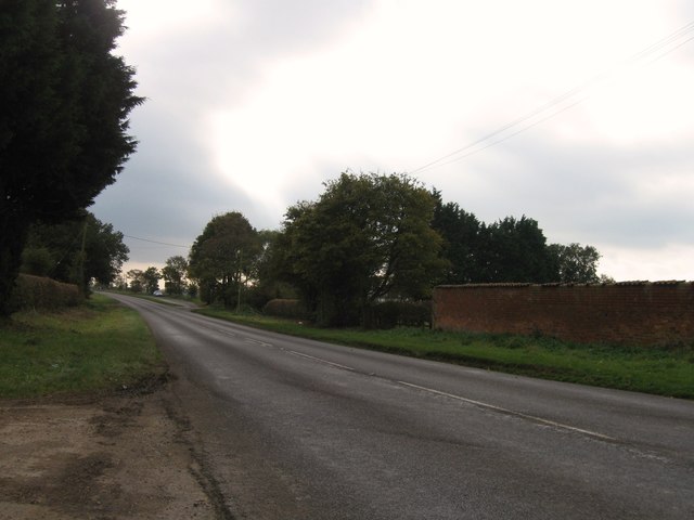
Scrivelsby is a small village located in the East Lindsey district of Lincolnshire, England. Situated around 10 miles east of the historic city of Lincoln, it lies within the scenic Lincolnshire Wolds Area of Outstanding Natural Beauty. The village is surrounded by picturesque countryside, offering stunning views and a tranquil atmosphere to residents and visitors alike.

Although small in size, Scrivelsby boasts a rich historical heritage. It is most notably associated with the Scrivelsby Estate, which has been held by the Dymoke family for over 700 years. The estate includes Scrivelsby Court, a Grade II listed country house that dates back to the 17th century. It is a fine example of Jacobean architecture and features beautiful gardens.

One of the village's main attractions is the Scrivelsby Walled Garden, a hidden gem that has been lovingly restored. This enchanting garden features well-manicured lawns, vibrant flower beds, and a variety of trees and shrubs. Visitors can enjoy leisurely walks, picnics, and even special events held throughout the year.

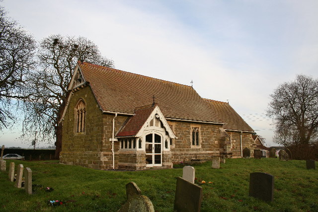
Despite its small population, Scrivelsby has a strong sense of community. The village has a charming church, St. Benedict's, which has been a place of worship for centuries. The church holds regular services and is a focal point for social gatherings and events.

In conclusion, Scrivelsby is a delightful village in Lincolnshire, known for its historical significance, natural beauty, and strong community spirit. Whether one seeks a peaceful retreat or an opportunity to explore the area's heritage, Scrivelsby offers a captivating experience for all who visit.

If you have any feedback on the listing, please let us know in the comments section below.

Scrivelsby Images

Images are sourced within 2km of 53.177086/-0.104875 or Grid Reference TF2666. Thanks to Geograph Open Source API. All images are credited.

Farm track and footpath to Horncastle
Scrivelsby Park: aerial 2022 (1)
Scrivelsby Park: aerial 2022 (2)
Sewage Works by the River Bain south of Horncastle: aerial 2022
The Lion Gateway With the Lion Lodge through the arch at Scrivelsby Manor, the holder of the Manor being the King's Champion
The Lion Gateway
With the Lion Lodge through the arch at Scrivelsby Manor, the holder of the Manor being the King's Champion
Cropmarks on fields S of Scrivelsby Spinney: aerial 2022
The Lion Gateway For Scrivelsby Court, with the Lion Lodge behind the arch
The Lion Gateway
For Scrivelsby Court, with the Lion Lodge behind the arch
Furrows on Thornton Lodge Farm The low winter sun shows up the structure of the newly-planted field. Seen from the Spa Trail.
Furrows on Thornton Lodge Farm
The low winter sun shows up the structure of the newly-planted field. Seen from the Spa Trail.
Yellowhammer by the Spa Trail There was a flock of these beautiful birds in the area on this fine December afternoon. They are very shy so this was the only photo I managed.


<span class="nowrap"><a title="http://www.rspb.org.uk/discoverandenjoynature/discoverandlearn/birdguide/name/y/yellowhammer/index.aspx" rel="nofollow ugc noopener" href="http://www.rspb.org.uk/discoverandenjoynature/discoverandlearn/birdguide/name/y/yellowhammer/index.aspx">Link</a><img style="margin-left:2px;" alt="External link" title="External link - shift click to open in new window" src="https://s1.geograph.org.uk/img/external.png" width="10" height="10"/></span>
Yellowhammer by the Spa Trail
There was a flock of these beautiful birds in the area on this fine December afternoon. They are very shy so this was the only photo I managed. LinkExternal link
Otter by the Spa Trail A superb otter and fish sculpture in natural wood.
Otter by the Spa Trail
A superb otter and fish sculpture in natural wood.
View from the churchyard Wood Enderby
The Viking Way following the Spa Trail towards Woodhall Spa
Bridleway from Dalderby to Roughton
Hard standing, High Lane, Mareham on the Hill Here is marked a "reservoir" on the OS map.
Hard standing, High Lane, Mareham on the Hill
Here is marked a "reservoir" on the OS map.
Field margin off High Lane, Mareham on the Hill Looking towards Northfield Plantation.
Field margin off High Lane, Mareham on the Hill
Looking towards Northfield Plantation.
Three little trees on the lane leading westwards from Scrivelsby Somewhat the worse for their covering of ivy, which provides the only greenery on this late April day.
Three little trees on the lane leading westwards from Scrivelsby
Somewhat the worse for their covering of ivy, which provides the only greenery on this late April day.
A153 southbound
A153 southbound
Scrivelsby Park: aerial 2017
Show me another place!

Scrivelsby is located at Grid Ref: TF2666 (Lat: 53.177086, Lng: -0.104875)

Division: Parts of Lindsey

Administrative County: Lincolnshire

District: East Lindsey

Police Authority: Lincolnshire

What 3 Words

///lion.origin.scrubbing. Near Horncastle, Lincolnshire

Related Wikis

Scrivelsby

Scrivelsby is a village and ecclesiastical parish in the East Lindsey district of the County of Lincolnshire, England. It is situated 2 miles (3.2 km...

Dalderby

Dalderby is a village and former civil parish, now in the parish of Roughton, in the East Lindsey district of Lincolnshire, England. It is situated approximately...

Wood Enderby

Wood Enderby is a village and civil parish in the East Lindsey district of Lincolnshire, England. It is situated approximately 4 miles (6 km) south from...

Mareham on the Hill

Mareham on the Hill is a village and civil parish about 2.5 miles (4.0 km) south-east from the town of Horncastle, Lincolnshire, England. Mareham on the...

Martin, East Lindsey

Martin is a village and former civil parish, now in the parish of Roughton, in the East Lindsey district of Lincolnshire, England. It is about 2 miles...

Thornton, Lincolnshire

Thornton, or Thornton by Horncastle, is a village in the civil parish of Roughton, in the East Lindsey district of Lincolnshire, England. It is situated...

Haltham Wood

Haltham Wood is a woodland in the parish of Haltham in the East Lindsey district of Lincolnshire, England. == References ==
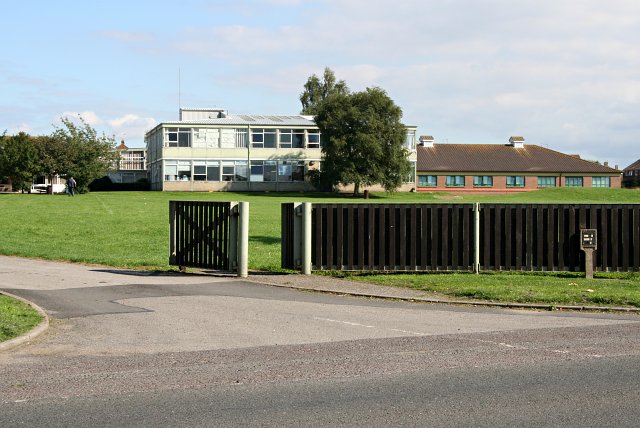
Banovallum School

The Banovallum School is a co-educational secondary school located in Horncastle, Lincolnshire, England. == History == The school was built in the early...

Nearby Amenities

Located within 500m of 53.177086,-0.104875
Scrivelsby
Is In: Lincolnshire, England, UK
Place: hamlet
Source: Bing
Lat/Long: 53.1780161/-0.1023101
Lodge Entrance To Park
Naptan AtcoCode: 270000009215
Naptan Bearing: N
Naptan BusStopType: CUS
Naptan CommonName: Lodge Entrance To Park
Naptan Indicator: opp
Naptan Landmark: Lodge Entrance To Park
Naptan NaptanCode: linjagtp
Naptan Street: B1183
Naptan Verified: no
Source: naptan_import
Lat/Long: 53.1766624/-0.1047624
Lodge Entrance To Park
Naptan AtcoCode: 2700LSLG1787
Naptan Bearing: S
Naptan BusStopType: CUS
Naptan CommonName: Lodge Entrance To Park
Naptan Indicator: adj
Naptan Landmark: Lodge Entrance To Park
Naptan NaptanCode: linampjt
Naptan Street: B1183
Naptan Verified: no
Source: naptan_import
Lat/Long: 53.1766057/-0.1045854
Power: pole
Source: Bing
Lat/Long: 53.1786911/-0.1045525
Power: pole
Source: Bing
Lat/Long: 53.1782137/-0.1018917
Power: pole
Source: Bing
Lat/Long: 53.1786558/-0.1054966
Power: pole
Source: Bing
Lat/Long: 53.1777553/-0.09924
Power: pole
Source: Bing
Lat/Long: 53.1785866/-0.1087783
Power: pole
Source: Bing
Lat/Long: 53.1784497/-0.1032261
Power: pole
Source: Bing
Lat/Long: 53.1779983/-0.1006458
Power: pole
Source: Bing
Lat/Long: 53.1786148/-0.1072172
Power: pole
Source: Bing
Lat/Long: 53.1775192/-0.0979301
Power: pole
Lat/Long: 53.1784685/-0.1099169
Power: pole
Lat/Long: 53.1783316/-0.1113558
Power: pole
Source: Bing
Lat/Long: 53.1779379/-0.1006505
Power: pole
Source: Bing
Lat/Long: 53.178733/-0.1000075
Power: pole
Lat/Long: 53.1768401/-0.1026508
Power: pole
Source: Bing
Lat/Long: 53.1791329/-0.0996822
Power: pole
Source: Bing
Lat/Long: 53.1775705/-0.1009436
Home Farm
Place: farm
Source: Bing
Lat/Long: 53.1781269/-0.1078743
Barrier: cattle_grid
Lat/Long: 53.1762083/-0.1018341
Barrier: cattle_grid
Lat/Long: 53.1766344/-0.1043701
Stocks
Historic: archaeological_site
Lat/Long: 53.1766431/-0.1061296
Power: pole
Source: Bing
Lat/Long: 53.1794812/-0.0995784
Power: pole
Source: Bing
Lat/Long: 53.178321/-0.1003407
Archaeological Site: fortification
Historic: archaeological_site
Source: Bing
Lat/Long: 53.1759319/-0.1005125
Archaeological Site: fortification
Historic: archaeological_site
Source: Bing
Lat/Long: 53.179565/-0.101748
Park Cottage
Place: isolated_dwelling
Source: Bing
Lat/Long: 53.1793909/-0.0993232
Lion Lodge
Place: isolated_dwelling
Source: Bing
Lat/Long: 53.1767445/-0.1042628
Generator Method: photovoltaic
Generator Output Electricity: yes
Generator Source: solar
Generator Type: solar_photovoltaic_panel
Location: roof
Power: generator
Lat/Long: 53.1780902/-0.1083094
The data included in this document is from www.openstreetmap.org. The data is made available under ODbL.

Have you been to Scrivelsby?

Leave your review of Scrivelsby below (or comments, questions and feedback).