Scotforth

Settlement in Lancashire Lancaster

England

Scotforth

Power lines crossing M6 at Bailrigg
Power lines crossing M6 at Bailrigg Credit: Alpin Stewart

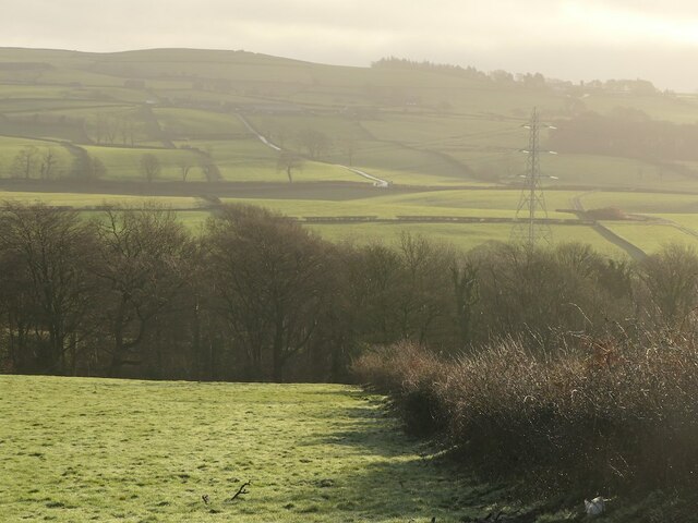
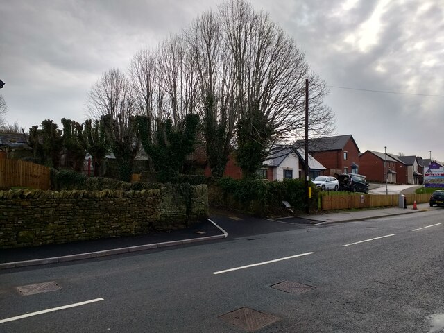
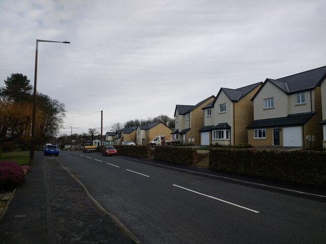
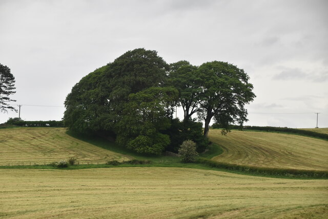
Scotforth is a suburban village located in the city of Lancaster, Lancashire in northwest England. It is situated approximately 2 miles south of the city center and is known for its picturesque countryside surroundings and historic buildings. The village is predominantly residential, with a mix of detached and semi-detached houses, as well as some newer developments.

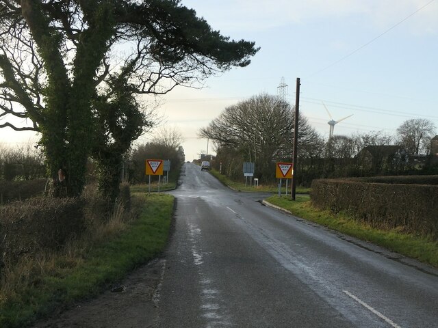
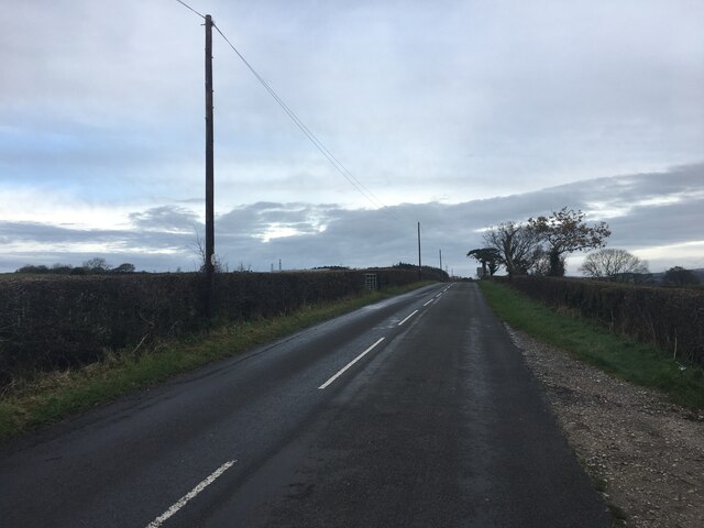
Scotforth has a strong sense of community, with a range of local amenities including shops, schools, and parks. The village is well-connected by road, with easy access to the M6 motorway and Lancaster train station for those commuting to nearby cities such as Manchester and Liverpool.

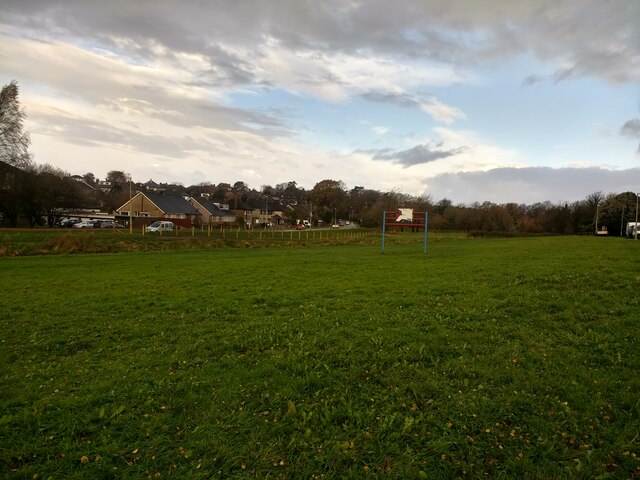
One of the notable landmarks in Scotforth is the historic St. Paul's Church, which dates back to the 19th century and is a focal point for the local community. The village also has a number of green spaces, including the popular Bowerham Playing Fields, which provide opportunities for outdoor recreation and leisure activities.

Overall, Scotforth offers a peaceful and idyllic setting for residents looking for a quiet and charming place to call home in Lancashire.

If you have any feedback on the listing, please let us know in the comments section below.

Scotforth Images

Images are sourced within 2km of 54.030969/-2.789117 or Grid Reference SD4859. Thanks to Geograph Open Source API. All images are credited.

Power lines crossing M6 at Bailrigg
Blea Tarn Road - M6 northbound
Footbridge -- M6 northbound
Masts, Langthwaite
Masts, Langthwaite
Little Fell Lane
Little Fell Lane
Roadworks, Little Fell Lane
Fields, Langthwaite
Fields, Langthwaite
Little Fell Lane Crossroads with Blea Tarn Road.
Little Fell Lane
Crossroads with Blea Tarn Road.
New houses and revamped driveway to Hala Carr Farm
New houses at The Paddocks
Old footbridge over Burrow Beck
The Boot & Shoe, Scotforth
Milestone Marker 29-28 F (between bridges 93-94), Lancaster Canal Milestone located by the side of the Lancaster Canal
This milestone is 28 miles from the centre of Preston and 29 miles from Kendal

Inscription reads:- 
Garstang / 11 :: Lancaster / 2 

Milestone Society National ID: LAN-28R
Milestone Marker 29-28 F (between bridges 93-94), Lancaster Canal
Milestone located by the side of the Lancaster Canal This milestone is 28 miles from the centre of Preston and 29 miles from Kendal Inscription reads:- Garstang / 11 :: Lancaster / 2 Milestone Society National ID: LAN-28R
Old Milestone by A6, South of Lawson's Bridge The Milestone is located by the road on the West of the road.  Parish of Scotforth (Lancaster District). Stone post (plate lost), Lancaster twin iron plate design, erected by the Garstang & Heronsyke turnpike trust in the 19th Century, edge chips. An earlier photograph can be found here: <a title="https://www.geograph.org.uk/photo/6095824" href="https://www.geograph.org.uk/photo/6095824">Link</a> 

Inscription reads:- 
SCOTFORTH 

Milestone Society National ID: LA_LAGS02
Old Milestone by A6, South of Lawson's Bridge
The Milestone is located by the road on the West of the road.  Parish of Scotforth (Lancaster District). Stone post (plate lost), Lancaster twin iron plate design, erected by the Garstang & Heronsyke turnpike trust in the 19th Century, edge chips. An earlier photograph can be found here: Link  Inscription reads:- SCOTFORTH Milestone Society National ID: LA_LAGS02
Littlefell Lane
Littlefell Lane
Pylons
Pylons
Clump of trees
Clump of trees
New flood defences finished and fenced off on Burrow Beck
Show me another place!

Scotforth is located at Grid Ref: SD4859 (Lat: 54.030969, Lng: -2.789117)

Administrative County: Lancashire

District: Lancaster

Police Authority: Lancashire

What 3 Words

///scored.scorecard.stall. Near Lancaster, Lancashire

Nearby Locations

Hala Scotforth

Related Wikis

Scotforth

Scotforth is a suburb in the south of the city of Lancaster in Lancashire, England. It is home to Scotforth St Paul's Church of England Primary School...

St Paul's Church, Scotforth

St Paul's Church is in Scotforth, a suburb of Lancaster, Lancashire, England. It is recorded in the National Heritage List for England as a designated...

Royal Albert Hospital

The Royal Albert Hospital was a hospital in Lancaster, Lancashire, England. It opened in 1870 as an institution for the care and education of children...

Greaves Park

Greaves House, now known as Greaves Park, is a Grade II listed house in Lancaster, England, now a pub and restaurant, and is also the name of the surrounding...

Nearby Amenities

Located within 500m of 54.030969,-2.789117
Turning Circle
Lat/Long: 54.0316213/-2.7929197
Turning Circle
Lat/Long: 54.0331591/-2.7934298
Turning Circle
Lat/Long: 54.0285476/-2.7920952
Turning Circle
Lat/Long: 54.0290616/-2.7928571
Crossing
Crossing: traffic_signals
Crossing Island: no
Kerb: flush
Tactile Paving: yes
Traffic Signals: pedestrian_crossing
Traffic Signals Direction: both
Lat/Long: 54.0318937/-2.7942326
Post Box
Check Date Collection Times: 2023-03-24
Collection Times: Mo-Fr 09:00; Sa 07:00
Ref: LA1 16
Royal Cypher: EIIR
Royal Cypher Wikidata: Q33102113
Lat/Long: 54.0285246/-2.7953583
Turning Circle
Lat/Long: 54.0266648/-2.7898763
Turning Circle
Lat/Long: 54.0277336/-2.7868408
School
Stepping Stones Short Stay School
Addr City: Lancaster
Addr Postcode: LA1 4HT
Addr Street: Bowerham Road
Fhrs Id: 105904
Phone: +44 1524 67164
Website: https://www.steppingstones.lancs.sch.uk/
Lat/Long: 54.0319471/-2.7836567
Crossing
Crossing: uncontrolled
Crossing Island: yes
Kerb: lowered
Tactile Paving: no
Lat/Long: 54.0345478/-2.7868673
Post Box
Collection Times: Mo-Fr 09:00; Sa 07:00
Post Box Type: wall
Ref: LA1 155
Royal Cypher: GR
Royal Cypher Wikidata: Q33102273
Lat/Long: 54.0343975/-2.7862402
Waste Basket
Check Date: 2020-12-16
Lat/Long: 54.0322798/-2.7942206
BP Insurance Brokers
Addr City: Lancaster
Addr Housenumber: 63
Addr Postcode: LA1 4SD
Addr Street: Scotforth Road
Check Date Opening Hours: 2023-07-17
Office: insurance
Opening Hours: Mo-Fr 09:00-17:30; Sa 09:00-12:00
Website: https://www.bpib.co.uk/
Wheelchair: yes
Lat/Long: 54.032015/-2.7940381
Bus Stop
Rutland Avenue
Bench: yes
Bin: yes
Bus: yes
Lit: yes
Naptan AtcoCode: 2500LAA15785
Naptan Bearing: S
Naptan CommonName: Rutland Avenue
Naptan Indicator: by
Naptan Landmark: Rutland Ave
Naptan LocalityCode: E0016015
Naptan NaptanCode: lanjtgda
Naptan Street: A6
Naptan Verified: yes
Public Transport: platform
Ref: lanjtgda
Shelter: yes
Tactile Paving: no
Lat/Long: 54.0331463/-2.7945354
Waste Basket
Lat/Long: 54.033107/-2.7945114
Bus Stop
Rutland Avenue
Bench: yes
Bin: no
Bus: yes
Lit: yes
Naptan AtcoCode: 2500LAA15784
Naptan Bearing: N
Naptan CommonName: Rutland Avenue
Naptan Indicator: opp
Naptan Landmark: Rutland Ave
Naptan LocalityCode: E0016015
Naptan NaptanCode: lanjtgaw
Naptan Street: Scotforth Road
Naptan Verified: yes
Public Transport: platform
Ref: lanjtgaw
Shelter: yes
Tactile Paving: no
Lat/Long: 54.0324226/-2.7944695
Pub
The Wobbly Cobbler
Addr City: Lancaster
Addr Housenumber: 49
Addr Postcode: LA1 4SA
Addr Street: Scotforth Road
Fhrs Id: 1269383
Indoor Seating: yes
Old Name: Simply Flowers
Opening Hours: We,Th 18:00-21:30; Fr 16:00-21:30; Sa 14:00-21:30; Su 14:00-20:00
Outdoor Seating: yes
Website: https://www.facebook.com/pages/category/Pub/The-Wobbly-Cobbler-100204864731324/
Wheelchair: no
Lat/Long: 54.0324787/-2.794154
Hairport 49
Addr City: Lancaster
Addr Housenumber: 49A
Addr Postcode: LA1 4SA
Addr Street: Scotforth Road
Female Signed: no
Male Signed: no
Opening Hours: "By appointment"
Shop: hairdresser
Wheelchair: limited
Lat/Long: 54.0324249/-2.7941376
Selectweb Computers
Addr City: Lancaster
Addr Housenumber: 51
Addr Postcode: LA1 4SA
Addr Street: Scotforth Road
Opening Hours: Mo-We 10:00-17:00; Fr 10:00-17:00; Sa 10:00-12:30
Shop: computer
Website: http://www.selectweb.net/
Wheelchair: limited
Lat/Long: 54.0323868/-2.7941259
Scotforth Local Stores
Addr City: Lancaster
Addr Housenumber: 53
Addr Postcode: LA1 4SA
Addr Street: Scotforth Road
Check Date Opening Hours: 2023-03-24
Fhrs Id: 116424
Opening Hours Signed: no
Shop: alcohol
Wheelchair: yes
Lat/Long: 54.0323481/-2.7941141
Fast Food
Mr Wang
Addr City: Lancaster
Addr Housenumber: 59
Addr Postcode: LA1 4SA
Addr Street: Scotforth Road
Cuisine: chinese
Delivery: yes
Diet Vegan: yes
Diet Vegetarian: yes
Drive Through: no
Fhrs Id: 116913
Opening Hours: Tu-Su 17:00-23:00
Phone: +44 1524 846484
Takeaway: only
Wheelchair: limited
Lat/Long: 54.0322257/-2.7940767
Scotforth Dry Cleaners
Addr City: Lancaster
Addr Housenumber: 61
Addr Postcode: LA1 4SA
Addr Street: Scotforth Road
Opening Hours: Mo-Fr 08:00-17:00; Sa 09:00-13:00
Shop: dry_cleaning
Wheelchair: limited
Lat/Long: 54.0321694/-2.7940595
Post Box
Collection Times: Mo-Fr 09:00; Sa 07:00
Post Box Type: pillar
Ref: LA1 109
Royal Cypher: EIIR
Royal Cypher Wikidata: Q33102113
Lat/Long: 54.0320535/-2.7934549
Bus Stop
Bowling Green
Bench: yes
Bin: yes
Bus: yes
Covered: yes
Lit: yes
Naptan AtcoCode: 250020009
Naptan Bearing: N
Naptan CommonName: Bowling Green
Naptan Indicator: opp
Naptan Landmark: Scotforth Road/Post Office
Naptan LocalityCode: E0016015
Naptan NaptanCode: lanatmag
Naptan Street: Scotforth Road
Naptan Verified: yes
Public Transport: platform
Ref: lanatmag
Shelter: yes
Tactile Paving: no
Lat/Long: 54.0287685/-2.7952394
Waste Basket
Check Date: 2020-12-16
Lat/Long: 54.028739/-2.7952827
Turning Circle
Lat/Long: 54.0280707/-2.7917523
Fast Food
Evergreens
Addr City: Lancaster
Addr Flats: 15
Addr Housename: Lentworth House
Addr Housenumber: 15-16
Addr Postcode: LA1 4RQ
Addr Street: Lentworth Drive
Cuisine: chinese
Delivery: yes
Diet Vegan: yes
Diet Vegetarian: yes
Drive Through: no
Fhrs Id: 89684
Opening Hours: Tu-Th 17:00-21:30; Fr-Sa 17:00-22:00; Su 17:00-21:30
Outdoor Seating: no
Payment Cash: yes
Payment Credit Cards: no
Payment Debit Cards: no
Phone: +44 1524 64163
Takeaway: only
Wheelchair: limited
Lat/Long: 54.0279648/-2.7913054
Waste Basket
Check Date: 2020-12-11
Lat/Long: 54.0279372/-2.7911872
Jan Kent Beauty
Addr City: Lancaster
Addr Flats: 14
Addr Housename: Lentworth House
Addr Postcode: LA1 4RQ
Addr Street: Lentworth Drive
Check Date: 2024-04-24
Opening Hours: "By appointment"
Shop: beauty
Wheelchair: limited
Lat/Long: 54.027886/-2.7913296
Hala Pet Stores
Addr City: Lancaster
Addr Flats: 10-11
Addr Housename: Lentworth House
Addr Postcode: LA1 4RQ
Addr Street: Lentworth Drive
Check Date Opening Hours: 2021-02-25
Opening Hours: Mo-Sa 09:00-17:00
Shop: pet
Wheelchair: limited
Lat/Long: 54.0277647/-2.7914207
Jan Kent Hair
Addr City: Lancaster
Addr Flats: 6
Addr Housename: Lentworth House
Addr Postcode: LA1 4RQ
Addr Street: Lentworth Drive
Female Signed: no
Male Signed: no
Opening Hours: "By appointment"
Shop: hairdresser
Website: https://www.jankenthair.co.uk/
Wheelchair: limited
Lat/Long: 54.0276788/-2.7915741
Bargain Booze
Addr City: Lancaster
Addr Flats: 2-3
Addr Housename: Lentworth House
Addr Postcode: LA1 4RQ
Addr Street: Lentworth Drive
Check Date Opening Hours: 2021-01-13
Fhrs Id: 114338
Opening Hours: Mo-Su 09:00-22:00
Shop: convenience
Wheelchair: limited
Lat/Long: 54.0276418/-2.7916809
Waste Basket
Lat/Long: 54.027799/-2.791222
Post Box
Collection Times: Mo-Fr 16:00; Sa 10:00
Ref: LA1 5
Royal Cypher: EIIR
Royal Cypher Wikidata: Q33102113
Lat/Long: 54.0277306/-2.7901668
Post Box
Collection Times: Mo-Fr 09:00; Sa 07:00
Ref: LA1 231
Royal Cypher: EIIR
Royal Cypher Wikidata: Q33102113
Lat/Long: 54.0285879/-2.783898
Post Box
Collection Times: Mo-Fr 09:00; Sa 07:00
Ref: LA1 124
Royal Cypher: GR
Royal Cypher Wikidata: Q33102273
Lat/Long: 54.0352669/-2.7898964
Entrance: yes
Lat/Long: 54.0268276/-2.7902512
Entrance: yes
Lat/Long: 54.0265969/-2.7903248
Noexit: yes
Lat/Long: 54.0347697/-2.7860608
Noexit: yes
Lat/Long: 54.033668/-2.7864953
Crossing
Crossing: unmarked
Crossing Island: no
Crossing Markings: no
Tactile Paving: no
Lat/Long: 54.0338727/-2.7854037
Bus Stop
Palatine Avenue
Bench: yes
Bin: no
Bus: yes
Lit: yes
Naptan AtcoCode: 2500LA00220
Naptan Bearing: NW
Naptan CommonName: Palatine Avenue
Naptan Indicator: by
Naptan LocalityCode: E0015942
Naptan NaptanCode: langpgtg
Naptan Street: Bowerham Road
Public Transport: platform
Ref: langpgtg
Shelter: yes
Tactile Paving: no
Lat/Long: 54.0350949/-2.7876346
Bus Stop
Palatine Avenue
Bench: no
Bin: no
Bus: yes
Lit: yes
Naptan AtcoCode: 2500DCL3024
Naptan Bearing: SE
Naptan CommonName: Palatine Avenue
Naptan Indicator: opp
Naptan LocalityCode: E0015942
Naptan NaptanCode: landgjgw
Naptan Street: Bowerham Road
Public Transport: platform
Ref: landgjgw
Shelter: no
Tactile Paving: no
Lat/Long: 54.0349954/-2.7872965
Bus Stop
Moorside School
Bench: yes
Bin: yes
Bus: yes
Lit: yes
Naptan AtcoCode: 2500LAA00400
Naptan Bearing: NW
Naptan CommonName: Moorside School
Naptan Indicator: by
Naptan LocalityCode: E0015942
Naptan NaptanCode: langwdjd
Naptan Street: Bowerham Road
Public Transport: platform
Ref: langwdjd
Shelter: yes
Tactile Paving: no
Lat/Long: 54.0334225/-2.7845491
Bus Stop
Fox and Goose
Bench: yes
Bin: yes
Bus: yes
Lit: yes
Naptan AtcoCode: 2500IMG1225
Naptan Bearing: S
Naptan CommonName: Fox and Goose
Naptan Indicator: by
Naptan LocalityCode: N0078716
Naptan NaptanCode: landpmgd
Naptan Street: Bowerham Road
Public Transport: platform
Public Transport Version: 2
Ref: landpmgd
Shelter: yes
Tactile Paving: no
Lat/Long: 54.0316553/-2.7826533
Bus Stop
Moorside School
Bench: yes
Bin: no
Bus: yes
Lit: yes
Naptan AtcoCode: 2500GCT
Naptan Bearing: SE
Naptan CommonName: Moorside School
Naptan Indicator: by
Naptan LocalityCode: N0078716
Naptan NaptanCode: landpamg
Naptan Street: Bowerham Road
Public Transport: platform
Ref: landpamg
Shelter: yes
Tactile Paving: no
Lat/Long: 54.0326663/-2.7833593
Bus Stop
Fox and Goose
Bench: yes
Bin: no
Bus: yes
Lit: yes
Naptan AtcoCode: 2500DCL3034
Naptan NaptanCode: landgjpg
Public Transport: platform
Shelter: yes
Tactile Paving: no
Lat/Long: 54.030998/-2.7823317
Bicycle Parking
Bicycle Parking: stands
Capacity: 6
Covered: no
Fee: no
Lat/Long: 54.0277869/-2.7943302
Bus Stop
Booths Supermarket
Bench: no
Bin: yes
Bus: yes
Lit: yes
Naptan AtcoCode: 2500LAA07483
Naptan Bearing: E
Naptan CommonName: Booths Supermarket
Naptan Indicator: by
Naptan Landmark: Booths
Naptan LocalityCode: E0016015
Naptan NaptanCode: lanjpgmp
Naptan Street: Hala Road
Naptan Verified: yes
Public Transport: platform
Ref: lanjpgmp
Shelter: yes
Tactile Paving: no
Lat/Long: 54.0277498/-2.7943346
Recycling
Check Date Recycling: 2023-02-12
Operator: Booths
Recycling Clothes: yes
Recycling Shoes: yes
Recycling Type: container
Lat/Long: 54.0281309/-2.7942531
Bus Stop
Hala Square
Bench: yes
Bin: no
Bus: yes
Lit: yes
Naptan AtcoCode: 2500IMG1223
Naptan Bearing: W
Naptan CommonName: Hala Square
Naptan Indicator: adj
Naptan Landmark: Hala Square
Naptan LocalityCode: E0015995
Naptan NaptanCode: landpmdw
Naptan Street: Hala Square
Naptan Verified: yes
Public Transport: platform
Ref: landpmdw
Shelter: yes
Tactile Paving: no
Lat/Long: 54.0270628/-2.7909847
Bus Stop
Hala Shops
Bench: yes
Bin: no
Bus: yes
Lit: yes
Naptan AtcoCode: 2500IMG1229
Naptan Bearing: E
Naptan CommonName: Hala Shops
Naptan Indicator: by
Naptan Landmark: Hala Shops
Naptan LocalityCode: E0015995
Naptan NaptanCode: landpmgt
Naptan Street: Hala Road
Naptan Verified: yes
Public Transport: platform
Ref: landpmgt
Shelter: yes
Tactile Paving: no
Lat/Long: 54.0274767/-2.7921464
Bus Stop
Booths
Bench: no
Bin: no
Bus: yes
Lit: yes
Naptan AtcoCode: 250012193
Naptan Bearing: W
Naptan CommonName: Hala Road
Naptan Indicator: by
Naptan Landmark: Hala Road
Naptan LocalityCode: E0015995
Naptan NaptanCode: lanagwtg
Naptan Street: Hala Road
Naptan Verified: yes
Public Transport: platform
Ref: lanagwtg
Shelter: no
Tactile Paving: no
Lat/Long: 54.0274518/-2.7931839
Bus Stop
Hala Square
Bench: no
Bin: no
Bus: yes
Lit: yes
Naptan AtcoCode: 2500884
Naptan Bearing: E
Naptan CommonName: Hala Square
Naptan Indicator: by
Naptan Landmark: Hala Square
Naptan LocalityCode: E0015995
Naptan NaptanCode: landagjm
Naptan Street: Hala Square
Naptan Verified: yes
Public Transport: platform
Public Transport Version: 2
Ref: landagjm
Shelter: yes
Tactile Paving: no
Lat/Long: 54.0270514/-2.7898484
Bus Stop
Community Centre
Bench: no
Bin: no
Bus: yes
Lit: yes
Naptan AtcoCode: 2500IMG1370
Naptan Bearing: SW
Naptan CommonName: Community Centre
Naptan Indicator: by
Naptan Landmark: Barton Road
Naptan LocalityCode: E0016015
Naptan NaptanCode: landpwtp
Naptan Street: Barton Road
Naptan Verified: yes
Public Transport: platform
Ref: landpwtp
Shelter: no
Tactile Paving: no
Lat/Long: 54.0326744/-2.7889932
Bus Stop
Wakefield Drive
Bench: no
Bin: no
Bus: yes
Lit: yes
Naptan AtcoCode: 2500DCL3026
Naptan Bearing: SW
Naptan CommonName: Wakefield Drive
Naptan Indicator: opp
Naptan Landmark: Barton Road
Naptan LocalityCode: E0016015
Naptan NaptanCode: landgjmd
Naptan Street: Barton Road
Naptan Verified: yes
Public Transport: platform
Ref: landgjmd
Shelter: no
Tactile Paving: no
Lat/Long: 54.0315874/-2.7916444
Bus Stop
Brooklands Court
Bench: no
Bin: yes
Bus: yes
Lit: yes
Naptan AtcoCode: 2500DCL3040
Naptan Bearing: SE
Naptan CommonName: Brooklands Court
Naptan Indicator: by
Naptan Landmark: Brooklands Court
Naptan LocalityCode: E0015995
Naptan NaptanCode: landgjtd
Naptan Street: Lentworth Drive
Naptan Verified: yes
Public Transport: platform
Ref: landgjtd
Shelter: no
Tactile Paving: no
Lat/Long: 54.02973/-2.7925403
Bus Stop
Hala Shops
Bench: no
Bin: no
Bus: yes
Lit: yes
Naptan AtcoCode: 2500LAA07484
Naptan Bearing: S
Naptan CommonName: Shops
Naptan Indicator: by
Naptan Landmark: opp Shops
Naptan LocalityCode: E0015995
Naptan NaptanCode: lanjpgmt
Naptan Street: Wentworth Drive
Naptan Verified: yes
Public Transport: platform
Ref: lanjpgmt
Shelter: no
Tactile Paving: no
Lat/Long: 54.0279786/-2.7909957
Bus Stop
Community Centre
Bench: yes
Bin: no
Bus: yes
Lit: yes
Naptan AtcoCode: 2500IMG1215
Naptan Bearing: NE
Naptan CommonName: Community Centre
Naptan Indicator: opp
Naptan Landmark: Barton Road Community Centre
Naptan LocalityCode: E0016015
Naptan NaptanCode: landpmat
Naptan Street: Barton Road
Naptan Verified: yes
Public Transport: platform
Ref: landpmat
Shelter: yes
Tactile Paving: no
Lat/Long: 54.0327768/-2.7890714
Bus Stop
Wakefield Drive
Bench: yes
Bin: no
Bus: yes
Lit: yes
Naptan AtcoCode: 2500IMG1217
Naptan Bearing: NE
Naptan CommonName: Wakefield Drive
Naptan Indicator: by
Naptan Landmark: Wakefield Drive
Naptan LocalityCode: E0016015
Naptan NaptanCode: landpmda
Naptan Street: Barton Road
Naptan Verified: yes
Public Transport: platform
Ref: landpmda
Shelter: yes
Tactile Paving: no
Lat/Long: 54.0313858/-2.7922359
Bus Stop
Brooklands Court
Bench: yes
Bin: no
Bus: yes
Lit: yes
Naptan AtcoCode: 2500IMG1231
Naptan Bearing: NW
Naptan CommonName: Brooklands Court
Naptan Indicator: opp
Naptan Landmark: Brooklands Court
Naptan LocalityCode: E0015995
Naptan NaptanCode: landpmja
Naptan Street: Lentworth Drive
Naptan Verified: yes
Public Transport: platform
Ref: landpmja
Shelter: yes
Tactile Paving: no
Lat/Long: 54.0293991/-2.7922898
Give Way
Direction: forward
Lat/Long: 54.0331029/-2.7956783
Give Way
Direction: forward
Lat/Long: 54.033191/-2.7947397
Give Way
Direction: backward
Lat/Long: 54.0323284/-2.7943974
Give Way
Direction: backward
Lat/Long: 54.0325896/-2.7943244
Give Way
Direction: forward
Lat/Long: 54.0333491/-2.7946468
Brooklands Court
Bus: yes
Public Transport: stop_position
Lat/Long: 54.0297119/-2.7925735
Brooklands Court
Bus: yes
Public Transport: stop_position
Lat/Long: 54.0294552/-2.7922033
Give Way
Direction: forward
Lat/Long: 54.0277442/-2.7910418
Give Way
Direction: forward
Lat/Long: 54.0274917/-2.7912504
Give Way
Direction: backward
Lat/Long: 54.0271361/-2.7911933
Give Way
Direction: backward
Lat/Long: 54.0270489/-2.7905285
Give Way
Direction: forward
Lat/Long: 54.02772/-2.7902785
Wakefield Drive
Bus: yes
Public Transport: stop_position
Lat/Long: 54.0313581/-2.7921422
Wakefield Drive
Bus: yes
Public Transport: stop_position
Lat/Long: 54.0316262/-2.7917028
Community Centre
Bus: yes
Public Transport: stop_position
Lat/Long: 54.0327331/-2.7890428
Hala Shops
Bus: yes
Public Transport: stop_position
Lat/Long: 54.0279851/-2.7910735
Hala Square
Bus: yes
Public Transport: stop_position
Lat/Long: 54.0270271/-2.7898543
Hala Square
Bus: yes
Public Transport: stop_position
Lat/Long: 54.0271079/-2.7908862
Moorside School
Bus: yes
Public Transport: stop_position
Public Transport Version: 2
Lat/Long: 54.0334633/-2.7844962
Fox and Goose
Bus: yes
Public Transport: stop_position
Public Transport Version: 2
Lat/Long: 54.0316681/-2.7825747
Booths Supermarket
Bus: yes
Public Transport: stop_position
Public Transport Version: 2
Lat/Long: 54.0276892/-2.7943461
Hala Shops
Bus: yes
Public Transport: stop_position
Public Transport Version: 2
Lat/Long: 54.0274521/-2.7921407
Ascot Close
Bus: yes
Public Transport: stop_position
Public Transport Version: 2
Lat/Long: 54.0304923/-2.7848551
Bus Stop
Ascot Close
Bench: yes
Bin: no
Bus: yes
Lit: yes
Naptan AtcoCode: 2500IMG1227
Naptan Bearing: NE
Naptan CommonName: Ascot Close
Naptan Indicator: by
Naptan Landmark: Kempton Road
Naptan LocalityCode: N0078717
Naptan NaptanCode: landpmgm
Naptan Street: Kempton Road
Naptan Verified: yes
Public Transport: platform
Ref: landpmgm
Shelter: yes
Tactile Paving: no
Lat/Long: 54.0305263/-2.7848763
Haydock Road
Bus: yes
Public Transport: stop_position
Public Transport Version: 2
Lat/Long: 54.0289697/-2.7859783
Bus Stop
Haydock Road
Bench: no
Bin: no
Bus: yes
Lit: yes
Naptan AtcoCode: 2500890
Naptan Bearing: N
Naptan CommonName: Haydock Road
Naptan Indicator: opp
Naptan Landmark: Newmarket Avenue (North)
Naptan LocalityCode: N0078717
Naptan NaptanCode: landagmd
Naptan Street: Newmarket Avenue
Naptan Verified: yes
Public Transport: platform
Ref: landagmd
Shelter: no
Tactile Paving: no
Lat/Long: 54.0289729/-2.7860225
Lingfield Close
Bus: yes
Public Transport: stop_position
Public Transport Version: 2
Lat/Long: 54.0277416/-2.7856839
Bus Stop
Lingfield Close
Bench: yes
Bin: yes
Bus: yes
Lit: yes
Naptan AtcoCode: 2500DCL3038
Naptan Bearing: NW
Naptan CommonName: Lingfield Close
Naptan Indicator: by
Naptan Landmark: Newmarket Avenue
Naptan LocalityCode: N0078717
Naptan NaptanCode: landgjpw
Naptan Street: Newmarket Avenue
Naptan Verified: yes
Public Transport: platform
Ref: landgjpw
Shelter: yes
Tactile Paving: no
Lat/Long: 54.0277165/-2.7857393
Palatine Avenue
Bus: yes
Public Transport: stop_position
Public Transport Version: 2
Lat/Long: 54.0350084/-2.7874163
Palatine Avenue
Bus: yes
Public Transport: stop_position
Public Transport Version: 2
Lat/Long: 54.0350995/-2.7875001
Give Way
Direction: forward
Lat/Long: 54.0297779/-2.7859233
Ascot Close
Bus: yes
Public Transport: stop_position
Lat/Long: 54.0305664/-2.7846076
Bus Stop
Ascot Close
Bench: yes
Bin: no
Bus: yes
Lit: yes
Naptan AtcoCode: 2500DCL3036
Naptan Bearing: W
Naptan CommonName: Ascot Close
Naptan Indicator: opp
Naptan Landmark: Kempton Road
Naptan LocalityCode: N0078717
Naptan NaptanCode: landgjpm
Naptan Street: Kempton Road
Naptan Verified: yes
Public Transport: platform
Ref: landgjpm
Shelter: yes
Tactile Paving: no
Lat/Long: 54.0305282/-2.7845862
Give Way
Direction: forward
Lat/Long: 54.026988/-2.7865005
Bentham Road
Bus: yes
Public Transport: stop_position
Lat/Long: 54.0269987/-2.7860729
Bus Stop
Bentham Road
Bench: no
Bin: no
Bus: yes
Lit: yes
Naptan AtcoCode: 250012192
Naptan Bearing: W
Naptan CommonName: Bentham Road
Naptan Indicator: by
Naptan Landmark: Hala Hill
Naptan LocalityCode: E0015995
Naptan NaptanCode: lanagwtd
Naptan Street: Hala Hill
Naptan Verified: yes
Public Transport: platform
Ref: lanagwtd
Shelter: no
Tactile Paving: no
Lat/Long: 54.0269412/-2.786091
Give Way
Direction: backward
Lat/Long: 54.0305861/-2.7846855
Give Way
Direction: forward
Lat/Long: 54.0302907/-2.7851898
Give Way
Direction: forward
Lat/Long: 54.0306278/-2.784027
Give Way
Direction: forward
Lat/Long: 54.0306609/-2.7825129
Give Way
Direction: forward
Lat/Long: 54.0312068/-2.7823256
Fox and Goose
Bus: yes
Public Transport: stop_position
Lat/Long: 54.0310103/-2.7824042
Booths
Bus: yes
Public Transport: stop_position
Lat/Long: 54.0275025/-2.7931633
Moorside School
Bus: yes
Public Transport: stop_position
Lat/Long: 54.0326459/-2.7834262
Haydock Road
Bus: yes
Public Transport: stop_position
Lat/Long: 54.0292076/-2.7858737
Bus Stop
Haydock Road
Bench: no
Bin: no
Bus: yes
Lit: yes
Naptan AtcoCode: 250020103
Naptan Bearing: S
Naptan CommonName: Haydock Road
Naptan Indicator: by
Naptan Landmark: Newmarket Avenue (South)
Naptan LocalityCode: N0078717
Naptan NaptanCode: lanatpgj
Naptan Street: Newmarket Avenue
Naptan Verified: yes
Public Transport: platform
Ref: lanatpgj
Shelter: no
Tactile Paving: no
Lat/Long: 54.0291993/-2.7857673
Addr City: Lancaster
Addr Flats: 5-10
Addr Housename: Gressingham House
Addr Postcode: LA1 4RG
Addr Street: Gressingham Drive
Entrance: main
Lat/Long: 54.0278903/-2.7898796
Bowling Green
Bus: yes
Public Transport: stop_position
Public Transport Version: 2
Lat/Long: 54.0287603/-2.7951455
Addr City: Lancaster
Addr Flats: 1-4
Addr Housename: Gressingham House
Addr Postcode: LA1 4RG
Addr Street: Gressingham Drive
Entrance: main
Lat/Long: 54.0280915/-2.7900908
Entrance: yes
Lat/Long: 54.0279929/-2.7893264
Entrance: yes
Lat/Long: 54.0282637/-2.7896702
Kerb: raised
Lat/Long: 54.0281688/-2.7891186
Crossing
Crossing: unmarked
Crossing Island: no
Crossing Markings: no
Kerb: lowered
Tactile Paving: no
Lat/Long: 54.0283539/-2.7877599
Rutland Avenue
Bus: yes
Public Transport: stop_position
Lat/Long: 54.0331508/-2.7946277
Rutland Avenue
Bus: yes
Public Transport: stop_position
Public Transport Version: 2
Lat/Long: 54.0324272/-2.7943522
Hall Park
Bus: yes
Public Transport: stop_position
Public Transport Version: 2
Lat/Long: 54.0306263/-2.7943623
Hall Park
Bus: yes
Public Transport: stop_position
Lat/Long: 54.029878/-2.794613
Bus Stop
Hall Park
Bench: yes
Bin: no
Bus: yes
Lit: yes
Naptan AtcoCode: 250012195
Naptan Bearing: N
Naptan CommonName: Hall Park
Naptan Indicator: by
Naptan Landmark: Scotforth Road/Hall Park
Naptan LocalityCode: E0016015
Naptan NaptanCode: lanagwtj
Naptan Street: Scotforth Road
Naptan Verified: yes
Public Transport: platform
Ref: lanagwtj
Shelter: yes
Tactile Paving: no
Lat/Long: 54.0306342/-2.7944506
Bus Stop
Hall Park
Bench: yes
Bin: no
Bus: yes
Lit: yes
Naptan AtcoCode: 250013812
Naptan Bearing: S
Naptan CommonName: Hall Park
Naptan Indicator: opp
Naptan Landmark: Barton Road/A6 (South)
Naptan LocalityCode: E0016015
Naptan NaptanCode: lanamdtg
Naptan Street: Scotforth Road
Naptan Verified: yes
Public Transport: platform
Ref: lanamdtg
Shelter: yes
Tactile Paving: no
Lat/Long: 54.0298698/-2.7945124
Crossing
Crossing: unmarked
Crossing Island: no
Crossing Markings: no
Tactile Paving: yes
Lat/Long: 54.0291475/-2.7825844
Addr City: Lancaster
Addr Housenumber: 63A
Addr Postcode: LA1 4SD
Addr Street: Scotforth Road
Lat/Long: 54.0320157/-2.7939715
Fringe Benefits
Addr City: Lancaster
Addr Housenumber: 199
Addr Postcode: LA1 4HT
Addr Street: Bowerham Road
Female Signed: no
Male Signed: no
Opening Hours Signed: no
Phone: +44 1524 66915
Shop: hairdresser
Wheelchair: limited
Lat/Long: 54.0328037/-2.7833059
Wolfwood
Addr City: Lancaster
Addr Housenumber: 201
Addr Postcode: LA1 4HT
Addr Street: Bowerham Road
Opening Hours Signed: no
Shop: charity
Website: http://wolfwood.co.uk
Wheelchair: limited
Lat/Long: 54.0327581/-2.7832456
Noexit: yes
Lat/Long: 54.031792/-2.783354
Noexit: yes
Lat/Long: 54.0323247/-2.7938932
Noexit: yes
Lat/Long: 54.0322828/-2.7935928
Crossing
Check Date Tactile Paving: 2023-05-22
Crossing: uncontrolled
Crossing Island: yes
Tactile Paving: no
Lat/Long: 54.0352226/-2.7876131
Give Way
Direction: backward
Lat/Long: 54.0301752/-2.7935659
Scotforth
Place: suburb
Lat/Long: 54.031399/-2.7955641
Give Way
Direction: backward
Lat/Long: 54.0272717/-2.7850709
Noexit: yes
Lat/Long: 54.0277288/-2.7934297
Noexit: yes
Lat/Long: 54.0278916/-2.7934021
Noexit: yes
Lat/Long: 54.0280341/-2.7933832
Give Way
Direction: backward
Lat/Long: 54.0276013/-2.793637
Crossing
Crossing: zebra
Crossing Island: no
Kerb: flush
Tactile Paving: yes
Lat/Long: 54.0279886/-2.7942297
Waste Basket
Check Date: 2020-12-11
Lat/Long: 54.027752/-2.7943144
Give Way
Direction: backward
Lat/Long: 54.0274457/-2.7927164
Give Way
Direction: backward
Lat/Long: 54.0275054/-2.7918536
Atm
Check Date: 2022-12-17
Currency GBP: yes
Drive Through: no
Lat/Long: 54.0285001/-2.7948101
School
Moorside Pre-School
Addr City: Lancaster
Addr Housename: Moorside Primary School
Addr Postcode: LA1 4HT
Addr Street: Bowerham Road
Fhrs Id: 114752
Website: https://moorsidepreschool.co.uk/
Lat/Long: 54.03301/-2.7846059
Studio
Beyond Radio
Addr City: Lancaster
Addr Housename: Palatine Bowling Pavilion
Addr Housenumber: 45A
Addr Postcode: LA1 4HA
Addr Street: Chester Place
Studio: radio
Website: https://www.beyondradio.co.uk/
Lat/Long: 54.0339476/-2.791297
yesmove
Addr City: Lancaster
Addr Housenumber: 55
Addr Postcode: LA1 4SA
Addr Street: Scotforth Road
Check Date: 2023-02-10
Office: estate_agent
Website: https://yesmove.co.uk/
Lat/Long: 54.0323136/-2.7941036
Fast Food
Scrumptious
Addr City: Lancaster
Addr Housenumber: 57
Addr Postcode: LA1 4SA
Addr Street: Scotforth Road
Cuisine: kebab;pizza;burger
Delivery: yes
Diet Vegan: no
Diet Vegetarian: yes
Drive Through: no
Fhrs Id: 90053
Opening Hours: Mo-Th, Su 16:00-23:00; Fr-Sa 16:00-00:00
Phone: +44 1524 874580
Takeaway: only
Wheelchair: limited
Lat/Long: 54.0322683/-2.7940897
Grit Bin
Lat/Long: 54.0270098/-2.7880283
Grit Bin
Lat/Long: 54.0297175/-2.7867815
Waste Basket
Lat/Long: 54.0295667/-2.7871305
Addr City: Lancaster
Addr Flats: 11-14
Addr Housename: Gressingham House
Addr Postcode: LA1 4RG
Addr Street: Gressingham Drive
Entrance: main
Lat/Long: 54.0277275/-2.7896296
Northern Delights
Addr City: Lancaster
Addr Housenumber: 89
Addr Postcode: LA1 4SD
Addr Street: Scotforth Road
Check Date: 2023-02-12
Note: Signage above the shopfront still says Northern Lights; newer signage on the window says Northern Delights (2023-07-17).
Shop: antiques
Lat/Long: 54.0314011/-2.7940033
Entrance: main
Lat/Long: 54.033286/-2.7943142
Bench
Backrest: yes
Lat/Long: 54.0333091/-2.7945336
Give Way
Direction: forward
Lat/Long: 54.0294131/-2.7947044
Bench
Backrest: yes
Lat/Long: 54.0298228/-2.794395
Waste Basket
Lat/Long: 54.0298489/-2.7943912
Give Way
Direction: forward
Lat/Long: 54.0295651/-2.7948581
Give Way
Direction: forward
Lat/Long: 54.0303218/-2.7945606
Waste Basket
Lat/Long: 54.0308289/-2.7944102
Give Way
Direction: forward
Lat/Long: 54.0311467/-2.7943249
Give Way
Direction: backward
Lat/Long: 54.0312583/-2.7941456
Give Way
Direction: forward
Lat/Long: 54.0320804/-2.7941786
Bench
Backrest: yes
Lat/Long: 54.0334523/-2.7946089
Give Way
Direction: backward
Lat/Long: 54.0351594/-2.7874995
Give Way
Direction: forward
Lat/Long: 54.0334953/-2.7833887
Give Way
Direction: forward
Lat/Long: 54.0330432/-2.7838269
Give Way
Direction: backward
Lat/Long: 54.0343482/-2.7850742
Give Way
Direction: backward
Lat/Long: 54.0340623/-2.7855815
Give Way
Direction: forward
Lat/Long: 54.034533/-2.7849789
Give Way
Direction: backward
Lat/Long: 54.0348266/-2.7856211
Barrier: bollard
Bollard: fixed
Lat/Long: 54.0346036/-2.7862062
Addr City: Lancaster
Addr Flats: 13
Addr Housename: Lentworth House
Addr Postcode: LA1 4RQ
Addr Street: Lentworth Drive
Entrance: yes
Lat/Long: 54.0278302/-2.7913114
Addr City: Lancaster
Addr Flats: 12
Addr Housename: Lentworth House
Addr Postcode: LA1 4RQ
Addr Street: Lentworth Drive
Entrance: yes
Lat/Long: 54.0278122/-2.7913279
Addr City: Lancaster
Addr Flats: 9
Addr Housename: Lentworth House
Addr Postcode: LA1 4RQ
Addr Street: Lentworth Drive
Entrance: yes
Lat/Long: 54.0277199/-2.7914304
Addr City: Lancaster
Addr Flats: 8
Addr Housename: Lentworth House
Addr Postcode: LA1 4RQ
Addr Street: Lentworth Drive
Entrance: yes
Lat/Long: 54.0277035/-2.7914512
Community Centre
Hala HeArts Hub
Addr City: Lancaster
Addr Flats: 7
Addr Housename: Lentworth House
Addr Postcode: LA1 4RQ
Addr Street: Lentworth Drive
Contact Facebook: https://www.facebook.com/groups/6457822294250175/
Note: Capitalisation of ‘HeArts’ in the name is not a typo, it’s as signed
Wheelchair: limited
Lat/Long: 54.0277082/-2.7915111
Addr City: Lancaster
Addr Flats: 4
Addr Housename: Lentworth House
Addr Postcode: LA1 4RQ
Addr Street: Lentworth Drive
Entrance: yes
Lat/Long: 54.0276317/-2.7916117
Addr City: Lancaster
Addr Flats: 5
Addr Housename: Lentworth House
Addr Postcode: LA1 4RQ
Addr Street: Lentworth Drive
Entrance: yes
Lat/Long: 54.0276375/-2.7915899
Addr City: Lancaster
Addr Flats: 1
Addr Housename: Lentworth House
Addr Postcode: LA1 4RQ
Addr Street: Lentworth Drive
Entrance: yes
Lat/Long: 54.027601/-2.7917845
Waste Basket
Lat/Long: 54.02769/-2.785704
Give Way
Direction: forward
Lat/Long: 54.0278282/-2.7858898
Give Way
Direction: backward
Lat/Long: 54.0287998/-2.7859742
Give Way
Direction: forward
Lat/Long: 54.0286803/-2.7838335
Give Way
Direction: forward
Lat/Long: 54.0280185/-2.7837927
Give Way
Direction: backward
Lat/Long: 54.0286164/-2.7850693
Bench
Backrest: yes
Lat/Long: 54.0278354/-2.7924798
Entrance: yes
Lat/Long: 54.0278934/-2.7924588
Entrance: yes
Lat/Long: 54.0276691/-2.7931136
Waste Basket
Lat/Long: 54.0275272/-2.7924077
Addr City: Lancaster
Addr Flats: 7-12
Addr Housename: Sandfield House
Addr Postcode: LA1 4QN
Addr Street: Hala Road
Entrance: yes
Lat/Long: 54.0271972/-2.7914548
Addr City: Lancaster
Addr Flats: 1-6
Addr Housename: Sandfield House
Addr Postcode: LA1 4QN
Addr Street: Hala Road
Entrance: yes
Lat/Long: 54.0273573/-2.7917261
Recycling
Check Date Recycling: 2023-03-24
Operator: College for International Co-operation and Development
Recycling Clothes: yes
Recycling Shoes: yes
Recycling Type: container
Lat/Long: 54.0321974/-2.7941335
Entrance: yes
Lat/Long: 54.0325726/-2.7892941
Give Way
Direction: forward
Lat/Long: 54.0326628/-2.7894172
Give Way
Direction: forward
Lat/Long: 54.0327494/-2.7888387
Give Way
Direction: backward
Lat/Long: 54.0342197/-2.78709
Give Way
Direction: forward
Lat/Long: 54.0332755/-2.7895487
Give Way
Direction: forward
Lat/Long: 54.034786/-2.7873485
Give Way
Direction: forward
Lat/Long: 54.0352928/-2.7877803
Give Way
Direction: backward
Lat/Long: 54.0345525/-2.7869944
Give Way
Direction: backward
Lat/Long: 54.034523/-2.7897928
Give Way
Direction: forward
Lat/Long: 54.0344849/-2.7898923
Give Way
Direction: backward
Lat/Long: 54.0351002/-2.7899658
Give Way
Direction: backward
Lat/Long: 54.0338952/-2.7896773
Give Way
Direction: forward
Lat/Long: 54.0338583/-2.7897767
Give Way
Direction: backward
Lat/Long: 54.0332347/-2.7896574
Give Way
Direction: forward
Lat/Long: 54.0326041/-2.7913716
Give Way
Direction: backward
Lat/Long: 54.0330679/-2.7918999
Waste Basket
Lat/Long: 54.0333086/-2.7913547
Give Way
Direction: forward
Lat/Long: 54.0268966/-2.7885652
Give Way
Direction: forward
Lat/Long: 54.026924/-2.7881832
Kerb: raised
Lat/Long: 54.0265038/-2.7887295
Give Way
Direction: backward
Lat/Long: 54.0295209/-2.7869027
Give Way
Direction: backward
Lat/Long: 54.0283718/-2.7878658
Give Way
Direction: backward
Lat/Long: 54.0296337/-2.7874706
Bench
Backrest: yes
Lat/Long: 54.0285741/-2.7954278
Barrier: entrance
Lat/Long: 54.0285135/-2.7954055
Barrier: entrance
Lat/Long: 54.028701/-2.7953082
Bicycle Parking
Access: customers
Bicycle Parking: stands
Capacity: 8
Check Date Capacity: 2023-11-10
Covered: no
Fee: no
Operator: Barton Road Community Centre
Lat/Long: 54.0326919/-2.7888613
Give Way
Direction: forward
Lat/Long: 54.0352362/-2.7898168
Give Way
Direction: backward
Lat/Long: 54.0339566/-2.79298
Give Way
Direction: forward
Lat/Long: 54.0321269/-2.790894
Give Way
Direction: forward
Lat/Long: 54.0330329/-2.7919937
Give Way
Direction: forward
Lat/Long: 54.0327629/-2.7931318
Barrier: entrance
Lat/Long: 54.0283923/-2.7912397
Entrance: yes
Lat/Long: 54.0283688/-2.7915577
Grit Bin
Lat/Long: 54.0283416/-2.791561
Grit Bin
Lat/Long: 54.0285185/-2.7916691
Barrier: entrance
Lat/Long: 54.0287064/-2.7914111
Entrance: yes
Lat/Long: 54.0285008/-2.791649
Give Way
Direction: forward
Lat/Long: 54.0312779/-2.7923818
Give Way
Direction: forward
Lat/Long: 54.0320925/-2.7929586
Give Way
Direction: backward
Lat/Long: 54.0325715/-2.7914585
Progressive Garage
Addr City: Lancaster
Addr Postcode: LA1 4EQ
Addr Street: Addle Street
Service Vehicle Car Repair: yes
Service Vehicle Mot: yes
Shop: car_repair
Wheelchair: yes
Lat/Long: 54.0323735/-2.7937886
Give Way
Direction: forward
Lat/Long: 54.0313241/-2.7934691
Give Way
Direction: backward
Lat/Long: 54.0320697/-2.7935309
Bench
Backrest: yes
Material: wood
Seats: 2
Lat/Long: 54.0339116/-2.7922242
Waste Basket
Lat/Long: 54.0340503/-2.7915493
Waste Basket
Lat/Long: 54.0338341/-2.7913081
Waste Basket
Lat/Long: 54.0335939/-2.7917359
Waste Basket
Lat/Long: 54.0338521/-2.7921607
Waste Basket
Lat/Long: 54.0316739/-2.7826748
Charging Station
Access: yes
Capacity: 1
Fee: yes
Network: InstaVolt
Operator: Booths
Operator Wikidata: Q4943949
Parking Fee: no
Payment Contactless: yes
Payment Telephone: yes
Ref: Scotforth 1
Socket Chademo: 1
Socket Type2 Combo: 1
Lat/Long: 54.0280056/-2.7937691
Entrance: main
Wheelchair: yes
Lat/Long: 54.0278361/-2.7942928
Addr City: Lancaster
Addr Flats: 1-9
Addr Housename: Leck House
Addr Postcode: LA1 4RH
Addr Street: Lentworth Drive
Entrance: main
Lat/Long: 54.028174/-2.7912129
Bench
Backrest: no
Material: wood
Seats: 2
Lat/Long: 54.0268195/-2.7911857
Waste Basket
Lat/Long: 54.0268339/-2.7912137
Bench
Backrest: no
Material: wood
Seats: 2
Lat/Long: 54.0266568/-2.7910962
Give Way
Direction: backward
Lat/Long: 54.0271238/-2.7873428
Give Way
Direction: backward
Lat/Long: 54.0270472/-2.7895435
Give Way
Direction: forward
Lat/Long: 54.0276012/-2.7894113
Crossing
Crossing: unmarked
Crossing Island: no
Crossing Markings: no
Kerb: lowered
Tactile Paving: yes
Lat/Long: 54.0307886/-2.7823497
Recycling
Brand: The Salvation Army
Brand Wikidata: Q188307
Operator: The Salvation Army
Recycling Clothes: yes
Recycling Shoes: yes
Recycling Type: container
Lat/Long: 54.0311687/-2.7814934
Generator Method: photovoltaic
Generator Orientation: west
Generator Output Electricity: yes
Generator Solar Modules: 14
Generator Source: solar
Generator Type: solar_photovoltaic_panel
Location: roof
Power: generator
Lat/Long: 54.0311333/-2.7844182
Generator Method: photovoltaic
Generator Orientation: west
Generator Output Electricity: yes
Generator Solar Modules: 14
Generator Source: solar
Generator Type: solar_photovoltaic_panel
Location: roof
Power: generator
Lat/Long: 54.0309211/-2.7851169
Generator Method: photovoltaic
Generator Orientation: south_east
Generator Output Electricity: yes
Generator Solar Modules: 16
Generator Source: solar
Generator Type: solar_photovoltaic_panel
Location: roof
Power: generator
Lat/Long: 54.0277502/-2.785219
Generator Method: photovoltaic
Generator Orientation: east
Generator Output Electricity: yes
Generator Solar Modules: 8
Generator Source: solar
Generator Type: solar_photovoltaic_panel
Location: roof
Power: generator
Lat/Long: 54.030016/-2.7869247
Waste Basket
Lat/Long: 54.0270787/-2.7898093
Entrance: yes
Lat/Long: 54.0273813/-2.7899878
Entrance: yes
Lat/Long: 54.0274505/-2.7900319
Entrance: yes
Lat/Long: 54.0273707/-2.7896002
Bench
Backrest: yes
Material: wood
Seats: 2
Lat/Long: 54.0272454/-2.7899751
Bench
Backrest: yes
Material: wood
Seats: 2
Lat/Long: 54.0272262/-2.78998
Entrance: yes
Lat/Long: 54.0272339/-2.7900585
Generator Method: photovoltaic
Generator Orientation: south
Generator Output Electricity: yes
Generator Solar Modules: 16
Generator Source: solar
Generator Type: solar_photovoltaic_panel
Location: roof
Power: generator
Lat/Long: 54.0352043/-2.7893621
Charging Station
Access: yes
Capacity: 1
Fee: yes
Network: InstaVolt
Operator: Booths
Operator Wikidata: Q4943949
Parking Fee: no
Payment Contactless: yes
Payment Telephone: yes
Ref: Scotforth 2
Socket Chademo: 1
Socket Type2 Combo: 1
Lat/Long: 54.0280084/-2.7938153
Generator Method: solar_thermal
Generator Orientation: south
Generator Output Heat: yes
Generator Solar Modules: 3
Generator Source: solar
Generator Type: solar_thermal_collector
Location: roof
Power: generator
Lat/Long: 54.0286156/-2.7829416
Direction: SE
Generator Method: solar_thermal
Generator Output Heat: yes
Generator Solar Modules: 2
Generator Source: solar
Generator Type: solar_thermal_collector
Location: roof
Power: generator
Lat/Long: 54.0324931/-2.7902393
Generator Method: thermal
Generator Output Heat: yes
Generator Source: solar
Generator Type: solar_thermal_collector
Location: roof
Power: generator
Lat/Long: 54.0317352/-2.7919085
Generator Method: photovoltaic
Generator Orientation: south
Generator Output Electricity: yes
Generator Solar Modules: 11
Generator Source: solar
Generator Type: solar_photovoltaic_panel
Location: roof
Power: generator
Lat/Long: 54.032934/-2.7958575
Generator Method: photovoltaic
Generator Orientation: south
Generator Output Electricity: yes
Generator Solar Modules: 21
Generator Source: solar
Generator Type: solar_photovoltaic_panel
Location: roof
Power: generator
Lat/Long: 54.0304631/-2.7959453
Generator Method: photovoltaic
Generator Orientation: south
Generator Output Electricity: yes
Generator Solar Modules: 19
Generator Source: solar
Generator Type: solar_photovoltaic_panel
Location: roof
Power: generator
Lat/Long: 54.0305971/-2.7966357
Generator Method: photovoltaic
Generator Orientation: south
Generator Output Electricity: yes
Generator Solar Modules: 18
Generator Source: solar
Generator Type: solar_photovoltaic_panel
Location: roof
Power: generator
Lat/Long: 54.0309767/-2.7954433
Generator Method: photovoltaic
Generator Orientation: south
Generator Output Electricity: yes
Generator Solar Modules: 18
Generator Source: solar
Generator Type: solar_photovoltaic_panel
Location: roof
Power: generator
Lat/Long: 54.030989/-2.7956504
Generator Method: photovoltaic
Generator Orientation: south
Generator Output Electricity: yes
Generator Solar Modules: 18
Generator Source: solar
Generator Type: solar_photovoltaic_panel
Location: roof
Power: generator
Lat/Long: 54.0313429/-2.7965018
Generator Method: photovoltaic
Generator Orientation: south_east
Generator Output Electricity: yes
Generator Solar Modules: 6
Generator Source: solar
Generator Type: solar_photovoltaic_panel
Location: roof
Power: generator
Lat/Long: 54.0326034/-2.7916839
Generator Method: photovoltaic
Generator Orientation: south
Generator Output Electricity: yes
Generator Solar Modules: 12
Generator Source: solar
Generator Type: solar_photovoltaic_panel
Location: roof
Power: generator
Lat/Long: 54.0300192/-2.7846854
Generator Method: photovoltaic
Generator Orientation: south
Generator Output Electricity: yes
Generator Solar Modules: 16
Generator Source: solar
Generator Type: solar_photovoltaic_panel
Location: roof
Power: generator
Lat/Long: 54.0294404/-2.7834839
Generator Method: photovoltaic
Generator Output Electricity: yes
Generator Source: solar
Generator Type: solar_photovoltaic_panel
Location: roof
Power: generator
Lat/Long: 54.0332797/-2.7908644
Generator Method: photovoltaic
Generator Orientation: south_west
Generator Output Electricity: yes
Generator Solar Modules: 5
Generator Source: solar
Generator Type: solar_photovoltaic_panel
Location: roof
Power: generator
Lat/Long: 54.0324784/-2.792101
Generator Method: photovoltaic
Generator Orientation: south
Generator Output Electricity: yes
Generator Solar Modules: 12
Generator Source: solar
Generator Type: solar_photovoltaic_panel
Location: roof
Power: generator
Lat/Long: 54.0320784/-2.7945334
Generator Method: photovoltaic
Generator Orientation: west
Generator Output Electricity: yes
Generator Solar Modules: 10
Generator Source: solar
Generator Type: solar_photovoltaic_panel
Location: roof
Power: generator
Lat/Long: 54.0285816/-2.7886833
Generator Method: photovoltaic
Generator Orientation: east
Generator Output Electricity: yes
Generator Solar Modules: 6
Generator Source: solar
Generator Type: solar_photovoltaic_panel
Location: roof
Power: generator
Lat/Long: 54.029875/-2.7894547
Generator Method: photovoltaic
Generator Orientation: south
Generator Output Electricity: yes
Generator Solar Modules: 8
Generator Source: solar
Generator Type: solar_photovoltaic_panel
Location: roof
Power: generator
Lat/Long: 54.0293648/-2.7850478
Generator Method: photovoltaic
Generator Orientation: east
Generator Output Electricity: yes
Generator Solar Modules: 10
Generator Source: solar
Generator Type: solar_photovoltaic_panel
Location: roof
Power: generator
Lat/Long: 54.0312147/-2.7834898
Generator Method: photovoltaic
Generator Output Electricity: yes
Generator Source: solar
Generator Type: solar_photovoltaic_panel
Location: roof
Power: generator
Lat/Long: 54.031462/-2.7828191
Generator Method: photovoltaic
Generator Output Electricity: yes
Generator Source: solar
Generator Type: solar_photovoltaic_panel
Location: roof
Power: generator
Lat/Long: 54.0329806/-2.7835232
Generator Method: photovoltaic
Generator Output Electricity: yes
Generator Source: solar
Generator Type: solar_photovoltaic_panel
Location: roof
Power: generator
Lat/Long: 54.0334069/-2.7831375
Generator Method: photovoltaic
Generator Orientation: south_east
Generator Output Electricity: yes
Generator Solar Modules: 16
Generator Source: solar
Generator Type: solar_photovoltaic_panel
Location: roof
Power: generator
Lat/Long: 54.0345289/-2.7861564
Generator Method: photovoltaic
Generator Orientation: south
Generator Output Electricity: yes
Generator Solar Modules: 15
Generator Source: solar
Generator Type: solar_photovoltaic_panel
Location: roof
Power: generator
Lat/Long: 54.0309649/-2.7945805
Generator Method: photovoltaic
Generator Orientation: south
Generator Output Electricity: yes
Generator Solar Modules: 7
Generator Source: solar
Generator Type: solar_photovoltaic_panel
Location: roof
Power: generator
Lat/Long: 54.0321946/-2.7951882
Generator Method: photovoltaic
Generator Orientation: south
Generator Output Electricity: yes
Generator Solar Modules: 6
Generator Source: solar
Generator Type: solar_photovoltaic_panel
Location: roof
Power: generator
Lat/Long: 54.0347805/-2.7878008
Generator Method: photovoltaic
Generator Orientation: west
Generator Output Electricity: yes
Generator Solar Modules: 6
Generator Source: solar
Generator Type: solar_photovoltaic_panel
Location: roof
Power: generator
Lat/Long: 54.034779/-2.7877519
Generator Method: photovoltaic
Generator Orientation: south_east
Generator Output Electricity: yes
Generator Solar Modules: 5
Generator Source: solar
Generator Type: solar_photovoltaic_panel
Location: roof
Power: generator
Lat/Long: 54.0324692/-2.792054
Generator Method: photovoltaic
Generator Orientation: south_west
Generator Output Electricity: yes
Generator Solar Modules: 5
Generator Source: solar
Generator Type: solar_photovoltaic_panel
Location: roof
Power: generator
Lat/Long: 54.032616/-2.7917552
Generator Method: photovoltaic
Generator Orientation: south
Generator Output Electricity: yes
Generator Solar Modules: 6
Generator Source: solar
Generator Type: solar_photovoltaic_panel
Location: roof
Power: generator
Lat/Long: 54.0298579/-2.7894847
Generator Method: photovoltaic
Generator Orientation: east
Generator Output Electricity: yes
Generator Solar Modules: 10
Generator Source: solar
Generator Type: solar_photovoltaic_panel
Location: roof
Power: generator
Lat/Long: 54.0285817/-2.7886101
Noexit: yes
Lat/Long: 54.03094/-2.7819794
Generator Method: solar_thermal
Generator Orientation: south_west
Generator Output Hot Water: yes
Generator Solar Modules: 2
Generator Source: solar
Generator Type: solar_thermal_collector
Location: roof
Power: generator
Lat/Long: 54.0292599/-2.7938746
Barrier: entrance
Lat/Long: 54.0334434/-2.7872662
Barrier: entrance
Lat/Long: 54.0333877/-2.7873192
Generator Method: photovoltaic
Generator Orientation: west
Generator Output Electricity: yes
Generator Solar Modules: 16
Generator Source: solar
Generator Type: solar_photovoltaic_panel
Location: roof
Power: generator
Lat/Long: 54.0275213/-2.790156
Give Way
Direction: backward
Lat/Long: 54.0323494/-2.7959724
Give Way
Direction: backward
Lat/Long: 54.0323733/-2.7952097
Give Way
Direction: forward
Lat/Long: 54.033041/-2.7954041
Barrier: entrance
Lat/Long: 54.0324335/-2.7897161
Barrier: entrance
Lat/Long: 54.0320493/-2.7907362
Waste Basket
Lat/Long: 54.0320441/-2.7907643
Barrier: entrance
Lat/Long: 54.0313529/-2.7919913
Waste Basket
Lat/Long: 54.0313625/-2.7919898
Ford: stepping_stones
Lat/Long: 54.0310628/-2.7894466
Ford: stepping_stones
Lat/Long: 54.031599/-2.7888032
Generator Method: photovoltaic
Generator Orientation: south
Generator Output Electricity: yes
Generator Solar Modules: 28
Generator Source: solar
Generator Type: solar_photovoltaic_panel
Location: roof
Power: generator
Lat/Long: 54.0279224/-2.7924501
Defibrillator
Check Date: 2024-04-26
Defibrillator Location: On outside wall of shop, far right of main entrance
Emergency: defibrillator
Indoor: no
Lat/Long: 54.0279671/-2.7942923
Waste Basket
Lat/Long: 54.0313178/-2.7852459
Ford: yes
Lat/Long: 54.0316145/-2.7838881
Barrier: cycle_barrier
Bicycle: no
Cycle Barrier: double
Cycle Barrier Installation: fixed
Foot: designated
Horse: no
Motor Vehicle: no
Lat/Long: 54.0301998/-2.7865608
Barrier: bollard
Bicycle: designated
Bollard: fixed
Foot: designated
Motor Vehicle: no
Lat/Long: 54.0298602/-2.7867992
Waste Basket
Waste: dog_excrement
Lat/Long: 54.0299532/-2.7911621
Waste Basket
Lat/Long: 54.0265853/-2.7906497
Waste Basket
Lat/Long: 54.0275514/-2.7917679
Waste Basket
Lat/Long: 54.0275989/-2.7916048
Access: private
Addr City: Lancaster
Addr Flats: 38
Addr Housename: Beck View
Addr Postcode: LA1 4RW
Addr Street: Hala Square
Entrance: home
Level: 0
Lat/Long: 54.0275589/-2.7901871
Access: private
Addr City: Lancaster
Addr Flats: 37
Addr Housename: Beck View
Addr Postcode: LA1 4RW
Addr Street: Hala Square
Entrance: home
Level: 0
Lat/Long: 54.0275098/-2.7901973
Man Made: street_cabinet
Lat/Long: 54.0292764/-2.7943396
Give Way
Direction: backward
Lat/Long: 54.0294228/-2.7945252
Give Way
Direction: forward
Lat/Long: 54.0289122/-2.7951613
Crossing
Crossing: unmarked
Crossing Island: no
Crossing Markings: no
Tactile Paving: no
Lat/Long: 54.0340652/-2.7858291
Give Way
Direction: forward
Lat/Long: 54.0340488/-2.7858533
Entrance: yes
Lat/Long: 54.0338641/-2.7857871
Entrance: yes
Lat/Long: 54.0336433/-2.7855979
Give Way
Direction: forward
Lat/Long: 54.0325739/-2.7832709
Waste Basket
Lat/Long: 54.0297533/-2.7925463
Generator Method: photovoltaic
Generator Orientation: east
Generator Output Electricity: yes
Generator Solar Modules: 10
Generator Source: solar
Generator Type: solar_photovoltaic_panel
Location: roof
Power: generator
Lat/Long: 54.0293344/-2.7951958
Generator Method: photovoltaic
Generator Orientation: east
Generator Output Electricity: yes
Generator Solar Modules: 10
Generator Source: solar
Generator Type: solar_photovoltaic_panel
Location: roof
Power: generator
Lat/Long: 54.0291781/-2.7952402
Man Made: street_cabinet
Lat/Long: 54.0291517/-2.7824982
Give Way
Direction: backward
Lat/Long: 54.0289933/-2.7825265
Waste Basket
Lat/Long: 54.0344084/-2.7927114
Noexit: yes
Lat/Long: 54.0293793/-2.7824231
Noexit: yes
Lat/Long: 54.0305702/-2.7822772
Crossing
Crossing: unmarked
Crossing Island: yes
Crossing Markings: no
Kerb: lowered
Tactile Paving: yes
Lat/Long: 54.0305328/-2.7824564
Cafe
Milk Kit Cafe
Contact Facebook: https://www.facebook.com/BartonRoadCentre
Cuisine: coffee;cake
Indoor Seating: yes
Opening Hours: Tu,We,Th 10:00-16:00
Outdoor Seating: no
Website: https://bartonroadcentre.co.uk/
Wheelchair: limited
Lat/Long: 54.0324909/-2.7894157
Social Facility
Morecambe Bay Foodbank
Note: Drop-off point for local food banks. Drop offs only, you can’t take away food here.
Opening Hours: Tu,Th 10:00-13:00
Social Facility: food_bank
Website: https://bartonroadcentre.co.uk/
Wheelchair: limited
Lat/Long: 54.0325115/-2.7893696
Barrier: entrance
Lat/Long: 54.0296595/-2.7824431
Barrier: entrance
Lat/Long: 54.0295681/-2.7824543
Crossing
Crossing: unmarked
Crossing Island: no
Crossing Markings: no
Kerb: lowered
Tactile Paving: yes
Lat/Long: 54.0306629/-2.7825609
Crossing
Crossing: unmarked
Crossing Island: no
Crossing Markings: no
Kerb: lowered
Tactile Paving: yes
Lat/Long: 54.0287985/-2.7859525
Noexit: yes
Lat/Long: 54.0316978/-2.7835502
Noexit: yes
Lat/Long: 54.0318803/-2.783135
Entrance: main
Lat/Long: 54.0326759/-2.7845512
Street Lamp
Lat/Long: 54.0326017/-2.7834788
Waste Basket
Lat/Long: 54.0323055/-2.7833176
Entrance: main
Lat/Long: 54.0318878/-2.7836212
Entrance: main
Lat/Long: 54.0315167/-2.7827568
Barrier: kerb
Kerb: lowered
Tactile Paving: no
Lat/Long: 54.0312912/-2.782052
Barrier: kerb
Kerb: lowered
Tactile Paving: no
Lat/Long: 54.0312276/-2.7820253
Street Lamp
Lat/Long: 54.0313677/-2.7822721
Entrance: main
Lat/Long: 54.0317198/-2.7829796
Parcel Locker
Brand: Evri
Brand Wikidata: Q115200168
Check Date: 2022-12-05
Operator: Spar
Parcel Mail In: yes
Parcel Pickup: yes
Lat/Long: 54.0284689/-2.7948257
Parcel Locker
Amazon Hub Locker
Brand: Amazon Hub
Brand Wikidata: Q100274430
Ref: svenja
Lat/Long: 54.0280125/-2.7942834
Crossing
Crossing: unmarked
Crossing Island: no
Crossing Markings: no
Kerb: lowered
Tactile Paving: yes
Lat/Long: 54.034078/-2.7855595
Crossing
Crossing: unmarked
Crossing Island: no
Crossing Markings: no
Kerb: lowered
Tactile Paving: yes
Lat/Long: 54.033054/-2.7838042
Crossing
Crossing: unmarked
Crossing Island: no
Crossing Markings: no
Kerb: lowered
Tactile Paving: no
Lat/Long: 54.0325818/-2.7832505
Crossing
Crossing: unmarked
Crossing Island: no
Crossing Markings: no
Kerb: lowered
Tactile Paving: yes
Lat/Long: 54.0293312/-2.7825058
Barrier: entrance
Lat/Long: 54.0302874/-2.7823705
Give Way
Direction: backward
Lat/Long: 54.0300371/-2.782452
Direction: SE
Generator Method: photovoltaic
Generator Output Electricity: yes
Generator Source: solar
Generator Type: solar_photovoltaic_panel
Location: roof
Power: generator
Lat/Long: 54.0324807/-2.790264
Crossing
Crossing: unmarked
Crossing Island: yes
Crossing Markings: no
Kerb: lowered
Tactile Paving: no
Lat/Long: 54.0325756/-2.7895321
Crossing
Crossing: unmarked
Crossing Island: no
Crossing Markings: no
Tactile Paving: yes
Lat/Long: 54.0343388/-2.7850557
Speed Camera
Lat/Long: 54.0285154/-2.7953671
The data included in this document is from www.openstreetmap.org. The data is made available under ODbL.

Have you been to Scotforth?

Leave your review of Scotforth below (or comments, questions and feedback).