Scole

Settlement in Norfolk South Norfolk

England

Scole

Norwich Road, Thelveton Norgate Lane on the right led to Billingford but has been closed for some time.
Norwich Road, Thelveton Credit: David Howard

Scole is a small village located in the county of Norfolk, England. It is situated approximately 18 miles south of the city of Norwich and lies within the district of South Norfolk. The village is nestled on the banks of the River Waveney, which forms part of the boundary between Norfolk and Suffolk.

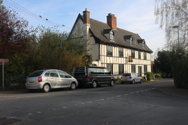
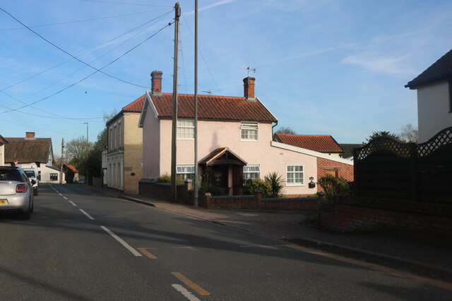
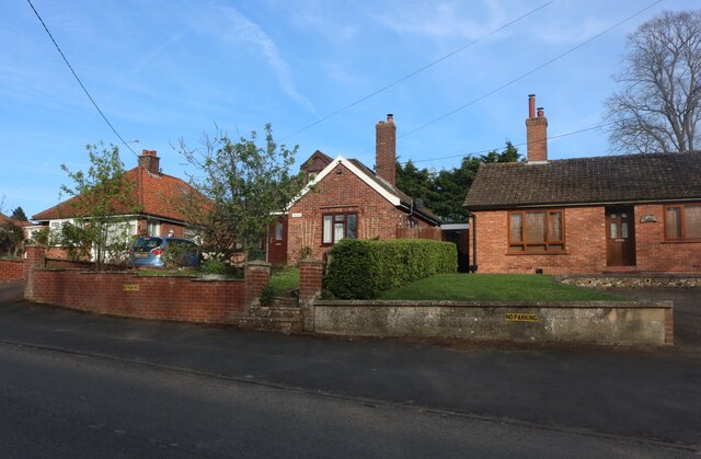
With a population of around 1,500 residents, Scole is a peaceful and picturesque village that offers a close-knit community atmosphere. The village is known for its charming architecture, featuring a mix of traditional thatched cottages and more modern houses.

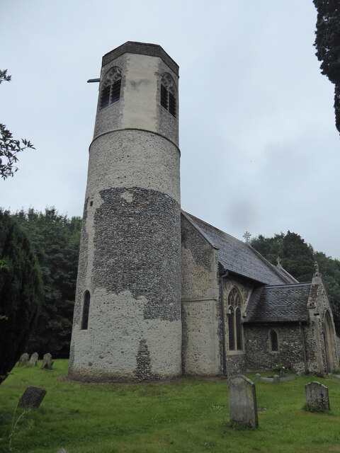
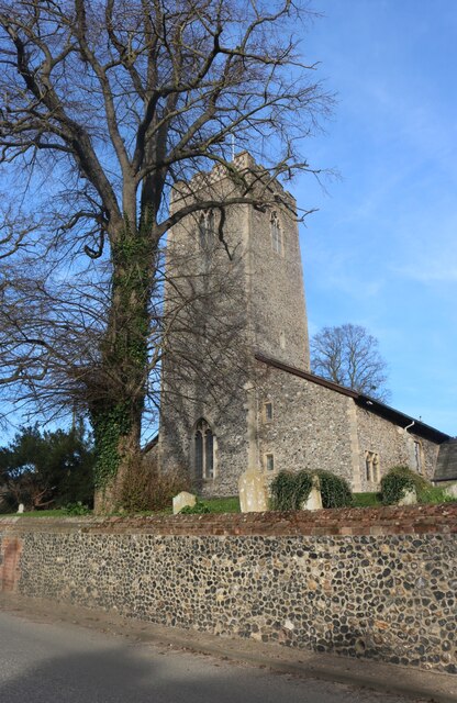
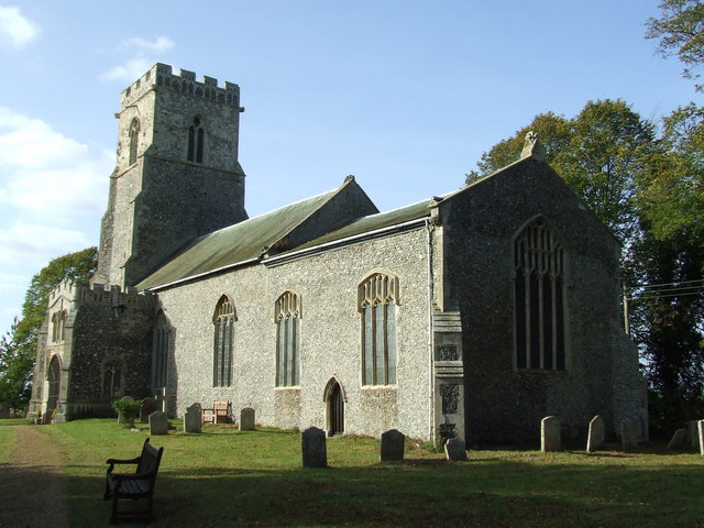
Scole benefits from a range of amenities and services to cater to the needs of its residents. These include a primary school, a village hall, a post office, a convenience store, and several local businesses. The village also boasts a historic church, St. Andrew's, which dates back to the 13th century and is a popular attraction for visitors.

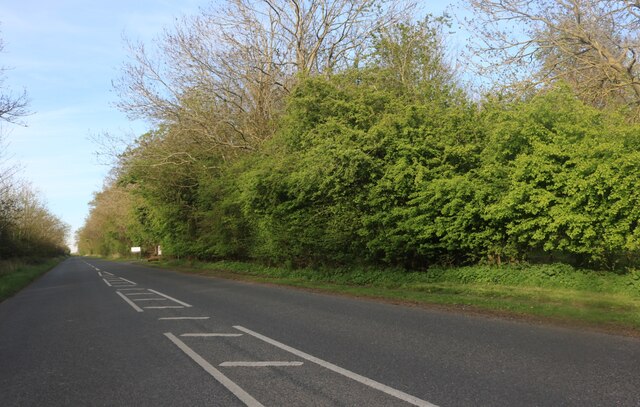
Nature enthusiasts can enjoy the beautiful surrounding countryside, with numerous walking paths and nature trails that offer stunning views of the rural landscape. The nearby River Waveney also provides opportunities for boating and fishing.

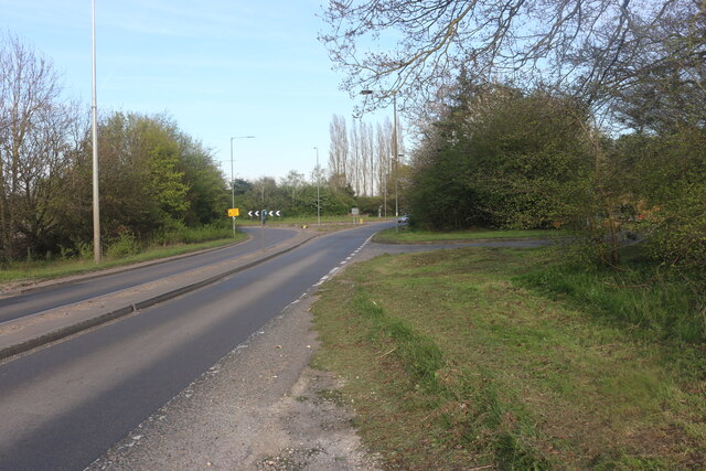
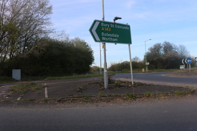
Scole's location makes it a convenient base for exploring the wider Norfolk area. The village is easily accessible by road, with the A140 passing nearby, connecting to Norwich and other major towns in the region. Overall, Scole offers a tranquil and idyllic setting for residents and visitors alike to enjoy the beauty of the Norfolk countryside.

If you have any feedback on the listing, please let us know in the comments section below.
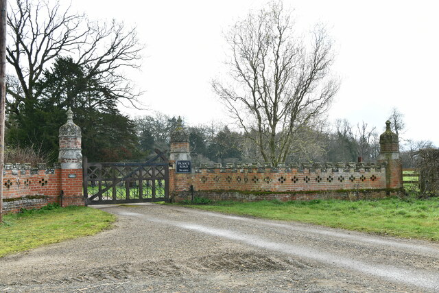
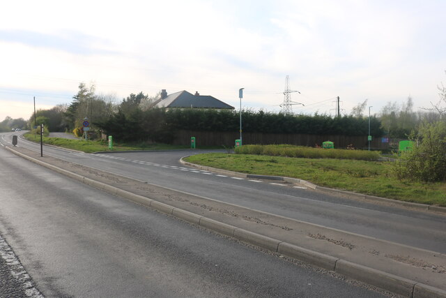
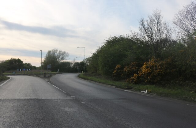
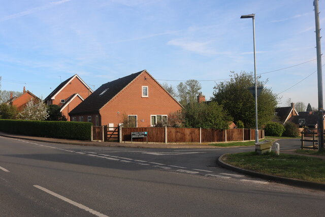
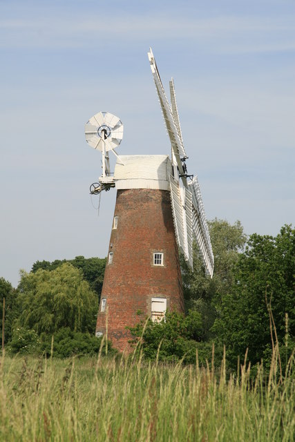
Scole Images

Images are sourced within 2km of 52.365999/1.156899 or Grid Reference TM1578. Thanks to Geograph Open Source API. All images are credited.

Norwich Road, Thelveton Norgate Lane on the right led to Billingford but has been closed for some time.
Norwich Road, Thelveton
Norgate Lane on the right led to Billingford but has been closed for some time.
Layby on the Scole Bypass, Thelveton
Norwich Road, Thelveton
Layby on the Scole Bypass, Thelveton
Thelveton: Grange Farm Cottages
Thelveton: Entrance to West Lodge
Thelveton: Junction of Norwich Road and Norgate Lane
Stuston, St Mary
Stuston, St Mary
Bridge Road, Scole At the end of Diss Road. Looking towards the Crossways Inn.
Bridge Road, Scole
At the end of Diss Road. Looking towards the Crossways Inn.
Old Bury Road, Scole
Roundabout on Old Bury Road, Stuston
Direction sign on Old Bury Road, Stuston
Diss Road at the junction of Karen Close
Diss Road, Scole
Diss Road, Scole
St Andrew's Church, Scole
Bungalows on Norwich Road, Scole
Norwich Road leaving Scole
Show me another place!

Scole is located at Grid Ref: TM1578 (Lat: 52.365999, Lng: 1.156899)

Administrative County: Norfolk

District: South Norfolk

Police Authority: Norfolk

What 3 Words

///extension.viewing.chins. Near Scole, Norfolk

Nearby Locations

Scole Alder Carr

Related Wikis

Scole

Scole () is a village on the Norfolk–Suffolk border in England. It is 19 miles south of Norwich and lay on the old Roman road to Venta Icenorum, which...

Oakley, Suffolk

Oakley is a village and former civil parish in the Mid Suffolk district, in the north of the English county of Suffolk. It lies immediately to the south...

Billingford, South Norfolk

Billingford or Pirleston is a village and former civil parish, 19 miles (31 km) south of Norwich, now in the parish of Scole, in the South Norfolk district...

Dickleburgh and Rushall

Dickleburgh and Rushall is a civil parish in South Norfolk. It covers an area of 14.90 km2 (5.75 sq mi) and had a population of 1356 in 565 households...

Nearby Amenities

Located within 500m of 52.365999,1.156899
Crossing
Crossing: uncontrolled
Tactile Paving: no
Lat/Long: 52.3658131/1.1512239
Crossing
Crossing: uncontrolled
Tactile Paving: no
Lat/Long: 52.3656876/1.1515644
Crossing
Crossing: uncontrolled
Lat/Long: 52.3661104/1.1529353
Bus Stop
Cedar House, adj
Naptan AtcoCode: 2900S081
Naptan Bearing: E
Naptan BusStopType: CUS
Naptan CommonName: Cedar House
Naptan Indicator: adj
Naptan Landmark: Slip Road
Naptan Locality: Scole
Naptan NaptanCode: nfodtawa
Naptan Street: The Street
Naptan Verified: no
Physically Present: no
Public Transport: platform
Source: naptan_import
Lat/Long: 52.3664713/1.1501211
Bus Stop
Scole Diss Road / opp Garage
Bench: no
Bin: no
Bus: yes
Covered: no
Naptan AtcoCode: 2900S0810
Naptan Bearing: NW
Naptan CommonName: Karen Close
Naptan Indicator: adj
Naptan Locality: Scole
Naptan NaptanCode: nfodtawd
Naptan Street: Diss Road
Naptan Verified: yes
Passenger Information Display: no
Public Transport: platform
Shelter: no
Source: naptan_import;survey
Tactile Paving: yes
Lat/Long: 52.3658616/1.153993
Bus Stop
Scole Norwich Road / Ransome Avenue
Bench: no
Bin: no
Bus: yes
Covered: no
Naptan AtcoCode: 2900S0811
Naptan Bearing: SW
Naptan CommonName: Primary School
Naptan Indicator: opp
Naptan Landmark: Scole Primary School
Naptan Locality: Scole
Naptan NaptanCode: nfodtawg
Naptan Street: Norwich Road
Naptan Verified: no
Passenger Information Display: no
Public Transport: platform
Shelter: no
Source: naptan_import;survey
Tactile Paving: yes
Lat/Long: 52.3691186/1.1600545
Bus Stop
Cedar House, opp
Naptan AtcoCode: 2900S0814
Naptan Bearing: W
Naptan CommonName: Cedar House
Naptan Indicator: opp
Naptan Landmark: Slip Road
Naptan Locality: Scole
Naptan NaptanCode: nfodtawp
Naptan Street: The Street
Naptan Verified: no
Physically Present: no
Source: naptan_import
Lat/Long: 52.3663179/1.1498017
Bus Stop
Fellows Close, adj
Naptan AtcoCode: 2900S0816
Naptan Bearing: E
Naptan BusStopType: CUS
Naptan CommonName: Fellows Close
Naptan Indicator: adj
Naptan Locality: Scole
Naptan NaptanCode: nfodtawt
Naptan Street: Bungay Road
Naptan Verified: yes
Physically Present: no
Public Transport: platform
Source: naptan_import
Lat/Long: 52.3656857/1.1599971
Bus Stop
Scole Diss Road / Jade Motor Co
Bench: no
Bin: no
Bus: yes
Covered: no
Naptan AtcoCode: 2900S082
Naptan Bearing: SE
Naptan CommonName: Karen Close
Naptan Indicator: opp
Naptan Locality: Scole
Naptan NaptanCode: nfodtdad
Naptan Street: Diss Road
Naptan Verified: yes
Passenger Information Display: no
Public Transport: platform
Shelter: no
Source: naptan_import;survey
Tactile Paving: yes
Lat/Long: 52.3660137/1.1536342
Bus Stop
Primary School, adj
Bench: no
Bin: no
Bus: yes
Covered: no
Naptan AtcoCode: 2900S086
Naptan Bearing: NE
Naptan BusStopType: CUS
Naptan CommonName: Primary School
Naptan Indicator: adj
Naptan Landmark: Scole Primary School
Naptan Locality: Scole
Naptan NaptanCode: nfodtdag
Naptan Street: Norwich Road
Naptan Verified: yes
Passenger Information Display: no
Public Transport: platform
Shelter: no
Source: naptan_import;survey
Tactile Paving: yes
Lat/Long: 52.3694378/1.1601888
Bus Stop
Fellows Close, opp
Naptan AtcoCode: 2900S089
Naptan Bearing: W
Naptan BusStopType: CUS
Naptan CommonName: Fellows Close
Naptan Indicator: opp
Naptan Locality: Scole
Naptan NaptanCode: nfodtdap
Naptan Street: Bungay Road
Naptan Verified: yes
Physically Present: no
Public Transport: platform
Source: naptan_import
Lat/Long: 52.3656292/1.1597938
Barrier: bollard
Bicycle: yes
Foot: yes
Horse: yes
Material: concrete
Lat/Long: 52.3631092/1.1520661
Crossing
Crossing: uncontrolled
Lat/Long: 52.3664118/1.1500824
Crossing
Crossing: uncontrolled
Tactile Paving: no
Lat/Long: 52.3666693/1.1520488
Crossing
Crossing: uncontrolled
Tactile Paving: no
Lat/Long: 52.3665496/1.1522092
Barrier: bollard
Foot: yes
Material: concrete
Lat/Long: 52.3667954/1.152104
Crossing
Crossing: uncontrolled
Lat/Long: 52.3663982/1.1498275
Turning Circle
Lat/Long: 52.3644227/1.1528195
turning, adj
Naptan AtcoCode: 2900S0815
Naptan Bearing: N
Naptan BusStopType: CUS
Naptan CommonName: turning
Naptan Indicator: adj
Naptan Locality: Scole
Naptan NaptanCode: nfogtamg
Naptan Street: Reeve Close
Naptan Verified: no
Physically Present: no
Source: naptan_import
Lat/Long: 52.3673848/1.1620432
Scole
Place: village
Source: NLS - OS 1:25k 1st Series 1937-61
Lat/Long: 52.3656924/1.1568858
Description: plaque
Historic: memorial
Inscription: This plaque was unveiled on the site of a Roman road on 22 October 1993 by the Right Hon. John Macgregor OBE MP Sec of State for Transport to mark the start of construction of the A140 Scole - Dickleburgh Improvemant
Memorial: plaque
Lat/Long: 52.3664807/1.1523568
Bench
Backrest: no
Material: wood
Seats: 2
Lat/Long: 52.3627806/1.1525134
Bench
Backrest: yes
Material: wood
Seats: 2
Lat/Long: 52.3630432/1.1520467
Tourism: picnic_site
Lat/Long: 52.3633373/1.1526871
Barrier: bollard
Bicycle: yes
Foot: yes
Horse: yes
Lat/Long: 52.3694509/1.1567446
Power: pole
Lat/Long: 52.3675452/1.1532004
Power: pole
Lat/Long: 52.3689958/1.1577834
Power: pole
Lat/Long: 52.3704666/1.1568463
Power: pole
Lat/Long: 52.3693824/1.1564963
Power: pole
Lat/Long: 52.3680824/1.1542808
Location Transition: yes
Power: pole
Lat/Long: 52.3679584/1.1576408
Power: pole
Lat/Long: 52.3687042/1.1553216
Power: pole
Lat/Long: 52.3683388/1.1564754
Entrance: yes
Lat/Long: 52.3671563/1.1582424
Entrance: main
Lat/Long: 52.367158/1.158019
Give Way
Lat/Long: 52.3662267/1.1565131
Give Way
Lat/Long: 52.3661853/1.1561917
Give Way
Lat/Long: 52.3656596/1.1550929
Board Type: notice
Information: board
Tourism: information
Lat/Long: 52.3663286/1.1567349
Bench
Backrest: yes
Seats: 3
Lat/Long: 52.3663024/1.1567362
Waste Basket
Lat/Long: 52.3662689/1.1567483
Scole
Colour: white
Man Made: village_sign
Material: metal
Lat/Long: 52.3663049/1.1567777
Historic: memorial
Memorial: war_memorial
Wikidata: Q66479879
Lat/Long: 52.3662484/1.1568851
Post Box
Collection Times: Mo-Fr 09:00; Sa 07:00
Operator: Royal Mail
Post Box Design: type_m
Post Box Type: lamp
Ref: IP21 7053D
Royal Cypher: EIIR
Royal Cypher Wikidata: Q33102113
Source: survey
Lat/Long: 52.3658224/1.1552907
Post Box
Collection Times: Mo-Fr 09:00; Sa 07:00
Operator: Royal Mail
Post Box Type: lamp
Ref: IP21 8132D
Royal Cypher: EIIR
Royal Cypher Wikidata: Q33102113
Source: survey
Lat/Long: 52.3684425/1.1604792
Barrier: height_restrictor
Maxheight: 2
Lat/Long: 52.3636891/1.1529638
Waste Basket
Waste: dog_excrement
Lat/Long: 52.3636588/1.1529702
Description: Angles Way
Information: route_marker
Tourism: information
Lat/Long: 52.3694319/1.1523141
Bench
Backrest: yes
Lat/Long: 52.3647891/1.149863
Barrier: debris
Foot: yes
Lat/Long: 52.3683881/1.1564089
Waste Basket
Waste: dog_excrement
Lat/Long: 52.3660625/1.1529442
Grit Bin
Lat/Long: 52.3660056/1.1530877
Bench
Backrest: no
Lat/Long: 52.3697871/1.1573135
Bench
Backrest: yes
Material: plastic
Lat/Long: 52.3652133/1.151766
Board Type: notice
Information: board
Tourism: information
Lat/Long: 52.3660367/1.1562467
Waste Basket
Waste: trash
Lat/Long: 52.36604/1.1562198
Bench
Backrest: yes
Material: wood
Lat/Long: 52.3661485/1.1569199
Board Type: notice
Information: board
Tourism: information
Lat/Long: 52.3671864/1.1578734
Bench
Backrest: yes
Material: wood
Lat/Long: 52.367123/1.1581457
Bench
Backrest: yes
Material: wood
Lat/Long: 52.3671803/1.157978
Waste Basket
Waste: dog_excrement
Lat/Long: 52.3696643/1.1607233
Waste Basket
Waste: dog_excrement
Lat/Long: 52.3656408/1.1632955
Barrier: stile
Foot: yes
Material: wood
Stile: stepover
Lat/Long: 52.3688832/1.1611615
Historic: stone
Lat/Long: 52.3633597/1.1524406
Bench
Backrest: yes
Lat/Long: 52.3630757/1.1522934
Leisure: fishing
Lat/Long: 52.362797/1.1526478
Leisure: fishing
Lat/Long: 52.3628446/1.1525092
Bench
Backrest: no
Lat/Long: 52.3626226/1.1528396
Board Type: nature
Information: board
Tourism: information
Lat/Long: 52.3627454/1.1526565
Barrier: bollard
Bicycle: yes
Foot: yes
Horse: yes
Material: concrete
Lat/Long: 52.3633609/1.1525211
Waste Basket
Waste: trash
Lat/Long: 52.3636786/1.1529844
Grit Bin
Lat/Long: 52.3645221/1.1540144
Grit Bin
Lat/Long: 52.3686817/1.1595521
Barrier: bollard
Foot: yes
Material: concrete
Lat/Long: 52.3666124/1.1613087
Barrier: cycle_barrier
Foot: yes
Lat/Long: 52.3664482/1.1621262
Bench
Backrest: yes
Material: wood
Lat/Long: 52.3671655/1.1590603
Grit Bin
Lat/Long: 52.3670646/1.1620308
Waste Basket
Waste: dog_excrement
Lat/Long: 52.3670894/1.1622461
Booth: KX100
Covered: booth
Disused Amenity: telephone
Man Made: telephone_box
Lat/Long: 52.369405/1.1601323
Scole Village Stores
Addr City: Diss
Addr Postcode: IP21 4DR
Addr Street: The Street
Addr Village: Scole
Fhrs Id: 648009
Shop: convenience
Source Addr: FHRS Open Data
Lat/Long: 52.3658304/1.1551941
Bench
Backrest: no
Lat/Long: 52.3694821/1.1522676
Defibrillator
Defibrillator Location: On outside wall of Scole Village Stores, facing The Street.
Emergency: defibrillator
Ref GB The Circuit: D358ECF1-76BB-4D43-89E9-AFFF00A8D356
Lat/Long: 52.3658372/1.1552946
Crossing
Crossing: uncontrolled
Lat/Long: 52.3677899/1.1581175
The data included in this document is from www.openstreetmap.org. The data is made available under ODbL.

Have you been to Scole?

Leave your review of Scole below (or comments, questions and feedback).