Blackwood

Settlement in Lancashire

England

Blackwood

Eddie Stobart, Warrington Eddie Stobart Logistics is the largest freight and transport haulage company in the UK. It is an offshoot of the Eddie Stobart Group Ltd founded by "steady" Eddie Stobart in the 1950s.
Eddie Stobart, Warrington Credit: N Chadwick

Blackwood is a small village located in the county of Lancashire, England. Situated in the northern part of the county, it is nestled amidst picturesque countryside and offers a tranquil and rural setting. The village is part of the Borough of Ribble Valley and is surrounded by rolling hills, lush green fields, and charming woodland areas.

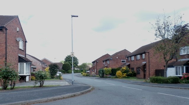
With a population of around 500 residents, Blackwood is a close-knit community with a strong sense of local pride. The village boasts a range of quaint stone-built houses and cottages, which add to its traditional and idyllic atmosphere. The architecture is predominantly 19th-century, giving Blackwood a historical charm.

Although small in size, Blackwood offers a few amenities to its residents. These include a local village hall, a primary school, and a small community shop. The village also benefits from a well-maintained park and playground, providing recreational facilities for families and children.

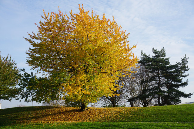
Blackwood is well-placed for those seeking outdoor activities, with several walking trails and nature reserves in the vicinity. The surrounding countryside offers ample opportunities for hiking, cycling, and exploring the natural beauty of the area. Additionally, nearby towns such as Clitheroe and Whalley provide further amenities and services, including shops, restaurants, and leisure facilities.

Overall, Blackwood is a charming and peaceful village, offering residents a close connection to nature and a tight-knit community spirit. It is a place where residents can enjoy the tranquility of rural living while still having access to nearby amenities and attractions.

If you have any feedback on the listing, please let us know in the comments section below.

Blackwood Images

Images are sourced within 2km of 53.405441/-2.5730513 or Grid Reference SJ6290. Thanks to Geograph Open Source API. All images are credited.

Eddie Stobart, Warrington Eddie Stobart Logistics is the largest freight and transport haulage company in the UK. It is an offshoot of the Eddie Stobart Group Ltd founded by "steady" Eddie Stobart in the 1950s.
Eddie Stobart, Warrington
Eddie Stobart Logistics is the largest freight and transport haulage company in the UK. It is an offshoot of the Eddie Stobart Group Ltd founded by "steady" Eddie Stobart in the 1950s.
Alban Retail Park, Warrington
Autumn tree display in Blackbrook Part of the frontage of University Academy.
Autumn tree display in Blackbrook
Part of the frontage of University Academy.
Canada Close A currently colourful housing development off Fearnhead Lane.
Canada Close
A currently colourful housing development off Fearnhead Lane.
Handley Drive Part of a new housing development.
Handley Drive
Part of a new housing development.
James Phoenix House A former Council car home which was opened in 1974 but is now likely to be demolished.
James Phoenix House
A former Council car home which was opened in 1974 but is now likely to be demolished.
Hilden Road Passing Brook Acre Community Primary School on the right, and looking into low autumn sun.
Hilden Road
Passing Brook Acre Community Primary School on the right, and looking into low autumn sun.
Motor and cycling parts shop on Orford Green I suspect this was once a pub, but cannot find any evidence yet.
Motor and cycling parts shop on Orford Green
I suspect this was once a pub, but cannot find any evidence yet.
Autumn leaf fall on Vale Owen Road This is a cul-de-sac off Orford Green.
Autumn leaf fall on Vale Owen Road
This is a cul-de-sac off Orford Green.
Accident advice bureau on Orford Green The road to the right is the A50, seen at its junction with Hallfields Road.
Accident advice bureau on Orford Green
The road to the right is the A50, seen at its junction with Hallfields Road.
Welsby Close - Cinnamon Brow
Capesthorne Road - Blackbrook
Studio 11 Barbers - Orford
Blackburne Arms - Orford
A49 Winwick Road
A49 Winwick Road
Old Milestone by Fearnhead Lane, Poulton with Fearnhead parish Carved stone post by the UC road (was A574), in parish of POULTON WITH FEARNHEAD (WARRINGTON District), Fearnhead Lane; opposite Methodist church next to No. 90, by the road, on North side of road. Lancs. CC stone triangle, erected by the County Council in the 19th/20th century. 

Inscription reads:-
: TO / LEIGH / MARKET PLACE / (7¾) MILES : : (TOWNSHIP OF POULTON / WITH FEARNHEAD / FEARNHEAD) : : TO / WARRINGTON / MARKET GATE / (3) MILES. :

Grade II listed.  
List Entry Number: 1392445 <span class="nowrap"><a title="https://historicengland.org.uk/listing/the-list/list-entry/1392445" rel="nofollow ugc noopener" href="https://historicengland.org.uk/listing/the-list/list-entry/1392445">Link</a><img style="margin-left:2px;" alt="External link" title="External link - shift click to open in new window" src="https://s1.geograph.org.uk/img/external.png" width="10" height="10"/></span>

Milestone Society National ID: LA_WALH03.
Old Milestone by Fearnhead Lane, Poulton with Fearnhead parish
Carved stone post by the UC road (was A574), in parish of POULTON WITH FEARNHEAD (WARRINGTON District), Fearnhead Lane; opposite Methodist church next to No. 90, by the road, on North side of road. Lancs. CC stone triangle, erected by the County Council in the 19th/20th century. Inscription reads:- : TO / LEIGH / MARKET PLACE / (7¾) MILES : : (TOWNSHIP OF POULTON / WITH FEARNHEAD / FEARNHEAD) : : TO / WARRINGTON / MARKET GATE / (3) MILES. : Grade II listed. List Entry Number: 1392445 LinkExternal link Milestone Society National ID: LA_WALH03.
Marina Drive & Clive Avenue, Warrington
Padgate Railway Station & Plaice Station
Show me another place!

Blackwood is located at Grid Ref: SJ6290 (Lat: 53.405441, Lng: -2.5730513)

Unitary Authority: Warrington

Police Authority: Cheshire

What 3 Words

///wages.flap.count. Near Warrington, Cheshire

Nearby Locations

Blackbrook Blackwood

Related Wikis

Warrington Rylands 1906 F.C.

Warrington Rylands 1906 Football Club is a football club based in Warrington, England. The club currently plays in the Northern Premier League Premier...

Orford Park

Orford Park is a municipal park in the town of Warrington, Cheshire, England. Orford Hall and surrounding lands were donated to Warrington Council in December...

Orford Hall, Warrington

Orford Hall, now demolished, was a 17th-century country house built in an estate which is now a public park (Orford Park) in Orford, Warrington, England...

Orford, Cheshire

Orford is a suburb of Warrington, in the Warrington district, in the ceremonial county of Cheshire, England. Originally a small area north of the township...

Warrington North (UK Parliament constituency)

Warrington North is a parliamentary constituency represented in the House of Commons of the Parliament of the United Kingdom since 2019 by Charlotte Nichols...

Peninsula Barracks, Warrington

Peninsula Barracks is a military installation on O'Leary Street in Warrington, England. == History == The barracks were built in the Fortress Gothic Revival...

Bruche, Warrington

Bruche is a large suburb of Warrington, in the Warrington district, in the ceremonial county of Cheshire, England.It forms the old border of Poulton and...

Padgate

Padgate is a suburb of Warrington, in the civil parish of Poulton-with-Fearnhead, in the Warrington district, in the ceremonial county of Cheshire, England...

Nearby Amenities

Located within 500m of 53.405441,-2.5730513
Traffic Signals
Traffic Signals: signal
Lat/Long: 53.4028745/-2.5733626
Turning Circle
Lat/Long: 53.4026273/-2.5687314
Traffic Calming: cushion
Lat/Long: 53.4068253/-2.5700934
Crossing
Crossing: uncontrolled
Crossing Island: no
Crossing Markings: zebra
Crossing Ref: zebra
Tactile Paving: yes
Traffic Calming: table
Lat/Long: 53.4080928/-2.5684665
Traffic Calming: table
Lat/Long: 53.40418/-2.5765004
Traffic Calming: table
Lat/Long: 53.4032433/-2.575773
Traffic Calming: table
Lat/Long: 53.4032916/-2.5785578
Traffic Calming: table
Lat/Long: 53.4055143/-2.5795245
Traffic Calming: table
Lat/Long: 53.4053706/-2.5770257
Turning Circle
Lat/Long: 53.4059068/-2.5763136
Crossing
Crossing: unmarked
Crossing Island: no
Crossing Markings: no
Kerb: lowered
Tactile Paving: yes
Lat/Long: 53.4056927/-2.5726927
Bus Stop
Hilden Place
Bus: yes
Departures Board: no
Public Transport: platform
Shelter: no
Lat/Long: 53.40605/-2.5717605
Bus Stop
Hilden Place
Bus: yes
Departures Board: no
Naptan AtcoCode: 069000021705
Naptan NaptanCode: wrgdmwp
Public Transport: platform
Shelter: no
Lat/Long: 53.4058703/-2.571953
Bus Stop
Derek Ave
Bench: yes
Bus: yes
Departures Board: timetable
Naptan AtcoCode: 069000021580
Naptan NaptanCode: wrgdmtm
Public Transport: platform
Shelter: yes
Lat/Long: 53.4061343/-2.5741339
Bus Stop
Derek Ave
Bus: yes
Departures Board: no
Public Transport: platform
Shelter: no
Lat/Long: 53.4063392/-2.5742821
Crossing
Crossing: unmarked
Crossing Island: no
Crossing Markings: no
Tactile Paving: no
Lat/Long: 53.4065683/-2.5740193
Bus Stop
Martin Avenue
Bus: yes
Departures Board: no
Naptan AtcoCode: 069000021570
Naptan NaptanCode: wrgdpag
Public Transport: platform
Shelter: no
Lat/Long: 53.4083388/-2.573611
Bus Stop
Hallows Avenue
Bus: yes
Departures Board: no
Public Transport: platform
Shelter: no
Lat/Long: 53.4050254/-2.5746765
Bus Stop
Hallows Avenue
Bus: yes
Departures Board: no
Public Transport: platform
Shelter: no
Lat/Long: 53.4050892/-2.5742878
Bus Stop
Lyndale Avenue
Bus: yes
Departures Board: no
Naptan AtcoCode: 069000011260
Naptan NaptanCode: wrgdpgp
Public Transport: platform
Shelter: no
Lat/Long: 53.4039482/-2.5771617
Bus Stop
Lyndale Avenue
Bus: yes
Departures Board: no
Public Transport: platform
Shelter: no
Lat/Long: 53.4035303/-2.5778826
Bus Stop
Bus: yes
Naptan AtcoCode: 069000022153
Naptan NaptanCode: wrgdpgj
Public Transport: platform
Lat/Long: 53.4019697/-2.5768729
Bus Stop
Orford Green
Bus: yes
Departures Board: no
Naptan AtcoCode: 069000021540
Naptan NaptanCode: wrgdpdm
Public Transport: platform
Shelter: yes
Lat/Long: 53.4059669/-2.580463
Bus Stop
St Margaret's Church
Bus: yes
Departures Board: no
Public Transport: platform
Shelter: no
Lat/Long: 53.4064693/-2.5794058
Bus Stop
Bruce Avenue
Bus: yes
Departures Board: timetable
Naptan AtcoCode: 069000021549
Naptan NaptanCode: wrgdmtd
Public Transport: platform
Shelter: no
Lat/Long: 53.4067029/-2.5773879
Crossing
Crossing: unmarked
Crossing Island: no
Crossing Markings: no
Tactile Paving: yes
Lat/Long: 53.4060883/-2.5743015
Bus Stop
Martin Avenue
Bus: yes
Departures Board: no
Public Transport: platform
Shelter: no
Lat/Long: 53.4086402/-2.5737678
Crossing
Crossing: uncontrolled
Crossing Island: no
Crossing Markings: zebra
Crossing Ref: zebra
Kerb: lowered
Tactile Paving: yes
Lat/Long: 53.4057936/-2.5737602
Crossing
Crossing: marked
Crossing Island: no
Crossing Markings: zebra
Crossing Ref: zebra
Kerb: lowered
Tactile Paving: yes
Lat/Long: 53.4056307/-2.5739098
Crossing
Crossing: unmarked
Crossing Island: no
Crossing Markings: no
Kerb: lowered
Tactile Paving: yes
Lat/Long: 53.4049877/-2.5735382
Crossing
Crossing: unmarked
Crossing Island: no
Crossing Markings: no
Kerb: lowered
Tactile Paving: yes
Lat/Long: 53.4049487/-2.5733509
Crossing
Crossing: unmarked
Crossing Island: no
Crossing Markings: no
Kerb: lowered
Tactile Paving: yes
Lat/Long: 53.4056066/-2.5725992
Crossing
Crossing: unmarked
Crossing Island: no
Crossing Markings: no
Tactile Paving: yes
Lat/Long: 53.4055597/-2.5740269
Barrier: bollard
Foot: yes
Lat/Long: 53.4050703/-2.5738136
Crossing
Crossing: unmarked
Crossing Island: no
Crossing Markings: no
Tactile Paving: yes
Lat/Long: 53.407236/-2.5698656
Generator Method: photovoltaic
Generator Output Electricity: yes
Generator Source: solar
Generator Type: solar_photovoltaic_panel
Location: roof
Power: generator
Lat/Long: 53.4084031/-2.5778362
Generator Method: photovoltaic
Generator Output Electricity: yes
Generator Source: solar
Generator Type: solar_photovoltaic_panel
Location: roof
Power: generator
Lat/Long: 53.4083899/-2.5779477
Generator Method: photovoltaic
Generator Output Electricity: yes
Generator Source: solar
Generator Type: solar_photovoltaic_panel
Location: roof
Power: generator
Lat/Long: 53.4083616/-2.5781882
Generator Method: photovoltaic
Generator Output Electricity: yes
Generator Source: solar
Generator Type: solar_photovoltaic_panel
Location: roof
Power: generator
Lat/Long: 53.4083487/-2.5782976
Generator Method: photovoltaic
Generator Output Electricity: yes
Generator Source: solar
Generator Type: solar_photovoltaic_panel
Location: roof
Power: generator
Lat/Long: 53.4023883/-2.5677717
Generator Method: photovoltaic
Generator Output Electricity: yes
Generator Source: solar
Generator Type: solar_photovoltaic_panel
Location: roof
Power: generator
Lat/Long: 53.4095166/-2.5717118
Generator Method: photovoltaic
Generator Output Electricity: yes
Generator Source: solar
Generator Type: solar_photovoltaic_panel
Location: roof
Power: generator
Lat/Long: 53.4095102/-2.5717655
Generator Method: photovoltaic
Generator Output Electricity: yes
Generator Source: solar
Generator Type: solar_photovoltaic_panel
Location: roof
Power: generator
Lat/Long: 53.4043537/-2.5725861
Padgate Junction
Railway: junction
Lat/Long: 53.4041834/-2.5662931
Crossing
Crossing: unmarked
Crossing Island: no
Crossing Markings: no
Tactile Paving: yes
Lat/Long: 53.4066709/-2.5702728
Traffic Calming: cushion
Lat/Long: 53.4073871/-2.5695868
Turning Circle
Lat/Long: 53.4056041/-2.5754188
Barrier: bollard
Bicycle: yes
Foot: yes
Horse: yes
Motor Vehicle: no
Lat/Long: 53.4076869/-2.5762476
Barrier: bollard
Bicycle: yes
Foot: yes
Motor Vehicle: no
Lat/Long: 53.4076403/-2.5753634
Crossing
Crossing: unmarked
Crossing Island: no
Tactile Paving: yes
Lat/Long: 53.4077621/-2.5718127
Traffic Signals
Traffic Signals: signal
Lat/Long: 53.4033296/-2.5734409
Crossing
Crossing: unmarked
Crossing Island: no
Crossing Markings: no
Tactile Paving: yes
Lat/Long: 53.4032962/-2.5734269
Crossing
Crossing: uncontrolled
Crossing Island: no
Crossing Markings: dots
Tactile Paving: yes
Lat/Long: 53.4029265/-2.5732848
Crossing
Crossing: uncontrolled
Crossing Island: no
Crossing Markings: dots
Tactile Paving: yes
Lat/Long: 53.4029091/-2.5733775
Crossing
Crossing: unmarked
Crossing Island: no
Crossing Markings: no
Tactile Paving: yes
Lat/Long: 53.4032869/-2.5735157
Traffic Signals
Traffic Signals: crossing
Lat/Long: 53.4033669/-2.5733644
Crossing
Button Operated: yes
Crossing: traffic_signals
Crossing Island: no
Crossing Markings: dots
Crossing Ref: pelican
Tactile Paving: yes
Lat/Long: 53.4033463/-2.5733072
Give Way
Lat/Long: 53.4033274/-2.5731721
Crossing
Button Operated: yes
Crossing: traffic_signals
Crossing Island: no
Crossing Markings: dots
Crossing Ref: pelican
Tactile Paving: yes
Lat/Long: 53.4032462/-2.573268
Traffic Signals
Traffic Signals: signal
Lat/Long: 53.4032391/-2.5730844
Crossing
Button Operated: yes
Crossing: traffic_signals
Crossing Island: no
Crossing Markings: dots
Crossing Ref: pelican
Tactile Paving: yes
Lat/Long: 53.4032136/-2.5731347
Turning Circle
Lat/Long: 53.4048105/-2.5760916
Crossing
Crossing: unmarked
Crossing Island: no
Crossing Markings: no
Kerb: lowered
Tactile Paving: yes
Lat/Long: 53.4052437/-2.5739025
Crossing
Crossing: unmarked
Crossing Island: no
Crossing Markings: no
Tactile Paving: yes
Lat/Long: 53.405184/-2.5738901
Traffic Calming: cushion
Lat/Long: 53.4059547/-2.5718693
Traffic Calming: cushion
Lat/Long: 53.4062785/-2.5710327
Crossing
Crossing: unmarked
Crossing Island: no
Crossing Markings: no
Tactile Paving: no
Lat/Long: 53.4070428/-2.5697038
Barrier: block
Lat/Long: 53.4072526/-2.5698904
Traffic Calming: cushion
Lat/Long: 53.4078375/-2.5689096
Traffic Calming: cushion
Lat/Long: 53.4085294/-2.5677215
Traffic Calming: cushion
Lat/Long: 53.404935/-2.5747645
Traffic Signals
Traffic Signals: signal
Traffic Signals Direction: backward
Lat/Long: 53.4065962/-2.580142
Bus Stop
Brian Avenue
Bus: yes
Departures Board: timetable
Public Transport: platform
Shelter: yes
Lat/Long: 53.4038057/-2.5737438
Bus Stop
Brian Avenue
Bus: yes
Departures Board: no
Public Transport: platform
Shelter: no
Lat/Long: 53.4045164/-2.5735991
Give Way
Direction: forward
Lat/Long: 53.40592/-2.574195
Crossing
Crossing: unmarked
Crossing Island: no
Crossing Markings: no
Tactile Paving: yes
Lat/Long: 53.4059366/-2.5726657
Crossing
Crossing: unmarked
Crossing Island: no
Crossing Markings: no
Tactile Paving: yes
Lat/Long: 53.4060555/-2.5732524
Give Way
Direction: forward
Lat/Long: 53.4051916/-2.5742548
Tactile Paving: yes
Lat/Long: 53.4055701/-2.5739207
Crossing
Crossing: unmarked
Crossing Island: no
Crossing Markings: no
Tactile Paving: no
Lat/Long: 53.4040666/-2.5738162
Bench
Backrest: yes
Material: wood
Seats: 2
Lat/Long: 53.4060339/-2.5740391
Crossing
Crossing: unmarked
Crossing Island: no
Crossing Markings: no
Tactile Paving: no
Lat/Long: 53.4060935/-2.5713076
Crossing
Crossing: unmarked
Crossing Island: no
Tactile Paving: no
Lat/Long: 53.4082012/-2.5681299
Crossing
Crossing: unmarked
Crossing Island: no
Crossing Markings: no
Tactile Paving: yes
Lat/Long: 53.4082523/-2.5683781
Addr City: Warrington
Addr Housenumber: 10
Addr Postcode: WA2 8ES
Addr Street: Smith Drive
Lat/Long: 53.4031091/-2.5793732
Addr City: Warrington
Addr Housenumber: 12
Addr Postcode: WA2 8ES
Addr Street: Smith Drive
Lat/Long: 53.4031318/-2.5793229
Addr City: Warrington
Addr Housenumber: 14
Addr Postcode: WA2 8ES
Addr Street: Smith Drive
Lat/Long: 53.4032109/-2.5791432
Addr City: Warrington
Addr Housenumber: 16
Addr Postcode: WA2 8ES
Addr Street: Smith Drive
Lat/Long: 53.4032467/-2.5790609
Addr City: Warrington
Addr Housenumber: 18
Addr Postcode: WA2 8ES
Addr Street: Smith Drive
Lat/Long: 53.4033132/-2.5789114
Addr City: Warrington
Addr Housenumber: 20
Addr Postcode: WA2 8ES
Addr Street: Smith Drive
Lat/Long: 53.4033359/-2.5788596
Addr City: Warrington
Addr Housenumber: 22
Addr Postcode: WA2 8ER
Addr Street: Smith Drive
Lat/Long: 53.4035103/-2.5784754
Addr City: Warrington
Addr Housenumber: 1
Addr Postcode: WA2 8DY
Addr Street: Roscoe Avenue
Lat/Long: 53.4035183/-2.5785498
Addr City: Warrington
Addr Housenumber: 24
Addr Postcode: WA2 8ER
Addr Street: Smith Drive
Lat/Long: 53.4035866/-2.5782672
Addr City: Warrington
Addr Housenumber: 26
Addr Postcode: WA2 8ER
Addr Street: Smith Drive
Lat/Long: 53.403613/-2.5782053
Addr City: Warrington
Addr Housenumber: 28
Addr Postcode: WA2 8ER
Addr Street: Smith Drive
Lat/Long: 53.4036722/-2.5780702
Addr City: Warrington
Addr Housenumber: 30
Addr Postcode: WA2 8ER
Addr Street: Smith Drive
Lat/Long: 53.4036988/-2.5780105
Addr City: Warrington
Addr Housenumber: 32
Addr Postcode: WA2 8ER
Addr Street: Smith Drive
Lat/Long: 53.403758/-2.5778782
Addr City: Warrington
Addr Housenumber: 34
Addr Postcode: WA2 8ER
Addr Street: Smith Drive
Lat/Long: 53.4037833/-2.5778178
Addr City: Warrington
Addr Housenumber: 36
Addr Postcode: WA2 8ER
Addr Street: Smith Drive
Lat/Long: 53.4038423/-2.5776803
Addr City: Warrington
Addr Housenumber: 38
Addr Postcode: WA2 8ER
Addr Street: Smith Drive
Lat/Long: 53.4038668/-2.5776225
Addr City: Warrington
Addr Housenumber: 40
Addr Postcode: WA2 8ER
Addr Street: Smith Drive
Lat/Long: 53.4039257/-2.5774873
Addr City: Warrington
Addr Housenumber: 42
Addr Postcode: WA2 8ER
Addr Street: Smith Drive
Lat/Long: 53.4039527/-2.5774268
Addr City: Warrington
Addr Housenumber: 44
Addr Postcode: WA2 8ER
Addr Street: Smith Drive
Lat/Long: 53.4040127/-2.5772932
Addr City: Warrington
Addr Housenumber: 46
Addr Postcode: WA2 8ER
Addr Street: Smith Drive
Lat/Long: 53.4040387/-2.5772332
Addr City: Warrington
Addr Housenumber: 48
Addr Postcode: WA2 8ER
Addr Street: Smith Drive
Lat/Long: 53.4040957/-2.577096
Addr City: Warrington
Addr Housenumber: 50
Addr Postcode: WA2 8ER
Addr Street: Smith Drive
Lat/Long: 53.4041232/-2.577036
Addr City: Warrington
Addr Housenumber: 52
Addr Postcode: WA2 8ER
Addr Street: Smith Drive
Lat/Long: 53.4042038/-2.5768983
Addr City: Warrington
Addr Housenumber: 2
Addr Postcode: WA2 8EP
Addr Street: Lyndale Avenue
Lat/Long: 53.4042386/-2.5768672
Cycleway: asl
Direction: backward
Lat/Long: 53.4066035/-2.580195
Crossing
Crossing: unmarked
Crossing Island: no
Crossing Markings: no
Tactile Paving: yes
Lat/Long: 53.4066338/-2.5765921
Crossing
Crossing: unmarked
Crossing Island: no
Crossing Markings: no
Tactile Paving: yes
Lat/Long: 53.4067187/-2.5776939
Crossing
Crossing: marked
Crossing Island: no
Tactile Paving: yes
Lat/Long: 53.4020872/-2.5776634
Crossing
Crossing: unmarked
Crossing Island: no
Crossing Markings: no
Tactile Paving: no
Lat/Long: 53.4055712/-2.5804626
Crossing
Crossing: unmarked
Crossing Island: no
Tactile Paving: no
Lat/Long: 53.4061367/-2.5804685
Crossing
Crossing: unmarked
Crossing Island: no
Tactile Paving: yes
Lat/Long: 53.4066292/-2.5799603
Crossing
Crossing: unmarked
Crossing Island: no
Tactile Paving: yes
Lat/Long: 53.4065721/-2.5794041
Crossing
Crossing: unmarked
Crossing Island: no
Crossing Markings: no
Tactile Paving: yes
Lat/Long: 53.4064772/-2.5784603
Tactile Paving: yes
Lat/Long: 53.4053925/-2.573989
Tactile Paving: yes
Lat/Long: 53.4058457/-2.5736357
Crossing
Crossing: unmarked
Crossing Island: no
Crossing Markings: no
Tactile Paving: yes
Lat/Long: 53.4064971/-2.5760574
Crossing
Crossing: unmarked
Crossing Island: no
Crossing Markings: no
Tactile Paving: yes
Lat/Long: 53.4064143/-2.5757377
Crossing
Crossing: pavement
Lat/Long: 53.4040992/-2.5736226
Crossing
Crossing: pavement
Lat/Long: 53.4018335/-2.5722725
Crossing
Crossing: unmarked
Lat/Long: 53.4013176/-2.5716028
Barrier: kerb
Lat/Long: 53.4012985/-2.5715766
Crossing
Crossing: pavement
Lat/Long: 53.4012063/-2.5714622
Barrier: cycle_barrier
Lat/Long: 53.4023137/-2.5731968
Crossing
Crossing: unmarked
Crossing Island: no
Crossing Markings: no
Tactile Paving: no
Lat/Long: 53.4031343/-2.5735263
Crossing
Crossing: unmarked
Crossing Island: no
Crossing Markings: no
Tactile Paving: no
Lat/Long: 53.4035459/-2.573681
Give Way
Direction: forward
Lat/Long: 53.404072/-2.5737607
Crossing
Crossing: unmarked
Lat/Long: 53.4081903/-2.5735722
Crossing
Crossing: unmarked
Lat/Long: 53.407913/-2.5736434
Barrier: kerb
Lat/Long: 53.4065933/-2.5740124
Barrier: kerb
Lat/Long: 53.4065406/-2.5740271
Barrier: kerb
Lat/Long: 53.4079301/-2.5736386
Barrier: kerb
Lat/Long: 53.4078926/-2.5736492
Crossing
Crossing: unmarked
Crossing Island: no
Crossing Markings: no
Tactile Paving: no
Lat/Long: 53.4061671/-2.573356
Crossing
Crossing: unmarked
Crossing Island: no
Crossing Markings: no
Tactile Paving: no
Lat/Long: 53.4063415/-2.5740323
Crossing
Crossing: unmarked
Crossing Island: no
Tactile Paving: no
Lat/Long: 53.4073992/-2.574026
Barrier: kerb
Lat/Long: 53.4074373/-2.574017
Barrier: kerb
Lat/Long: 53.4073584/-2.5740357
Crossing
Crossing: unmarked
Crossing Island: no
Crossing Markings: no
Tactile Paving: yes
Lat/Long: 53.4086832/-2.5737018
Crossing
Button Operated: yes
Crossing: traffic_signals
Crossing Island: no
Crossing Markings: dots
Crossing Ref: puffin
Tactile Paving: yes
Lat/Long: 53.4066107/-2.580248
Crossing
Crossing: unmarked
Crossing Island: no
Crossing Markings: no
Tactile Paving: yes
Lat/Long: 53.4066612/-2.5773158
Crossing
Crossing: unmarked
Crossing Island: no
Crossing Markings: no
Tactile Paving: yes
Lat/Long: 53.406041/-2.5716471
Give Way
Direction: forward
Lat/Long: 53.4061218/-2.571337
Information: guidepost
Tourism: information
Lat/Long: 53.4067034/-2.5704197
Information: guidepost
Tourism: information
Lat/Long: 53.4058418/-2.572746
Information: guidepost
Tourism: information
Lat/Long: 53.4048849/-2.5732243
Information: guidepost
Tourism: information
Lat/Long: 53.4055617/-2.5739624
Information: guidepost
Tourism: information
Lat/Long: 53.4050931/-2.5742538
Crossing
Crossing: unmarked
Crossing Island: no
Crossing Markings: no
Tactile Paving: no
Lat/Long: 53.4073073/-2.5797172
Best-one
Addr City: Warrington
Addr Housenumber: 4B
Addr Postcode: WA2 0HQ
Addr Street: Martin Avenue
Addr Suburb: Orford
Brand: Best-one
Brand Wikidata: Q4896532
Fhrs Id: 761223
Level: 0
Opening Hours: 07:00-23:00
Phone: +44 1925 415082
Shop: convenience
Website: https://stores.best-one.co.uk/tanas-food-and-wine-best-one-7c604a03e758
Lat/Long: 53.4083193/-2.5724621
Kayleigh Louise Hair & Beauty Salon
Addr City: Warrington
Addr Housenumber: 4
Addr Postcode: WA2 0HQ
Addr Street: Martin Avenue
Addr Suburb: Orford
Email: kayleighlouisehairandbeauty@gmail.com
Level: 0
Phone: +44 1925 550766
Shop: hairdresser
Website: https://www.kayleighlouisehair.co.uk
Lat/Long: 53.4083168/-2.5723464
Fast Food
Family Pizza
Addr City: Warrington
Addr Housenumber: 6
Addr Postcode: WA2 0HQ
Addr Street: Martin Avenue
Addr Suburb: Orford
Cuisine: pizza
Drive Through: no
Fhrs Id: 419911
Level: 0
Opening Hours: Su-Th 16:00-23:00; Fr-Sa 16:00-24:00
Phone: +44 1925 445785
Website: https://familypizzawarrington.co.uk
Lat/Long: 53.4083145/-2.5722417
Good Fellas Barbers
Addr City: Warrington
Addr Housenumber: 8
Addr Postcode: WA2 0HQ
Addr Street: Martin Avenue
Addr Suburb: Orford
Alt Name: GoodFellas
Contact Facebook: https://www.facebook.com/people/GoodFellas/100057604892382/
Level: 0
Opening Hours: Mo 09:00-17:00; Tu-Th 09:00-18:00; Fr 09:00-19:00; Sa 08:00-16:00
Phone: +44 7385 923506
Shop: hairdresser
Lat/Long: 53.4083122/-2.5721319
Restaurant
Neighbours Chinese Takeaway
Addr City: Warrington
Addr Housenumber: 10
Addr Postcode: WA2 0HQ
Addr Street: Martin Avenue
Addr Suburb: Orford
Contact Facebook: https://www.facebook.com/neighbourschinesefood/
Cuisine: chinese
Fhrs Id: 420703
Level: 0
Opening Hours: Mo 17:00-21:00; We-Su 17:00-22:00
Phone: +44 1925 657887
Lat/Long: 53.4083102/-2.5720383
Give Way
Direction: backward
Lat/Long: 53.4041472/-2.5764651
Give Way
Direction: backward
Lat/Long: 53.4042106/-2.5765293
Give Way
Direction: backward
Lat/Long: 53.4045109/-2.5758488
Give Way
Direction: backward
Lat/Long: 53.4044503/-2.5757857
Give Way
Direction: forward
Lat/Long: 53.4033918/-2.5749625
Give Way
Direction: forward
Lat/Long: 53.4032734/-2.5757869
Give Way
Direction: backward
Lat/Long: 53.4033162/-2.5785855
Waste Basket
Material: metal
Lat/Long: 53.4081915/-2.5706401
Street Lamp
Lamp Mount: straight_mast
Lamp Type: led
Lat/Long: 53.4032381/-2.5729729
Street Lamp
Lamp Mount: straight_mast
Lamp Type: led
Lat/Long: 53.4033713/-2.5731393
Street Lamp
Lamp Mount: straight_mast
Lamp Type: led
Lat/Long: 53.4034366/-2.5726343
Street Lamp
Lamp Mount: straight_mast
Lamp Type: led
Lat/Long: 53.403713/-2.5724981
Street Lamp
Lamp Mount: straight_mast
Lamp Type: led
Lat/Long: 53.4036578/-2.5723334
Street Lamp
Lamp Mount: straight_mast
Lamp Type: led
Lat/Long: 53.4038529/-2.5720763
Street Lamp
Lamp Mount: straight_mast
Lamp Type: led
Lat/Long: 53.4040612/-2.5717938
Street Lamp
Lamp Mount: straight_mast
Lamp Type: led
Lat/Long: 53.4042509/-2.5714935
Street Lamp
Lamp Mount: straight_mast
Lamp Type: led
Lat/Long: 53.40445/-2.571185
Street Lamp
Lamp Mount: straight_mast
Lamp Type: led
Lat/Long: 53.4046411/-2.5708712
Street Lamp
Lamp Mount: straight_mast
Lamp Type: led
Lat/Long: 53.404829/-2.5705494
Street Lamp
Lamp Mount: straight_mast
Lamp Type: led
Lat/Long: 53.4050041/-2.5702087
Street Lamp
Lamp Mount: straight_mast
Lamp Type: led
Lat/Long: 53.4051838/-2.5698797
Street Lamp
Lamp Mount: straight_mast
Lamp Type: led
Lat/Long: 53.4053485/-2.5695284
Barrier: swing_gate
Lat/Long: 53.4053693/-2.5692803
Street Lamp
Lamp Mount: straight_mast
Lamp Type: led
Lat/Long: 53.4055056/-2.5691663
Street Lamp
Lamp Mount: straight_mast
Lamp Type: led
Lat/Long: 53.4056406/-2.568802
Street Lamp
Lamp Mount: straight_mast
Lamp Type: led
Lat/Long: 53.4057861/-2.5684121
Street Lamp
Lamp Mount: straight_mast
Lamp Type: led
Lat/Long: 53.4059169/-2.5680128
Street Lamp
Lamp Mount: straight_mast
Lamp Type: led
Lat/Long: 53.4060506/-2.5676088
Street Lamp
Lamp Mount: straight_mast
Lamp Type: led
Lat/Long: 53.4061765/-2.5672025
Street Lamp
Lamp Mount: straight_mast
Lamp Type: led
Lat/Long: 53.4062907/-2.5668114
Street Lamp
Lamp Mount: straight_mast
Lamp Type: led
Lat/Long: 53.4063972/-2.5664075
Street Lamp
Lamp Mount: straight_mast
Lamp Type: led
Lat/Long: 53.4065106/-2.5659942
Street Lamp
Lamp Type: led
Lat/Long: 53.4085671/-2.5677774
Street Lamp
Lamp Type: led
Lat/Long: 53.4083118/-2.5680082
Street Lamp
Lamp Type: led
Lat/Long: 53.4081786/-2.5684363
Street Lamp
Lamp Type: led
Lat/Long: 53.4080515/-2.5686712
Street Lamp
Lamp Type: led
Lat/Long: 53.4078637/-2.5689862
Street Lamp
Lamp Type: led
Lat/Long: 53.4076589/-2.5693329
Street Lamp
Lamp Type: led
Lat/Long: 53.4074576/-2.5696111
Street Lamp
Lamp Type: led
Lat/Long: 53.4071502/-2.5697192
Street Lamp
Lamp Type: led
Lat/Long: 53.4069114/-2.5699365
Street Lamp
Lamp Type: led
Lat/Long: 53.4066666/-2.5701891
Street Lamp
Lamp Type: led
Lat/Long: 53.4064752/-2.5704792
Street Lamp
Lamp Type: led
Lat/Long: 53.4063143/-2.5707871
Street Lamp
Lamp Type: led
Lat/Long: 53.4061612/-2.5712004
Street Lamp
Lamp Type: led
Lat/Long: 53.4060892/-2.5716996
Street Lamp
Lamp Type: led
Lat/Long: 53.4058473/-2.5720119
Street Lamp
Lamp Type: led
Lat/Long: 53.4057978/-2.5724368
Street Lamp
Lamp Type: led
Lat/Long: 53.4056571/-2.5726225
Street Lamp
Lamp Type: led
Lat/Long: 53.4056123/-2.5727191
Street Lamp
Lamp Type: led
Lat/Long: 53.4057368/-2.5729672
Street Lamp
Lamp Type: led
Lat/Long: 53.4057689/-2.5732559
Street Lamp
Lamp Type: led
Lat/Long: 53.4056514/-2.5736644
Street Lamp
Lamp Type: led
Lat/Long: 53.405698/-2.5739277
Street Lamp
Lamp Type: led
Lat/Long: 53.4054518/-2.5738979
Street Lamp
Lamp Type: led
Lat/Long: 53.4050761/-2.5736967
Street Lamp
Lamp Type: led
Lat/Long: 53.4049382/-2.5734559
Street Lamp
Lamp Type: led
Lat/Long: 53.4049937/-2.5729644
Street Lamp
Lamp Type: led
Lat/Long: 53.4051241/-2.5726962
Street Lamp
Lamp Type: led
Lat/Long: 53.4053731/-2.5725581
Street Lamp
Lamp Type: led
Lat/Long: 53.4060574/-2.5741676
Street Lamp
Lamp Type: led
Lat/Long: 53.4061207/-2.5744136
Street Lamp
Lamp Type: led
Lat/Long: 53.4058354/-2.5745877
Street Lamp
Lamp Type: led
Lat/Long: 53.4052456/-2.5741042
Street Lamp
Lamp Type: led
Lat/Long: 53.4048491/-2.573636
Street Lamp
Lamp Type: led
Lat/Long: 53.40491/-2.5733102
Post Box
Operator: Royal Mail
Operator Wikidata: Q638098
Post Box Design: type_b
Post Box Type: pillar
Ref: WA2 231
Royal Cypher: EIIR
Lat/Long: 53.4050493/-2.5738561
Waste Basket
Colour: #000000
Material: plastic
Lat/Long: 53.4081834/-2.57201
Waste Basket
Colour: #000000
Material: plastic
Lat/Long: 53.408223/-2.5724642
Bicycle Parking
Bicycle Parking: stands
Capacity: 2
Colour: #000000
Covered: no
Fee: no
Lat/Long: 53.4082298/-2.5722105
Barrier: bollard
Bicycle: yes
Bollard: removable
Foot: yes
Motor Vehicle: private
Lat/Long: 53.4081701/-2.5708782
Man Made: street_cabinet
Lat/Long: 53.4083282/-2.5735073
Man Made: street_cabinet
Lat/Long: 53.4082314/-2.5731144
Post Box
Operator: Royal Mail
Operator Wikidata: Q638098
Post Box Type: lamp
Ref: WA2 342
Royal Cypher: EIIR
Lat/Long: 53.4067855/-2.5725049
Traffic Calming: cushion
Lat/Long: 53.4051876/-2.5739608
Traffic Calming: cushion
Lat/Long: 53.4052153/-2.5739801
Traffic Calming: cushion
Lat/Long: 53.4052435/-2.5749331
Traffic Calming: cushion
Lat/Long: 53.4045345/-2.5756953
Traffic Calming: cushion
Lat/Long: 53.4037358/-2.5775291
Traffic Calming: cushion
Lat/Long: 53.4028747/-2.5783389
Traffic Calming: cushion
Lat/Long: 53.4028661/-2.5783352
Traffic Calming: cushion
Lat/Long: 53.4034062/-2.5746511
Traffic Calming: cushion
Lat/Long: 53.4039812/-2.5753196
Traffic Calming: cushion
Lat/Long: 53.4054454/-2.5783612
Crossing
Crossing: unmarked
Crossing Island: no
Crossing Markings: no
Tactile Paving: yes
Lat/Long: 53.4033277/-2.5785984
Crossing
Crossing: unmarked
Crossing Island: no
Crossing Markings: no
Tactile Paving: yes
Lat/Long: 53.4054698/-2.5795296
Crossing
Crossing: unmarked
Crossing Island: no
Crossing Markings: no
Tactile Paving: no
Lat/Long: 53.4036836/-2.5791004
Crossing
Crossing: unmarked
Crossing Island: no
Crossing Markings: no
Tactile Paving: yes
Lat/Long: 53.4042259/-2.5765444
Padgate
Board Type: welcome_sign
Direction: 240
Information: board
Inscription: Borough of Warrington;Padgate;Parish of;Poulton-with-Fearnhead
Is In City: Warrington
Is In Parish: Poulton-with-Fearnhead
Operator: Warrington Borough Council
Operator Wikidata: Q17033474
Operator Wikipedia: en:Warrington Borough Council
Subject Wikidata: Q7123717
Subject Wikipedia: en:Padgate
Tourism: information
Lat/Long: 53.4059034/-2.5721506
Orford
Board Type: welcome_sign
Direction: 80
Information: board
Inscription: Borough of Warrington;Orford;Please Drive Carefully
Is In City: Warrington
Operator: Warrington Borough Council
Operator Wikidata: Q17033474
Operator Wikipedia: en:Warrington Borough Council
Subject Wikidata: Q7101720
Subject Wikipedia: en:Orford, Cheshire
Tourism: information
Lat/Long: 53.4051527/-2.5744458
Orford
Board Type: welcome_sign
Direction: 180
Information: board
Inscription: Borough of Warrington;Orford;Please Drive Carefully
Is In City: Warrington
Operator: Warrington Borough Council
Operator Wikidata: Q17033474
Operator Wikipedia: en:Warrington Borough Council
Subject Wikidata: Q7101720
Subject Wikipedia: en:Orford, Cheshire
Tourism: information
Lat/Long: 53.4061108/-2.5745037
Traffic Calming: hump
Lat/Long: 53.4078795/-2.5676046
Information: guidepost
Tourism: information
Lat/Long: 53.4082818/-2.5688216
Barrier: bollard
Bollard: fixed
Material: concrete
Lat/Long: 53.4080122/-2.567965
Barrier: bollard
Bollard: fixed
Material: concrete
Lat/Long: 53.4076579/-2.5677582
Barrier: bollard
Bollard: fixed
Material: concrete
Lat/Long: 53.4076093/-2.5678954
Barrier: bollard
Bollard: fixed
Material: concrete
Lat/Long: 53.4073276/-2.5670174
Barrier: bollard
Bollard: fixed
Material: concrete
Lat/Long: 53.4074836/-2.5687945
Barrier: bollard
Bollard: fixed
Material: concrete
Lat/Long: 53.4073062/-2.5684331
Waste Basket
Colour: #000000
Material: plastic
Lat/Long: 53.4078712/-2.5687358
Barrier: bollard
Bollard: fixed
Material: concrete
Lat/Long: 53.4058455/-2.5736596
Tactile Paving: yes
Lat/Long: 53.4060264/-2.5734203
Tactile Paving: yes
Lat/Long: 53.4060533/-2.5734279
Tactile Paving: yes
Lat/Long: 53.4057449/-2.5722336
Man Made: street_cabinet
Lat/Long: 53.4059956/-2.5715538
Street Lamp
Lamp Type: led
Lat/Long: 53.4061677/-2.5722217
Street Lamp
Lamp Type: led
Lat/Long: 53.4058953/-2.5728375
Street Lamp
Lamp Type: led
Lat/Long: 53.4060946/-2.5734339
Man Made: utility_pole
Material: wood
Utility: telecom
Lat/Long: 53.4061103/-2.5734776
Street Lamp
Lamp Type: led
Lat/Long: 53.4063724/-2.5743268
Street Lamp
Lamp Type: led
Lat/Long: 53.4066721/-2.5740434
Man Made: street_cabinet
Lat/Long: 53.4061413/-2.5744568
Man Made: street_cabinet
Lat/Long: 53.4061053/-2.5745331
Man Made: street_cabinet
Lat/Long: 53.4061106/-2.574696
Tactile Paving: yes
Lat/Long: 53.4052532/-2.5743011
Crossing
Crossing: unmarked
Crossing Island: no
Crossing Markings: no
Tactile Paving: yes
Lat/Long: 53.4041185/-2.5764341
Crossing
Crossing: unmarked
Crossing Island: no
Crossing Markings: no
Tactile Paving: no
Lat/Long: 53.405088/-2.5745543
Crossing
Crossing: unmarked
Crossing Island: no
Crossing Markings: no
Tactile Paving: no
Lat/Long: 53.4052124/-2.5743733
Give Way
Direction: forward
Lat/Long: 53.4053363/-2.5770321
Crossing
Crossing: unmarked
Crossing Island: no
Crossing Markings: no
Tactile Paving: no
Lat/Long: 53.4053191/-2.5770339
Man Made: street_cabinet
Operator: Royal Mail
Operator Wikidata: Q638098
Utility: post
Lat/Long: 53.4051496/-2.5745128
Crossing
Crossing: unmarked
Crossing Island: no
Crossing Markings: no
Tactile Paving: yes
Lat/Long: 53.4032524/-2.578644
Tactile Paving: yes
Lat/Long: 53.4051427/-2.5741113
Crossing
Crossing: unmarked
Crossing Island: no
Crossing Markings: no
Tactile Paving: no
Lat/Long: 53.4038701/-2.5751586
Traffic Calming: cushion
Lat/Long: 53.405321/-2.5762108
Crossing
Crossing: unmarked
Crossing Island: no
Crossing Markings: no
Tactile Paving: no
Lat/Long: 53.4028893/-2.5785534
Crossing
Crossing: unmarked
Crossing Island: no
Crossing Markings: no
Tactile Paving: no
Lat/Long: 53.4028489/-2.5788088
Barrier: kerb
Lat/Long: 53.403031/-2.579017
Man Made: street_cabinet
Operator: Royal Mail
Operator Wikidata: Q638098
Utility: post
Lat/Long: 53.4032494/-2.5785022
Crossing
Crossing: unmarked
Crossing Island: no
Crossing Markings: no
Tactile Paving: yes
Lat/Long: 53.4032869/-2.575793
Crossing
Crossing: unmarked
Crossing Island: no
Crossing Markings: no
Tactile Paving: no
Lat/Long: 53.4034146/-2.5749731
Crossing
Crossing: unmarked
Crossing Island: no
Crossing Markings: no
Tactile Paving: no
Lat/Long: 53.4044355/-2.5757677
Crossing
Crossing: unmarked
Crossing Island: no
Crossing Markings: no
Tactile Paving: no
Lat/Long: 53.4045297/-2.5758673
The data included in this document is from www.openstreetmap.org. The data is made available under ODbL.

Have you been to Blackwood?

Leave your review of Blackwood below (or comments, questions and feedback).