Sandwich
Settlement in Kent Dover
England
Sandwich

Sandwich is a historic town located in the county of Kent, England. It is situated on the River Stour, around 10 miles south-east of the city of Canterbury. With a population of around 4,500, Sandwich is known for its picturesque setting and rich heritage.
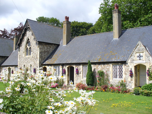
The town's origins date back to Roman times, and it was once a major medieval port. Today, it is a charming and well-preserved market town with a wealth of medieval and Georgian architecture. The historic center is designated as a Conservation Area, featuring narrow streets, timber-framed buildings, and beautiful old houses.
One of the town's most notable landmarks is the ancient Sandwich Guildhall, which dates back to the 16th century. The impressive structure houses a museum that displays artifacts and documents related to Sandwich's history. Other notable landmarks include St. Peter's Church, which boasts a Norman doorway and a stunning stained glass window.
Sandwich is also renowned for its golfing heritage. The Royal St George's Golf Club, one of the oldest and most prestigious golf clubs in the world, is located nearby. The club has hosted the Open Championship numerous times, attracting golf enthusiasts from around the globe.
In addition to its historic and cultural appeal, Sandwich offers a range of amenities, including traditional pubs, restaurants, and shops. The town hosts various events throughout the year, such as the Sandwich Food Fayre and the Sandwich Arts Week.
Overall, Sandwich, Kent is a charming town that seamlessly blends its rich history with modern amenities, making it a popular destination for both locals and tourists alike.
If you have any feedback on the listing, please let us know in the comments section below.
Sandwich Images
Images are sourced within 2km of 51.274817/1.339692 or Grid Reference TR3358. Thanks to Geograph Open Source API. All images are credited.


![Sandwich features [1] Sandwich Toll Bridge carries Ramsgate Road over the River Stour. The bridge was part of the A256 road, a major route across east Kent and was a major traffic bottleneck, until a bypass opened in 1981. The bridge was constructed of Portland stone in 1755 and has had several central sections - currently an iron swing bridge opened in 1892. Tolls were abolished in 1977. Listed, grade II, with details at: <span class="nowrap"><a title="https://historicengland.org.uk/listing/the-list/list-entry/1343735" rel="nofollow ugc noopener" href="https://historicengland.org.uk/listing/the-list/list-entry/1343735">Link</a><img style="margin-left:2px;" alt="External link" title="External link - shift click to open in new window" src="https://s1.geograph.org.uk/img/external.png" width="10" height="10"/></span>
Sandwich is a historic town in Kent, situated on the River Stour, 11½ miles east of Canterbury and 10½ miles north of Dover. Once a major port, one of the Cinque Ports, the town is now 2 miles inland due to the silting up of the Wantsum Channel. The town has a great many medieval buildings and was once home to a great many Flemish settlers. In Sandwich Bay are two world-class golf courses.](https://s1.geograph.org.uk/geophotos/07/06/20/7062049_8a4979f4.jpg)
![Sandwich buildings [1] The Barbican was part of the town defences, guarding the bridge over the River Stour. Probably with 14th century origins, the building is mostly 16th century. There are two round towers of chequerwork stone and flint on ashlar bases, partly weatherboarded, partly rendered, all under tile roofs. Listed, grade I, with details at: <span class="nowrap"><a title="https://historicengland.org.uk/listing/the-list/list-entry/1069655" rel="nofollow ugc noopener" href="https://historicengland.org.uk/listing/the-list/list-entry/1069655">Link</a><img style="margin-left:2px;" alt="External link" title="External link - shift click to open in new window" src="https://s1.geograph.org.uk/img/external.png" width="10" height="10"/></span>
Sandwich is a historic town in Kent, situated on the River Stour, 11½ miles east of Canterbury and 10½ miles north of Dover. Once a major port, one of the Cinque Ports, the town is now 2 miles inland due to the silting up of the Wantsum Channel. The town has a great many medieval buildings and was once home to a great many Flemish settlers. In Sandwich Bay are two world-class golf courses.](https://s2.geograph.org.uk/geophotos/07/06/20/7062050_34fabdca.jpg)
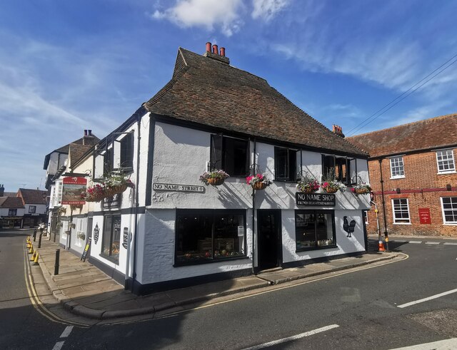
![Sandwich buildings [2] On the corner of High Street and Strand Street, the Crispin Inn is a 16th century building altered in the 18th century. Timber framed, jettied to both streets, roughcast ground floor, plastered first floor, all under a tile roof. Originally the Crispin and Crispianus. Listed, grade II, with details at: <span class="nowrap"><a title="https://historicengland.org.uk/listing/the-list/list-entry/1343736" rel="nofollow ugc noopener" href="https://historicengland.org.uk/listing/the-list/list-entry/1343736">Link</a><img style="margin-left:2px;" alt="External link" title="External link - shift click to open in new window" src="https://s1.geograph.org.uk/img/external.png" width="10" height="10"/></span>
Sandwich is a historic town in Kent, situated on the River Stour, 11½ miles east of Canterbury and 10½ miles north of Dover. Once a major port, one of the Cinque Ports, the town is now 2 miles inland due to the silting up of the Wantsum Channel. The town has a great many medieval buildings and was once home to a great many Flemish settlers. In Sandwich Bay are two world-class golf courses.](https://s3.geograph.org.uk/geophotos/07/06/20/7062051_4a8700e0.jpg)
Sandwich is located at Grid Ref: TR3358 (Lat: 51.274817, Lng: 1.339692)
Administrative County: Kent
District: Dover
Police Authority: Kent
What 3 Words
///rentals.grips.emperor. Near Sandwich, Kent
Nearby Locations
Related Wikis

St Peter's Church, Sandwich
St Peter's Church is a redundant Anglican church in Sandwich, Kent, England. It is recorded in the National Heritage List for England as a designated Grade...

Guilford Tramway
The Guilford Tramway was a narrow gauge industrial railway at Sandwich in Kent, England in the first half of the twentieth century. == History == A freight...
Sandwich, Kent
Sandwich is a town and civil parish in the Dover District of Kent, south-east England. It lies on the River Stour and has a population of 4,985. Sandwich...

Sandwich Guildhall
Sandwich Guildhall is a municipal building in the Cattle Market, Sandwich, Kent, England. The structure, which accommodates the offices and meeting place...
Nearby Amenities
Located within 500m of 51.274817,1.339692Have you been to Sandwich?
Leave your review of Sandwich below (or comments, questions and feedback).