Salen

Settlement in Argyllshire

Scotland

Salen

Old Pier at Salen An old picture from the 1980s showing a few bits more structure than in more recent shots.
Old Pier at Salen Credit: Des Blenkinsopp

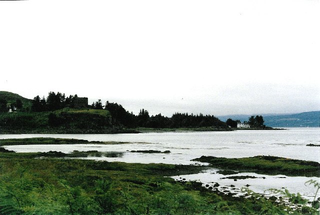
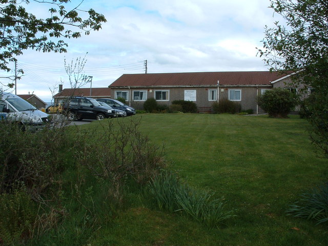
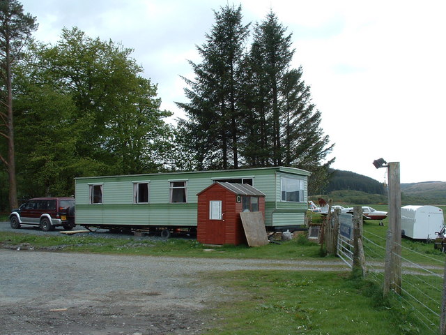
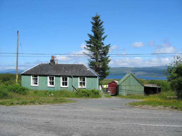
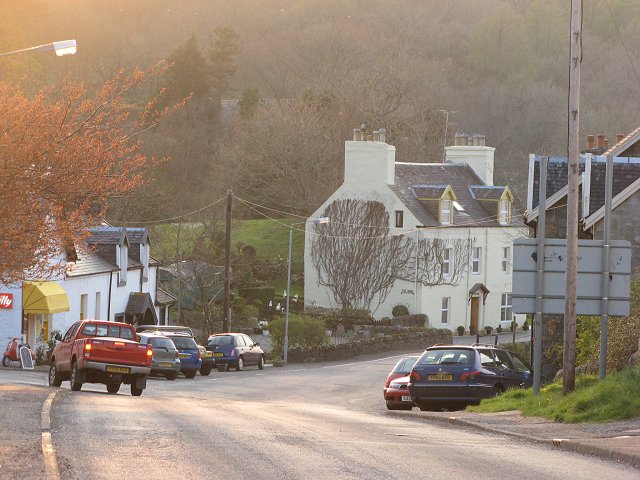
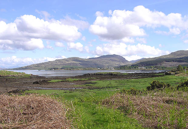
Salen is a picturesque village located in Argyllshire, Scotland. Situated on the eastern shore of Loch Sunart, it offers breathtaking views of the surrounding mountains and tranquil waters. With a population of approximately 350 residents, Salen is a close-knit community that exudes a welcoming and friendly atmosphere.

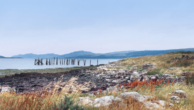
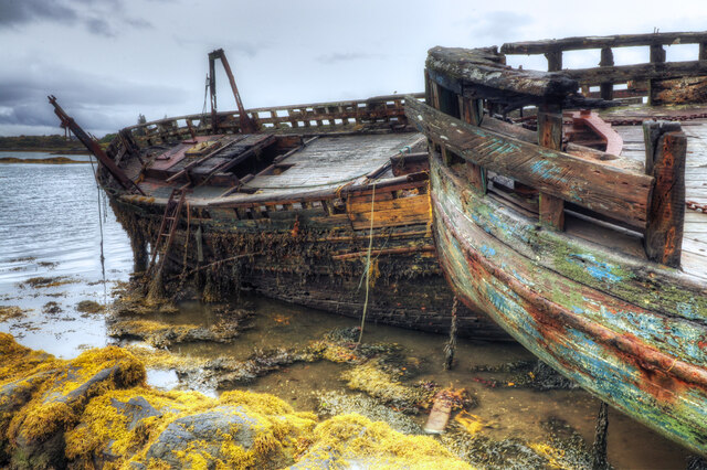
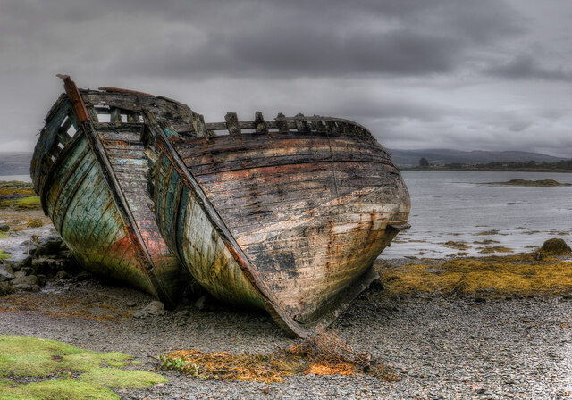
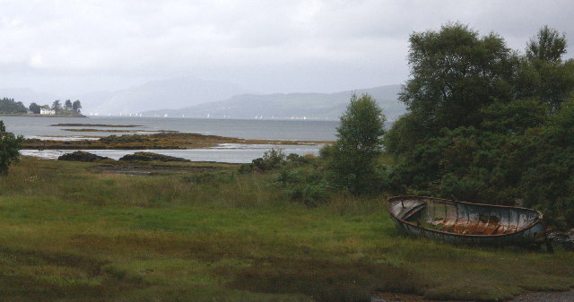
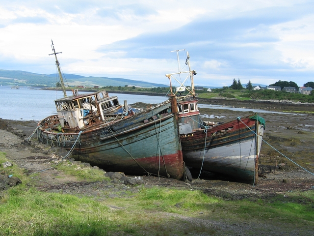
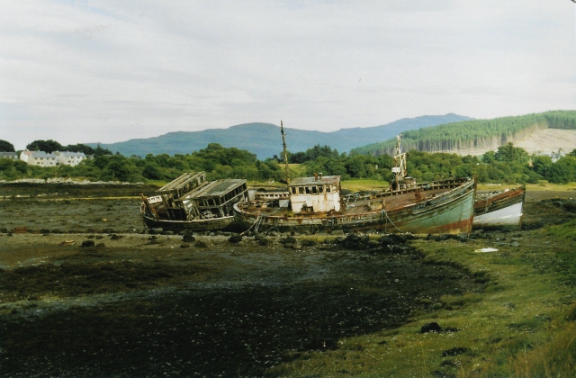
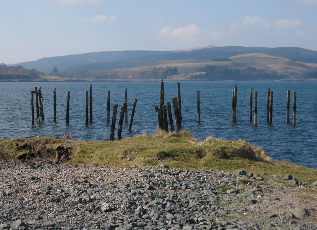
The village is known for its rich history and natural beauty. It has a significant place in Scotland's maritime heritage, as it once served as a bustling port for the local fishing industry. Today, remnants of its maritime past can still be seen in the form of traditional fishing boats and quaint harbors.

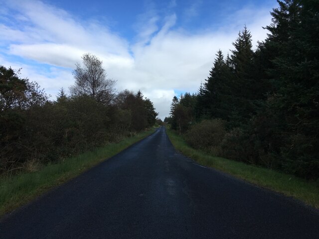
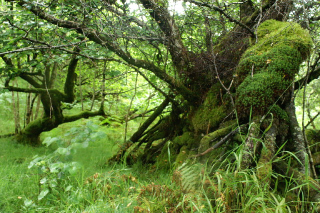
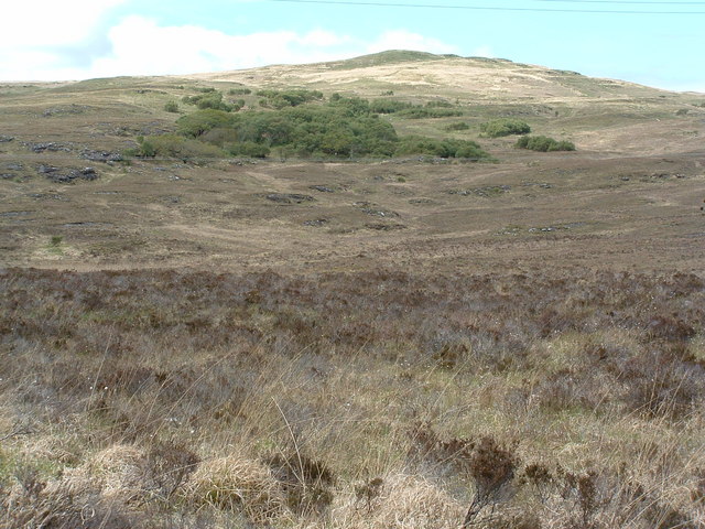
Salen offers a range of outdoor activities for nature enthusiasts. The surrounding area is a haven for hikers, with numerous trails that showcase the region's diverse flora and fauna. Loch Sunart is also a popular spot for water sports such as kayaking and fishing.

The village itself boasts a few amenities, including a small grocery store, a post office, and a couple of charming cafes and restaurants. Visitors can savor local delicacies, including freshly caught seafood, in a cozy and relaxed setting.

Salen is also a great base for exploring the wider Argyllshire region. Nearby attractions include the Ardnamurchan Peninsula, renowned for its rugged landscapes and pristine beaches, as well as the picturesque Isle of Mull, accessible by a short ferry ride.

Overall, Salen offers a tranquil retreat for those seeking a peaceful getaway amidst stunning natural surroundings. Its rich history, warm community spirit, and proximity to outdoor adventures make it a delightful destination for visitors.

If you have any feedback on the listing, please let us know in the comments section below.
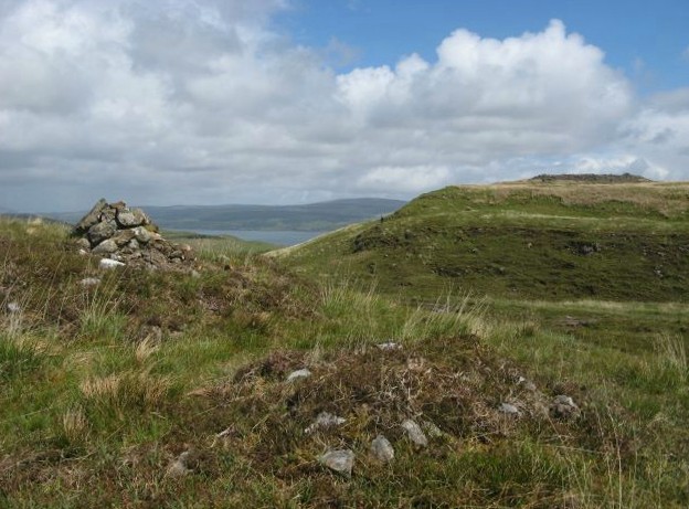
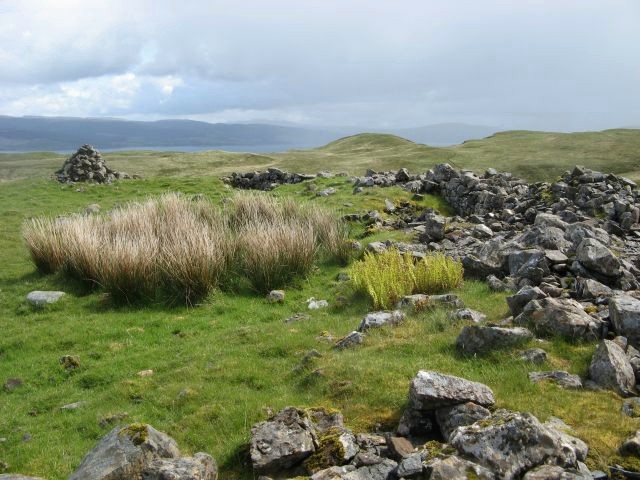
Salen Images

Images are sourced within 2km of 56.51592/-5.9477365 or Grid Reference NM5742. Thanks to Geograph Open Source API. All images are credited.

Old Pier at Salen An old picture from the 1980s showing a few bits more structure than in more recent shots.
Old Pier at Salen
An old picture from the 1980s showing a few bits more structure than in more recent shots.
B8035 near Criagmore Cottage
Girl Claire and Pavonia The fishing boats have been here since the 1970s.
Girl Claire and Pavonia
The fishing boats have been here since the 1970s.
The Salen Wrecks Compare with earlier versions to see the rate of deterioration!
The Salen Wrecks
Compare with earlier versions to see the rate of deterioration!
Aros Castle & the White House of Aros Seen from the roadside towards the southern edge of the square, these 2 landmarks mark the bottom of Glen Aros as it meets the Tobermory road.
Aros Castle & the White House of Aros
Seen from the roadside towards the southern edge of the square, these 2 landmarks mark the bottom of Glen Aros as it meets the Tobermory road.
Sound of Mull From Salen The area in the foreground floods on High water springs. The view is to the North west towards Tobermory up the Sound of Mull. On the left is Aros point. A yacht race is taking place out of Tobermory Harbour.
Sound of Mull From Salen
The area in the foreground floods on High water springs. The view is to the North west towards Tobermory up the Sound of Mull. On the left is Aros point. A yacht race is taking place out of Tobermory Harbour.
Trees in the wood above Salen
Woodland on Braigh a' choire Mhor
Hospital at Salen As far as I am aware, the building in the photo is the only NHS hospital for Mull, housing the casualty, out patients and x-ray departments for all of the island. It is also an old people's home.
Hospital at Salen
As far as I am aware, the building in the photo is the only NHS hospital for Mull, housing the casualty, out patients and x-ray departments for all of the island. It is also an old people's home.
Glenforsa airfield Flight control and the waiting room at the grass runway airfield.
Glenforsa airfield
Flight control and the waiting room at the grass runway airfield.
Old House near Salen
Boats at the old pier, Salen These three fishing boats have been tied up here at the disused pier to rot away. Odd how they look so attractive, when dumped cars and the like look so ugly.
Boats at the old pier, Salen
These three fishing boats have been tied up here at the disused pier to rot away. Odd how they look so attractive, when dumped cars and the like look so ugly.
Wrecks at Salen Familiar to any visitor who's travelled up or down this road, these have been here for years and are immortalised on a local postcard too (a better picture than mine!).
Wrecks at Salen
Familiar to any visitor who's travelled up or down this road, these have been here for years and are immortalised on a local postcard too (a better picture than mine!).
Salen The centre of the village, looking downhill to the junction with the Gruline road.
Salen
The centre of the village, looking downhill to the junction with the Gruline road.
Remains of old pier. Looking over Salen Bay
Remains of old pier.
Looking over Salen Bay
Aros Bay looking east
Dun on Cnoc na Sroine View of the Iron Age fort on Cnoc na Sroine from near the path leading from Aros Bridge to Killiechronan, on Mull.  The mainland can be seen in the background, across the Sound of Mull.
Dun on Cnoc na Sroine
View of the Iron Age fort on Cnoc na Sroine from near the path leading from Aros Bridge to Killiechronan, on Mull. The mainland can be seen in the background, across the Sound of Mull.
Cnoc na Sroine The flat summit of Cnoc na Sroine was the site of an Iron Age fort or dun, the remains of which can be seen in the photo.
Cnoc na Sroine
The flat summit of Cnoc na Sroine was the site of an Iron Age fort or dun, the remains of which can be seen in the photo.
Show me another place!

Salen is located at Grid Ref: NM5742 (Lat: 56.51592, Lng: -5.9477365)

Unitary Authority: Argyll and Bute

Police Authority: Argyll and West Dunbartonshire

What 3 Words

///announced.dabble.manicured. Near Salen, Argyll & Bute

Related Wikis

Salen, Mull

Salen (Scottish Gaelic: An t-Sàilean) is a settlement on the Isle of Mull, Scotland. It is on the east coast of the island, on the Sound of Mull, approximately...

Aros Castle

Aros Castle, also known as Dounarwyse Castle, is a ruined 13th-century castle near Salen on the Isle of Mull, Scotland. The castle overlooks the Sound...

Great Mull Air Mystery

The Great Mull Air Mystery is the name given by the media to the disappearance of pilot Peter Gibbs on 24 December 1975 after he took an unscheduled solo...

SS Rondo

SS Rondo was a steam cargo ship. She was built by Tampa Shipbuilding & Drydock Company of Florida for the British government under the name War Wonder...

Nearby Amenities

Located within 500m of 56.51592,-5.9477365
Source: PGS
Lat/Long: 56.5195326/-5.9524261
Source: PGS
Lat/Long: 56.5194835/-5.9514216
Source: PGS
Lat/Long: 56.5200552/-5.9493017
Source: PGS
Lat/Long: 56.5202137/-5.9493179
Source: PGS
Lat/Long: 56.5202411/-5.948364
Salen
Alt Name Gd: Sàilean Dubh Chaluim Chille
Name Gd: An t-Sàilean
Place: village
Population: 154
Wikidata: Q7404274
Wikipedia: en:Salen, Mull
Lat/Long: 56.5167795/-5.9474853
The Salen Hotel
Addr Postcode: PA72 6JE
Fhrs Id: 4594
Source Postcode: FHRS Open Data
Tourism: hotel
Website: https://www.salenhotelmull.co.uk/
Lat/Long: 56.5172323/-5.9467348
Recycling
Recycling Glass: yes
Lat/Long: 56.5177392/-5.9494676
Spar
Brand: Spar
Brand Wikidata: Q610492
Brand Wikipedia: en:SPAR (retailer)
Shop: supermarket
Website: https://www.spar.co.uk/store-locator/lan95444-spar-salen/
Lat/Long: 56.5173474/-5.9451933
Fuel
Rowleys
Lat/Long: 56.5163101/-5.9482845
Kennedys
Shop: car_repair
Lat/Long: 56.5137588/-5.946171
Cafe
The Little Bespoke Bakery
Addr Street: Main Street
Contact Facebook: https://www.facebook.com/thelittlebespokebakery/
Fhrs Id: 4597
Opening Hours: Tu-Su 09:00-16:00
Source Name: FHRS Open Data
Source Postcode: FHRS Open Data
Lat/Long: 56.5171447/-5.948542
Post Box
Ref: PA72 152
Lat/Long: 56.5186989/-5.9434373
Telephone
Booth: KX100
Covered: booth
Lat/Long: 56.5172118/-5.9449794
Post Box
Post Box Type: pillar
Ref: PA72 142
Royal Cypher: scottish_crown
Lat/Long: 56.5172003/-5.9449597
Power: pole
Source: Bing
Lat/Long: 56.5148431/-5.947104
Power: pole
Source: Bing
Lat/Long: 56.5150503/-5.9420588
Power: pole
Lat/Long: 56.5151214/-5.9407524
Power: pole
Source: Bing
Lat/Long: 56.5148994/-5.9459319
Power: pole
Source: Bing
Lat/Long: 56.5150326/-5.9433221
On Yer Bike
Service Bicycle Rental: yes
Service Bicycle Repair: yes
Service Bicycle Retail: yes
Shop: bicycle
Source: survey
Lat/Long: 56.5172923/-5.9481318
Toilets
Lat/Long: 56.5176828/-5.9495957
Bus Stop
Bus: yes
Naptan AtcoCode: 60709653
Naptan NaptanCode: 54724878
Public Transport: platform
Shelter: yes
Lat/Long: 56.5175912/-5.949703
Bicycle Parking
Bicycle Parking: ground_slots
Capacity: 5
Covered: no
Lat/Long: 56.5162684/-5.9481477
Bicycle Parking
Bicycle Parking: ground_slots
Capacity: 5
Covered: no
Lat/Long: 56.5171838/-5.9467036
Community Centre
Salen Community Centre
Lat/Long: 56.5190075/-5.9430007
Power: pole
Lat/Long: 56.5172803/-5.954107
Power: pole
Lat/Long: 56.5168793/-5.9525192
Power: pole
Lat/Long: 56.5151435/-5.95128
Power: pole
Lat/Long: 56.5150325/-5.950014
Power: pole
Lat/Long: 56.5148253/-5.9478655
Power: pole
Lat/Long: 56.5140425/-5.9492067
Power: pole
Lat/Long: 56.5119987/-5.9508267
Power: pole
Lat/Long: 56.5128038/-5.9488875
Power: pole
Lat/Long: 56.5151227/-5.9445611
Power: pole
Lat/Long: 56.5149555/-5.9446442
Power: pole
Lat/Long: 56.5146418/-5.9477395
Power: pole
Lat/Long: 56.5147513/-5.9472191
Power: pole
Lat/Long: 56.514815/-5.945363
Power: pole
Lat/Long: 56.5148653/-5.9438422
Power: pole
Lat/Long: 56.5149393/-5.9422785
Power: pole
Lat/Long: 56.5150399/-5.9402856
Power: pole
Lat/Long: 56.5146065/-5.9477422
Generator Method: photovoltaic
Generator Output Electricity: yes
Generator Source: solar
Generator Type: solar_photovoltaic_panel
Power: generator
Lat/Long: 56.5175989/-5.9452974
Generator Method: photovoltaic
Generator Output Electricity: yes
Generator Source: solar
Generator Type: solar_photovoltaic_panel
Power: generator
Lat/Long: 56.5176213/-5.9452197
Generator Method: photovoltaic
Generator Output Electricity: yes
Generator Source: solar
Generator Type: solar_photovoltaic_panel
Power: generator
Lat/Long: 56.517652/-5.9451464
Entrance: yes
Lat/Long: 56.5172761/-5.9451233
Recycling
Recycling Type: container
Lat/Long: 56.5172084/-5.9448789
Recycling
Recycling Type: container
Lat/Long: 56.5172038/-5.9449235
Isle Of Mull
Information: board
Tourism: information
Lat/Long: 56.5172901/-5.9450172
Power: pole
Lat/Long: 56.5153002/-5.9404281
Power: pole
Lat/Long: 56.5151989/-5.942067
Power: pole
Lat/Long: 56.51509/-5.9437798
Power: pole
Lat/Long: 56.515211/-5.9454967
Power: pole
Lat/Long: 56.5151051/-5.9467766
Power: pole
Lat/Long: 56.5150945/-5.9469753
Power: pole
Lat/Long: 56.5150152/-5.9480167
Power: pole
Lat/Long: 56.5151611/-5.9488854
Power: pole
Lat/Long: 56.5153206/-5.9497158
Power: pole
Lat/Long: 56.5159594/-5.9506942
Power: pole
Lat/Long: 56.5164969/-5.9514807
Power: pole
Lat/Long: 56.5173897/-5.9540362
Power: pole
Lat/Long: 56.5168348/-5.9529592
Power: pole
Lat/Long: 56.5164795/-5.952
Defibrillator
Defibrillator Location: Side of building near the entrance.
Emergency: defibrillator
Indoor: no
Ref GB The Circuit: CF60B4E8-8BCA-4521-A728-B729A9FE4014
Lat/Long: 56.517299/-5.945072
Generator Method: photovoltaic
Generator Output Electricity: yes
Generator Source: solar
Generator Type: solar_photovoltaic_panel
Power: generator
Lat/Long: 56.5194688/-5.9431937
Defibrillator
Defibrillator Location: Outside the school near the carpark
Emergency: defibrillator
Indoor: no
Lat/Long: 56.5189632/-5.9428375
Generator Method: photovoltaic
Generator Output Electricity: yes
Generator Source: solar
Generator Type: solar_photovoltaic_panel
Power: generator
Lat/Long: 56.5175138/-5.9489221
Give Way
Direction: forward
Lat/Long: 56.5171625/-5.9482322
Give Way
Direction: backward
Lat/Long: 56.5171402/-5.9460249
The data included in this document is from www.openstreetmap.org. The data is made available under ODbL.

Have you been to Salen?

Leave your review of Salen below (or comments, questions and feedback).