Saint Leonards

Settlement in Lanarkshire

Scotland

Saint Leonards

Torrance Road, East Kilbride Approaching West Mains Road.
Torrance Road, East Kilbride Credit: Richard Vince

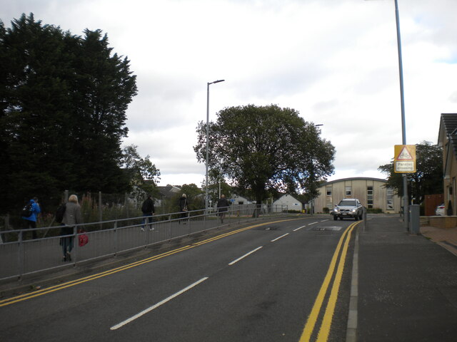
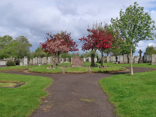
Saint Leonards is a small village located in the South Lanarkshire council area of Scotland. Situated on the outskirts of the town of East Kilbride, it is about 12 miles southeast of Glasgow city center. The village is nestled in a picturesque setting, surrounded by lush green fields and rolling hills.

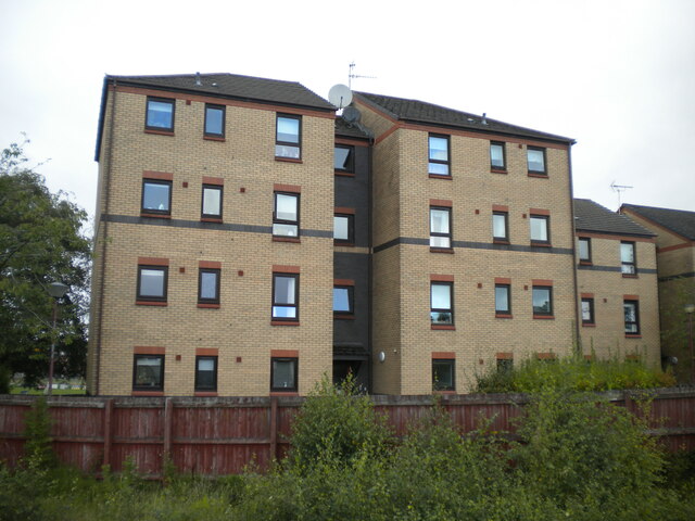
With a population of around 2,500 residents, Saint Leonards is a tight-knit community known for its peaceful and friendly atmosphere. The village offers a range of amenities, including a primary school, a community center, and a local convenience store. There are also several parks and recreational areas, providing opportunities for outdoor activities and leisurely walks.

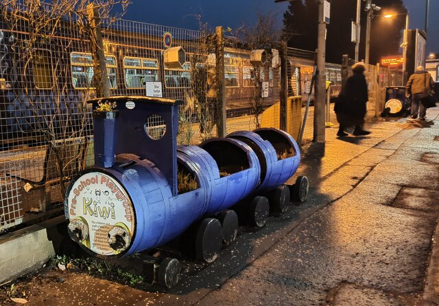
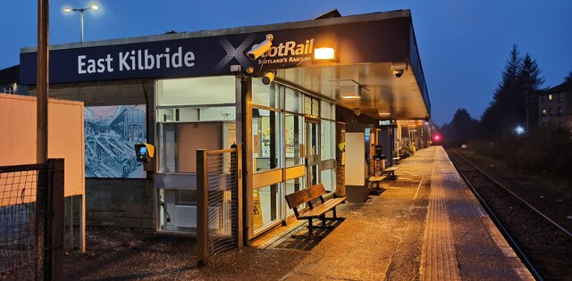
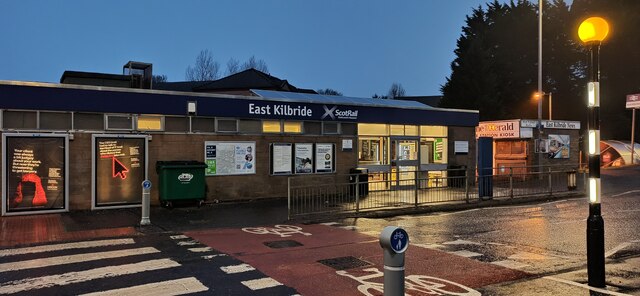
The village has good transport links, with regular bus services connecting it to nearby towns and cities. The nearby East Kilbride railway station provides easy access to Glasgow and other destinations. Additionally, the M74 motorway is just a short drive away, offering convenient road connections to the rest of Scotland.

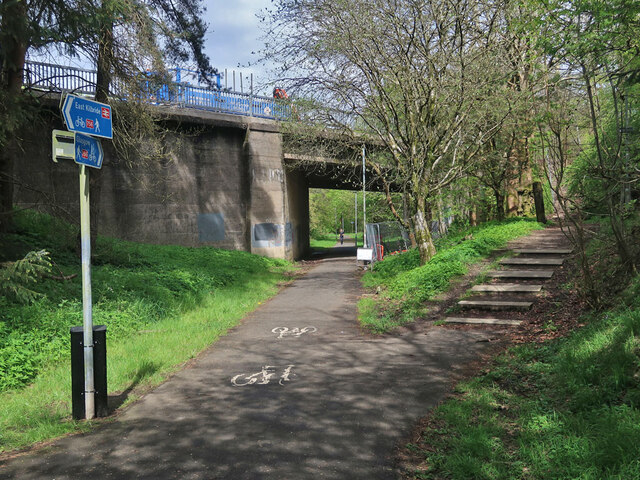
Surrounded by beautiful countryside, Saint Leonards is a popular destination for nature lovers and outdoor enthusiasts. The area boasts scenic walking and cycling routes, with trails leading to nearby attractions such as Calderglen Country Park and Langlands Moss Nature Reserve.

Overall, Saint Leonards offers a tranquil and idyllic setting for residents and visitors alike. With its close proximity to larger towns and cities, as well as its natural beauty, the village provides a perfect balance between rural charm and urban convenience.

If you have any feedback on the listing, please let us know in the comments section below.

Saint Leonards Images

Images are sourced within 2km of 55.761596/-4.1513055 or Grid Reference NS6554. Thanks to Geograph Open Source API. All images are credited.

Torrance Road, East Kilbride Approaching West Mains Road.
Torrance Road, East Kilbride
Approaching West Mains Road.
Low rise flats, Kirkton Gate, East Kilbride The rear elevation, seen from the railway station.
Low rise flats, Kirkton Gate, East Kilbride
The rear elevation, seen from the railway station.
Bridge and snowdrops in Calderglen Country Park At the Horseshoe Falls on the Rotten Calder.
Bridge and snowdrops in Calderglen Country Park
At the Horseshoe Falls on the Rotten Calder.
East Kilbride Cemetery The cemetery dates from around 1910 and is still in use.
East Kilbride Cemetery
The cemetery dates from around 1910 and is still in use.
National Cycle Route 756 in East Kilbride The route runs for 8 miles from Kelvindale in Glasgow to East Kilbride railway station. Here it follows the course of the old East Kilbride to Hamilton railway under East Mains Road. The line to Hamilton was closed in 1935 but this section remained open till 1966 to connect to the nearby Mavor and Coulson Mining Equipment works.
National Cycle Route 756 in East Kilbride
The route runs for 8 miles from Kelvindale in Glasgow to East Kilbride railway station. Here it follows the course of the old East Kilbride to Hamilton railway under East Mains Road. The line to Hamilton was closed in 1935 but this section remained open till 1966 to connect to the nearby Mavor and Coulson Mining Equipment works.
National Cycle Route 756 near East Kilbride railway station The route runs for 8 miles from Kelvindale in Glasgow to East Kilbride railway station.
National Cycle Route 756 near East Kilbride railway station
The route runs for 8 miles from Kelvindale in Glasgow to East Kilbride railway station.
Underpass below the Kingsway, East Kilbride The Kingsway is the main north-south road and the Queensway is the main east-west road.
Underpass below the Kingsway, East Kilbride
The Kingsway is the main north-south road and the Queensway is the main east-west road.
St Leonards Road, East Kilbride One of the original parts of the new town where pedestrians are kept separate from the main roads.
St Leonards Road, East Kilbride
One of the original parts of the new town where pedestrians are kept separate from the main roads.
Glen Esk Urban Greenspace, East Kilbride Located in a former landfill site and funded via the Scottish Government Vacant Derelict Land Fund. The site includes footpaths, artworks, an outdoor classroom and a junior bike track. See, 
<span class="nowrap"><a title="https://www.covanburn.com/covanburn-projects/glen-esk-urban-greenspace/" rel="nofollow ugc noopener" href="https://www.covanburn.com/covanburn-projects/glen-esk-urban-greenspace/">Link</a><img style="margin-left:2px;" alt="External link" title="External link - shift click to open in new window" src="https://s1.geograph.org.uk/img/external.png" width="10" height="10"/></span>
Glen Esk Urban Greenspace, East Kilbride
Located in a former landfill site and funded via the Scottish Government Vacant Derelict Land Fund. The site includes footpaths, artworks, an outdoor classroom and a junior bike track. See, LinkExternal link
Field with cows next to Lodgehill Farm A high viewpoint with the hazy outline of Ben Lomond 36 miles away beyond the tower blocks of East Kilbride.
Field with cows next to Lodgehill Farm
A high viewpoint with the hazy outline of Ben Lomond 36 miles away beyond the tower blocks of East Kilbride.
Blocked road to Edge Farm The farm is unoccupied.
Blocked road to Edge Farm
The farm is unoccupied.
Field beside Calderside Road Like most fields in the area it has a metal gate that is padlocked when it is closed. A high viewpoint to the tower blocks in East Kilbride and the distant Ben Lomond with Dumgoyne and the Campsies on the right.
Field beside Calderside Road
Like most fields in the area it has a metal gate that is padlocked when it is closed. A high viewpoint to the tower blocks in East Kilbride and the distant Ben Lomond with Dumgoyne and the Campsies on the right.
Dollan Aquacentre, East Kilbride Category A Listed leisure centre <span class="nowrap"><a title="https://portal.historicenvironment.scot/designation/LB48682" rel="nofollow ugc noopener" href="https://portal.historicenvironment.scot/designation/LB48682">Link</a><img style="margin-left:2px;" alt="External link" title="External link - shift click to open in new window" src="https://s1.geograph.org.uk/img/external.png" width="10" height="10"/></span> located on Brouster Hill, near the shopping centre.
Dollan Aquacentre, East Kilbride
Category A Listed leisure centre LinkExternal link located on Brouster Hill, near the shopping centre.
Barry the Barrel at East Kilbride railway station One of two Barrys at the station. The other can be seen in the background.
Barry the Barrel at East Kilbride railway station
One of two Barrys at the station. The other can be seen in the background.
Barry the Barrel at East Kilbride railway station One of two Barrys at the station.
Barry the Barrel at East Kilbride railway station
One of two Barrys at the station.
Mural at East Kilbride railway station Featuring local landmarks, including the Dollan Aquacentre and the Guitar Man sculpture.
Mural at East Kilbride railway station
Featuring local landmarks, including the Dollan Aquacentre and the Guitar Man sculpture.
East Kilbride railway station A night view of the station, which is the terminus of the line from Glasgow Central.
East Kilbride railway station
A night view of the station, which is the terminus of the line from Glasgow Central.
East Kilbride railway station Road crossings for pedestrians and cyclists at the station.
East Kilbride railway station
Road crossings for pedestrians and cyclists at the station.
Show me another place!

Saint Leonards is located at Grid Ref: NS6554 (Lat: 55.761596, Lng: -4.1513055)

Unitary Authority: South Lanarkshire

Police Authority: Lanarkshire

What 3 Words

///crass.hosts.venue. Near East Kilbride, South Lanarkshire

Nearby Locations

Saint Leonards St Leonards

Related Wikis

St Leonards, East Kilbride

St Leonards is an area of the Scottish new town East Kilbride, in South Lanarkshire. St Leonards is a residential area on the east side of the town. The...

Calderglen High School

Calderglen High School (Scottish Gaelic: Àrd-sgoil Ghlinn Challdair) is a state-run secondary school in the St Leonards area of the Scottish new town East...

Sanderson High School, East Kilbride

Sanderson High School is a non-denominational secondary school in East Kilbride, South Lanarkshire, Scotland for pupils with additional support needs....

Claremont High School, East Kilbride

Claremont High School was a non-denominational, state-funded secondary school based in the St Leonards area of East Kilbride. It closed in June 2007 and...

Related Videos

Calderglen Country Park #eastkilbride #glasgow #walk #view #chillmusic #relaxing #tourism

Map of calderflen country park. It's a beautiful park with stunning views and a huge play area for the kids. There's even a zoo that's ...

Nearby Amenities

Located within 500m of 55.761596,-4.1513055
Fuel
Co-op
Atm: yes
Lat/Long: 55.763099/-4.1516362
Pub
Bonnie Prince Charlie
Lat/Long: 55.763934/-4.1518556
Post Office
St Leonards Post Office
Lat/Long: 55.7640039/-4.1523402
Post Box
Lat/Long: 55.7636731/-4.1522718
Pharmacy
St Leonards Pharmacy
Lat/Long: 55.7641307/-4.1523222
Fourbuoys
Shop: convenience
Lat/Long: 55.763859/-4.1523402
Cafe
Lat/Long: 55.7641689/-4.15281
Post Box
Lat/Long: 55.7622441/-4.1568567
Post Box
Lat/Long: 55.7614552/-4.1496976
Post Box
Lat/Long: 55.7611916/-4.1539619
Recycling
Lat/Long: 55.7631694/-4.1529858
Noexit: yes
Lat/Long: 55.7633862/-4.1465664
Fast Food
Emmanuals Chip Shop
Cuisine: fish_and_chips
Lat/Long: 55.7635481/-4.1514246
Crossing
Crossing: zebra
Lat/Long: 55.7612061/-4.1516015
Telephone
Booth: KX100
Covered: booth
Lat/Long: 55.7613607/-4.1585869
Bus Stop
Glen Farrar
Naptan AtcoCode: 61501605
Naptan Bearing: NE
Naptan CommonName: Glen Farrar
Naptan Indicator: at Glen Farrar
Naptan Landmark: Glen Farrar
Naptan NaptanCode: 75236352
Naptan Street: Blacklaw Drive
Naptan Verified: no
Source: naptan_import
Lat/Long: 55.7622655/-4.1567694
Bus Stop
High Common Road
Bench: yes
Naptan AtcoCode: 61501606
Naptan Bearing: N
Naptan CommonName: St Leonards Road
Naptan Indicator: Near Bonnie Prince Charlie
Naptan Landmark: St Leonards Road
Naptan NaptanCode: 75235634
Naptan Street: High Common Road
Naptan Verified: no
Shelter: yes
Source: naptan_import
Lat/Long: 55.763863/-4.1512624
Bus Stop
Glen Farrar
Naptan AtcoCode: 61501609
Naptan Bearing: SW
Naptan CommonName: Glen Farrar
Naptan Indicator: opp Glen Farrar
Naptan Landmark: Glen Farrar
Naptan NaptanCode: 75232794
Naptan Street: Blacklaw Drive
Naptan Verified: no
Source: naptan_import
Lat/Long: 55.7622403/-4.1566724
Bus Stop
Morrishall Road
Naptan AtcoCode: 6150793
Naptan Bearing: NE
Naptan CommonName: Morrishall Road
Naptan Indicator: near Morrishall Road
Naptan Landmark: Glen Shee
Naptan NaptanCode: 75236972
Naptan Street: St Leonards Road
Naptan Verified: no
Source: naptan_import
Lat/Long: 55.7657116/-4.1481941
Bus Stop
Morrishall Road
Naptan AtcoCode: 6150794
Naptan Bearing: SW
Naptan CommonName: Morrishall Road
Naptan Indicator: opp Morrishall Road
Naptan Landmark: Glen Shee
Naptan NaptanCode: 75234929
Naptan Street: St Leonards Road
Naptan Verified: no
Source: naptan_import
Lat/Long: 55.7651454/-4.1493722
Bus Stop
St. Leonard's Road
Naptan AtcoCode: 6150795
Naptan Bearing: NE
Naptan CommonName: High Common Road
Naptan Indicator: at Glen Isla
Naptan Landmark: High Common Road
Naptan NaptanCode: 75234375
Naptan Street: St Leonards Road
Naptan Verified: no
Shelter: yes
Source: naptan_import
Lat/Long: 55.765015/-4.1506563
Bus Stop
Glen Doll
Naptan AtcoCode: 6150796
Naptan Bearing: W
Naptan CommonName: Glen Doll
Naptan Indicator: opp Glen Doll
Naptan Landmark: High Common Road
Naptan NaptanCode: 75234959
Naptan Street: St Leonards Road
Naptan Verified: no
Source: naptan_import
Lat/Long: 55.7646269/-4.1528029
Bus Stop
Claremont Parish Church
Bench: yes
Naptan AtcoCode: 6150799
Naptan Bearing: S
Naptan CommonName: Bonnie Prince Charlie
Naptan Indicator: opp Bonnie Prince Charlie
Naptan Landmark: St Leonards Road
Naptan NaptanCode: 75234656
Naptan Street: High Common Road
Naptan Verified: no
Shelter: yes
Source: naptan_import
Lat/Long: 55.763104/-4.1509118
Bus Stop
Bench: no
Naptan AtcoCode: 6150801
Naptan Bearing: S
Naptan CommonName: Calderglen Road
Naptan Indicator: near Calderglen Road
Naptan Landmark: Calderglen Road
Naptan NaptanCode: 75236546
Naptan Street: High Common Road
Naptan Verified: no
Shelter: no
Source: naptan_import
Lat/Long: 55.7610408/-4.1512663
Bus Stop
Mull
Naptan AtcoCode: 6150803
Naptan Bearing: S
Naptan CommonName: Mull
Naptan Indicator: at High School
Naptan Landmark: Claremont High School
Naptan NaptanCode: 75234263
Naptan Street: High Common Road
Naptan Verified: no
Source: naptan_import
Lat/Long: 55.7578057/-4.1517576
Noexit: yes
Lat/Long: 55.7620404/-4.1515709
Power: tower
Lat/Long: 55.759113/-4.1487675
St Leonards
Place: suburb
Wikidata: Q7594006
Wikipedia: en:St Leonards, East Kilbride
Lat/Long: 55.7646952/-4.1515237
Noexit: yes
Lat/Long: 55.761168/-4.1511217
Atm
Lat/Long: 55.7629016/-4.1516642
Noexit: yes
Lat/Long: 55.7614259/-4.1586724
Pub
The Ospreys / Club 2000, East Kilbride
Addr City: East Kilbride
Addr Housenumber: 15
Addr Street: St.Leonards Square
Contact Facebook: https://www.facebook.com/Ospreys.Club2000
Internet Access: wlan
Internet Access Fee: no
Lat/Long: 55.7637797/-4.1523954
William Hill
Addr City: East Kilbride
Addr Housenumber: 21
Addr Street: St.Leonards Square
Brand: William Hill
Brand Wikidata: Q4053147
Shop: bookmaker
Lat/Long: 55.7637329/-4.1514217
Fast Food
Tikka's
Cuisine: indian
Lat/Long: 55.7633644/-4.1514886
Entrance: yes
Lat/Long: 55.7605381/-4.1519448
Entrance: yes
Lat/Long: 55.7601231/-4.1520378
Entrance: yes
Lat/Long: 55.759679/-4.1521371
Benbecula Entrance - Calderglen Country Park
Entrance: main
Ref: Benbecula Entrance - Calderglen Country Park
Lat/Long: 55.7608199/-4.1460952
Bus Stop
Bench: no
Shelter: no
Lat/Long: 55.7612127/-4.1514572
Ancient Native Forest (Oak, Alder, Birch & Hazel)
Lat/Long: 55.7602911/-4.1446896
Restpoint
Lat/Long: 55.7592151/-4.1464411
School Linn (informal name)
Waterway: waterfall
Lat/Long: 55.7588783/-4.1473489
Bench
Lat/Long: 55.759717/-4.1460382
Entrance: yes
Lat/Long: 55.765187/-4.151427
Entrance: yes
Lat/Long: 55.7652861/-4.1508949
Entrance: yes
Lat/Long: 55.7653804/-4.1503659
Entrance: yes
Lat/Long: 55.7654787/-4.1498485
Post Box
Lat/Long: 55.765641/-4.1517446
Entrance: yes
Lat/Long: 55.7654885/-4.1516779
Entrance: yes
Lat/Long: 55.7650908/-4.1519471
Crossing
Lat/Long: 55.7631641/-4.1522402
Generator Method: photovoltaic
Generator Output Electricity: yes
Generator Source: solar
Generator Type: solar_photovoltaic_panel
Power: generator
Lat/Long: 55.7619195/-4.159028
Generator Method: photovoltaic
Generator Output Electricity: yes
Generator Source: solar
Generator Type: solar_photovoltaic_panel
Power: generator
Lat/Long: 55.759958/-4.1576454
Generator Method: photovoltaic
Generator Output Electricity: yes
Generator Source: solar
Generator Type: solar_photovoltaic_panel
Power: generator
Lat/Long: 55.7599942/-4.1576105
Generator Method: photovoltaic
Generator Output Electricity: yes
Generator Source: solar
Generator Type: solar_photovoltaic_panel
Power: generator
Lat/Long: 55.7595385/-4.1579565
Generator Method: photovoltaic
Generator Output Electricity: yes
Generator Source: solar
Generator Type: solar_photovoltaic_panel
Power: generator
Lat/Long: 55.7620194/-4.1526881
Jean Cameron of Glen Dessary Grave Memorial
Historic: memorial
Memorial: plaque
Lat/Long: 55.759375/-4.1572295
Staffa Entrance - Calderglen Country Park
Entrance: main
Ref: Staffa Entrance - Calderglen Country Park
Lat/Long: 55.7575723/-4.1486671
The data included in this document is from www.openstreetmap.org. The data is made available under ODbL.

Have you been to Saint Leonards?

Leave your review of Saint Leonards below (or comments, questions and feedback).