Blackthorpe
Settlement in Suffolk West Suffolk
England
Blackthorpe

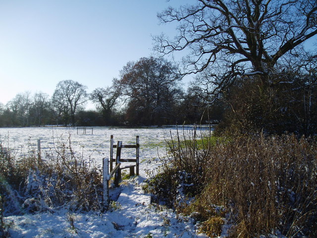
Blackthorpe is a small village located in the county of Suffolk, England. Situated in the eastern region of the country, it is part of the Mid Suffolk district. The village is surrounded by picturesque countryside, characterized by rolling hills, meadows, and woodlands, offering residents and visitors a tranquil and idyllic setting.
Historically, Blackthorpe was an agricultural community, with farming being the main occupation of its inhabitants. Today, although farming still plays a role in the local economy, the village has evolved into a predominantly residential area. It retains its rural charm, with many traditional cottages and farmhouses dotting the landscape.
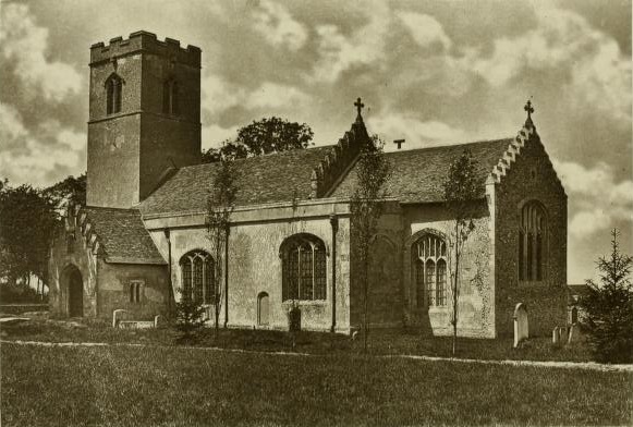
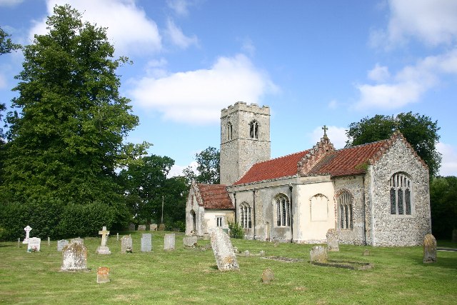
One of the notable landmarks in Blackthorpe is St. Mary's Church, a beautiful medieval church that dates back to the 13th century. This historic building is renowned for its architectural features, including a Norman tower and intricate stained glass windows.
The village is also home to Blackthorpe Barn, an events venue that hosts various exhibitions and craft fairs throughout the year. This popular attraction showcases the work of local artisans and provides a platform for the community to come together and appreciate creative endeavors.
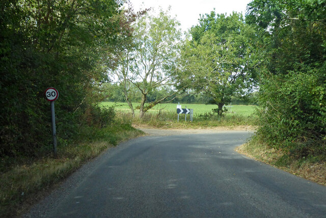
For those who enjoy outdoor activities, Blackthorpe offers ample opportunities for walking, cycling, and exploring the surrounding countryside. The village is also located in close proximity to the town of Bury St. Edmunds, which provides additional amenities such as shops, restaurants, and cultural attractions.
Overall, Blackthorpe is a charming village that embraces its rural heritage while offering residents and visitors a peaceful and picturesque place to live or visit.
If you have any feedback on the listing, please let us know in the comments section below.
Blackthorpe Images
Images are sourced within 2km of 52.234428/0.78199269 or Grid Reference TL9063. Thanks to Geograph Open Source API. All images are credited.


Blackthorpe is located at Grid Ref: TL9063 (Lat: 52.234428, Lng: 0.78199269)
Administrative County: Suffolk
District: West Suffolk
Police Authority: Suffolk
What 3 Words
///format.hinders.disbanded. Near Thurston, Suffolk
Nearby Locations
Related Wikis
Rushbrooke with Rougham
Rushbrooke with Rougham is a large civil parish in the West Suffolk district of Suffolk in eastern England covering the villages of Blackthorpe, Rougham...

Rougham, Suffolk
Rougham is a village and former civil parish 19 miles (31 km) north west of Ipswich, now in the parish of Rushbrooke with Rougham, in the West Suffolk...
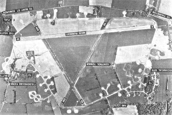
Rougham Airfield
Rougham Airfield, formerly Royal Air Force Bury St Edmunds or more simply RAF Bury St Edmunds is a former Royal Air Force station located 3 miles (4.8...
Rushbrooke, West Suffolk
Rushbrooke is a village and former civil parish on the River Lark, 20 miles (32 km) north west of Ipswich, now in the parish of Rushbrooke with Rougham...

Thedwastre Hundred
Thedwastre (also Thedwestry) was a hundred of the county of Suffolk, England covering an area of 40,362 acres (163.34 km2). It formed part of the Liberty...
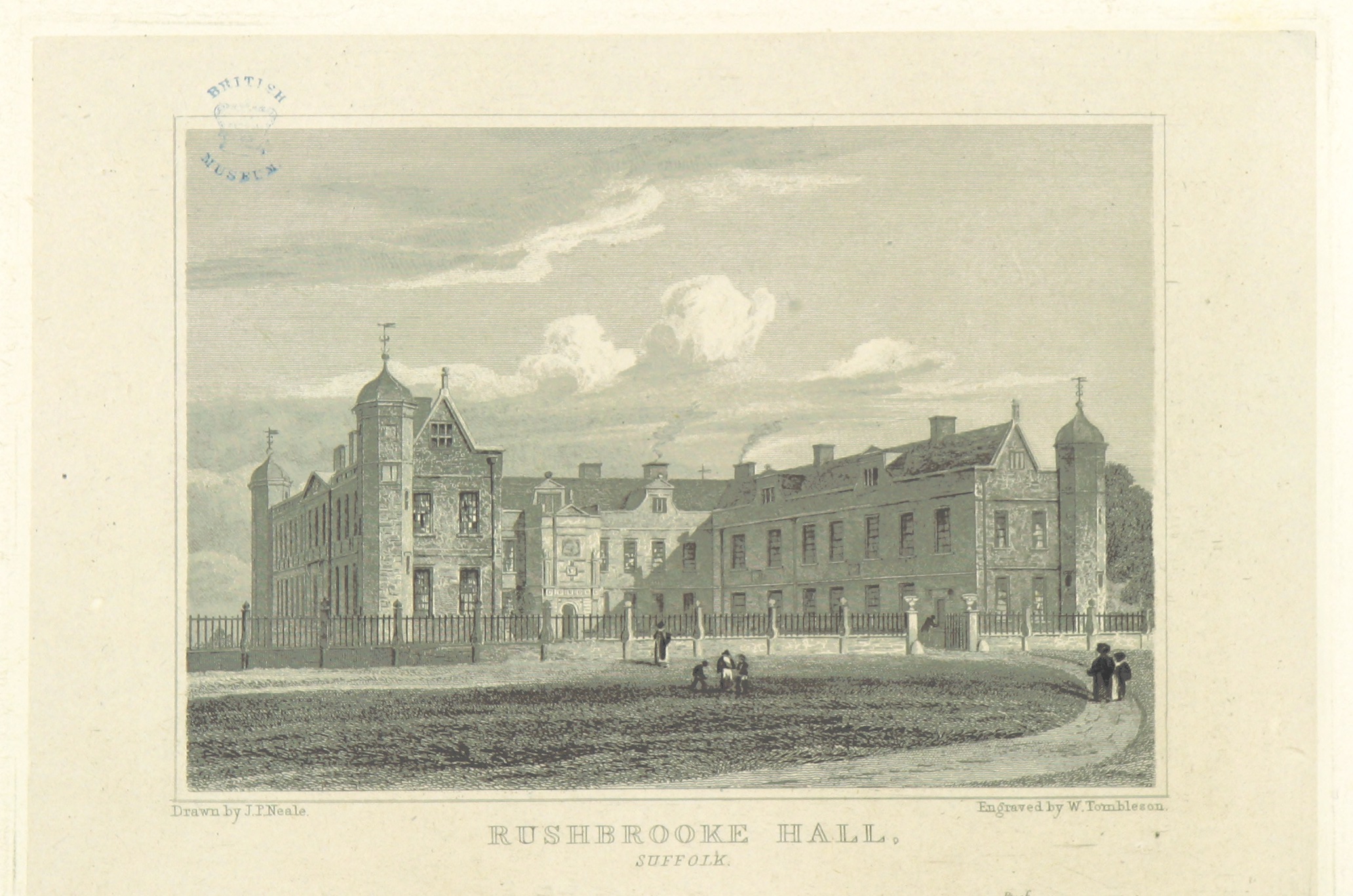
Rushbrooke Hall
Rushbrooke Hall was a British stately home in Rushbrooke, Suffolk. For several hundred years it was the family seat of the Jermyn family. It was demolished...
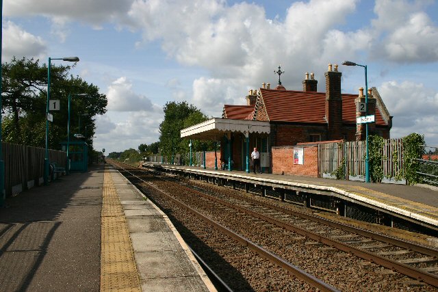
Thurston railway station
Thurston railway station serves the village of Thurston in Suffolk, England. The station, and all trains serving it, are operated by Greater Anglia. It...

Thurston Community College
Thurston Community College is a co-educational secondary school and sixth form located in Thurston, Suffolk, England. As of 2018, it has 1,733 students...
Nearby Amenities
Located within 500m of 52.234428,0.78199269Have you been to Blackthorpe?
Leave your review of Blackthorpe below (or comments, questions and feedback).