Blacko

Settlement in Lancashire Pendle

England

Blacko

Moorcock Inn Located on a bend on the A682, this popular country pub dates from the 18th century. It is seen here in 1996 when it was a Thwaites house.
Moorcock Inn Credit: Stephen McKay

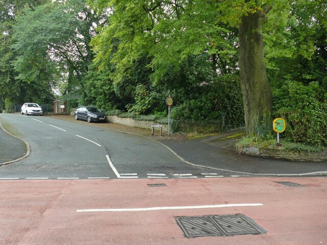
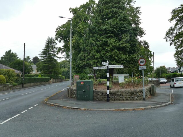
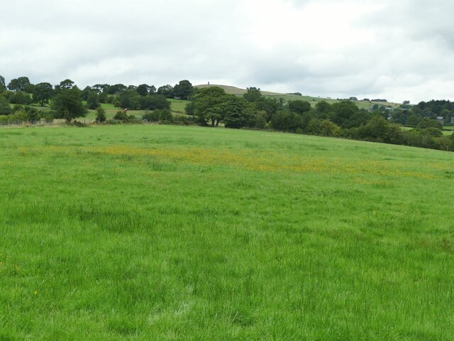
Blacko is a small village located in the county of Lancashire, England. Situated in the Pendle district, it lies about 3 miles north of the town of Nelson and approximately 5 miles east of the city of Burnley. The village is nestled in the foothills of the stunning Pennine Hills, offering picturesque views of the surrounding countryside.

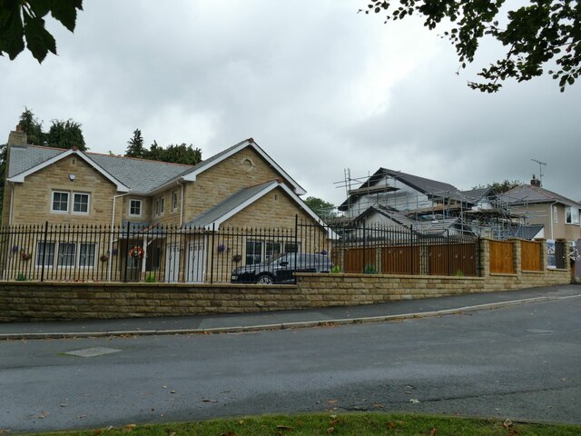
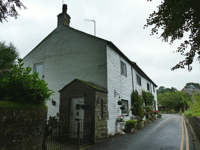
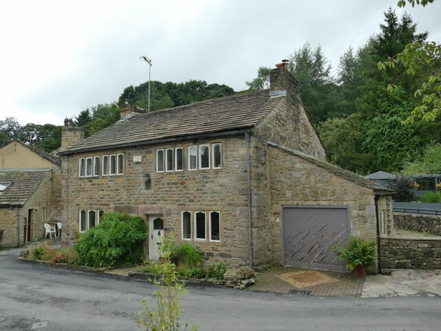
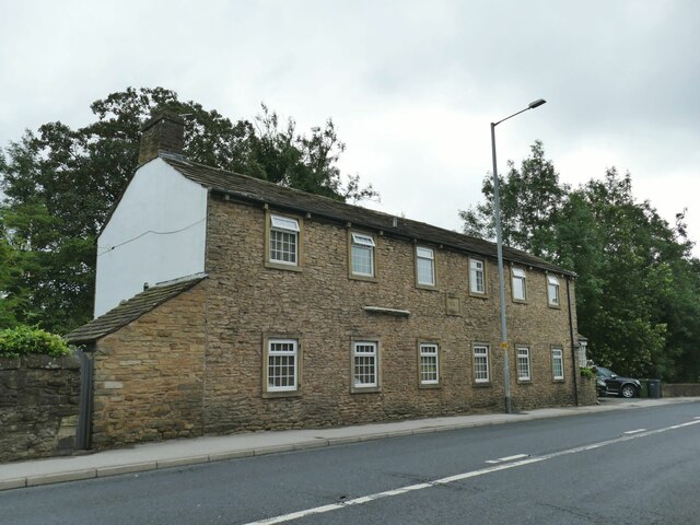
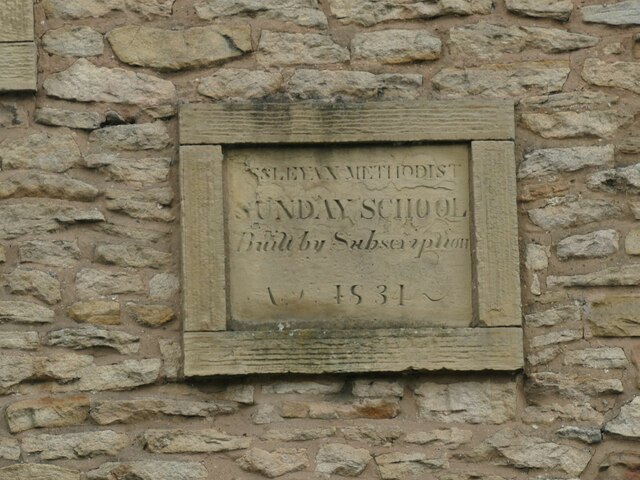
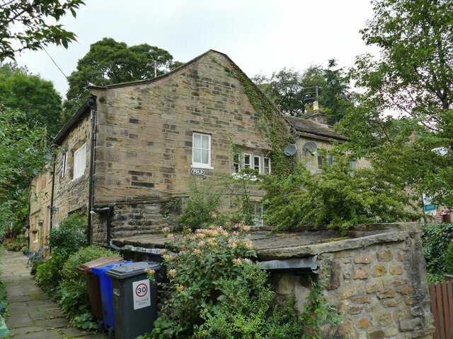
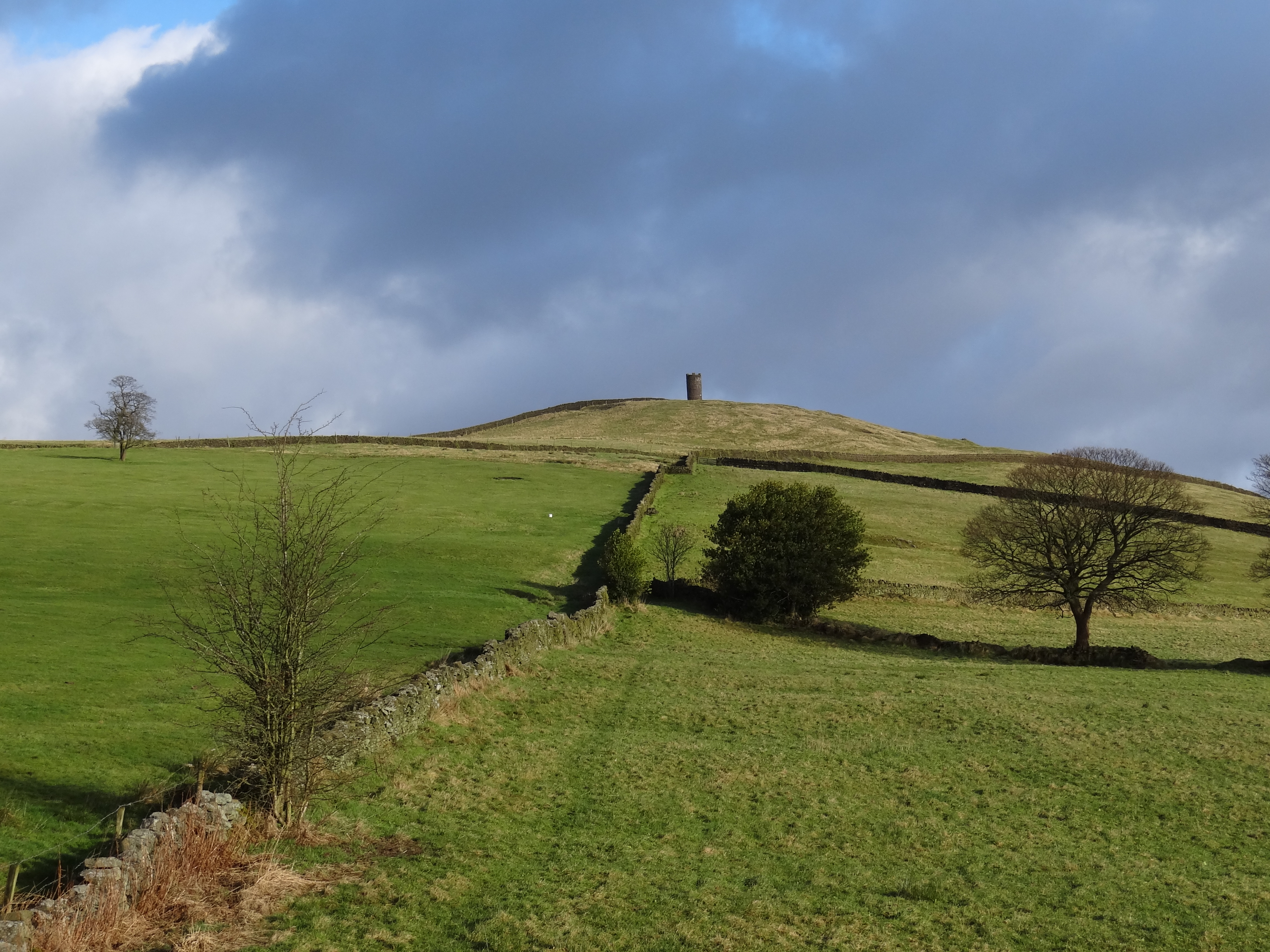
With a population of around 800 people, Blacko is a close-knit community that exudes a charming and peaceful atmosphere. The village is known for its quaint stone-built houses, many of which date back to the 18th and 19th centuries, adding to its historic appeal. The local Stansfield Tower, a prominent landmark, stands tall on the hillside and offers panoramic views of the area.

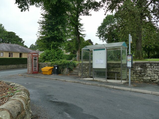
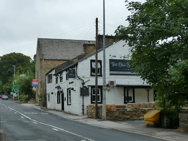
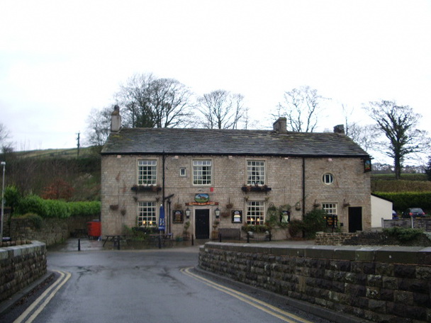
Blacko boasts a range of amenities for its residents, including a primary school, village hall, and a welcoming local pub. The village also benefits from its proximity to nearby towns and cities, providing easy access to a wider range of services, shops, and employment opportunities.

Nature enthusiasts will find Blacko to be an ideal location, as the village sits on the doorstep of the stunning Pendle Hill. This iconic landmark is renowned for its scenic walking trails, attracting hikers and outdoor enthusiasts throughout the year. The area surrounding Blacko is also dotted with picturesque reservoirs, providing tranquil spots for fishing and boating activities.

With its idyllic countryside setting, rich history, and strong sense of community, Blacko offers a peaceful retreat for residents and visitors alike, providing a charming glimpse into rural Lancashire life.

If you have any feedback on the listing, please let us know in the comments section below.
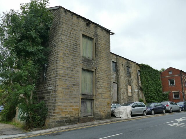
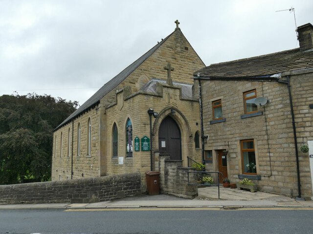
Blacko Images

Images are sourced within 2km of 53.871599/-2.221026 or Grid Reference SD8541. Thanks to Geograph Open Source API. All images are credited.
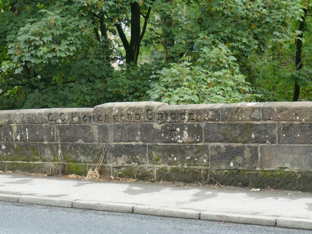
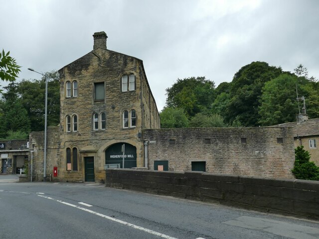
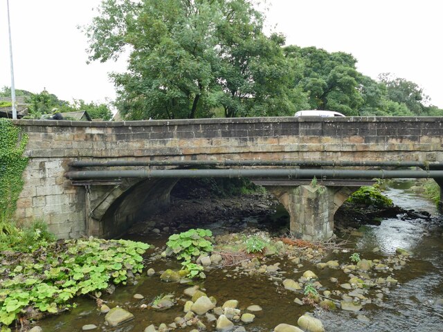
Moorcock Inn Located on a bend on the A682, this popular country pub dates from the 18th century. It is seen here in 1996 when it was a Thwaites house.
Moorcock Inn
Located on a bend on the A682, this popular country pub dates from the 18th century. It is seen here in 1996 when it was a Thwaites house.
Caspers Fold, Francis Avenue, Higherford The house bears a datestone of 2000.
Caspers Fold, Francis Avenue, Higherford
The house bears a datestone of 2000.
Defibrillator on the corner of Francis Avenue These devices are normally found on the wall of public buildings, but here is one on a post by the street in an area of housing.
Defibrillator on the corner of Francis Avenue
These devices are normally found on the wall of public buildings, but here is one on a post by the street in an area of housing.
Bus shelter and old phone box Located at the junction of Barnoldswick Road and Gisburn Road in Higherford.  The phone box appears disused. Street furniture here also includes a grit bin and litter bin.
Bus shelter and old phone box
Located at the junction of Barnoldswick Road and Gisburn Road in Higherford. The phone box appears disused. Street furniture here also includes a grit bin and litter bin.
Road sign in Higherford Located at the junction of Barnoldswick Road and Gisburn Road; the sign also points to Nelson in the opposite direction. Milestone Society National ID: LA_SD8640
Road sign in Higherford
Located at the junction of Barnoldswick Road and Gisburn Road; the sign also points to Nelson in the opposite direction. Milestone Society National ID: LA_SD8640
Old mill, Gisburn Road, Higherford The 1912 map shows this as a corn mill. It's probably too high above the river to have been water powered. Now in private hands, a 2015 proposal for 'brownfield' development on the site was not approved. <a href="https://www.geograph.org.uk/photo/506484">SD8640 : Old mill on Gisburn Road, Barrowford</a> shows it from the other direction.
Old mill, Gisburn Road, Higherford
The 1912 map shows this as a corn mill. It's probably too high above the river to have been water powered. Now in private hands, a 2015 proposal for 'brownfield' development on the site was not approved. SD8640 : Old mill on Gisburn Road, Barrowford shows it from the other direction.
Former Catholic church, Gisburn Road, Higherford The name on the sign board is 'Parish of the Good Shepherd' but other contributors name the building itself as St Peter & St Paul's. A local website says that it was built from 1897, the first service registers being from 1902, but closed for worship in 2019. It appears no new use has been found yet.
Former Catholic church, Gisburn Road, Higherford
The name on the sign board is 'Parish of the Good Shepherd' but other contributors name the building itself as St Peter & St Paul's. A local website says that it was built from 1897, the first service registers being from 1902, but closed for worship in 2019. It appears no new use has been found yet.
Detail of Gisburn Road bridge, Higherford An inscription 'C C Higherford Bridge' and an OS cut benchmark (shown on the 1912 map as 437.9ft). It was built in 1807. See <a href="https://www.geograph.org.uk/photo/4956971">SD8640 : Higherford Bridge and Mill</a> for a side view of the bridge.
Detail of Gisburn Road bridge, Higherford
An inscription 'C C Higherford Bridge' and an OS cut benchmark (shown on the 1912 map as 437.9ft). It was built in 1807. See SD8640 : Higherford Bridge and Mill for a side view of the bridge.
Former cotton mill, Higherford Listed grade II (List entry 1271499) where it is dated to 'c.1844, incorporating elements of an earlier C19 mill, with further additions of 1882, and C20 alterations'. The main weaving shed seen in <a href="https://www.geograph.org.uk/photo/4957250">SD8640 : Grimshaw's (Higherford) Mill</a> is claimed to be the oldest surviving example of its kind. Note the iron beam and high level doorway, presumably for loading bales of cotton from road vehicles.
Former cotton mill, Higherford
Listed grade II (List entry 1271499) where it is dated to 'c.1844, incorporating elements of an earlier C19 mill, with further additions of 1882, and C20 alterations'. The main weaving shed seen in SD8640 : Grimshaw's (Higherford) Mill is claimed to be the oldest surviving example of its kind. Note the iron beam and high level doorway, presumably for loading bales of cotton from road vehicles.
Listed cottages, Foreside, Higherford Listed grade II (List entry 1073432) where the oldest is dated to 1755.
Listed cottages, Foreside, Higherford
Listed grade II (List entry 1073432) where the oldest is dated to 1755.
Crowtree Cottage, Foreside, Higherford Listed grade II (List entry 1273168) where it is dated to the mid-18th century. The large number of windows at first floor level suggests it was used for weaving.
Crowtree Cottage, Foreside, Higherford
Listed grade II (List entry 1273168) where it is dated to the mid-18th century. The large number of windows at first floor level suggests it was used for weaving.
Th' Owd Brig at Higherford This is described by Margaret Slack (Ref.1) as 'One of the most attractive packhorse bridges in [the Pennines] ...standing on the direct line of the Roman Road from Castercliffe to Ribchester. It was crossed by teams of packhorses bringing coal from near Gisburn and ... lime from Lothersdale.' She adds that the date of the bridge is not known with certainty, but probably late 16th century. 

The bridge crosses Pendle Water, draining the steep eastern scarp of that great hill, and subject to flash flooding; Slack relates a story that a bell used to hang from the bridge that rang a warning when water approached flood level.

Listed grade II *(List entry 1273194) and a Scheduled Monument. Originally it would have had no, or very low, parapets to allow ponies with low-hanging panniers to cross; the present parapets were added in 1815.

(1) 'The Bridges of Lancashire and Yorkshire', Margaret Slack, 1986.
Th' Owd Brig at Higherford
This is described by Margaret Slack (Ref.1) as 'One of the most attractive packhorse bridges in [the Pennines] ...standing on the direct line of the Roman Road from Castercliffe to Ribchester. It was crossed by teams of packhorses bringing coal from near Gisburn and ... lime from Lothersdale.' She adds that the date of the bridge is not known with certainty, but probably late 16th century. The bridge crosses Pendle Water, draining the steep eastern scarp of that great hill, and subject to flash flooding; Slack relates a story that a bell used to hang from the bridge that rang a warning when water approached flood level. Listed grade II *(List entry 1273194) and a Scheduled Monument. Originally it would have had no, or very low, parapets to allow ponies with low-hanging panniers to cross; the present parapets were added in 1815. (1) 'The Bridges of Lancashire and Yorkshire', Margaret Slack, 1986.
Gisburn Road bridge, Higherford This road bridge over Pendle Water was erected in 1807 to supersede the old packhorse bridge, which still stands but closed to motor traffic <a href="https://www.geograph.org.uk/photo/7265480">SD8640 : Th' Owd Brig at Higherford</a>.
Gisburn Road bridge, Higherford
This road bridge over Pendle Water was erected in 1807 to supersede the old packhorse bridge, which still stands but closed to motor traffic SD8640 : Th' Owd Brig at Higherford.
The Old Bridge Inn, Higherford Actually close to the 'new' bridge, not the old one <a href="https://www.geograph.org.uk/photo/7265480">SD8640 : Th' Owd Brig at Higherford</a>.
The Old Bridge Inn, Higherford
Actually close to the 'new' bridge, not the old one SD8640 : Th' Owd Brig at Higherford.
Former Methodist Sunday School, Higherford Dated 1834, in residential use since 1972 (source: <span class="nowrap"><a title="https://www.flickr.com/photos/rossendalewadey/5885068439" rel="nofollow ugc noopener" href="https://www.flickr.com/photos/rossendalewadey/5885068439">Link</a><img style="margin-left:2px;" alt="External link" title="External link - shift click to open in new window" src="https://s1.geograph.org.uk/img/external.png" width="10" height="10"/></span> ). An early 20th century map shows a tram terminus outside; the tramway from Nelson opened in the early years of the century and closed in 1934.
Former Methodist Sunday School, Higherford
Dated 1834, in residential use since 1972 (source: LinkExternal link ). An early 20th century map shows a tram terminus outside; the tramway from Nelson opened in the early years of the century and closed in 1934.
Former Methodist Sunday School, Higherford - datestone Wesleyan Methodist Sunday School Built by Subscription AD 1834. See <a href="https://www.geograph.org.uk/photo/7265486">SD8640 : Former Methodist Sunday School, Higherford</a> for context.
Former Methodist Sunday School, Higherford - datestone
Wesleyan Methodist Sunday School Built by Subscription AD 1834. See SD8640 : Former Methodist Sunday School, Higherford for context.
Fold, Gisburn Road, Higherford Mid-18th century stone cottages, grade II listed (list entry 1073435).
Fold, Gisburn Road, Higherford
Mid-18th century stone cottages, grade II listed (list entry 1073435).
Field with distant tower The structure on the horizon is Stansfield Tower (also known as Blacko Tower) <a href="https://www.geograph.org.uk/photo/4000070">SD8542 : Stansfield Tower</a>.
Field with distant tower
The structure on the horizon is Stansfield Tower (also known as Blacko Tower) SD8542 : Stansfield Tower.
Show me another place!

Blacko is located at Grid Ref: SD8541 (Lat: 53.871599, Lng: -2.221026)

Administrative County: Lancashire

District: Pendle

Police Authority: Lancashire

What 3 Words

///blend.novelists.joined. Near Barrowford, Lancashire

Nearby Locations

Blacko

Related Wikis

Blacko

Blacko is a village and civil parish in the Pendle district of Lancashire, England. Before local government reorganisation in 1974 the village lay on...

Higherford

Higherford is a village in the Pendle district of Lancashire, England. Although it is a village in its own right and shown on maps, it is sometimes confused...

Roughlee

Roughlee is a village in the civil parish of Roughlee Booth, in the Pendle district, in the county of Lancashire, England. It is close to Nelson, Barrowford...

Roughlee Booth

Roughlee Booth is a civil parish located in Pendle, Lancashire. It is approximately 449.43 hectares in size and situated in the Forest of Bowland AONB...

Nearby Amenities

Located within 500m of 53.871599,-2.221026
Blacko
Place: village
Source: npe
Lat/Long: 53.8687661/-2.2162679
Turning Circle
Lat/Long: 53.8715809/-2.2210412
Post Box
Post Box Type: lamp
Royal Cypher: EIIR
Royal Cypher Wikidata: Q33102113
Lat/Long: 53.8710265/-2.2171821
Barrier: stile
Lat/Long: 53.8726956/-2.2158051
Barrier: stile
Lat/Long: 53.8717263/-2.2203542
Information: guidepost
Tourism: information
Lat/Long: 53.8697379/-2.2179447
Defibrillator
Defibrillator Location: outside Blacko primary School - facing Beverley Road
Emergency: defibrillator
Indoor: no
Ref GB The Circuit: 1A0975FC-DD6F-4163-93B6-AEDD00A33799
Lat/Long: 53.8704283/-2.2148057
Historic: memorial
Memorial: war_memorial
Lat/Long: 53.8708826/-2.2165795
Bench
Lat/Long: 53.8709011/-2.2166591
The data included in this document is from www.openstreetmap.org. The data is made available under ODbL.

Have you been to Blacko?

Leave your review of Blacko below (or comments, questions and feedback).