Blacknuck

Settlement in Pembrokeshire

Wales

Blacknuck

Hedge enclosed rack and footpath to St Bernard's Well Looking north-westward.
Hedge enclosed rack and footpath to St Bernard's Well Credit: Peter Wood

Blacknuck is a small coastal village located in the county of Pembrokeshire, Wales. Situated on the western edge of the stunning Pembrokeshire Coast National Park, Blacknuck offers residents and visitors alike a picturesque setting with breathtaking views of the Atlantic Ocean.

The village itself is characterized by its charming stone cottages, which are scattered along narrow winding streets. Blacknuck's population is relatively small, with just over 100 residents, giving it a close-knit community feel. The village is primarily residential, with a few local businesses catering to the needs of the residents and visitors.

One of the main attractions of Blacknuck is its beautiful beach, which stretches for several miles along the coast. The sandy shoreline and clear blue waters make it a popular spot for swimming, sunbathing, and beachcombing. The beach also offers opportunities for water activities such as surfing, kayaking, and fishing.

The surrounding area of Blacknuck is rich in natural beauty, with rugged cliffs, rolling hills, and lush green countryside. The Pembrokeshire Coast Path, a long-distance trail that follows the coastline, passes through the village, providing walkers and hikers with stunning views and access to nearby attractions.

Overall, Blacknuck is a peaceful and idyllic village that offers residents and visitors a chance to escape the hustle and bustle of everyday life and enjoy the beauty of the Welsh coast.

If you have any feedback on the listing, please let us know in the comments section below.
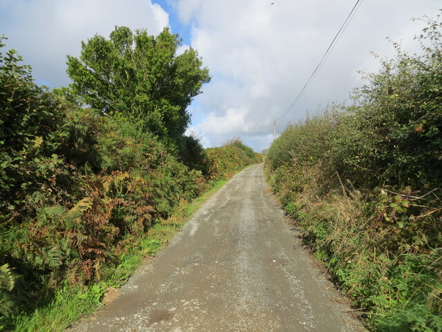
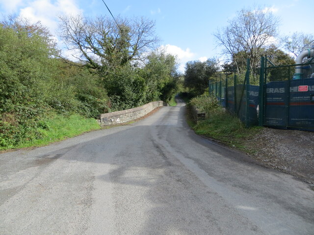
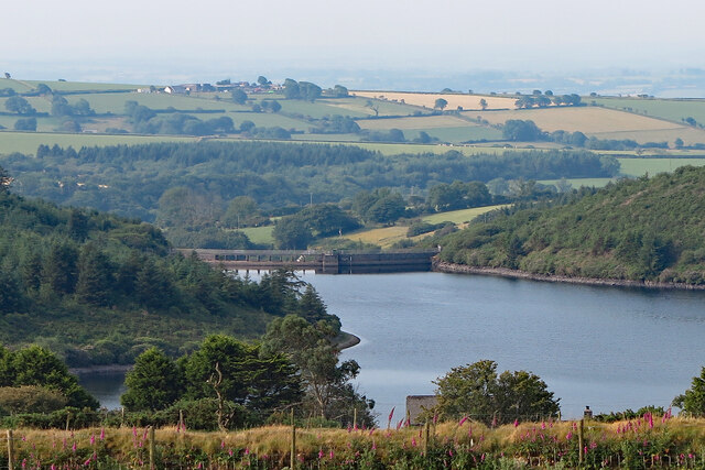
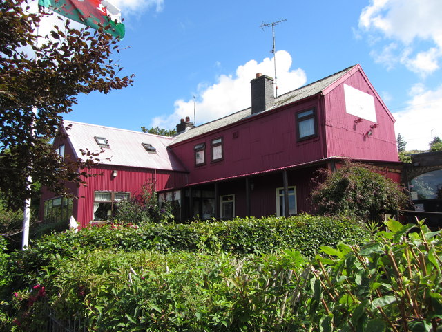
Blacknuck Images

Images are sourced within 2km of 51.912898/-4.80829 or Grid Reference SN0627. Thanks to Geograph Open Source API. All images are credited.

Hedge enclosed rack and footpath to St Bernard's Well Looking north-westward.
Hedge enclosed rack and footpath to St Bernard's Well
Looking north-westward.
Road and Bridge crossing Afon Syfynwy Looking eastward from beside Rhyd Fawr Water Works.
Road and Bridge crossing Afon Syfynwy
Looking eastward from beside Rhyd Fawr Water Works.
Minor road at Tafarn Sinc, Rosebush Looking south-westward.
Minor road at Tafarn Sinc, Rosebush
Looking south-westward.
Capel Horeb and part of its burial ground at Trebengych Looking south-eastward.
Capel Horeb and part of its burial ground at Trebengych
Looking south-eastward.
Hedged pasture fields near Eithbed Looking south-eastward.
Hedged pasture fields near Eithbed
Looking south-eastward.
Rosebush Dam, Maenclochog The concrete dam was built across the River Syfynwy in 1932. The river here marks the boundary between the parishes of Maenclochog (east - left) and Henry's Moat (west - right).
Rosebush Dam, Maenclochog
The concrete dam was built across the River Syfynwy in 1932. The river here marks the boundary between the parishes of Maenclochog (east - left) and Henry's Moat (west - right).
Y Tafarn Sinc in Rosebush
Cameo scene near the former Rosebush Station Recreated scene in the garden of Y Tafarn Sinc.
Cameo scene near the former Rosebush Station
Recreated scene in the garden of Y Tafarn Sinc.
Approaching the village centre at Maenclochog The prominent building was once the Castle Inn, now totally decrepit, with two rotting vehicles in front of it - you have to wonder why this eyesore is tolerated, as it detracts from what is otherwise an attractive set of buildings around the village green.
Approaching the village centre at Maenclochog
The prominent building was once the Castle Inn, now totally decrepit, with two rotting vehicles in front of it - you have to wonder why this eyesore is tolerated, as it detracts from what is otherwise an attractive set of buildings around the village green.
General stores in Maenclochog
Ordnance Survey Cut Mark This OS cut mark can be found on the SE angle of St Mary's Church. It marks a point 211.196m above mean sea level.
Ordnance Survey Cut Mark
This OS cut mark can be found on the SE angle of St Mary's Church. It marks a point 211.196m above mean sea level.
Ordnance Survey Cut Mark This OS cut mark can be found on the west angle of the school. It marks a point 214.479m above mean sea level.
Ordnance Survey Cut Mark
This OS cut mark can be found on the west angle of the school. It marks a point 214.479m above mean sea level.
Ordnance Survey Cut Mark This OS cut mark can be found on the gatepost south of the road. It marks a point 232.971m above mean sea level.
Ordnance Survey Cut Mark
This OS cut mark can be found on the gatepost south of the road. It marks a point 232.971m above mean sea level.
Ordnance Survey Cut Mark This OS cut mark can be found on the SE face of the Baptist Chapel. It marks a point 229.947m above mean sea level.
Ordnance Survey Cut Mark
This OS cut mark can be found on the SE face of the Baptist Chapel. It marks a point 229.947m above mean sea level.
Ordnance Survey Cut Mark This OS cut mark can be found on the gatepost to the SW of the road. It marks a point 247.458m above mean sea level.
Ordnance Survey Cut Mark
This OS cut mark can be found on the gatepost to the SW of the road. It marks a point 247.458m above mean sea level.
Boundary Stone West side of road on railway bridge.
Boundary Stone
West side of road on railway bridge.
Information Board - Maenclochog carpark
Show me another place!

Blacknuck is located at Grid Ref: SN0627 (Lat: 51.912898, Lng: -4.80829)

Unitary Authority: Pembrokeshire

Police Authority: Dyfed Powys

What 3 Words

///meanders.verdict.grudges. Near Ambleston, Pembrokeshire

Nearby Locations

Blacknuck

Related Wikis

Maenclochog railway station

Maenclochog railway station served the village of Maenclochog, Pembrokeshire, Wales, from 1876 to 1949 on the Narberth Road and Maenclochog Railway....

Maenclochog

Maenclochog () is a village, parish and community in Pembrokeshire, south-west Wales. It is also the name of an electoral ward comprising a wider area...

Rosebush, Pembrokeshire

Rosebush (Welsh: Rhos-y-bwlch) is a small village in the community of Maenclochog, Pembrokeshire, southwest Wales, UK. It lies in the southern slopes of...

Tafarn Sinc

Tafarn Sinc (English: Zinc Tavern) is a pub located in Rosebush, Pembrokeshire, Wales.The building is constructed of corrugated metal, which was commonly...

Nearby Amenities

Located within 500m of 51.912898,-4.80829
Give Way
Direction: forward
Lat/Long: 51.9154121/-4.8031753
Give Way
Direction: forward
Lat/Long: 51.9153187/-4.8032178
The data included in this document is from www.openstreetmap.org. The data is made available under ODbL.

Have you been to Blacknuck?

Leave your review of Blacknuck below (or comments, questions and feedback).