Rowington

Settlement in Warwickshire Warwick

England

Rowington

Grand Union Canal near Turner's Green
Grand Union Canal near Turner's Green Credit: Mark Percy

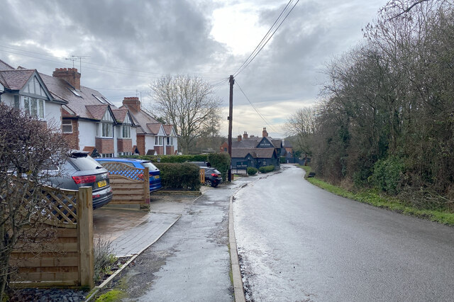
Rowington is a small village located in the county of Warwickshire in central England. Situated approximately 6 miles northwest of the town of Warwick, Rowington is surrounded by picturesque countryside and offers a tranquil and rural setting.

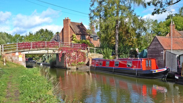
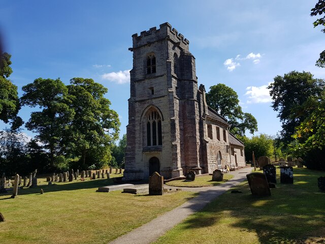
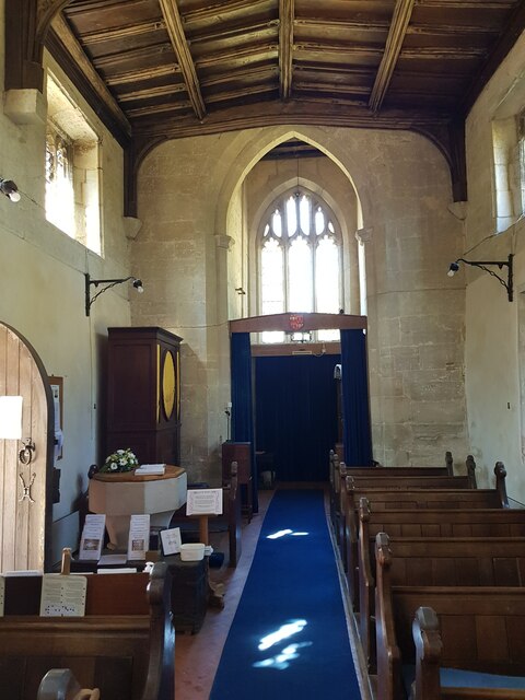
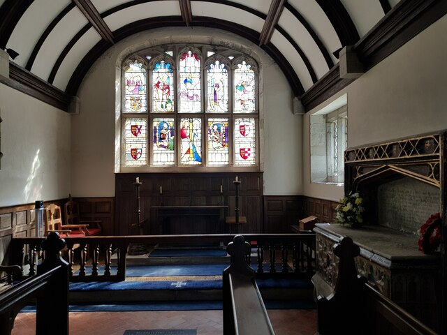
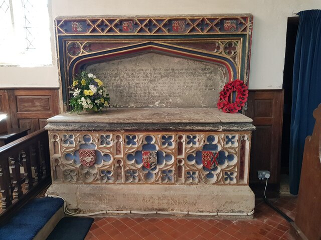
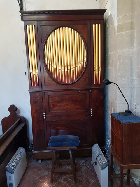
The village is known for its charming and traditional architecture, with many buildings dating back to the 17th and 18th centuries. The local church, dedicated to St. Lawrence, is a notable landmark, featuring a beautiful spire and stained glass windows.

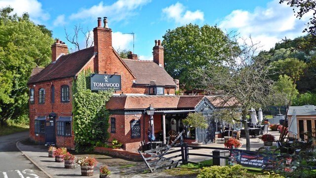
Despite its small size, Rowington is well-served by amenities. The village has a primary school, a village hall, and a local pub, providing a sense of community for its residents. The nearby town of Kenilworth offers additional services and facilities, including supermarkets, shops, and healthcare facilities.

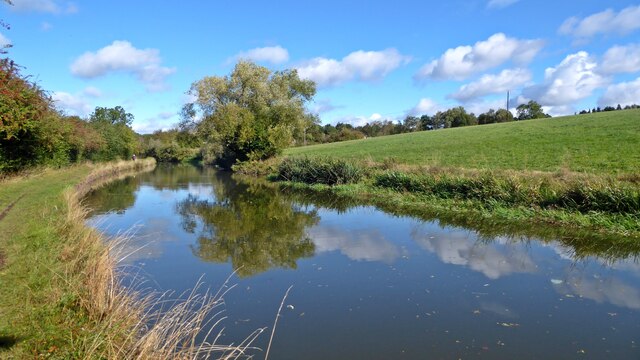
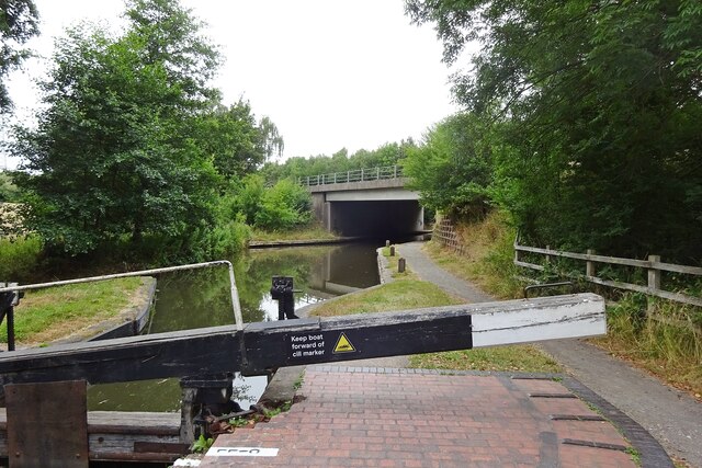
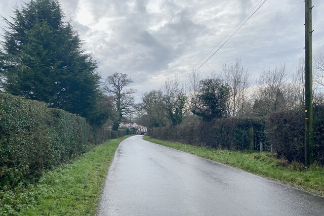
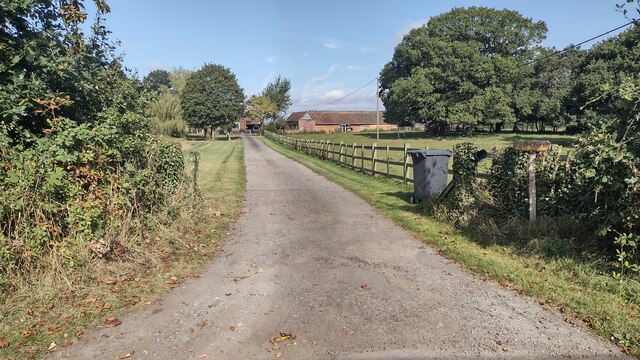
Rowington is also known for its natural beauty and is surrounded by lush green fields and rolling hills, making it an ideal location for outdoor enthusiasts. The village is situated close to several walking and cycling trails, providing opportunities for residents and visitors to explore the stunning Warwickshire countryside.

Transport links in Rowington are convenient, with easy access to major roads including the A4177 and A425, connecting the village to nearby towns and cities. The nearest train station is Warwick Parkway, which provides regular services to Birmingham, London, and other major cities.

Overall, Rowington offers a peaceful and idyllic setting, with its rich history, beautiful architecture, and stunning natural surroundings making it an attractive place to live or visit in Warwickshire.

If you have any feedback on the listing, please let us know in the comments section below.
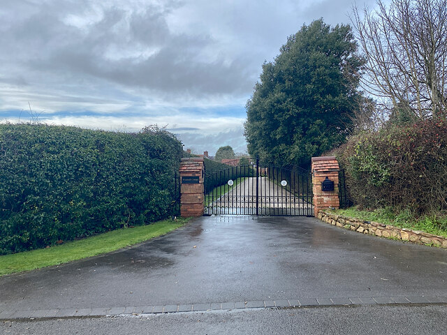
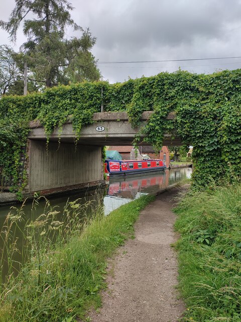
Rowington Images

Images are sourced within 2km of 52.322251/-1.704224 or Grid Reference SP2069. Thanks to Geograph Open Source API. All images are credited.

Grand Union Canal near Turner's Green
Tom O'The Wood country pub and restaurant
Grand Union Canal at Turner's Green
Kingswood-Stratford Canal M40 Motorway Bridge.
Kingswood-Stratford Canal
M40 Motorway Bridge.
Approaching Turner's Green Finwood Road drops down into the canalside hamlet.
Approaching Turner's Green
Finwood Road drops down into the canalside hamlet.
Southwest on Finwod Road Finwood Road turns south from the Old Warwick Road for Turner's Green, ahead, and Lowsonford.
Southwest on Finwod Road
Finwood Road turns south from the Old Warwick Road for Turner's Green, ahead, and Lowsonford.
Gates to Windmill Cottage, Turner's Green An entrance on Finwood Road. Old maps show Windmill House here and a circular feature where a windmill  might have been. This is the same relatively high ground as the Rowington Mill site <a href="https://www.geograph.org.uk/photo/7378320">SP2070 : Rowington Mill, Rowington Green</a>.
Gates to Windmill Cottage, Turner's Green
An entrance on Finwood Road. Old maps show Windmill House here and a circular feature where a windmill might have been. This is the same relatively high ground as the Rowington Mill site SP2070 : Rowington Mill, Rowington Green.
Turner's Green Bridge
Path up to Green Farm Path and drive up to Green Farm
Path up to Green Farm
Path and drive up to Green Farm
St Michael's, Baddesley Clinton, Warwickshire  Next to but not part of the National Trust property.
St Michael's, Baddesley Clinton, Warwickshire
Next to but not part of the National Trust property.
St Michael's Church, Baddesley Clinton (interior 1)
St Michael's Church, Baddesley Clinton (interior 2)
Tomb for Sir Edward Ferrers and family In St Michael's Church, Baddesley Clinton. The family owned Baddesley Clinton for generations.
Tomb for Sir Edward Ferrers and family
In St Michael's Church, Baddesley Clinton. The family owned Baddesley Clinton for generations.
The Ferrer's memorial in St Michael's Church, Baddesley Clinton
Mini organ, St Michael's Church, Baddesley Clinton
Rowington Mill, Rowington Green A former windmill has been converted and extended as a private house. There are references to windmills in housenames in nearby Turner's Green. The area is a relatively high spot on the Arden plateau. The view is from the Heart of England Way.
Rowington Mill, Rowington Green
A former windmill has been converted and extended as a private house. There are references to windmills in housenames in nearby Turner's Green. The area is a relatively high spot on the Arden plateau. The view is from the Heart of England Way.
Quarry Farm, Rowington Green The view is from the Heart of England Way.
Quarry Farm, Rowington Green
The view is from the Heart of England Way.
Rowington Mill, Rowington Green A former windmill has been converted and extended as a private house. There are references to windmills in housenames in nearby Turner's Green. The area is a relatively high spot on the Arden plateau. The view is from the Heart of England Way.
Image reference: 7378320
Rowington Mill, Rowington Green
A former windmill has been converted and extended as a private house. There are references to windmills in housenames in nearby Turner's Green. The area is a relatively high spot on the Arden plateau. The view is from the Heart of England Way. Image reference: 7378320
Show me another place!

Rowington is located at Grid Ref: SP2069 (Lat: 52.322251, Lng: -1.704224)

Administrative County: Warwickshire

District: Warwick

Police Authority: Warwickshire

What 3 Words

///score.seashell.clicker. Near Wroxall, Warwickshire

Nearby Locations

Rowington Rowington Green

Related Wikis

Rowington

Rowington is a village and civil parish in the English county of Warwickshire. It is five miles north-west of the town of Warwick and five miles south...

Mercia Mudstone Group

The Mercia Mudstone Group is an early Triassic lithostratigraphic group (a sequence of rock strata) which is widespread in Britain, especially in the English...
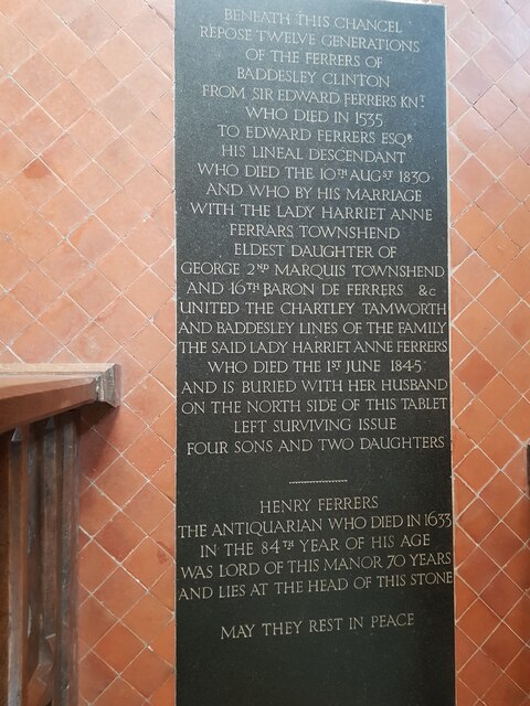
Baddesley Clinton

Baddesley Clinton (grid reference SP199714) is a moated manor house, about 8 miles (13 km) north-west of the town of Warwick, in the village of Baddesley...

Kingswood Junction

Kingswood Junction (grid reference SP185709) is a canal junction where the Stratford-upon-Avon Canal meets the Grand Union Canal at Kingswood, Warwickshire...

Nearby Amenities

Located within 500m of 52.322251,-1.704224
Bus Stop
Church
Bus: yes
Naptan AtcoCode: 4200F054900
Naptan Bearing: NW
Naptan CommonName: Church
Naptan Indicator: Adj
Naptan NaptanCode: wardgadp
Naptan Street: Old Warwick Road
Naptan Verified: no
Public Transport: platform
Source: naptan_import
Lat/Long: 52.3221769/-1.7042936
Bus Stop
Mill Lane
Bus: yes
Naptan AtcoCode: 4200F170900
Naptan Bearing: NW
Naptan CommonName: Mill Lane
Naptan Indicator: Adj
Naptan NaptanCode: wardgmap
Naptan Street: B4439
Naptan Verified: no
Public Transport: platform
Source: naptan_import
Lat/Long: 52.3222002/-1.7043133
Mill Lane
Naptan AtcoCode: 4200F170903
Naptan Bearing: SE
Naptan BusStopType: CUS
Naptan CommonName: Mill Lane
Naptan Indicator: Opp
Naptan NaptanCode: wardjpjd
Naptan Street: Old Warwick Road
Naptan Verified: no
Source: naptan_import
Lat/Long: 52.3221993/-1.7039465
Post Box
Collection Times: Mo-Fr 15:45; Sa 07:15
Operator: Royal Mail
Operator Wikidata: Q638098
Post Box Type: wall
Ref: CV35 120
Royal Cypher: VR
Royal Cypher Wikidata: Q33102356
Source: survey
Lat/Long: 52.3213946/-1.7028961
Rowington
Place: village
Source Name: OS OpenData StreetView
Wikidata: Q7372081
Lat/Long: 52.3220311/-1.7032604
Barrier: kissing_gate
Lat/Long: 52.3209895/-1.7006135
Barrier: stile
Lat/Long: 52.3213374/-1.6991155
Barrier: kissing_gate
Lat/Long: 52.3216462/-1.6984069
Operator: National Grid Electricity Distribution
Operator Wikidata: Q7988183
Power: pole
Source: bing
Lat/Long: 52.3215535/-1.7102811
Operator: National Grid Electricity Distribution
Operator Wikidata: Q7988183
Power: pole
Source: bing
Lat/Long: 52.3217125/-1.7084035
Operator: National Grid Electricity Distribution
Operator Wikidata: Q7988183
Power: pole
Source: bing
Lat/Long: 52.3212453/-1.7072395
Operator: National Grid Electricity Distribution
Operator Wikidata: Q7988183
Power: pole
Source: bing
Lat/Long: 52.3202304/-1.7048657
Operator: National Grid Electricity Distribution
Operator Wikidata: Q7988183
Power: pole
Ref: 931756
Source: wpd_opendata
Transformer: distribution
Lat/Long: 52.3197369/-1.7037392
Operator: National Grid Electricity Distribution
Operator Wikidata: Q7988183
Power: pole
Source: bing
Lat/Long: 52.3190975/-1.7076136
Operator: National Grid Electricity Distribution
Operator Wikidata: Q7988183
Power: pole
Source: bing
Lat/Long: 52.3197091/-1.7068867
Operator: National Grid Electricity Distribution
Operator Wikidata: Q7988183
Power: pole
Source: bing
Lat/Long: 52.3201345/-1.7063811
Operator: National Grid Electricity Distribution
Operator Wikidata: Q7988183
Power: pole
Source: bing
Lat/Long: 52.3207256/-1.706066
Operator: National Grid Electricity Distribution
Operator Wikidata: Q7988183
Power: pole
Source: bing
Lat/Long: 52.3186376/-1.7006265
Operator: National Grid Electricity Distribution
Operator Wikidata: Q7988183
Power: pole
Source: bing
Lat/Long: 52.3189885/-1.7015961
Operator: National Grid Electricity Distribution
Operator Wikidata: Q7988183
Power: pole
Source: bing
Lat/Long: 52.3193787/-1.7026462
The data included in this document is from www.openstreetmap.org. The data is made available under ODbL.

Have you been to Rowington?

Leave your review of Rowington below (or comments, questions and feedback).