Blacklunans

Settlement in Angus

Scotland

Blacklunans

The Black Water flowing downstream The river heading towards its joining with the River Ericht as seen from Drumfork Bridge.
The Black Water flowing downstream Credit: Trevor Littlewood

Blacklunans is a small village located in the Angus region of Scotland, nestled in the picturesque surroundings of the Sidlaw Hills. With a population of around 200 residents, it is known for its tranquil and idyllic setting, making it a popular destination for nature enthusiasts and those seeking a peaceful retreat.

The village is situated about 9 miles north of Blairgowrie and 12 miles northeast of Coupar Angus. It can be reached via the B951 road, which winds its way through the scenic countryside. Surrounded by rolling hills, lush green fields, and dense woodlands, Blacklunans offers stunning views and a sense of serenity that attracts visitors.

Historically, the village was primarily an agricultural community, with farming being the main occupation for the locals. However, in recent years, it has seen an increase in tourism, as more people discover its natural beauty and the wide array of outdoor activities it has to offer. The nearby Sidlaw Hills provide ample opportunities for hiking, cycling, and wildlife spotting.

In terms of amenities, Blacklunans has limited facilities. There is a small local pub that serves as a social hub for both residents and visitors alike. The village lacks major commercial establishments, with most residents having to travel to nearby towns for shopping and other services.

Overall, Blacklunans is a charming village that appeals to those seeking tranquility and a connection with nature. Its breathtaking landscapes and peaceful atmosphere make it a hidden gem in the Angus region.

If you have any feedback on the listing, please let us know in the comments section below.
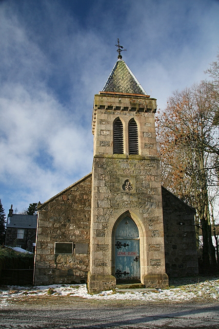
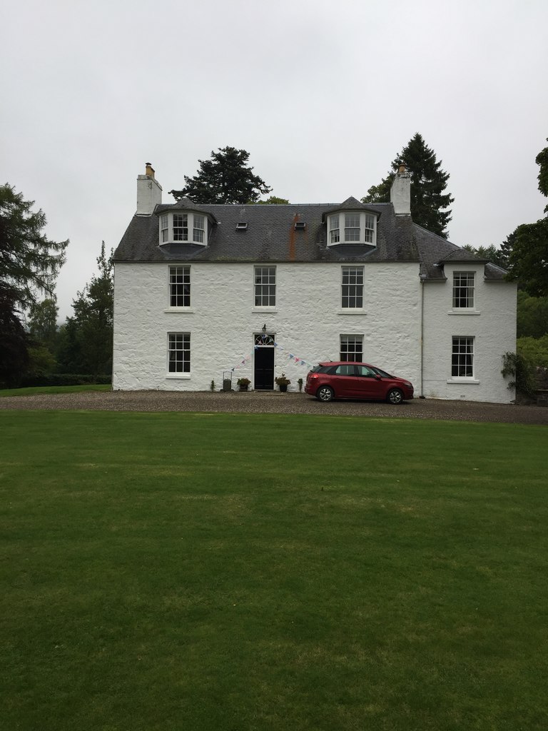
Blacklunans Images

Images are sourced within 2km of 56.727958/-3.39238 or Grid Reference NO1460. Thanks to Geograph Open Source API. All images are credited.

The Black Water flowing downstream The river heading towards its joining with the River Ericht as seen from Drumfork Bridge.
The Black Water flowing downstream
The river heading towards its joining with the River Ericht as seen from Drumfork Bridge.
Black Water at Drumfork Bridge, Glenshee Looking downstream.
Black Water at Drumfork Bridge, Glenshee
Looking downstream.
Dipper (Cinclus cinclus) on the Black Water from Drumfork Bridge
Black Water in Glenshee from Drumfork Bridge Mount Blair is in the distance.
Black Water in Glenshee from Drumfork Bridge
Mount Blair is in the distance.
Mains of Dalrulzion, Glenshee
Black Water at Mains of Dalrulzion
Dalrulzion Hotel, Glenshee Or the former Dalrulzion Hotel from the look of things.
Dalrulzion Hotel, Glenshee
Or the former Dalrulzion Hotel from the look of things.
Shasta Daisies (Leucanthemum maximum) beside the Dalrulzion Hotel, Glenshee
Ornamental entrance to Drumfork The entrance to this 'castle' is immediately across Drumfork Bridge
Ornamental entrance to Drumfork
The entrance to this 'castle' is immediately across Drumfork Bridge
Drumfork Bridge The bridge carries the minor road over the Black Water and it dates from 1878.
Drumfork Bridge
The bridge carries the minor road over the Black Water and it dates from 1878.
Black Water at Drumfork Looking downstream from Drumfork Bridge.
Black Water at Drumfork
Looking downstream from Drumfork Bridge.
Black Water at Drumfork Looking upstream from Drumfork Bridge.
Black Water at Drumfork
Looking upstream from Drumfork Bridge.
Flush Bracket G844, Drumfork Bridge The Ordnance Survey flush bracket is to be found on the bridge parapet.  For a wider image of the bridge <a href="https://www.geograph.org.uk/photo/2641955">NO1459 : Drumfork Bridge</a> and for further information on the bracket and others in the area <span class="nowrap"><a title="http://www.bench-marks.org.uk/bm17969" rel="nofollow ugc noopener" href="http://www.bench-marks.org.uk/bm17969">Link</a><img style="margin-left:2px;" alt="External link" title="External link - shift click to open in new window" src="https://s1.geograph.org.uk/img/external.png" width="10" height="10"/></span>
Flush Bracket G844, Drumfork Bridge
The Ordnance Survey flush bracket is to be found on the bridge parapet. For a wider image of the bridge NO1459 : Drumfork Bridge and for further information on the bracket and others in the area LinkExternal link
Arched Gateway The arched gateway marks the entrance to the Drumfork Estate.
Arched Gateway
The arched gateway marks the entrance to the Drumfork Estate.
Junction for Blacklunans from A93 Via Drumfok Bridge.
Junction for Blacklunans from A93
Via Drumfok Bridge.
Steadings at Mains of Dalrulzion By A93.
Steadings at Mains of Dalrulzion
By A93.
Blackwater Outdoor Centre By A93; available for hire.
Blackwater Outdoor Centre
By A93; available for hire.
The road to Blacklunans
Show me another place!

Blacklunans is located at Grid Ref: NO1460 (Lat: 56.727958, Lng: -3.39238)

Unitary Authority: Perth and Kinross

Police Authority: Tayside

What 3 Words

///passwords.motel.tell. Near Alyth, Perth & Kinross

Nearby Locations

Blacklunans

Related Wikis

Mount Blair (Scotland)

Mount Blair is a large hill on the Perth and Kinross and Angus border, Scotland, in the southern foothills of the Grampian Mountains. It lies between the...

Cray Parish Church

Cray Parish Church, also known as Cray Free Church and Kirkmichael Free Church, is a former Church of Scotland church in Cray, Perth and Kinross, Scotland...

Cray, Perth and Kinross

Cray is a settlement in Perth and Kinross, Scotland, about 4.5 miles (7 kilometres) northeast of Kirkmichael, on the Shee Water at the foot of Mount Blair...

Dalnaglar Castle

Dalnaglar Castle is a 19th-century castle, about 6.0 kilometres (3.7 mi) south of Spittal of Glenshee, Perth and Kinross, Scotland, on the east of the...

Nearby Amenities

Located within 500m of 56.727958,-3.39238
Milton
1860name: Millton Corn Mill
Pont: Mil of blacklounas?
Stobie1783: no
Designation: Historic mill
Historic: archaeological_site
Source: OS Six inch 1st series
Lat/Long: 56.728175/-3.3939191
Blacklunans
Alt Name Gd: Bealach Lùnaig
Name Gd: Bealach Glùineig
Place: hamlet
Lat/Long: 56.7283385/-3.3905318
Public Bookcase
Library
Booth: K6
Colour: red
Disused Amenity: telephone
Man Made: telephone_box
Old Operator: British Telecom
Public Bookcase Type: phone_box
Lat/Long: 56.7279027/-3.3921741
Post Box
Collection Times: Mo-Fr 12:45; Sa 10:45
Operator: Royal Mail
Post Box Mounting: pier
Post Box Type: lamp
Ref: PH10 117
Royal Cypher: scottish_crown
Source: survey;local knowledge
Lat/Long: 56.7279371/-3.392131
Note: w
Lat/Long: 56.7290315/-3.3914301
Power: pole
Lat/Long: 56.7248348/-3.3981208
Power: pole
Lat/Long: 56.7251727/-3.3972015
Power: pole
Lat/Long: 56.7254968/-3.3962972
Power: pole
Lat/Long: 56.7256503/-3.3981721
Power: pole
Lat/Long: 56.7261342/-3.3991601
Power: pole
Lat/Long: 56.7266194/-3.4001593
Power: pole
Lat/Long: 56.7258546/-3.3953204
Power: pole
Lat/Long: 56.7262096/-3.3943237
Power: pole
Lat/Long: 56.7264617/-3.3936567
Power: pole
Lat/Long: 56.7266406/-3.3931583
Power: pole
Lat/Long: 56.7270381/-3.3920678
Power: pole
Lat/Long: 56.7272758/-3.3914058
Power: pole
Lat/Long: 56.7247999/-3.3931108
Power: pole
Lat/Long: 56.7251775/-3.3927149
Power: pole
Lat/Long: 56.7255119/-3.3923539
Power: pole
Lat/Long: 56.7258422/-3.3920004
Power: pole
Lat/Long: 56.7262109/-3.3917443
Power: pole
Lat/Long: 56.7265823/-3.3914608
Power: pole
Lat/Long: 56.7269593/-3.3911785
Power: pole
Lat/Long: 56.7278556/-3.3908163
Power: pole
Lat/Long: 56.7284394/-3.3902317
Power: pole
Lat/Long: 56.7289081/-3.389767
Power: pole
Lat/Long: 56.7293947/-3.3894373
Power: pole
Lat/Long: 56.7302258/-3.388804
Power: pole
Lat/Long: 56.7306548/-3.3892662
Power: pole
Lat/Long: 56.7315284/-3.3901892
Power: pole
Lat/Long: 56.7319813/-3.3896546
Power: pole
Lat/Long: 56.7263781/-3.389827
Power: pole
Lat/Long: 56.7266817/-3.390544
Power: pole
Lat/Long: 56.7275191/-3.3918405
Power: pole
Lat/Long: 56.7295749/-3.3885367
Power: pole
Lat/Long: 56.7299202/-3.387435
Power: pole
Lat/Long: 56.730145/-3.3866731
The data included in this document is from www.openstreetmap.org. The data is made available under ODbL.

Have you been to Blacklunans?

Leave your review of Blacklunans below (or comments, questions and feedback).