Rosedale

Settlement in Hertfordshire Broxbourne

England

Rosedale

The Great Cambridge Road, Cheshunt
The Great Cambridge Road, Cheshunt Credit: David Howard

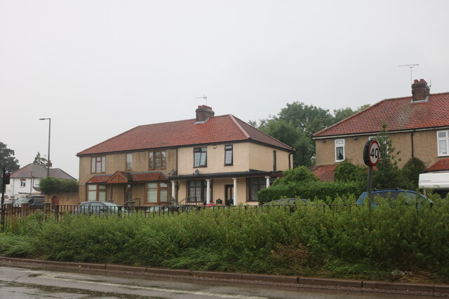
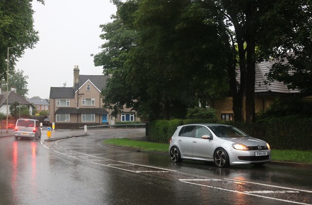
Rosedale is a picturesque village located in the county of Hertfordshire, England. Situated in the East Hertfordshire district, it is nestled in the heart of the beautiful countryside, offering residents and visitors stunning views and a peaceful ambiance. With a population of around 500, Rosedale exudes a small-town charm and close-knit community feel.

The village is renowned for its historic architecture, with many buildings dating back to the 17th and 18th centuries. The quintessential English cottages and Georgian houses add to the village's charm, creating a delightful ambiance that captures the essence of traditional rural England.

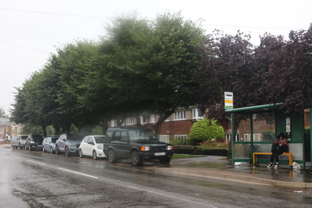
Despite its small size, Rosedale offers a range of amenities and services for its residents. The village boasts a well-maintained community center, a local pub, and a small convenience store, ensuring that basic needs are met without having to travel too far. Additionally, there is a primary school within the village, providing education for the local children.

For those who appreciate the outdoors, Rosedale offers abundant opportunities for scenic walks and exploration. The surrounding countryside is adorned with rolling hills, picturesque meadows, and well-maintained footpaths, making it an ideal location for nature enthusiasts and hikers.

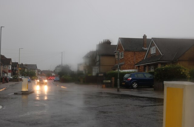
Rosedale's location also offers convenient access to nearby towns and cities. The town of Hertford is within easy reach, providing a wider range of amenities, shopping centers, and recreational facilities.

Overall, Rosedale, Hertfordshire, is a charming and idyllic village that offers a tranquil lifestyle amidst stunning natural beauty, making it an attractive place to reside or visit for a peaceful retreat.

If you have any feedback on the listing, please let us know in the comments section below.
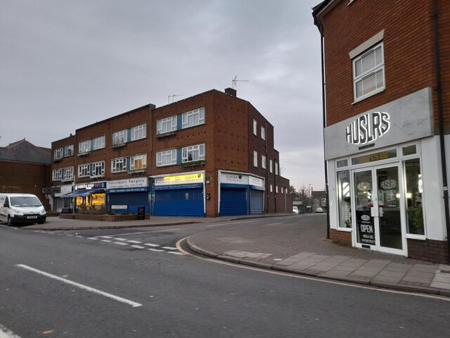
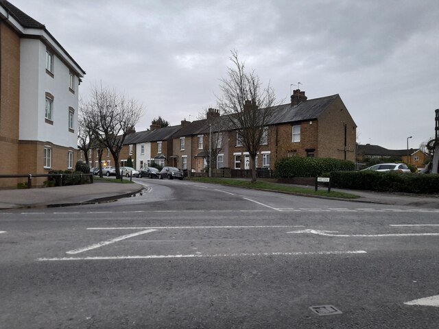
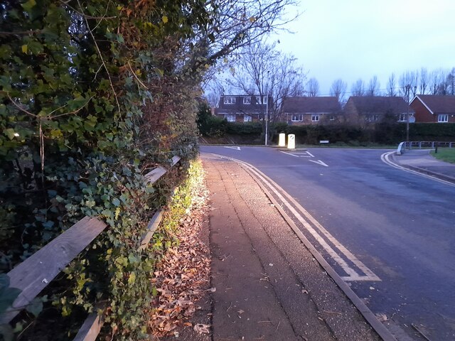
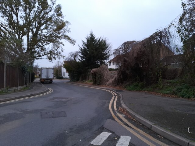
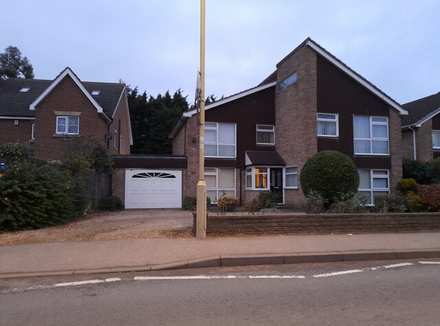
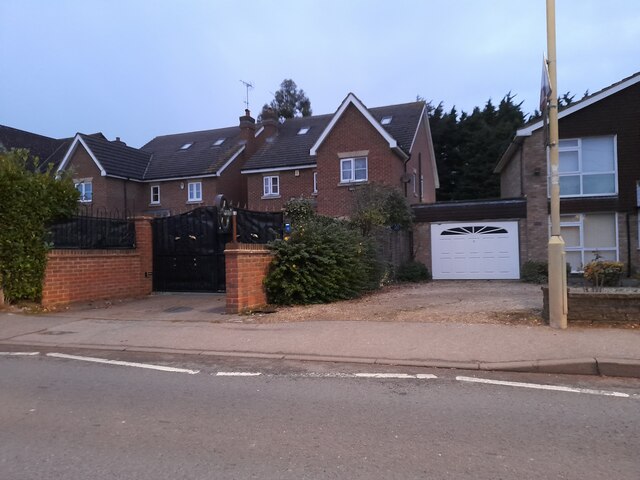
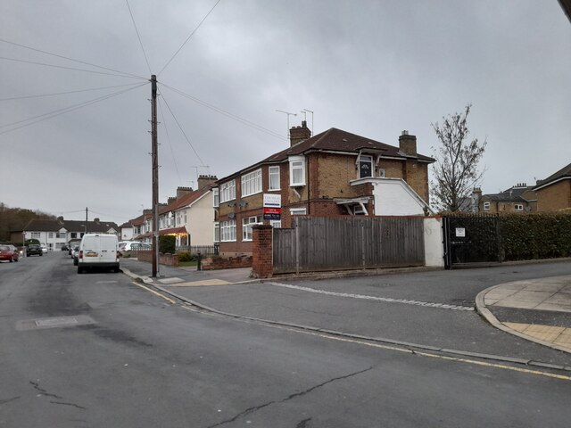
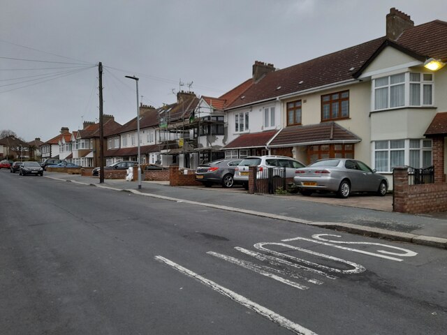
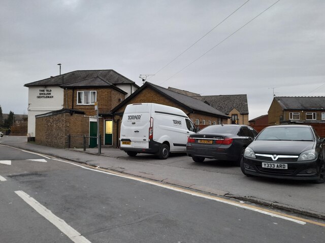
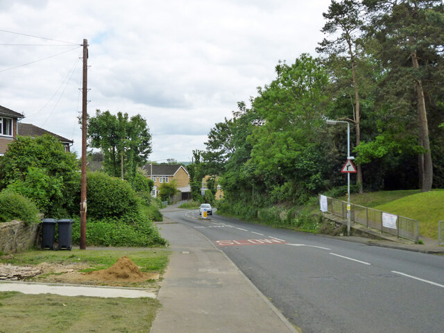
Rosedale Images

Images are sourced within 2km of 51.712336/-0.060435 or Grid Reference TL3403. Thanks to Geograph Open Source API. All images are credited.

The Great Cambridge Road, Cheshunt
College Road, Cheshunt
Churchgate, Cheshunt Wet wet wet
Churchgate, Cheshunt
Wet wet wet
Roundabout on Churchgate, Cheshunt
Shops on High Street, Cheshunt
Mill Lane at the junction of High Street, Cheshunt
Brookfield Lane West, Turnford The road is split in two by the A10
Brookfield Lane West, Turnford
The road is split in two by the A10
Field by Brookfield Lane West, Turnford
Brookfield Lane West, Turnford
Houses on Brookfield Lane West, Turnford
Southbrook Drive, Turnford
Brookfield Lane West, Turnford
Modern house on Brookfield Road West, Flamstead End This style was popular in the 70s, I had a flat like it once. <a title="https://www.geograph.org.uk/photo/4839443" href="https://www.geograph.org.uk/photo/4839443">Link</a>
Modern house on Brookfield Road West, Flamstead End
This style was popular in the 70s, I had a flat like it once. Link
Houses on Brookfield Road West, Flamstead End
Clarendon Road, Cheshunt
The Old English Gentleman pub, Cheshunt
Dig Dag Hill, Cheshunt
Show me another place!

Rosedale is located at Grid Ref: TL3403 (Lat: 51.712336, Lng: -0.060435)

Administrative County: Hertfordshire

District: Broxbourne

Police Authority: Hertfordshire

What 3 Words

///supporter.urgent.liability. Near Cheshunt, Hertfordshire

Nearby Locations

Rosedale Flamstead End

Related Wikis

Goffs Academy

Goffs Academy is a selective secondary school and sixth form with academy status located in Cheshunt, Hertfordshire, England with around 1,300 students...

F.C. Broxbourne Borough

Football Club Broxbourne Borough was a football club based in Broxbourne, Hertfordshire, England. They played at Goffs Lane in Cheshunt. == History... ==
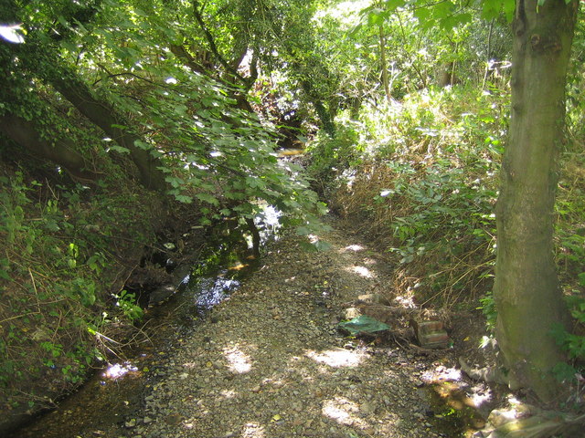
Rags Brook

Rags Brook is a tributary of the Small River Lea, which is a tributary of the River Lea. Rags Brook rises in the hills between Goffs Oak Cuffley in Hertfordshire...

Cheshunt Park

Cheshunt Park is a 40 hectare public park and Local Nature Reserve in Cheshunt in Hertfordshire. It is owned and managed by Broxbourne Borough Council...

Bishops' College, Cheshunt

Bishops' College, Cheshunt was an Anglican theological College set up to train clergy to serve in the Church of England. It was housed in buildings formerly...

Goffs Oak

Goffs Oak (Goff's Oak on Ordnance Survey maps) is a large village in the borough of Broxbourne in Hertfordshire in the United Kingdom. It lies between...

Goffs-Churchgate Academy

Goffs-Churchgate Academy is a secondary school with academy status located in Cheshunt, Hertfordshire, England with around 600 students. == History... ==

Broxbourne (UK Parliament constituency)

Broxbourne is a constituency in Hertfordshire represented in the House of Commons of the UK Parliament since 2005 by Charles Walker of the Conservative...

Nearby Amenities

Located within 500m of 51.712336,-0.060435
Mini Roundabout
Direction: clockwise
Lat/Long: 51.7148278/-0.0557582
Noexit: yes
Lat/Long: 51.7081625/-0.0622199
Mini Roundabout
Direction: clockwise
Lat/Long: 51.7143083/-0.056145
Noexit: yes
Lat/Long: 51.7082301/-0.0575889
Noexit: yes
Lat/Long: 51.7110345/-0.0630295
Noexit: yes
Lat/Long: 51.7110553/-0.0580675
Noexit: yes
Lat/Long: 51.7140773/-0.0552372
Noexit: yes
Lat/Long: 51.7150062/-0.056666
Bus Stop
School
Naptan AtcoCode: 210021700600
Naptan Bearing: W
Naptan CommonName: School
Naptan Indicator: opp
Naptan Landmark: Unknown
Naptan NaptanCode: hrtamgtg
Naptan PlusbusZoneRef: CHESHNT
Naptan ShortCommonName: NA
Naptan Street: Longfield Lane
Naptan Verified: no
Public Transport: platform
Source: naptan_import
Lat/Long: 51.7155378/-0.0573335
Bus Stop
Hornbeam Way
Bus: yes
Local Ref: NR
Naptan AtcoCode: 210021700725
Naptan Bearing: N
Naptan CommonName: Hornbeam Way
Naptan Indicator: nr
Naptan Landmark: Unknown
Naptan NaptanCode: hrtamgmj
Naptan PlusbusZoneRef: CHESHNT
Naptan ShortCommonName: NA
Naptan Street: Rosedale Way
Naptan Verified: no
Public Transport: platform
Source: naptan_import
Lat/Long: 51.7081917/-0.0611945
Bus Stop
Granby Park Road
Local Ref: NR
Naptan AtcoCode: 210021700730
Naptan Bearing: N
Naptan CommonName: Granby Park Road
Naptan Crossing: Andrew's Lane
Naptan Indicator: nr
Naptan Landmark: Andrew's Lane
Naptan NaptanCode: hrtamgmp
Naptan PlusbusZoneRef: CHESHNT
Naptan ShortCommonName: NA
Naptan Street: Rosedale Way
Naptan Verified: no
Public Transport: platform
Source: naptan_import
Lat/Long: 51.7112322/-0.0612527
Bus Stop
Fourfields
Naptan AtcoCode: 210021700740
Naptan Bearing: N
Naptan CommonName: Fourfields
Naptan Indicator: N-bound
Naptan Landmark: Unknown
Naptan NaptanCode: hrtamgmt
Naptan PlusbusZoneRef: CHESHNT
Naptan ShortCommonName: NA
Naptan Street: Rosedale Way
Naptan Verified: no
Public Transport: platform
Source: naptan_import
Lat/Long: 51.7136593/-0.0606567
Bus Stop
Jacksons Drive
Naptan AtcoCode: 210021700750
Naptan Bearing: E
Naptan CommonName: Jacksons Drive
Naptan Crossing: Rose Court
Naptan Indicator: opp
Naptan Landmark: Rose Court
Naptan NaptanCode: hrtamgmw
Naptan PlusbusZoneRef: CHESHNT
Naptan ShortCommonName: NA
Naptan Street: Rosedale Way
Naptan Verified: no
Public Transport: platform
Source: naptan_import
Lat/Long: 51.7144591/-0.0568151
Bus Stop
Jacksons Drive
Local Ref: NR
Naptan AtcoCode: 210021700920
Naptan Bearing: W
Naptan CommonName: Jacksons Drive
Naptan Crossing: Jacksons Drive
Naptan Indicator: nr
Naptan Landmark: Jacksons Drive
Naptan NaptanCode: hrtamgjg
Naptan PlusbusZoneRef: CHESHNT
Naptan ShortCommonName: NA
Naptan Street: Rosedale Way
Naptan Verified: no
Public Transport: platform
Source: naptan_import
Lat/Long: 51.7143318/-0.0572694
Bus Stop
Fourfields
Naptan AtcoCode: 210021700940
Naptan Bearing: S
Naptan CommonName: Fourfields
Naptan Indicator: S-bound
Naptan Landmark: Unknown
Naptan NaptanCode: hrtamgjm
Naptan PlusbusZoneRef: CHESHNT
Naptan ShortCommonName: NA
Naptan Street: Rosedale Way
Naptan Verified: no
Public Transport: platform
Source: naptan_import
Lat/Long: 51.7133046/-0.0604113
Bus Stop
Granby Park Road
Naptan AtcoCode: 210021700960
Naptan Bearing: S
Naptan CommonName: Granby Park Road
Naptan Crossing: Valence Drive
Naptan Indicator: opp
Naptan Landmark: Valence Drive
Naptan NaptanCode: hrtamgaj
Naptan PlusbusZoneRef: CHESHNT
Naptan ShortCommonName: NA
Naptan Street: Rosedale Way
Naptan Verified: no
Public Transport: platform
Source: naptan_import
Lat/Long: 51.7118249/-0.0606628
Bus Stop
Hornbeam Way
Bus: yes
Naptan AtcoCode: 210021700965
Naptan Bearing: S
Naptan CommonName: Hornbeam Way
Naptan Crossing: Goffs Lane
Naptan Indicator: opp
Naptan Landmark: Goffs Lane
Naptan NaptanCode: hrtamgam
Naptan PlusbusZoneRef: CHESHNT
Naptan ShortCommonName: NA
Naptan Street: Rosedale Way
Naptan Verified: no
Public Transport: platform
Source: naptan_import
Lat/Long: 51.7083936/-0.0608964
Bus Stop
School
Local Ref: NR
Naptan AtcoCode: 210021703000
Naptan Bearing: SE
Naptan CommonName: School
Naptan Indicator: nr
Naptan Landmark: Unknown
Naptan NaptanCode: hrtajwpm
Naptan PlusbusZoneRef: CHESHNT
Naptan ShortCommonName: NA
Naptan Street: Longfield Lane
Naptan Verified: no
Public Transport: platform
Source: naptan_import
Lat/Long: 51.7155881/-0.0571142
Noexit: yes
Lat/Long: 51.7165105/-0.0578248
Noexit: yes
Lat/Long: 51.7120903/-0.0618422
Post Box
Lat/Long: 51.7135714/-0.0604589
Fixme: fncfd
Source: gps+mapnoter
Lat/Long: 51.713323/-0.0577104
Noexit: yes
Lat/Long: 51.7132571/-0.0541131
Noexit: yes
Lat/Long: 51.710418/-0.0615087
Noexit: yes
Lat/Long: 51.7115431/-0.0612509
Noexit: yes
Lat/Long: 51.709904/-0.061483
Noexit: yes
Lat/Long: 51.7105707/-0.0631882
Noexit: yes
Lat/Long: 51.7094622/-0.0619266
Noexit: yes
Lat/Long: 51.7101933/-0.0650426
Noexit: yes
Lat/Long: 51.713079/-0.0594437
Noexit: yes
Lat/Long: 51.7131913/-0.0590335
Noexit: yes
Lat/Long: 51.7125648/-0.058062
Noexit: yes
Lat/Long: 51.7137601/-0.0554341
Noexit: yes
Lat/Long: 51.7123011/-0.0606787
Noexit: yes
Lat/Long: 51.7121342/-0.0622
Noexit: yes
Lat/Long: 51.712083/-0.0599548
Noexit: yes
Lat/Long: 51.7119964/-0.0598493
Noexit: yes
Lat/Long: 51.711763/-0.0589877
Noexit: yes
Lat/Long: 51.7113317/-0.0635615
Noexit: yes
Lat/Long: 51.7078978/-0.0608487
Noexit: yes
Lat/Long: 51.7081254/-0.0623464
Noexit: yes
Lat/Long: 51.7095585/-0.0637367
Noexit: yes
Lat/Long: 51.7095499/-0.0636097
Noexit: yes
Lat/Long: 51.7083076/-0.0581923
Noexit: yes
Lat/Long: 51.7083775/-0.0583553
Noexit: yes
Lat/Long: 51.7086419/-0.0602058
Noexit: yes
Lat/Long: 51.7078596/-0.060169
Noexit: yes
Lat/Long: 51.7080229/-0.0592713
The data included in this document is from www.openstreetmap.org. The data is made available under ODbL.

Have you been to Rosedale?

Leave your review of Rosedale below (or comments, questions and feedback).