Blackird Leys

Settlement in Oxfordshire Oxford

England

Blackird Leys

A4074 towards Oxford The bridge carries Sandford Road between Sandford and Littlemore.
A4074 towards Oxford Credit: Robin Webster

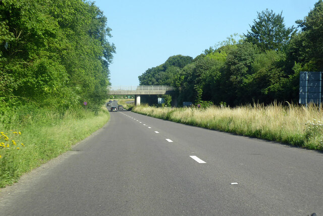
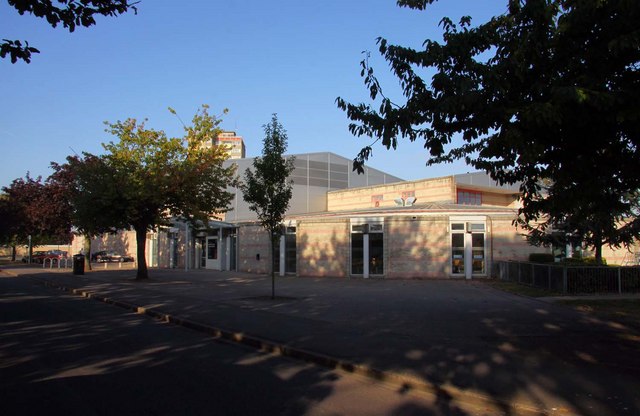
Blackbird Leys is a large housing estate located on the eastern outskirts of Oxford, Oxfordshire, England. It covers an area of approximately 1.3 square kilometers and is home to a diverse community of approximately 13,000 residents.

Originally built in the 1950s as a response to the post-war housing shortage, Blackbird Leys was initially intended as social housing. However, over time, the estate has undergone significant changes and now includes a mix of social and private housing.

The estate is known for its distinct architectural style, characterized by low-rise brick buildings and an abundance of green spaces. Blackbird Leys houses a range of community facilities, including a community center, a library, a health center, and several schools.

The estate has a reputation for being a close-knit community, with a strong sense of identity and community spirit. It is served by regular bus services, providing easy access to the city center and other parts of Oxfordshire.

Despite its positive aspects, Blackbird Leys has faced some challenges over the years, including issues related to crime and social deprivation. However, community initiatives and investment in recent years have aimed to address these challenges and improve the overall quality of life for residents.

Overall, Blackbird Leys remains an important residential area within Oxford, offering affordable housing and a sense of community for its residents.

If you have any feedback on the listing, please let us know in the comments section below.

Blackird Leys Images

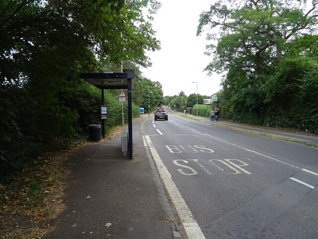
Images are sourced within 2km of 51.723033/-1.2051634 or Grid Reference SP5503. Thanks to Geograph Open Source API. All images are credited.

A4074 towards Oxford The bridge carries Sandford Road between Sandford and Littlemore.
A4074 towards Oxford
The bridge carries Sandford Road between Sandford and Littlemore.
Sign of the times on A4074 Towards Oxford.
Sign of the times on A4074
Towards Oxford.
The Kassam Stadium The Kassam Stadium is the home of Oxford United.
The Kassam Stadium
The Kassam Stadium is the home of Oxford United.
Grenoble Way Road near Oxford.
Grenoble Way
Road near Oxford.
Entrance to Horspath Sports Ground Home to Oxford Harlequins RFC, Oxford City Athletics Club, and Eire Og Gaelic Games Club.
Entrance to Horspath Sports Ground
Home to Oxford Harlequins RFC, Oxford City Athletics Club, and Eire Og Gaelic Games Club.
Stagecoach bus depot, Horspath Road
Barracks Lane
Barracks Lane
The Catherine Wheel, Sandford-on-Thames On Henley Road.
See <a href="https://www.geograph.org.uk/photo/7247930">SP5301 : Sign for the Catherine Wheel, Sandford-on-Thames</a> for sign.
The Catherine Wheel, Sandford-on-Thames
Sign for the Catherine Wheel, Sandford-on-Thames See <a href="https://www.geograph.org.uk/photo/7247929">SP5301 : The Catherine Wheel, Sandford-on-Thames</a> for context.
Sign for the Catherine Wheel, Sandford-on-Thames
Road junction on Henley Road, Sandford-on-Thames
Cottages on Henley Road, Sandford-on-Thames
Henley Road, Sandford-on-Thames
A4074 towards Oxford From the bridge on Sandford Road.
A4074 towards Oxford
From the bridge on Sandford Road.
Sandford Road bridging the A4074 Towards Littlemore.
Sandford Road bridging the A4074
Towards Littlemore.
Bus stop and shelter on Sandford Road
Railway towards Oxford Single track line from the BMW-Mini car factory.
Railway towards Oxford
Single track line from the BMW-Mini car factory.
The George, Littlemore, Oxford On Sandford Road.
See <a href="https://www.geograph.org.uk/photo/7247944">SP5302 : Sign for the George, Littlemore, Oxford</a> for sign.
The George, Littlemore, Oxford
On Sandford Road. See SP5302 : Sign for the George, Littlemore, Oxford for sign.
Sign for the George, Littlemore, Oxford See <a href="https://www.geograph.org.uk/photo/7247943">SP5302 : The George, Littlemore, Oxford</a> for context.
Sign for the George, Littlemore, Oxford
Show me another place!

Blackird Leys is located at Grid Ref: SP5503 (Lat: 51.723033, Lng: -1.2051634)

Administrative County: Oxfordshire

District: Oxford

Police Authority: Thames Valley

What 3 Words

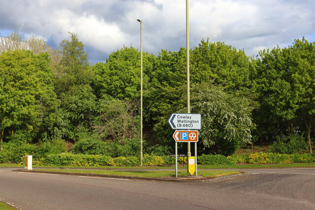
///woof.branded.dash. Near Cowley, Oxfordshire

Nearby Locations

Blackird Leys

Related Wikis

Death of Dr. Michael Meenaghan

Dr. Michael "Spike" Meenaghan was a forensic scientist at Oxford University who was shot dead through his kitchen window on 10 December 1994. He was a...

Blackbird Leys

Blackbird Leys is a civil parish and ward in Oxford, England. According to the 2011 census, the population of the ward (whose boundaries may change occasionally...
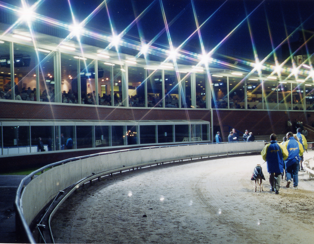
Oxford Stadium

Oxford Stadium is a greyhound racing and speedway venue in Oxford, located in Sandy Lane, Cowley.Races were historically held every Tuesday, Thursday and...

Morris Cowley railway station

Morris Cowley was an intermediate station on the Wycombe Railway which served the small town of Cowley, just outside Oxford, from 1908 to 1915, and again...
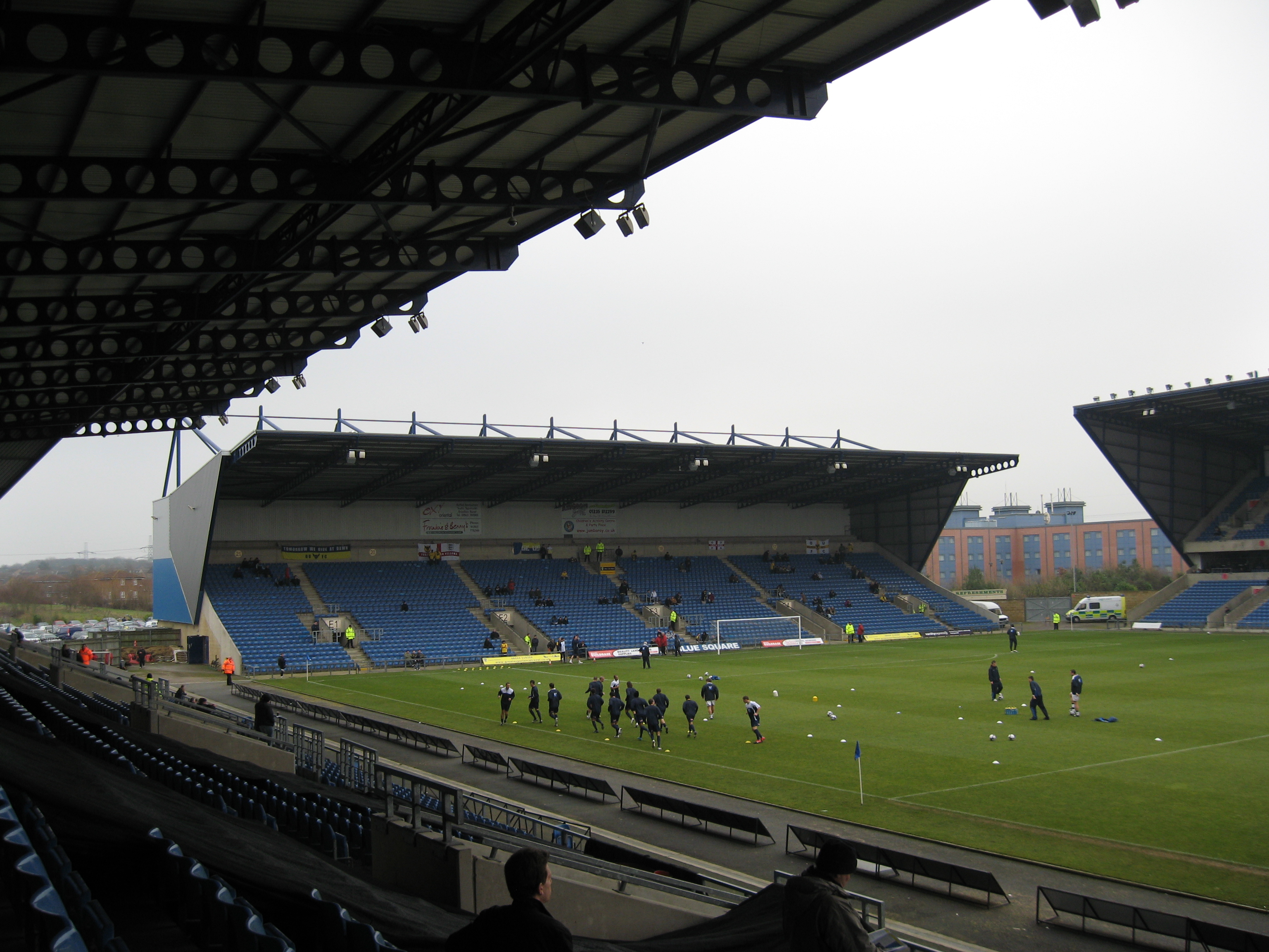
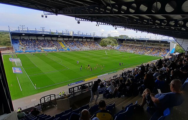
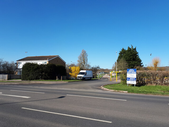
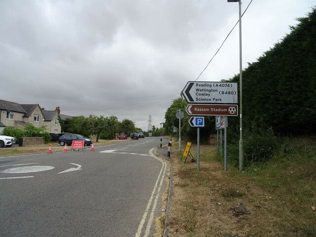
Kassam Stadium

The Kassam Stadium (also known as Grenoble Road) is the home of Oxford United Football Club, and is named after the ground's owner and former chairman...

Magna Carta College

Magna Carta College (also known as Magna Carta College, Oxford and formerly as GBSO) is an independent business school in Oxford, United Kingdom. ��2...

Oxford Military College

Oxford Military College was an all-male private boarding school and military academy in Cowley, Oxford, England, from 1876 to 1896. The military college...

Oxford Academy, Oxfordshire

The Oxford Academy is a coeducational secondary school and sixth form located in Littlemore, Oxford, England. Formerly Peers School, it was re-opened as...

Nearby Amenities

Located within 500m of 51.723033,-1.2051634
Motorway Junction
Lat/Long: 51.7273243/-1.204767
Mini Roundabout
Direction: clockwise
Traffic Calming: table
Lat/Long: 51.7221419/-1.2045275
Mini Roundabout
Direction: clockwise
Lat/Long: 51.7238584/-1.2083394
Traffic Calming: table
Lat/Long: 51.7223598/-1.2077624
Mini Roundabout
Direction: clockwise
Traffic Calming: table
Lat/Long: 51.7219846/-1.2040662
Source: Bing;local_knowledge
Traffic Calming: hump
Lat/Long: 51.7229954/-1.2035209
Source: Bing;local_knowledge
Traffic Calming: hump
Lat/Long: 51.7241302/-1.2009053
Traffic Calming: island
Lat/Long: 51.7254267/-1.2097032
Turning Circle
Turning Circle: knuckle
Lat/Long: 51.7236498/-1.2115213
Railway: level_crossing
Lat/Long: 51.7211289/-1.2105325
Mini Roundabout
Direction: clockwise
Lat/Long: 51.7230162/-1.2088184
Source: Bing
Traffic Calming: hump
Lat/Long: 51.7232491/-1.2043502
Post Box
Collection Times: Mo-Fr 17:00; Sa 12:00
Post Box Type: pillar
Ref: OX4 815
Royal Cypher: EIIR
Source: photograph
Lat/Long: 51.723466/-1.2045908
Bicycle Parking
Bicycle Parking: stands
Capacity: 14
Covered: yes
Lat/Long: 51.7270824/-1.2031879
Post Box
Collection Times: Mo-Fr 17:00; Sa 12:00
Ref: OX4 768
Source: photograph
Lat/Long: 51.7244762/-1.199323
Turning Circle
Turning Circle: square
Lat/Long: 51.7229512/-1.2073408
Crossing
Crossing: uncontrolled
Lat/Long: 51.7195743/-1.209023
Turning Circle
Turning Circle: square
Lat/Long: 51.7198929/-1.2056021
Post Box
Collection Times: Mo-Fr 18:30; Sa 12:00
Post Box Type: pillar
Ref: OX4 802
Lat/Long: 51.7206148/-1.2017316
Telephone
Booth: KX100
Covered: booth
Lat/Long: 51.7205134/-1.2015351
Telephone
Booth: KX100
Covered: booth
Phone: +44 1865 775929
Lat/Long: 51.7233979/-1.204623
Best One
Brand Wikidata: Q4896532
Contact Website: https://stores.best-one.co.uk/best-one-e047c533a573
Shop: convenience
Source: local_knowledge
Lat/Long: 51.7245792/-1.1989314
Created By: osm2go v0.6.13
Lat/Long: 51.7202596/-1.2032754
Created By: osm2go v0.6.13
Lat/Long: 51.719475/-1.2028531
Created By: osm2go v0.6.13
Lat/Long: 51.7202207/-1.2032125
Bus Stop
Kersington Cres.
Bus: yes
Bus Routes: 1;5;10;12
Bus Stop Ref: 69325283
Direction: S
Naptan AtcoCode: 340001225CNR
Naptan Bearing: S
Naptan CommonName: Kersington Crescent
Naptan Indicator: Corner
Naptan Landmark: Kersington Crescent
Naptan NaptanCode: oxfajatd
Naptan PlusbusZoneRef: OXFD
Naptan Street: Kersington Crescent
Public Transport: platform
Source: naptan_import
Lat/Long: 51.7258124/-1.2097693
Turning Circle
Lat/Long: 51.726781/-1.2074158
Atm
Check Date: 2021-05-04
Operator: Tesco Bank
Lat/Long: 51.7268851/-1.2024364
Crossing
Check Date Crossing: 2022-03-14
Crossing: uncontrolled
Crossing Ref: zebra
Tactile Paving: yes
Lat/Long: 51.7274205/-1.203834
Crossing
Crossing: traffic_signals
Crossing Ref: pelican
Lat/Long: 51.7225429/-1.2056079
Post Box
Collection Times: Mo-Fr 17:00; Sa 12:00
Post Box Type: pillar
Postal Code: OX4
Ref: OX4 784
Royal Cypher: EIIR
Royal Cypher Wikidata: Q33102113
Lat/Long: 51.7218895/-1.2067518
Created By: osm2go v0.6.13
Lat/Long: 51.7196085/-1.2025657
Created By: osm2go v0.6.13
Lat/Long: 51.7200871/-1.203464
Post Box
Check Date: 2021-11-16
Collection Times: Mo-Fr 17:30; Sa 11:45
Ref: OX4 10
Royal Cypher: EIIR
Royal Cypher Wikidata: Q33102113
Lat/Long: 51.7271459/-1.2027036
Maxspeed: 20 mph
Maxspeed Note: Oxford 20 mph zone
Maxspeed Spec: A point 186m SE of its junction w/ Sandy Lane West
Lat/Long: 51.7228352/-1.2062594
Maxspeed: 20 mph
Maxspeed Note: Oxford 20 mph zone
Maxspeed Spec: to jn with Cuddesdon Way
Lat/Long: 51.7207054/-1.2011441
Bus Stop
Sandy Lane
Bus: yes
Naptan AtcoCode: 340001219CNR
Naptan Bearing: NE
Naptan CommonName: Sandy Lane
Naptan Indicator: corner Sandy Lane
Naptan Landmark: Sandy Lane
Naptan NaptanCode: oxfajawa
Naptan PlusbusZoneRef: OXFD
Naptan Street: Balfour Road
Naptan Verified: no
Public Transport: platform
Ref: 69325292
Route Ref: 1;5;10
Source: naptan_import
Lat/Long: 51.7227466/-1.2040168
Bus Stop
Kersington Cres.
Bench: yes
Bin: yes
Bus: yes
Bus Routes: 1;5;10;12
Direction: N
Naptan AtcoCode: 340001225OPP
Naptan Bearing: N
Naptan CommonName: Kersington Crescent
Naptan Indicator: Opposite
Naptan Landmark: Kersington Crescent
Naptan NaptanCode: oxfajata
Naptan PlusbusZoneRef: OXFD
Naptan Street: Kersington Crescent
Public Transport: platform
Ref: 69325282
Shelter: yes
Source: naptan_import;photograph
Tactile Paving: no
Lat/Long: 51.7264225/-1.2099115
Bus Stop
Knights Road
Bus: yes
Naptan AtcoCode: 340001226OPP
Naptan Bearing: E
Naptan CommonName: Knights Road
Naptan Indicator: Opposite Post Office
Naptan Landmark: Post Office
Naptan NaptanCode: oxfajapw
Naptan PlusbusZoneRef: OXFD
Naptan Street: Knights Road
Naptan Verified: no
Public Transport: platform
Ref: 69325279
Lat/Long: 51.7202384/-1.2032831
Bus Stop
Oxford FE College
Bus: yes
Naptan AtcoCode: 340001228OPP
Naptan Bearing: N
Naptan CommonName: Oxford FE College
Naptan Indicator: Opp Evenlode Tower
Naptan Landmark: Evenlode Tower
Naptan NaptanCode: oxfajapm
Naptan PlusbusZoneRef: OXFD
Naptan Street: Blackbird Leys Road
Naptan Verified: no
Public Transport: platform
Source: naptan_import
Lat/Long: 51.7198305/-1.2007606
Bus Stop
Oxford FE College
Bus: yes
Frequency: 0
Naptan AtcoCode: 340001228OUT
Naptan Bearing: S
Naptan CommonName: Oxford FE College
Naptan Indicator: Adj Evenlode Tower
Naptan Landmark: Evenlode Tower
Naptan NaptanCode: oxfajapj
Naptan PlusbusZoneRef: OXFD
Naptan Street: Blackbird Leys Road
Naptan Verified: no
Public Transport: platform
Source: naptan_import
Lat/Long: 51.7201777/-1.2009679
Bus Stop
Sandy Lane West
Bus: yes
Naptan AtcoCode: 340001230ERB
Naptan Bearing: SE
Naptan CommonName: Sandy Lane West
Naptan Indicator: East of Rail Bridge
Naptan Landmark: Sandy Lane West
Naptan NaptanCode: oxfajapd
Naptan PlusbusZoneRef: OXFD
Naptan Street: Blackbird Leys Road
Public Transport: platform
Ref: 69325273
Route Ref: 1;5;10;12
Shelter: no
Source: naptan_import
Lat/Long: 51.7229765/-1.2064439
Bus Stop
Sandy Lane West
Bus: yes
Naptan AtcoCode: 340001230OPP
Naptan Bearing: NW
Naptan CommonName: Sandy Lane West
Naptan Indicator: Adj Mallard Close
Naptan Landmark: Sandy Lane West
Naptan NaptanCode: oxfajapa
Naptan PlusbusZoneRef: OXFD
Naptan Street: Blackbird Leys Road
Public Transport: platform
Route Ref: 1;5;10;12
Shelter: yes
Source: naptan_import
Lat/Long: 51.7226351/-1.2059437
Bus Stop
Spindleberry Close
Bus: yes
Naptan AtcoCode: 340001232CNR
Naptan Bearing: NW
Naptan CommonName: Spindleberry Close
Naptan Indicator: Corner
Naptan Landmark: Spindleberry Close
Naptan NaptanCode: oxfajdjt
Naptan PlusbusZoneRef: OXFD
Naptan Street: Pegasus Road
Naptan Verified: no
Public Transport: platform
Ref: 69325358
Shelter: yes
Source: naptan_import
Lat/Long: 51.7190539/-1.2049687
Bus Stop
The Blackbird
Bus: yes
Naptan AtcoCode: 340001233OMO
Naptan Bearing: NW
Naptan CommonName: The Blackbird
Naptan Indicator: Opposite Moorbank
Naptan Landmark: The Blackbird PH
Naptan NaptanCode: oxfajatw
Naptan PlusbusZoneRef: OXFD
Naptan Street: Blackbird Leys Road
Public Transport: platform
Ref: 69325289
Shelter: yes
Source: naptan_import
Lat/Long: 51.7213648/-1.2025413
Bus Stop
The Blackbird
Bus: yes
Naptan AtcoCode: 340001233OMR
Naptan Bearing: SE
Naptan CommonName: The Blackbird
Naptan Indicator: Opposite Merlin Road
Naptan Landmark: The Blackbird PH
Naptan NaptanCode: oxfajdpg
Naptan PlusbusZoneRef: OXFD
Naptan Street: Blackbird Leys Road
Naptan Verified: no
Public Transport: platform
Source: naptan_import
Lat/Long: 51.7218763/-1.2035005
Bus Stop
Wingate Close
Bus: yes
Naptan AtcoCode: 340001234CNR
Naptan Bearing: E
Naptan CommonName: Wingate Close
Naptan Indicator: Corner
Naptan Landmark: Wingate Close
Naptan NaptanCode: oxfajdpd
Naptan PlusbusZoneRef: OXFD
Naptan Street: Balfour Road
Naptan Verified: no
Public Transport: platform
Source: naptan_import
Lat/Long: 51.7237322/-1.2021841
Martin's
Brand: Martin's
Brand Wikidata: Q116779207
Shop: convenience
Website: https://my.morrisons.com/storefinder/60181/martins-oxford-balfour-road
Lat/Long: 51.7245593/-1.1991889
Co-Op Funeral Care
Operator: Central England Co-operative
Operator Wikidata: Q16986583
Shop: funeral_directors
Website: https://stores.centralengland.coop/oxford/71-balfour-road
Lat/Long: 51.7245659/-1.1991003
J. E. Pill & Son
Shop: butcher
Lat/Long: 51.7245709/-1.1990172
Atm
Lat/Long: 51.7204609/-1.2016669
Atm
Lat/Long: 51.7205772/-1.2018385
Trimmers
Shop: hairdresser
Lat/Long: 51.7206503/-1.2020317
Agnes Smith Advice Centre
Lat/Long: 51.720603/-1.2019633
Post Office
Martin's
Brand: Martin's
Brand Wikidata: Q116779207
Shop: newsagent
Lat/Long: 51.7205573/-1.201897
Pharmacy
The Leys Pharmacy
Addr City: Oxford
Addr Housenumber: 100
Addr Street: Blackbird Leys Road
Healthcare: pharmacy
Operator: The Leys Pharmacy
Website: https://www.theleyspharmacy.co.uk/
Lat/Long: 51.7205153/-1.2018362
Deltey
Shop: supermarket
Lat/Long: 51.7204576/-1.2017527
Ladbrokes
Brand: Ladbrokes
Brand Wikidata: Q1799875
Shop: bookmaker
Lat/Long: 51.7203579/-1.2015971
Nash's Bakery
Shop: bakery
Lat/Long: 51.7203114/-1.2015328
Fast Food
Jake's
Addr City: Oxford
Addr Housenumber: 110
Addr Postcode: OX4 6HS
Addr Street: Blackbird Leys Road
Cuisine: pizza;burger;kebab;chicken;fried_chicken
Opening Hours: Mo-Sa 11:30-23:00; Su 14:00-23:00
Operator: Jake's Takeaway
Phone: +44 1865 45 41 41
Website: https://www.jakestakeaway.co.uk/
Lat/Long: 51.7202582/-1.2014684
Source: Bing;local_knowledge
Traffic Calming: hump
Lat/Long: 51.7235515/-1.2025155
Source: Bing;local_knowledge
Traffic Calming: hump
Lat/Long: 51.7244092/-1.199246
Source: Bing
Traffic Calming: hump
Lat/Long: 51.7229753/-1.203904
Source: Bing;local_knowledge
Traffic Calming: hump
Lat/Long: 51.723876/-1.2016912
Source: Bing;local_knowledge
Traffic Calming: hump
Lat/Long: 51.7243338/-1.1998467
Source: Bing;local_knowledge
Traffic Calming: hump
Lat/Long: 51.7224162/-1.2042571
Barrier: cycle_barrier
Lat/Long: 51.7196083/-1.2090606
Barrier: bollard
Bicycle: yes
Foot: yes
Lat/Long: 51.7193049/-1.2086863
Traffic Calming: island
Lat/Long: 51.7237828/-1.2081656
Crossing
Crossing: unmarked
Lat/Long: 51.7237613/-1.2084951
Traffic Calming: island
Lat/Long: 51.7222057/-1.2047578
Fast Food
Cuisine: chinese
Lat/Long: 51.7206759/-1.2022749
Main Entrance
Entrance: main
Lat/Long: 51.7209778/-1.200444
Pedestrian Entrance
Entrance: yes
Lat/Long: 51.720814/-1.2007231
Bicycle Parking
Lat/Long: 51.7207649/-1.2003364
Motorcycle Parking
Lat/Long: 51.7207608/-1.2003254
Reception
Entrance: yes
Lat/Long: 51.7206466/-1.2001988
Tesco Superstore
Brand: Tesco
Brand Wikidata: Q487494
Brand Wikipedia: en:Tesco
Contact Website: https://www.tesco.com/store-locator/oxford/unit-7-oxford-retail-park
Shop: supermarket
Lat/Long: 51.7267829/-1.2028916
Man Made: manhole
Manhole: yes
Lat/Long: 51.7239868/-1.2013354
The Glow Tree
Artist Name: Neil Wood
Artwork Type: sculpture
Material: steel
Start Date: 2005
Tourism: artwork
Lat/Long: 51.7213433/-1.2019922
Direction: 145
Generator Method: photovoltaic
Generator Output Electricity: yes
Generator Solar Modules: 12
Generator Source: solar
Generator Type: solar_photovoltaic_panel
Location: roof
Power: generator
Lat/Long: 51.7241935/-1.2030664
Direction: 170
Generator Method: photovoltaic
Generator Output Electricity: yes
Generator Solar Modules: 16
Generator Source: solar
Generator Type: solar_photovoltaic_panel
Location: roof
Power: generator
Lat/Long: 51.724218/-1.1995273
Direction: SSE
Generator Method: photovoltaic
Generator Output Electricity: yes
Generator Solar Modules: 15
Generator Source: solar
Generator Type: solar_photovoltaic_panel
Location: roof
Power: generator
Lat/Long: 51.724299/-1.2006602
Direction: 165
Generator Method: photovoltaic
Generator Output Electricity: yes
Generator Solar Modules: 15
Generator Source: solar
Generator Type: solar_photovoltaic_panel
Location: roof
Power: generator
Lat/Long: 51.7244473/-1.2000054
Bicycle Parking
Access: yes
Bicycle Parking: stands
Capacity: 8
Covered: yes
Fee: no
Lat/Long: 51.7268907/-1.2036131
Waste Basket
Waste: trash
Lat/Long: 51.720446/-1.2011378
Waste Basket
Waste: cigarettes;trash
Lat/Long: 51.7203738/-1.2014491
Waste Basket
Waste: cigarettes;trash
Lat/Long: 51.720822/-1.2020763
Waste Basket
Waste: cigarettes;trash
Lat/Long: 51.7206304/-1.2018589
Recycling
Recycling Aluminium: yes
Recycling Cardboard: yes
Recycling Glass: yes
Recycling Glass Bottles: yes
Recycling Paper: yes
Recycling Plastic: yes
Recycling Plastic Bottles: yes
Recycling Type: container
Lat/Long: 51.720627/-1.2018558
Waste Basket
Waste: cigarettes;trash
Lat/Long: 51.7204366/-1.2016171
Waste Basket
Waste: cigarettes;trash
Lat/Long: 51.7205497/-1.2017246
Waste Basket
Waste: cigarettes;trash
Lat/Long: 51.7208004/-1.2022171
Waste Basket
Waste: trash
Lat/Long: 51.7213736/-1.1996163
Bench
Backrest: yes
Material: metal
Seats: 3
Lat/Long: 51.7216496/-1.1992267
Waste Basket
Waste: cigarettes;trash
Lat/Long: 51.7206817/-1.2024208
Direction: 140
Generator Method: photovoltaic
Generator Output Electricity: yes
Generator Solar Modules: 15
Generator Source: solar
Generator Type: solar_photovoltaic_panel
Location: roof
Power: generator
Lat/Long: 51.7232524/-1.2026466
Traffic Calming: island
Lat/Long: 51.722056/-1.2043044
Traffic Calming: island
Lat/Long: 51.7209157/-1.2015087
Traffic Calming: island
Lat/Long: 51.7210378/-1.2017195
Traffic Calming: island
Lat/Long: 51.7212205/-1.2020704
Traffic Calming: hump
Lat/Long: 51.7215532/-1.1995468
Direction: 140
Generator Method: photovoltaic
Generator Output Electricity: yes
Generator Solar Modules: 12
Generator Source: solar
Generator Type: solar_photovoltaic_panel
Location: roof
Power: generator
Lat/Long: 51.7239261/-1.2048838
Direction: 140
Generator Method: photovoltaic
Generator Output Electricity: yes
Generator Solar Modules: 8
Generator Source: solar
Generator Type: solar_photovoltaic_panel
Location: roof
Power: generator
Lat/Long: 51.7236435/-1.2055734
Direction: 140
Generator Method: photovoltaic
Generator Output Electricity: yes
Generator Solar Modules: 16
Generator Source: solar
Generator Type: solar_photovoltaic_panel
Location: roof
Power: generator
Lat/Long: 51.7244201/-1.205587
Direction: 140
Generator Method: photovoltaic
Generator Output Electricity: yes
Generator Solar Modules: 12
Generator Source: solar
Generator Type: solar_photovoltaic_panel
Location: roof
Power: generator
Lat/Long: 51.7244388/-1.2054952
Traffic Calming: hump
Lat/Long: 51.7188229/-1.2042957
Traffic Calming: hump
Lat/Long: 51.7190063/-1.2047853
Power: substation
Lat/Long: 51.7188808/-1.2048636
Fixme: solar panels?
Lat/Long: 51.7192296/-1.2046994
Direction: 150
Fixme: survey for panel count
Generator Method: photovoltaic
Generator Output Electricity: yes
Generator Solar Modules: 12
Generator Source: solar
Generator Type: solar_photovoltaic_panel
Location: roof
Power: generator
Lat/Long: 51.7195859/-1.2057034
Direction: 140
Fixme: survey for panel count
Generator Method: photovoltaic
Generator Output Electricity: yes
Generator Solar Modules: 14
Generator Source: solar
Generator Type: solar_photovoltaic_panel
Location: roof
Power: generator
Lat/Long: 51.720259/-1.208009
Direction: 140
Fixme: survey for panel count
Generator Method: photovoltaic
Generator Output Electricity: yes
Generator Solar Modules: 8
Generator Source: solar
Generator Type: solar_photovoltaic_panel
Location: roof
Power: generator
Lat/Long: 51.7204376/-1.2084068
Direction: 140
Generator Method: photovoltaic
Generator Output Electricity: yes
Generator Solar Modules: 9
Generator Source: solar
Generator Type: solar_photovoltaic_panel
Location: roof
Power: generator
Lat/Long: 51.7208266/-1.2084863
Direction: 130
Generator Method: photovoltaic
Generator Output Electricity: yes
Generator Solar Modules: 8
Generator Source: solar
Generator Type: solar_photovoltaic_panel
Location: roof
Power: generator
Lat/Long: 51.7211206/-1.2087403
Direction: 225
Fixme: survey for panel count
Generator Method: photovoltaic
Generator Output Electricity: yes
Generator Solar Modules: 12
Generator Source: solar
Generator Type: solar_photovoltaic_panel
Location: roof
Power: generator
Lat/Long: 51.7203367/-1.209485
Fixme: solar oanels?
Lat/Long: 51.7203745/-1.2094411
Direction: 125
Generator Method: photovoltaic
Generator Output Electricity: yes
Generator Solar Modules: 12
Generator Source: solar
Generator Type: solar_photovoltaic_panel
Location: roof
Power: generator
Lat/Long: 51.7212453/-1.2097006
Direction: 125
Generator Method: photovoltaic
Generator Output Electricity: yes
Generator Solar Modules: 11
Generator Source: solar
Generator Type: solar_photovoltaic_panel
Location: roof
Power: generator
Lat/Long: 51.721426/-1.2094778
Direction: 125
Generator Method: photovoltaic
Generator Output Electricity: yes
Generator Solar Modules: 12
Generator Source: solar
Generator Type: solar_photovoltaic_panel
Location: roof
Power: generator
Lat/Long: 51.7224842/-1.2081719
Direction: 215
Generator Method: photovoltaic
Generator Output Electricity: yes
Generator Solar Modules: 12
Generator Source: solar
Generator Type: solar_photovoltaic_panel
Location: roof
Power: generator
Lat/Long: 51.7219382/-1.2070143
Direction: 205
Generator Method: photovoltaic
Generator Output Electricity: yes
Generator Solar Modules: 8
Generator Source: solar
Generator Type: solar_photovoltaic_panel
Location: roof
Power: generator
Lat/Long: 51.7222339/-1.2056205
Direction: 115
Generator Method: photovoltaic
Generator Output Electricity: yes
Generator Solar Modules: 7
Generator Source: solar
Generator Type: solar_photovoltaic_panel
Location: roof
Power: generator
Lat/Long: 51.7211725/-1.2044718
Direction: 255
Generator Method: photovoltaic
Generator Output Electricity: yes
Generator Solar Modules: 15
Generator Source: solar
Generator Type: solar_photovoltaic_panel
Location: roof
Power: generator
Tilt: 10
Lat/Long: 51.7229291/-1.2119587
Direction: 255
Generator Method: photovoltaic
Generator Output Electricity: yes
Generator Solar Modules: 26
Generator Source: solar
Generator Type: solar_photovoltaic_panel
Location: roof
Power: generator
Tilt: 10
Lat/Long: 51.7227112/-1.2118841
Direction: 255
Generator Method: photovoltaic
Generator Output Electricity: yes
Generator Solar Modules: 11
Generator Source: solar
Generator Type: solar_photovoltaic_panel
Location: roof
Power: generator
Tilt: 10
Lat/Long: 51.7225726/-1.2118329
Direction: 255
Generator Method: photovoltaic
Generator Output Electricity: yes
Generator Solar Modules: 14
Generator Source: solar
Generator Type: solar_photovoltaic_panel
Location: roof
Power: generator
Tilt: 10
Lat/Long: 51.7223898/-1.2117615
Direction: 330
Generator Method: photovoltaic
Generator Output Electricity: yes
Generator Solar Modules: 14
Generator Source: solar
Generator Type: solar_photovoltaic_panel
Location: roof
Power: generator
Tilt: 10
Lat/Long: 51.7221963/-1.2114262
Direction: 330
Generator Method: photovoltaic
Generator Output Electricity: yes
Generator Solar Modules: 27
Generator Source: solar
Generator Type: solar_photovoltaic_panel
Location: roof
Power: generator
Tilt: 10
Lat/Long: 51.7220899/-1.2117748
Direction: 330
Generator Method: photovoltaic
Generator Output Electricity: yes
Generator Solar Modules: 13
Generator Source: solar
Generator Type: solar_photovoltaic_panel
Location: roof
Power: generator
Tilt: 10
Lat/Long: 51.722004/-1.2120568
Turning Circle
Turning Circle: knuckle
Lat/Long: 51.7213927/-1.210682
Crossing
Crossing: unmarked
Lat/Long: 51.7233394/-1.2091431
Direction: 220
Generator Method: photovoltaic
Generator Output Electricity: yes
Generator Solar Modules: 63
Generator Source: solar
Generator Type: solar_photovoltaic_panel
Location: roof
Power: generator
Lat/Long: 51.727069/-1.2065565
Bench
Lat/Long: 51.7251833/-1.2105062
Leisure: picnic_table
Lat/Long: 51.7249067/-1.2117257
Waste Basket
Lat/Long: 51.7251932/-1.2104275
Waste Basket
Lat/Long: 51.7249672/-1.2116411
Waste Basket
Lat/Long: 51.725146/-1.2105163
Bench
Lat/Long: 51.7249462/-1.2113791
Barrier: bollard
Lat/Long: 51.7201319/-1.2017364
Post Office
Balfour Road Post Office
Addr Postcode: OX4 6AG
Brand: Post Office
Brand Wikidata: Q1783168
Opening Hours: Mo-Sa 06:00-18:30; Su 07:00-13:00
Operator: Martin's
Operator Wikidata: Q116779207
Ref Pol Id: 1001
Website: https://www.postoffice.co.uk/branch-finder/0891371/balfour-road
Lat/Long: 51.7245776/-1.1991915
Restaurant
MOMO
Cuisine: romanian
Website: https://www.momooxford.co.uk/
Lat/Long: 51.7237483/-1.2108751
Addr Housenumber: 30
Addr Street: Moorbank
Lat/Long: 51.7228412/-1.2013853
The data included in this document is from www.openstreetmap.org. The data is made available under ODbL.

Have you been to Blackird Leys?

Leave your review of Blackird Leys below (or comments, questions and feedback).