Romford

Settlement in Kent Tunbridge Wells

England

Romford

Footpath to Dundale Road This field path is part of a long path leading from Hastings Road, Pembury towards the road near Dundale Farm.
Footpath to Dundale Road Credit: David Anstiss

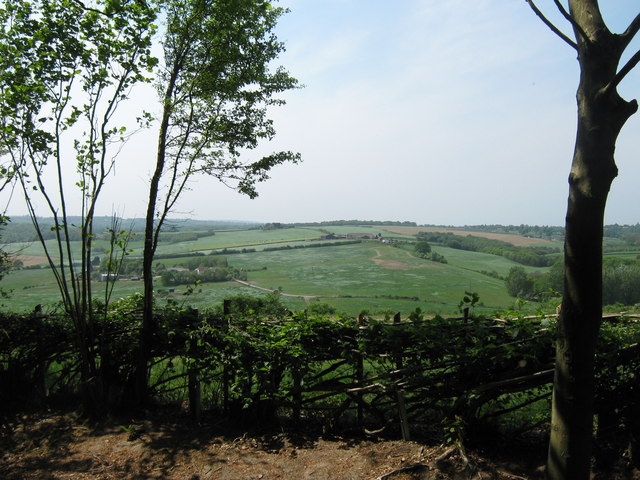
Romford is a small village located in the county of Kent, England. Situated in the southeastern part of the country, Romford is nestled in the picturesque countryside, surrounded by rolling hills and lush green fields. The village is known for its tranquility and charm, offering a peaceful retreat from the hustle and bustle of city life.

With a population of around 2,000 residents, Romford maintains a tight-knit community atmosphere. The village is centered around a historic church, which dates back to the 12th century, showcasing its rich heritage and architectural beauty. The village also boasts a few local shops and amenities, including a traditional pub and a post office, catering to the daily needs of its inhabitants.

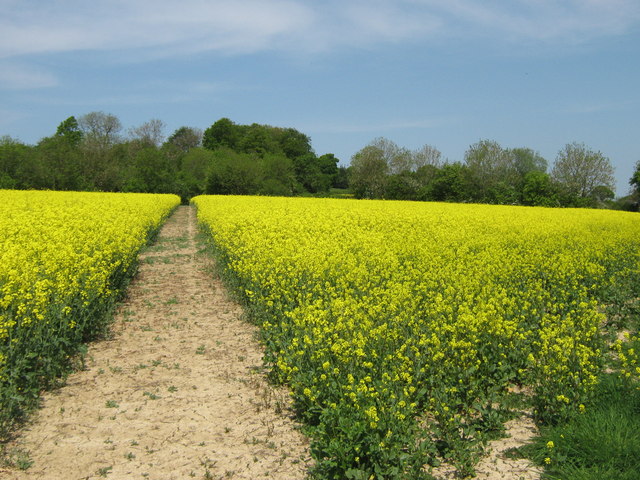
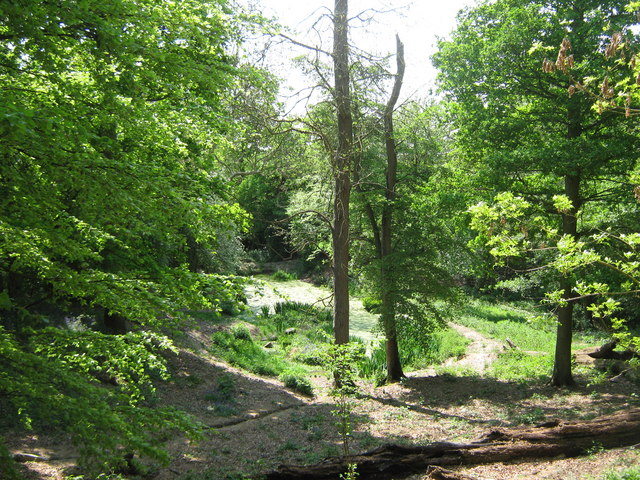
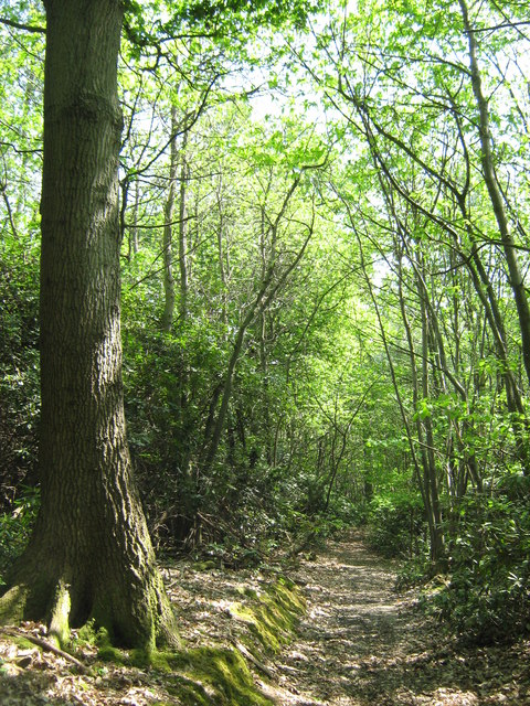
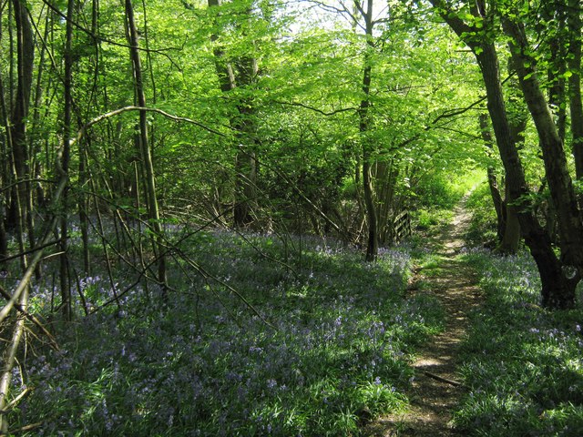
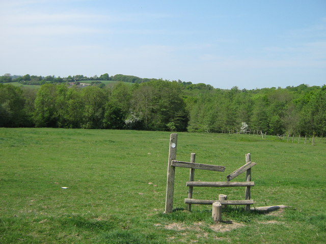
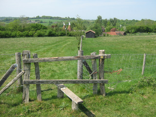
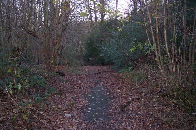
Nature enthusiasts are drawn to Romford for its stunning landscapes and scenic walking trails. The village is surrounded by several nature reserves and parks, providing ample opportunities for outdoor activities such as hiking, birdwatching, and picnicking. The nearby River Medway offers a peaceful spot for fishing and boating, adding to the recreational options available to residents and visitors alike.

Romford's location within Kent provides easy access to larger towns and cities in the region. The village is well-connected by road and public transportation, allowing for convenient travel to nearby locations such as Maidstone and Canterbury. Additionally, London is within commuting distance, making Romford an attractive place to reside for those seeking a quieter lifestyle while still having access to urban amenities and employment opportunities.

Overall, Romford is a charming village in the heart of the Kent countryside, offering a peaceful and picturesque setting for its residents and visitors to enjoy.

If you have any feedback on the listing, please let us know in the comments section below.

Romford Images

Images are sourced within 2km of 51.145566/0.340971 or Grid Reference TQ6341. Thanks to Geograph Open Source API. All images are credited.

Footpath to Dundale Road This field path is part of a long path leading from Hastings Road, Pembury towards the road near Dundale Farm.
Footpath to Dundale Road
This field path is part of a long path leading from Hastings Road, Pembury towards the road near Dundale Farm.
Small pond near Great Bayhall Farm This pond is beside a footpath from Hastings Road, Pembury heading down to Dundale Farm. Overlooked by two picnic tables.  See <a href="https://www.geograph.org.uk/photo/1409246">TQ6239 : Picnic Bench beside footpath</a>.
Small pond near Great Bayhall Farm
This pond is beside a footpath from Hastings Road, Pembury heading down to Dundale Farm. Overlooked by two picnic tables. See TQ6239 : Picnic Bench beside footpath.
Layered hedge near Great Bayhall Farm As seen from a footpath towards Pembury.
Layered hedge near Great Bayhall Farm
As seen from a footpath towards Pembury.
Footpath in Marlborough Wood A footpath leads from the A21 near Pastheap Farm through the wood, towards Dundale Road near Elmhurst Farm.
Footpath in Marlborough Wood
A footpath leads from the A21 near Pastheap Farm through the wood, towards Dundale Road near Elmhurst Farm.
Footpath in Marlborough Wood A footpath leads from the A21 near Pastheap Farm through the wood, towards Dundale Road near Elmhurst Farm. In the background is a footbridge leading over a stream beside the wood.
Footpath in Marlborough Wood
A footpath leads from the A21 near Pastheap Farm through the wood, towards Dundale Road near Elmhurst Farm. In the background is a footbridge leading over a stream beside the wood.
Unused stile near Elmhurst Farm A footpath leads from Dundale Road near Elmhurst Farm, towards Marlborough Wood (in the background) and then through the wood towards the A21 near Pastheap Farm.
Unused stile near Elmhurst Farm
A footpath leads from Dundale Road near Elmhurst Farm, towards Marlborough Wood (in the background) and then through the wood towards the A21 near Pastheap Farm.
The Stables, Elmhurst Farm On Dundale Road, opposite the farm. Stables been converted into housing.
The Stables, Elmhurst Farm
On Dundale Road, opposite the farm. Stables been converted into housing.
Stile towards Elmhurst Farm A footpath leads from the A21 near Key's Green towards Dundale Road and Elmhurst Farm (seen in the background).
Stile towards Elmhurst Farm
A footpath leads from the A21 near Key's Green towards Dundale Road and Elmhurst Farm (seen in the background).
Mobile Phone Mast near Pembury This large phone mast is beside two large covered water reservoirs on hill near Key's Green.
Mobile Phone Mast near Pembury
This large phone mast is beside two large covered water reservoirs on hill near Key's Green.
Service Area, Kipping's Cross This small service area is located just south of the Kipping's Cross roundabout at the end of the Pembury bypass, on the A21. It has a fuel filling station, a Marks & Spencer and a Wild Bean Coffee shop.
Service Area, Kipping's Cross
This small service area is located just south of the Kipping's Cross roundabout at the end of the Pembury bypass, on the A21. It has a fuel filling station, a Marks & Spencer and a Wild Bean Coffee shop.
Blue Boys Formerly a pub, now a cafe by the A21.
Blue Boys
Formerly a pub, now a cafe by the A21.
Tunbridge Wells Services, Kipping Cross Just off the A21.
Tunbridge Wells Services, Kipping Cross
Just off the A21.
Muddy path A 27 mile circular walk around the town of Tunbridge Wells. The route was established in 1989 as part of the centenary celebrations of the town being granted the Borough Charter. There is no official start or end to the walk. The walk visits Southborough, Pembury, Frant, Eridge, Groombridge and Speldhurst as well as Eridge Rocks and Harrison Rocks. It is well signed along its entire length. As well as the main path there are four link paths from Tunbridge Wells and High Brooms stations to meet the path at Groombridge, Speldhurst, Southborough and Hawkenbury.
Muddy path
A 27 mile circular walk around the town of Tunbridge Wells. The route was established in 1989 as part of the centenary celebrations of the town being granted the Borough Charter. There is no official start or end to the walk. The walk visits Southborough, Pembury, Frant, Eridge, Groombridge and Speldhurst as well as Eridge Rocks and Harrison Rocks. It is well signed along its entire length. As well as the main path there are four link paths from Tunbridge Wells and High Brooms stations to meet the path at Groombridge, Speldhurst, Southborough and Hawkenbury.
River Teise The River Teise is a tributary of the River Medway in Kent. It begins in Dunorlan Park, Tunbridge Wells, and flows eastwards past Bayham Abbey and then through Lamberhurst. 3km downstream of Lamberhurst the small River Bewl, on which is the reservoir Bewl Water, joins the Teise.

Unusually the Teise bifurcates 2km southwest of the village of Marden, passing either side of a low ridge. The Lesser Teise flows for about 6.5km before joining the River Beult at Hunton. The Greater Teise, now carrying only minor quantities, flows for about 8km to the River Medway at Twyford Bridge, upstream of Yalding, formerly the site of a double ford over both the Medway and Teise rivers.
River Teise
The River Teise is a tributary of the River Medway in Kent. It begins in Dunorlan Park, Tunbridge Wells, and flows eastwards past Bayham Abbey and then through Lamberhurst. 3km downstream of Lamberhurst the small River Bewl, on which is the reservoir Bewl Water, joins the Teise. Unusually the Teise bifurcates 2km southwest of the village of Marden, passing either side of a low ridge. The Lesser Teise flows for about 6.5km before joining the River Beult at Hunton. The Greater Teise, now carrying only minor quantities, flows for about 8km to the River Medway at Twyford Bridge, upstream of Yalding, formerly the site of a double ford over both the Medway and Teise rivers.
River Teise, Cooper's Rough The River Teise is a tributary of the River Medway in Kent. It begins in Dunorlan Park, Tunbridge Wells, and flows eastwards past Bayham Abbey and then through Lamberhurst. 3km downstream of Lamberhurst the small River Bewl, on which is the reservoir Bewl Water, joins the Teise.

Unusually the Teise bifurcates 2km southwest of the village of Marden, passing either side of a low ridge. The Lesser Teise flows for about 6.5km before joining the River Beult at Hunton. The Greater Teise, now carrying only minor quantities, flows for about 8km to the River Medway at Twyford Bridge, upstream of Yalding, formerly the site of a double ford over both the Medway and Teise rivers.
River Teise, Cooper's Rough
The River Teise is a tributary of the River Medway in Kent. It begins in Dunorlan Park, Tunbridge Wells, and flows eastwards past Bayham Abbey and then through Lamberhurst. 3km downstream of Lamberhurst the small River Bewl, on which is the reservoir Bewl Water, joins the Teise. Unusually the Teise bifurcates 2km southwest of the village of Marden, passing either side of a low ridge. The Lesser Teise flows for about 6.5km before joining the River Beult at Hunton. The Greater Teise, now carrying only minor quantities, flows for about 8km to the River Medway at Twyford Bridge, upstream of Yalding, formerly the site of a double ford over both the Medway and Teise rivers.
Hodges Oast Single round kiln oast house.
Hodges Oast
Single round kiln oast house.
Fields near Hodges Farm Looking from Dundale Road.
Fields near Hodges Farm
Looking from Dundale Road.
Dundale Road Looking north from the edge of woodland.
Dundale Road
Looking north from the edge of woodland.
Show me another place!

Romford is located at Grid Ref: TQ6341 (Lat: 51.145566, Lng: 0.340971)

Administrative County: Kent

District: Tunbridge Wells

Police Authority: Kent

What 3 Words

///nutty.rifled.dorm. Near Pembury, Kent

Related Wikis

Pembury

Pembury is a large village in Kent, in the south east of England, with a population of 6,128 at the 2011 Census. It lies just to the north-east of Royal...

Brenchley Wood

Brenchley Wood is a 15-hectare (37-acre) nature reserve south of Paddock Wood in Kent. It is managed by the Kent Wildlife Trust, and it is part of the...

St Luke's Church, Matfield

St Luke's Church is a parish church in the village of Matfield, Kent, England. It is a Grade II listed building.The church is dedicated to Luke the Evangelist...

Matfield

Matfield is a small village, part of the civil parish of Brenchley and Matfield, in the Tunbridge Wells borough of Kent, England. Matfield was awarded...

Matfield House

Matfield House is a Grade I listed Georgian house in the village of Matfield, Kent, England.The house was built in 1728 in the Queen Anne style for Thomas...

Kent College, Pembury

Kent College is an independent day and boarding school from 3-18. Forest Explorers Nursery is for girls and boys from rising 3 years, boys can join Reception...

Tunbridge Wells Hospital

Tunbridge Wells Hospital is a large district general hospital in Pembury near Royal Tunbridge Wells, Kent, England, run by the Maidstone and Tunbridge...

Pembury Cutting and Pit

Pembury Cutting and Pit is a 1.6-hectare (4.0-acre) geological Site of Special Scientific Interest east of Tunbridge Wells in Kent. It is a Geological...

Nearby Amenities

Located within 500m of 51.145566,0.340971
Romford
Place: hamlet
Lat/Long: 51.1452388/0.3378651
Barrier: stile
Lat/Long: 51.1433086/0.3404645
Barrier: stile
Material: wood
Step Count: 2
Stile: stepover
Lat/Long: 51.1445967/0.3409848
Fixme: this fp carries on...
Lat/Long: 51.1493659/0.3390392
Fixme: this fp carries on...
Lat/Long: 51.1496098/0.341339
Fixme: this fp carries on...
Lat/Long: 51.1499588/0.3409191
Post Box
Collection Times: Mo-Fr 09:00; Sa 07:00
Operator: Royal Mail
Post Box Type: lamp
Ref: TN2 237D
Royal Cypher: EIIR
Royal Cypher Wikidata: Q33102113
Lat/Long: 51.1470117/0.3436033
Post Box
Operator: Royal Mail
Post Box Type: wall
Ref: TN2 34
Royal Cypher: VR
Royal Cypher Wikidata: Q33102356
Lat/Long: 51.1450733/0.3371933
Turning Circle
Lat/Long: 51.14611/0.3444347
Turning Circle
Lat/Long: 51.1468317/0.3443754
The data included in this document is from www.openstreetmap.org. The data is made available under ODbL.

Have you been to Romford?

Leave your review of Romford below (or comments, questions and feedback).