Roe Green

Settlement in Hertfordshire Welwyn Hatfield

England

Roe Green

Inside the Horse and Groom, Hatfield A lovely old public  house.
Inside the Horse and Groom, Hatfield Credit: Christine Matthews

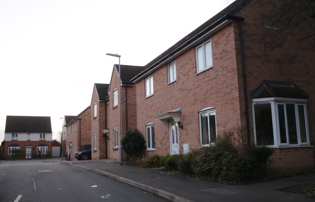
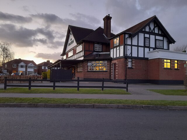
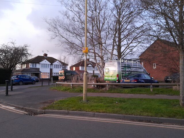
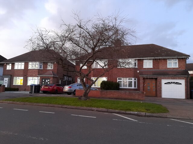
Roe Green is a small village located in the county of Hertfordshire, England. Situated approximately 15 miles northwest of central London, the village falls within the borough of Brent. It is known for its picturesque surroundings, charming cottages, and tranquil atmosphere.

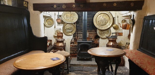
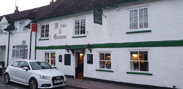
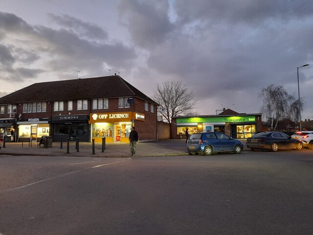
The village is home to a close-knit community, with a population of around 2,000 residents. It offers a range of amenities, including a primary school, a community center, a local pub, and a few shops for everyday needs. The surrounding countryside provides ample opportunities for outdoor activities, such as walking, cycling, and horse riding.

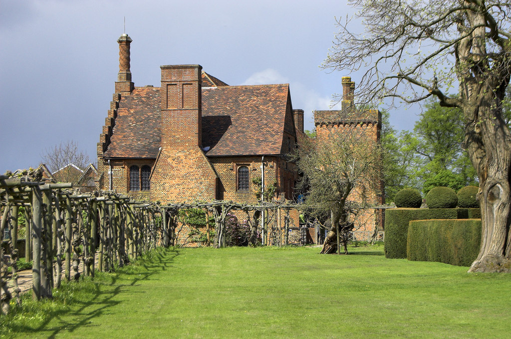
Roe Green has a rich history, with some of its buildings dating back to the 17th century. The village has managed to preserve its traditional character, with many of the original cottages and farmhouses still intact. The stunning architecture and old-world charm make it an attractive destination for visitors seeking a glimpse into rural English life.

Transport links to Roe Green are convenient, with easy access to major road networks like the M1 and A41. Public transportation is also readily available, with regular bus services connecting the village to nearby towns and the wider region.

Overall, Roe Green is a delightful village that offers a peaceful and idyllic setting for its residents and visitors alike. Its combination of historic charm, natural beauty, and community spirit make it a truly special place within Hertfordshire.

If you have any feedback on the listing, please let us know in the comments section below.
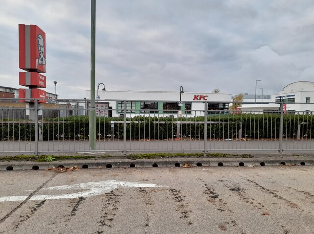
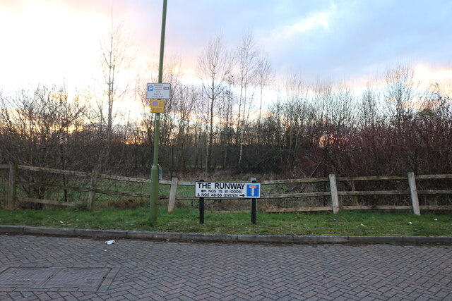
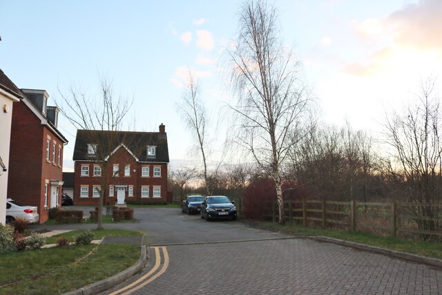
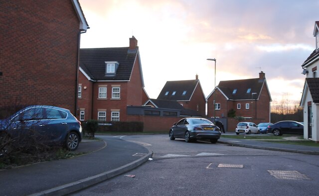
Roe Green Images

Images are sourced within 2km of 51.762123/-0.231157 or Grid Reference TL2208. Thanks to Geograph Open Source API. All images are credited.

Inside the Horse and Groom, Hatfield A lovely old public  house.
Inside the Horse and Groom, Hatfield
A lovely old public house.
Horse and Groom, Hatfield A lovely old public  house.
Horse and Groom, Hatfield
A lovely old public house.
Old Hatfield at Night Moon behind clouds.
Old Hatfield at Night
Moon behind clouds.
The Galleria, Hatfield
The YMCA on Comet Way, Hatfield
The Galleria, Hatfield
KFC on Comet Way, Hatfield This is an original art deco building which has been fully restored
KFC on Comet Way, Hatfield
This is an original art deco building which has been fully restored
The Runway, Hatfield Now no longer a runway but a huge mock-Georgian housing estate. This is the end of the runway and the road.
The Runway, Hatfield
Now no longer a runway but a huge mock-Georgian housing estate. This is the end of the runway and the road.
The Runway, Hatfield No longer a runway but a huge estate.
The Runway, Hatfield
No longer a runway but a huge estate.
The Runway, Hatfield
Seat Garage on The Great North Road, Hatfield
Sovereign Place, Hatfield
Mount Pleasant Lane, Hatfield
The Hopfields, Birchwood A very typical suburban pub style.
The Hopfields, Birchwood
A very typical suburban pub style.
Shops on Birchwood Avenue, Hatfield
Birchwood Avenue, Hatfield
Houses on Birchwood Avenue, Hatfield
Show me another place!

Roe Green is located at Grid Ref: TL2208 (Lat: 51.762123, Lng: -0.231157)

Administrative County: Hertfordshire

District: Welwyn Hatfield

Police Authority: Hertfordshire

What 3 Words

///button.edgy.united. Near Hatfield, Hertfordshire

Nearby Locations

Roe Green Hatfield

Related Wikis

Lemsford Road Halt railway station

Lemsford Road Halt was a railway station on the St Albans Branch of the Great Northern Railway. The platforms are still visible next to the line of the...

Hatfield, Hertfordshire

Hatfield is a town and civil parish in Hertfordshire, England, in the borough of Welwyn Hatfield. It had a population of 29,616 in 2001, 39,201 at the...

Bishop's Hatfield Girls' School

Bishop's Hatfield Girls' School is a girls' secondary academy school for years 7 to sixth form. It is located in Hatfield, Hertfordshire in Wood's Avenue...

The Galleria, Hatfield

The Galleria is a designer outlet centre in Hatfield, Hertfordshire in South-East England. == History == The Galleria was constructed in 1991 as part of...

David Lloyd Leisure

David Lloyd Leisure is a chain of health clubs with its headquarters in the United Kingdom. It is the largest health, fitness and leisure business in Europe...

Onslow St Audrey's School

Onslow St Audrey's School is a co-educational secondary school and sixth form situated in Hatfield, Hertfordshire in England. It specialises in business...

Howe Dell

Howe Dell is a 4 hectare Local Nature Reserve in Hatfield in Hertfordshire. The declaring authority is Welwyn Hatfield Borough Council. The site is woodland...

Hatfield Rural District

Hatfield Rural District was a rural district in Hertfordshire, England, from 1894 to 1974, covering an area in the south of the county. == Evolution... ==

Nearby Amenities

Located within 500m of 51.762123,-0.231157
Hatfield
Is In: Hertfordshire, UK
Name Ru: Хатфилд
Place: town
Population: 37577
Wikidata: Q19788
Wikipedia: en:Hatfield, Hertfordshire
Lat/Long: 51.7634675/-0.2258741
Crossing
Crossing: traffic_signals
Crossing Island: no
Crossing Ref: toucan
Tactile Paving: yes
Lat/Long: 51.7620709/-0.2272529
Turning Circle
Lat/Long: 51.7582991/-0.2325193
Bus Stop
Oaktree Close
Bus: yes
Naptan AtcoCode: 210021602510
Naptan Bearing: N
Naptan CommonName: Oaktree Close
Naptan Indicator: opp
Naptan Landmark: Unknown
Naptan NaptanCode: hrtapmpw
Naptan PlusbusZoneRef: HATFILD
Naptan ShortCommonName: NA
Naptan Street: Lemsford Road
Naptan Verified: no
Public Transport: platform
Source: naptan_import
Lat/Long: 51.7651148/-0.2336856
Bus Stop
Swim Centre
Bus: yes
Naptan AtcoCode: 210021602515
Naptan Bearing: NW
Naptan CommonName: Swim Centre
Naptan Crossing: opp The Common
Naptan Indicator: nr
Naptan Landmark: opp The Common
Naptan NaptanCode: hrtapmta
Naptan PlusbusZoneRef: HATFILD
Naptan ShortCommonName: NA
Naptan Street: Lemsford Road
Public Transport: platform
Source: naptan_import
Lat/Long: 51.7624881/-0.2315819
Bus Stop
Woods Avenue
Bus: yes
Naptan AtcoCode: 210021602540
Naptan Bearing: S
Naptan CommonName: Woods Avenue
Naptan Crossing: Oaklands Wood
Naptan Indicator: S-bound
Naptan Landmark: Oaklands Wood
Naptan NaptanCode: hrtapmtg
Naptan PlusbusZoneRef: HATFILD
Naptan ShortCommonName: NA
Naptan Street: Woods Avenue
Naptan Verified: no
Public Transport: platform
Shelter: yes
Source: naptan_import
Lat/Long: 51.7609649/-0.2266311
Bus Stop
Town Centre
Bus: yes
Local Ref: U
Naptan AtcoCode: 210021602600
Naptan Bearing: W
Naptan CommonName: Gracemead House
Naptan Crossing: Gracemead House
Naptan Indicator: o/s
Naptan Landmark: Gracemead House
Naptan NaptanCode: hrtapmtw
Naptan PlusbusZoneRef: HATFILD
Naptan ShortCommonName: NA
Naptan Street: Queensway
Naptan Verified: no
Public Transport: platform
Source: naptan_import
Lat/Long: 51.7619692/-0.2277453
Bus Stop
Holliers Way
Bus: yes
Naptan AtcoCode: 210021602610
Naptan Bearing: SE
Naptan BusStopType: CUS
Naptan CommonName: Holliers Way
Naptan Crossing: Bishop's Stortford Girls School
Naptan Indicator: opp
Naptan Landmark: Bishop's Stortford Girls School
Naptan NaptanCode: hrtapmwd
Naptan PlusbusZoneRef: HATFILD
Naptan ShortCommonName: NA
Naptan Street: Briars Lane
Naptan Verified: no
Public Transport: platform
Source: naptan_import
Lat/Long: 51.7591748/-0.2295901
Bus Stop
St Albans Road West
Bus: yes
Naptan AtcoCode: 210021602620
Naptan Bearing: SW
Naptan CommonName: St Albans Road West
Naptan Crossing: Feather Dell
Naptan Indicator: opp
Naptan Landmark: Feather Dell
Naptan NaptanCode: hrtapmwj
Naptan PlusbusZoneRef: HATFILD
Naptan ShortCommonName: NA
Naptan Street: Cavendish Way
Naptan Verified: no
Public Transport: platform
Source: naptan_import
Lat/Long: 51.7611715/-0.2333931
Bus Stop
Meadow Dell
Bus: yes
Naptan AtcoCode: 210021602630
Naptan Bearing: SW
Naptan CommonName: Meadow Dell
Naptan Indicator: opp
Naptan Landmark: Unknown
Naptan NaptanCode: hrtapmjg
Naptan PlusbusZoneRef: HATFILD
Naptan ShortCommonName: NA
Naptan Street: Cavendish Way
Naptan Verified: no
Public Transport: platform
Source: naptan_import
Lat/Long: 51.7601331/-0.2356798
Bus Stop
Holliers Way
Bus: yes
Local Ref: NR
Naptan AtcoCode: 210021602675
Naptan Bearing: NW
Naptan BusStopType: CUS
Naptan CommonName: Holliers Way
Naptan Crossing: opp New Briars JMI School
Naptan Indicator: nr
Naptan Landmark: opp New Briars JMI School
Naptan NaptanCode: hrtapmpa
Naptan PlusbusZoneRef: HATFILD
Naptan ShortCommonName: NA
Naptan Street: Briars Lane
Naptan Verified: no
Public Transport: platform
Source: naptan_import
Lat/Long: 51.7591511/-0.2297699
Bus Stop
Meadow Dell
Bus: yes
Naptan AtcoCode: 210021605120
Naptan Bearing: NE
Naptan CommonName: Meadow Dell
Naptan Indicator: nr
Naptan Landmark: Unknown
Naptan NaptanCode: hrtapdja
Naptan PlusbusZoneRef: HATFILD
Naptan ShortCommonName: NA
Naptan Street: Cavendish Way
Naptan Verified: no
Public Transport: platform
Source: naptan_import
Lat/Long: 51.7599817/-0.2364975
Bus Stop
St Albans Road West
Bus: yes
Naptan AtcoCode: 210021605140
Naptan Bearing: E
Naptan CommonName: St Albans Road West
Naptan Crossing: Swim Centre
Naptan Indicator: nr
Naptan Landmark: Swim Centre
Naptan NaptanCode: hrtapdjd
Naptan PlusbusZoneRef: HATFILD
Naptan ShortCommonName: NA
Naptan Street: Cavendish Way
Naptan Verified: no
Public Transport: platform
Source: naptan_import
Lat/Long: 51.7613739/-0.2330479
Bus Stop
ASDA
Bus: yes
Naptan AtcoCode: 210021605150
Naptan Bearing: NE
Naptan CommonName: ASDA
Naptan Crossing: Asda
Naptan Indicator: o/s
Naptan Landmark: Asda
Naptan NaptanCode: hrtapdjg
Naptan PlusbusZoneRef: HATFILD
Naptan ShortCommonName: NA
Naptan Street: Queensway
Naptan Verified: no
Public Transport: platform
Source: naptan_import
Lat/Long: 51.7619592/-0.2293307
Bus Stop
Town Centre
Bus: yes
Local Ref: V
Naptan AtcoCode: 210021605220
Naptan Bearing: NE
Naptan CommonName: Market Place
Naptan Crossing: Market Place
Naptan Indicator: o/s
Naptan Landmark: Market Place
Naptan NaptanCode: hrtapdjw
Naptan PlusbusZoneRef: HATFILD
Naptan ShortCommonName: NA
Naptan Street: Queensway
Naptan Verified: no
Public Transport: platform
Shelter: yes
Source: naptan_import
Lat/Long: 51.7621505/-0.226248
Bus Stop
Oaktree Close
Bus: yes
Naptan AtcoCode: 210021605310
Naptan Bearing: S
Naptan CommonName: Oaktree Close
Naptan Indicator: nr
Naptan Landmark: Unknown
Naptan NaptanCode: hrtapatw
Naptan PlusbusZoneRef: HATFILD
Naptan ShortCommonName: NA
Naptan Street: Lemsford Road
Naptan Verified: no
Public Transport: platform
Source: naptan_import
Lat/Long: 51.7655716/-0.233516
Bus Stop
Swim Centre
Bus: yes
Naptan AtcoCode: 210021605315
Naptan Bearing: SE
Naptan CommonName: Swim Centre
Naptan Crossing: Stockbreach Road
Naptan Indicator: opp
Naptan Landmark: Stockbreach Road
Naptan NaptanCode: hrtapawa
Naptan PlusbusZoneRef: HATFILD
Naptan ShortCommonName: NA
Naptan Street: Lemsford Road
Public Transport: platform
Source: naptan_import
Lat/Long: 51.7628041/-0.2316627
Crossing
Crossing: uncontrolled
Crossing Island: no
Crossing Markings: zebra
Tactile Paving: yes
Lat/Long: 51.7631248/-0.2379043
Recycling
Recycling Cans: yes
Recycling Clothes: yes
Recycling Electrical Appliances: yes
Recycling Glass Bottles: yes
Recycling Plastic Bottles: yes
Recycling Type: container
Lat/Long: 51.7627475/-0.2274886
Crossing
Crossing: traffic_signals
Crossing Island: yes
Crossing Ref: toucan
Tactile Paving: no
Lat/Long: 51.7623059/-0.225472
Crossing
Crossing: traffic_signals
Crossing Island: yes
Crossing Ref: toucan
Tactile Paving: yes
Lat/Long: 51.7619522/-0.2271978
Fast Food
McDonald's
Addr City: London
Addr Housename: The Galleria
Addr Housenumber: 68
Addr Postcode: AL10 0XY
Addr Street: Comet Way
Brand: McDonald's
Brand Wikidata: Q38076
Brand Wikipedia: en:McDonald's
Contact Website: https://www.mcdonalds.com/gb/en-gb/location/hatfield/hatfield/68-the-galleria/8260423.html
Cuisine: burger
Drive Through: yes
Level: 0
Phone: +441707268440
Takeaway: yes
Lat/Long: 51.762921/-0.2379143
Disused Shop: yes
Level: 0
Lat/Long: 51.7627392/-0.2380749
Fast Food
Masala Hut
Cuisine: indian
Level: 1
Source: local_knowledge
Lat/Long: 51.7623358/-0.226546
Fast Food
Hatfield Kebab House
Cuisine: kebab
Lat/Long: 51.7625014/-0.2311854
Fast Food
Skippers
Cuisine: fish_and_chips
Opening Hours: Mo-Th 11:45-22:00; Fr 11:45-22:30; Sa 11:30-22:30; Su 14:00-22:00
Lat/Long: 51.7625239/-0.2310987
Fast Food
Peri-Peri Original
Cuisine: chicken
Lat/Long: 51.762668/-0.230584
Fast Food
Tops Pizza
Addr City: Hatfield
Addr Housenumber: 21
Addr Postcode: AL10 0LJ
Addr Street: Market Place
Brand: Tops Pizza
Brand Wikidata: Q24439136
Cuisine: pizza
Level: 0
Source: local_knowledge
Takeaway: yes
Lat/Long: 51.7625934/-0.226345
Fast Food
Pizza Go Go
Addr City: Hatfield
Addr Housenumber: 31
Addr Postcode: AL10 0LJ
Addr Street: Market Place
Cuisine: pizza
Fhrs Id: 182064
Level: 0
Lat/Long: 51.7623346/-0.2265204
Barrier: bollard
Lat/Long: 51.7622503/-0.2316406
Post Box
Collection Times: Mo-Fr 18:45; Sa 12:00
Operator: Royal Mail
Operator Wikidata: Q638098
Post Box Apertures: 2
Post Box Type: wall
Ref: AL10 18
Lat/Long: 51.7643235/-0.225938
Iceland
Brand: Iceland
Brand Wikidata: Q721810
Brand Wikipedia: en:Iceland (supermarket)
Contact Website: https://www.iceland.co.uk/store-finder/store?StoreID=707&StoreName=HATFIELD
Opening Hours: Mo-Sa 09:00-18:00; Su 10:00-16:00
Shop: frozen_food
Source: local_knowledge
Lat/Long: 51.7633447/-0.2269275
Post Box
Collection Times: Mo-Fr 18:30; Sa 12:00
Operator: Royal Mail
Operator Wikidata: Q638098
Post Box Type: pillar
Ref: AL10 311
Royal Cypher: EIIR
Royal Cypher Wikidata: Q33102113
Source: local_knowledge
Lat/Long: 51.7623298/-0.22638
Fast Food
Subway
Brand: Subway
Brand Wikidata: Q244457
Brand Wikipedia: en:Subway (restaurant)
Contact Website: https://restaurants.subway.com/united-kingdom/en/hatfield/42-the-common
Cuisine: sandwich
Opening Hours: Mo-Su 10:00-22:00
Takeaway: yes
Lat/Long: 51.7626548/-0.2306389
Turning Circle
Lat/Long: 51.7636141/-0.2267803
Street Lamp
Lat/Long: 51.7617671/-0.2265128
Restaurant
Hyderabad Flavours
Addr City: Hatfield
Addr Housenumber: 15
Addr Postcode: AL10 0LJ
Addr Street: Market Place
Cuisine: indian
Level: 0
Source: local_knowledge
Lat/Long: 51.7626527/-0.2261035
Dentist
Hatfield Dental Care
Healthcare: dentist
Level: 1
Source: local_knowledge
Lat/Long: 51.7624396/-0.2265505
Fast Food
Roast Duck Inn
Addr City: Hatfield
Addr Housenumber: 19
Addr Postcode: AL10 0LJ
Addr Street: Market Place
Cuisine: chinese
Fhrs Id: 1277892
Level: 0
Source: local_knowledge
Lat/Long: 51.7626151/-0.2262532
Fast Food
China Sky
Cuisine: chinese
Level: 1
Source: local_knowledge
Lat/Long: 51.7626586/-0.2261499
Fast Food
Bengal Spices
Addr City: Hatfield
Addr Housenumber: 10
Addr Postcode: AL10 0LN
Addr Street: Market Place
Cuisine: indian
Fhrs Id: 1007339
Fhrs Local Authority Id: PI/000086011
Level: 1
Lat/Long: 51.7627214/-0.2258956
Fast Food
Favourite Chicken & Ribs
Brand Wikidata: Q120070660
Cuisine: fried_chicken
Website: https://favorite.co.uk/store-finder/favorite-chicken-ribs-hatfield.html
Lat/Long: 51.7626819/-0.2305208
Crossing
Crossing: uncontrolled
Crossing Ref: zebra
Tactile Paving: yes
Lat/Long: 51.7621919/-0.2309033
Crossing
Crossing: uncontrolled
Crossing Ref: zebra
Tactile Paving: yes
Lat/Long: 51.7624222/-0.2295858
Noexit: yes
Lat/Long: 51.7622597/-0.2276882
Social Facility
Citizens Advice
Addr City: Hatfield
Addr Postcode: AL10 0LW
Addr Street: Queensway
Branch: Welwyn Hatfield
Brand: Citizens Advice
Brand Wikidata: Q5122657
Opening Hours: Mo-Tu 09:30-14:00; Th 09:30-14:00
Social Facility: outreach
Website: https://www.whcab.org.uk/
Lat/Long: 51.7621574/-0.2268102
Crossing
Crossing: traffic_signals
Crossing Island: yes
Crossing Ref: toucan
Tactile Paving: no
Lat/Long: 51.7622541/-0.2254172
Crossing
Crossing: uncontrolled
Crossing Ref: zebra
Lat/Long: 51.7623205/-0.2290784
Crossing
Crossing: uncontrolled
Crossing Ref: zebra
Lat/Long: 51.7621101/-0.2292223
Atm
Lat/Long: 51.7626619/-0.2284462
Direction: both
Traffic Calming: bump
Lat/Long: 51.7606179/-0.2272884
Direction: both
Traffic Calming: bump
Lat/Long: 51.7604701/-0.2278392
Bacau European Food
Cuisine: romanian;bulgarian
Level: 0
Shop: convenience
Lat/Long: 51.7625613/-0.2264862
Specsavers
Brand: Specsavers
Brand Wikidata: Q2000610
Brand Wikipedia: en:Specsavers
Contact Website: https://www.specsavers.co.uk/stores/hatfield
Shop: optician
Source: local_knowledge
Lat/Long: 51.7632969/-0.2271109
Shoe Zone
Brand: Shoe Zone
Brand Wikidata: Q7500016
Brand Wikipedia: en:Shoe Zone
Contact Website: https://www.shoezone.com/Stores/Hatfield-1178
Shop: shoes
Source: local_knowledge
Lat/Long: 51.7633721/-0.2268048
Bicycle Parking
Bicycle Parking: stands
Covered: no
Lat/Long: 51.7631553/-0.2279256
Crossing
Crossing: unmarked
Crossing Island: yes
Crossing Markings: no
Tactile Paving: yes
Lat/Long: 51.762168/-0.2277481
Crossing
Crossing: unmarked
Crossing Island: yes
Crossing Markings: no
Tactile Paving: yes
Lat/Long: 51.7621612/-0.2279612
Crossing
Crossing: unmarked
Crossing Island: no
Crossing Markings: no
Tactile Paving: yes
Lat/Long: 51.7640711/-0.2248434
Taxi
Capacity: 7
Lat/Long: 51.7625499/-0.2284404
Roe Green
Is In: Hatfield
Place: suburb
Lat/Long: 51.7599056/-0.232347
Restaurant
Prezzo
Brand: Prezzo
Brand Wikidata: Q7242489
Brand Wikipedia: en:Prezzo (restaurant)
Cuisine: italian
Indoor Seating: yes
Level: 0
Outdoor Seating: no
Lat/Long: 51.7630077/-0.2381393
Crossing
Crossing: unmarked
Crossing Island: yes
Crossing Markings: no
Tactile Paving: yes
Lat/Long: 51.7622076/-0.2312137
Barrier: bollard
Lat/Long: 51.762835/-0.2252401
Fast Food
Hatfield Best Kebab
Cuisine: kebab
Fhrs Id: 182039
Source: local_knowledge
Lat/Long: 51.7628133/-0.2250699
Ladbrokes
Brand: Ladbrokes
Brand Wikidata: Q1799875
Brand Wikipedia: en:Ladbrokes Coral
Shop: bookmaker
Lat/Long: 51.7626344/-0.2307204
Sims TV
Shop: electronics
Lat/Long: 51.7625435/-0.2310292
Palmer's Newsagents
Opening Hours: Mo-Su
Shop: newsagent
Lat/Long: 51.7624802/-0.2312771
Bradley James Hair
Shop: hairdresser
Lat/Long: 51.7626974/-0.2304637
Bicycle Parking
Bikepark Style: Sheffield
Capacity: 6
Source: survey
Lat/Long: 51.7628848/-0.2301591
Crossing
Crossing: unmarked
Crossing Island: no
Crossing Markings: no
Lat/Long: 51.7629628/-0.2300066
Bicycle Parking
Bicycle Parking: stands
Capacity: 10
Note: Sheffield stands
Lat/Long: 51.7644348/-0.2257537
Crossing
Crossing: unmarked
Crossing Island: no
Crossing Markings: no
Tactile Paving: no
Lat/Long: 51.764338/-0.2255115
Post Box
Operator: Royal Mail
Operator Wikidata: Q638098
Post Box Type: pillar
Ref: AL10 253
Royal Cypher: GVIR
Royal Cypher Wikidata: Q33102169
Lat/Long: 51.7608451/-0.2359977
Post Box
Collection Times: Mo-Fr 18:30; Sa 12:00
Description: On wide pavement.
10m E of Bingo Hall.
Opposite exit from ASDA Car Park.
Operator: Royal Mail
Operator Wikidata: Q638098
Post Box Type: pillar
Ref: AL10 161
Royal Cypher: GR
Royal Cypher Wikidata: Q33102273
Lat/Long: 51.7626096/-0.2306633
Post Box
Operator: Royal Mail
Operator Wikidata: Q638098
Post Box Type: pillar
Ref: AL10 260
Lat/Long: 51.759624/-0.234575
Post Box
Operator: Royal Mail
Operator Wikidata: Q638098
Post Box Type: lamp
Ref: AL10 322
Lat/Long: 51.76604/-0.23347
Post Box
Collection Times: Mo-Fr 18:30; Sa 12:00
Operator: Royal Mail
Operator Wikidata: Q638098
Post Box Apertures: 2
Post Box Design: type_c
Post Box Type: pillar
Ref: AL10 327
Royal Cypher: EIIR
Royal Cypher Wikidata: Q33102113
Lat/Long: 51.7636936/-0.2250524
Post Box
Operator: Royal Mail
Operator Wikidata: Q638098
Post Box Type: pillar
Ref: AL10 267
Lat/Long: 51.7578643/-0.2313739
Barrier: bollard
Lat/Long: 51.7643896/-0.225729
Crossing
Crossing: marked
Crossing Island: yes
Crossing Markings: zebra
Tactile Paving: yes
Lat/Long: 51.7633821/-0.2381184
Crossing
Crossing: unmarked
Crossing Island: no
Crossing Markings: no
Lat/Long: 51.7631139/-0.237698
Artwork Type: sculpture
Tourism: artwork
Lat/Long: 51.7620118/-0.2313308
Trimz House
Level: 1
Shop: hairdresser
Source: local_knowledge
Lat/Long: 51.7626321/-0.2262629
Crossing
Crossing: unmarked
Crossing Island: no
Crossing Markings: no
Lat/Long: 51.7632242/-0.2379592
Crossing
Crossing: unmarked
Crossing Markings: no
Lat/Long: 51.7615651/-0.2324015
Crossing
Crossing: unmarked
Crossing Island: no
Crossing Markings: no
Tactile Paving: no
Lat/Long: 51.7611862/-0.22683
Post Box
Collection Times: Mo-Fr 16:30, Sa 11:30
Operator: Royal Mail
Operator Wikidata: Q638098
Ref: AL10 328
Lat/Long: 51.762564/-0.2291565
Telephone
Booth: KX300
Covered: booth
Operator: BT
Operator Wikidata: Q593786
Lat/Long: 51.7626195/-0.23062
Entrance: service
Lat/Long: 51.7633778/-0.229106
Entrance: service
Lat/Long: 51.7635773/-0.228672
Crossing
Crossing: unmarked
Crossing Markings: no
Lat/Long: 51.7597995/-0.2371145
Crossing
Crossing: unmarked
Crossing Markings: no
Tactile Paving: yes
Lat/Long: 51.7654223/-0.2268616
Crossing
Crossing: unmarked
Crossing Markings: no
Lat/Long: 51.7659683/-0.2278724
Crossing
Crossing: unmarked
Crossing Island: no
Crossing Markings: no
Tactile Paving: yes
Lat/Long: 51.7647336/-0.2261932
Crossing
Crossing: unmarked
Crossing Island: yes
Crossing Markings: no
Tactile Paving: yes
Lat/Long: 51.7613849/-0.2325744
Crossing
Crossing: unmarked
Crossing Island: yes
Crossing Markings: no
Tactile Paving: yes
Lat/Long: 51.7645325/-0.2256294
Hatfield Conservative Club
Club: yes
Fixme: Does this still exist? WHTimes says it closed
Lat/Long: 51.7648064/-0.2263575
Bicycle Parking
Covered: yes
Lat/Long: 51.7621537/-0.2266711
Crossing
Crossing: unmarked
Crossing Island: no
Crossing Markings: no
Lat/Long: 51.7610276/-0.2307174
Entrance: yes
Lat/Long: 51.7630451/-0.2379775
Entrance: yes
Lat/Long: 51.7638606/-0.2370099
Addr City: Hatfield
Addr Housenumber: 88-95
Addr Postcode: AL10 0RR
Addr Street: Walsingham Close
Entrance: yes
Lat/Long: 51.765585/-0.2356793
Addr City: Hatfield
Addr Housenumber: 96-102
Addr Postcode: AL10 0RR
Addr Street: Walsingham Close
Entrance: yes
Lat/Long: 51.7654722/-0.2357826
Access: customers
Barrier: lift_gate
Lat/Long: 51.7643001/-0.23745
Barrier: height_restrictor
Lat/Long: 51.7636929/-0.2376947
Crossing
Crossing: uncontrolled
Crossing Island: no
Crossing Markings: zebra
Tactile Paving: yes
Lat/Long: 51.763094/-0.2379307
Fast Food
Eli’s Fried Chicken
Cuisine: chicken
Level: 0
Website: https://www.elispopup.co.uk/
Lat/Long: 51.7628776/-0.2382916
Car Rental
Enterprise
Brand: Enterprise
Brand Wikidata: Q17085454
Brand Wikipedia: en:Enterprise Rent-A-Car
Level: 0
Official Name: Enterprise Rent-A-Car
Lat/Long: 51.7626202/-0.2383108
Access: customers
Barrier: lift_gate
Lat/Long: 51.7638775/-0.2371064
Entrance: yes
Lat/Long: 51.7630987/-0.2367302
Entrance: yes
Lat/Long: 51.7634681/-0.2325861
Entrance: yes
Lat/Long: 51.7636481/-0.2328216
Entrance: yes
Lat/Long: 51.7631522/-0.2324334
Crossing
Crossing: unmarked
Crossing Island: no
Crossing Markings: no
Tactile Paving: no
Lat/Long: 51.7603086/-0.2352095
Crossing
Crossing: uncontrolled
Crossing Ref: zebra
Lat/Long: 51.762711/-0.2297762
Entrance: main
Lat/Long: 51.7625028/-0.2291686
Entrance: yes
Lat/Long: 51.7628727/-0.227891
Entrance: yes
Lat/Long: 51.762155/-0.2267872
Entrance: yes
Lat/Long: 51.7623348/-0.2269672
Entrance: yes
Lat/Long: 51.7628809/-0.2302894
Restaurant
Pizza Hut
Addr City: Hatfield
Addr Housenumber: 46
Addr Postcode: AL10 0LU
Addr Street: The Common
Brand: Pizza Hut
Brand Wikidata: Q191615
Brand Wikipedia: en:Pizza Hut
Cuisine: pizza
Fhrs Id: 1467857
Opening Hours: Su-Th 11:00-24:00, Fr,Sa 11:00-02:00
Outdoor Seating: no
Source Addr: FHRS Open Data
Lat/Long: 51.7626209/-0.2308031
CW Carpets
Shop: carpet
Lat/Long: 51.7632661/-0.225983
Addr City: Hatfield
Addr Housename: 92A Flat 1-15
Addr Postcode: AL10 0JW
Addr Street: Town Centre
Entrance: home
Lat/Long: 51.7631811/-0.2277512
Savers
Addr City: Hatfield
Addr Housenumber: 94-96
Addr Postcode: AL10 0JW
Addr Street: Town Centre
Brand: Savers
Brand Wikidata: Q7428189
Brand Wikipedia: en:Savers (UK retailer)
Official Name: Savers Health & Beauty
Opening Hours: Mo-Sa 09:00-18:00; Su 10:00-16:00
Shop: chemist
Lat/Long: 51.7631832/-0.2278386
Fonesmart
Shop: mobile_phone
Lat/Long: 51.7632117/-0.227728
Restaurant
Maz's Cafe & Restaurant
Addr City: Hatfield
Addr Housenumber: 90
Addr Postcode: AL10 0JW
Addr Street: Town Centre
Lat/Long: 51.7632324/-0.2276511
Megabet
Addr City: Hatfield
Addr Housenumber: 88
Addr Postcode: AL10 0JW
Addr Street: Town Centre
Opening Hours: Mo-Sa 08:30-22:00; Su 10:00-21:30
Shop: bookmaker
Lat/Long: 51.7632543/-0.2275681
Isabel Hospice
Opening Hours: Tu-Sa 10:00-16:00
Shop: charity
Lat/Long: 51.7634249/-0.2265842
Boots Opticians
Brand: Boots Opticians
Brand Wikidata: Q4944037
Brand Wikipedia: en:Boots Opticians
Opening Hours: Mo-Sa 09:00-17:30
Shop: optician
Short Name: Boots
Lat/Long: 51.7634411/-0.2265133
Poundland
Brand: Poundland
Brand Wikidata: Q1434528
Brand Wikipedia: en:Poundland
Opening Hours: Mo-Sa 09:00-18:00; Su 10:00-16:00
Shop: variety_store
Lat/Long: 51.7632719/-0.2272219
Access: private
Addr City: Hatfield
Addr Housenumber: 82A-C;84A-C
Addr Postcode: AL10 0JW
Addr Street: Town Centre
Entrance: home
Lat/Long: 51.7632682/-0.2273092
Addr City: Hatfield
Addr Housename: Culpitt House
Addr Housenumber: 74-78
Addr Postcode: AL10 0JW
Addr Street: Town Centre
Entrance: yes
Lat/Long: 51.7632985/-0.2270389
Access: private
Entrance: yes
Lat/Long: 51.7634507/-0.2267717
Bar
Frank’s
Sport: billiards
Lat/Long: 51.763499/-0.2269535
énergie Fitness
Brand: énergie Fitness
Brand Wikidata: Q109855553
Leisure: fitness_centre
Lat/Long: 51.7635206/-0.226857
Addr City: Hatfield
Addr Housename: White Lion House
Addr Postcode: AL10 0JL
Addr Street: Town Centre
Entrance: yes
Lat/Long: 51.7633917/-0.2266613
Hatfield Housing Office
Addr City: Hatfield
Addr Housename: White Lion House
Addr Postcode: AL10 0JL
Addr Street: Town Centre
Government: housing
Office: government
Opening Hours: Mo-Th 08:45-17:15; Fr 08:45-16:45
Phone: +44 1707 357088
Lat/Long: 51.7634072/-0.2266658
Information: map
Tourism: information
Lat/Long: 51.7634391/-0.2261643
Entrance: secondary
Lat/Long: 51.7640624/-0.2270182
Entrance: main
Lat/Long: 51.7640473/-0.2266217
Crossing
Crossing: unmarked
Crossing Island: no
Crossing Markings: no
Lat/Long: 51.7645417/-0.2264914
Noexit: yes
Lat/Long: 51.7646466/-0.2260853
Noexit: yes
Lat/Long: 51.7644082/-0.2265832
Access: private
Addr City: Hatfield
Addr Housenumber: 16A-36A
Addr Postcode: AL10 0LD
Addr Street: Town Centre
Entrance: yes
Lat/Long: 51.7641361/-0.2253889
Entrance: yes
Lat/Long: 51.7630759/-0.2244748
Hatfield Rugby Clubhouse
Addr City: Hatfield
Addr Housename: Hatfield QE RFC, The Town Inn
Addr Postcode: AL10 0LW
Addr Street: Queensway
Club: sport
Sport: rugby
Lat/Long: 51.7627277/-0.2251884
Place Of Worship
King's Community Church
Religion: christian
Lat/Long: 51.7630225/-0.2252061
Restaurant
Here Japan
Addr Housenumber: 2-6
Addr Postcode: AL10 0LN
Addr Street: Market Place
Cuisine: japanese
Fhrs Id: 175816
Level: 1
Lat/Long: 51.762788/-0.2256404
Herts Off License
Level: 0
Shop: alcohol
Lat/Long: 51.7627905/-0.2255495
Restaurant
Agogo's
Addr City: Hatfield
Addr Housenumber: 8
Addr Postcode: AL10 0LN
Addr Street: Market Place
Cuisine: caribbean
Fhrs Id: 917004
Level: 1
Lat/Long: 51.7627441/-0.2258137
Scope
Brand: Scope
Brand Wikidata: Q7434435
Brand Wikipedia: en:Scope (charity)
Level: 0
Shop: charity
Lat/Long: 51.7627492/-0.2257171
Willow
Level: 0
Shop: charity
Lat/Long: 51.762728/-0.2258081
Wrights
Level: 0
Office: estate_agent
Lat/Long: 51.7627072/-0.2258851
Raine and Co
Level: 0
Office: estate_agent
Lat/Long: 51.762687/-0.225965
K & K Solicitors
Addr Housenumber: 12
Level: 1
Office: lawyer
Lat/Long: 51.7627017/-0.2259724
Miss Vee Unisex Saloon
Addr City: Hatfield
Addr Housenumber: 13
Addr Postcode: AL10 0LJ
Addr Street: Market Place
Level: 0
Shop: hairdresser
Lat/Long: 51.7626642/-0.2260482
N&P Beauty
Addr City: Hatfield
Addr Housenumber: 14
Addr Postcode: AL10 0LN
Addr Street: Market Place
Level: 1
Shop: beauty
Lat/Long: 51.7626848/-0.2260415
Hatfield Fresh Meat, Groceries & Fresh Fish
Level: 0
Shop: convenience
Lat/Long: 51.7627703/-0.2256322
Restaurant
Taste it
Addr City: Hatfield
Addr Housenumber: 17
Addr Postcode: AL10 0LJ
Addr Street: Market Place
Cuisine: polish
Fhrs Id: 1007342
Level: 0
Source: local_knowledge
Lat/Long: 51.762635/-0.2261724
Karen Knight Hair Design
Level: 1
Shop: hairdresser
Source: local_knowledge
Lat/Long: 51.7626094/-0.2263535
Gift Hair Collection
Addr City: Hatfield
Addr Housenumber: 24
Addr Postcode: AL10 0LN
Addr Street: Market Place
Level: 1
Shop: hairdresser
Source: local_knowledge
Website: https://gifthaircollection.co.uk/
Lat/Long: 51.762585/-0.226455
Handmade by Camelia
Level: 0
Shop: gift
Lat/Long: 51.7625703/-0.2264473
Cuisine: vietnamese
Level: 0
Shop: convenience
Lat/Long: 51.7625212/-0.2265248
Hatfield Nails Spa
Beauty: nails
Level: 0
Shop: beauty
Source: local_knowledge
Lat/Long: 51.7624977/-0.226524
Living Plus Care Services
Addr City: Hatfield
Addr Housenumber: 31
Addr Postcode: AL10 0LJ
Addr Street: Market Place
Level: 1
Office: healthcare
Source: local_knowledge
Lat/Long: 51.7623845/-0.2265474
Mother Marshall
Level: 0
Office: estate_agent
Lat/Long: 51.7624601/-0.2265225
Best-one
Brand: Best-one
Brand Wikidata: Q4896532
Brand Wikipedia: en:Best-one
Level: 0
Shop: convenience
Lat/Long: 51.7624121/-0.2265234
Social Facility
Resolve
Social Facility: outreach
Lat/Long: 51.7623303/-0.2271766
Welcome Supermarket
Cuisine: asian
Shop: convenience
Lat/Long: 51.7623477/-0.226848
Crossing
Crossing: uncontrolled
Crossing Ref: zebra
Lat/Long: 51.7627743/-0.2298915
Crossing
Crossing: unmarked
Crossing Island: yes
Crossing Markings: no
Tactile Paving: yes
Lat/Long: 51.7606348/-0.2265006
Cafe
SPARKS Community Cafe
Lat/Long: 51.7623309/-0.2272107
Entrance: yes
Lat/Long: 51.7624233/-0.2361362
Entrance: yes
Lat/Long: 51.7625003/-0.2361189
Crossing
Crossing: unmarked
Crossing Island: no
Crossing Markings: no
Tactile Paving: no
Lat/Long: 51.7603113/-0.2354011
Crossing
Crossing: unmarked
Crossing Island: no
Crossing Markings: no
Tactile Paving: no
Lat/Long: 51.7604271/-0.2351599
Crossing
Crossing: unmarked
Crossing Island: no
Crossing Markings: no
Tactile Paving: no
Lat/Long: 51.761079/-0.233885
Crossing
Crossing: unmarked
Crossing Island: no
Crossing Markings: no
Tactile Paving: no
Lat/Long: 51.7597727/-0.2369485
Entrance: yes
Lat/Long: 51.7649845/-0.2344732
Entrance: yes
Lat/Long: 51.7648626/-0.2343767
Entrance: yes
Lat/Long: 51.7647433/-0.2342735
Entrance: yes
Lat/Long: 51.765067/-0.2342692
Entrance: yes
Lat/Long: 51.7651278/-0.2340739
Entrance: yes
Lat/Long: 51.7651844/-0.2338746
Entrance: yes
Lat/Long: 51.7647429/-0.2339181
Entrance: yes
Lat/Long: 51.7648332/-0.2338707
Entrance: yes
Lat/Long: 51.7649918/-0.2338942
Entrance: yes
Lat/Long: 51.7625698/-0.2348221
Entrance: yes
Lat/Long: 51.762605/-0.2350138
Entrance: yes
Lat/Long: 51.7626424/-0.2351851
Entrance: yes
Lat/Long: 51.7626809/-0.2353683
Fast Food
McDonald's
Addr City: Hatfield
Brand: McDonald's
Brand Wikidata: Q38076
Brand Wikipedia: en:McDonald's
Contact Website: https://www.mcdonalds.com/gb/en-gb/location/hatfield/hatfield---asda/98-town-centre/8261564.html
Cuisine: burger
Drive Through: no
Takeaway: yes
Lat/Long: 51.7626621/-0.2286144
Noexit: yes
Lat/Long: 51.765229/-0.2259816
Crossing
Crossing: unmarked
Crossing Island: no
Crossing Markings: no
Tactile Paving: yes
Lat/Long: 51.7655023/-0.2267736
Place Of Worship
Gracemead Church
Addr City: Hatfield
Addr Housename: Gracemead House
Addr Postcode: AL10 8HX
Addr Street: Woods Avenue
Denomination: pentecostal
Religion: christian
Lat/Long: 51.7615817/-0.2274457
Veterinary
Attimore Veterinary Group
Lat/Long: 51.7642022/-0.2278783
Absolute Solution
Office: employment_agency
Lat/Long: 51.7642664/-0.2279227
Caremark Home Care
Health Facility Type: office
Healthcare: centre
Lat/Long: 51.7642506/-0.227971
Addr City: Hatfield
Addr Flats: 7-36
Addr Housename: Queensway House
Addr Postcode: AL10 0LR
Addr Street: Queensway
Lat/Long: 51.7622509/-0.2270139
Addr City: Hatfield
Addr Flats: 37-72
Addr Housename: Queensway House
Addr Postcode: AL10 0LS
Addr Street: Queensway
Lat/Long: 51.7622519/-0.226914
Barrier: cycle_barrier
Bicycle: yes
Foot: yes
Horse: no
Lat/Long: 51.7662361/-0.2286307
Lemsford Road
Historic Railway: halt
Railway: site
Wikidata: Q6521525
Wikipedia: en:Lemsford Road Halt railway station
Lat/Long: 51.7647516/-0.2317627
Bicycle Parking
Access: yes
Bicycle Parking: stands
Capacity: 6
Covered: no
Fee: no
Lat/Long: 51.7631211/-0.2377912
Telephone
Booth: KX300
Covered: booth
Operator: BT
Operator Wikidata: Q593786
Lat/Long: 51.762595/-0.2307261
Traffic Signals
Traffic Signals: pedestrian_crossing
Traffic Signals Direction: forward
Lat/Long: 51.7619363/-0.2271545
Traffic Signals
Traffic Signals: pedestrian_crossing
Traffic Signals Direction: forward
Lat/Long: 51.7620822/-0.2273034
Traffic Signals
Traffic Signals: pedestrian_crossing
Traffic Signals Direction: forward
Lat/Long: 51.7622756/-0.2253586
Traffic Signals
Traffic Signals: pedestrian_crossing
Traffic Signals Direction: forward
Lat/Long: 51.7622914/-0.2255219
Fast Food
Mcdonalds
Addr Street: Comet Road
Internet Access: wlan
Lat/Long: 51.762875/-0.2378056
Crossing
Crossing: unmarked
Crossing Island: no
Crossing Markings: no
Tactile Paving: no
Lat/Long: 51.7661224/-0.2279525
Crossing
Crossing: unmarked
Crossing Island: no
Crossing Markings: no
Tactile Paving: yes
Lat/Long: 51.7658789/-0.2273698
Crossing
Crossing: unmarked
Crossing Island: no
Crossing Markings: no
Tactile Paving: yes
Lat/Long: 51.765782/-0.2272182
Crossing
Crossing: traffic_signals
Crossing Island: no
Crossing Markings: dots
Tactile Paving: yes
Lat/Long: 51.7652696/-0.2265492
Crossing
Crossing: unmarked
Crossing Island: no
Crossing Markings: no
Tactile Paving: no
Lat/Long: 51.7651663/-0.2263162
Crossing
Crossing: unmarked
Crossing Island: yes
Crossing Markings: no
Tactile Paving: yes
Lat/Long: 51.7649213/-0.2257859
Pearl
Artwork Type: sculpture
Material: stone
Tourism: artwork
Lat/Long: 51.7637044/-0.2259925
Leisure: picnic_table
Lat/Long: 51.7640725/-0.2261735
Leisure: picnic_table
Lat/Long: 51.7640348/-0.2261529
Leisure: picnic_table
Lat/Long: 51.7639344/-0.2260364
Access: yes
Leisure: pitch
Sport: table_tennis
Lat/Long: 51.7639975/-0.2261088
Access: yes
Leisure: pitch
Sport: table_tennis
Lat/Long: 51.763965/-0.226073
Leisure: picnic_table
Lat/Long: 51.7638966/-0.2260158
Entrance: main
Lat/Long: 51.7642187/-0.2261985
Bicycle Parking
Bicycle Parking: stands
Lat/Long: 51.764244/-0.2260598
Bicycle Parking
Bicycle Parking: stands
Lat/Long: 51.7637792/-0.2264675
Bicycle Parking
Bicycle Parking: stands
Lat/Long: 51.7637443/-0.2266458
Bicycle Parking
Bicycle Parking: stands
Lat/Long: 51.7641318/-0.2272494
Bench
Lat/Long: 51.7640481/-0.2263726
Bench
Lat/Long: 51.7640065/-0.2264306
Bench
Lat/Long: 51.7639473/-0.2264177
Bench
Lat/Long: 51.7638716/-0.2263689
Bench
Lat/Long: 51.7637116/-0.2262733
Bench
Lat/Long: 51.7635932/-0.2261997
Bench
Lat/Long: 51.7635648/-0.2258894
Bench
Lat/Long: 51.7635357/-0.2260101
Royal Studio
Beauty: nails
Level: 0
Shop: beauty
Lat/Long: 51.7626723/-0.2260133
Bicycle Parking
Lat/Long: 51.762438/-0.2264132
Entrance: yes
Lat/Long: 51.7647895/-0.2265005
Entrance: yes
Lat/Long: 51.7623075/-0.2351925
Entrance: yes
Lat/Long: 51.7621434/-0.2353708
Entrance: yes
Lat/Long: 51.7621728/-0.2353068
Entrance: yes
Lat/Long: 51.7622024/-0.2352424
Entrance: staircase
Lat/Long: 51.7620792/-0.2350026
Entrance: staircase
Lat/Long: 51.7619224/-0.2347597
Entrance: staircase
Lat/Long: 51.7620415/-0.2349534
Entrance: home
Lat/Long: 51.7634217/-0.2260125
Entrance: main
Lat/Long: 51.7634447/-0.225912
Entrance: main
Lat/Long: 51.7634936/-0.225723
Entrance: home
Lat/Long: 51.7635159/-0.22563
Entrance: yes
Lat/Long: 51.7640238/-0.2252097
Bicycle Parking
Bicycle Parking: stands
Lat/Long: 51.7640064/-0.2252967
Entrance: yes
Lat/Long: 51.7635336/-0.2248631
Entrance: yes
Lat/Long: 51.7637226/-0.2244394
Bicycle Parking
Lat/Long: 51.7639692/-0.2246389
Entrance: yes
Lat/Long: 51.7630891/-0.2364309
Entrance: yes
Lat/Long: 51.763043/-0.2363238
Entrance: yes
Lat/Long: 51.76308/-0.2361996
Direction: both
Surface: paved
Traffic Calming: table
Lat/Long: 51.7655356/-0.226708
The data included in this document is from www.openstreetmap.org. The data is made available under ODbL.

Have you been to Roe Green?

Leave your review of Roe Green below (or comments, questions and feedback).