Roachill

Settlement in Devon North Devon

England

Roachill
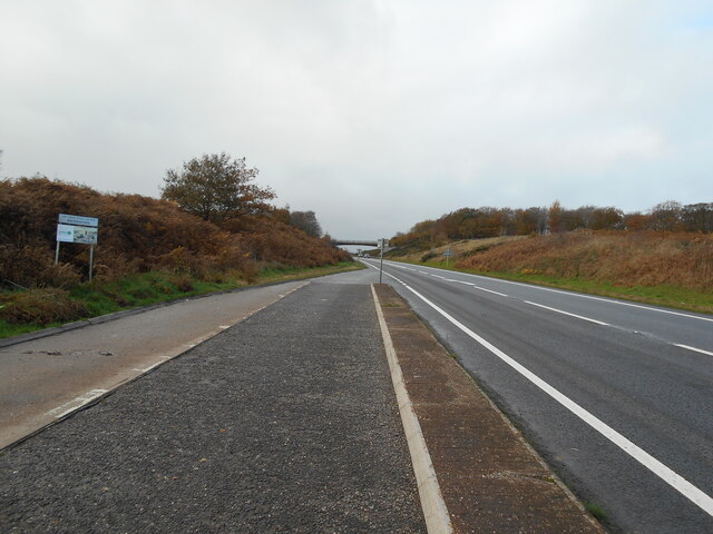
Lay By at Rackenfrord Northbound on the A361 North Devon Link Road.
Lay By at Rackenfrord Credit: Anthony Vosper

Roachill is a small village located in the district of Devon, England. Situated in the southwestern part of the country, it lies within the rolling hills and lush green landscapes that characterize this rural region. With a population of around 500 residents, Roachill epitomizes the quintessential English village charm.

The village is known for its picturesque beauty, with traditional thatched-roof cottages dotting the landscape and a tranquil atmosphere that attracts tourists seeking a peaceful retreat. The surrounding countryside offers opportunities for outdoor activities such as hiking and cycling, with numerous trails and paths winding through the scenic countryside.

Roachill is also home to a historic church, St. Mary's, which dates back to the 13th century. The church features stunning architectural details and serves as a focal point for the community, hosting regular services and events.

Despite its small size, Roachill boasts a strong sense of community. The village has a local pub, The Roachill Arms, where residents and visitors can gather to enjoy a drink or a meal. The pub often hosts social events and is a popular meeting place for locals.

While Roachill may be off the beaten path, its idyllic setting and warm community spirit make it a charming destination for those seeking a tranquil escape in the heart of Devon's countryside.

If you have any feedback on the listing, please let us know in the comments section below.

Roachill Images

Images are sourced within 2km of 50.992675/-3.645042 or Grid Reference SS8422. Thanks to Geograph Open Source API. All images are credited.

Lay By at Rackenfrord Northbound on the A361 North Devon Link Road.
Lay By at Rackenfrord
Northbound on the A361 North Devon Link Road.
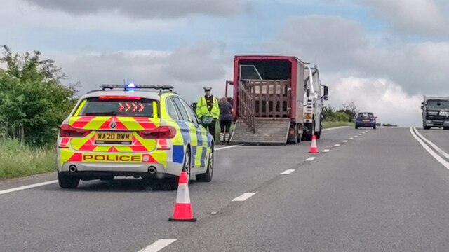
Rackenford : North Devon Link Road A361 Looking along the A361 where it seems a lorry has broken down.
Rackenford : North Devon Link Road A361
Looking along the A361 where it seems a lorry has broken down.
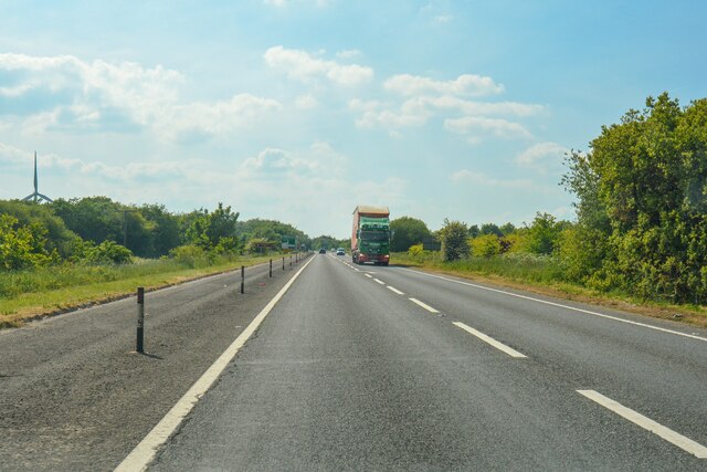
Knowstone : North Devon Link Road A361 Looking along the North Devon Link Road.
Knowstone : North Devon Link Road A361
Looking along the North Devon Link Road.
Knowstone: St Peter’s church Looking north west
Knowstone: St Peter’s church
Looking north west
Knowstone: The Mason’s Arms Looking east-north-east. The building is reputed to date from the 13th century
Knowstone: The Mason’s Arms
Looking east-north-east. The building is reputed to date from the 13th century
Knowstone: Knowstone Moor Looking west-north-west on Knowstone Inner Moor by the old road from Rackenford to Knowstone, now downgraded to a footpath at this point. The moor, managed by Devon Wildlife Trust, is home to skylarks and marsh fritillary butterflies
Knowstone: Knowstone Moor
Looking west-north-west on Knowstone Inner Moor by the old road from Rackenford to Knowstone, now downgraded to a footpath at this point. The moor, managed by Devon Wildlife Trust, is home to skylarks and marsh fritillary butterflies
Knowstone: old road from Rackenford Now downgraded to a footpath since the North Devon Link Road was constructed. Looking north west in the direction of Knowstone
Knowstone: old road from Rackenford
Now downgraded to a footpath since the North Devon Link Road was constructed. Looking north west in the direction of Knowstone
Knowstone: West Bowden entrance Looking east-north-east on the road from Knowstone to Knowstone Moor which at this point double as the Two Moors Way
Knowstone: West Bowden entrance
Looking east-north-east on the road from Knowstone to Knowstone Moor which at this point double as the Two Moors Way
Knowstone: above Hill Wood Looking west-north-west. In the distance plantations cover side valleys of the Crooked Oak river
Knowstone: above Hill Wood
Looking west-north-west. In the distance plantations cover side valleys of the Crooked Oak river
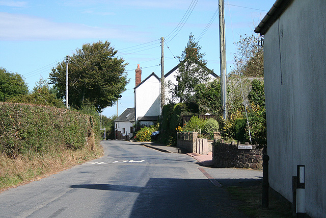
Knowstone: Roachill Looking north east past the entrance to Roachill Farm. Beyond the second pole stands the Old Smithy
Knowstone: Roachill
Looking north east past the entrance to Roachill Farm. Beyond the second pole stands the Old Smithy
Knowstone: on Hares Down Entrance to Middle Hill Farm. Looking north-north-west with Exmoor on the horizon
Knowstone: on Hares Down
Entrance to Middle Hill Farm. Looking north-north-west with Exmoor on the horizon
Knowstone: North Devon Link Road Looking west-north-west on the A361. A trunk road linking Barnstaple and Bideford with the M5 Motorway
Knowstone: North Devon Link Road
Looking west-north-west on the A361. A trunk road linking Barnstaple and Bideford with the M5 Motorway
Knowstone: Knowstone Outer Moor Looking north-north-west towards the North Devon Link Road
Knowstone: Knowstone Outer Moor
Looking north-north-west towards the North Devon Link Road
Knowstone: Bickham Moor Cross On Swineham Hill, looking north
Knowstone: Bickham Moor Cross
On Swineham Hill, looking north
Knowstone: barns at Wiston Seen from the lane between Swineham Moor and Wiston Cross. Looking east-north-east
Knowstone: barns at Wiston
Seen from the lane between Swineham Moor and Wiston Cross. Looking east-north-east
Oakford: by Swineham Farm Looking north-north-west at the farm entrance with Exmoor on the horizon
Oakford: by Swineham Farm
Looking north-north-west at the farm entrance with Exmoor on the horizon
Knowstone: Shapcott Barton Seen from the public footpath to East Knowstone. Looking north
Knowstone: Shapcott Barton
Seen from the public footpath to East Knowstone. Looking north
Knowstone: public footpath By the entrance to Shapcott Barton and a little overgrown. Looking west
Knowstone: public footpath
By the entrance to Shapcott Barton and a little overgrown. Looking west
Show me another place!

Roachill is located at Grid Ref: SS8422 (Lat: 50.992675, Lng: -3.645042)

Administrative County: Devon

District: North Devon

Police Authority: Devon and Cornwall

What 3 Words

///arranger.spectacle.articulated. Near Dulverton, Somerset

Nearby Locations

Roachill

Related Wikis

Roachill

Roachill is a hamlet in the civil parish of Knowstone in the North Devon district of Devon, England. Its nearest town is Tiverton, which lies approximately...

Knowstone

Knowstone is a village and civil parish situated in the North Devon district of Devon, England, halfway between the Mid Devon town of Tiverton, Devon and...

Rackenford and Knowstone Moors

Rackenford and Knowstone Moors is a nature reserve of the Devon Wildlife Trust, situated about 8 miles (13 km) north-west of Tiverton, in Devon, England...

East Anstey

East Anstey is a village and civil parish in the North Devon district of Devon, England. The parish is located in an area which has been designated as...

Nearby Amenities

Located within 500m of 50.992675,-3.645042
Roachill
Place: hamlet
Source: OS_OpenData_StreetView
Lat/Long: 50.992998/-3.6432925
Roachill Cross
Junction: yes
Source: OS_OpenData_StreetView
Lat/Long: 50.9932074/-3.6430278
Wiston Cross
Place: locality
Lat/Long: 50.9952897/-3.6394725
Generator Method: photovoltaic
Generator Output Electricity: yes
Generator Source: solar
Generator Type: solar_photovoltaic_panel
Location: roof
Power: generator
Lat/Long: 50.9944359/-3.6413267
Post Box
Operator: Royal Mail
Operator Wikidata: Q638098
Ref: EX36 140
Royal Cypher: EIIR
Royal Cypher Wikidata: Q33102113
Lat/Long: 50.9929249/-3.6433357
Power: pole
Source: bing
Lat/Long: 50.9932931/-3.6428375
Power: pole
Source: bing
Lat/Long: 50.9936912/-3.6421543
Power: pole
Source: bing
Lat/Long: 50.9940408/-3.6416203
Power: pole
Source: bing
Lat/Long: 50.9939275/-3.6387766
Power: pole
Source: bing
Lat/Long: 50.9938384/-3.6384319
Power: pole
Source: bing
Lat/Long: 50.9939401/-3.6391459
Power: pole
Source: bing
Lat/Long: 50.994006/-3.6406709
Power: pole
Source: bing
Transformer: distribution
Lat/Long: 50.9932747/-3.6437439
Power: pole
Source: bing
Lat/Long: 50.9934181/-3.6451134
Power: pole
Source: bing
Lat/Long: 50.9935449/-3.6463553
Power: pole
Source: bing
Lat/Long: 50.9936737/-3.6476386
Power: pole
Source: bing
Lat/Long: 50.9940553/-3.651361
Power: pole
Source: bing
Lat/Long: 50.9938016/-3.6488651
Power: pole
Source: bing
Lat/Long: 50.9939294/-3.6501854
The data included in this document is from www.openstreetmap.org. The data is made available under ODbL.

Have you been to Roachill?

Leave your review of Roachill below (or comments, questions and feedback).